Butcher's Wood

Wood, Forest in Derbyshire Derbyshire Dales

England

Butcher's Wood

Grave of John Millington, railway navvy, Youlgreave Churchyard During the construction of the Midland Railway near Haddon Hall in 1861 a tunnel was insisted upon by the Duke of Rutland so that the line could not be seen from the hall. A part of this tunnel collapsed during construction on 2nd July 1861 killing five workers. The grave of one of these can be found in the churchyard. The inscription reads: "In memory of John Millington of Stanton, killed by the falling of an arch on the railway near Haddon Hall, July 2nd 1861 aged 46 years". Reference to his 6 year old daughter is also on the stone whose body rests in Warrick churchyard, Ruthin, North Wales.
Grave of John Millington, railway navvy, Youlgreave Churchyard Credit: Richard Bird

Butcher's Wood is a picturesque forest located in Derbyshire, England. Covering an area of approximately 100 acres, it is a popular destination for nature lovers and outdoor enthusiasts. The wood is known for its abundant wildlife, diverse flora, and tranquil atmosphere.

Comprising mainly of deciduous trees such as oak, beech, and birch, Butcher's Wood boasts a stunning display of colors during the autumn months. The forest floor is covered with a rich carpet of ferns, bluebells, and wildflowers, creating a vibrant and enchanting landscape.

The wood is crisscrossed by a network of well-maintained walking trails, making it an ideal spot for hiking and leisurely strolls. These trails lead visitors through ancient woodland, past babbling brooks, and alongside meandering streams. Along the way, one may encounter a variety of woodland creatures, including deer, foxes, and a multitude of bird species.

Butcher's Wood also has a small picnic area, providing a perfect spot for visitors to relax and enjoy a meal amidst the natural beauty. The wood is well-maintained by local authorities, ensuring a clean and safe environment for all who visit.

Located just a short distance from the charming village of Derbyshire, Butcher's Wood offers a peaceful escape from the hustle and bustle of everyday life. Whether you are seeking a quiet retreat in nature or an opportunity to explore the local wildlife, Butcher's Wood is a must-visit destination for nature enthusiasts of all ages.

If you have any feedback on the listing, please let us know in the comments section below.

Butcher's Wood Images

Images are sourced within 2km of 53.17126/-1.7077975 or Grid Reference SK1963. Thanks to Geograph Open Source API. All images are credited.

Grave of John Millington, railway navvy, Youlgreave Churchyard During the construction of the Midland Railway near Haddon Hall in 1861 a tunnel was insisted upon by the Duke of Rutland so that the line could not be seen from the hall. A part of this tunnel collapsed during construction on 2nd July 1861 killing five workers. The grave of one of these can be found in the churchyard. The inscription reads: "In memory of John Millington of Stanton, killed by the falling of an arch on the railway near Haddon Hall, July 2nd 1861 aged 46 years". Reference to his 6 year old daughter is also on the stone whose body rests in Warrick churchyard, Ruthin, North Wales.
Grave of John Millington, railway navvy, Youlgreave Churchyard
During the construction of the Midland Railway near Haddon Hall in 1861 a tunnel was insisted upon by the Duke of Rutland so that the line could not be seen from the hall. A part of this tunnel collapsed during construction on 2nd July 1861 killing five workers. The grave of one of these can be found in the churchyard. The inscription reads: "In memory of John Millington of Stanton, killed by the falling of an arch on the railway near Haddon Hall, July 2nd 1861 aged 46 years". Reference to his 6 year old daughter is also on the stone whose body rests in Warrick churchyard, Ruthin, North Wales.
Meadow Place Grange Meadow Place Grange viewed from the footpath approaching from the south-west.  Over Haddon can be seen in the distance.
Meadow Place Grange
Meadow Place Grange viewed from the footpath approaching from the south-west. Over Haddon can be seen in the distance.
Unusual Font With Stoup Attached C12th, Youlgreave 12th Century Font with attached stoup  at the side. This would have held holy water or oil for people to cross themselves with.  Stoups are normally found in the entrance of the church.  

This font was originally in Elton church which was a chapelries of Youlgrave, It was moved here after Elton spire fell in and was rebuilt in the early 1800's
Unusual Font With Stoup Attached C12th, Youlgreave
12th Century Font with attached stoup at the side. This would have held holy water or oil for people to cross themselves with. Stoups are normally found in the entrance of the church. This font was originally in Elton church which was a chapelries of Youlgrave, It was moved here after Elton spire fell in and was rebuilt in the early 1800's
Stone Effigy of a Knight Holding His Heart C14th, Youlgreave Thought to be Sir John Rossington. He lies cross-legged, his head on a pillow and his feet on a dog. He his holding his hearts in his hands over his chest.
Stone Effigy of a Knight Holding His Heart C14th, Youlgreave
Thought to be Sir John Rossington. He lies cross-legged, his head on a pillow and his feet on a dog. He his holding his hearts in his hands over his chest.
Thomas Cokayne Alabaster Tomb C15th, Youlgreave Thomas (Cockayne) Cokayne (1451 - 1488) died at the age of 37 in Polesworth, Warwickshire after a quarrel with Thomas Burdett on their way to Polesworth Church. 

His tomb is small in size because he died before his father, and it was restored in 1870 by members of his family. 

<span class="nowrap"><a title="https://www.wikitree.com/wiki/Cockayne-168" rel="nofollow ugc noopener" href="https://www.wikitree.com/wiki/Cockayne-168">Link</a><img style="margin-left:2px;" alt="External link" title="External link - shift click to open in new window" src="https://s1.geograph.org.uk/img/external.png" width="10" height="10"/></span>
Thomas Cokayne Alabaster Tomb C15th, Youlgreave
Thomas (Cockayne) Cokayne (1451 - 1488) died at the age of 37 in Polesworth, Warwickshire after a quarrel with Thomas Burdett on their way to Polesworth Church. His tomb is small in size because he died before his father, and it was restored in 1870 by members of his family. LinkExternal link
Carved Stone Pilgrim C12th, Youlgreave May represent a pilgrim with a Staff and Bag or Wallet
Carved Stone Pilgrim C12th, Youlgreave
May represent a pilgrim with a Staff and Bag or Wallet
Alabaster Reredos, Robert & Joan Gilbert C15th, Youlgreave Robert had the memorial panel made after Joan died in November 1492, depicting a Virgin and Child in the centre, Robert and seven sons on the left and Joan with ten daughters on the right.

<span class="nowrap"><a title="https://www.wikitree.com/wiki/Gilbert-9839" rel="nofollow ugc noopener" href="https://www.wikitree.com/wiki/Gilbert-9839">Link</a><img style="margin-left:2px;" alt="External link" title="External link - shift click to open in new window" src="https://s1.geograph.org.uk/img/external.png" width="10" height="10"/></span>
Alabaster Reredos, Robert & Joan Gilbert C15th, Youlgreave
Robert had the memorial panel made after Joan died in November 1492, depicting a Virgin and Child in the centre, Robert and seven sons on the left and Joan with ten daughters on the right. LinkExternal link
Alabaster Wall Memorial Roger Rooe 1613, Youlgreave Roger Rooe of Alport, who died 30th April 1613. The Panel shows Roger and his wife Catherine kneeling at a prayer desk facing each other. Roger is in armour and a ruffled collar, Catherine is in a dress and tall hat.  Below them are their eight daughters in a line.

HIC JACET RODERVS
ROOE DE ALPORT AR:
QVI OBIIT 30. APRIL IS
AN. DNI: 1613
Alabaster Wall Memorial Roger Rooe 1613, Youlgreave
Roger Rooe of Alport, who died 30th April 1613. The Panel shows Roger and his wife Catherine kneeling at a prayer desk facing each other. Roger is in armour and a ruffled collar, Catherine is in a dress and tall hat. Below them are their eight daughters in a line. HIC JACET RODERVS ROOE DE ALPORT AR: QVI OBIIT 30. APRIL IS AN. DNI: 1613
Mawstone Barn The door is ace.. Not much holding it on.
Mawstone Barn
The door is ace.. Not much holding it on.
Stone Slab Footbridge Over The River Bradford
Pommie Plaque, Youlgreave Interesting mosaic on the village hall..

<span class="nowrap"><a title="http://www.pommieplaque.org.uk/" rel="nofollow ugc noopener" href="http://www.pommieplaque.org.uk/">Link</a><img style="margin-left:2px;" alt="External link" title="External link - shift click to open in new window" src="https://s1.geograph.org.uk/img/external.png" width="10" height="10"/></span>
Pommie Plaque, Youlgreave
Interesting mosaic on the village hall.. LinkExternal link
Carved Stone Head Piscina, Youlgreave Maybe Norman by the look of the carving. Definitely moved from its original location as it's in the C16th wall and would not have been used post reformation.
Carved Stone Head Piscina, Youlgreave
Maybe Norman by the look of the carving. Definitely moved from its original location as it's in the C16th wall and would not have been used post reformation.
Kissing gate on the Limestone Way Low Moor Plantation can be seen in the background.
Kissing gate on the Limestone Way
Low Moor Plantation can be seen in the background.
Stile on the Limestone Way Stile in a drystone wall on the Limestone Way near Youlgreave.
Stile on the Limestone Way
Stile in a drystone wall on the Limestone Way near Youlgreave.
Sign on Back Lane Sign on Back Lane, a country road to Youlgreave.
Sign on Back Lane
Sign on Back Lane, a country road to Youlgreave.
Barn in farmland Barn in farmland above Lathkill Dale near Youlgreave.
Barn in farmland
Barn in farmland above Lathkill Dale near Youlgreave.
Footpath to Over Haddon Footpath to Lathkill Dale and the village of Over Haddon.
Footpath to Over Haddon
Footpath to Lathkill Dale and the village of Over Haddon.
Limestone country Drystone walls in limestone grassland above Lathkill Dale.
Limestone country
Drystone walls in limestone grassland above Lathkill Dale.
Show me another place!

Butcher's Wood is located at Grid Ref: SK1963 (Lat: 53.17126, Lng: -1.7077975)

Administrative County: Derbyshire

District: Derbyshire Dales

Police Authority: Derbyshire

What 3 Words

///tangling.taken.blunt. Near Youlgreave, Derbyshire

Related Wikis

Middleton-by-Youlgreave

Middleton, often known as Middleton-by-Youlgreave or Middleton-by-Youlgrave to distinguish it from nearby Middleton-by-Wirksworth, is a village in the...

Youlgreave

Youlgreave or Youlgrave is a village and civil parish in the Peak District of Derbyshire, England, on the River Bradford 2+1⁄2 miles (4.0 km) south of...

Conksbury

Conksbury is the site of a deserted medieval settlement between Over Haddon and Youlgreave in Derbyshire, England. == History == The village was recorded...

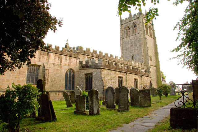
All Saints' Church, Youlgreave

All Saints’ Church, Youlgreave is a Grade I listed parish church in the Church of England in Youlgreave, Derbyshire. == History == The church dates from...

Middleton and Smerrill

Middleton and Smerrill is a civil parish within the Derbyshire Dales district, in the county of Derbyshire, England. Largely rural except for the village...

Harthill Moor

Harthill Moor is a small upland area in the Derbyshire Peak District of central and northern England, lying between Matlock and Bakewell near the villages...

River Bradford

The River Bradford is a river in the Peak District National Park in Derbyshire. Its source is on Gratton Moor and after passing below Youlgreave it joins...

Limey Way

The Limey Way is a 65-kilometre (40 mi) challenge walk through Derbyshire, England. It starts at Castleton and progresses through 15 major and 5 minor...

Nearby Amenities

Located within 500m of 53.17126,-1.7077975
Castle Farm
Guest House: bed_and_breakfast
Tourism: guest_house
Lat/Long: 53.1675856/-1.7080264
Barrier: stile
Steps: 3
Stile: wall
Lat/Long: 53.1744195/-1.7047906
Barrier: stile
Lat/Long: 53.174324/-1.7037501
Barrier: stile
Stile: wall
Lat/Long: 53.1742343/-1.703757
Barrier: stile
Lat/Long: 53.1750023/-1.7037572
Barrier: stile
Material: stone
Source: survey
Stile: squeezer
Lat/Long: 53.1731426/-1.7034662
Barrier: stile
Stile: squeezer
Lat/Long: 53.1699429/-1.7026359
Barrier: kissing_gate
Lat/Long: 53.1702839/-1.7022232
Bench
Lat/Long: 53.1754103/-1.710174
Power: pole
Lat/Long: 53.167204/-1.7062523
Power: pole
Lat/Long: 53.1690997/-1.7052522
Power: pole
Lat/Long: 53.1696862/-1.7064389
Power: pole
Lat/Long: 53.1703192/-1.7076552
Power: pole
Lat/Long: 53.1709805/-1.7088793
Power: pole
Lat/Long: 53.1717032/-1.7102688
Power: pole
Lat/Long: 53.1722438/-1.7115394
Power: pole
Lat/Long: 53.1729452/-1.7131605
Power: pole
Source: Bing
Lat/Long: 53.1725857/-1.7117446
Power: pole
Source: Bing
Lat/Long: 53.1720765/-1.7104668
Power: pole
Source: Bing
Lat/Long: 53.171119/-1.7080172
Power: pole
Source: Bing
Lat/Long: 53.1705491/-1.707238
Power: pole
Source: Bing
Lat/Long: 53.1698938/-1.7062425
Power: pole
Lat/Long: 53.1690064/-1.7049062
Littleton Dale
Place: locality
Lat/Long: 53.1725839/-1.7016765
Bench
Backrest: yes
Lat/Long: 53.1730051/-1.701296
The data included in this document is from www.openstreetmap.org. The data is made available under ODbL.

Have you been to Butcher's Wood?

Leave your review of Butcher's Wood below (or comments, questions and feedback).