Kew Hill Bottom

Valley in Yorkshire

England

Kew Hill Bottom

The 643, Lindley Moor Road
The 643, Lindley Moor Road Credit: Ian S

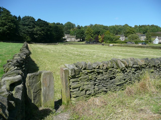
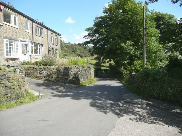
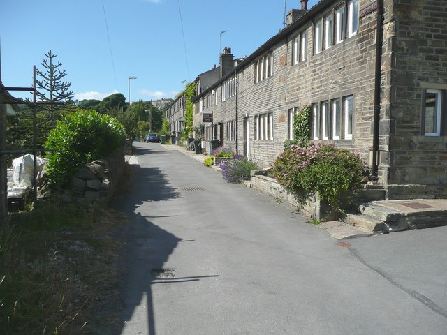
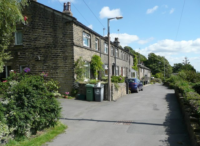
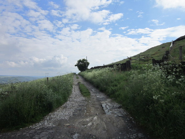
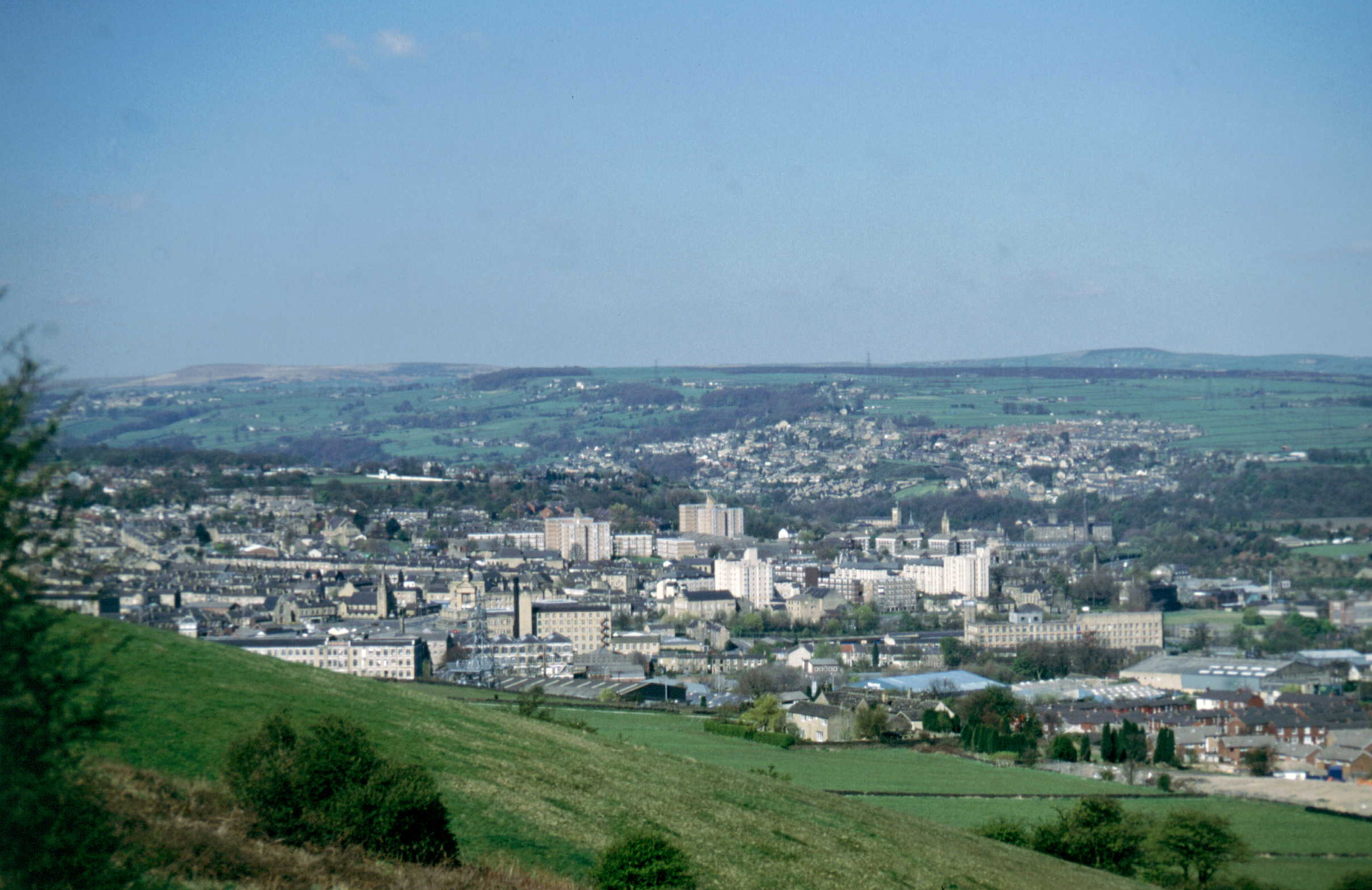
Kew Hill Bottom, located in Yorkshire, England, is a picturesque valley renowned for its natural beauty and tranquil surroundings. Nestled amidst rolling hills and lush greenery, this idyllic spot is a popular destination for nature enthusiasts and those seeking a peaceful retreat.

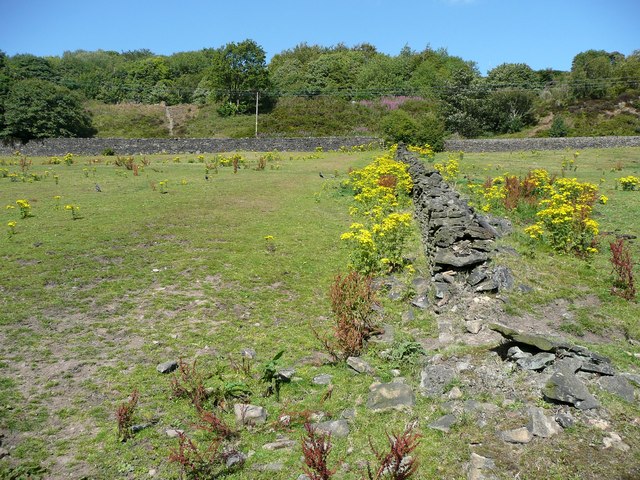
The valley is characterized by its verdant landscape, with meandering streams and babbling brooks that add to its charm. The area is home to a diverse range of flora and fauna, with an abundance of wildflowers, ancient trees, and various species of birds and small mammals.

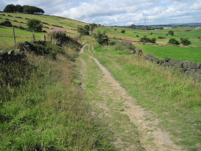
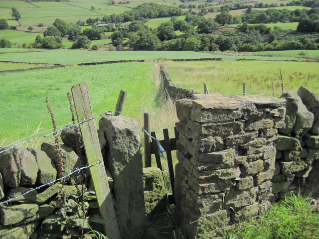
Kew Hill Bottom is a haven for hikers and walkers, offering a network of scenic trails that wind through the valley, providing breathtaking views at every turn. The paths cater to different fitness levels and interests, making it accessible to visitors of all ages and abilities. Whether you prefer a leisurely stroll or a more challenging hike, Kew Hill Bottom has something to offer.

In addition to its natural splendor, the valley also boasts a rich history. The area has evidence of human occupation dating back centuries, with archaeological finds revealing traces of ancient settlements and farming practices. Visitors can explore the remnants of these past civilizations, adding a sense of intrigue and discovery to their visit.

Kew Hill Bottom is a hidden gem in Yorkshire, offering a peaceful escape from the hustle and bustle of everyday life. Whether you are seeking solitude in nature, a chance to explore the region's history, or simply a scenic spot to relax and unwind, this valley is sure to captivate and inspire.

If you have any feedback on the listing, please let us know in the comments section below.

Kew Hill Bottom Images

Images are sourced within 2km of 53.671049/-1.8398828 or Grid Reference SE1019. Thanks to Geograph Open Source API. All images are credited.

The 643, Lindley Moor Road
The A640, New Hey Road, goes over the M62
Footpath into the valley from Snow Lea, Longwood The houses are along Lamb Hall Road at Snow Lea.
Footpath into the valley from Snow Lea, Longwood
The houses are along Lamb Hall Road at Snow Lea.
Lamb Hall Road at Snow Lea
Stoops, Lamb Hall Road, Longwood
Footpath off Lamb Hall Road, Longwood The ragwort is bright and cheerful, but should really have been cut down, along with the docks.
Footpath off Lamb Hall Road, Longwood
The ragwort is bright and cheerful, but should really have been cut down, along with the docks.
Turley Cote Lane
Turley Cote Lane
Footpath towards Shavey Clough
Shaw Park Gateway This mock castle style gateway forms one of the entrances to Shaw Park
Shaw Park Gateway
This mock castle style gateway forms one of the entrances to Shaw Park
Shaw Park Aviary Built originally as an Aviary around 1870, now disused.
Shaw Park Aviary
Built originally as an Aviary around 1870, now disused.
Shaw Park Folly The first of 3 follies linked by a wall in Shaw Park
Shaw Park Folly
The first of 3 follies linked by a wall in Shaw Park
Shaw Park Folly The second of 3 follies linked by a wall in Shaw Park
Shaw Park Folly
The second of 3 follies linked by a wall in Shaw Park
Shaw Park Folly The third of 3 follies linked by a wall in Shaw Park. The round tower housed a dovecote.
Shaw Park Folly
The third of 3 follies linked by a wall in Shaw Park. The round tower housed a dovecote.
Shaw Park Arches This small folly is formed with 3 arches in a curved wall
Shaw Park Arches
This small folly is formed with 3 arches in a curved wall
The Rock public house, Holywell Green
Turley Cote Lane near Outlane
Show me another place!

Kew Hill Bottom is located at Grid Ref: SE1019 (Lat: 53.671049, Lng: -1.8398828)

Division: West Riding

Unitary Authority: Kirklees

Police Authority: West Yorkshire

What 3 Words

///tilt.soda.sides. Near Elland, West Yorkshire

Related Wikis

Blackley, West Yorkshire

Blackley is a hamlet in the Calderdale district, in the county of West Yorkshire, England. It is near the town of Elland, the A629 road and the M62 motorway...

Ainley Top

Ainley Top is a village in Calderdale, West Yorkshire in England. It is situated approximately 3 miles (4.8 km) north west of Huddersfield on the A629...

Church of All Saints, Elland

The Church of All Saints is a Church of England parish church in Elland, Calderdale, West Yorkshire. The church is a grade II* listed building. == History... ==

The Brooksbank School

The Brooksbank School is a secondary school with academy status in Elland, near Halifax in West Yorkshire, England. It is a sports college, as well as...

Lindley, Huddersfield

Lindley is a suburb of Huddersfield, within the metropolitan borough of Kirklees in West Yorkshire, England. It is approximately 2 miles (3 km) northwest...

Elland

Elland is a market town in Calderdale, in the county of West Yorkshire, England. It is situated south of Halifax, by the River Calder and the Calder and...

Old Lindley

Old Lindley or Over Lindley is a hamlet in the civil parish of Stainland and District, in the Calderdale district, in the county of West Yorkshire, England...

Salendine Nook

Salendine Nook is an area of Huddersfield in West Yorkshire, England. It is 2 miles (3 km) to the north-west of central Huddersfield, and is bordered to...

Nearby Amenities

Located within 500m of 53.671049,-1.8398828
Power: tower
Lat/Long: 53.6684654/-1.8350096
Power: tower
Lat/Long: 53.6685079/-1.8378067
Power: tower
Lat/Long: 53.6686069/-1.8433861
Bus Stop
Blackley New Road
Bus: yes
Local Ref: 45022197
Naptan AtcoCode: 450022197
Naptan Bearing: NW
Naptan CommonName: Blackley New Road
Naptan Crossing: Nr-At Lindley Road
Naptan Indicator: Stop 45022197
Naptan Landmark: Blackley Cricket Ground
Naptan Notes: OSR taken place 061205
Naptan PlusbusZoneRef: LEEDS
Naptan ShortCommonName: Lindley Road
Naptan Street: Blackley Road
Naptan Verified: no
Public Transport: platform
Shelter: no
Source: naptan_import
Lat/Long: 53.6737682/-1.842649
Bus Stop
Blackley New Road
Bus: yes
Local Ref: 45022198
Naptan AtcoCode: 450022198
Naptan Bearing: SE
Naptan CommonName: Blackley New Road
Naptan Crossing: South Lane
Naptan Indicator: Stop 45022198
Naptan Landmark: Blackley Cricket Ground
Naptan PlusbusZoneRef: LEEDS
Naptan ShortCommonName: Blackley New Road
Naptan Street: Blackley Road
Naptan Verified: no
Public Transport: platform
Shelter: no
Source: naptan_import
Lat/Long: 53.6741554/-1.8432896
Bus Stop
Blackley New Road
Bus: yes
Local Ref: 45022199
Naptan AtcoCode: 450022199
Naptan Bearing: W
Naptan CommonName: Blackley New Road
Naptan Crossing: Lindley Road
Naptan Indicator: Stop 45022199
Naptan Landmark: Blackley Cricket Ground
Naptan Notes: OSR taken place 071205 size 2 case fitted
Naptan PlusbusZoneRef: LEEDS
Naptan ShortCommonName: Lindley Road
Naptan Street: Blackley New Road
Naptan Verified: no
Public Transport: platform
Ref: 45022199
Shelter: yes
Source: naptan_import
Lat/Long: 53.6731681/-1.8407511
Bus Stop
Lindley Moor Road Action Flat Road
Local Ref: 45022740
Naptan AtcoCode: 450022740
Naptan Bearing: NE
Naptan CommonName: Lindley Moor Road Action Flat Road
Naptan Crossing: Adj Action Flat Lane
Naptan Indicator: Stop 45022740
Naptan Landmark: Warren House Farm
Naptan Notes: OSR taken place 071205
Naptan PlusbusZoneRef: LEEDS
Naptan ShortCommonName: Acton Flat Lane
Naptan Street: Lindley Moor Road
Naptan Verified: no
Source: naptan_import
Lat/Long: 53.6695121/-1.8342004
Lindley Moor Road
Local Ref: 45051222
Naptan AtcoCode: 450051222
Naptan Bearing: SW
Naptan BusStopType: CUS
Naptan CommonName: Lindley Moor Road
Naptan Indicator: Stop 45051222
Naptan PlusbusZoneRef: LEEDS
Naptan ShortCommonName: Warren House Farm
Naptan Street: Lindley Moor Road
Naptan Verified: no
Source: naptan_import
Lat/Long: 53.6694311/-1.8341099
Traffic Signals
Traffic Signals: signal
Traffic Signals Direction: both
Lat/Long: 53.6673735/-1.8390856
Phone
Check Date: 2023-10-15
Emergency: phone
Ref: 1891A
Lat/Long: 53.6707625/-1.8359009
Barrier: stile
Lat/Long: 53.6687242/-1.8448287
Power: tower
Source: Bing
Lat/Long: 53.6697886/-1.8385158
Barrier: stile
Bicycle: no
Foot: yes
Horse: no
Motor Vehicle: no
Stile: stepover
Lat/Long: 53.6709694/-1.8396094
Power: tower
Source: Bing
Lat/Long: 53.6723216/-1.8365919
Phone
Emergency: phone
Ref: 1891B
Lat/Long: 53.6704671/-1.8355913
Power: tower
Lat/Long: 53.6671482/-1.8381893
Power: tower
Lat/Long: 53.6684841/-1.8373098
Power: tower
Lat/Long: 53.6685536/-1.8382294
Blackley
Place: hamlet
Wikidata: Q4923089
Lat/Long: 53.6736931/-1.8416475
Crossing
Crossing: marked
Crossing Island: no
Lat/Long: 53.6748124/-1.8427779
Weighbridge
Operator: DVSA
Lat/Long: 53.6728149/-1.8339733
Crossing
Lat/Long: 53.671284/-1.8326767
Crossing
Crossing: unmarked
Crossing Island: no
Crossing Markings: no
Tactile Paving: no
Lat/Long: 53.6727137/-1.8333037
Power: pole
Lat/Long: 53.667475/-1.8442038
Power: pole
Lat/Long: 53.667974/-1.8447992
Man Made: flagpole
Lat/Long: 53.6728298/-1.8397128
Bench
Backrest: yes
Seats: 4
Lat/Long: 53.672937/-1.8406355
Bench
Backrest: yes
Seats: 4
Lat/Long: 53.6729497/-1.8405939
Bench
Backrest: yes
Seats: 4
Lat/Long: 53.6729593/-1.8405591
Bench
Backrest: yes
Seats: 4
Lat/Long: 53.6729712/-1.8405255
Bench
Backrest: yes
Seats: 4
Lat/Long: 53.6729791/-1.840488
Bench
Backrest: yes
Seats: 4
Lat/Long: 53.6729851/-1.8404551
Bench
Backrest: yes
Seats: 4
Lat/Long: 53.6721954/-1.8398114
Bench
Backrest: yes
Seats: 4
Lat/Long: 53.6721716/-1.8399267
Bench
Backrest: yes
Seats: 4
Lat/Long: 53.6721978/-1.8398858
Bench
Backrest: yes
Seats: 4
Lat/Long: 53.67223/-1.8398369
Bench
Backrest: yes
Seats: 4
Lat/Long: 53.672278/-1.8397544
Bench
Backrest: yes
Seats: 4
Lat/Long: 53.672218/-1.8397712
Bench
Backrest: yes
Seats: 4
Lat/Long: 53.672187/-1.8399804
Bench
Backrest: yes
Seats: 4
Lat/Long: 53.6722228/-1.8399153
Bench
Backrest: yes
Seats: 4
Lat/Long: 53.672249/-1.8398885
Bench
Backrest: yes
Seats: 4
Lat/Long: 53.6722689/-1.8398604
Bench
Backrest: yes
Seats: 4
Lat/Long: 53.6722879/-1.8398349
Bench
Backrest: yes
Seats: 4
Lat/Long: 53.6723098/-1.8398101
Bench
Backrest: yes
Seats: 4
Lat/Long: 53.6723336/-1.8397906
Bench
Backrest: yes
Seats: 4
Lat/Long: 53.6723551/-1.8397645
Bench
Backrest: yes
Seats: 4
Lat/Long: 53.6723884/-1.8397417
Bench
Backrest: yes
Seats: 4
Lat/Long: 53.6724151/-1.8397249
Bench
Backrest: yes
Seats: 4
Lat/Long: 53.6724401/-1.8397209
Bench
Backrest: yes
Seats: 4
Lat/Long: 53.6724619/-1.8397122
Crossing
Lat/Long: 53.6681785/-1.8430838
Access: no
Barrier: stile
Bicycle: no
Foot: yes
Horse: no
Motor Vehicle: no
Lat/Long: 53.6698048/-1.8390805
Barrier: stile
Bicycle: no
Foot: yes
Horse: no
Motor Vehicle: no
Lat/Long: 53.669263/-1.8462887
Barrier: stile
Lat/Long: 53.6691064/-1.8443118
Barrier: stile
Lat/Long: 53.6692998/-1.8432216
Post Box
Brand: Royal Mail
Brand Wikidata: Q638098
Brand Wikipedia: en:Royal Mail
Drive Through: no
Operator: Royal Mail
Operator Wikidata: Q638098
Post Box Type: wall
Royal Cypher: VR
Lat/Long: 53.6733538/-1.8418198
Defibrillator
Access: yes
Defibrillator Location: on the outside wall of Blackley Cricket Club pavilion, facing the pitch
Emergency: defibrillator
Indoor: no
Ref GB The Circuit: 332FB5D9-EC7C-4A3C-A092-AD5E00C1CF50
Lat/Long: 53.6728575/-1.8396558
The data included in this document is from www.openstreetmap.org. The data is made available under ODbL.

Have you been to Kew Hill Bottom?

Leave your review of Kew Hill Bottom below (or comments, questions and feedback).