Kew Hill

Hill, Mountain in Yorkshire

England

Kew Hill

The 643, Lindley Moor Road
The 643, Lindley Moor Road Credit: Ian S

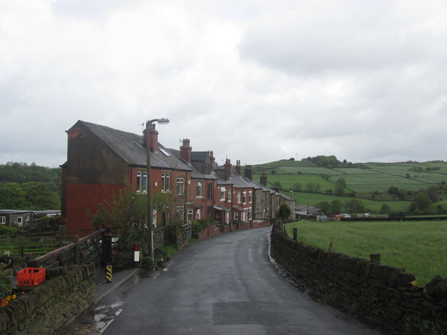
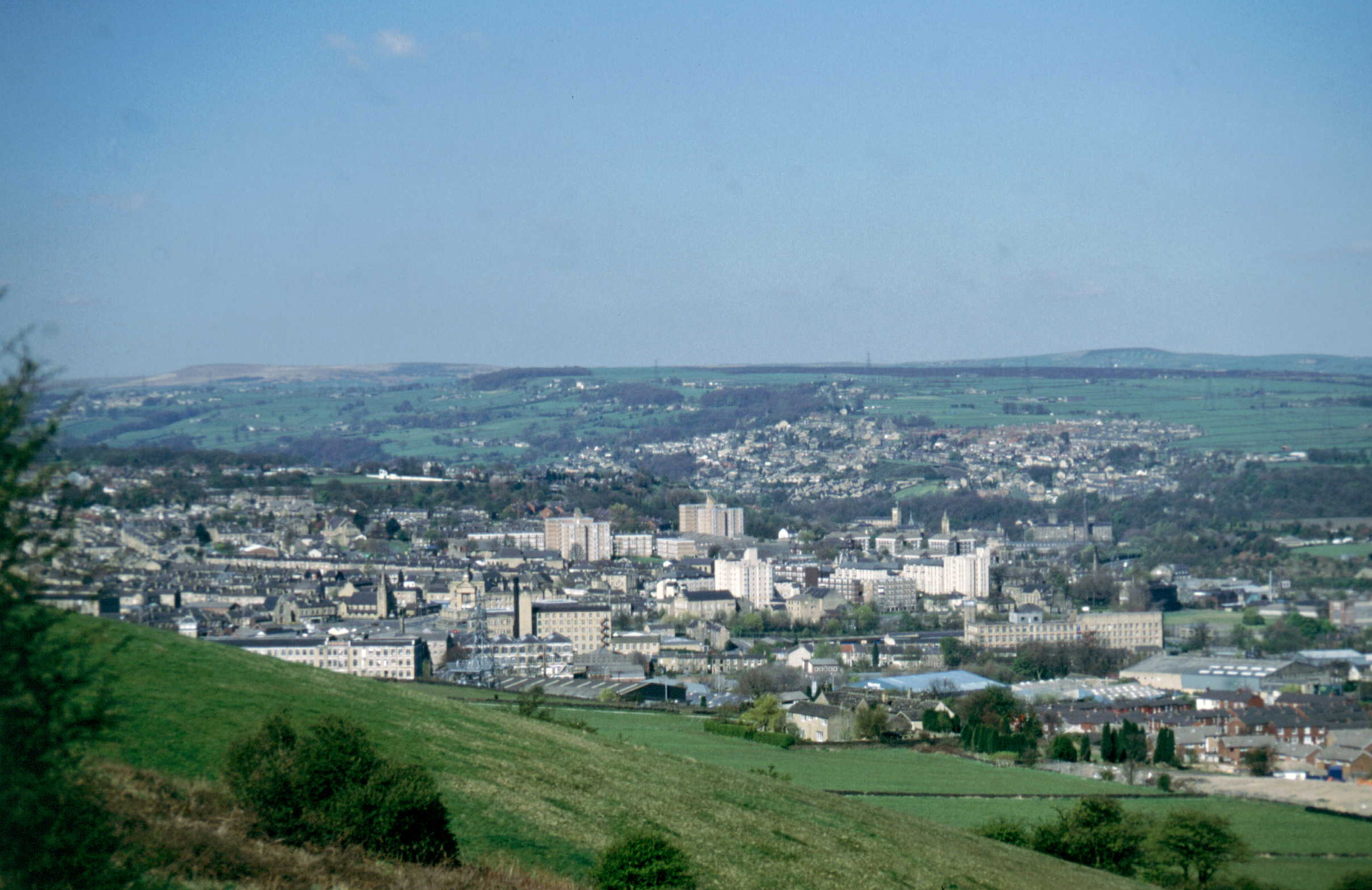
Kew Hill, located in Yorkshire, is a prominent hill that offers breathtaking views and outdoor recreational opportunities to visitors. Situated in the picturesque Yorkshire Dales National Park, it stands at an elevation of about 400 meters (1,312 feet). While not classified as a mountain, it provides a challenging climb for outdoor enthusiasts.

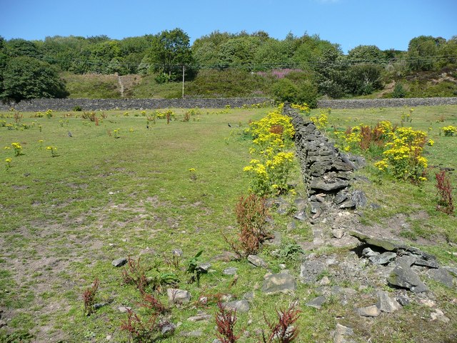
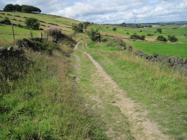
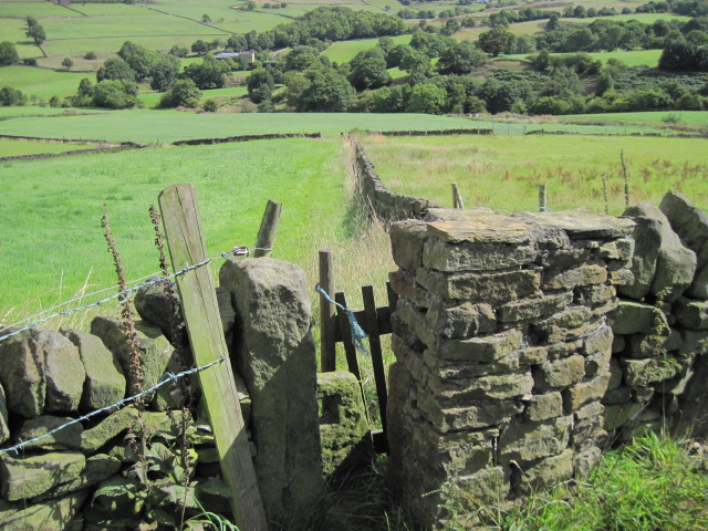
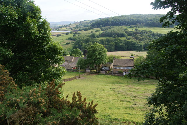
Covered in lush greenery and dotted with vibrant wildflowers during the summer months, Kew Hill boasts a diverse range of flora and fauna. The hill features a mixture of grassy slopes and rocky outcrops, creating an interesting terrain for hikers and climbers. The ascent to the summit rewards adventurers with panoramic views of the surrounding countryside, including rolling hills, expansive moorlands, and quaint villages nestled in the valleys.

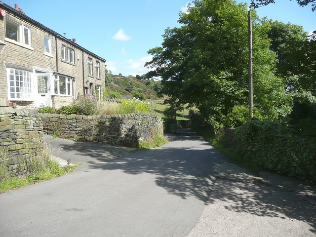
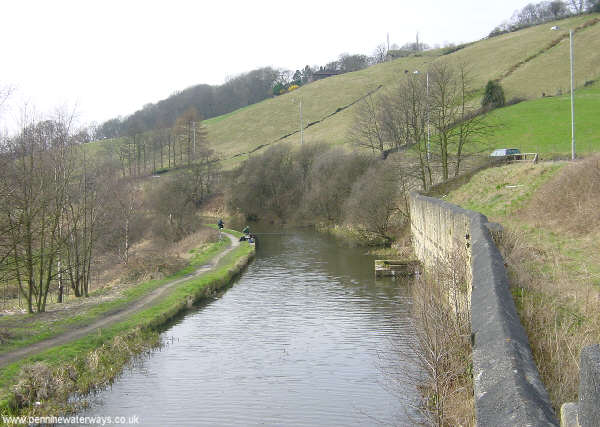
Kew Hill is a popular destination for walkers and nature lovers, with various well-marked trails and footpaths crisscrossing the area. The hill offers opportunities for both leisurely strolls and more challenging hikes, catering to individuals of different fitness levels. Its location in the Yorkshire Dales National Park means that visitors can also explore other nearby attractions, such as rivers, caves, and historical landmarks.

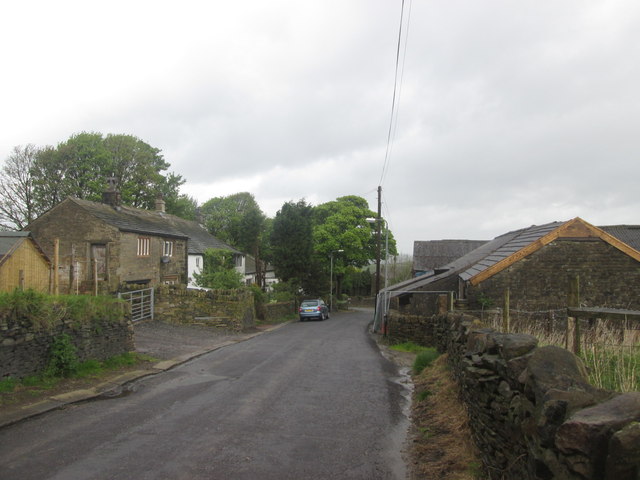
The hill's proximity to quaint villages and towns provides ample accommodation options and amenities for visitors. Additionally, Kew Hill is well-connected by public transportation, making it easily accessible to those without private vehicles.

Overall, Kew Hill in Yorkshire offers an idyllic setting for outdoor enthusiasts seeking natural beauty and adventure. Its picturesque landscapes, diverse flora and fauna, and extensive trail systems make it a must-visit destination for nature lovers and hikers exploring the Yorkshire Dales.

If you have any feedback on the listing, please let us know in the comments section below.
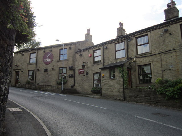
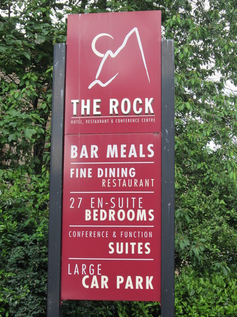
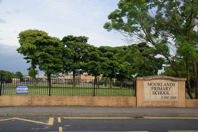
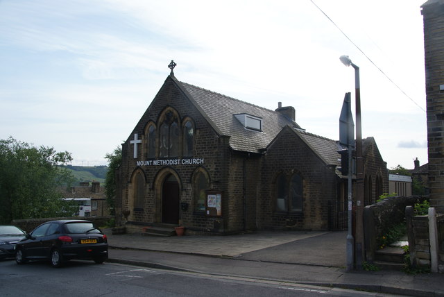
Kew Hill Images

Images are sourced within 2km of 53.671493/-1.8363998 or Grid Reference SE1019. Thanks to Geograph Open Source API. All images are credited.

The 643, Lindley Moor Road
Lamb Hall Road at Snow Lea
Footpath off Lamb Hall Road, Longwood The ragwort is bright and cheerful, but should really have been cut down, along with the docks.
Footpath off Lamb Hall Road, Longwood
The ragwort is bright and cheerful, but should really have been cut down, along with the docks.
Turley Cote Lane
Turley Cote Lane
Footpath towards Shavey Clough
The Rock public house, Holywell Green
New Hey Road from the junction of Longwood Edge Road
Entrance to Quarry Garage from New Hey Road
Moorlands Primary School A newly rebuilt school on the edge of Huddersfield.
Moorlands Primary School
A newly rebuilt school on the edge of Huddersfield.
Mount Methodist Church The area is called Mount and it is quite high even though built up.
Mount Methodist Church
The area is called Mount and it is quite high even though built up.
Footpath near Upper Hirst Looking down into the valley of Longwood Brook.
Footpath near Upper Hirst
Looking down into the valley of Longwood Brook.
Overlooking Snow Lea The hill opposite is Pendle Hill which is nothing like the Lancashire one. (Holmfirth has a River Ribble too, a very small one.)
Overlooking Snow Lea
The hill opposite is Pendle Hill which is nothing like the Lancashire one. (Holmfirth has a River Ribble too, a very small one.)
The M62 on Old Lindley Moor Between Junctions 23 & 24, where there are good views on the far side.
The M62 on Old Lindley Moor
Between Junctions 23 & 24, where there are good views on the far side.
Old Dan Lane at Broad Carr Lane Old Dan Lane was called Back Lane on the 1850 six-inch map. It was part of the old route from Brow Bridge, Greetland, to Stainland and is now a public bridleway.
Old Dan Lane at Broad Carr Lane
Old Dan Lane was called Back Lane on the 1850 six-inch map. It was part of the old route from Brow Bridge, Greetland, to Stainland and is now a public bridleway.
Dated gatepost, Broad Carr Lane The gatepost is inscribed 'Hullenedge / 1854 / A.H.' It is one of several at entrances to fields in the Hullen Edge estate.
Dated gatepost, Broad Carr Lane
The gatepost is inscribed 'Hullenedge / 1854 / A.H.' It is one of several at entrances to fields in the Hullen Edge estate.
Old Lindley
Old Lindley
Benroyd Terrace, north of Jagger Green
Show me another place!

Kew Hill is located at Grid Ref: SE1019 (Lat: 53.671493, Lng: -1.8363998)

Division: West Riding

Unitary Authority: Calderdale

Police Authority: West Yorkshire

What 3 Words

///rivers.slope.dozen. Near Elland, West Yorkshire

Related Wikis

Blackley, West Yorkshire

Blackley is a hamlet in the Calderdale district, in the county of West Yorkshire, England. It is near the town of Elland, the A629 road and the M62 motorway...

Ainley Top

Ainley Top is a village in Calderdale, West Yorkshire in England. It is situated approximately 3 miles (4.8 km) north west of Huddersfield on the A629...

Church of All Saints, Elland

The Church of All Saints is a Church of England parish church in Elland, Calderdale, West Yorkshire. The church is a grade II* listed building. == History... ==

Lindley, Huddersfield

Lindley is a suburb of Huddersfield, within the metropolitan borough of Kirklees in West Yorkshire, England. It is approximately 2 miles (3 km) northwest...

Elland

Elland is a market town in Calderdale, in the county of West Yorkshire, England. It is situated south of Halifax, by the River Calder and the Calder and...

The Brooksbank School

The Brooksbank School is a secondary school with academy status in Elland, near Halifax in West Yorkshire, England. It is a sports college, as well as...

South Pennine Ring

The South Pennine Ring is an English canal ring which crosses the Pennines between Manchester and Huddersfield. It covers parts of five canals, and includes...
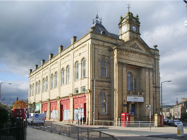
Elland Town Hall

Elland Town Hall is a municipal building in Southgate, Elland, West Yorkshire, England. The structure, which was primarily used as an events venue, is...

Nearby Amenities

Located within 500m of 53.671493,-1.8363998
Power: tower
Lat/Long: 53.668411/-1.8318147
Power: tower
Lat/Long: 53.6684654/-1.8350096
Power: tower
Lat/Long: 53.6685079/-1.8378067
Bus Stop
Blackley New Road
Bus: yes
Local Ref: 45022197
Naptan AtcoCode: 450022197
Naptan Bearing: NW
Naptan CommonName: Blackley New Road
Naptan Crossing: Nr-At Lindley Road
Naptan Indicator: Stop 45022197
Naptan Landmark: Blackley Cricket Ground
Naptan Notes: OSR taken place 061205
Naptan PlusbusZoneRef: LEEDS
Naptan ShortCommonName: Lindley Road
Naptan Street: Blackley Road
Naptan Verified: no
Public Transport: platform
Shelter: no
Source: naptan_import
Lat/Long: 53.6737682/-1.842649
Bus Stop
Blackley New Road
Bus: yes
Local Ref: 45022199
Naptan AtcoCode: 450022199
Naptan Bearing: W
Naptan CommonName: Blackley New Road
Naptan Crossing: Lindley Road
Naptan Indicator: Stop 45022199
Naptan Landmark: Blackley Cricket Ground
Naptan Notes: OSR taken place 071205 size 2 case fitted
Naptan PlusbusZoneRef: LEEDS
Naptan ShortCommonName: Lindley Road
Naptan Street: Blackley New Road
Naptan Verified: no
Public Transport: platform
Ref: 45022199
Shelter: yes
Source: naptan_import
Lat/Long: 53.6731681/-1.8407511
Bus Stop
Lindley Moor Road Action Flat Road
Local Ref: 45022740
Naptan AtcoCode: 450022740
Naptan Bearing: NE
Naptan CommonName: Lindley Moor Road Action Flat Road
Naptan Crossing: Adj Action Flat Lane
Naptan Indicator: Stop 45022740
Naptan Landmark: Warren House Farm
Naptan Notes: OSR taken place 071205
Naptan PlusbusZoneRef: LEEDS
Naptan ShortCommonName: Acton Flat Lane
Naptan Street: Lindley Moor Road
Naptan Verified: no
Source: naptan_import
Lat/Long: 53.6695121/-1.8342004
Bus Stop
Lindley Moor Road Crest Road
Local Ref: 45022794
Naptan AtcoCode: 450022794
Naptan Bearing: SW
Naptan CommonName: Lindley Moor Road Crest Road
Naptan Crossing: Crest Road
Naptan Indicator: Stop 45022794
Naptan PlusbusZoneRef: LEEDS
Naptan ShortCommonName: Crest Road
Naptan Street: Lindley Moor Road
Naptan Verified: no
Shelter: yes
Source: naptan_import
Lat/Long: 53.6710335/-1.8294264
Bus Stop
Lindley Moor Road Crest Road
Local Ref: 45022795
Naptan AtcoCode: 450022795
Naptan Bearing: NE
Naptan CommonName: Lindley Moor Road Crest Road
Naptan Crossing: Crest Road
Naptan Indicator: Stop 45022795
Naptan PlusbusZoneRef: LEEDS
Naptan ShortCommonName: Crest Road
Naptan Street: Lindley Moor Road
Naptan Verified: no
Shelter: no
Source: naptan_import
Lat/Long: 53.6710159/-1.8297443
Bus Stop
Lindley Moor Road Cedar Court Hotel
Local Ref: 45027920
Naptan AtcoCode: 450027920
Naptan Bearing: W
Naptan CommonName: Lindley Moor Road Cedar Court Hotel
Naptan Crossing: Adj Warren House Lane
Naptan Indicator: Stop 45027920
Naptan Landmark: Cedar Court Hotel
Naptan PlusbusZoneRef: LEEDS
Naptan ShortCommonName: Cedar Court Hotel
Naptan Street: Lindley Moor Road
Naptan Verified: no
Shelter: no
Source: naptan_import
Lat/Long: 53.6700381/-1.8310954
Lindley Moor Road
Local Ref: 45051222
Naptan AtcoCode: 450051222
Naptan Bearing: SW
Naptan BusStopType: CUS
Naptan CommonName: Lindley Moor Road
Naptan Indicator: Stop 45051222
Naptan PlusbusZoneRef: LEEDS
Naptan ShortCommonName: Warren House Farm
Naptan Street: Lindley Moor Road
Naptan Verified: no
Source: naptan_import
Lat/Long: 53.6694311/-1.8341099
Traffic Signals
Traffic Signals: signal
Traffic Signals Direction: both
Lat/Long: 53.6673735/-1.8390856
Mini Roundabout
Direction: clockwise
Lat/Long: 53.6707334/-1.8303886
Phone
Check Date: 2023-10-15
Emergency: phone
Ref: 1891A
Lat/Long: 53.6707625/-1.8359009
Power: tower
Source: Bing
Lat/Long: 53.6748109/-1.8346696
Power: tower
Source: Bing
Lat/Long: 53.6697886/-1.8385158
Barrier: stile
Bicycle: no
Foot: yes
Horse: no
Motor Vehicle: no
Stile: stepover
Lat/Long: 53.6709694/-1.8396094
Power: tower
Source: Bing
Lat/Long: 53.6723216/-1.8365919
Phone
Emergency: phone
Ref: 1891B
Lat/Long: 53.6704671/-1.8355913
Power: tower
Lat/Long: 53.6671482/-1.8381893
Power: tower
Lat/Long: 53.6684841/-1.8373098
Power: tower
Lat/Long: 53.6685536/-1.8382294
Blackley
Place: hamlet
Wikidata: Q4923089
Lat/Long: 53.6736931/-1.8416475
Generator Method: photovoltaic
Generator Output Electricity: yes
Generator Source: solar
Generator Type: solar_photovoltaic_panel
Location: roof
Power: generator
Lat/Long: 53.6677569/-1.8326822
Weighbridge
Operator: DVSA
Lat/Long: 53.6728149/-1.8339733
Crossing
Lat/Long: 53.671284/-1.8326767
Crossing
Crossing: unmarked
Crossing Island: no
Crossing Markings: no
Tactile Paving: no
Lat/Long: 53.6727137/-1.8333037
Man Made: flagpole
Lat/Long: 53.6728298/-1.8397128
Bench
Backrest: yes
Seats: 4
Lat/Long: 53.672937/-1.8406355
Bench
Backrest: yes
Seats: 4
Lat/Long: 53.6729497/-1.8405939
Bench
Backrest: yes
Seats: 4
Lat/Long: 53.6729593/-1.8405591
Bench
Backrest: yes
Seats: 4
Lat/Long: 53.6729712/-1.8405255
Bench
Backrest: yes
Seats: 4
Lat/Long: 53.6729791/-1.840488
Bench
Backrest: yes
Seats: 4
Lat/Long: 53.6729851/-1.8404551
Bench
Backrest: yes
Seats: 4
Lat/Long: 53.6721954/-1.8398114
Bench
Backrest: yes
Seats: 4
Lat/Long: 53.6721716/-1.8399267
Bench
Backrest: yes
Seats: 4
Lat/Long: 53.6721978/-1.8398858
Bench
Backrest: yes
Seats: 4
Lat/Long: 53.67223/-1.8398369
Bench
Backrest: yes
Seats: 4
Lat/Long: 53.672278/-1.8397544
Bench
Backrest: yes
Seats: 4
Lat/Long: 53.672218/-1.8397712
Bench
Backrest: yes
Seats: 4
Lat/Long: 53.672187/-1.8399804
Bench
Backrest: yes
Seats: 4
Lat/Long: 53.6722228/-1.8399153
Bench
Backrest: yes
Seats: 4
Lat/Long: 53.672249/-1.8398885
Bench
Backrest: yes
Seats: 4
Lat/Long: 53.6722689/-1.8398604
Bench
Backrest: yes
Seats: 4
Lat/Long: 53.6722879/-1.8398349
Bench
Backrest: yes
Seats: 4
Lat/Long: 53.6723098/-1.8398101
Bench
Backrest: yes
Seats: 4
Lat/Long: 53.6723336/-1.8397906
Bench
Backrest: yes
Seats: 4
Lat/Long: 53.6723551/-1.8397645
Bench
Backrest: yes
Seats: 4
Lat/Long: 53.6723884/-1.8397417
Bench
Backrest: yes
Seats: 4
Lat/Long: 53.6724151/-1.8397249
Bench
Backrest: yes
Seats: 4
Lat/Long: 53.6724401/-1.8397209
Bench
Backrest: yes
Seats: 4
Lat/Long: 53.6724619/-1.8397122
Access: no
Barrier: stile
Bicycle: no
Foot: yes
Horse: no
Motor Vehicle: no
Lat/Long: 53.6698048/-1.8390805
Post Box
Brand: Royal Mail
Brand Wikidata: Q638098
Brand Wikipedia: en:Royal Mail
Drive Through: no
Operator: Royal Mail
Operator Wikidata: Q638098
Post Box Type: wall
Royal Cypher: VR
Lat/Long: 53.6733538/-1.8418198
Defibrillator
Access: yes
Defibrillator Location: on the outside wall of Blackley Cricket Club pavilion, facing the pitch
Emergency: defibrillator
Indoor: no
Ref GB The Circuit: 332FB5D9-EC7C-4A3C-A092-AD5E00C1CF50
Lat/Long: 53.6728575/-1.8396558
The data included in this document is from www.openstreetmap.org. The data is made available under ODbL.

Have you been to Kew Hill?

Leave your review of Kew Hill below (or comments, questions and feedback).