Middle Chine

Valley in Hampshire

England

Middle Chine

Groyne at Branksome Dene Chine, Bournemouth A wooden groyne reflected in the water at Branksome Dene Chine, in Bournemouth.

Just visible in the distance are the white chalk cliffs of The Needles, on the Isle of Wight.
Groyne at Branksome Dene Chine, Bournemouth Credit: Malc McDonald

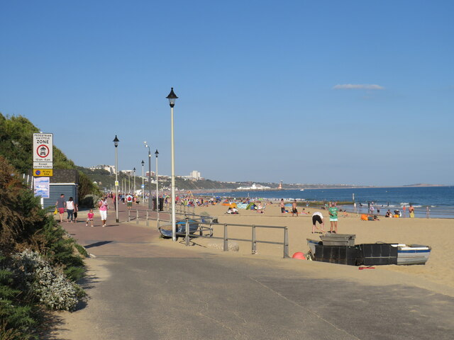
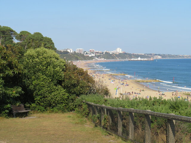
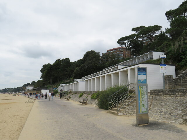
Middle Chine, located in Hampshire, England, is a picturesque valley renowned for its natural beauty and tranquil atmosphere. Nestled between the coastal towns of Bournemouth and Poole, this charming valley offers visitors a serene escape from the bustling city life.

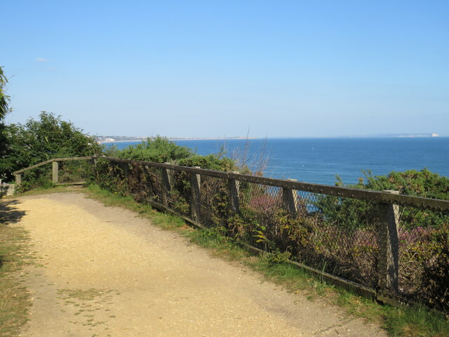
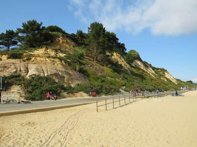
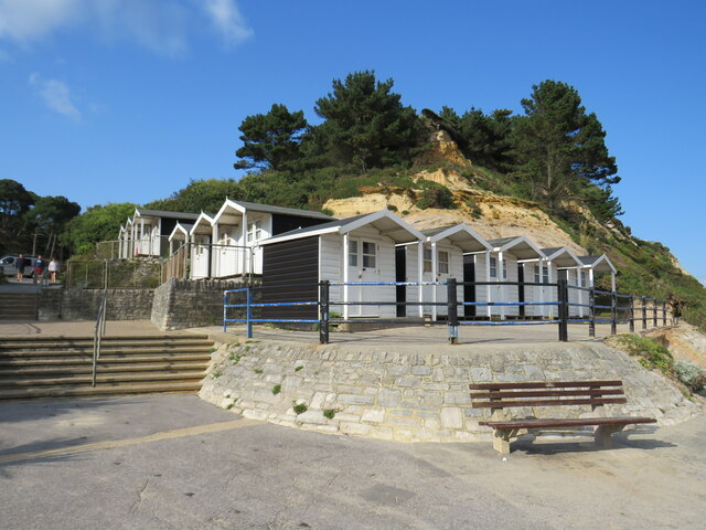
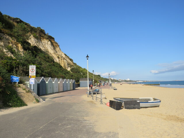
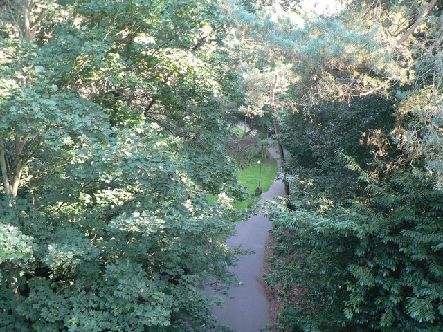
The main attraction of Middle Chine is its stunning wooded area, which stretches for approximately half a mile. Towering trees, including oak, beech, and pine, create a dense canopy, casting dappled sunlight onto the forest floor. The chine's unique geological formation, with steep sides and a narrow pathway, adds to its allure, making it a popular spot for nature enthusiasts and hikers.

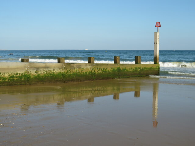
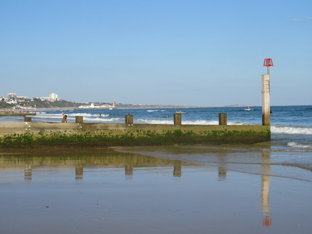
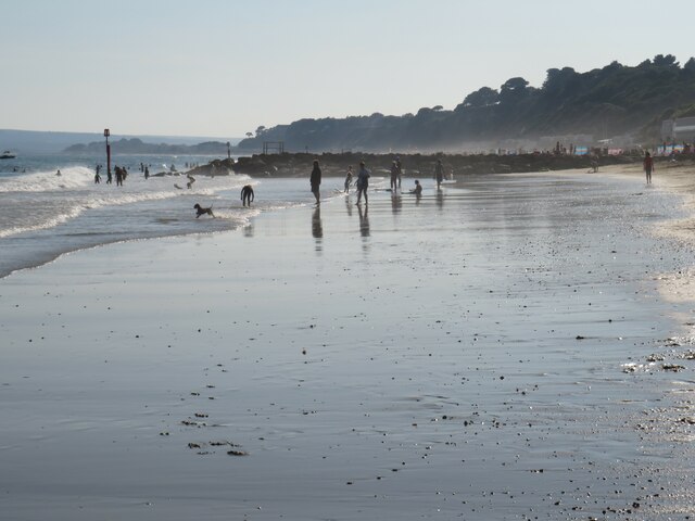
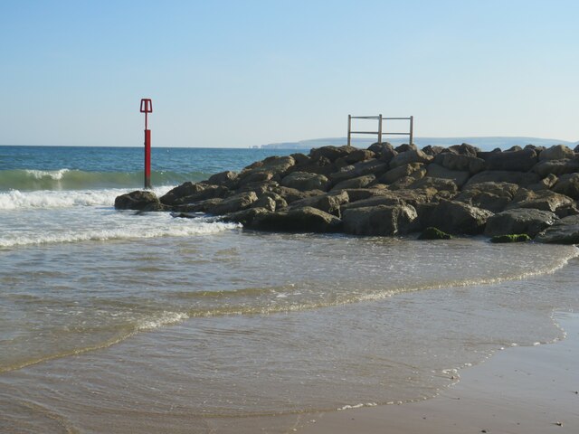
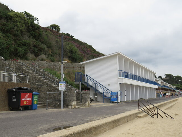
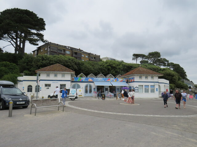
A crystal-clear stream meanders through the valley, adding to its idyllic charm. The sound of trickling water provides a soothing soundtrack, while small bridges allow visitors to cross the stream and explore the chine from multiple angles. The stream eventually flows into the nearby sandy beach, making it a convenient starting point for coastal walks and beach visits.

Middle Chine is also home to a variety of flora and fauna. Rare plant species thrive in this protected habitat, while birdwatchers can spot a diverse range of avian species, including woodpeckers, kingfishers, and nuthatches. Squirrels and rabbits are often seen darting among the undergrowth, adding to the area's enchantment.

Local authorities maintain the chine, ensuring its preservation and accessibility for visitors. Clear pathways and benches are strategically placed throughout the valley, providing convenient resting spots and allowing visitors to immerse themselves in the natural beauty of Middle Chine.

Overall, Middle Chine, Hampshire, stands as a tranquil oasis, offering visitors a chance to reconnect with nature in a serene and captivating environment.

If you have any feedback on the listing, please let us know in the comments section below.

Middle Chine Images

Images are sourced within 2km of 50.71348/-1.8934933 or Grid Reference SZ0790. Thanks to Geograph Open Source API. All images are credited.

Groyne at Branksome Dene Chine, Bournemouth A wooden groyne reflected in the water at Branksome Dene Chine, in Bournemouth.

Just visible in the distance are the white chalk cliffs of The Needles, on the Isle of Wight.
Groyne at Branksome Dene Chine, Bournemouth
A wooden groyne reflected in the water at Branksome Dene Chine, in Bournemouth. Just visible in the distance are the white chalk cliffs of The Needles, on the Isle of Wight.
Groyne at Branksome Dene Chine, Bournemouth A wooden groyne on the beach at Branksome Dene Chine, in Bournemouth.  In the background, the view of Bournemouth's coastline stretched to Bournemouth Pier and along to Hengistbury Head, visible just to the left of the white marker post.
Groyne at Branksome Dene Chine, Bournemouth
A wooden groyne on the beach at Branksome Dene Chine, in Bournemouth. In the background, the view of Bournemouth's coastline stretched to Bournemouth Pier and along to Hengistbury Head, visible just to the left of the white marker post.
Receding tide at Branksome Dene Chine The beach at Branksome Dene Chine, on the border between Bournemouth and Poole, photographed on a sunny afternoon in August 2021.  The tide was receding when this image was taken, leaving wet sand.
Receding tide at Branksome Dene Chine
The beach at Branksome Dene Chine, on the border between Bournemouth and Poole, photographed on a sunny afternoon in August 2021. The tide was receding when this image was taken, leaving wet sand.
Promenade at Branksome Dene Chine, near Bournemouth A promenade runs for around 10 miles along the seafront at Bournemouth, stretching to Southbourne in the east and Sandbanks in the west.  The last few miles to Sandbanks are in the Borough of Poole, rather than in Bournemouth.

The promenade forms part of the route of National Cycle Network route 2, which stretches along England's south coast. However, during the peak summer holiday months of July and August, cycling is prohibited on the promenade between 10:00 and 18:00.  Between those times, cyclists must use an alternative route.

This image was taken just beyond the Bournemouth/Poole boundary, looking westwards on a fine and sunny afternoon in August 2021.
Promenade at Branksome Dene Chine, near Bournemouth
A promenade runs for around 10 miles along the seafront at Bournemouth, stretching to Southbourne in the east and Sandbanks in the west. The last few miles to Sandbanks are in the Borough of Poole, rather than in Bournemouth. The promenade forms part of the route of National Cycle Network route 2, which stretches along England's south coast. However, during the peak summer holiday months of July and August, cycling is prohibited on the promenade between 10:00 and 18:00. Between those times, cyclists must use an alternative route. This image was taken just beyond the Bournemouth/Poole boundary, looking westwards on a fine and sunny afternoon in August 2021.
Seafront at Branksome Dene Chine, near Bournemouth A promenade runs for approximately 10 miles along Bournemouth's seafront, from Sandbanks in the west to Southbourne in the east.  The first section from Sandbanks is in the Borough of Poole.  Here at Branksome Dene Chine the promenade crosses the boundary into the Borough of Bournemouth, at the point where the path surface changes from grey to dark red.

The promenade forms part of the route of National Cycle Network route 2, which stretches along England's south coast. However, during the peak summer holiday months of July and August, cycling is prohibited on the promenade between 10:00 and 18:00.  Between those times, cyclists must use an alternative route.

In the distance in the centre of the image is Bournemouth Pier and to the right, further around the coastline, is Hengistbury Head.
Seafront at Branksome Dene Chine, near Bournemouth
A promenade runs for approximately 10 miles along Bournemouth's seafront, from Sandbanks in the west to Southbourne in the east. The first section from Sandbanks is in the Borough of Poole. Here at Branksome Dene Chine the promenade crosses the boundary into the Borough of Bournemouth, at the point where the path surface changes from grey to dark red. The promenade forms part of the route of National Cycle Network route 2, which stretches along England's south coast. However, during the peak summer holiday months of July and August, cycling is prohibited on the promenade between 10:00 and 18:00. Between those times, cyclists must use an alternative route. In the distance in the centre of the image is Bournemouth Pier and to the right, further around the coastline, is Hengistbury Head.
Groyne at Branksome Dene Chine, Bournemouth A rock groyne and marker on the beach at Branksome Dene Chine, near Bournemouth.  Visible in the distance are Old Harry Rocks and the Purbeck Hills.
Groyne at Branksome Dene Chine, Bournemouth
A rock groyne and marker on the beach at Branksome Dene Chine, near Bournemouth. Visible in the distance are Old Harry Rocks and the Purbeck Hills.
Groyne marker at Branksome Dene Chine, Bournemouth The red post marks the end of a groyne on the beach at Branksome Dene Chine, near Bournemouth.
Groyne marker at Branksome Dene Chine, Bournemouth
The red post marks the end of a groyne on the beach at Branksome Dene Chine, near Bournemouth.
Overcliff at Branksome Dene, near Bournemouth A bench on the overcliff at Branksome Dene, near Bournemouth.  In the background, the coastline stretches to Bournemouth Pier and beyond.
Overcliff at Branksome Dene, near Bournemouth
A bench on the overcliff at Branksome Dene, near Bournemouth. In the background, the coastline stretches to Bournemouth Pier and beyond.
Overcliff path at Branksome Chine, near Bournemouth A path on the overcliff at Branksome Chine, near Bournemouth.

This image was taken on a relatively clear day with views along the coastline to Hengistbury Head (in the distance in the centre of the image) and across to chalk cliffs at The Needles, at the westernmost tip of the Isle of Wight (visible to the right).
Overcliff path at Branksome Chine, near Bournemouth
A path on the overcliff at Branksome Chine, near Bournemouth. This image was taken on a relatively clear day with views along the coastline to Hengistbury Head (in the distance in the centre of the image) and across to chalk cliffs at The Needles, at the westernmost tip of the Isle of Wight (visible to the right).
Pinecliff Gardens, Branksome Chine, near Bournemouth Pinecliff Gardens look out over the beach and coastline at Branksome Chine, near Bournemouth.
Pinecliff Gardens, Branksome Chine, near Bournemouth
Pinecliff Gardens look out over the beach and coastline at Branksome Chine, near Bournemouth.
Promenade near Branksome Chine, Poole The seafront promenade stretches for around 10 miles along the coastline through Bournemouth.

The promenade forms part of the route of National Cycle Network route 2. However, during the peak summer holiday months of July and August when the beaches and seafront are at their busiest, cycling is prohibited between 10:00 and 18:00. During those times, cyclists must use an alternative route.
Promenade near Branksome Chine, Poole
The seafront promenade stretches for around 10 miles along the coastline through Bournemouth. The promenade forms part of the route of National Cycle Network route 2. However, during the peak summer holiday months of July and August when the beaches and seafront are at their busiest, cycling is prohibited between 10:00 and 18:00. During those times, cyclists must use an alternative route.
Beachfront café at Branksome Chine, near Poole A café on the beachfront at Branksome Chine, near Poole.
Beachfront café at Branksome Chine, near Poole
A café on the beachfront at Branksome Chine, near Poole.
Toilets and shop at Branksome Chine Beach, near Poole This building on the beachfront at Branksome Chine contains public toilets along with a shop selling beach accessories.
Toilets and shop at Branksome Chine Beach, near Poole
This building on the beachfront at Branksome Chine contains public toilets along with a shop selling beach accessories.
Promenade at Branksome Dene Chine, near Bournemouth The seafront promenade stretches for around 10 miles along the coastline through Bournemouth.

The promenade forms part of the route of National Cycle Network route 2. However, during the peak summer holiday months of July and August when the beaches and seafront are at their busiest, cycling is prohibited between 10:00 and 18:00. During those times, cyclists must use an alternative route.
Promenade at Branksome Dene Chine, near Bournemouth
The seafront promenade stretches for around 10 miles along the coastline through Bournemouth. The promenade forms part of the route of National Cycle Network route 2. However, during the peak summer holiday months of July and August when the beaches and seafront are at their busiest, cycling is prohibited between 10:00 and 18:00. During those times, cyclists must use an alternative route.
Branksome Dene Chine beach, near Bournemouth The sandy beach at Branksome Dene Chine, near Bourneouth.

The seafront promenade stretches for around 10 miles along the coastline through Bournemouth.

The promenade forms part of the route of National Cycle Network route 2. However, during the peak summer holiday months of July and August when the beaches and seafront are at their busiest, cycling is prohibited between 10:00 and 18:00. During those times, cyclists must use an alternative route.
Branksome Dene Chine beach, near Bournemouth
The sandy beach at Branksome Dene Chine, near Bourneouth. The seafront promenade stretches for around 10 miles along the coastline through Bournemouth. The promenade forms part of the route of National Cycle Network route 2. However, during the peak summer holiday months of July and August when the beaches and seafront are at their busiest, cycling is prohibited between 10:00 and 18:00. During those times, cyclists must use an alternative route.
Beach huts at Branksome Dene Chine, near Bournemouth A beach hut is a small, usually wooden and often brightly coloured, box or structure above the high tide mark on popular bathing beaches. They are generally used as a shelter from the sun or wind, changing into and out of swimming costumes and for the safe storing of some personal belongings. Some beach huts incorporate simple facilities for preparing food and hot drinks by either bottled gas or occasionally mains electricity.
Wikipedia: <span class="nowrap"><a title="http://en.wikipedia.org/wiki/Beach_hut" rel="nofollow ugc noopener" href="http://en.wikipedia.org/wiki/Beach_hut">Link</a><img style="margin-left:2px;" alt="External link" title="External link - shift click to open in new window" src="https://s1.geograph.org.uk/img/external.png" width="10" height="10"/></span>
Beach huts at Branksome Dene Chine, near Bournemouth
A beach hut is a small, usually wooden and often brightly coloured, box or structure above the high tide mark on popular bathing beaches. They are generally used as a shelter from the sun or wind, changing into and out of swimming costumes and for the safe storing of some personal belongings. Some beach huts incorporate simple facilities for preparing food and hot drinks by either bottled gas or occasionally mains electricity. Wikipedia: LinkExternal link
Promenade at the Bournemouth/Poole boundary The seafront promenade stretches for around 10 miles along the coastline through Bournemouth.  It starts at Sandbanks, in the Borough of Poole.  This image shows the point at which the promenade crosses the boundary into the Borough of Bournemouth.  Note the change in the path surface, and the blue sign to the left of the image which welcomes people into Bournemouth.

The promenade forms part of the route of National Cycle Network route 2. However, during the peak summer holiday months of July and August when the beaches and seafront are at their busiest, cycling is prohibited between 10:00 and 18:00. During those times, cyclists must use an alternative route.
Promenade at the Bournemouth/Poole boundary
The seafront promenade stretches for around 10 miles along the coastline through Bournemouth. It starts at Sandbanks, in the Borough of Poole. This image shows the point at which the promenade crosses the boundary into the Borough of Bournemouth. Note the change in the path surface, and the blue sign to the left of the image which welcomes people into Bournemouth. The promenade forms part of the route of National Cycle Network route 2. However, during the peak summer holiday months of July and August when the beaches and seafront are at their busiest, cycling is prohibited between 10:00 and 18:00. During those times, cyclists must use an alternative route.
Show me another place!

Middle Chine is located at Grid Ref: SZ0790 (Lat: 50.71348, Lng: -1.8934933)

Unitary Authority: Bournemouth, Christchurch and Poole

Police Authority: Dorset

What 3 Words

///cigar.blog.intro. Near Bournemouth, Dorset

Related Wikis

Durley Chine

Durley Chine is a Blue Flag beach and chine in Bournemouth, Dorset in England. It is to the west of Bournemouth Town Centre, north of West Cliff, and east...

Alum Chine

Alum Chine is the largest chine in Bournemouth, England. The gorge was crossed by a suspension bridge by the early part of the twentieth century. ��2...

Westbourne, Dorset

Westbourne is a residential and shopping area of Bournemouth, Dorset, England. It is located in between Branksome, Poole and the centre of Bournemouth...

Bournemouth Highcliff Marriott Hotel

The Bournemouth Highcliff Marriott Hotel is located in St. Michael's Road, Bournemouth, Dorset. Formerly four large mansions in 1873 and part of the Coastguard...

Nearby Amenities

Located within 500m of 50.71348,-1.8934933
Crossing
Crossing: unmarked
Crossing Island: yes
Segregated: no
Source: local_knowledge
Supervised: no
Tactile Paving: yes
Lat/Long: 50.7166006/-1.8953164
Turning Circle
Lat/Long: 50.7122567/-1.8973004
Post Box
Operator: Royal Mail
Operator Wikidata: Q638098
Post Box Type: pillar
Ref: BH4 185
Ref GB Uprn: 10015332766
Royal Cypher: GR
Royal Cypher Wikidata: Q33102273
Lat/Long: 50.7134753/-1.8957608
Post Box
Operator: Royal Mail
Operator Wikidata: Q638098
Post Box Type: pillar
Ref: BH4 101
Ref GB Uprn: 10015440124
Royal Cypher: EVIIR
Royal Cypher Wikidata: Q33102324
Lat/Long: 50.7164776/-1.8945274
Post Box
Operator: Royal Mail
Operator Wikidata: Q638098
Post Box Type: pillar
Ref: BH4 120
Ref GB Uprn: 10015296169
Royal Cypher: EVIIR
Royal Cypher Wikidata: Q33102324
Lat/Long: 50.715912/-1.8981997
Crossing
Crossing: unmarked
Crossing Island: yes
Segregated: no
Source: local_knowledge
Supervised: no
Tactile Paving: yes
Lat/Long: 50.7168458/-1.8951359
Crossing
Crossing: unmarked
Crossing Island: yes
Segregated: no
Source: local_knowledge
Supervised: no
Tactile Paving: yes
Lat/Long: 50.7168006/-1.8955698
Vending Machine
Vending: parking_tickets
Lat/Long: 50.7136138/-1.889463
Vending Machine
Vending: parking_tickets
Lat/Long: 50.7142337/-1.8905898
Durley Chine
Hiking: yes
Information: map
Map Size: region
Map Type: scheme
Tourism: information
Lat/Long: 50.7135994/-1.8893923
Bench
Backrest: yes
Colour: brown
Material: wood
Lat/Long: 50.714339/-1.890511
Turning Circle
Source: survey
Lat/Long: 50.7146943/-1.8983178
Cafe
Chineside
Lat/Long: 50.7133005/-1.8892582
Atm
Fee: £1.25
Source: local_knowledge
Lat/Long: 50.7135535/-1.8890409
Cafe
Argyll Cafe
Addr Postcode: BH4 8AB
Addr Street: West Overcliff Drive
Fhrs Id: 342267
Source: survey
Source Addr: FHRS Open Data
Lat/Long: 50.7129271/-1.8941958
Drinking Water
Source: survey
Lat/Long: 50.712602/-1.8924252
Bench
Backrest: yes
Lat/Long: 50.7143504/-1.8879426
Bus Stop
Clarendon Road
Bench: yes
Bin: no
Bus: yes
Lit: yes
Naptan AtcoCode: 1290BOB20572
Naptan Bearing: E
Naptan CommonName: Clarendon Road
Naptan Indicator: E-bound
Naptan NaptanCode: bouapja
Naptan PlusbusZoneRef: BOMO
Naptan Street: West Cliff Road
Naptan Verified: no
Public Transport: platform
Shelter: yes
Tactile Paving: no
Lat/Long: 50.7169496/-1.8958794
Bench
Lat/Long: 50.7148195/-1.8950005
Bench
Lat/Long: 50.715274/-1.8949357
Waste Basket
Bin
Lat/Long: 50.7152976/-1.8949455
Bench
Lat/Long: 50.7158113/-1.8954641
Bench
Backrest: yes
Lat/Long: 50.716948/-1.8957895
Bench
Backrest: yes
Lat/Long: 50.7168081/-1.8956862
Bench
Backrest: yes
Lat/Long: 50.7112/-1.8968416
Bench
Backrest: yes
Lat/Long: 50.7108926/-1.8980566
Bench
Backrest: yes
Lat/Long: 50.7107856/-1.8984777
Bench
Backrest: yes
Lat/Long: 50.7106548/-1.8990169
Waste Basket
Lat/Long: 50.7107125/-1.8987969
Access: yes
Drinking Water: yes
Drinking Water Legal: yes
Man Made: water_tap
Lat/Long: 50.7110666/-1.8962797
Bench
Lat/Long: 50.7133251/-1.8907569
Bench
Lat/Long: 50.713306/-1.8908266
Bench
Lat/Long: 50.7132253/-1.8909781
Bench
Lat/Long: 50.7131706/-1.8911156
Bench
Lat/Long: 50.713129/-1.8912658
Bench
Lat/Long: 50.7130912/-1.891412
Bench
Lat/Long: 50.7130716/-1.8915179
Bench
Lat/Long: 50.7130453/-1.8916132
Bench
Lat/Long: 50.7130317/-1.8917218
Bench
Covered: yes
Lat/Long: 50.7130589/-1.8919404
Bicycle Rental
Durley Chine
Bicycle Rental: dropoff_point
Capacity: 10
Email: support@beryl.cc
Fee: yes
Name Signed: no
Network: Beryl - Bournemouth Poole Christchurch
Official Name: Durley Chine
Operator: Beryl
Operator Wikidata: Q106575369
Payment App: yes
Payment App Android: cc.beryl.basis
Payment App Ios: 1386768364
Payment Cash: no
Payment Credit Cards: no
Payment Cryptocurrencies: no
Payment Debit Cards: no
Payment Electronic Purses: no
Phone: +44 20 3003 5044
Ref Gbfs: beryl_bcp:147
Rental: city_bike
Website: https://beryl.cc/scheme/bournemouth-christchurch-and-poole
Lat/Long: 50.7135048/-1.889467
Bicycle Rental
Middle Chine
Bicycle Rental: dropoff_point
Capacity: 7
Email: support@beryl.cc
Fee: yes
Name Signed: no
Network: Beryl - Bournemouth Poole Christchurch
Official Name: Middle Chine
Operator: Beryl
Operator Wikidata: Q106575369
Payment App: yes
Payment App Android: cc.beryl.basis
Payment App Ios: 1386768364
Payment Cash: no
Payment Credit Cards: no
Payment Cryptocurrencies: no
Payment Debit Cards: no
Payment Electronic Purses: no
Phone: +44 20 3003 5044
Ref Gbfs: beryl_bcp:213
Rental: city_bike
Website: https://beryl.cc/scheme/bournemouth-christchurch-and-poole
Lat/Long: 50.7125473/-1.892511
Bicycle Rental
Alum Chine
Bicycle Rental: dropoff_point
Capacity: 8
Email: support@beryl.cc
Fee: yes
Name Signed: no
Network: Beryl - Bournemouth Poole Christchurch
Official Name: Alum Chine
Operator: Beryl
Operator Wikidata: Q106575369
Payment App: yes
Payment App Android: cc.beryl.basis
Payment App Ios: 1386768364
Payment Cash: no
Payment Credit Cards: no
Payment Cryptocurrencies: no
Payment Debit Cards: no
Payment Electronic Purses: no
Phone: +44 20 3003 5044
Ref Gbfs: beryl_bcp:157
Rental: city_bike
Website: https://beryl.cc/scheme/bournemouth-christchurch-and-poole
Lat/Long: 50.7114868/-1.8960381
Bus Stop
Admirals Walk
Bench: yes
Bin: no
Bus: yes
Lit: no
Naptan AtcoCode: 1290BOB20574
Naptan Bearing: E
Naptan CommonName: Admirals Walk
Naptan Indicator: E-bound
Naptan NaptanCode: bouatmj
Naptan PlusbusZoneRef: BOMO
Naptan Street: West Cliff Road
Naptan Verified: no
Public Transport: platform
Shelter: no
Tactile Paving: no
Lat/Long: 50.7163825/-1.8889967
Bus Stop
Chine Crescent Road
Bench: yes
Bin: no
Bus: yes
Lit: no
Naptan AtcoCode: 1290BOB20573
Naptan Bearing: E
Naptan CommonName: Chine Crescent Road
Naptan Indicator: E-bound
Naptan NaptanCode: bouatap
Naptan PlusbusZoneRef: BOMO
Naptan Street: West Cliff Road
Naptan Verified: no
Public Transport: platform
Shelter: no
Tactile Paving: no
Lat/Long: 50.7160047/-1.8921496
Bus Stop
Clarendon Road
Bench: yes
Bin: no
Bus: yes
Lit: yes
Naptan AtcoCode: 1290BOB20569
Naptan Bearing: W
Naptan CommonName: Clarendon Road
Naptan Indicator: W-bound
Naptan NaptanCode: bouapgp
Naptan PlusbusZoneRef: BOMO
Naptan Street: West Cliff Road
Naptan Verified: no
Public Transport: platform
Shelter: yes
Tactile Paving: no
Lat/Long: 50.716813/-1.8957196
Bus Stop
Chine Crescent Road
Bench: yes
Bin: no
Bus: yes
Lit: no
Naptan AtcoCode: 1290BOB20568
Naptan Bearing: W
Naptan CommonName: Chine Crescent Road
Naptan Indicator: W-bound
Naptan NaptanCode: bouatag
Naptan PlusbusZoneRef: BOMO
Naptan Street: West Cliff Road
Naptan Verified: no
Public Transport: platform
Shelter: no
Tactile Paving: no
Lat/Long: 50.715907/-1.8926699
Bus Stop
Admirals Walk
Bench: yes
Bin: no
Bus: yes
Lit: no
Naptan AtcoCode: 1290BOB20575
Naptan Bearing: W
Naptan CommonName: Admirals Walk
Naptan Indicator: W-bound
Naptan NaptanCode: bouatmp
Naptan PlusbusZoneRef: BOMO
Naptan Street: West Cliff Road
Naptan Verified: no
Public Transport: platform
Shelter: no
Tactile Paving: no
Lat/Long: 50.7163256/-1.8889725
Bus Stop
Studland Road
Bench: no
Bin: no
Bus: yes
Lit: yes
Naptan AtcoCode: 1290BOB20550
Naptan Bearing: W
Naptan CommonName: Studland Road
Naptan Indicator: W-bound
Naptan NaptanCode: bouapag
Naptan PlusbusZoneRef: BOMO
Naptan Street: Alumhurst Road
Naptan Verified: no
Public Transport: platform
Shelter: no
Tactile Paving: no
Lat/Long: 50.7108425/-1.8984944
Bus Stop
Alum Chine
Bench: yes
Bin: no
Bus: yes
Lit: yes
Naptan AtcoCode: 1290BOB20549
Naptan Bearing: SE
Naptan CommonName: Alum Chine
Naptan Indicator: SE-bound
Naptan NaptanCode: bouapdm
Naptan PlusbusZoneRef: BOMO
Naptan Street: Alumhurst Road
Naptan Verified: no
Public Transport: platform
Shelter: yes
Tactile Paving: no
Lat/Long: 50.7121643/-1.8970473
Bus Stop
Studland Road
Bench: no
Bin: no
Bus: yes
Lit: yes
Naptan AtcoCode: 1290BOB20548
Naptan Bearing: E
Naptan CommonName: Studland Road
Naptan Indicator: E-bound
Naptan NaptanCode: bouapap
Naptan PlusbusZoneRef: BOMO
Naptan Street: Alumhurst Road
Naptan Verified: no
Public Transport: platform
Shelter: no
Tactile Paving: no
Lat/Long: 50.7110301/-1.8980894
Turning Circle
Lat/Long: 50.7161182/-1.8926973
Turning Circle
Lat/Long: 50.7160976/-1.8921557
Bicycle Rental
West Overcliff Drive
Bicycle Rental: dropoff_point
Capacity: 6
Email: support@beryl.cc
Fee: yes
Name Signed: no
Network: Beryl - Bournemouth Poole Christchurch
Official Name: West Overcliff Drive
Operator: Beryl
Operator Wikidata: Q106575369
Payment App: yes
Payment App Android: cc.beryl.basis
Payment App Ios: 1386768364
Payment Cash: no
Payment Credit Cards: no
Payment Cryptocurrencies: no
Payment Debit Cards: no
Payment Electronic Purses: no
Phone: +44 20 3003 5044
Ref Gbfs: beryl_bcp:3105
Rental: city_bike
Website: https://beryl.cc/scheme/bournemouth-christchurch-and-poole
Lat/Long: 50.7128716/-1.895129
Bench
Backrest: yes
Lat/Long: 50.7138527/-1.8999189
Bench
Backrest: yes
Lat/Long: 50.7131195/-1.8988259
Bench
Backrest: yes
Lat/Long: 50.7123984/-1.8976602
Bench
Backrest: yes
Lat/Long: 50.7123538/-1.8975214
Bench
Backrest: yes
Lat/Long: 50.711299/-1.8957803
Bench
Backrest: yes
Lat/Long: 50.7111747/-1.8957536
Bench
Backrest: yes
Lat/Long: 50.7111137/-1.8959409
The data included in this document is from www.openstreetmap.org. The data is made available under ODbL.

Have you been to Middle Chine?

Leave your review of Middle Chine below (or comments, questions and feedback).