Alum Chine

Valley in Hampshire

England

Alum Chine

Groyne at Branksome Dene Chine, Bournemouth A wooden groyne reflected in the water at Branksome Dene Chine, in Bournemouth.

Just visible in the distance are the white chalk cliffs of The Needles, on the Isle of Wight.
Groyne at Branksome Dene Chine, Bournemouth Credit: Malc McDonald

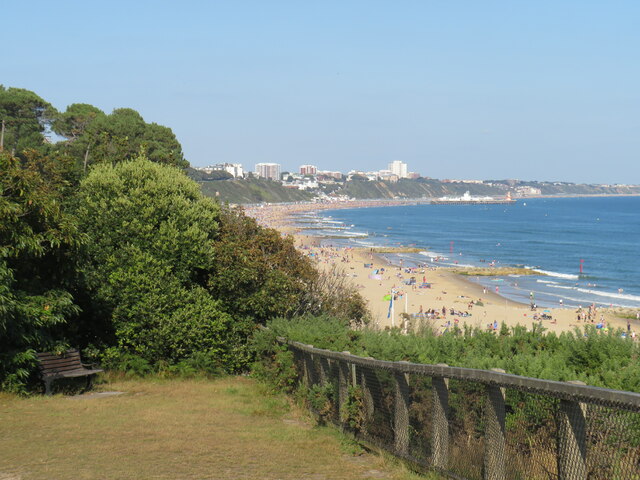
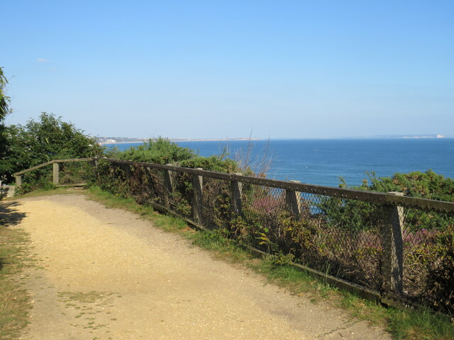
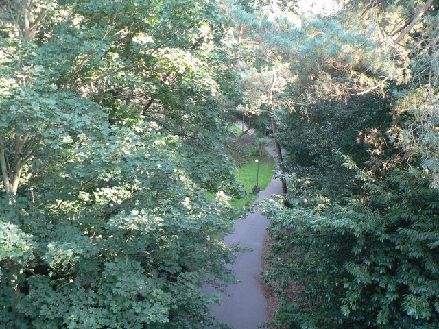
Alum Chine is a picturesque valley located in Hampshire, England. Situated on the southern coast, it forms part of the larger Bournemouth area. The chine, a local term for a steep-sided river valley, stretches approximately one mile from the clifftop down to the sandy beach.

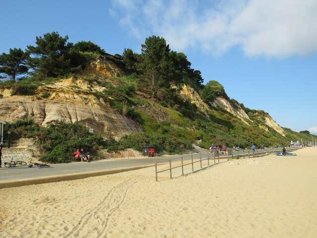
Known for its natural beauty and tranquil atmosphere, Alum Chine attracts both locals and tourists alike. The valley is characterized by lush greenery, including a variety of trees such as oak, beech, and pine, creating a verdant and serene environment. A small stream runs through the chine, adding to its charm and providing a peaceful soundtrack to visitors.

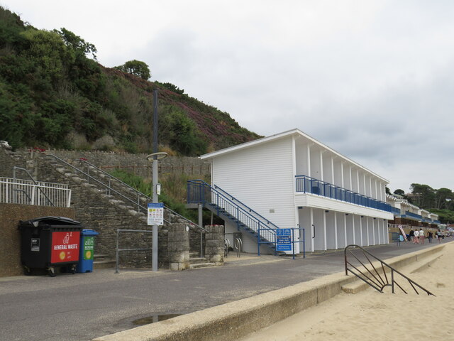
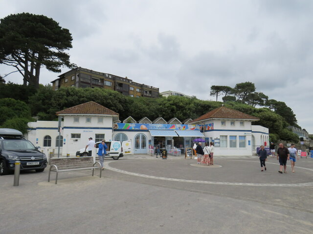
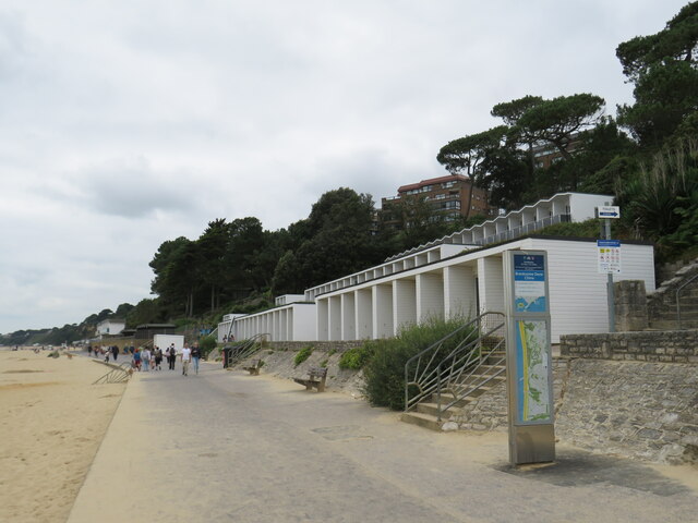
At the top of the valley, there is a popular park that offers stunning panoramic views of the coastline and the English Channel. This park features well-maintained gardens, a children's play area, and picnic spots, making it an ideal destination for families. There are also several cafes and restaurants nearby, providing a range of culinary options for visitors.

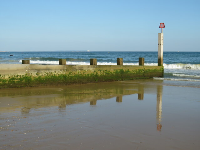
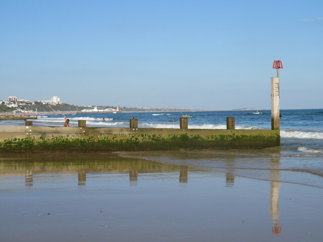
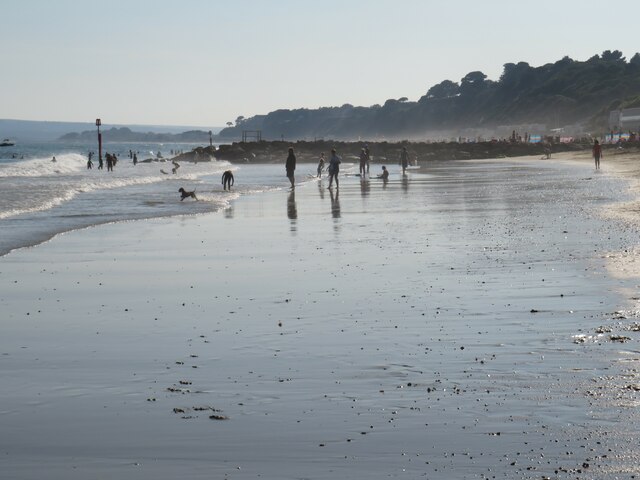
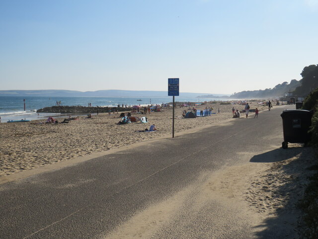
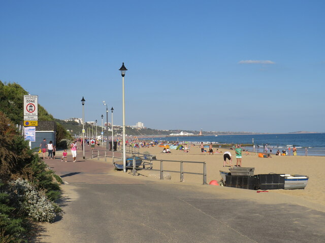
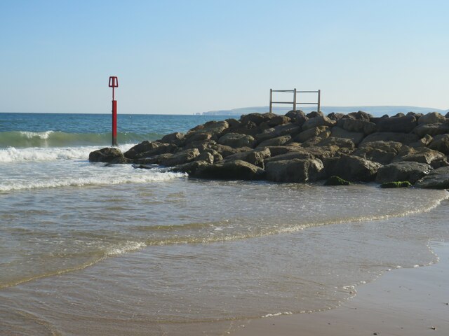
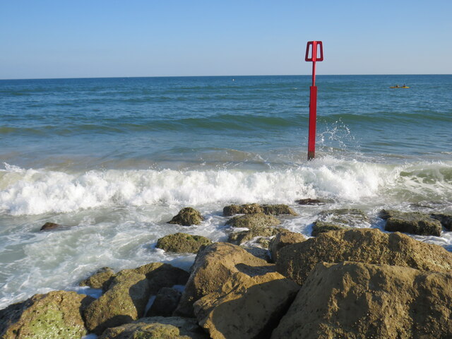
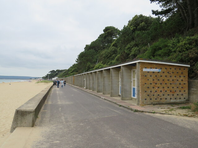
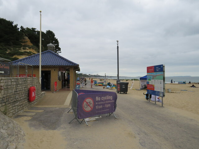
Alum Chine's sandy beach is a major attraction for sunbathers and water sports enthusiasts. The beach is clean and well-maintained, with lifeguards on duty during the summer months. It offers a wide range of activities, including swimming, kayaking, and paddleboarding.

The chine is easily accessible, with a car park located at the top and regular bus services running to and from the area. It is also connected to the Bournemouth seafront via a promenade, allowing visitors to explore the wider coastal area.

Overall, Alum Chine is a hidden gem in Hampshire, offering a blend of natural beauty, recreational activities, and stunning views of the coastline.

If you have any feedback on the listing, please let us know in the comments section below.

Alum Chine Images

Images are sourced within 2km of 50.714493/-1.9000914 or Grid Reference SZ0790. Thanks to Geograph Open Source API. All images are credited.

Groyne at Branksome Dene Chine, Bournemouth A wooden groyne reflected in the water at Branksome Dene Chine, in Bournemouth.

Just visible in the distance are the white chalk cliffs of The Needles, on the Isle of Wight.
Groyne at Branksome Dene Chine, Bournemouth
A wooden groyne reflected in the water at Branksome Dene Chine, in Bournemouth. Just visible in the distance are the white chalk cliffs of The Needles, on the Isle of Wight.
Groyne at Branksome Dene Chine, Bournemouth A wooden groyne on the beach at Branksome Dene Chine, in Bournemouth.  In the background, the view of Bournemouth's coastline stretched to Bournemouth Pier and along to Hengistbury Head, visible just to the left of the white marker post.
Groyne at Branksome Dene Chine, Bournemouth
A wooden groyne on the beach at Branksome Dene Chine, in Bournemouth. In the background, the view of Bournemouth's coastline stretched to Bournemouth Pier and along to Hengistbury Head, visible just to the left of the white marker post.
Receding tide at Branksome Dene Chine The beach at Branksome Dene Chine, on the border between Bournemouth and Poole, photographed on a sunny afternoon in August 2021.  The tide was receding when this image was taken, leaving wet sand.
Receding tide at Branksome Dene Chine
The beach at Branksome Dene Chine, on the border between Bournemouth and Poole, photographed on a sunny afternoon in August 2021. The tide was receding when this image was taken, leaving wet sand.
Promenade at Branksome Dene Chine, near Bournemouth A promenade runs for around 10 miles along the seafront at Bournemouth, stretching to Southbourne in the east and Sandbanks in the west.  The last few miles to Sandbanks are in the Borough of Poole, rather than in Bournemouth.

The promenade forms part of the route of National Cycle Network route 2, which stretches along England's south coast. However, during the peak summer holiday months of July and August, cycling is prohibited on the promenade between 10:00 and 18:00.  Between those times, cyclists must use an alternative route.

This image was taken just beyond the Bournemouth/Poole boundary, looking westwards on a fine and sunny afternoon in August 2021.
Promenade at Branksome Dene Chine, near Bournemouth
A promenade runs for around 10 miles along the seafront at Bournemouth, stretching to Southbourne in the east and Sandbanks in the west. The last few miles to Sandbanks are in the Borough of Poole, rather than in Bournemouth. The promenade forms part of the route of National Cycle Network route 2, which stretches along England's south coast. However, during the peak summer holiday months of July and August, cycling is prohibited on the promenade between 10:00 and 18:00. Between those times, cyclists must use an alternative route. This image was taken just beyond the Bournemouth/Poole boundary, looking westwards on a fine and sunny afternoon in August 2021.
Seafront at Branksome Dene Chine, near Bournemouth A promenade runs for approximately 10 miles along Bournemouth's seafront, from Sandbanks in the west to Southbourne in the east.  The first section from Sandbanks is in the Borough of Poole.  Here at Branksome Dene Chine the promenade crosses the boundary into the Borough of Bournemouth, at the point where the path surface changes from grey to dark red.

The promenade forms part of the route of National Cycle Network route 2, which stretches along England's south coast. However, during the peak summer holiday months of July and August, cycling is prohibited on the promenade between 10:00 and 18:00.  Between those times, cyclists must use an alternative route.

In the distance in the centre of the image is Bournemouth Pier and to the right, further around the coastline, is Hengistbury Head.
Seafront at Branksome Dene Chine, near Bournemouth
A promenade runs for approximately 10 miles along Bournemouth's seafront, from Sandbanks in the west to Southbourne in the east. The first section from Sandbanks is in the Borough of Poole. Here at Branksome Dene Chine the promenade crosses the boundary into the Borough of Bournemouth, at the point where the path surface changes from grey to dark red. The promenade forms part of the route of National Cycle Network route 2, which stretches along England's south coast. However, during the peak summer holiday months of July and August, cycling is prohibited on the promenade between 10:00 and 18:00. Between those times, cyclists must use an alternative route. In the distance in the centre of the image is Bournemouth Pier and to the right, further around the coastline, is Hengistbury Head.
Groyne at Branksome Dene Chine, Bournemouth A rock groyne and marker on the beach at Branksome Dene Chine, near Bournemouth.  Visible in the distance are Old Harry Rocks and the Purbeck Hills.
Groyne at Branksome Dene Chine, Bournemouth
A rock groyne and marker on the beach at Branksome Dene Chine, near Bournemouth. Visible in the distance are Old Harry Rocks and the Purbeck Hills.
Groyne marker at Branksome Dene Chine, Bournemouth The red post marks the end of a groyne on the beach at Branksome Dene Chine, near Bournemouth.
Groyne marker at Branksome Dene Chine, Bournemouth
The red post marks the end of a groyne on the beach at Branksome Dene Chine, near Bournemouth.
Overcliff at Branksome Dene, near Bournemouth A bench on the overcliff at Branksome Dene, near Bournemouth.  In the background, the coastline stretches to Bournemouth Pier and beyond.
Overcliff at Branksome Dene, near Bournemouth
A bench on the overcliff at Branksome Dene, near Bournemouth. In the background, the coastline stretches to Bournemouth Pier and beyond.
Overcliff path at Branksome Chine, near Bournemouth A path on the overcliff at Branksome Chine, near Bournemouth.

This image was taken on a relatively clear day with views along the coastline to Hengistbury Head (in the distance in the centre of the image) and across to chalk cliffs at The Needles, at the westernmost tip of the Isle of Wight (visible to the right).
Overcliff path at Branksome Chine, near Bournemouth
A path on the overcliff at Branksome Chine, near Bournemouth. This image was taken on a relatively clear day with views along the coastline to Hengistbury Head (in the distance in the centre of the image) and across to chalk cliffs at The Needles, at the westernmost tip of the Isle of Wight (visible to the right).
Pinecliff Gardens, Branksome Chine, near Bournemouth Pinecliff Gardens look out over the beach and coastline at Branksome Chine, near Bournemouth.
Pinecliff Gardens, Branksome Chine, near Bournemouth
Pinecliff Gardens look out over the beach and coastline at Branksome Chine, near Bournemouth.
Promenade at Canford Cliffs, near Poole The seafront promenade stretches for around 10 miles along the coastline through Bournemouth and into the Borough of Poole.

The promenade forms part of the route of National Cycle Network route 2.  However, during the peak summer holiday months of July and August when the beaches and seafront are at their busiest, cycling is prohibited between 10:00 and 18:00.  During those times, cyclists must use an alternative route.
Promenade at Canford Cliffs, near Poole
The seafront promenade stretches for around 10 miles along the coastline through Bournemouth and into the Borough of Poole. The promenade forms part of the route of National Cycle Network route 2. However, during the peak summer holiday months of July and August when the beaches and seafront are at their busiest, cycling is prohibited between 10:00 and 18:00. During those times, cyclists must use an alternative route.
Promenade near Canford Cliffs, Poole The seafront promenade stretches for around 10 miles along the coastline through Bournemouth.

The promenade forms part of the route of National Cycle Network route 2.  However, during the peak summer holiday months of July and August when the beaches and seafront are at their busiest, cycling is prohibited between 10:00 and 18:00.  During those times, cyclists must use an alternative route.
Promenade near Canford Cliffs, Poole
The seafront promenade stretches for around 10 miles along the coastline through Bournemouth. The promenade forms part of the route of National Cycle Network route 2. However, during the peak summer holiday months of July and August when the beaches and seafront are at their busiest, cycling is prohibited between 10:00 and 18:00. During those times, cyclists must use an alternative route.
Promenade near Branksome Chine, Poole The seafront promenade stretches for around 10 miles along the coastline through Bournemouth.

The promenade forms part of the route of National Cycle Network route 2. However, during the peak summer holiday months of July and August when the beaches and seafront are at their busiest, cycling is prohibited between 10:00 and 18:00. During those times, cyclists must use an alternative route.
Promenade near Branksome Chine, Poole
The seafront promenade stretches for around 10 miles along the coastline through Bournemouth. The promenade forms part of the route of National Cycle Network route 2. However, during the peak summer holiday months of July and August when the beaches and seafront are at their busiest, cycling is prohibited between 10:00 and 18:00. During those times, cyclists must use an alternative route.
Beachfront café at Branksome Chine, near Poole A café on the beachfront at Branksome Chine, near Poole.
Beachfront café at Branksome Chine, near Poole
A café on the beachfront at Branksome Chine, near Poole.
Toilets and shop at Branksome Chine Beach, near Poole This building on the beachfront at Branksome Chine contains public toilets along with a shop selling beach accessories.
Toilets and shop at Branksome Chine Beach, near Poole
This building on the beachfront at Branksome Chine contains public toilets along with a shop selling beach accessories.
Promenade at Branksome Dene Chine, near Bournemouth The seafront promenade stretches for around 10 miles along the coastline through Bournemouth.

The promenade forms part of the route of National Cycle Network route 2. However, during the peak summer holiday months of July and August when the beaches and seafront are at their busiest, cycling is prohibited between 10:00 and 18:00. During those times, cyclists must use an alternative route.
Promenade at Branksome Dene Chine, near Bournemouth
The seafront promenade stretches for around 10 miles along the coastline through Bournemouth. The promenade forms part of the route of National Cycle Network route 2. However, during the peak summer holiday months of July and August when the beaches and seafront are at their busiest, cycling is prohibited between 10:00 and 18:00. During those times, cyclists must use an alternative route.
Branksome Dene Chine beach, near Bournemouth The sandy beach at Branksome Dene Chine, near Bourneouth.

The seafront promenade stretches for around 10 miles along the coastline through Bournemouth.

The promenade forms part of the route of National Cycle Network route 2. However, during the peak summer holiday months of July and August when the beaches and seafront are at their busiest, cycling is prohibited between 10:00 and 18:00. During those times, cyclists must use an alternative route.
Branksome Dene Chine beach, near Bournemouth
The sandy beach at Branksome Dene Chine, near Bourneouth. The seafront promenade stretches for around 10 miles along the coastline through Bournemouth. The promenade forms part of the route of National Cycle Network route 2. However, during the peak summer holiday months of July and August when the beaches and seafront are at their busiest, cycling is prohibited between 10:00 and 18:00. During those times, cyclists must use an alternative route.
Show me another place!

Alum Chine is located at Grid Ref: SZ0790 (Lat: 50.714493, Lng: -1.9000914)

Unitary Authority: Bournemouth, Christchurch and Poole

Police Authority: Dorset

What 3 Words

///rigid.finely.strike. Near Bournemouth, Dorset

Related Wikis

Alum Chine

Alum Chine is the largest chine in Bournemouth, England. The gorge was crossed by a suspension bridge by the early part of the twentieth century. ��2...

Westbourne, Dorset

Westbourne is a residential and shopping area of Bournemouth, Dorset, England. It is located in between Branksome, Poole and the centre of Bournemouth...

Durley Chine

Durley Chine is a Blue Flag beach and chine in Bournemouth, Dorset in England. It is to the west of Bournemouth Town Centre, north of West Cliff, and east...

Royal Victoria Hospital, Bournemouth

The Royal Victoria Hospital was a hospital situated on two sites in Bournemouth, England. The primary site was in Boscombe but for a period of time it...

Bournemouth West (UK Parliament constituency)

Bournemouth West is a parliamentary constituency in Dorset represented in the House of Commons of the UK Parliament since 2010 by Conor Burns, a Conservative...

Bournemouth West railway station

Bournemouth West railway station was a railway station in Bournemouth, Dorset, England. == History == The station opened on 15 June 1874. Although passenger...

Bournemouth Borough Council

Bournemouth Borough Council was the local authority of Bournemouth in Dorset, England and ceased to exist on 1 April 2019. It was a unitary authority,...

Bournemouth Highcliff Marriott Hotel

The Bournemouth Highcliff Marriott Hotel is located in St. Michael's Road, Bournemouth, Dorset. Formerly four large mansions in 1873 and part of the Coastguard...

Nearby Amenities

Located within 500m of 50.714493,-1.9000914
Crossing
Crossing: unmarked
Crossing Island: yes
Segregated: no
Source: local_knowledge
Supervised: no
Tactile Paving: yes
Lat/Long: 50.7166006/-1.8953164
Turning Circle
Lat/Long: 50.7122567/-1.8973004
Post Box
Operator: Royal Mail
Operator Wikidata: Q638098
Post Box Type: pillar
Ref: BH4 185
Ref GB Uprn: 10015332766
Royal Cypher: GR
Royal Cypher Wikidata: Q33102273
Lat/Long: 50.7134753/-1.8957608
Post Box
Collection Times: Mo-Fr 09:00; Sa 07:00
Description: Victorian anonymous
Operator: Royal Mail
Operator Wikidata: Q638098
Post Box Type: pillar
Ref: BH4 45
Ref GB Uprn: 10015370932
Royal Cypher: no
Lat/Long: 50.7115435/-1.9002732
Post Box
Collection Times: Mo-Fr 09:00; Sa 07:00
Operator: Royal Mail
Operator Wikidata: Q638098
Post Box Type: pillar
Ref: BH4 127
Ref GB Uprn: 10015369598
Royal Cypher: GR
Royal Cypher Wikidata: Q33102273
Lat/Long: 50.7153829/-1.9041666
Post Box
Operator: Royal Mail
Operator Wikidata: Q638098
Post Box Type: pillar
Ref: BH4 101
Ref GB Uprn: 10015440124
Royal Cypher: EVIIR
Royal Cypher Wikidata: Q33102324
Lat/Long: 50.7164776/-1.8945274
Post Box
Collection Times: Mo-Fr 07:00; Sa 07:00
Operator: Royal Mail
Operator Wikidata: Q638098
Post Box Type: pillar
Ref: BH4 75
Ref GB Uprn: 10015363029
Royal Cypher: VR
Royal Cypher Wikidata: Q33102356
Lat/Long: 50.7185274/-1.9012489
Post Box
Operator: Royal Mail
Operator Wikidata: Q638098
Post Box Type: pillar
Ref: BH4 120
Ref GB Uprn: 10015296169
Royal Cypher: EVIIR
Royal Cypher Wikidata: Q33102324
Lat/Long: 50.715912/-1.8981997
Post Box
Collection Times: Mo-Fr 09:00; Sa 07:00
Operator: Royal Mail
Operator Wikidata: Q638098
Post Box Type: pillar
Ref: BH4 122
Ref GB Uprn: 10015389310
Royal Cypher: EVIIR
Royal Cypher Wikidata: Q33102324
Lat/Long: 50.71414/-1.9012796
Crossing
Crossing: unmarked
Crossing Island: yes
Segregated: no
Source: local_knowledge
Supervised: no
Tactile Paving: yes
Lat/Long: 50.7168458/-1.8951359
Crossing
Crossing: unmarked
Crossing Island: yes
Segregated: no
Source: local_knowledge
Supervised: no
Tactile Paving: yes
Lat/Long: 50.7168006/-1.8955698
Turning Circle
Lat/Long: 50.7156575/-1.9021478
Turning Circle
Source: survey
Lat/Long: 50.7146943/-1.8983178
Kindergarten
Schools Out Pre School Playgroup
Addr Housename: St Ambrose Church Hall
Addr Housenumber: 72
Addr Postcode: BH4 8BE
Addr Street: West Cliff Road
Source: local knowledge
Lat/Long: 50.7173112/-1.9005414
Crossing
Crossing: marked
Crossing Island: no
Crossing Ref: zebra
Source: survey
Tactile Paving: yes
Lat/Long: 50.7186095/-1.9019536
Cafe
Argyll Cafe
Addr Postcode: BH4 8AB
Addr Street: West Overcliff Drive
Fhrs Id: 342267
Source: survey
Source Addr: FHRS Open Data
Lat/Long: 50.7129271/-1.8941958
Bus Stop
Clarendon Road
Bench: yes
Bin: no
Bus: yes
Lit: yes
Naptan AtcoCode: 1290BOB20572
Naptan Bearing: E
Naptan CommonName: Clarendon Road
Naptan Indicator: E-bound
Naptan NaptanCode: bouapja
Naptan PlusbusZoneRef: BOMO
Naptan Street: West Cliff Road
Naptan Verified: no
Public Transport: platform
Shelter: yes
Tactile Paving: no
Lat/Long: 50.7169496/-1.8958794
Bus Stop
Tower Road
Bench: yes
Bin: no
Bus: yes
Lit: no
Naptan AtcoCode: 1280POA11911
Naptan Bearing: NW
Naptan CommonName: Tower Road
Naptan Indicator: NW-bound
Naptan NaptanCode: plejgaw
Naptan PlusbusZoneRef: BOMO
Naptan Street: Tower Road
Naptan Verified: no
Public Transport: platform
Shelter: no
Tactile Paving: no
Lat/Long: 50.7142239/-1.9070854
Post Box
Collection Times: Mo-Fr 17:30; Sa 13:00
Operator: Royal Mail
Operator Wikidata: Q638098
Post Box Design: type_b
Post Box Type: pillar
Ref: BH13 83
Ref GB Uprn: 10015352664
Royal Cypher: VR
Royal Cypher Wikidata: Q33102356
Source: survey
Lat/Long: 50.7139474/-1.906593
Bench
Lat/Long: 50.7148195/-1.8950005
Bench
Lat/Long: 50.715274/-1.8949357
Waste Basket
Bin
Lat/Long: 50.7152976/-1.8949455
Bench
Lat/Long: 50.7158113/-1.8954641
Bench
Backrest: yes
Lat/Long: 50.716948/-1.8957895
Bench
Backrest: yes
Lat/Long: 50.7168081/-1.8956862
Bench
Backrest: yes
Lat/Long: 50.7177737/-1.9001978
Bench
Backrest: yes
Lat/Long: 50.7112/-1.8968416
Bench
Backrest: yes
Lat/Long: 50.7108926/-1.8980566
Bench
Backrest: yes
Lat/Long: 50.7107856/-1.8984777
Bench
Backrest: yes
Lat/Long: 50.7106548/-1.8990169
Waste Basket
Lat/Long: 50.7107125/-1.8987969
Access: yes
Drinking Water: yes
Drinking Water Legal: yes
Man Made: water_tap
Lat/Long: 50.7110666/-1.8962797
Bicycle Rental
Alum Chine
Bicycle Rental: dropoff_point
Capacity: 8
Email: support@beryl.cc
Fee: yes
Name Signed: no
Network: Beryl - Bournemouth Poole Christchurch
Official Name: Alum Chine
Operator: Beryl
Operator Wikidata: Q106575369
Payment App: yes
Payment App Android: cc.beryl.basis
Payment App Ios: 1386768364
Payment Cash: no
Payment Credit Cards: no
Payment Cryptocurrencies: no
Payment Debit Cards: no
Payment Electronic Purses: no
Phone: +44 20 3003 5044
Ref Gbfs: beryl_bcp:157
Rental: city_bike
Website: https://beryl.cc/scheme/bournemouth-christchurch-and-poole
Lat/Long: 50.7114868/-1.8960381
Bus Stop
St Ambrose Church
Bench: no
Bin: no
Bus: yes
Lit: no
Naptan AtcoCode: 1290BOB20571
Naptan Bearing: SE
Naptan CommonName: St Ambrose Church
Naptan Indicator: SE-bound
Naptan NaptanCode: bouamtj
Naptan PlusbusZoneRef: BOMO
Naptan Street: West Cliff Road
Naptan Verified: no
Public Transport: platform
Shelter: no
Tactile Paving: no
Lat/Long: 50.7177827/-1.9002418
Bus Stop
Tower Road
Bench: yes
Bin: no
Bus: yes
Lit: no
Naptan AtcoCode: 1280POA11910
Naptan Bearing: SE
Naptan CommonName: Tower Road
Naptan Indicator: opp
Naptan NaptanCode: plejgdp
Naptan PlusbusZoneRef: BOMO
Naptan Street: Tower Road
Naptan Verified: no
Public Transport: platform
Shelter: no
Tactile Paving: no
Lat/Long: 50.7139217/-1.9065692
Bus Stop
St Ambrose Church
Bench: yes
Bin: no
Bus: yes
Lit: no
Naptan AtcoCode: 1290BOB20570
Naptan Bearing: NW
Naptan CommonName: St Ambrose Church
Naptan Indicator: NW-bound
Naptan NaptanCode: bouampd
Naptan PlusbusZoneRef: BOMO
Naptan Street: West Cliff Road
Naptan Verified: no
Public Transport: platform
Shelter: no
Tactile Paving: no
Lat/Long: 50.7182081/-1.9010398
Bus Stop
Clarendon Road
Bench: yes
Bin: no
Bus: yes
Lit: yes
Naptan AtcoCode: 1290BOB20569
Naptan Bearing: W
Naptan CommonName: Clarendon Road
Naptan Indicator: W-bound
Naptan NaptanCode: bouapgp
Naptan PlusbusZoneRef: BOMO
Naptan Street: West Cliff Road
Naptan Verified: no
Public Transport: platform
Shelter: yes
Tactile Paving: no
Lat/Long: 50.716813/-1.8957196
Bus Stop
Herbert Road
Bench: no
Bin: no
Bus: yes
Lit: yes
Public Transport: platform
Shelter: yes
Tactile Paving: no
Lat/Long: 50.7159121/-1.9046339
Bus Stop
Alumdale Road
Bench: yes
Bin: no
Bus: yes
Lit: no
Naptan AtcoCode: 1290BOB20554
Naptan NaptanCode: bouajwa
Public Transport: platform
Shelter: no
Tactile Paving: no
Lat/Long: 50.7147709/-1.9041243
Bus Stop
Beaulieu Road
Bench: yes
Bin: no
Bus: yes
Lit: yes
Naptan AtcoCode: 1290BOB20553
Naptan Bearing: NW
Naptan CommonName: Beaulieu Road
Naptan Indicator: NW-bound
Naptan NaptanCode: bouamap
Naptan PlusbusZoneRef: BOMO
Naptan Street: Alumhurst Road
Naptan Verified: no
Public Transport: platform
Shelter: yes
Tactile Paving: no
Lat/Long: 50.7132508/-1.9030005
Bus Stop
Crosby Road
Bench: no
Bin: no
Bus: yes
Lit: no
Naptan AtcoCode: 1290BOB20552
Naptan Bearing: NW
Naptan CommonName: Crosby Road
Naptan Indicator: NW-bound
Naptan NaptanCode: bouampg
Naptan PlusbusZoneRef: BOMO
Naptan Street: Alumhurst Road
Naptan Verified: no
Public Transport: platform
Shelter: no
Tactile Paving: no
Lat/Long: 50.7115558/-1.9008534
Bus Stop
Sandbourne Road
Bench: yes
Bin: no
Bus: yes
Lit: yes
Naptan AtcoCode: 1290BOB20551
Naptan Bearing: W
Naptan CommonName: Sandbourne Road
Naptan Indicator: W-bound
Naptan NaptanCode: bouamwg
Naptan PlusbusZoneRef: BOMO
Naptan Street: Alumhurst Road
Naptan Verified: no
Public Transport: platform
Shelter: no
Tactile Paving: no
Lat/Long: 50.7107541/-1.8994398
Bus Stop
Studland Road
Bench: no
Bin: no
Bus: yes
Lit: yes
Naptan AtcoCode: 1290BOB20550
Naptan Bearing: W
Naptan CommonName: Studland Road
Naptan Indicator: W-bound
Naptan NaptanCode: bouapag
Naptan PlusbusZoneRef: BOMO
Naptan Street: Alumhurst Road
Naptan Verified: no
Public Transport: platform
Shelter: no
Tactile Paving: no
Lat/Long: 50.7108425/-1.8984944
Bus Stop
Alum Chine
Bench: yes
Bin: no
Bus: yes
Lit: yes
Naptan AtcoCode: 1290BOB20549
Naptan Bearing: SE
Naptan CommonName: Alum Chine
Naptan Indicator: SE-bound
Naptan NaptanCode: bouapdm
Naptan PlusbusZoneRef: BOMO
Naptan Street: Alumhurst Road
Naptan Verified: no
Public Transport: platform
Shelter: yes
Tactile Paving: no
Lat/Long: 50.7121643/-1.8970473
Bus Stop
Sandbourne Road
Bench: no
Bin: no
Bus: yes
Lit: no
Naptan AtcoCode: 1290BOB20547
Naptan Bearing: E
Naptan CommonName: Sandbourne Road
Naptan Indicator: E-bound
Naptan NaptanCode: bouamtw
Naptan PlusbusZoneRef: BOMO
Naptan Street: Alumhurst Road
Naptan Verified: no
Public Transport: platform
Shelter: no
Tactile Paving: no
Lat/Long: 50.7108662/-1.8995525
Bus Stop
Studland Road
Bench: no
Bin: no
Bus: yes
Lit: yes
Naptan AtcoCode: 1290BOB20548
Naptan Bearing: E
Naptan CommonName: Studland Road
Naptan Indicator: E-bound
Naptan NaptanCode: bouapap
Naptan PlusbusZoneRef: BOMO
Naptan Street: Alumhurst Road
Naptan Verified: no
Public Transport: platform
Shelter: no
Tactile Paving: no
Lat/Long: 50.7110301/-1.8980894
Bus Stop
Crosby Road
Bench: no
Bin: no
Bus: yes
Lit: yes
Naptan AtcoCode: 1290BOB20546
Naptan Bearing: SE
Naptan CommonName: Crosby Road
Naptan Indicator: SE-bound
Naptan NaptanCode: bouampm
Naptan PlusbusZoneRef: BOMO
Naptan Street: Alumhurst Road
Naptan Verified: no
Public Transport: platform
Shelter: no
Tactile Paving: no
Lat/Long: 50.7117647/-1.9009593
Bus Stop
Beaulieu Road
Bench: no
Bin: no
Bus: yes
Lit: no
Naptan AtcoCode: 1290BOB20545
Naptan Bearing: SE
Naptan CommonName: Beaulieu Road
Naptan Indicator: SE-bound
Naptan NaptanCode: bouamat
Naptan PlusbusZoneRef: BOMO
Naptan Street: Alumhuurst Road
Naptan Verified: no
Public Transport: platform
Shelter: no
Tactile Paving: no
Lat/Long: 50.7131803/-1.9026893
Bus Stop
Alumdale Road
Bench: no
Bin: no
Bus: yes
Lit: no
Naptan AtcoCode: 1290BOB20544
Naptan NaptanCode: bouajwj
Public Transport: platform
Shelter: no
Tactile Paving: no
Lat/Long: 50.7150698/-1.9040854
Bus Stop
Herbert Road
Bench: no
Bin: no
Bus: yes
Lit: yes
Naptan AtcoCode: 1290BOB20542
Naptan NaptanCode: bouajtm
Public Transport: platform
Shelter: no
Tactile Paving: no
Lat/Long: 50.7165354/-1.904587
Bus Stop
Warren Road
Bench: no
Bin: no
Bus: yes
Lit: yes
Public Transport: platform
Shelter: no
Tactile Paving: no
Lat/Long: 50.7177326/-1.9050229
Crossing
Crossing: marked
Crossing Island: no
Crossing Ref: zebra
Tactile Paving: yes
Lat/Long: 50.7186365/-1.9020166
Bicycle Rental
West Overcliff Drive
Bicycle Rental: dropoff_point
Capacity: 6
Email: support@beryl.cc
Fee: yes
Name Signed: no
Network: Beryl - Bournemouth Poole Christchurch
Official Name: West Overcliff Drive
Operator: Beryl
Operator Wikidata: Q106575369
Payment App: yes
Payment App Android: cc.beryl.basis
Payment App Ios: 1386768364
Payment Cash: no
Payment Credit Cards: no
Payment Cryptocurrencies: no
Payment Debit Cards: no
Payment Electronic Purses: no
Phone: +44 20 3003 5044
Ref Gbfs: beryl_bcp:3105
Rental: city_bike
Website: https://beryl.cc/scheme/bournemouth-christchurch-and-poole
Lat/Long: 50.7128716/-1.895129
Bench
Backrest: yes
Lat/Long: 50.7171377/-1.9020097
Bench
Backrest: yes
Lat/Long: 50.716407/-1.9017456
Bench
Backrest: yes
Lat/Long: 50.7145652/-1.9006165
Bench
Backrest: yes
Lat/Long: 50.7138527/-1.8999189
Bench
Backrest: yes
Lat/Long: 50.7131195/-1.8988259
Bench
Backrest: yes
Lat/Long: 50.7123984/-1.8976602
Bench
Backrest: yes
Lat/Long: 50.7123538/-1.8975214
Bench
Backrest: yes
Lat/Long: 50.711299/-1.8957803
Bench
Backrest: yes
Lat/Long: 50.7111747/-1.8957536
Bench
Backrest: yes
Lat/Long: 50.7111137/-1.8959409
The data included in this document is from www.openstreetmap.org. The data is made available under ODbL.

Have you been to Alum Chine?

Leave your review of Alum Chine below (or comments, questions and feedback).