Cliff Clough

Valley in Cheshire

England

Cliff Clough

Outflow from Toddbrook Reservoir The level of this reservoir has been kept much lower than normal since a national incident in August 2019 when the dam was in danger of breaking. Remedial works are now in course but will take several years to complete. The footpath across the dam has been closed.
Outflow from Toddbrook Reservoir Credit: Bill Boaden

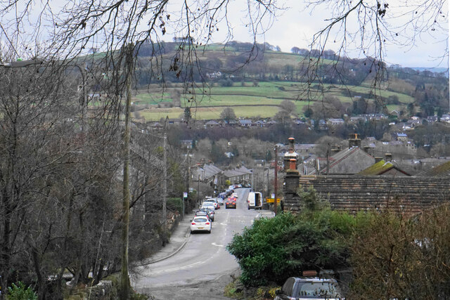
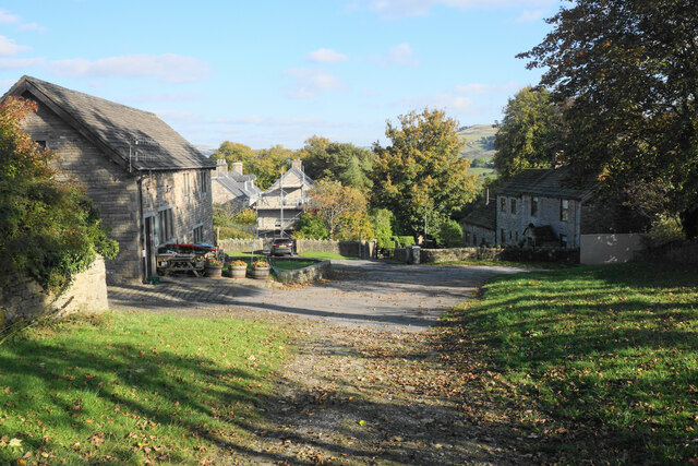
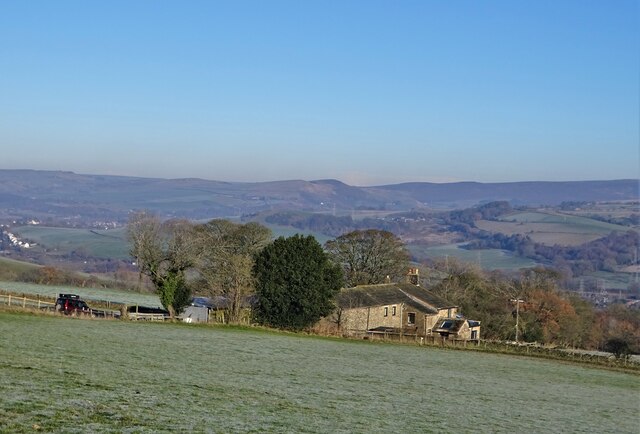
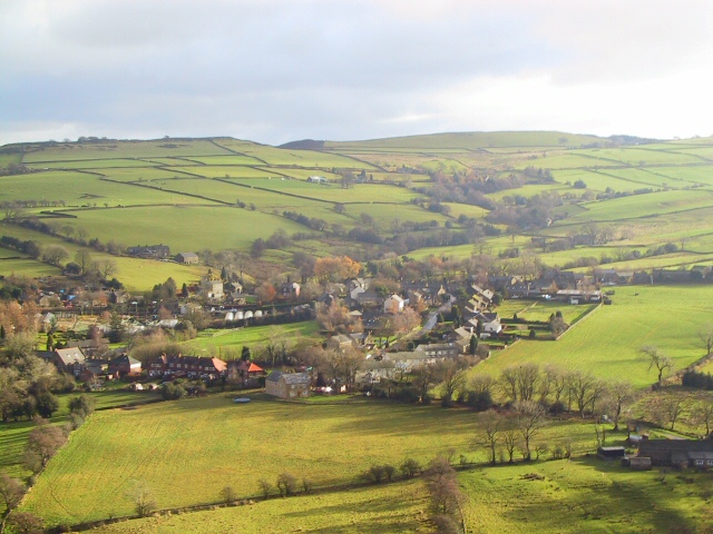
Cliff Clough is a small village located in the county of Cheshire, England. Situated in the Cheshire Valley, the village is known for its picturesque landscapes and tranquil atmosphere. With a population of around 500 residents, Cliff Clough offers a close-knit community that values its rural surroundings.

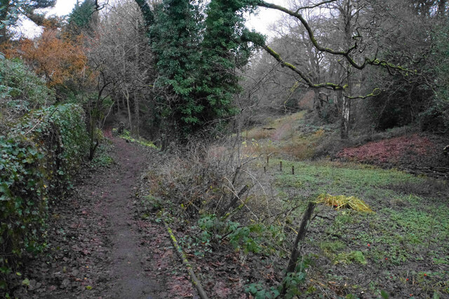
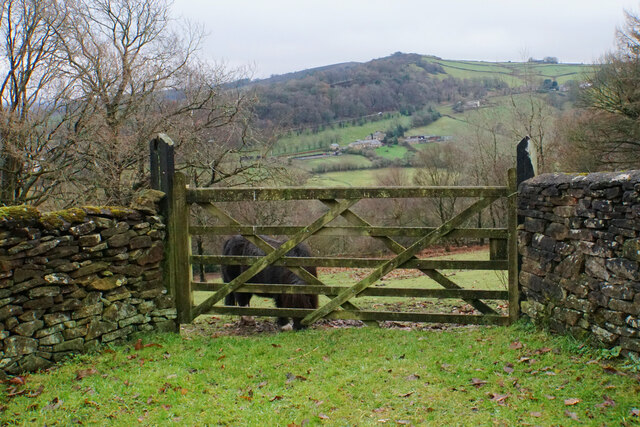
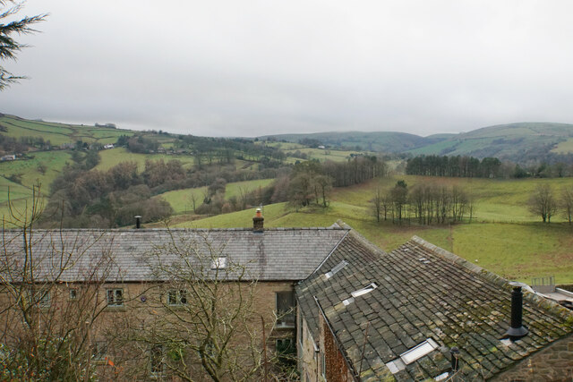
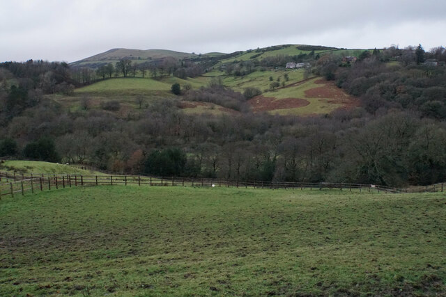
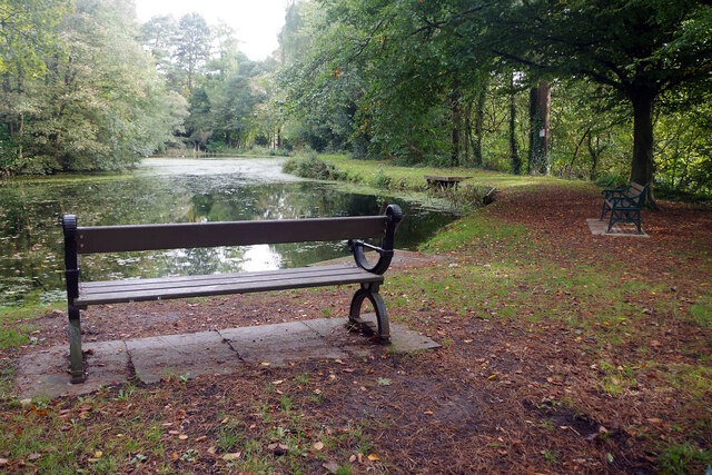
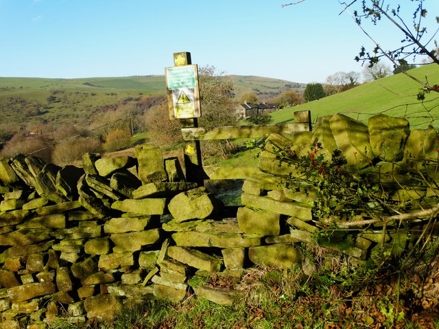
The village is nestled within the rolling hills of the Cheshire countryside, providing residents and visitors with stunning views of the surrounding valleys and meadows. The area is renowned for its natural beauty, making it a popular destination for hikers and nature enthusiasts. Numerous walking trails and footpaths crisscross the village, allowing visitors to explore the scenic surroundings at their own pace.

Cliff Clough boasts a rich history that dates back centuries. The village is home to several historic buildings, including St. Mary's Church, which dates back to the 12th century. The church showcases beautiful architecture and serves as a reminder of the village's heritage.

Despite its small size, Cliff Clough offers a range of amenities to cater to the needs of its residents. The village features a local pub, a small convenience store, and a community center, where various events and activities take place throughout the year. Additionally, the nearby town of Chester provides easy access to a wider range of amenities, including shops, schools, and healthcare facilities.

Cliff Clough's idyllic setting, rich history, and friendly community make it a charming destination for those seeking a peaceful retreat in the heart of the Cheshire Valley.

If you have any feedback on the listing, please let us know in the comments section below.

Cliff Clough Images

Images are sourced within 2km of 53.330089/-2.0173931 or Grid Reference SJ9881. Thanks to Geograph Open Source API. All images are credited.

Outflow from Toddbrook Reservoir The level of this reservoir has been kept much lower than normal since a national incident in August 2019 when the dam was in danger of breaking. Remedial works are now in course but will take several years to complete. The footpath across the dam has been closed.
Outflow from Toddbrook Reservoir
The level of this reservoir has been kept much lower than normal since a national incident in August 2019 when the dam was in danger of breaking. Remedial works are now in course but will take several years to complete. The footpath across the dam has been closed.
Hurst Clough The path on the left follows the clough up from Toddbrook Reservoir to Start Lane.
Hurst Clough
The path on the left follows the clough up from Toddbrook Reservoir to Start Lane.
Field entrance off Start Lane This point gives a view over the Todd Brook valley, with Taxal Edge climbing behind.
Field entrance off Start Lane
This point gives a view over the Todd Brook valley, with Taxal Edge climbing behind.
Rooftops by Start Lane From here there is a view across the Todd Brook valley in the direction of Kettleshulme.
Rooftops by Start Lane
From here there is a view across the Todd Brook valley in the direction of Kettleshulme.
Grazing land by Walker Brow Farm The land is mainly used for equestrianism. It is overlooking the valley of Todd Brook.
Grazing land by Walker Brow Farm
The land is mainly used for equestrianism. It is overlooking the valley of Todd Brook.
Macclesfield Road The B5470 descends steadily towards Whaley Bridge. The valley ahead holds the River Goyt.
Macclesfield Road
The B5470 descends steadily towards Whaley Bridge. The valley ahead holds the River Goyt.
Footpath to Whaley Bridge The route also incorporates part of the Midshires Way. The path has been diverted because of remedial works being undertaken around the Toddbrook Reservoir.
Footpath to Whaley Bridge
The route also incorporates part of the Midshires Way. The path has been diverted because of remedial works being undertaken around the Toddbrook Reservoir.
Toddbrook Reservoir dam About to be repaired. The current spillway that partially collapsed is to be grassed over as part of the repair work following the almost disastrous breach on 1st August 2019. A new spillway is to be constructed.
Toddbrook Reservoir dam
About to be repaired. The current spillway that partially collapsed is to be grassed over as part of the repair work following the almost disastrous breach on 1st August 2019. A new spillway is to be constructed.
Hockerley A small farming hamlet which is now on the outskirts of Whaley Bridge.
Hockerley
A small farming hamlet which is now on the outskirts of Whaley Bridge.
A view of Brownough A former farm south west of Furness Vale
A view of Brownough
A former farm south west of Furness Vale
Pond in Whaley Bridge A local nature reserve.
Pond in Whaley Bridge
A local nature reserve.
Toddbrook Dam - remedial work The site gate allows a glimpse of the work being undertaken by contractors to secure the dam of Toddbrook Reservoir for the future. In 2019, following a period of heavy rainfall, concrete slabs on the overflow spillway were partially dislodged leading to fears that the dam could collapse. The story made the national news when local residents had to be evacuated; they were only allowed to return home when water levels in the reservoir were reduced, relieving pressure on the dam. The current works involve raising the height of the dam and providing a new weir and spillway. Completion is expected in 2024.
Toddbrook Dam - remedial work
The site gate allows a glimpse of the work being undertaken by contractors to secure the dam of Toddbrook Reservoir for the future. In 2019, following a period of heavy rainfall, concrete slabs on the overflow spillway were partially dislodged leading to fears that the dam could collapse. The story made the national news when local residents had to be evacuated; they were only allowed to return home when water levels in the reservoir were reduced, relieving pressure on the dam. The current works involve raising the height of the dam and providing a new weir and spillway. Completion is expected in 2024.
Brookfield Pond Brookfield Pond (also known as the CPA - Calico Printers Association - pond) dates from the 1850s when it was built to provide a supply of clean water to a nearby print works. That role has now ceased but the pond is now an important wildlife site and is owned by Whaley Bridge Town Council. Public access is available from Reservoir Road and these benches are provided to allow peaceful contemplation.
Brookfield Pond
Brookfield Pond (also known as the CPA - Calico Printers Association - pond) dates from the 1850s when it was built to provide a supply of clean water to a nearby print works. That role has now ceased but the pond is now an important wildlife site and is owned by Whaley Bridge Town Council. Public access is available from Reservoir Road and these benches are provided to allow peaceful contemplation.
Toddbrook Reservoir Toddbrook Reservoir is owned and managed by the Canal and River Trust, serving as a feeder for the Peak Forest Canal. In 2019 a spillway failed leading to a major incident in which it was feared the dam might collapse. In this view major remedial work is taking place with completion planned for 2024.
Toddbrook Reservoir
Toddbrook Reservoir is owned and managed by the Canal and River Trust, serving as a feeder for the Peak Forest Canal. In 2019 a spillway failed leading to a major incident in which it was feared the dam might collapse. In this view major remedial work is taking place with completion planned for 2024.
Path to Memorial Park The path from Reservoir Road passes the hoardings protecting the worksite where Canal and River Trust contractors are undertaking major remedial work on the Toddbrook Dam.
Path to Memorial Park
The path from Reservoir Road passes the hoardings protecting the worksite where Canal and River Trust contractors are undertaking major remedial work on the Toddbrook Dam.
Marl Bank Cottage, Kettleshulme
Path to Stocksbank Farm, Kettleshulme
Looking Down on Kettleshulme Not an airborne camera shot, but this view from the slopes of Reed Hill by Higher Lane could give that impression. Judging by the contour lines on the O/S map, the viewpoint is some 150 metres higher than the view. Looking ESE.
Looking Down on Kettleshulme
Not an airborne camera shot, but this view from the slopes of Reed Hill by Higher Lane could give that impression. Judging by the contour lines on the O/S map, the viewpoint is some 150 metres higher than the view. Looking ESE.
Show me another place!

Cliff Clough is located at Grid Ref: SJ9881 (Lat: 53.330089, Lng: -2.0173931)

Unitary Authority: Cheshire East

Police Authority: Cheshire

What 3 Words

///nitrogen.person.massaging. Near Whaley Bridge, Derbyshire

Related Wikis

Bowstones

The Bowstones are a pair of Anglian cross shafts in Cheshire, England. Situated beside the old ridgeway between Disley and Macclesfield, overlooking Lyme...
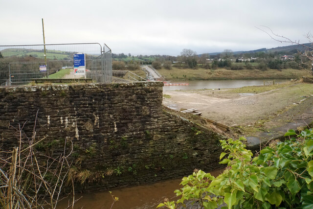
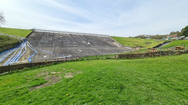
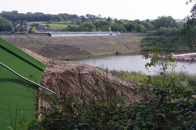
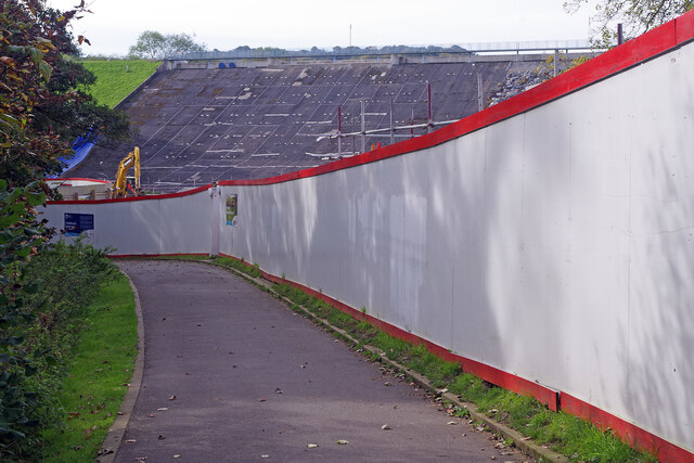
Toddbrook Reservoir

Toddbrook Reservoir, a feeder for the Peak Forest Canal, opened in 1838. It is above the town of Whaley Bridge in the High Peak area of Derbyshire, England...
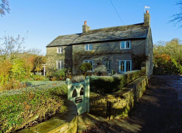
Kettleshulme

Kettleshulme (Old Norse Ketil's island or Ketil's watermeadow) is a village and former civil parish, now in the parish of Kettleshulme and Lyme Handley...

Todd Brook

Todd Brook is a small river running through the English counties of Cheshire and Derbyshire. The Brook rises beneath Shining Tor on the border between...

Nearby Amenities

Located within 500m of 53.330089,-2.0173931
Barrier: stile
Material: stone
Step Count: 3
Stile: stepover
Lat/Long: 53.332982/-2.0168026
Barrier: stile
Material: wood
Step Count: 3
Stile: ladder
Lat/Long: 53.3338342/-2.0210483
Barrier: stile
Material: wood
Step Count: 2
Stile: stepover
Lat/Long: 53.3270833/-2.0145392
Barrier: kissing_gate
Material: metal
Lat/Long: 53.3309436/-2.0247527
The data included in this document is from www.openstreetmap.org. The data is made available under ODbL.

Have you been to Cliff Clough?

Leave your review of Cliff Clough below (or comments, questions and feedback).