Thief Clough

Valley in Yorkshire

England

Thief Clough

Pennine Way, Blackstone Edge Taken just to the south of the trig pillar. Looking out over littleborough and Rochdale.
Pennine Way, Blackstone Edge Credit: michael ely

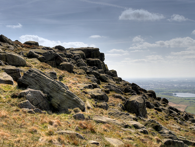
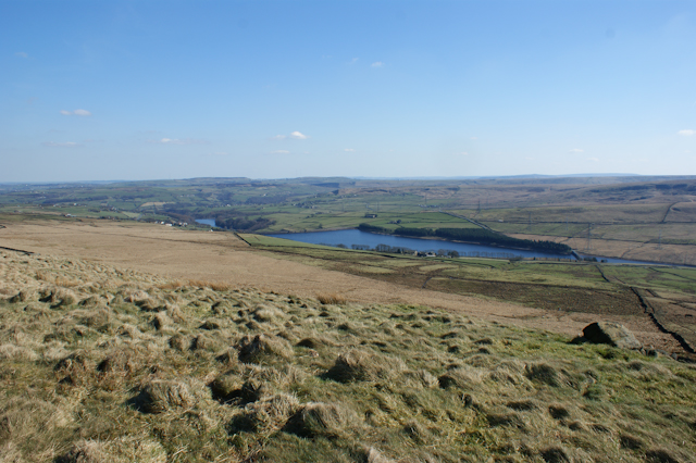
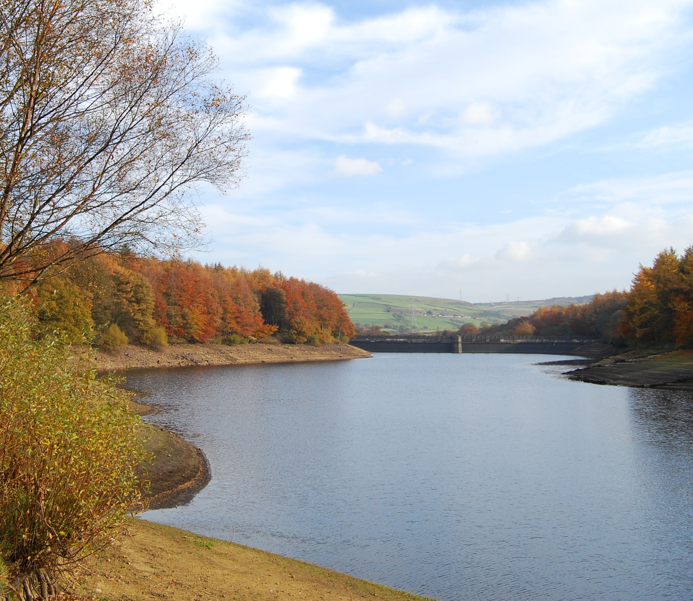
Thief Clough is a picturesque valley located in Yorkshire, England. Nestled amidst the rolling hills and lush greenery, it is a haven for nature enthusiasts and visitors seeking tranquility. The valley is situated near the village of Marsden, approximately 15 miles west of Huddersfield.

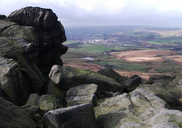
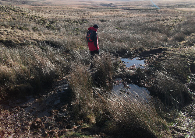
Thief Clough is known for its stunning natural beauty, boasting a diverse range of flora and fauna. The valley is home to a variety of wildlife, including birds, butterflies, and small mammals. Walking along the trails, visitors can immerse themselves in the sights and sounds of nature, with the soothing sound of the nearby river adding to the serenity.

The valley is also famous for its captivating waterfalls. The cascading waters create a mesmerizing spectacle, attracting photographers and nature lovers alike. The most prominent waterfall in Thief Clough is the impressive Standedge Waterfall, which is a popular spot for visitors to capture the beauty of nature through their lenses.

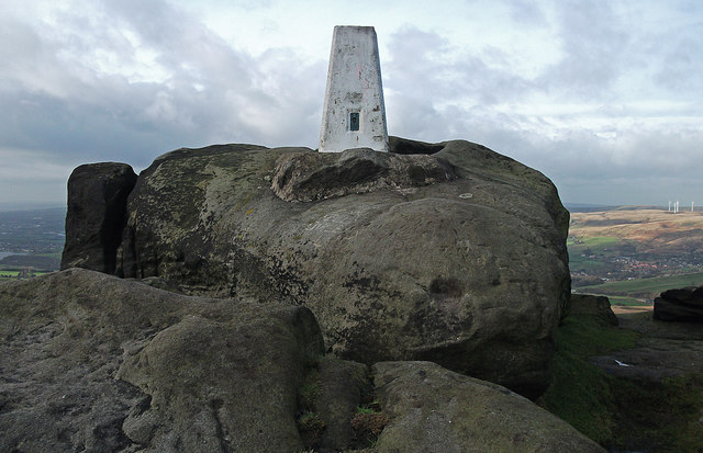
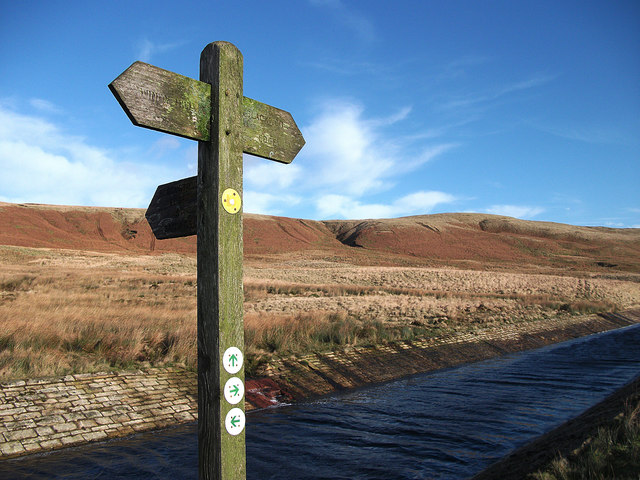
In addition to its natural wonders, Thief Clough offers several walking and hiking trails, allowing visitors to explore the valley's beauty at their own pace. The trails vary in difficulty, catering to both casual walkers and experienced hikers. Along these paths, one can relish breathtaking views of the surrounding countryside and enjoy the fresh air.

Thief Clough is a hidden gem in Yorkshire, providing an idyllic escape from the hustle and bustle of city life. Its natural beauty, tranquil ambiance, and enchanting waterfalls make it a must-visit destination for those seeking a peaceful retreat amidst nature's splendor.

If you have any feedback on the listing, please let us know in the comments section below.

Thief Clough Images

Images are sourced within 2km of 53.647209/-2.0178884 or Grid Reference SD9816. Thanks to Geograph Open Source API. All images are credited.

Pennine Way, Blackstone Edge Taken just to the south of the trig pillar. Looking out over littleborough and Rochdale.
Pennine Way, Blackstone Edge
Taken just to the south of the trig pillar. Looking out over littleborough and Rochdale.
Blackstone Edge trig pillar On the Pennine Way at 472 metres above sea level.
Blackstone Edge trig pillar
On the Pennine Way at 472 metres above sea level.
Bog trotting on Rishworth Moor On the concessionary path leading to Green Withens. It's been one of the wettest winters on record and the peat is saturated.
Bog trotting on Rishworth Moor
On the concessionary path leading to Green Withens. It's been one of the wettest winters on record and the peat is saturated.
Fingerpost at Green Withens
Broad Head Drain
Broad Head Drain
Black Castle Drain
Black Castle Drain
Black Castle Drain
Black Castle Drain
Stone Bridge over Broad Head Drain, Blackstone Edge Moor
Blackstone Edge Moor
'Roman' Road over Blackstone Edge Blackstone Edge Long Causeway also known as Blackstone Edge Roman is a cobbled ‘road’ surface crossing the bleak moorland for about 2 miles along Blackstone Edge on the Lancashire-West Yorkshire border. The road has a deep groove running down the centre. 

It is a Scheduled monument (List entry Number: 1003746 <span class="nowrap"><a title="https://historicengland.org.uk/listing/the-list/list-entry/1003746" rel="nofollow ugc noopener" href="https://historicengland.org.uk/listing/the-list/list-entry/1003746">Link</a><img style="margin-left:2px;" alt="External link" title="External link - shift click to open in new window" src="https://s1.geograph.org.uk/img/external.png" width="10" height="10"/></span>  Historic England). Initially thought to be of Roman Origin, this road is still marked on Ordnance Survey maps as a ‘Roman Road’ but many historians have argued over whether or not the paved road over Blackstone Edge was built by the Romans, with no firm conclusion ever being reached but nowadays the most widely accepted theory is that it is an early turnpike road from circa 1735. Indeed, in 1965 James Leonard Maxim reported the discovery of a medieval pack-horse track that passed under part of the road and that therefore must pre-date it (Maxim, James L., A Lancashire Lion, J.L. Maxim Trustees: Leeds 1965). 

Others believe that it may be even more modern being constructed in connection with stone gathering or quarrying activity on the moor. It is, however, likely that a Roman road did once cross the Pennines hereabouts before the medieval pack-horse tracks and the 1735 turnpike road were constructed.
'Roman' Road over Blackstone Edge
Blackstone Edge Long Causeway also known as Blackstone Edge Roman is a cobbled ‘road’ surface crossing the bleak moorland for about 2 miles along Blackstone Edge on the Lancashire-West Yorkshire border. The road has a deep groove running down the centre. It is a Scheduled monument (List entry Number: 1003746 LinkExternal link Historic England). Initially thought to be of Roman Origin, this road is still marked on Ordnance Survey maps as a ‘Roman Road’ but many historians have argued over whether or not the paved road over Blackstone Edge was built by the Romans, with no firm conclusion ever being reached but nowadays the most widely accepted theory is that it is an early turnpike road from circa 1735. Indeed, in 1965 James Leonard Maxim reported the discovery of a medieval pack-horse track that passed under part of the road and that therefore must pre-date it (Maxim, James L., A Lancashire Lion, J.L. Maxim Trustees: Leeds 1965). Others believe that it may be even more modern being constructed in connection with stone gathering or quarrying activity on the moor. It is, however, likely that a Roman road did once cross the Pennines hereabouts before the medieval pack-horse tracks and the 1735 turnpike road were constructed.
The Aiggin Stone The Aiggin Stone, an irregular block of gritstone approximately 7 feet long, stands alongside the packhorse route marking the county boundary. The stone has a cross and the letters I and T cut into it. Its name is said to derive from the French aiguille for a needle or aigle an eagle.

Some suggest that it is Roman in origin (linked to the nearby “Roman” road, others that it’s merely a waymarker, others that it’s a milestone, and the more common notion is that it’s a boundary marker of the counties of Yorkshire and Lancashire (its position in the landscape presently sits it in Lancashire).  According to a nearby information plate, The Littleborough and District Lions regard it to be “A mediæval guide stone …..some 600 years old” (<a href="https://www.geograph.org.uk/photo/4938914">SD9717 : Aiggin Stone Information</a>).

<span class="nowrap"><a title="https://megalithix.wordpress.com/2011/03/25/aiggin-stone/" rel="nofollow ugc noopener" href="https://megalithix.wordpress.com/2011/03/25/aiggin-stone/">Link</a><img style="margin-left:2px;" alt="External link" title="External link - shift click to open in new window" src="https://s1.geograph.org.uk/img/external.png" width="10" height="10"/></span>  The Northern Antiquarian
The Aiggin Stone
The Aiggin Stone, an irregular block of gritstone approximately 7 feet long, stands alongside the packhorse route marking the county boundary. The stone has a cross and the letters I and T cut into it. Its name is said to derive from the French aiguille for a needle or aigle an eagle. Some suggest that it is Roman in origin (linked to the nearby “Roman” road, others that it’s merely a waymarker, others that it’s a milestone, and the more common notion is that it’s a boundary marker of the counties of Yorkshire and Lancashire (its position in the landscape presently sits it in Lancashire). According to a nearby information plate, The Littleborough and District Lions regard it to be “A mediæval guide stone …..some 600 years old” (SD9717 : Aiggin Stone Information). LinkExternal link The Northern Antiquarian
Aiggin Stone Information Small stone tablet positioned near to <a href="https://www.geograph.org.uk/photo/4938903">SD9717 : The Aiggin Stone</a> by the Littleborough and District Lions, declaring the Aiggin Stone to be "A mediæval guide stone for travellers some 600 years old".
Aiggin Stone Information
Small stone tablet positioned near to SD9717 : The Aiggin Stone by the Littleborough and District Lions, declaring the Aiggin Stone to be "A mediæval guide stone for travellers some 600 years old".
Aiggin Stone and Cairn, Blackstone Edge The Aiggin Stone, an irregular block of gritstone approximately 7 feet long, stands alongside the packhorse route marking the county boundary. The stone has a cross and the letters I and T cut into it. Its name is said to derive from the French aiguille for a needle or aigle an eagle.

Some suggest that it is Roman in origin (linked to the nearby “Roman” road, others that it’s merely a waymarker, others that it’s a milestone, and the more common notion is that it’s a boundary marker of the counties of Yorkshire and Lancashire (its position in the landscape presently sits it in Lancashire).  According to a nearby information tablet (<a href="https://www.geograph.org.uk/photo/4938914">SD9717 : Aiggin Stone Information</a>), The Littleborough and District Lions regard it to be “A mediæval guide stone …..some 600 years old” 

The cairn is more recent; there is no indication of its significance, it is the largest of several cairns sited on the moorland alongside the Pennine Way in this area.
Aiggin Stone and Cairn, Blackstone Edge
The Aiggin Stone, an irregular block of gritstone approximately 7 feet long, stands alongside the packhorse route marking the county boundary. The stone has a cross and the letters I and T cut into it. Its name is said to derive from the French aiguille for a needle or aigle an eagle. Some suggest that it is Roman in origin (linked to the nearby “Roman” road, others that it’s merely a waymarker, others that it’s a milestone, and the more common notion is that it’s a boundary marker of the counties of Yorkshire and Lancashire (its position in the landscape presently sits it in Lancashire). According to a nearby information tablet (SD9717 : Aiggin Stone Information), The Littleborough and District Lions regard it to be “A mediæval guide stone …..some 600 years old” The cairn is more recent; there is no indication of its significance, it is the largest of several cairns sited on the moorland alongside the Pennine Way in this area.
Aiggin Stone and Cairn The Aiggin Stone, an irregular block of gritstone approximately 7 feet long, stands alongside the packhorse route marking the county boundary. The stone has a cross and the letters I and T cut into it. Its name is said to derive from the French aiguille for a needle or aigle an eagle.

Some suggest that it is Roman in origin (linked to the nearby “Roman” road, others that it’s merely a waymarker, others that it’s a milestone, and the more common notion is that it’s a boundary marker of the counties of Yorkshire and Lancashire (its position in the landscape presently sits it in Lancashire).  According to a nearby information tablet (<a href="https://www.geograph.org.uk/photo/4938914">SD9717 : Aiggin Stone Information</a>), The Littleborough and District Lions regard it to be “A mediæval guide stone …..some 600 years old” 

The cairn is more recent; there is no indication of its significance, it is the largest of several cairns sited on the moorland alongside the Pennine Way in this area.
Aiggin Stone and Cairn
The Aiggin Stone, an irregular block of gritstone approximately 7 feet long, stands alongside the packhorse route marking the county boundary. The stone has a cross and the letters I and T cut into it. Its name is said to derive from the French aiguille for a needle or aigle an eagle. Some suggest that it is Roman in origin (linked to the nearby “Roman” road, others that it’s merely a waymarker, others that it’s a milestone, and the more common notion is that it’s a boundary marker of the counties of Yorkshire and Lancashire (its position in the landscape presently sits it in Lancashire). According to a nearby information tablet (SD9717 : Aiggin Stone Information), The Littleborough and District Lions regard it to be “A mediæval guide stone …..some 600 years old” The cairn is more recent; there is no indication of its significance, it is the largest of several cairns sited on the moorland alongside the Pennine Way in this area.
Gate on the Pennine Way The gate is where the Pennine Way meets the old pack horse route across Blackstone Edge. <a href="https://www.geograph.org.uk/photo/4938935">SD9717 : Aiggin Stone and Cairn</a> can be seen behind the gate and fence.
Gate on the Pennine Way
The gate is where the Pennine Way meets the old pack horse route across Blackstone Edge. SD9717 : Aiggin Stone and Cairn can be seen behind the gate and fence.
Blackstone Edge Blackstone Edge is a gritstone escarpment at 1549 feet (472 m) above sea level in the Pennine hills surrounded by moorland on the boundary between Greater Manchester and West Yorkshire.
Blackstone Edge
Blackstone Edge is a gritstone escarpment at 1549 feet (472 m) above sea level in the Pennine hills surrounded by moorland on the boundary between Greater Manchester and West Yorkshire.
Blackstone Edge Escarpment Blackstone Edge is a gritstone escarpment at 1549 feet (472 m) above sea level in the Pennine hills surrounded by moorland overlooking Littleborough and Rochdale on the boundary between Greater Manchester and West Yorkshire.
Blackstone Edge Escarpment
Blackstone Edge is a gritstone escarpment at 1549 feet (472 m) above sea level in the Pennine hills surrounded by moorland overlooking Littleborough and Rochdale on the boundary between Greater Manchester and West Yorkshire.
Pennine Way, Blackstone Edge
Show me another place!

Thief Clough is located at Grid Ref: SD9816 (Lat: 53.647209, Lng: -2.0178884)

Division: West Riding

Unitary Authority: Calderdale

Police Authority: West Yorkshire

What 3 Words

///dentistry.beards.avocado. Near Littleborough, Manchester

Related Wikis

Blackstone Edge

Blackstone Edge ( BLAK-stən) is a gritstone escarpment at 472 metres (1,549 ft) above sea level in the Pennine hills surrounded by moorland on the boundary...

Blackstone Edge Reservoir

Blackstone Edge Reservoir is a reservoir in the Metropolitan Borough of Rochdale, Greater Manchester, England. It is close to Blackstone Edge, from which...

Baitings Reservoir

Baitings Reservoir is a large water supply reservoir operated by Yorkshire Water close to Ripponden in the West Yorkshire Pennines, England. It lies in...

A640 road

The A640 is a road in England which runs between Rochdale in Greater Manchester and Huddersfield in West Yorkshire. The road's most westbound point as...

Ryburn Reservoir

Ryburn Reservoir is a supply reservoir operated by Yorkshire Water close to Ripponden in the Yorkshire Pennines, England. It lies in the valley of the...

Booth Wood Reservoir

Booth Wood Reservoir is a man-made upland reservoir that lies north of the M62 motorway and south of the A672 road near to Rishworth and Ripponden in Calderdale...

Norman Hill Reservoir

Norman Hill Reservoir is a reservoir in the Piethorne Valley in the Metropolitan Borough of Rochdale, within Greater Manchester, England. == References ==

Stott Hall Farm

Stott Hall Farm is a farm located between the eastbound and westbound carriageways of the M62 motorway in Calderdale, England. It is the only farm in the...

Nearby Amenities

Located within 500m of 53.647209,-2.0178884
Waterway: weir
Lat/Long: 53.647125/-2.0107302
Waterway: weir
Lat/Long: 53.6467548/-2.012164
The data included in this document is from www.openstreetmap.org. The data is made available under ODbL.

Have you been to Thief Clough?

Leave your review of Thief Clough below (or comments, questions and feedback).