Lower Fox Valley

Valley in Northumberland

England

Lower Fox Valley

Track Junction, High Kellas Plantation A lonesome pine standing tall in a much younger block of forestry.
Track Junction, High Kellas Plantation Credit: Mick Garratt

Lower Fox Valley is a scenic region located in Northumberland, a county in the northeast of England. Nestled within the larger Fox Valley, this area is known for its picturesque landscapes, charming villages, and historical significance.

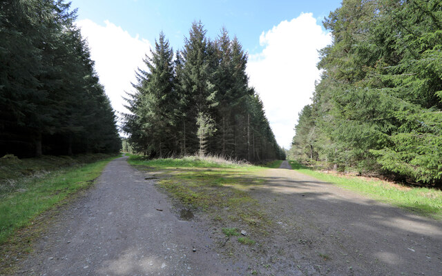
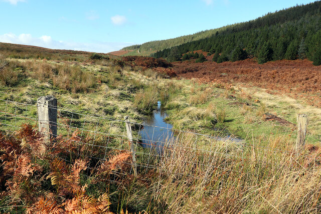
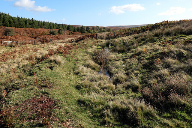
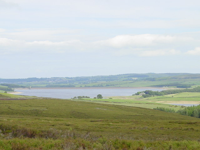
The region is defined by the River Fox, which meanders through the valley, providing a peaceful and idyllic setting. The surrounding countryside is characterized by rolling hills, lush green fields, and dense woodlands, making it a haven for nature enthusiasts and hikers.

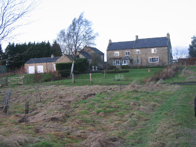
Lower Fox Valley is home to several quaint villages and hamlets, each with its own unique character. The villages often feature traditional stone cottages, charming pubs, and local shops, creating a nostalgic atmosphere. The residents of these villages are known for their warm hospitality and strong sense of community.

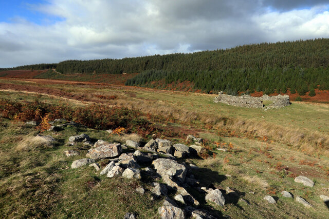
History buffs will find plenty to explore in Lower Fox Valley. The area boasts several historic landmarks, including ancient castles, churches, and ruins. These remnants of the past provide insight into the region's rich history and cultural heritage.

In terms of amenities, Lower Fox Valley offers a range of facilities to cater to residents and visitors. The region has a selection of shops, restaurants, and accommodations to suit different preferences and budgets. Additionally, there are recreational opportunities such as golf courses, fishing spots, and nature reserves, ensuring there is something for everyone to enjoy.

Overall, Lower Fox Valley is a charming and tranquil region that offers a perfect blend of natural beauty, historical significance, and a close-knit community atmosphere.

If you have any feedback on the listing, please let us know in the comments section below.

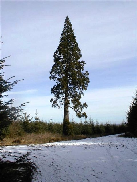
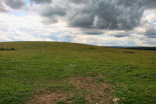
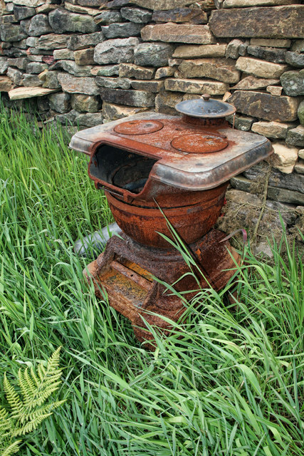
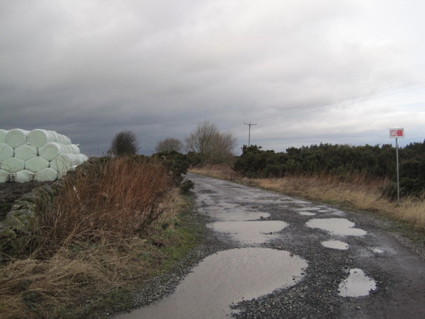
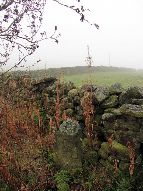
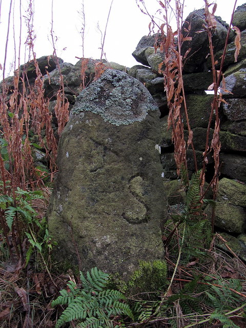
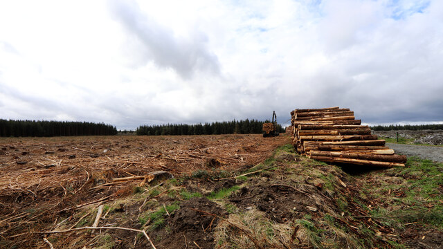
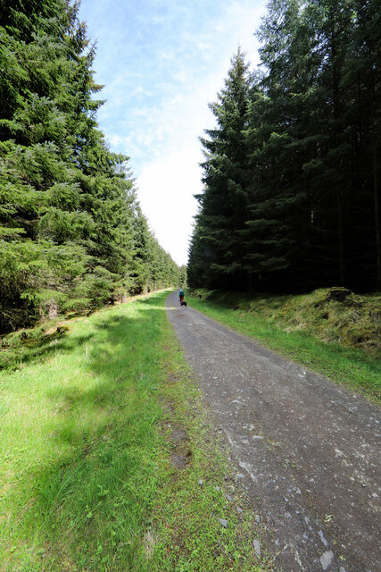
Lower Fox Valley Images

Images are sourced within 2km of 54.894745/-2.0261783 or Grid Reference NY9855. Thanks to Geograph Open Source API. All images are credited.

Track Junction, High Kellas Plantation A lonesome pine standing tall in a much younger block of forestry.
Track Junction, High Kellas Plantation
A lonesome pine standing tall in a much younger block of forestry.
Hairy Side View across Hairy Side above Derwent Reservoir.
Hairy Side
View across Hairy Side above Derwent Reservoir.
Old Stove Old Stove, including stove pipe and fuel, near Hairy Side.
Old Stove
Old Stove, including stove pipe and fuel, near Hairy Side.
Coal Road leading to Slaley Golf Course
Donald's Grave near Esper Shields Donald's Grave is apparently the name of this boundary stone on the south side of the minor road that runs from Kiln Pit Hill on the A68 to Blanchland, 10m east of the Coal Road (track) that leads north-west through the grounds of Slaley Hall.

The stone is Grade II Listed (List Entry Number: 1045376) and is described as:
"Probable boundary marker, C18th or perhaps a reworking of a more ancient stone. Gritstone. Roughly-cut monolith of trapezoidal plan, exposed height 0.9 metres. East face with incised B; north face with remains of incised design, possibly a cross within a circle; west face incised A (laid sideways) and S."

See closer photo here <a href="https://www.geograph.org.uk/photo/4246157">NZ0054 : Donald's Grave near Esper Shields (detail)</a>

Local researchers think the stone may be an allotment marker from the Bulbeck Common Award (1771) which was divided between George Silvertop of Minsteracres (S) and George Baker (B), the Lord of the Manor. It has also been suggested that Donald's Grave may have originally been mapped on the north side of the road but the nature of the feature represented by the name is not specified.

There are two further named stones just to the north, possibly on the same boundary: Greyhound Stone (which I couldn't find) and Hare Stone, an C18th boundary stone.

All 3 stones are named on the 1st Edition 6" OS Map Northumberland, 104 (1864):
<span class="nowrap"><a title="http://maps.nls.uk/view/102346503#zoom=5&lat=3290&lon=2260&layers=BT" rel="nofollow ugc noopener" href="http://maps.nls.uk/view/102346503#zoom=5&lat=3290&lon=2260&layers=BT">Link</a><img style="margin-left:2px;" alt="External link" title="External link - shift click to open in new window" src="https://s1.geograph.org.uk/img/external.png" width="10" height="10"/></span>

Only Donald's Grave is represented on current large scale mapping.

The Hare Stone is also Listed Grade II (List Entry Number: 1370318) said to be marked B (Blanchland) on south-west, and S (Slaley) on north-east side <a href="https://www.geograph.org.uk/photo/4247180">NY9955 : The Hare Stone near Slaley Hall</a>


The hill in the field beyond the wall is named Hairy Side.
Donald's Grave near Esper Shields
Donald's Grave is apparently the name of this boundary stone on the south side of the minor road that runs from Kiln Pit Hill on the A68 to Blanchland, 10m east of the Coal Road (track) that leads north-west through the grounds of Slaley Hall. The stone is Grade II Listed (List Entry Number: 1045376) and is described as: "Probable boundary marker, C18th or perhaps a reworking of a more ancient stone. Gritstone. Roughly-cut monolith of trapezoidal plan, exposed height 0.9 metres. East face with incised B; north face with remains of incised design, possibly a cross within a circle; west face incised A (laid sideways) and S." See closer photo here NZ0054 : Donald's Grave near Esper Shields (detail) Local researchers think the stone may be an allotment marker from the Bulbeck Common Award (1771) which was divided between George Silvertop of Minsteracres (S) and George Baker (B), the Lord of the Manor. It has also been suggested that Donald's Grave may have originally been mapped on the north side of the road but the nature of the feature represented by the name is not specified. There are two further named stones just to the north, possibly on the same boundary: Greyhound Stone (which I couldn't find) and Hare Stone, an C18th boundary stone. All 3 stones are named on the 1st Edition 6" OS Map Northumberland, 104 (1864): LinkExternal link Only Donald's Grave is represented on current large scale mapping. The Hare Stone is also Listed Grade II (List Entry Number: 1370318) said to be marked B (Blanchland) on south-west, and S (Slaley) on north-east side NY9955 : The Hare Stone near Slaley Hall The hill in the field beyond the wall is named Hairy Side.
Donald's Grave near Esper Shields (detail) See description here <a href="https://www.geograph.org.uk/photo/4246082">NZ0054 : Donald's Grave near Esper Shields</a>
Donald's Grave near Esper Shields (detail)
Harvesting a section of Slaley Forest Signs at the entrance to the eastern end of Slaley Forest warn of a number of closed tracks as a diamond-shaped section of the plantation was being actively clear-cut. The noise of chainsaws filled the air, which a tractor dragged cut logs on a trailer, using a crane to lift these into stacks. A big road-legal timber truck was the other side of the logpile using its own crane to take them off again and away to become glamourous new products like fenceposts or newsprint.
Harvesting a section of Slaley Forest
Signs at the entrance to the eastern end of Slaley Forest warn of a number of closed tracks as a diamond-shaped section of the plantation was being actively clear-cut. The noise of chainsaws filled the air, which a tractor dragged cut logs on a trailer, using a crane to lift these into stacks. A big road-legal timber truck was the other side of the logpile using its own crane to take them off again and away to become glamourous new products like fenceposts or newsprint.
Forest track in Slaley Forest A byway is shown on maps running roughly east-west for a kilometre and a half in this area of Slaley Forest, but on the ground, the line it supposedly takes is just densely planted forest. Instead, one is obliged to take a longer route via a number of SW-NE and SE-NW forest tracks such as this one, which are not rights of way of any description (though the bulk of the forest is CROW Access Land).
Forest track in Slaley Forest
A byway is shown on maps running roughly east-west for a kilometre and a half in this area of Slaley Forest, but on the ground, the line it supposedly takes is just densely planted forest. Instead, one is obliged to take a longer route via a number of SW-NE and SE-NW forest tracks such as this one, which are not rights of way of any description (though the bulk of the forest is CROW Access Land).
Forest track branches off byway, Slaley Forest The route to the right is supposedly a byway, though the line of that right of way some way ahead seems to have been wholly effaced by the forest leaving only rather longer routes on the forest tracks (with signage making clear that these are not for vehicles). The route to the left is one of these tracks, and the one we have just taken to reach this point (in the absence of any trace of the byway we'd intended to use starting about two kilometres away).
Forest track branches off byway, Slaley Forest
The route to the right is supposedly a byway, though the line of that right of way some way ahead seems to have been wholly effaced by the forest leaving only rather longer routes on the forest tracks (with signage making clear that these are not for vehicles). The route to the left is one of these tracks, and the one we have just taken to reach this point (in the absence of any trace of the byway we'd intended to use starting about two kilometres away).
Old watercourse near site of Acton High Mill Likely to be the original feed for the watercourse leading from Acton Burn to Acton High Mill. There is a view in the other direction here: <a href="https://www.geograph.org.uk/photo/7306915">NY9753 : Old watercourse near site of Acton High Mill</a>
Old watercourse near site of Acton High Mill
Likely to be the original feed for the watercourse leading from Acton Burn to Acton High Mill. There is a view in the other direction here: NY9753 : Old watercourse near site of Acton High Mill
Old watercourse near site of Acton High Mill See photo in other direction here: <a href="https://www.geograph.org.uk/photo/7306908">NY9753 : Old watercourse near site of Acton High Mill</a>
Old watercourse near site of Acton High Mill
See photo in other direction here: NY9753 : Old watercourse near site of Acton High Mill
Sheepfold, Acton Fell
Course of aqueduct, Acton Fell
Acton Cleugh The steep valley of Acton Burn.
Acton Cleugh
The steep valley of Acton Burn.
Archers Fold A sheep fold on Acton Fell, South of Acton Burn.
OS Namebook (c1860): <span class="nowrap"><a title="http://namebooks.org.uk/browse/main/?OSref=411&Page=19.0" rel="nofollow ugc noopener" href="http://namebooks.org.uk/browse/main/?OSref=411&Page=19.0">Link</a><img style="margin-left:2px;" alt="External link" title="External link - shift click to open in new window" src="https://s1.geograph.org.uk/img/external.png" width="10" height="10"/></span> <span class="nowrap"><a title="https://web.archive.org/web/20221010200331/http://namebooks.org.uk/browse/main/?OSref=411&Page=19.0" rel="nofollow ugc noopener" href="https://web.archive.org/web/20221010200331/http://namebooks.org.uk/browse/main/?OSref=411&Page=19.0">Archive Link</a><img style="margin-left:2px;" alt="External link" title="External link - shift click to open in new window" src="https://s1.geograph.org.uk/img/external.png" width="10" height="10"/></span>
Archers Fold
A sheep fold on Acton Fell, South of Acton Burn. OS Namebook (c1860): LinkExternal link Archive LinkExternal link
Derwent Reservoir viewed from Westcowburn Head
Slaley Hall Hotel and Golf Course View of the hotel across the golf course.
Slaley Hall Hotel and Golf Course
View of the hotel across the golf course.
Pry, south of Slaley
Show me another place!

Lower Fox Valley is located at Grid Ref: NY9855 (Lat: 54.894745, Lng: -2.0261783)

Unitary Authority: Northumberland

Police Authority: Northumbria

What 3 Words

///yesterday.elevate.proved. Near Slaley, Northumberland

Related Wikis

Colpitts Grange

Colpitts Grange is a hamlet in Northumberland, England. It is about 7 miles (11 km) to the south-east of Hexham. == Governance == Colpitts Grange is in...
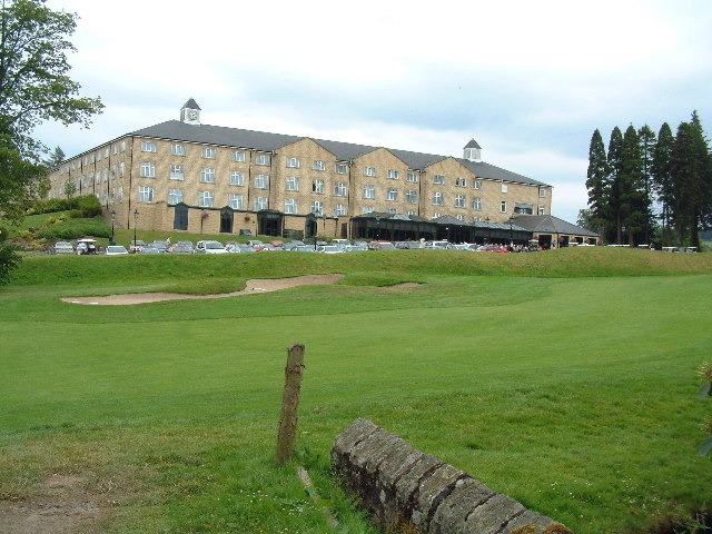
Slaley Hall

Slaley Hall is a country house golf resort in Northumberland in North East England, built by local developers Seamus O'Carroll and John Rourke which hosted...

Slaley, Northumberland

Slaley is a village in Northumberland, England. It is situated to the southeast of Hexham. It is surrounded by the following villages: Ruffside, Whitley...

Minsteracres

Minsteracres is an 18th-century mansion house, now a Christian retreat centre, in Northumberland, England. It is a Grade II listed building.The house was...

Derwent Reservoir (North East England)

The Derwent Reservoir is a reservoir on the River Derwent, on the border between County Durham and Northumberland, in England. It is west of Consett. It...

Healey, Northumberland

Healey is a rural estate and civil parish in Northumberland, England, situated between Riding Mill to the north and Slaley to the south. The neo-Norman...

Pow Hill Bog

Pow Hill Bog is a Site of Special Scientific Interest in the Wear Valley district of County Durham, England. It lies alongside Derwent Reservoir, approximately...

Rowley Burn (Northumberland)

Rowley Burn (also known as Rowley Brook and Ham Burn, NY 9358) is a stream in Northumberland, running around three miles south of Hexham before joining...

Related Videos

Timeshare Holiday Review: Slaley Hall, Northumberland, England - May 2021

Timeshare Holiday Review: Slaley Hall, Northumberland, England - May 2021 https://youtu.be/qGMKdeUjmwE Slaley Hall is ...

Winter Wildcamping with my dog

A chilly and breezy Winter Wildcamp after the hectic Christmas holidays it's always nice to re centre with some time in the woods.

Slaley, Slaley Forest and Devil's Water #Northumberland loop walk with iWalks NE (10 miles)

A serendipitous one: I'd intended to go out by myself, the day before, but the weather was awful...but saw an invitation for a rare ...

Wildcamping Hexham…… Kind of

So I decided to embark on a solo Wildcamp in my favourite forest with my sidekick Koda and encountered a few problems along ...

Nearby Amenities

Located within 500m of 54.894745,-2.0261783
Noexit: yes
Lat/Long: 54.8981252/-2.0241988
The data included in this document is from www.openstreetmap.org. The data is made available under ODbL.

Have you been to Lower Fox Valley?

Leave your review of Lower Fox Valley below (or comments, questions and feedback).