Marple Dale

Valley in Cheshire

England

Marple Dale

Peaceful Canal Scene Rural Canal bridge at Marple Locks
Peaceful Canal Scene Credit: Roger May

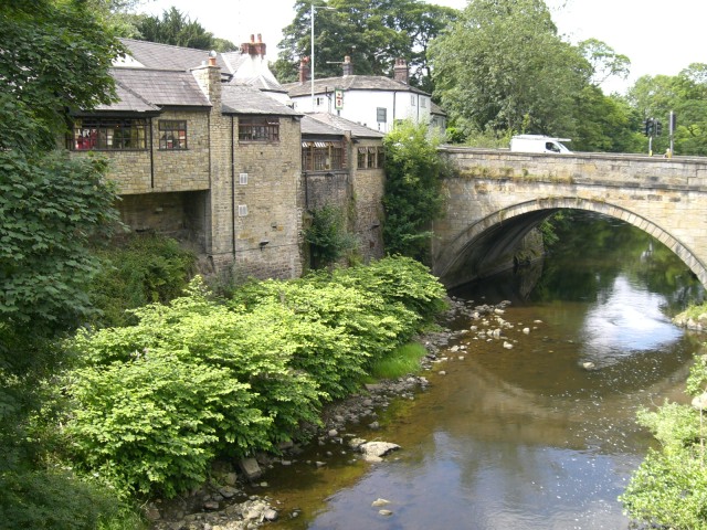
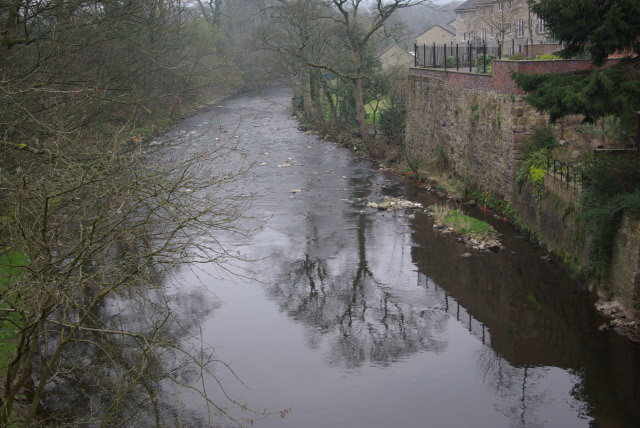
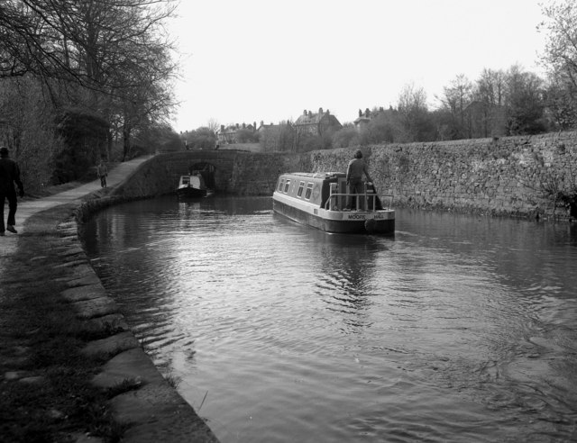
Marple Dale is a picturesque valley located in Cheshire, England. Situated in the eastern part of the county, Marple Dale is renowned for its stunning natural beauty and tranquil surroundings. It is part of the larger town of Marple, which lies on the River Goyt.

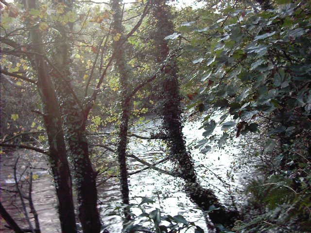
The valley is characterized by its rolling hills, lush green meadows, and dense woodland, making it an ideal destination for nature lovers and outdoor enthusiasts. Marple Dale is home to a diverse range of flora and fauna, with a variety of plant species and birdlife thriving in the area.

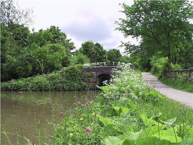
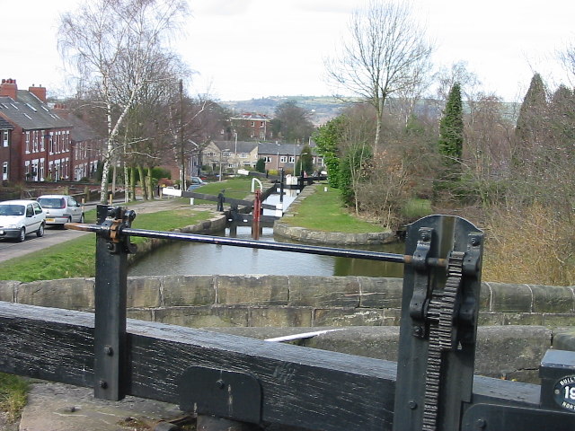
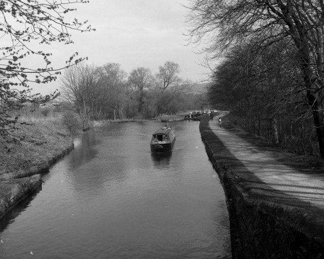
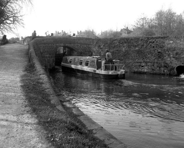
One of the notable features of Marple Dale is the Marple Aqueduct, a magnificent stone structure that spans the valley, carrying the Peak Forest Canal. This remarkable feat of engineering is a testament to the industrial heritage of the region and offers stunning views of the surrounding countryside.

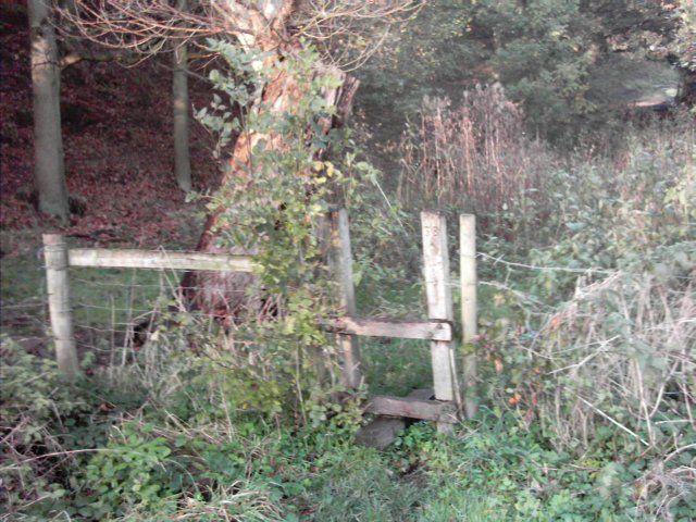
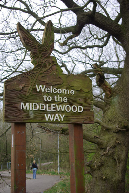
The valley is also intersected by several footpaths and trails, providing ample opportunities for walking, hiking, and cycling. These routes offer visitors the chance to explore the area's natural wonders, including babbling brooks, ancient woodlands, and hidden waterfalls.

In addition to its natural attractions, Marple Dale is also home to a vibrant community. The town of Marple, located nearby, offers a range of amenities, including shops, restaurants, and pubs, ensuring visitors have everything they need for a comfortable stay.

Overall, Marple Dale in Cheshire is a charming and idyllic location, combining natural beauty with a rich history. Whether it's for a leisurely stroll or a more adventurous outing, this valley offers a truly enchanting experience for all who visit.

If you have any feedback on the listing, please let us know in the comments section below.
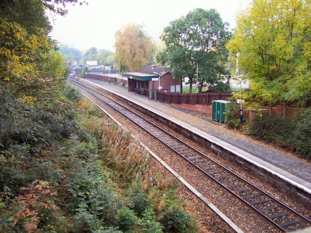
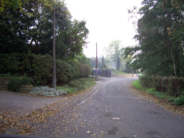
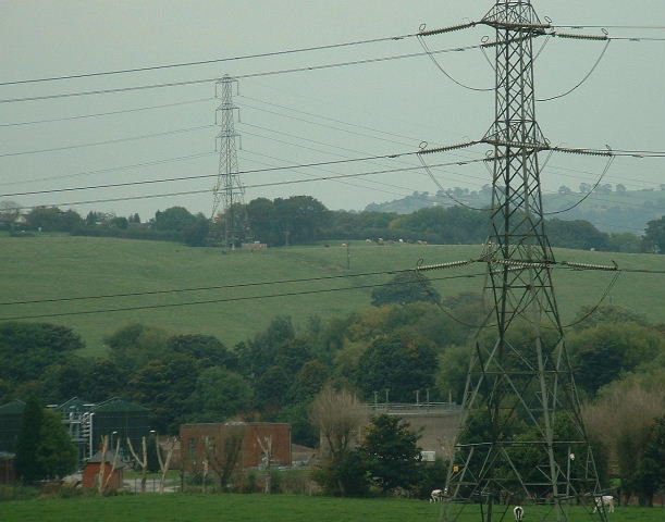
Marple Dale Images

Images are sourced within 2km of 53.405467/-2.0823292 or Grid Reference SJ9489. Thanks to Geograph Open Source API. All images are credited.

Peaceful Canal Scene Rural Canal bridge at Marple Locks
Peaceful Canal Scene
Rural Canal bridge at Marple Locks
Farmers' Market Early Sunday morning assembly of fruit and veg sellers behind the pub on Dooley Lane, Marple.  The mist has not yet burned off.
Farmers' Market
Early Sunday morning assembly of fruit and veg sellers behind the pub on Dooley Lane, Marple. The mist has not yet burned off.
Marple Hall School The Bradshaw Buildings, Marple Hall School.
Marple Hall School
The Bradshaw Buildings, Marple Hall School.
Room without a View Old Lodge at Marple, in front of the police station and adjacent to a park.
Now boarded up and long disused.
Room without a View
Old Lodge at Marple, in front of the police station and adjacent to a park. Now boarded up and long disused.
Rose Hill station Looking south from the road bridge above the station. The northbound platform (on the right of shot) is just within the square.
Rose Hill station
Looking south from the road bridge above the station. The northbound platform (on the right of shot) is just within the square.
Old Torkington Road Before the new piece of road to the traffic lights was constructed, this section of road joined the A626 near Yew Tree Farm.
Old Torkington Road
Before the new piece of road to the traffic lights was constructed, this section of road joined the A626 near Yew Tree Farm.
Bunkers Hill and Sewage Works Looking over the Goyt valley from the SW
Bunkers Hill and Sewage Works
Looking over the Goyt valley from the SW
River  Goyt Looking downstream from a point on the Goyt Valley Way to the south of Bredbury Green.
River Goyt
Looking downstream from a point on the Goyt Valley Way to the south of Bredbury Green.
Stile A stile on the public footpath from Bredbury Green to the banks of the River Goyt to the east of Stockport.
Stile
A stile on the public footpath from Bredbury Green to the banks of the River Goyt to the east of Stockport.
Marple locks Marple locks on the Peak Forest Canal
Marple locks
Marple locks on the Peak Forest Canal
Winnington Road Bridge At the end of Winnington Road, on the Ley Hey Park estate in Marple, the metalled road ends at this track crossing the railway bridge to the north of Rose Hill Station.
Winnington Road Bridge
At the end of Winnington Road, on the Ley Hey Park estate in Marple, the metalled road ends at this track crossing the railway bridge to the north of Rose Hill Station.
Marple Bridge
Marple Bridge
River Goyt, Marple Bridge The River Goyt rises on the moors west of Buxton and reaches the Greater Manchester suburbs here at Marple. It continues to Stockport where it meets the Mersey.
River Goyt, Marple Bridge
The River Goyt rises on the moors west of Buxton and reaches the Greater Manchester suburbs here at Marple. It continues to Stockport where it meets the Mersey.
Welcome to the Middlewood Way The Middlewood Way is a cycleway and footpath which follows the course of the Macclesfield - Marple railway, closed in 1970.
Welcome to the Middlewood Way
The Middlewood Way is a cycleway and footpath which follows the course of the Macclesfield - Marple railway, closed in 1970.
Rose Hill Marple Station Since 1970, this station has been the terminus of a short branch with a regular service to Manchester. The line used to continue southwards to Bollington and Macclesfield.
Rose Hill Marple Station
Since 1970, this station has been the terminus of a short branch with a regular service to Manchester. The line used to continue southwards to Bollington and Macclesfield.
Marple Locks, Peak Forest Canal The boat has just ascended the second lock from the bottom. These locks were only restored in the 1970s after a long period of disuse and dereliction.
Marple Locks, Peak Forest Canal
The boat has just ascended the second lock from the bottom. These locks were only restored in the 1970s after a long period of disuse and dereliction.
Marple Locks, Peak Forest Canal At the lower end, the Marple locks are set in the wild and unpopulated Goyt Valley, but as they rise, the canal passes into the very attractive village of Marple, one of the most desirable areas of the Greater Manchester region.
Marple Locks, Peak Forest Canal
At the lower end, the Marple locks are set in the wild and unpopulated Goyt Valley, but as they rise, the canal passes into the very attractive village of Marple, one of the most desirable areas of the Greater Manchester region.
Marple Locks, Peak Forest Canal The high quality of the stonework of these locks can be seen.  The restoration was very well done to the same standards.
Marple Locks, Peak Forest Canal
The high quality of the stonework of these locks can be seen. The restoration was very well done to the same standards.
Show me another place!

Marple Dale is located at Grid Ref: SJ9489 (Lat: 53.405467, Lng: -2.0823292)

Unitary Authority: Stockport

Police Authority: Greater Manchester

What 3 Words

///receive.radically.fevered. Near Marple, Manchester

Related Wikis

Romiley

Romiley is a village in the Metropolitan Borough of Stockport, Greater Manchester, England. Historically part of Cheshire, it borders Marple, Bredbury...

Chadkirk

Chadkirk is an area in the Metropolitan Borough of Stockport in Greater Manchester, England. It is located between the River Goyt and the Peak Forest Canal...

Chadkirk Chapel

Chadkirk Chapel is a restored historic chapel near Romiley in the Metropolitan Borough of Stockport in Greater Manchester, England. It is recorded in...

Marple Aqueduct

Marple Aqueduct (also known as Goyt Aqueduct) at Marple, Greater Manchester, in north-west England was built to carry the lower level of the Peak Forest...

Nearby Amenities

Located within 500m of 53.405467,-2.0823292
Power: tower
Lat/Long: 53.4067822/-2.0778939
Power: tower
Lat/Long: 53.4054885/-2.081349
Power: tower
Lat/Long: 53.4052243/-2.0862855
HE Ref: 1117377
Wikidata: Q26410919
Lat/Long: 53.4091727/-2.0781604
The data included in this document is from www.openstreetmap.org. The data is made available under ODbL.

Have you been to Marple Dale?

Leave your review of Marple Dale below (or comments, questions and feedback).