Greenhurst Hey Clough

Valley in Yorkshire

England

Greenhurst Hey Clough
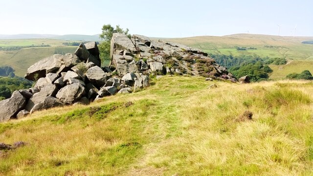
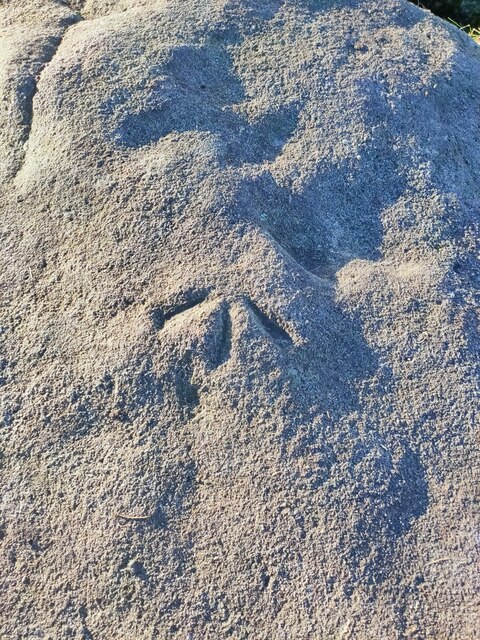
Orchan Rocks Rocky outcrop.
Orchan Rocks Credit: Stephen Shaw

Greenhurst Hey Clough is a picturesque valley located in Yorkshire, England. Nestled within the rolling hills of the region, this idyllic spot boasts breathtaking natural beauty and a tranquil atmosphere that attracts visitors from far and wide.

The valley is characterized by its lush greenery, with dense woodlands, meandering streams, and cascading waterfalls dotting the landscape. The area is home to a variety of plant and animal species, making it a haven for nature enthusiasts and wildlife lovers. Visitors can expect to spot native birds, small mammals, and even the occasional deer or fox.

Greenhurst Hey Clough offers numerous walking trails that wind through the valley, providing ample opportunities for outdoor exploration and adventure. The paths range in difficulty, catering to both beginners and experienced hikers. Along the way, visitors can enjoy breathtaking views of the surrounding countryside, as well as the chance to discover hidden gems such as secluded picnic spots and ancient ruins.

For those seeking a more leisurely experience, Greenhurst Hey Clough also features well-maintained picnic areas where visitors can relax and soak in the peaceful ambiance. The valley is a popular destination for families, who can enjoy a day of outdoor activities such as nature walks, birdwatching, and simply enjoying the fresh air.

Overall, Greenhurst Hey Clough is a captivating destination for nature lovers and those looking to escape the hustle and bustle of everyday life. Its natural beauty, diverse wildlife, and serene atmosphere make it a must-visit location for anyone exploring Yorkshire.

If you have any feedback on the listing, please let us know in the comments section below.

Greenhurst Hey Clough Images

Images are sourced within 2km of 53.731834/-2.0919713 or Grid Reference SD9426. Thanks to Geograph Open Source API. All images are credited.
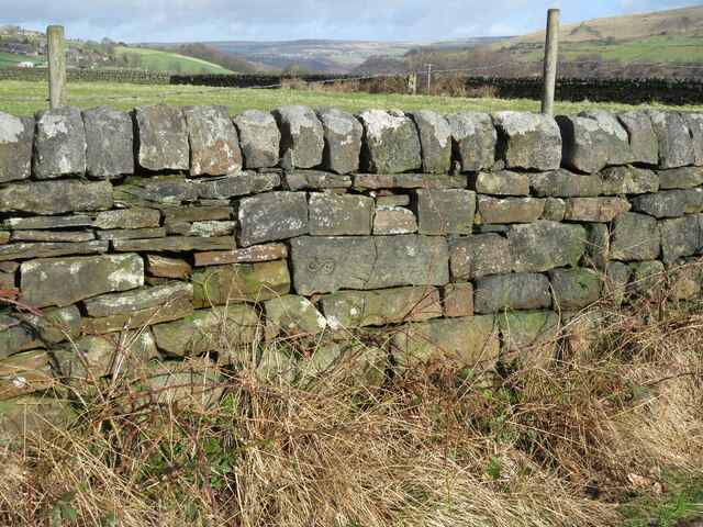
Orchan Rocks Rocky outcrop.
Orchan Rocks
Rocky outcrop.
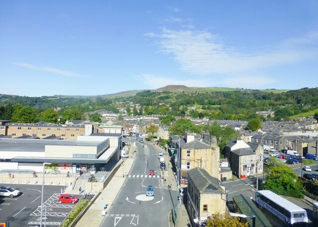
Burnley Road, Todmorden View from Rochdale to Leeds railway
Burnley Road, Todmorden
View from Rochdale to Leeds railway
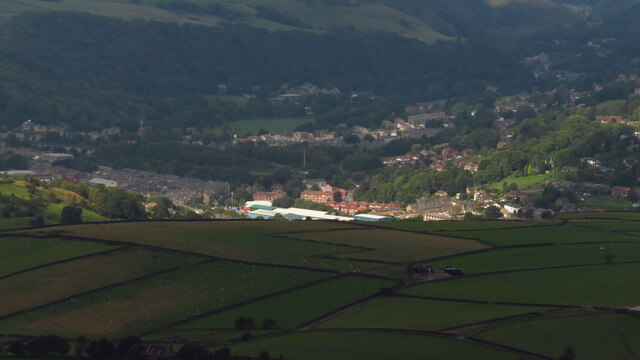
Sunlight on Todmorden from ridge south of Stoodley Pike Monument
OS Bench Mark OS cut bench mark from the first, 19th century, levelling, on flat rock close to the trig point. There is no sign of a pivot or rivet. The BM is shown on the 1853 6" OS map but not on subsequent editions, nor on any 25" maps. Marked as 1434.7 feet above old datum
OS Bench Mark
OS cut bench mark from the first, 19th century, levelling, on flat rock close to the trig point. There is no sign of a pivot or rivet. The BM is shown on the 1853 6" OS map but not on subsequent editions, nor on any 25" maps. Marked as 1434.7 feet above old datum
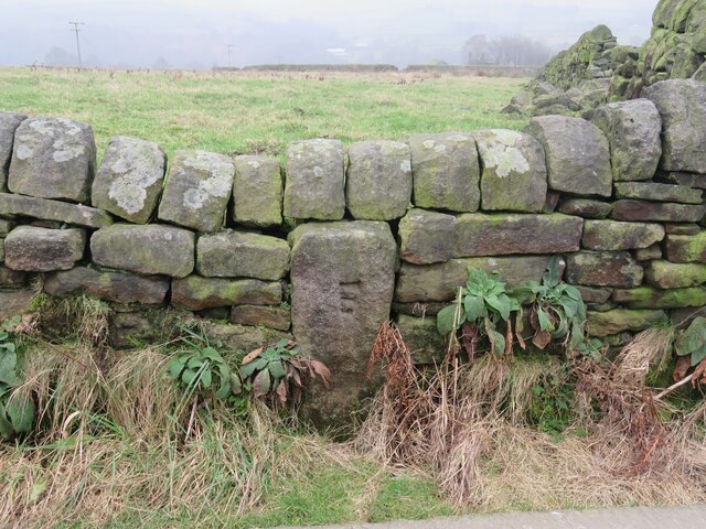
Old Boundary Marker Estate Boundary Marker set in a stone wall on Matthew Lane, a green lane. In the former Stansfield township and parish, absorbed into Todmorden parish in 1897. Not on any township or parish boundary so is thought to mark an estate boundary.

Milestone Society National ID: YW_TOD10em
Old Boundary Marker
Estate Boundary Marker set in a stone wall on Matthew Lane, a green lane. In the former Stansfield township and parish, absorbed into Todmorden parish in 1897. Not on any township or parish boundary so is thought to mark an estate boundary. Milestone Society National ID: YW_TOD10em
Old Boundary Marker on Baulk Head Lane, Todmorden Estate Boundary Marker set in a stone wall on Baulk Head Lane, a green lane. In the former Stansfield township and parish, absorbed into Todmorden parish in 1897. Not on any township or parish boundary so is thought to mark an estate boundary.

Milestone Society National ID: YW_TOD11em
Old Boundary Marker on Baulk Head Lane, Todmorden
Estate Boundary Marker set in a stone wall on Baulk Head Lane, a green lane. In the former Stansfield township and parish, absorbed into Todmorden parish in 1897. Not on any township or parish boundary so is thought to mark an estate boundary. Milestone Society National ID: YW_TOD11em
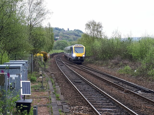
Train coming off Todmorden viaduct The line was opened by the Manchester and Leeds Railway in 1840 and passed through the hands of the Lancashire and Yorkshire, London Midland & Scottish Railway and eventually British Rail. Trains are currently operated by Northern Railway (a publicly owned company).  This recently introduced Civity diesel unit (195132) is operating a service to Manchester Victoria.
Train coming off Todmorden viaduct
The line was opened by the Manchester and Leeds Railway in 1840 and passed through the hands of the Lancashire and Yorkshire, London Midland & Scottish Railway and eventually British Rail. Trains are currently operated by Northern Railway (a publicly owned company). This recently introduced Civity diesel unit (195132) is operating a service to Manchester Victoria.
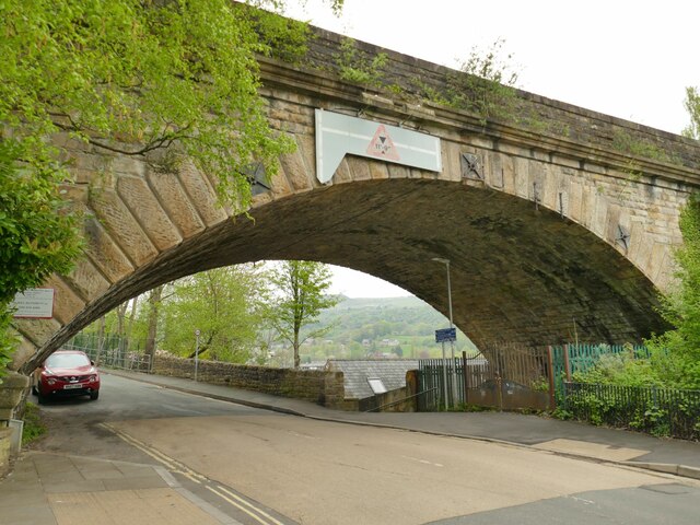
Railway arch over Ridge Road This is the southernmost arch of Todmorden railway viaduct, built c.1840 by George Stephenson for the Manchester and Leeds Railway.
Railway arch over Ridge Road
This is the southernmost arch of Todmorden railway viaduct, built c.1840 by George Stephenson for the Manchester and Leeds Railway.
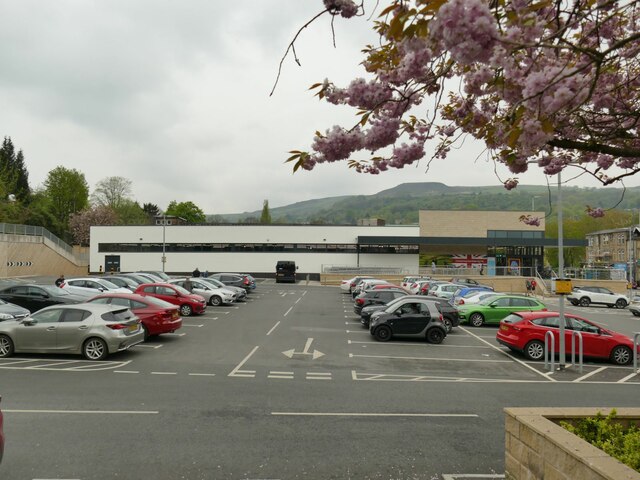
ALDI car park, Todmorden The car park occupies the site of the former Ridgefoot cotton mill.
ALDI car park, Todmorden
The car park occupies the site of the former Ridgefoot cotton mill.
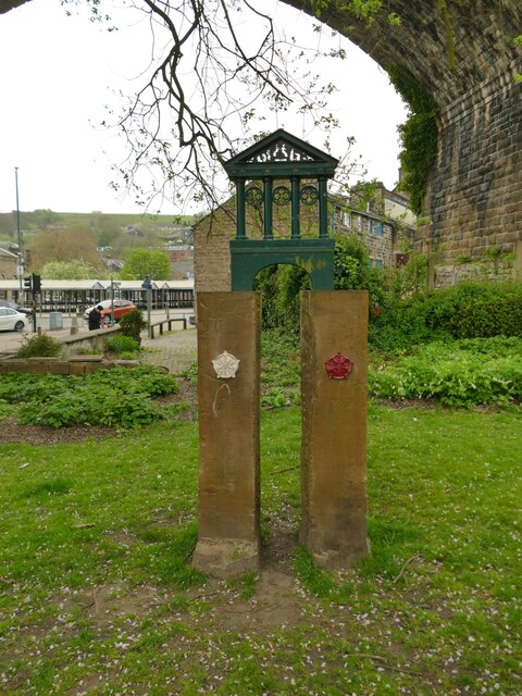
Boundary monument, Todmorden Todmorden was on the boundary (some would say border) of Lancashire and Yorkshire, until the whole town became part of West Yorkshire in 1974. The monument is on the site of the former Ridgefoot cotton mill, a little way on the Lancashire side of the old boundary. It illustrates the Town Hall nearby, which famously straddled the boundary.
Boundary monument, Todmorden
Todmorden was on the boundary (some would say border) of Lancashire and Yorkshire, until the whole town became part of West Yorkshire in 1974. The monument is on the site of the former Ridgefoot cotton mill, a little way on the Lancashire side of the old boundary. It illustrates the Town Hall nearby, which famously straddled the boundary.
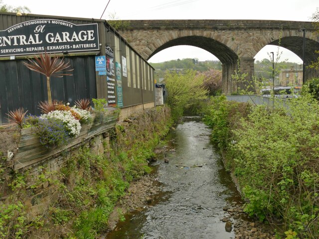
River Calder downstream of Stansfield Road, Todmorden The Yorkshire Calder is quite insignificant, at least in dry weather, at this point approaching the grade II listed railway viaduct of 1840, though the whole upper section of the river is prone to flash flooding.
River Calder downstream of Stansfield Road, Todmorden
The Yorkshire Calder is quite insignificant, at least in dry weather, at this point approaching the grade II listed railway viaduct of 1840, though the whole upper section of the river is prone to flash flooding.
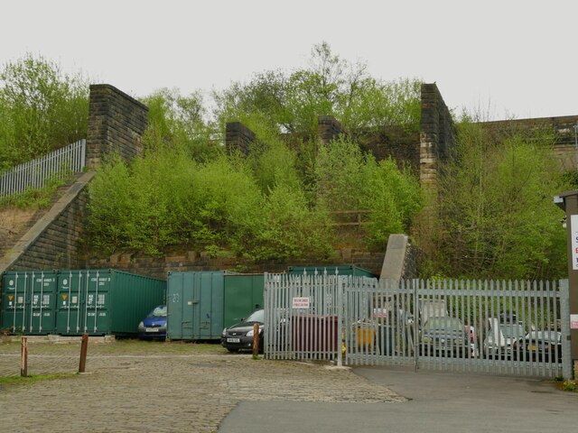
Coal drops, Todmorden The disused coal drops (or staithes) at Halifax and Sowerby Bridge are well known to railway enthusiasts, but I hadn't been aware that Todmorden had them too. This is where hopper wagons would be emptied into wagons or lorries waiting below to distribute coal to customers in the area.
Coal drops, Todmorden
The disused coal drops (or staithes) at Halifax and Sowerby Bridge are well known to railway enthusiasts, but I hadn't been aware that Todmorden had them too. This is where hopper wagons would be emptied into wagons or lorries waiting below to distribute coal to customers in the area.
Empire Books, Stansfield Street, Todmorden The building is shown on early 20th century maps as 'Carr Mill (Slipper)'. It presumably made carpet slippers from fabric produced in one of the many local cotton mills.  A comment on a local history website says 'The footwear industry in Rossendale [not far from Todmorden] didn't really finish until the late 1980s'.
Empire Books, Stansfield Street, Todmorden
The building is shown on early 20th century maps as 'Carr Mill (Slipper)'. It presumably made carpet slippers from fabric produced in one of the many local cotton mills. A comment on a local history website says 'The footwear industry in Rossendale [not far from Todmorden] didn't really finish until the late 1980s'.
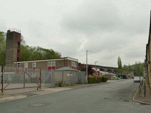
Fire station, Stansfield Street, Todmorden See also <a href="https://www.geograph.org.uk/photo/2432393">SD9324 : Todmorden Fire Station</a>. The ambulance station is just beyond it.
Fire station, Stansfield Street, Todmorden
See also SD9324 : Todmorden Fire Station. The ambulance station is just beyond it.
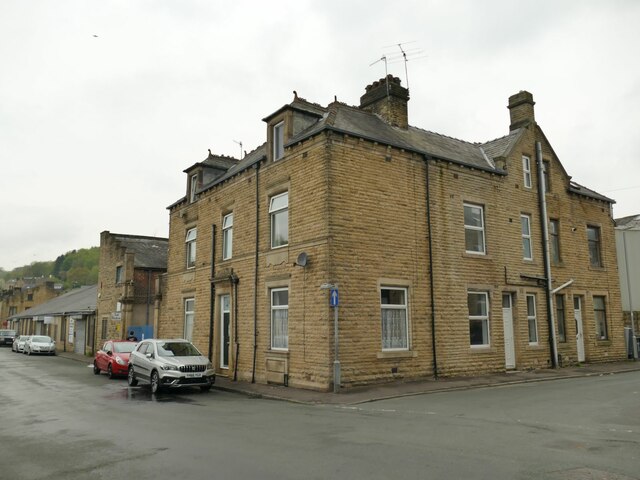
House on the corner of Whiteplatts Street, Todmorden A grander residence than most in the area, maybe built for a manager of one of the nearby cotton mills.
House on the corner of Whiteplatts Street, Todmorden
A grander residence than most in the area, maybe built for a manager of one of the nearby cotton mills.
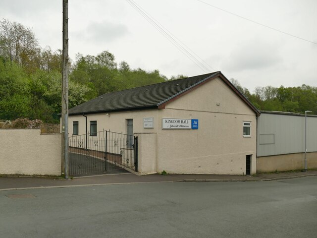
Kingdom Hall, Stansfield Street, Todmorden A place of worship of the Jehovah's Witnesses.
Kingdom Hall, Stansfield Street, Todmorden
A place of worship of the Jehovah's Witnesses.
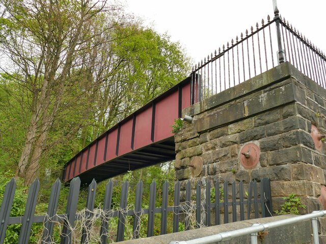
Railway footbridge at the end of Stansfield Road I presume this is a modern steel replacement for the original bridge. See <a href="https://www.geograph.org.uk/photo/2011138">SD9324 : Footbridge at the end of Stansfield Road</a> for a wider view including the stone setted approach ramp.
Railway footbridge at the end of Stansfield Road
I presume this is a modern steel replacement for the original bridge. See SD9324 : Footbridge at the end of Stansfield Road for a wider view including the stone setted approach ramp.
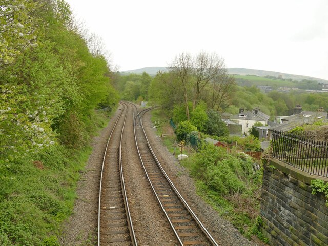
Site of Stansfield Hall station This is the site of a railway station opened in 1869 and closed as early as 1944. The footbridge (or a modern replacement) is all that remains. The two tracks east of the footbridge bearing left lead to Hebden Bridge and the Calder Valley main line. The single lead to the right, which was overgrown when photographed in 2010 <a href="https://www.geograph.org.uk/photo/2011144">SD9324 : Burnley to Halifax Railway</a> has since been restored and is used by services from Blackburn to Manchester via Todmorden. The location is known as Stansfield Hall Junction.
Site of Stansfield Hall station
This is the site of a railway station opened in 1869 and closed as early as 1944. The footbridge (or a modern replacement) is all that remains. The two tracks east of the footbridge bearing left lead to Hebden Bridge and the Calder Valley main line. The single lead to the right, which was overgrown when photographed in 2010 SD9324 : Burnley to Halifax Railway has since been restored and is used by services from Blackburn to Manchester via Todmorden. The location is known as Stansfield Hall Junction.
Show me another place!

Greenhurst Hey Clough is located at Grid Ref: SD9426 (Lat: 53.731834, Lng: -2.0919713)

Division: West Riding

Unitary Authority: Calderdale

Police Authority: West Yorkshire

What 3 Words

///breakaway.self.friction. Near Todmorden, West Yorkshire

Related Wikis

Stansfield Hall railway station

Stansfield Hall railway station (English: ) was the second station in Stansfield, Todmorden in West Yorkshire, England and was situated on the Copy Pit...

Mons Mill, Todmorden

Mons Mill, Todmorden, is a former cotton spinning mill in Todmorden, Calderdale, West Yorkshire, England built for the Hare Spinning Company Limited. It...

Todmorden High School

Todmorden High School is a comprehensive school in the town of Todmorden, Calderdale LEA, West Yorkshire, England. == Admissions == Todmorden High School...

Blackshaw

Blackshaw is a civil parish in the Calderdale metropolitan borough of West Yorkshire, England. It contains the village of Blackshaw Head. According to...

Nearby Amenities

Located within 500m of 53.731834,-2.0919713
Historic: boundary_stone
Lat/Long: 53.7352638/-2.0924999
The Wizard of Whirlaw
Artwork Type: statue
Tourism: artwork
Lat/Long: 53.7308893/-2.09668
Barrier: stile
Foot: yes
Lat/Long: 53.7308232/-2.0967145
Ford: yes
Lat/Long: 53.7315606/-2.0913776
Ford: yes
Lat/Long: 53.7323402/-2.0927698
Barrier: stile
Lat/Long: 53.7347425/-2.0955634
The data included in this document is from www.openstreetmap.org. The data is made available under ODbL.

Have you been to Greenhurst Hey Clough?

Leave your review of Greenhurst Hey Clough below (or comments, questions and feedback).