Creech Bottom

Valley in Dorset

England

Creech Bottom

New Road A finger post indicates the route of the Purbeck Way.
New Road Credit: Trevor Harris

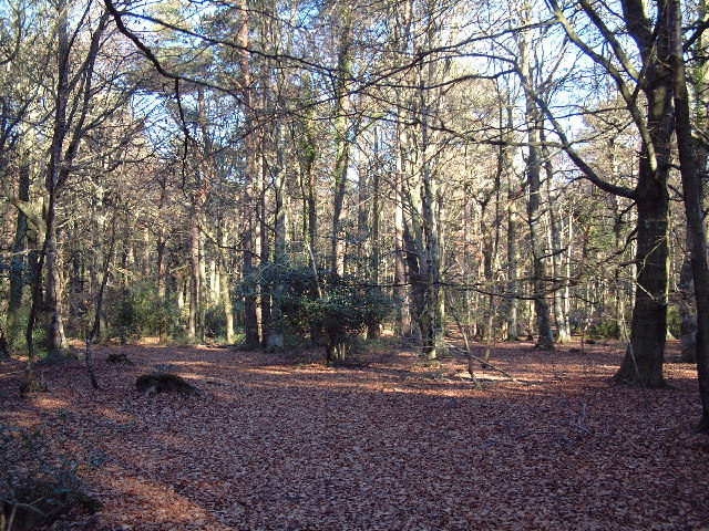
Creech Bottom is a picturesque valley located in the county of Dorset, England. Situated in the heart of the Wessex Downs, it is renowned for its natural beauty and tranquil atmosphere. Nestled between rolling hills and surrounded by lush greenery, this idyllic valley offers visitors a chance to escape the hustle and bustle of city life and immerse themselves in the serenity of the countryside.

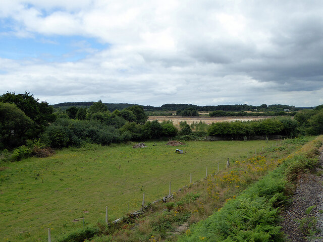
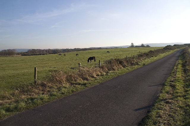
The landscape of Creech Bottom is characterized by its gently sloping hills and meandering streams. The valley is dotted with charming farmhouses and cottages, adding to its rural charm. The area is primarily used for agricultural purposes, with fields of crops and grazing pastures for livestock.

Wildlife enthusiasts flock to Creech Bottom for its diverse flora and fauna. The valley is home to a variety of bird species, including skylarks and yellowhammers, making it a haven for birdwatchers. Additionally, the area is frequented by small mammals such as rabbits and hares, as well as occasional sightings of deer.

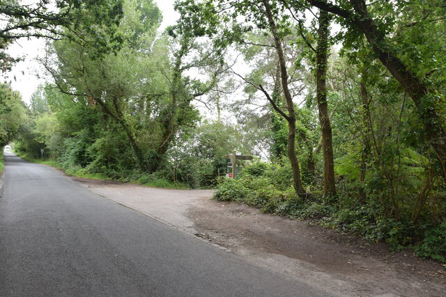
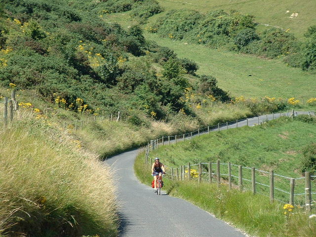
The valley is crisscrossed by numerous footpaths and bridleways, making it a popular destination for hikers, cyclists, and horse riders. Visitors can explore the countryside, taking in breathtaking views of the surrounding hills and valleys. For those seeking a longer adventure, the nearby Wessex Ridgeway offers a scenic trail that extends for miles, showcasing the natural beauty of the region.

In summary, Creech Bottom in Dorset is a charming valley that offers visitors a tranquil retreat amidst stunning natural landscapes. With its abundant wildlife, agricultural scenery, and outdoor activities, it is an ideal destination for nature lovers and those seeking a peaceful escape.

If you have any feedback on the listing, please let us know in the comments section below.

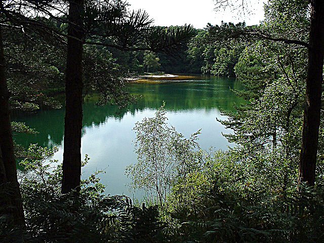
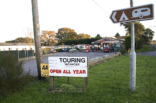
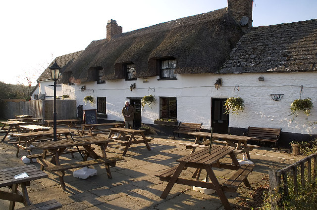
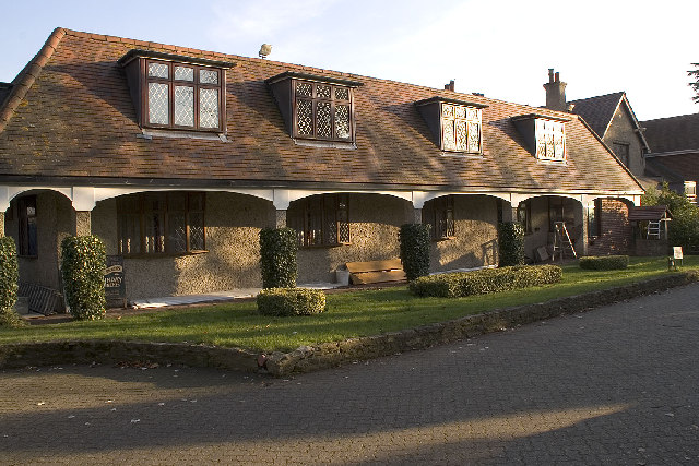
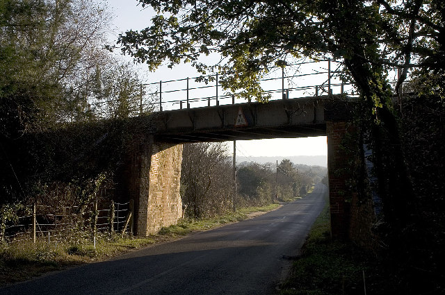
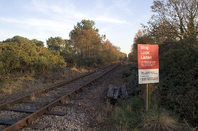
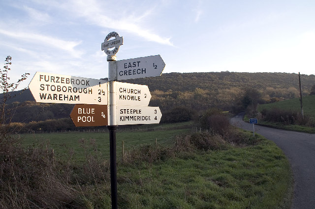
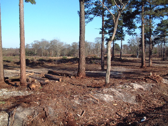
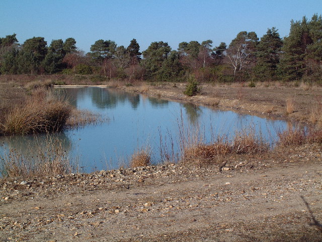
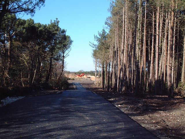
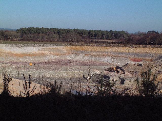
Creech Bottom Images

Images are sourced within 2km of 50.657901/-2.1100536 or Grid Reference SY9284. Thanks to Geograph Open Source API. All images are credited.

New Road A finger post indicates the route of the Purbeck Way.
New Road
A finger post indicates the route of the Purbeck Way.
Halfway Inn Public house and restaurant on the A531. Located approximately halfway between Wareham and Corfe Castle.
Halfway Inn
Public house and restaurant on the A531. Located approximately halfway between Wareham and Corfe Castle.
Pasture beside the railway Looking towards Stoborough Heath, viewed from a Swanage to Wareham train service.
Pasture beside the railway
Looking towards Stoborough Heath, viewed from a Swanage to Wareham train service.
Old Milestone by the A351, south of Stoborough Green Carved stone post by the A351, in parish of ARNE (PURBECK District), by bus stop and path to Blue Pool, opposite sign 'RVP No 5' at entrance to Hartland Nature reserve, on West side of road. Dorset 2 (limestone), erected by the Wareham (North, South & West Branches) turnpike trust in the 19th century.

Inscription reads:-
II
MILES FROM
WAREHAM
Carved benchmark bottom centre of front face. 

Grade II Listed. List Entry Number:1120342 <span class="nowrap"><a title="https://historicengland.org.uk/listing/the-list/list-entry/1120342" rel="nofollow ugc noopener" href="https://historicengland.org.uk/listing/the-list/list-entry/1120342">Link</a><img style="margin-left:2px;" alt="External link" title="External link - shift click to open in new window" src="https://s1.geograph.org.uk/img/external.png" width="10" height="10"/></span>

Milestone Society National ID: DO_WASW02
Old Milestone by the A351, south of Stoborough Green
Carved stone post by the A351, in parish of ARNE (PURBECK District), by bus stop and path to Blue Pool, opposite sign 'RVP No 5' at entrance to Hartland Nature reserve, on West side of road. Dorset 2 (limestone), erected by the Wareham (North, South & West Branches) turnpike trust in the 19th century. Inscription reads:- II MILES FROM WAREHAM Carved benchmark bottom centre of front face. Grade II Listed. List Entry Number:1120342 LinkExternal link Milestone Society National ID: DO_WASW02
Stonehill Down Looking NW down the steep hill - tough work on a Tandem!
Stonehill Down
Looking NW down the steep hill - tough work on a Tandem!
The Blue Pool, Furzebrook From the early 17th century the Blue Pool at Furzebrook was dug for clay to make high quality pottery and clay pipes. The colloidal clay particles in the water disperse light in such a way as to give the pool a greenish-blue colour. In 1985 it was designated a Site of Special Scientific Interest (SSSI) and many rare species may be found in the locality. The pool itself supports no life forms whatsoever.
<span class="nowrap"><a title="http://blue.pool.users.btopenworld.com/" rel="nofollow ugc noopener" href="http://blue.pool.users.btopenworld.com/">Link</a><img style="margin-left:2px;" alt="External link" title="External link - shift click to open in new window" src="https://s1.geograph.org.uk/img/external.png" width="10" height="10"/></span>
The Blue Pool, Furzebrook
From the early 17th century the Blue Pool at Furzebrook was dug for clay to make high quality pottery and clay pipes. The colloidal clay particles in the water disperse light in such a way as to give the pool a greenish-blue colour. In 1985 it was designated a Site of Special Scientific Interest (SSSI) and many rare species may be found in the locality. The pool itself supports no life forms whatsoever. LinkExternal link
Lookout Holiday Park, Stoborough, Wareham, Dorset One of the many caravan parks catering for the multitude of summer visitors to the Isle of Purbeck.
Lookout Holiday Park, Stoborough, Wareham, Dorset
One of the many caravan parks catering for the multitude of summer visitors to the Isle of Purbeck.
Hartland Moor NNR, Dorset Hartland Moor NNR (National Nature Reserve) is on the left and the Purbeck Hills can be seen in the distance.
Hartland Moor NNR, Dorset
Hartland Moor NNR (National Nature Reserve) is on the left and the Purbeck Hills can be seen in the distance.
The Halfway Inn, Norden, Dorset The inn is halfway between Wareham and Corfe Castle.
The Halfway Inn, Norden, Dorset
The inn is halfway between Wareham and Corfe Castle.
Springfield Country Hotel and Leisure Club, Wareham, Dorset <span class="nowrap"><a title="http://www.springfield-country-hotel.co.uk/" rel="nofollow ugc noopener" href="http://www.springfield-country-hotel.co.uk/">Link</a><img style="margin-left:2px;" alt="External link" title="External link - shift click to open in new window" src="https://s1.geograph.org.uk/img/external.png" width="10" height="10"/></span>
Springfield Country Hotel and Leisure Club, Wareham, Dorset
Railway Bridge, Creech Bottom, Dorset The bridge carries the section of the line used by trains carrying Liquefied Petroleum Gas from the BP terminal at Furzebrook. On average eleven trains a week arrive at Furzebrook where they are loaded with butane and propane destined for BP's distribution terminal at Avonmouth. On 3rd January 2002 the remaining track was re-laid at Norden to connect with this section, re-establishing the rail link between Swanage and the main line that was closed in 1972.
<span class="nowrap"><a title="http://www.swanagerailway.co.uk/history.htm" rel="nofollow ugc noopener" href="http://www.swanagerailway.co.uk/history.htm">Link</a><img style="margin-left:2px;" alt="External link" title="External link - shift click to open in new window" src="https://s1.geograph.org.uk/img/external.png" width="10" height="10"/></span>
Railway Bridge, Creech Bottom, Dorset
The bridge carries the section of the line used by trains carrying Liquefied Petroleum Gas from the BP terminal at Furzebrook. On average eleven trains a week arrive at Furzebrook where they are loaded with butane and propane destined for BP's distribution terminal at Avonmouth. On 3rd January 2002 the remaining track was re-laid at Norden to connect with this section, re-establishing the rail link between Swanage and the main line that was closed in 1972. LinkExternal link
Railway Crossing, Creech Bottom, Dorset The Purbeck Way crosses the railway line at this point. This section of the line is used by trains carrying Liquefied Petroleum Gas from the BP terminal at Furzebrook. On average eleven trains a week arrive at Furzebrook where they are loaded with butane and propane destined for BP's distribution terminal at Avonmouth. On 3rd January 2002 the remaining track was re-laid at Norden to connect with this section, re-establishing the rail link between Swanage and the main line that was closed in 1972.
<span class="nowrap"><a title="http://www.swanagerailway.co.uk/history.htm" rel="nofollow ugc noopener" href="http://www.swanagerailway.co.uk/history.htm">Link</a><img style="margin-left:2px;" alt="External link" title="External link - shift click to open in new window" src="https://s1.geograph.org.uk/img/external.png" width="10" height="10"/></span>
Railway Crossing, Creech Bottom, Dorset
The Purbeck Way crosses the railway line at this point. This section of the line is used by trains carrying Liquefied Petroleum Gas from the BP terminal at Furzebrook. On average eleven trains a week arrive at Furzebrook where they are loaded with butane and propane destined for BP's distribution terminal at Avonmouth. On 3rd January 2002 the remaining track was re-laid at Norden to connect with this section, re-establishing the rail link between Swanage and the main line that was closed in 1972. LinkExternal link
Road Sign near East Creech, Dorset The Purbeck Hills are ahead.
Road Sign near East Creech, Dorset
The Purbeck Hills are ahead.
Holme Lane Plantation The undergrowth here has been cleared recently, probably of rhododendrons judging from nearby areas that have not been cleared.
Holme Lane Plantation
The undergrowth here has been cleared recently, probably of rhododendrons judging from nearby areas that have not been cleared.
Disused Clay Workings The former clay workings here are flooded.
Disused Clay Workings
The former clay workings here are flooded.
Quarry Access Road Looking north west from the point where the road is crossed by a permissive path. The surface, if not the road itself, is very new.
Quarry Access Road
Looking north west from the point where the road is crossed by a permissive path. The surface, if not the road itself, is very new.
Clay Pit near Dorey's Farm Clay has been extracted in this area for hundreds of years. Extensive Roman era kilns have recently been uncovered near Swineham Point and Josiah Wedgwood apparently sourced his clay from this area as well. Clay extraction continues now with modern methods. Note the colours of the exposed strata and the patterns made by the scoops.
Clay Pit near Dorey's Farm
Clay has been extracted in this area for hundreds of years. Extensive Roman era kilns have recently been uncovered near Swineham Point and Josiah Wedgwood apparently sourced his clay from this area as well. Clay extraction continues now with modern methods. Note the colours of the exposed strata and the patterns made by the scoops.
Bridewell Plantation A clearing viewed looking north east from the permissive path running through the wood.
Bridewell Plantation
A clearing viewed looking north east from the permissive path running through the wood.
Show me another place!

Creech Bottom is located at Grid Ref: SY9284 (Lat: 50.657901, Lng: -2.1100536)

Unitary Authority: Dorset

Police Authority: Dorset

What 3 Words

///berated.outlooks.fades. Near Wareham, Dorset

Related Wikis

Furzebrook, Dorset

Furzebrook is a small village on the Isle of Purbeck, in the county of Dorset in the south of England. It is about 2 miles (3.2 km) south of Wareham and...

Stoborough Green

Stoborough Green is a village in the English county of Dorset. It is situated to the south of the village of Stoborough and about 2 kilometres south of...

Blue Pool, Dorset

Blue Pool is a flooded, disused clay pit where Purbeck ball clay was once extracted. It is now a lake within the Furzebrook Estate, a 25-acre (10 ha) park...

East Creech

East Creech is a hamlet in the parish of Church Knowle in the county of Dorset, England. East Creech lies at the northern foot of the Purbeck Hills about...

Nearby Amenities

Located within 500m of 50.657901,-2.1100536
Creech Bottom
Railway: level_crossing
Ref: Access Point No. 19
Lat/Long: 50.6610579/-2.1133122
Material: wood
Power: pole
Source: survey
Switch: recloser
Lat/Long: 50.6593488/-2.1165021
Material: wood
Note: Vertically stacked
Power: pole
Source: bing
Lat/Long: 50.6598803/-2.1143339
Material: wood
Power: pole
Source: bing
Lat/Long: 50.6604181/-2.114018
Material: wood
Power: pole
Ref: 57101141
Source: bing
Lat/Long: 50.6613496/-2.1135323
Animal Boarding
Witch End Boarding Cattery
Addr Housename: Witch End
Animal Boarding: cat
Lat/Long: 50.6611478/-2.1113316
Fire Flapper
Emergency: fire_flapper
Lat/Long: 50.6559944/-2.1062054
Fire Flapper
Emergency: fire_flapper
Lat/Long: 50.6565466/-2.1103472
Information: board
Source: survey
Tourism: information
Lat/Long: 50.6576923/-2.1110607
Power: pole
Source: survey
Lat/Long: 50.6597829/-2.1129979
Material: wood
Power: pole
Source: survey
Lat/Long: 50.6597966/-2.1133755
Marker: pipeline
Note: P.S.P. Pipeline
Operator: Perenco UK Ltd
Lat/Long: 50.6608473/-2.1134878
Marker: pipeline
Note: P.S.P. Pipeline
Operator: Perenco UK Ltd
Lat/Long: 50.6608721/-2.1133233
Barrier: stile
Source: survey
Lat/Long: 50.6589833/-2.1079292
Railway: crossing
Source: survey
Lat/Long: 50.6590646/-2.1078725
Barrier: stile
Source: survey
Lat/Long: 50.6591083/-2.1078433
Power: pole
Source: bing
Lat/Long: 50.6595487/-2.1156903
The data included in this document is from www.openstreetmap.org. The data is made available under ODbL.

Have you been to Creech Bottom?

Leave your review of Creech Bottom below (or comments, questions and feedback).