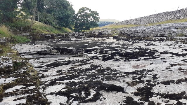
Litton Fosse

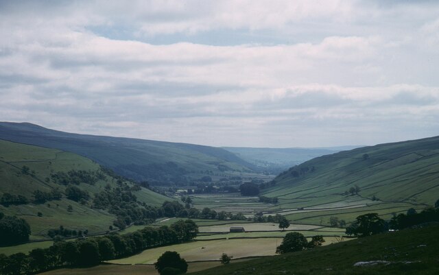
Valley in Yorkshire Craven

England

Litton Fosse

Benchmark on stone at base of wall on south side of road west of Litton Ordnance Survey rivet benchmark levelled at 257.779m above Newlyn Datum verified 1954
Benchmark on stone at base of wall on south side of road west of Litton Credit: Roger Templeman

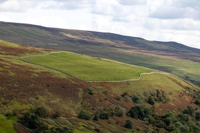
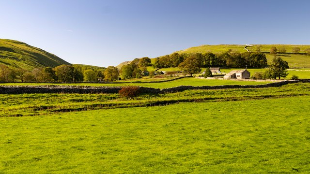
Litton Fosse is a small village located in the Yorkshire Dales, England. Situated within the idyllic Littondale valley, this picturesque hamlet offers a serene and charming atmosphere. With a population of around 100 residents, Litton Fosse is renowned for its tranquility and unspoiled natural surroundings.

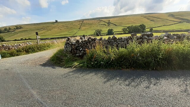
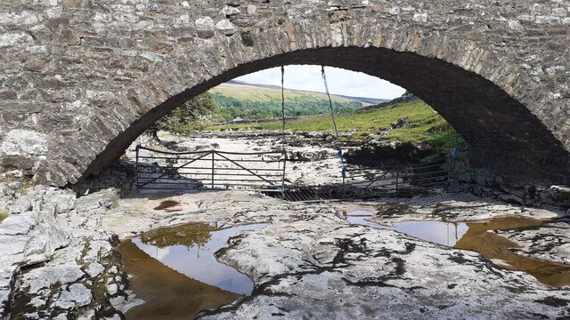
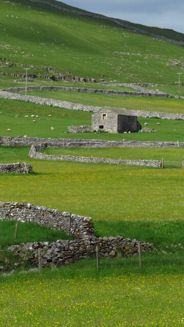
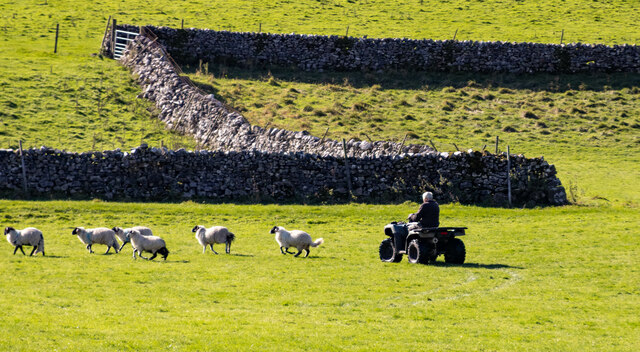
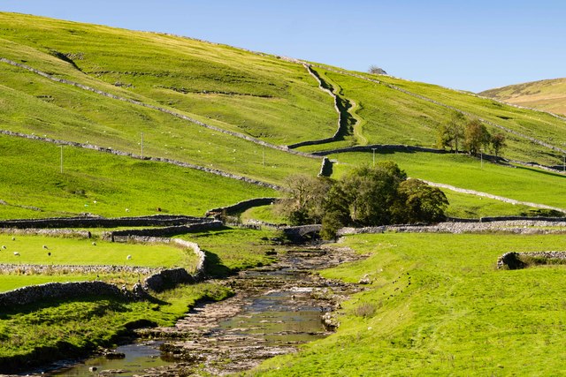
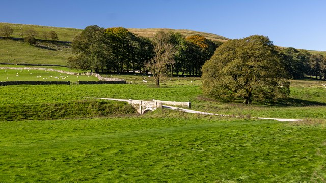
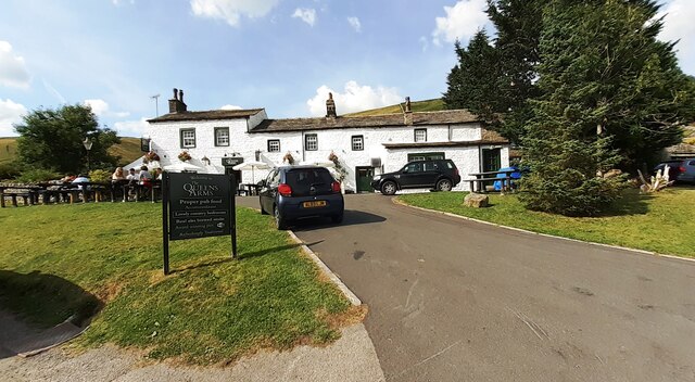
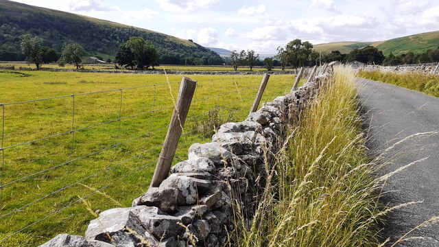
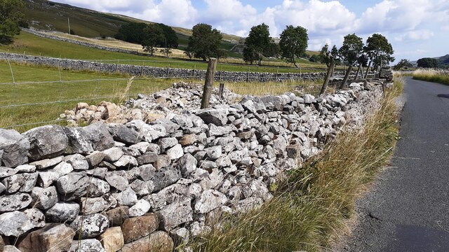
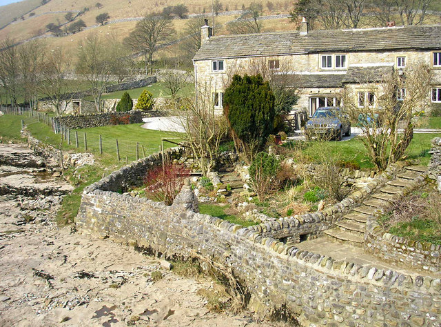
The village is characterized by its traditional stone-built houses, many of which date back several centuries, giving it a distinct historic charm. The surrounding countryside is a haven for nature enthusiasts, with rolling hills, lush meadows, and babbling streams, all contributing to the area's outstanding natural beauty.

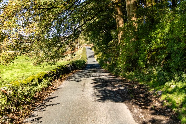
Litton Fosse is well-connected to nearby towns and cities, with the market town of Skipton being just a short drive away. This provides residents with access to a range of amenities, including shops, schools, and healthcare facilities. However, the village itself is relatively secluded, offering a peaceful retreat from the hustle and bustle of urban life.

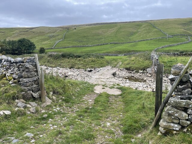
Outdoor activities are plentiful in Litton Fosse, with numerous walking trails and cycling routes crisscrossing the surrounding countryside. The village is also a popular base for exploring the wider Yorkshire Dales National Park, with its breathtaking landscapes and diverse wildlife.

Overall, Litton Fosse is a hidden gem in the heart of Yorkshire. Its unspoiled beauty, rich history, and tranquil ambiance make it an ideal destination for those seeking a peaceful retreat or a gateway to the stunning Yorkshire Dales.

If you have any feedback on the listing, please let us know in the comments section below.
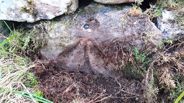
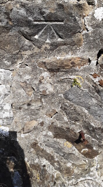
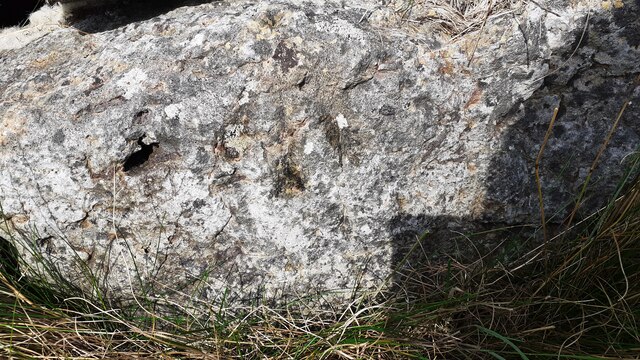
Litton Fosse Images

Images are sourced within 2km of 54.159988/-2.1499041 or Grid Reference SD9073. Thanks to Geograph Open Source API. All images are credited.

Benchmark on stone at base of wall on south side of road west of Litton Ordnance Survey rivet benchmark levelled at 257.779m above Newlyn Datum verified 1954
Benchmark on stone at base of wall on south side of road west of Litton
Ordnance Survey rivet benchmark levelled at 257.779m above Newlyn Datum verified 1954
Track towards bridge over River Skirfare from road to Litton There is an Ordnance Survey benchmark <a href="https://www.geograph.org.uk/photo/6926956">SD8974 : Benchmark on stone at base of wall on south side of road west of Litton</a> on the base of the wall about 3 feet from the corner
Track towards bridge over River Skirfare from road to Litton
There is an Ordnance Survey benchmark SD8974 : Benchmark on stone at base of wall on south side of road west of Litton on the base of the wall about 3 feet from the corner
Benchmark on back of west parapet of bridge taking track over River Skirfare Ordnance Survey cut mark benchmark levelled at 254.843m above Newlyn Datum verified 1954
Benchmark on back of west parapet of bridge taking track over River Skirfare
Ordnance Survey cut mark benchmark levelled at 254.843m above Newlyn Datum verified 1954
Bridge taking track over River Skirfare 1km west of Litton There is an Ordnance Survey benchmark <a href="https://www.geograph.org.uk/photo/6927562">SD8974 : Benchmark on back of west parapet of bridge taking track over River Skirfare</a> on the bridge wall on the left hand side of its arch
Bridge taking track over River Skirfare 1km west of Litton
There is an Ordnance Survey benchmark SD8974 : Benchmark on back of west parapet of bridge taking track over River Skirfare on the bridge wall on the left hand side of its arch
View west along the dry bed of River Skirfare at New Bridge
New Ings Barns, Littondale
Littondale spectacular view
River Skirfare Ford This ford is found on the River Skirfare.
River Skirfare Ford
This ford is found on the River Skirfare.
Potts Moor Field beneath Potts Moor.
Potts Moor
Field beneath Potts Moor.
Littondale Herding sheep in Littondale.
Littondale
Herding sheep in Littondale.
New Bridge New Bridge on the River Skirfare.
New Bridge
New Bridge on the River Skirfare.
Littondale Bridge crossing the River Skirfare in Littondale.
Littondale
Bridge crossing the River Skirfare in Littondale.
Hesleden Beck View looking up the valley of Hesleden Back.
Hesleden Beck
View looking up the valley of Hesleden Back.
Littondale The road leading up Littondale to Halton Gill.
Littondale
The road leading up Littondale to Halton Gill.
The Queens Arms
The Queens Arms
Road towards Litton approaching Cave Barn
Benchmark on roadside rock which was part of Low Fields Barn Ordnance Survey pivot benchmark described on the Bench Mark Database at <span class="nowrap"><a title="www.bench-marks.org.uk/bm100720" rel="nofollow ugc noopener" href="http://www.bench-marks.org.uk/bm100720">Link</a><img style="margin-left:2px;" alt="External link" title="External link - shift click to open in new window" src="https://s1.geograph.org.uk/img/external.png" width="10" height="10"/></span>
Benchmark on roadside rock which was part of Low Fields Barn
Ordnance Survey pivot benchmark described on the Bench Mark Database at LinkExternal link
The remains of Low Fields Barn behind wall on NE side of Littondale road Part of the barn wall is now the roadside wall with its Ordnance Survey benchmark <a href="https://www.geograph.org.uk/photo/6926885">SD9173 : Benchmark on roadside rock which was part of Low Fields Barn</a> on a stone at the base of the wall
The remains of Low Fields Barn behind wall on NE side of Littondale road
Part of the barn wall is now the roadside wall with its Ordnance Survey benchmark SD9173 : Benchmark on roadside rock which was part of Low Fields Barn on a stone at the base of the wall
Show me another place!

Litton Fosse is located at Grid Ref: SD9073 (Lat: 54.159988, Lng: -2.1499041)

Division: West Riding

Administrative County: North Yorkshire

District: Craven

Police Authority: North Yorkshire

What 3 Words

///country.drumbeat.signature. Near Settle, North Yorkshire

Related Wikis

Litton, North Yorkshire

Litton is a village and civil parish in Littondale in the Yorkshire Dales in England. It lies in the Craven District of North Yorkshire, 1.5 miles (2...

Scoska Wood

Scoska Wood is an IUCN Category IV – habitat or species management area, a British national nature reserve (NNR), and a Site of Special Scientific Interest...

Hesleden, North Yorkshire

Hesleden is a hamlet in Littondale in the Yorkshire Dales in England. It lies within the civil parish of Halton Gill in the Craven district of North Yorkshire...

Birks Fell

Birks Fell is a hill in the Yorkshire Dales, near to Hubberholme in North Yorkshire, England. It is classed as a Marilyn (a hill with topographic prominence...

Ewecross

The historical area of Ewecross or Ewcross is a district in the West Riding of Yorkshire, England. It included the parishes of Bentham, Clapham, Horton...

Arncliffe, North Yorkshire

Arncliffe is a small village and civil parish in Littondale, one of the Yorkshire Dales in England. Littondale is a small valley beside Upper Wharfedale...

Halton Gill

Halton Gill is a hamlet and civil parish in Littondale in the Yorkshire Dales in North Yorkshire, England. It is situated 2 miles (3.2 km) up Littondale...

Fountains Fell Tarn

Fountains Fell Tarn, is an upland lake between the two peaks of Fountains Fell, in North Yorkshire, England. The tarn is close to the Pennine Way, some...

Nearby Amenities

Located within 500m of 54.159988,-2.1499041
Litton
Is In: UK, England, Yorkshire, North Yorkshire, Yorkshire Dales, Littondale
Is In Country Code: GB
Is In County: North Yorkshire
Is In Historic County: Yorkshire
Is In Municipality: Craven
Is In Valley: Littondale
Place: hamlet
Lat/Long: 54.1625746/-2.1463279
Telephone
Booth: K6
Covered: booth
Lat/Long: 54.1632517/-2.1469769
Post Box
Post Box Type: lamp
Source: survey
Lat/Long: 54.1627182/-2.1447731
Bench
Source: survey;gps
Lat/Long: 54.1632541/-2.1464513
limekiln
Fixme: are ruins still visible? If so, please cahnge to historic=ruins. Also, confirm exact location.
Historic: archaeological_site
Mineral: limestone
Output: lime
Source: OS 1852 sheet 98;Bing
Lat/Long: 54.1598331/-2.1567308
Power: pole
Lat/Long: 54.1636926/-2.1472009
Power: pole
Lat/Long: 54.163629/-2.1459992
Power: pole
Lat/Long: 54.1629404/-2.1466135
Power: pole
Lat/Long: 54.1624481/-2.1472371
Power: pole
Lat/Long: 54.1617289/-2.1480444
Power: pole
Lat/Long: 54.1613394/-2.1485232
Power: pole
Lat/Long: 54.1607693/-2.1497154
Power: pole
Lat/Long: 54.1610567/-2.150614
Power: pole
Lat/Long: 54.1614917/-2.1519765
Power: pole
Lat/Long: 54.1618796/-2.1531996
Power: pole
Lat/Long: 54.1622392/-2.1542403
Power: pole
Lat/Long: 54.1626004/-2.1554661
The data included in this document is from www.openstreetmap.org. The data is made available under ODbL.

Have you been to Litton Fosse?

Leave your review of Litton Fosse below (or comments, questions and feedback).