Middleshank Cleugh

Valley in Northumberland

England

Middleshank Cleugh

Summit of Bloodybush Edge This triangulation pillar marks the 610 metre top of this the sixth highest of the Cheviot Hills. For a selection of detailed free to download walking routes in the area visit <span class="nowrap"><a title="www.cheviotwalks.co.uk" rel="nofollow ugc noopener" href="http://www.cheviotwalks.co.uk">Link</a><img style="margin-left:2px;" alt="External link" title="External link - shift click to open in new window" src="https://s1.geograph.org.uk/img/external.png" width="10" height="10"/></span>
Summit of Bloodybush Edge Credit: Geoff Holland

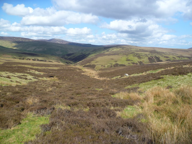
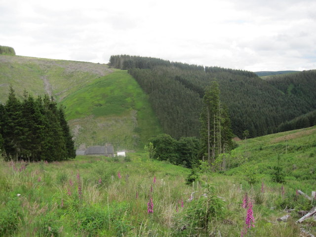
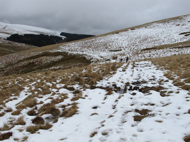
Middleshank Cleugh, located in Northumberland, is a picturesque valley known for its natural beauty and rich history. Situated in the northernmost county of England, this tranquil valley stretches for approximately 5 miles, encompassing rolling hills, lush meadows, and a meandering river.

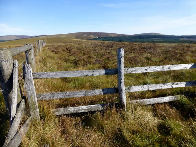
The valley is named after the Middleshank Burn, a small river that flows through its heart, carving out a deep, narrow gorge over thousands of years. The river is flanked by steep slopes covered in dense vegetation, creating a stunning backdrop for visitors and hikers.

Middleshank Cleugh boasts a diverse range of flora and fauna, with its woodlands providing a habitat for numerous species of birds, mammals, and insects. The cleugh is particularly known for the presence of red squirrels, which thrive in the area's woodland and make for a delightful sight for nature enthusiasts.

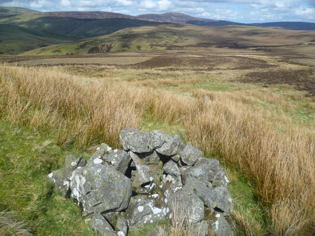
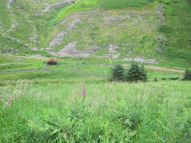
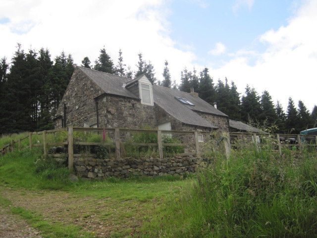
The valley has a rich history, with evidence of human activity dating back thousands of years. Ancient settlements, burial sites, and remnants of old stone structures can be found throughout the area, offering a glimpse into the lives of the people who once inhabited this land.

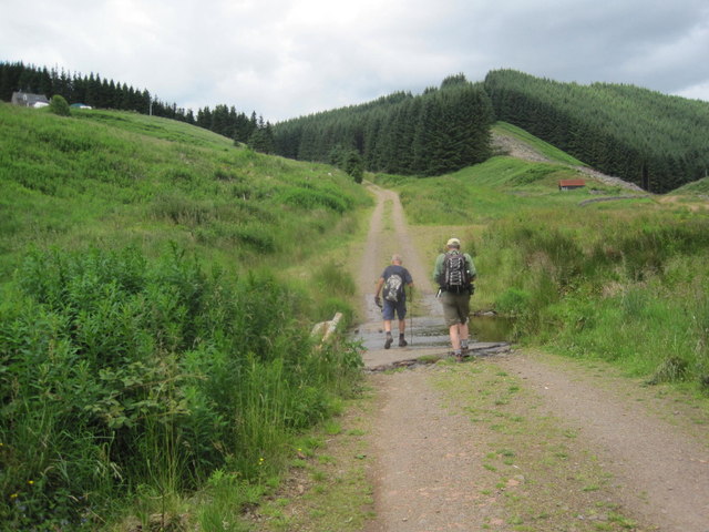
Today, Middleshank Cleugh is a popular destination for outdoor enthusiasts, offering a range of activities such as hiking, birdwatching, and picnicking. The well-maintained trails provide opportunities for exploration, allowing visitors to appreciate the valley's natural wonders up close.

With its idyllic scenery and historical significance, Middleshank Cleugh is a hidden gem in Northumberland, offering a peaceful retreat for those seeking solace in nature or an opportunity to delve into the region's past.

If you have any feedback on the listing, please let us know in the comments section below.

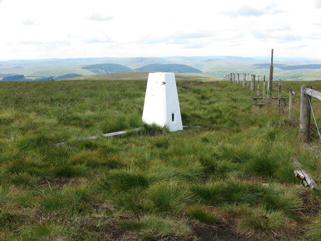
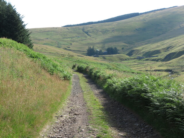
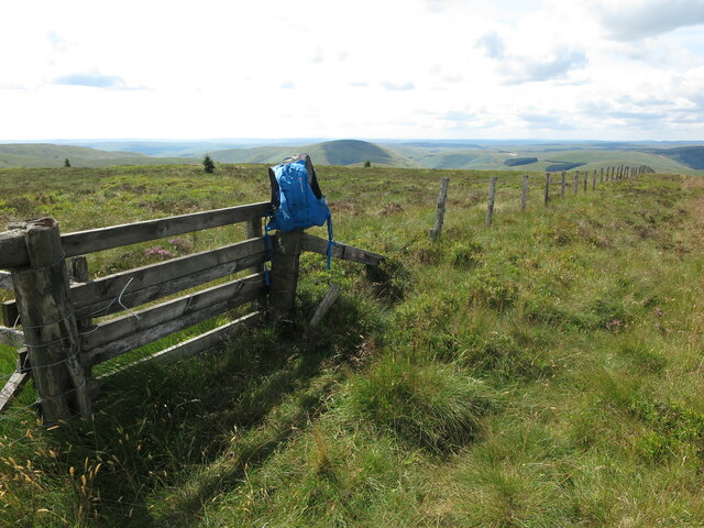
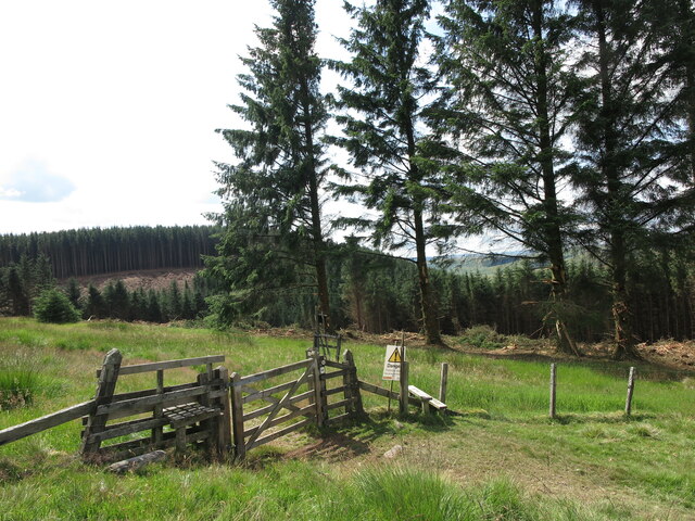
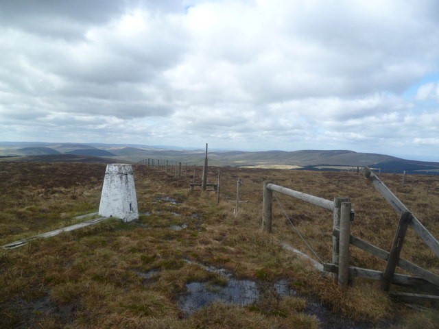
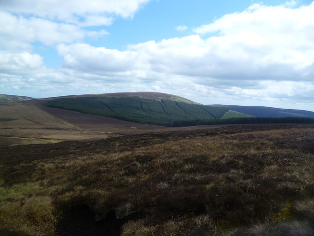
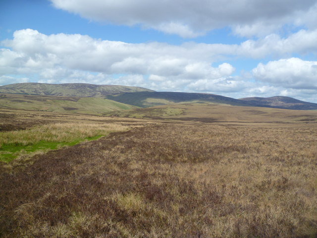
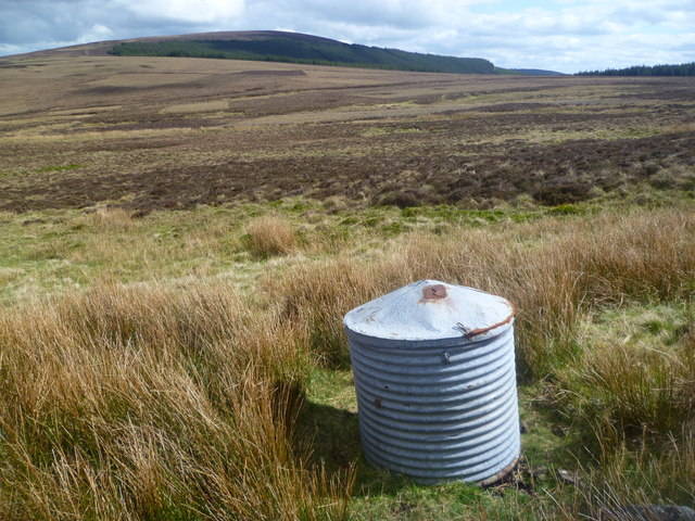
Middleshank Cleugh Images

Images are sourced within 2km of 55.415087/-2.1625258 or Grid Reference NT8913. Thanks to Geograph Open Source API. All images are credited.

Summit of Bloodybush Edge This triangulation pillar marks the 610 metre top of this the sixth highest of the Cheviot Hills. For a selection of detailed free to download walking routes in the area visit <span class="nowrap"><a title="www.cheviotwalks.co.uk" rel="nofollow ugc noopener" href="http://www.cheviotwalks.co.uk">Link</a><img style="margin-left:2px;" alt="External link" title="External link - shift click to open in new window" src="https://s1.geograph.org.uk/img/external.png" width="10" height="10"/></span>
Summit of Bloodybush Edge
This triangulation pillar marks the 610 metre top of this the sixth highest of the Cheviot Hills. For a selection of detailed free to download walking routes in the area visit LinkExternal link
Public Bridleway near Uswayford This public bridleway leads to the remote farm of Uswayford, seen in the distance. It is the farms only means of access to the single track valley road at Slymefoot and the outside world. For a selection of detailed free to download walking routes in the area visit <span class="nowrap"><a title="www.cheviotwalks.co.uk" rel="nofollow ugc noopener" href="http://www.cheviotwalks.co.uk">Link</a><img style="margin-left:2px;" alt="External link" title="External link - shift click to open in new window" src="https://s1.geograph.org.uk/img/external.png" width="10" height="10"/></span>
Public Bridleway near Uswayford
This public bridleway leads to the remote farm of Uswayford, seen in the distance. It is the farms only means of access to the single track valley road at Slymefoot and the outside world. For a selection of detailed free to download walking routes in the area visit LinkExternal link
The Summit of Yarnspath Law The sac marks the top of Yarnspath Law, which is also shown in my photograph submitted in October 2011 <a title="https://www.geograph.org.uk/photo/2654998" href="https://www.geograph.org.uk/photo/2654998">Link</a> although taken from the opposite direction. For a selection of detailed free to download walking routes in the area visit <span class="nowrap"><a title="www.cheviotwalks.co.uk" rel="nofollow ugc noopener" href="http://www.cheviotwalks.co.uk">Link</a><img style="margin-left:2px;" alt="External link" title="External link - shift click to open in new window" src="https://s1.geograph.org.uk/img/external.png" width="10" height="10"/></span>
The Summit of Yarnspath Law
The sac marks the top of Yarnspath Law, which is also shown in my photograph submitted in October 2011 Link although taken from the opposite direction. For a selection of detailed free to download walking routes in the area visit LinkExternal link
Gate into the Kidland Forest This gate lies on the northern edge of the vast Kidland Forest, as well as on the route of the ancient cross-border track of Clennell Street. The trees in the background are in the process of being harvested and by this time next year the scene will have somewhat changed. For a selection of detailed free to download walking routes in the area visit <span class="nowrap"><a title="www.cheviotwalks.co.uk" rel="nofollow ugc noopener" href="http://www.cheviotwalks.co.uk">Link</a><img style="margin-left:2px;" alt="External link" title="External link - shift click to open in new window" src="https://s1.geograph.org.uk/img/external.png" width="10" height="10"/></span>
Gate into the Kidland Forest
This gate lies on the northern edge of the vast Kidland Forest, as well as on the route of the ancient cross-border track of Clennell Street. The trees in the background are in the process of being harvested and by this time next year the scene will have somewhat changed. For a selection of detailed free to download walking routes in the area visit LinkExternal link
Trig Pillar, Bloodybush Edge Named after of a battle between the old enemies in the 1500's. Apparently the English won this one.
Trig Pillar, Bloodybush Edge
Named after of a battle between the old enemies in the 1500's. Apparently the English won this one.
Descending Bloodybush Edge Looking towards Cushat Law beyond the forest
Descending Bloodybush Edge
Looking towards Cushat Law beyond the forest
Ainsey Burn Crossing the col between Cushat Law and Bloodybush Edge. The burn seen as a rush filled gutter on the gently sloping moor.
Ainsey Burn
Crossing the col between Cushat Law and Bloodybush Edge. The burn seen as a rush filled gutter on the gently sloping moor.
Metal Cylinder under Bloodybush Edge Looks like a storage container for use by the sheep farmer. Cushat Law in the distance.
Metal Cylinder under Bloodybush Edge
Looks like a storage container for use by the sheep farmer. Cushat Law in the distance.
Cairn, under Bloodybush Edge A small cairn near a rock outcrop in the moor.
Cairn, under Bloodybush Edge
A small cairn near a rock outcrop in the moor.
Above Redscar Sike Redscar Sike joins the Ainsey Burn to flow into the River Breamish
Above Redscar Sike
Redscar Sike joins the Ainsey Burn to flow into the River Breamish
Shivering Stone, Bloodybush Edge Brrrrrrr!

There is a photo of the Shivering Stone in better weather here <a href="https://www.geograph.org.uk/photo/1307559">NT9014 : The view southwards from the Shivering Stone</a>. Today I was just glad to find it.

This is one of the 'Named Stones of Northumberland' <span class="nowrap"><a title="http://heddonhistory.weebly.com/blog/the-named-stones-of-northumberland-revisited" rel="nofollow ugc noopener" href="http://heddonhistory.weebly.com/blog/the-named-stones-of-northumberland-revisited">Link</a><img style="margin-left:2px;" alt="External link" title="External link - shift click to open in new window" src="https://s1.geograph.org.uk/img/external.png" width="10" height="10"/></span>

The Shivering Stone, like the Hanging Stone (near Cheviot) and the Leaping Stones (north of Kielder) all carry a notion of movement; the broken rocks appearing to tumble down hill. Outcropping of the volcanic andesite in this part of the Cheviot Hills is not particularly common as it is mainly covered by a deep quarternary peat deposit.
Shivering Stone, Bloodybush Edge
Brrrrrrr! There is a photo of the Shivering Stone in better weather here NT9014 : The view southwards from the Shivering Stone. Today I was just glad to find it. This is one of the 'Named Stones of Northumberland' LinkExternal link The Shivering Stone, like the Hanging Stone (near Cheviot) and the Leaping Stones (north of Kielder) all carry a notion of movement; the broken rocks appearing to tumble down hill. Outcropping of the volcanic andesite in this part of the Cheviot Hills is not particularly common as it is mainly covered by a deep quarternary peat deposit.
Trig point on Bloodybush Edge
Yarnspath Law Parked SW of Barrow Law then up track past Rowhope and Trows to Uswayford then uphill to bag Bloodybush Edge with Dusty. Then four TUMPs on our high return route over Yarnspath Law, The Middle, Middle Hill and finally Kyloe Shin.
Name: Yarnspath Law
Hill number: 3549
Height: 543m / 1781ft
Parent (Ma/M): 2302  The Cheviot
Section: 33: The Scottish Border to the River Tyne
Area: The Cheviots
County/UA: Northumberland (CoU)
Class: Dewey
Grid ref: NT 88427 13236
Summit feature: no feature: ground c 4m from fence
Drop: 37m
Col: 506m  NT893139  
Observations: top 400m NE at NT 88710 13539 may be as high
Survey: Abney level
Yarnspath Law
Parked SW of Barrow Law then up track past Rowhope and Trows to Uswayford then uphill to bag Bloodybush Edge with Dusty. Then four TUMPs on our high return route over Yarnspath Law, The Middle, Middle Hill and finally Kyloe Shin. Name: Yarnspath Law Hill number: 3549 Height: 543m / 1781ft Parent (Ma/M): 2302 The Cheviot Section: 33: The Scottish Border to the River Tyne Area: The Cheviots County/UA: Northumberland (CoU) Class: Dewey Grid ref: NT 88427 13236 Summit feature: no feature: ground c 4m from fence Drop: 37m Col: 506m NT893139 Observations: top 400m NE at NT 88710 13539 may be as high Survey: Abney level
Ford through White Burn Whiteburnshank in the distance
Ford through White Burn
Whiteburnshank in the distance
Temporary Shepherds Hut in the Valley of the East Burn
Whiteburnshank Outdoor Centre Whiteburnshank is an old shepherd’s cottage located in the heart of Kidland Forest in the Northumberland National Park 8 kms from Alwinton in a secluded hillside location accessed by forest tracks.
Available 365 days a year, the cottage is ideal for groups or organisations wanting to organise their own outdoor activities and pursuits. Scouts, guides, D of E, school groups, bona fide organisations and families wishing to get away from it all can book by the night for any length of stay. We do not operate a seasonal booking tariff.
<span class="nowrap"><a title="http://www.whiteburnshank.org.uk/" rel="nofollow ugc noopener" href="http://www.whiteburnshank.org.uk/">Link</a><img style="margin-left:2px;" alt="External link" title="External link - shift click to open in new window" src="https://s1.geograph.org.uk/img/external.png" width="10" height="10"/></span>
Whiteburnshank Outdoor Centre
Whiteburnshank is an old shepherd’s cottage located in the heart of Kidland Forest in the Northumberland National Park 8 kms from Alwinton in a secluded hillside location accessed by forest tracks. Available 365 days a year, the cottage is ideal for groups or organisations wanting to organise their own outdoor activities and pursuits. Scouts, guides, D of E, school groups, bona fide organisations and families wishing to get away from it all can book by the night for any length of stay. We do not operate a seasonal booking tariff. LinkExternal link
Whiteburnshank and the East Burn Valley
Clennell Street and Well Cleugh The two walkers have just negotiated the crossing of Well Cleugh on the route of Clennell Street a track with a history dating back to time immemorial. They are heading uphill to the Kidland Forest which is now undergoing substantial harvesting. For a selection of free to download walking routes in the area visit <span class="nowrap"><a title="www.cheviotwalks.co.uk" rel="nofollow ugc noopener" href="http://www.cheviotwalks.co.uk">Link</a><img style="margin-left:2px;" alt="External link" title="External link - shift click to open in new window" src="https://s1.geograph.org.uk/img/external.png" width="10" height="10"/></span>
Clennell Street and Well Cleugh
The two walkers have just negotiated the crossing of Well Cleugh on the route of Clennell Street a track with a history dating back to time immemorial. They are heading uphill to the Kidland Forest which is now undergoing substantial harvesting. For a selection of free to download walking routes in the area visit LinkExternal link
Show me another place!

Middleshank Cleugh is located at Grid Ref: NT8913 (Lat: 55.415087, Lng: -2.1625258)

Unitary Authority: Northumberland

Police Authority: Northumbria

What 3 Words

///softly.workroom.entitles. Near Kirknewton, Northumberland

Related Wikis

Kidland

Kidland is a former civil parish, now in the parish of Alwinton in Northumberland, England, about 2 miles (3 km) northwest of Alwinton village. In 1951...

Barrow Burn Meadows

Barrow Burn Meadows is a Site of Special Scientific Interest (SSSI) in north Northumberland, England. The site is a species-rich hay meadow of a sort now...

Barrow Burn

Barrowburn is a hamlet in Upper Coquetdale in the county of Northumberland, England. It comprises a working farm with associated buildings and two holiday...

Shillhope Law

Shillhope Law is a hill in the southern Cheviots, a range of hills in Northumberland, England. Shillhope Law is a relatively unremarkable member of this...

Have you been to Middleshank Cleugh?

Leave your review of Middleshank Cleugh below (or comments, questions and feedback).