Green Cleugh

Valley in Northumberland

England

Green Cleugh

Trig Pillar, Bloodybush Edge Named after of a battle between the old enemies in the 1500's. Apparently the English won this one.
Trig Pillar, Bloodybush Edge Credit: Michael Graham

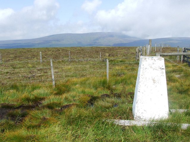
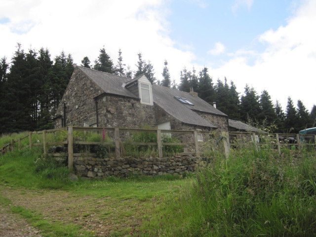
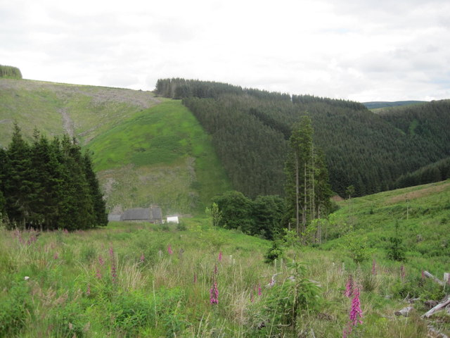
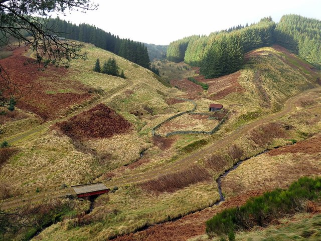
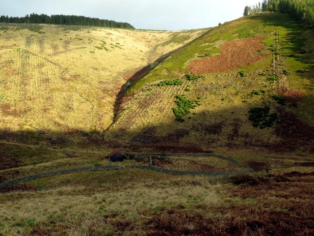
Green Cleugh is a picturesque valley located in the county of Northumberland, England. Situated amidst the stunning North Pennines, this hidden gem offers a serene and idyllic setting for visitors to explore.

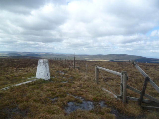
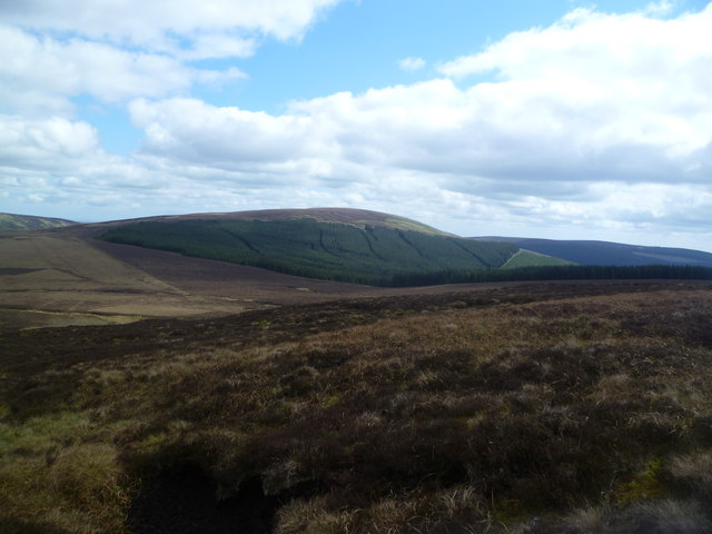
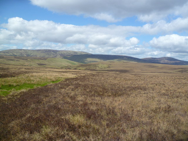
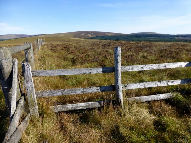
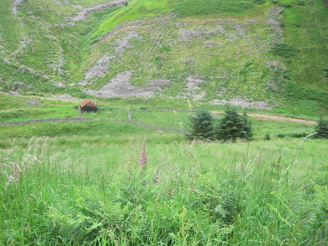
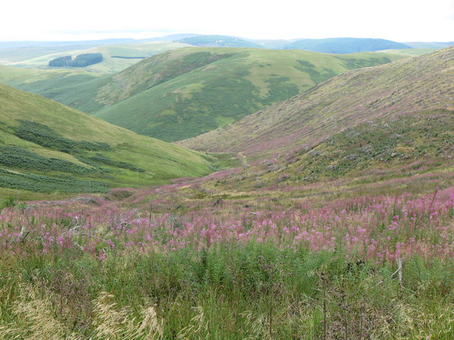
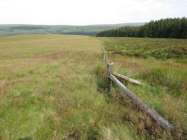
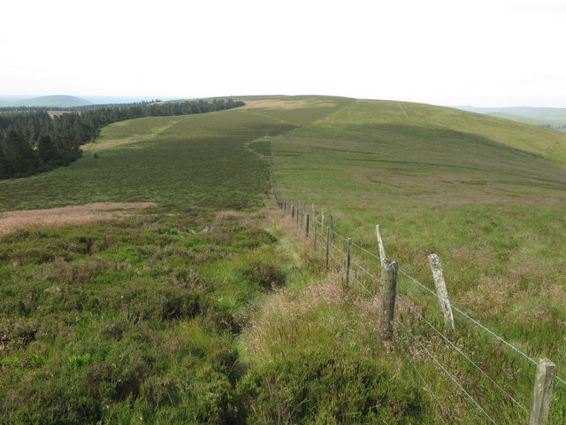
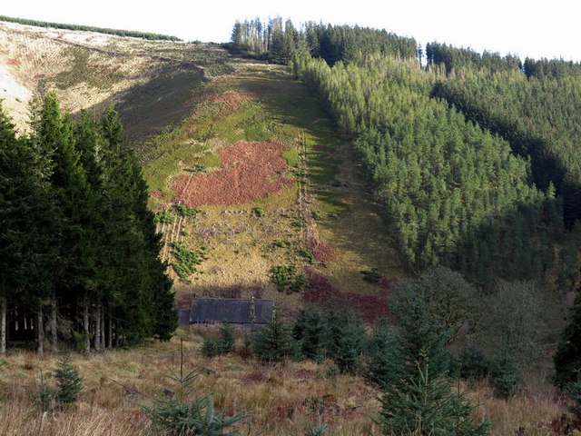
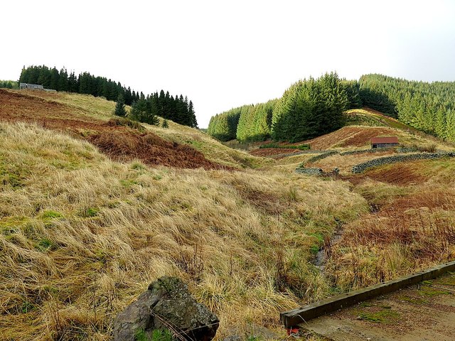
The valley is nestled between rolling hills and is traversed by a meandering river, which adds to its natural charm. Lush green meadows, dotted with wildflowers during the summer months, stretch as far as the eye can see, creating a breathtaking landscape.

Green Cleugh is renowned for its diverse wildlife, making it a popular destination for nature lovers. The valley is home to a variety of bird species, including buzzards, skylarks, and peregrine falcons, making it a haven for birdwatchers. In addition, the river provides a habitat for otters and trout, adding to the biodiversity of the area.

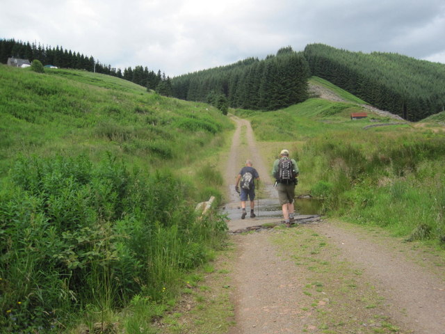
For those seeking outdoor activities, Green Cleugh offers numerous opportunities for exploration and adventure. The valley is crisscrossed by walking trails, allowing visitors to discover its hidden nooks and crannies. Hiking enthusiasts can embark on challenging routes to the surrounding hills, providing breathtaking views of the valley from above.

The tranquility of Green Cleugh makes it an ideal spot for picnics and relaxation. Visitors can unwind by the riverside, enjoying the soothing sounds of nature and the calming atmosphere. The valley also offers several picnic spots, complete with benches and tables, providing a perfect setting for a leisurely lunch.

In summary, Green Cleugh in Northumberland is a stunning valley, rich in both natural beauty and biodiversity. With its meandering river, rolling hills, and abundant wildlife, it offers a peaceful retreat for nature enthusiasts and those seeking a break from the hustle and bustle of everyday life.

If you have any feedback on the listing, please let us know in the comments section below.

Green Cleugh Images

Images are sourced within 2km of 55.412017/-2.1598281 or Grid Reference NT8913. Thanks to Geograph Open Source API. All images are credited.

Trig Pillar, Bloodybush Edge Named after of a battle between the old enemies in the 1500's. Apparently the English won this one.
Trig Pillar, Bloodybush Edge
Named after of a battle between the old enemies in the 1500's. Apparently the English won this one.
Descending Bloodybush Edge Looking towards Cushat Law beyond the forest
Descending Bloodybush Edge
Looking towards Cushat Law beyond the forest
Ainsey Burn Crossing the col between Cushat Law and Bloodybush Edge. The burn seen as a rush filled gutter on the gently sloping moor.
Ainsey Burn
Crossing the col between Cushat Law and Bloodybush Edge. The burn seen as a rush filled gutter on the gently sloping moor.
Shivering Stone, Bloodybush Edge Brrrrrrr!

There is a photo of the Shivering Stone in better weather here <a href="https://www.geograph.org.uk/photo/1307559">NT9014 : The view southwards from the Shivering Stone</a>. Today I was just glad to find it.

This is one of the 'Named Stones of Northumberland' <span class="nowrap"><a title="http://heddonhistory.weebly.com/blog/the-named-stones-of-northumberland-revisited" rel="nofollow ugc noopener" href="http://heddonhistory.weebly.com/blog/the-named-stones-of-northumberland-revisited">Link</a><img style="margin-left:2px;" alt="External link" title="External link - shift click to open in new window" src="https://s1.geograph.org.uk/img/external.png" width="10" height="10"/></span>

The Shivering Stone, like the Hanging Stone (near Cheviot) and the Leaping Stones (north of Kielder) all carry a notion of movement; the broken rocks appearing to tumble down hill. Outcropping of the volcanic andesite in this part of the Cheviot Hills is not particularly common as it is mainly covered by a deep quarternary peat deposit.
Shivering Stone, Bloodybush Edge
Brrrrrrr! There is a photo of the Shivering Stone in better weather here NT9014 : The view southwards from the Shivering Stone. Today I was just glad to find it. This is one of the 'Named Stones of Northumberland' LinkExternal link The Shivering Stone, like the Hanging Stone (near Cheviot) and the Leaping Stones (north of Kielder) all carry a notion of movement; the broken rocks appearing to tumble down hill. Outcropping of the volcanic andesite in this part of the Cheviot Hills is not particularly common as it is mainly covered by a deep quarternary peat deposit.
Trig point on Bloodybush Edge
Yarnspath Law Parked SW of Barrow Law then up track past Rowhope and Trows to Uswayford then uphill to bag Bloodybush Edge with Dusty. Then four TUMPs on our high return route over Yarnspath Law, The Middle, Middle Hill and finally Kyloe Shin.
Name: Yarnspath Law
Hill number: 3549
Height: 543m / 1781ft
Parent (Ma/M): 2302  The Cheviot
Section: 33: The Scottish Border to the River Tyne
Area: The Cheviots
County/UA: Northumberland (CoU)
Class: Dewey
Grid ref: NT 88427 13236
Summit feature: no feature: ground c 4m from fence
Drop: 37m
Col: 506m  NT893139  
Observations: top 400m NE at NT 88710 13539 may be as high
Survey: Abney level
Yarnspath Law
Parked SW of Barrow Law then up track past Rowhope and Trows to Uswayford then uphill to bag Bloodybush Edge with Dusty. Then four TUMPs on our high return route over Yarnspath Law, The Middle, Middle Hill and finally Kyloe Shin. Name: Yarnspath Law Hill number: 3549 Height: 543m / 1781ft Parent (Ma/M): 2302 The Cheviot Section: 33: The Scottish Border to the River Tyne Area: The Cheviots County/UA: Northumberland (CoU) Class: Dewey Grid ref: NT 88427 13236 Summit feature: no feature: ground c 4m from fence Drop: 37m Col: 506m NT893139 Observations: top 400m NE at NT 88710 13539 may be as high Survey: Abney level
Ford through White Burn Whiteburnshank in the distance
Ford through White Burn
Whiteburnshank in the distance
Temporary Shepherds Hut in the Valley of the East Burn
Whiteburnshank Outdoor Centre Whiteburnshank is an old shepherd’s cottage located in the heart of Kidland Forest in the Northumberland National Park 8 kms from Alwinton in a secluded hillside location accessed by forest tracks.
Available 365 days a year, the cottage is ideal for groups or organisations wanting to organise their own outdoor activities and pursuits. Scouts, guides, D of E, school groups, bona fide organisations and families wishing to get away from it all can book by the night for any length of stay. We do not operate a seasonal booking tariff.
<span class="nowrap"><a title="http://www.whiteburnshank.org.uk/" rel="nofollow ugc noopener" href="http://www.whiteburnshank.org.uk/">Link</a><img style="margin-left:2px;" alt="External link" title="External link - shift click to open in new window" src="https://s1.geograph.org.uk/img/external.png" width="10" height="10"/></span>
Whiteburnshank Outdoor Centre
Whiteburnshank is an old shepherd’s cottage located in the heart of Kidland Forest in the Northumberland National Park 8 kms from Alwinton in a secluded hillside location accessed by forest tracks. Available 365 days a year, the cottage is ideal for groups or organisations wanting to organise their own outdoor activities and pursuits. Scouts, guides, D of E, school groups, bona fide organisations and families wishing to get away from it all can book by the night for any length of stay. We do not operate a seasonal booking tariff. LinkExternal link
Whiteburnshank and the East Burn Valley
Hosden Hope This photograph was taken from roughly the same spot as the one at <a title="https://www.geograph.org.uk/photo/1221886" href="https://www.geograph.org.uk/photo/1221886">Link</a> although, nine years on the scene has changed somewhat with the harvesting of the conifers on Hosden Law. The slopes which sweep downhill are now covered with flowering willow herb. For a selection of detailed free to download walking routes in the area visit <span class="nowrap"><a title="www.cheviotwalks.co.uk" rel="nofollow ugc noopener" href="http://www.cheviotwalks.co.uk">Link</a><img style="margin-left:2px;" alt="External link" title="External link - shift click to open in new window" src="https://s1.geograph.org.uk/img/external.png" width="10" height="10"/></span>
Hosden Hope
This photograph was taken from roughly the same spot as the one at Link although, nine years on the scene has changed somewhat with the harvesting of the conifers on Hosden Law. The slopes which sweep downhill are now covered with flowering willow herb. For a selection of detailed free to download walking routes in the area visit LinkExternal link
Boundary fence on Bloodybush Edge This fence climbs the north western slopes of Hen Hill and the upper slopes of Bloodybush Edge and separates the Uswayford Forest from the rough grasslands to the south west. A section of this fence lower down on Hen Hill can be seen at <a title="https://www.geograph.org.uk/photo/6213279" href="https://www.geograph.org.uk/photo/6213279">Link</a>. For a selection of detailed free to download walking routes in the area visit <span class="nowrap"><a title="www.cheviotwalks.co.uk" rel="nofollow ugc noopener" href="http://www.cheviotwalks.co.uk">Link</a><img style="margin-left:2px;" alt="External link" title="External link - shift click to open in new window" src="https://s1.geograph.org.uk/img/external.png" width="10" height="10"/></span>
Boundary fence on Bloodybush Edge
This fence climbs the north western slopes of Hen Hill and the upper slopes of Bloodybush Edge and separates the Uswayford Forest from the rough grasslands to the south west. A section of this fence lower down on Hen Hill can be seen at Link. For a selection of detailed free to download walking routes in the area visit LinkExternal link
Boundary fence on Bloodybush Edge The footpath leading to and from Bloodybush Edge follows the fence on the left hand side and can just be seen cutting a narrow trough through the thick overhanging heather. The hill in the distance is Yarnspath Law. For a selection of detailed free to download walking routes in the area visit <span class="nowrap"><a title="www.cheviotwalks.co.uk" rel="nofollow ugc noopener" href="http://www.cheviotwalks.co.uk">Link</a><img style="margin-left:2px;" alt="External link" title="External link - shift click to open in new window" src="https://s1.geograph.org.uk/img/external.png" width="10" height="10"/></span>
Boundary fence on Bloodybush Edge
The footpath leading to and from Bloodybush Edge follows the fence on the left hand side and can just be seen cutting a narrow trough through the thick overhanging heather. The hill in the distance is Yarnspath Law. For a selection of detailed free to download walking routes in the area visit LinkExternal link
Whiteburnshank from above
Whiteburnshank Remote cottage in the depths of Kidland Forest situated near the junction of the deeply incised valleys of East Burn and West Burn (becoming White Burn below), formerly used as an outdoor centre, currently boarded up, looking very unloved and heading into disarray. It is shown as a small farm cottage or shepherd's house on the 1st edition Ordnance Survey map of 1860, well before the forest was planted.

In Natural History Notes from Upper Coquetdale by William Thompson of Harbottle reported in History of the Berwickshire Natuaralists' Club (1887, vol.12, p.129):
"Badger (Meles Taxus). One was found sleeping at Whiteburnshank (Kidland), and killed by Murdie, the shepherd, and his dog; it was a female and weighed 19 lbs."
Whiteburnshank
Remote cottage in the depths of Kidland Forest situated near the junction of the deeply incised valleys of East Burn and West Burn (becoming White Burn below), formerly used as an outdoor centre, currently boarded up, looking very unloved and heading into disarray. It is shown as a small farm cottage or shepherd's house on the 1st edition Ordnance Survey map of 1860, well before the forest was planted. In Natural History Notes from Upper Coquetdale by William Thompson of Harbottle reported in History of the Berwickshire Natuaralists' Club (1887, vol.12, p.129): "Badger (Meles Taxus). One was found sleeping at Whiteburnshank (Kidland), and killed by Murdie, the shepherd, and his dog; it was a female and weighed 19 lbs."
Whiteburnshank from below Looking up from the bridge over West Burn <a href="https://www.geograph.org.uk/photo/3986434">NT8912 : Former Ford at Whiteburnshank</a>. Whiteburnshank cottage is high on the left side and the old farm hut and sheep fold on the right <a href="https://www.geograph.org.uk/photo/4753790">NT8912 : Temporary Shepherds Hut in the Valley of the East Burn</a>
Whiteburnshank from below
Looking up from the bridge over West Burn NT8912 : Former Ford at Whiteburnshank. Whiteburnshank cottage is high on the left side and the old farm hut and sheep fold on the right NT8912 : Temporary Shepherds Hut in the Valley of the East Burn
Whiteburnshank from slopes of Wether Hill "It is worthy of remark that while the shepherds' dwelling houses up Coquetdale are all built in the bottom of the valley on the banks of the Coquet, those of Kidland stand on the heights. In the earlier days of its occupation by the monks of Newminster, the shepherds' 'shealings' were erected along the burn sides, as we can gather from the description already given of Kidland in the days of Henry VIII, when the outcry or alarm of those living in one 'valye or hope' could not be heard by those living in the next, owing to the high hills lying between them. The present day dwellings of Milkhope, Kidlandlee. Heigh, Uswayford, and Wholehope all stand at an elevation from 1,000 to 1,300 feet above the sea level.
Whiteburn Shank, Trows, and Rowhope evidently occupy the original low-level sites - Trows on the Trows Burn, Rowhope on the Rowhope Burn, and Whiteburn Shank on the White Burn."
Upper Coquetdale by David Dippie Dixon (1903), p.57-58.

The cottage currently standing at Whiteburnshank occupies an east facing slope at a height of 370m (1,200 feet) and I can't be certain that this replaced an older property where there is now only a small corrugated-iron roofed hut and the rectilinear walls of a large stock pen. Indeed, the cottage is shown in its current location, high up beside a tributary of East Burn at the west end of a single large enclosed field, at the time of the first Ordnance Survey (c1860).
Whiteburnshank from slopes of Wether Hill
"It is worthy of remark that while the shepherds' dwelling houses up Coquetdale are all built in the bottom of the valley on the banks of the Coquet, those of Kidland stand on the heights. In the earlier days of its occupation by the monks of Newminster, the shepherds' 'shealings' were erected along the burn sides, as we can gather from the description already given of Kidland in the days of Henry VIII, when the outcry or alarm of those living in one 'valye or hope' could not be heard by those living in the next, owing to the high hills lying between them. The present day dwellings of Milkhope, Kidlandlee. Heigh, Uswayford, and Wholehope all stand at an elevation from 1,000 to 1,300 feet above the sea level. Whiteburn Shank, Trows, and Rowhope evidently occupy the original low-level sites - Trows on the Trows Burn, Rowhope on the Rowhope Burn, and Whiteburn Shank on the White Burn." Upper Coquetdale by David Dippie Dixon (1903), p.57-58. The cottage currently standing at Whiteburnshank occupies an east facing slope at a height of 370m (1,200 feet) and I can't be certain that this replaced an older property where there is now only a small corrugated-iron roofed hut and the rectilinear walls of a large stock pen. Indeed, the cottage is shown in its current location, high up beside a tributary of East Burn at the west end of a single large enclosed field, at the time of the first Ordnance Survey (c1860).
Dry Slack from Whiteburnshank A small stream draining the steep western slope of Wether Hill.
Dry Slack from Whiteburnshank
A small stream draining the steep western slope of Wether Hill.
Show me another place!

Green Cleugh is located at Grid Ref: NT8913 (Lat: 55.412017, Lng: -2.1598281)

Unitary Authority: Northumberland

Police Authority: Northumbria

What 3 Words

///windows.flagpole.frostbite. Near Kirknewton, Northumberland

Related Wikis

Kidland

Kidland is a former civil parish, now in the parish of Alwinton in Northumberland, England, about 2 miles (3 km) northwest of Alwinton village. In 1951...

Barrow Burn Meadows

Barrow Burn Meadows is a Site of Special Scientific Interest (SSSI) in north Northumberland, England. The site is a species-rich hay meadow of a sort now...

Barrow Burn

Barrowburn is a hamlet in Upper Coquetdale in the county of Northumberland, England. It comprises a working farm with associated buildings and two holiday...

Shillhope Law

Shillhope Law is a hill in the southern Cheviots, a range of hills in Northumberland, England. Shillhope Law is a relatively unremarkable member of this...

Windy Gyle

Windy Gyle is a mountain in the Cheviot Hills range, on the border between England and Scotland. Like the other hills in the area, it is rounded and grass...

Usway Burn

The Usway Burn is an upland river on the southern flanks of the Cheviot Hills, in the Northumberland National Park, England. It is a tributary of the River...

Clennell, Northumberland

Clennell is a small village and as Clennel, a former civil parish, now in the parish of Alwinton, in Northumberland, England. It is about 1 mile (1.6 km...

Clennell Hall

Clennell Hall is an historic manor house, now operated as a country hotel, situated at Clennell, near Alwinton, Northumberland, England. It is a Grade...

Have you been to Green Cleugh?

Leave your review of Green Cleugh below (or comments, questions and feedback).