Swinhope Bottoms

Valley in Durham

England

Swinhope Bottoms

Minor Road at Swinhope Head The road begins a long descent into the Upper Tees Valley from here.
Minor Road at Swinhope Head Credit: Philip Cornwall

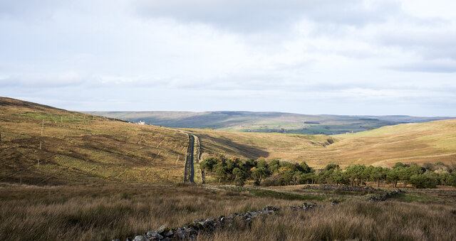
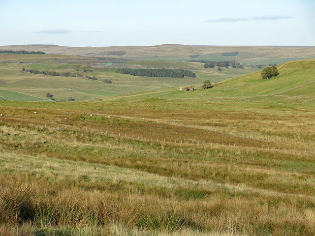
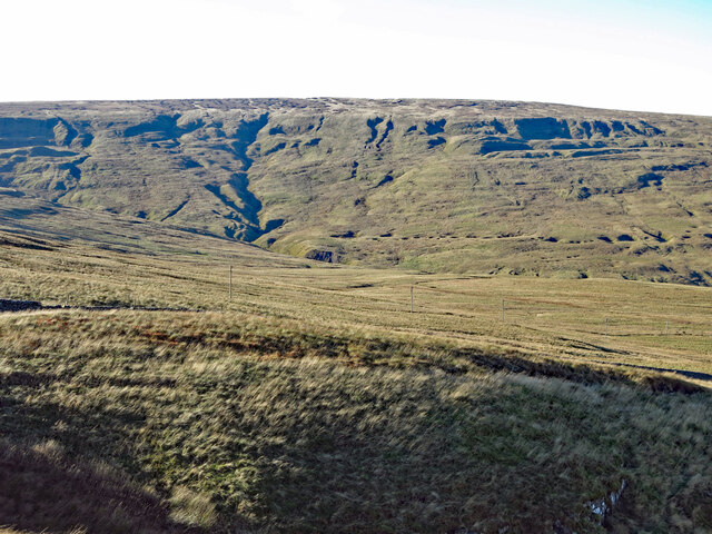
Swinhope Bottoms, located in County Durham, England, is a picturesque valley renowned for its natural beauty and tranquil atmosphere. Nestled within the North Pennines Area of Outstanding Natural Beauty, this rural haven offers visitors a glimpse into the region's rich heritage and diverse wildlife.

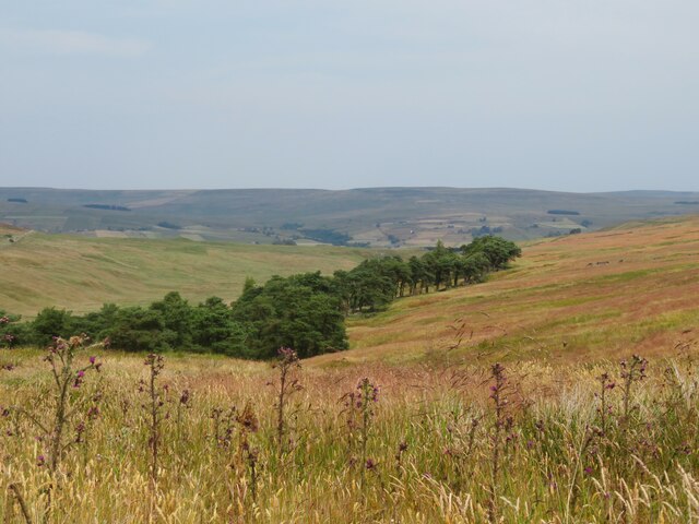
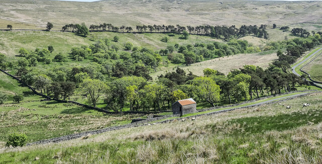
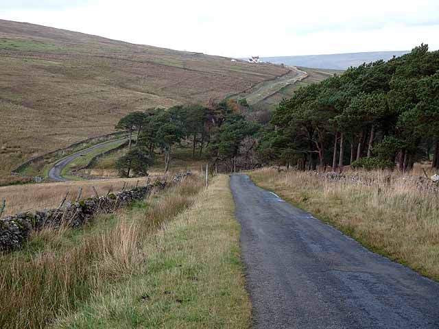
The valley is characterized by its rolling hills, dense woodlands, and meandering streams, which collectively create a breathtaking landscape that attracts nature enthusiasts and hikers alike. The area is home to an abundance of flora and fauna, including rare bird species such as the black grouse and the red kite, making it an ideal destination for birdwatching enthusiasts.

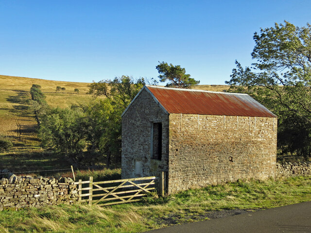
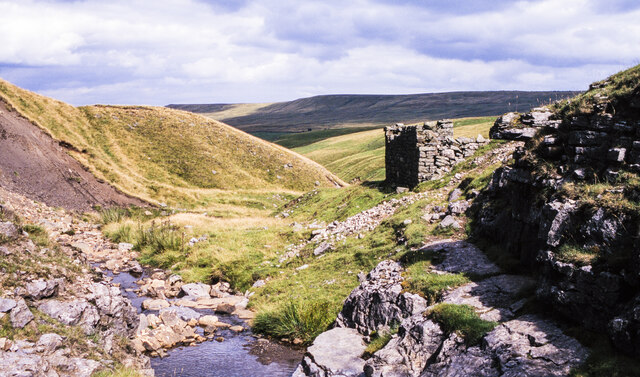
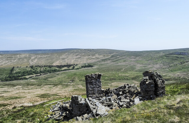
Historically, Swinhope Bottoms has been an important region for lead mining, with evidence of mining operations dating back to the Roman era. The remains of old mines and stone buildings can still be seen in the valley, serving as a reminder of the area's industrial past.

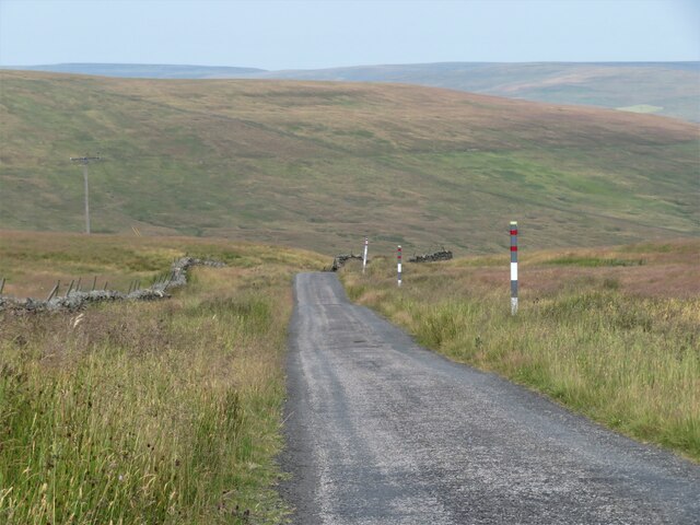
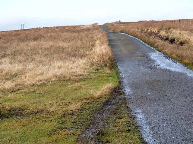
Visitors to Swinhope Bottoms can enjoy a range of outdoor activities such as walking, cycling, and horse riding, thanks to the numerous well-maintained trails that crisscross the valley. Additionally, the valley offers ample opportunities for picnicking, photography, and simply taking in the serene surroundings.

While Swinhope Bottoms is primarily a rural area, nearby towns and villages provide amenities such as accommodation, dining options, and visitor centers that offer information about the valley's history and ecology.

In summary, Swinhope Bottoms in Durham is a captivating valley that showcases the beauty of the North Pennines. With its stunning landscapes, rich history, and diverse wildlife, it is a must-visit destination for anyone seeking a peaceful and immersive natural experience.

If you have any feedback on the listing, please let us know in the comments section below.

Swinhope Bottoms Images

Images are sourced within 2km of 54.708839/-2.1596538 or Grid Reference NY8934. Thanks to Geograph Open Source API. All images are credited.
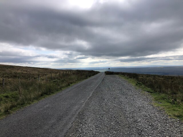
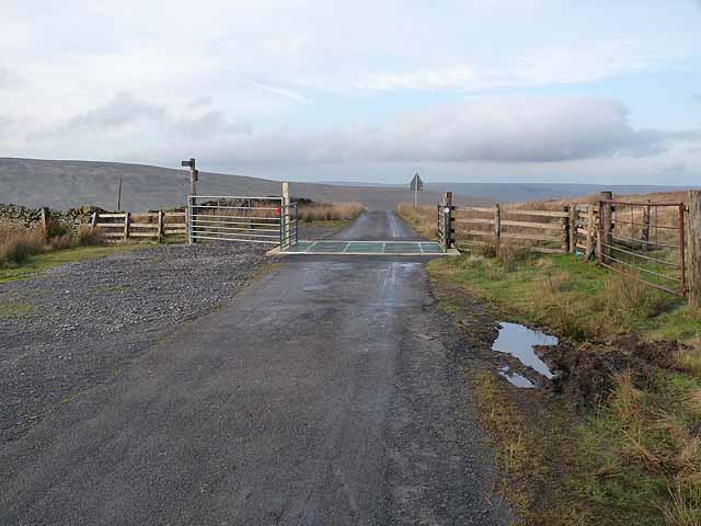
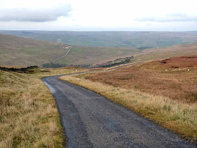
Minor Road at Swinhope Head The road begins a long descent into the Upper Tees Valley from here.
Minor Road at Swinhope Head
The road begins a long descent into the Upper Tees Valley from here.
View from Swinhope Head towards Dora's Seat
Pine trees in Swin Hope Swin Hope is a tributary valley of the River Wear; it's seen here looking downhill towards the parent valley.
Pine trees in Swin Hope
Swin Hope is a tributary valley of the River Wear; it's seen here looking downhill towards the parent valley.
Road summit at Swinhope Head [2] Quite a contrast to the last time I took a photograph here [22/03/18] as the temperature on that occasion was only a little above freezing, but on this occasion it was 33°C, even at 2000ft. Taken on a day of record breaking temperatures across Britain. Not much point in coming up here to keep cool.
Road summit at Swinhope Head [2]
Quite a contrast to the last time I took a photograph here [22/03/18] as the temperature on that occasion was only a little above freezing, but on this occasion it was 33°C, even at 2000ft. Taken on a day of record breaking temperatures across Britain. Not much point in coming up here to keep cool.
The start of a long descent The minor road from Newbiggin to Westgate begins a long descent here from the 2000ft contour to below 1000ft in Weardale.
The start of a long descent
The minor road from Newbiggin to Westgate begins a long descent here from the 2000ft contour to below 1000ft in Weardale.
Swinhope Plantation First edition OS maps of the 1850's show an extensive area of trees around the upper reaches of the Swinhope Burn. This view shows the eastern edge of the wooded area with plenty of Scots pine in evidence. If the old OS map is accurate, then the wooded area is in decline as there are areas now without trees, but the question is, why was this area planted in the first place?
Swinhope Plantation
First edition OS maps of the 1850's show an extensive area of trees around the upper reaches of the Swinhope Burn. This view shows the eastern edge of the wooded area with plenty of Scots pine in evidence. If the old OS map is accurate, then the wooded area is in decline as there are areas now without trees, but the question is, why was this area planted in the first place?
Moorland south of Swinhope Head Looking south west towards Mickle Fell (left) and Meldon Hill (right).
Moorland south of Swinhope Head
Looking south west towards Mickle Fell (left) and Meldon Hill (right).
Swin Hope below Swinside House Looking north east from just to the south of <a href="https://www.geograph.org.uk/photo/2691160">NY8935 : Swinside House</a> (photographed by Oliver Dixon) across the valley towards the ruined farmhouse at <a href="https://www.geograph.org.uk/photo/6217773">NY9036 : Far New Close (3)</a>.
Swin Hope below Swinside House
Looking north east from just to the south of NY8935 : Swinside House (photographed by Oliver Dixon) across the valley towards the ruined farmhouse at NY9036 : Far New Close (3).
Swinhope Moor below Chapelfell Top
New House
New House
Ruined building at Swinhopehead mine in 1994 The building is in the valley of the Swinhope Burn below the moorland summits, Chapel Fell and Fendrith Hill. The image was made from the water outflow of the actual mine level.
The distant shadowed ridge is Black Fell.
Ruined building at Swinhopehead mine in 1994
The building is in the valley of the Swinhope Burn below the moorland summits, Chapel Fell and Fendrith Hill. The image was made from the water outflow of the actual mine level. The distant shadowed ridge is Black Fell.
Ruins of Cockran's Cabin The tiny, remote building is now a total ruin. It's at an altitude of 620 metres and lies on the eastern side of Chapel Fell overlooking Swindale. The slopes on which it stands descend into Swindale, beyond which is Westernhope Moor.
Ruins of Cockran's Cabin
The tiny, remote building is now a total ruin. It's at an altitude of 620 metres and lies on the eastern side of Chapel Fell overlooking Swindale. The slopes on which it stands descend into Swindale, beyond which is Westernhope Moor.
Swinhope Plantation The plantation is in the upper valley of Swin Hope, a tributary to the River Wear. The trees are well scattered and give the impression of an open, mixed woodland. The building with the rusting roof is known as New House.
Swinhope Plantation
The plantation is in the upper valley of Swin Hope, a tributary to the River Wear. The trees are well scattered and give the impression of an open, mixed woodland. The building with the rusting roof is known as New House.
Minor road on Newbiggin Common Just below the summit at Swinhope Head which, at 609 metres above sea level, I believe is the highest public motorable road in England.
Minor road on Newbiggin Common
Just below the summit at Swinhope Head which, at 609 metres above sea level, I believe is the highest public motorable road in England.
Road summit at Swinhope Head Cattle grid at the summit of the road from Newbiggin (Teesdale) to Westgate (Weardale) at Swinhope Head which, at 609 metres above sea level, I believe is the highest public motorable road in England.
Road summit at Swinhope Head
Cattle grid at the summit of the road from Newbiggin (Teesdale) to Westgate (Weardale) at Swinhope Head which, at 609 metres above sea level, I believe is the highest public motorable road in England.
Descent into the valley of the Swinhope Burn Dramatic descent on the road from Newbiggin (Teesdale) to Westgate (Weardale) from the summit at  Swinhope Head which, at 609 metres above sea level, I believe is the highest public motorable road in England. Swinside House <a href="https://www.geograph.org.uk/gridref/NY8935">NY8935</a> can be seen on the flank of the valley to the left.
Descent into the valley of the Swinhope Burn
Dramatic descent on the road from Newbiggin (Teesdale) to Westgate (Weardale) from the summit at Swinhope Head which, at 609 metres above sea level, I believe is the highest public motorable road in England. Swinside House NY8935 can be seen on the flank of the valley to the left.
Electric transmission line at Swinhope Head On the watershed between Teesdale (to the left) and Weardale.
Electric transmission line at Swinhope Head
On the watershed between Teesdale (to the left) and Weardale.
Descent to Swinhope Bridge On the mountain road between Newbiggin (Teesdale) and Westgate (Weardale). Swinside House <a href="https://www.geograph.org.uk/gridref/NY8935">NY8935</a> stands on the hillside beyond.
Descent to Swinhope Bridge
On the mountain road between Newbiggin (Teesdale) and Westgate (Weardale). Swinside House NY8935 stands on the hillside beyond.
Show me another place!

Swinhope Bottoms is located at Grid Ref: NY8934 (Lat: 54.708839, Lng: -2.1596538)

Unitary Authority: County Durham

Police Authority: Durham

What 3 Words

///swear.stocky.overused. Near Newbiggin, Co. Durham

Related Wikis

Daddry Shield

Daddry Shield is a village in the civil parish of Stanhope, in County Durham, England. It is situated on the south side of the River Wear in Weardale,...

Westgate, County Durham

Westgate is a village in the civil parish of Stanhope, in County Durham, England. It is situated in Weardale between St John's Chapel and Eastgate. In...

North Pennines

The North Pennines is the northernmost section of the Pennine range of hills which runs north–south through northern England. It lies between Carlisle...

Westgate Methodist Chapel

Westgate Methodist Chapel stands on the A689 road in the village of Westgate, some 5 miles (8 km) west of Stanhope, County Durham, England (grid reference...

Westgate-in-Weardale railway station

Westgate-in-Weardale railway station served the village of Westgate, County Durham, England, from 1895 to 1965 on the Weardale Railway. == History == The...

St John's Chapel railway station

St John's Chapel railway station served the village of St John's Chapel, County Durham, England, from 1895 to 1965 on the Weardale Railway. == History... ==

St John's Chapel, County Durham

St John's Chapel is a village in the civil parish of Stanhope, in County Durham, England. It is situated in Weardale, on the south side of the River Wear...

Harthope Moss

Harthope Moss, also known as Chapel Fell (elevation 627 m; 2,057 ft) is a mountain pass in the English Pennines. The pass divides Weardale to the north...

Nearby Amenities

Located within 500m of 54.708839,-2.1596538
Power: pole
Lat/Long: 54.7099497/-2.1656258
Power: pole
Lat/Long: 54.7099002/-2.1656181
Historic: mine_shaft
Note: could also be a shake hole
Source: Bing
Lat/Long: 54.7093871/-2.1530143
Historic: mine_shaft
Note: could also be a shake hole
Source: Bing
Lat/Long: 54.7070226/-2.1547309
Historic: mine_shaft
Note: could also be a shake hole
Source: Bing
Lat/Long: 54.7074938/-2.1551869
Historic: mine_shaft
Note: could also be a shake hole
Source: Bing
Lat/Long: 54.7056497/-2.1567372
Historic: mine_shaft
Note: could also be a shake hole
Source: Bing
Lat/Long: 54.7091333/-2.1539423
Historic: mine_shaft
Note: could also be a shake hole
Source: Bing
Lat/Long: 54.706725/-2.1552673
Historic: mine_shaft
Note: could also be a shake hole
Source: Bing
Lat/Long: 54.7073389/-2.1553049
Historic: mine_shaft
Note: could also be a shake hole
Source: Bing
Lat/Long: 54.7076207/-2.1546665
Historic: mine_shaft
Note: could also be a shake hole
Source: Bing
Lat/Long: 54.7100968/-2.153717
Historic: mine_shaft
Note: could also be a shake hole
Source: Bing
Lat/Long: 54.7085381/-2.1529016
Historic: mine_shaft
Note: could also be a shake hole
Source: Bing
Lat/Long: 54.7079711/-2.1538028
Historic: mine_shaft
Note: could also be a shake hole
Source: Bing
Lat/Long: 54.7074194/-2.1552459
Historic: mine_shaft
Note: could also be a shake hole
Source: Bing
Lat/Long: 54.7068926/-2.1549616
The data included in this document is from www.openstreetmap.org. The data is made available under ODbL.

Have you been to Swinhope Bottoms?

Leave your review of Swinhope Bottoms below (or comments, questions and feedback).