Clapham Bottoms

Valley in Yorkshire Craven

England

Clapham Bottoms

Clapdale Drive, Clapdale Wood Clapdale Drive is a wide track that passes along the western side of the lake and above Clapham Beck as it climbs from Clapham village, through Clapdale Wood towards Ingleborough Cave.
Clapdale Drive, Clapdale Wood Credit: David Dixon

Clapham Bottoms is a picturesque valley located in Yorkshire, England. Nestled amidst the rolling hills of the Yorkshire Dales National Park, it offers visitors a tranquil escape from the hustle and bustle of everyday life. The valley is situated near the village of Clapham, known for its charming limestone buildings and quaint atmosphere.

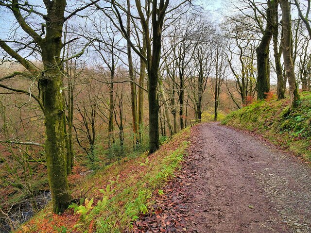
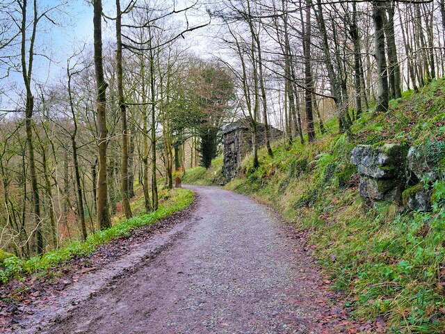
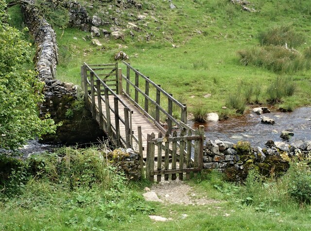
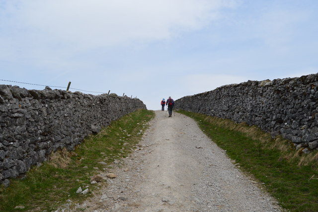
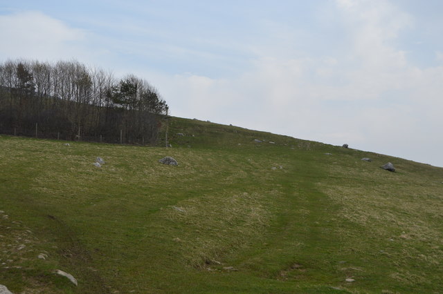
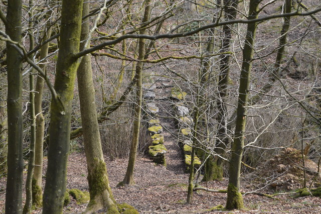
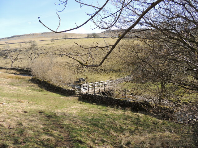
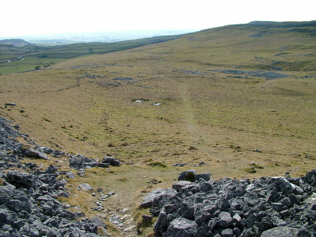
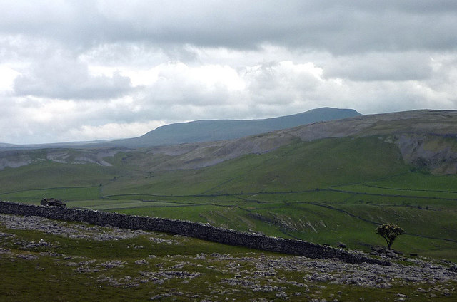
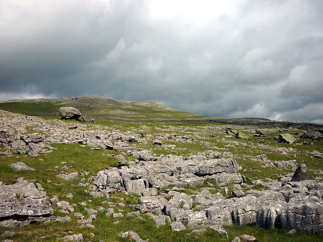
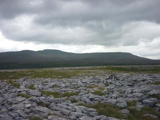
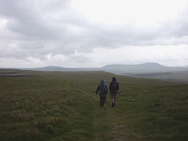
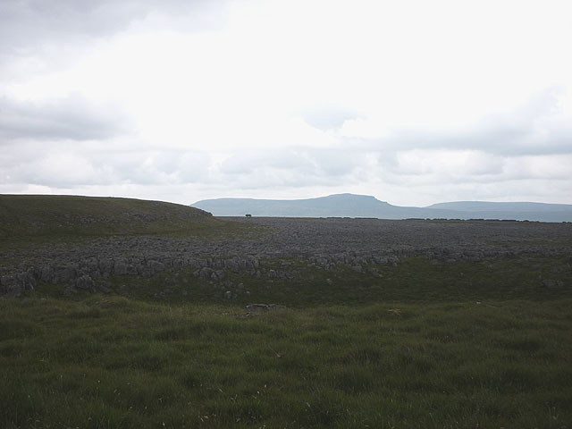
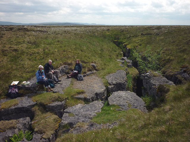
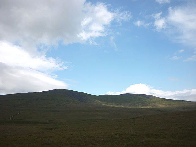
Clapham Bottoms is renowned for its natural beauty, with lush green meadows, meandering streams, and striking limestone formations. The valley is crisscrossed by a network of walking trails, making it a popular destination for hikers and nature enthusiasts. These trails provide breathtaking views of the surrounding countryside, including the majestic Ingleborough, one of the famous Three Peaks.

Nature lovers will be delighted to discover the diverse wildlife that calls Clapham Bottoms home. The valley is home to a wide range of bird species, including the elusive kingfisher and the majestic peregrine falcon. It is also inhabited by various mammals, such as badgers, foxes, and deer, which can often be spotted grazing in the fields.

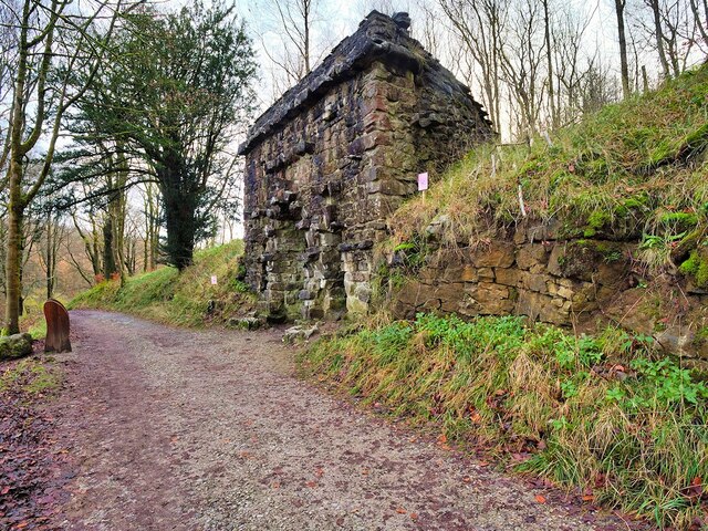
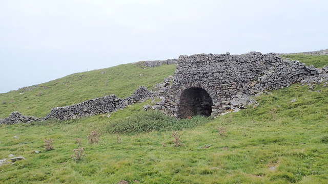
For those interested in history and geology, Clapham Bottoms offers fascinating insights into the region's past. The valley is home to Ingleborough Cave, a natural wonder that has been shaped by underground rivers over millions of years. Guided tours of the cave allow visitors to explore its stunning limestone formations and learn about its geological significance.

In conclusion, Clapham Bottoms is a haven of natural beauty, offering visitors a chance to immerse themselves in the stunning Yorkshire countryside. Its idyllic landscapes, diverse wildlife, and rich history make it a must-visit destination for anyone seeking tranquility and a connection with nature.

If you have any feedback on the listing, please let us know in the comments section below.

Clapham Bottoms Images

Images are sourced within 2km of 54.141703/-2.371778 or Grid Reference SD7571. Thanks to Geograph Open Source API. All images are credited.

Clapdale Drive, Clapdale Wood Clapdale Drive is a wide track that passes along the western side of the lake and above Clapham Beck as it climbs from Clapham village, through Clapdale Wood towards Ingleborough Cave.
Clapdale Drive, Clapdale Wood
Clapdale Drive is a wide track that passes along the western side of the lake and above Clapham Beck as it climbs from Clapham village, through Clapdale Wood towards Ingleborough Cave.
The Grotto, Clapdale Drive The Grotto is a late-nineteenth century folly commissioned by the Farrer family as a place to sit and enjoy the views of Thwaite Scars. It was constructed of large pieces of limestone set back against the steep hillside.

Although it has become rather dilapidated, it is still a useful place to shelter when caught out by the weather.
The Grotto, Clapdale Drive
The Grotto is a late-nineteenth century folly commissioned by the Farrer family as a place to sit and enjoy the views of Thwaite Scars. It was constructed of large pieces of limestone set back against the steep hillside. Although it has become rather dilapidated, it is still a useful place to shelter when caught out by the weather.
Ingleborough Estate Trail, Clapdale Drive Clapdale Drive is a wide track that passes along the western side of the lake and above Clapham Beck as it climbs from Clapham village, through Clapdale Wood towards Ingleborough Cave.
Ingleborough Estate Trail, Clapdale Drive
Clapdale Drive is a wide track that passes along the western side of the lake and above Clapham Beck as it climbs from Clapham village, through Clapdale Wood towards Ingleborough Cave.
Cairn on Long Scar Quite impressive.
Cairn on Long Scar
Quite impressive.
Footbridge over Clapham Beck Footbridge looking over from the Ingleborough Nature Trail path. A view of the footbridge from the opposite side of the Beck can be seen here  - <a title="https://www.geograph.org.uk/photo/1813070" href="https://www.geograph.org.uk/photo/1813070">Link</a>
Footbridge over Clapham Beck
Footbridge looking over from the Ingleborough Nature Trail path. A view of the footbridge from the opposite side of the Beck can be seen here - Link
Limekiln, Norber
Limekiln, Norber
Long Lane The Pennine Bridleway is a new National Trail.
It runs roughly parallel with the Pennine Way but provides access for horseback riders and cyclists as well as walkers. The trail is around 205 miles long, extending from Derbyshire to Cumbria.
Wikipedia: <span class="nowrap"><a title="https://en.wikipedia.org/wiki/Pennine_Bridleway" rel="nofollow ugc noopener" href="https://en.wikipedia.org/wiki/Pennine_Bridleway">Link</a><img style="margin-left:2px;" alt="External link" title="External link - shift click to open in new window" src="https://s1.geograph.org.uk/img/external.png" width="10" height="10"/></span>
Long Lane
The Pennine Bridleway is a new National Trail. It runs roughly parallel with the Pennine Way but provides access for horseback riders and cyclists as well as walkers. The trail is around 205 miles long, extending from Derbyshire to Cumbria. Wikipedia: LinkExternal link
Thwaite Moor
Thwaite Moor
Rustic footbridge
Rustic footbridge
Clapham On walk from Clapham Village
Clapham
On walk from Clapham Village
Crummack Dale
Crummack Dale
Looking over Crummackdale from the east flank of Norber Penyghent looms massively behind the limestone hill of Moughton above an unseen Ribblesdale.
Looking over Crummackdale from the east flank of Norber
Penyghent looms massively behind the limestone hill of Moughton above an unseen Ribblesdale.
Norber pasture The upper part of the pasture containing the famous erratics that take their name from the limestone upland above.
Norber pasture
The upper part of the pasture containing the famous erratics that take their name from the limestone upland above.
On top of Norber looking to Ingleborough The top of Norber is a broad, undulating ridge of limestone covered in broken outcrops and many cairns. The highest point is here at 408m but you would be hard pressed to be able to tell this easily by sight alone (think plateau with many minor bumps).
On top of Norber looking to Ingleborough
The top of Norber is a broad, undulating ridge of limestone covered in broken outcrops and many cairns. The highest point is here at 408m but you would be hard pressed to be able to tell this easily by sight alone (think plateau with many minor bumps).
On the bridleway, Long Scar Looking to Penyghent beyond Crummackdale.
On the bridleway, Long Scar
Looking to Penyghent beyond Crummackdale.
Shakehole on Long Scar This is one of the larger ones on Ingleborough but, being well forward of the shale/limestone boundary it does not have any cave or pothole entrance. Looking to Penyghent.
Shakehole on Long Scar
This is one of the larger ones on Ingleborough but, being well forward of the shale/limestone boundary it does not have any cave or pothole entrance. Looking to Penyghent.
Juniper Gulf on the Allotment This is one of the major potholes of the eastern side of Ingleborough. The entrance is about 18m deep but eventually the system reaches a depth of 128m via several deep shafts including a magnificent final drop of 61m. The stream (along with several others sinking on the Allotment) resurges at Austwick Beck Head <a title="https://www.geograph.org.uk/photo/2127605" href="https://www.geograph.org.uk/photo/2127605">Link</a> There is as yet no passable route for people between the two caves despite cave divers trying. Juniper Gulf entrance pitch was first descended by the Yorkshire Ramblers' Club in 1905 although the bottom wasn't reached until 1924 (by the Gritstone Club). The keen-eyed visitor will notice several bolts fixed around the flat rocks where the entrance rift is narrowest. These are used by modern cavers to anchor ropes on which they will abseil in and prussik out - single rope technique (SRT). Today we just sat out of the wind and ate our lunch.
Juniper Gulf on the Allotment
This is one of the major potholes of the eastern side of Ingleborough. The entrance is about 18m deep but eventually the system reaches a depth of 128m via several deep shafts including a magnificent final drop of 61m. The stream (along with several others sinking on the Allotment) resurges at Austwick Beck Head Link There is as yet no passable route for people between the two caves despite cave divers trying. Juniper Gulf entrance pitch was first descended by the Yorkshire Ramblers' Club in 1905 although the bottom wasn't reached until 1924 (by the Gritstone Club). The keen-eyed visitor will notice several bolts fixed around the flat rocks where the entrance rift is narrowest. These are used by modern cavers to anchor ropes on which they will abseil in and prussik out - single rope technique (SRT). Today we just sat out of the wind and ate our lunch.
On Bottoms Rigg A nondescript patch of wet moorland close to the famous Gaping Gill. The curlews like it though judging by the numbers calling. Looking towards Ingleborough and its prominent southern spur, Little Ingleborough.
On Bottoms Rigg
A nondescript patch of wet moorland close to the famous Gaping Gill. The curlews like it though judging by the numbers calling. Looking towards Ingleborough and its prominent southern spur, Little Ingleborough.
Show me another place!

Clapham Bottoms is located at Grid Ref: SD7571 (Lat: 54.141703, Lng: -2.371778)

Division: West Riding

Administrative County: North Yorkshire

District: Craven

Police Authority: North Yorkshire

What 3 Words

///songbird.products.arise. Near Ingleton, North Yorkshire

Related Wikis

Trow Ghyll skeleton

The Trow Ghyll skeleton is a set of human remains discovered on 24 August 1947 in a cave near Clapham in the West Riding of Yorkshire, England. It was...

Bar Pot

Bar Pot is one of the entrances to the Gaping Gill cave system being located about 340 metres (370 yd) south of Gaping Gill Main Shaft, on Ingleborough...
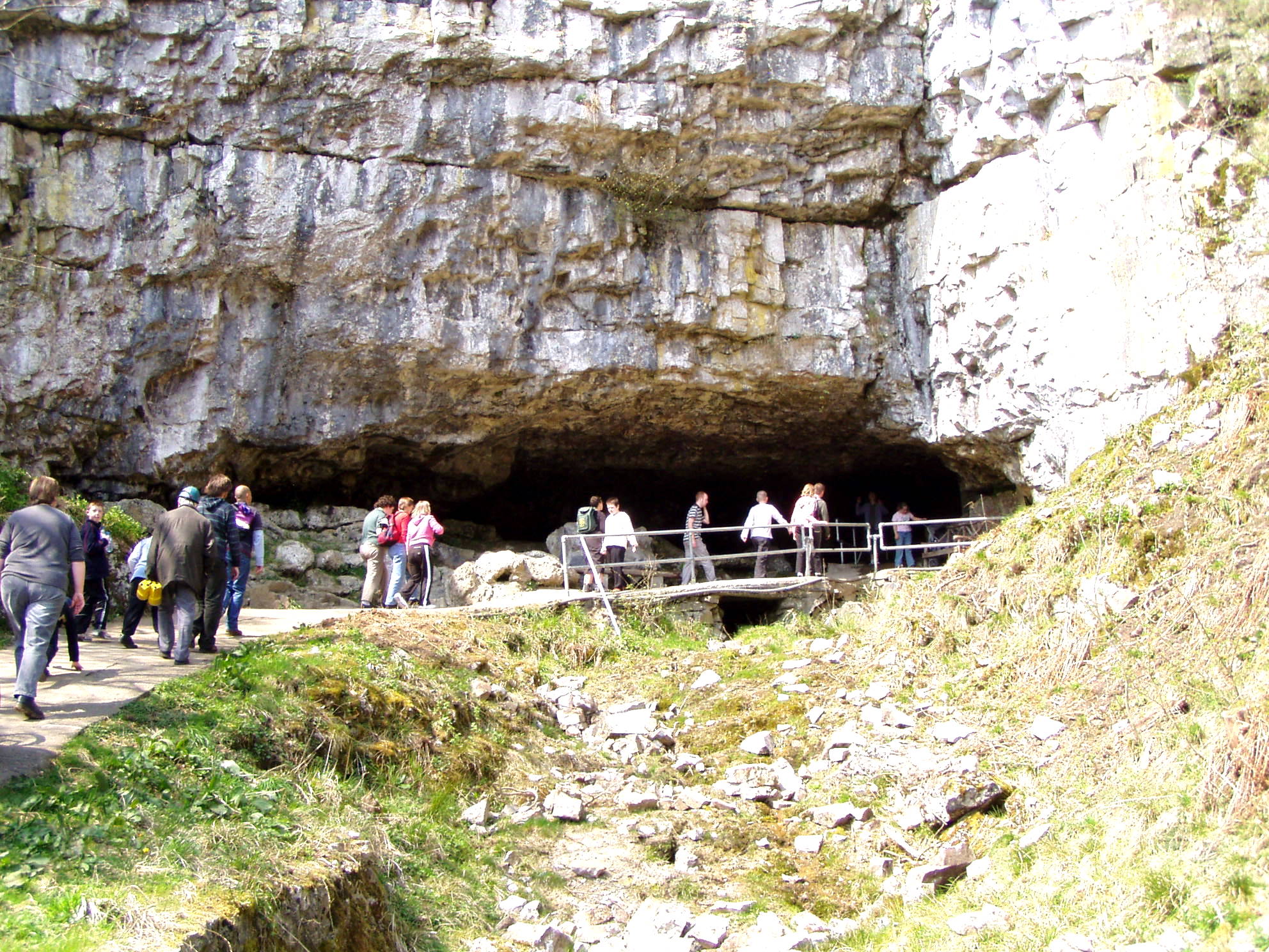
Ingleborough Cave

Ingleborough Cave (formerly known as Clapham Caves) is a show cave close to the village of Clapham in North Yorkshire, England, adjacent to where the water...

Flood Entrance Pot

Flood Entrance Pot (sometimes known as Flood Exit Pot) is one of the entrances to the Gaping Gill cave system located about 300 metres (330 yd) south of...

Disappointment Pot

Disappointment Pot is one of the entrances to the Gaping Gill cave system, located in a steep grassy shakehole some 120 metres (130 yd) south-east of Gaping...

Fell Beck

Fell Beck is a stream near the foot of Ingleborough, in the Yorkshire Dales National Park. It is notable for running into Gaping Gill, the second-largest...

Gaping Gill

Gaping Gill (also known as Gaping Ghyll) is a natural cave in North Yorkshire, England. It is one of the unmistakable landmarks on the southern slopes...

Jib Tunnel

Jib Tunnel, also known as Lateral Passage is one of the entrances into the Gaping Gill cave system, located behind a large boulder in the north bank of...

Nearby Amenities

Located within 500m of 54.141703,-2.371778
Trow Gill
Image: https://www.geograph.org.uk/photo/1417858
Tourism: attraction
Lat/Long: 54.1404708/-2.3768967
Barrier: stile
Image: https://www.geograph.org.uk/photo/858929
Material: wood
Stile: ladder
Lat/Long: 54.1382159/-2.3722089
Clapham Bottoms
Is In: Craven, North Yorkshire, Yorkshire, England, UK
Place: locality
Source: npe
Lat/Long: 54.1439517/-2.3699451
Ele: 1292 ft
Man Made: survey_point
Source: NPE
Lat/Long: 54.1450379/-2.3752626
Barrier: stile
Material: wood
Stile: ladder
Lat/Long: 54.1387801/-2.3729471
Foxholes
Access: permit
Image: https://www.geograph.org.uk/photo/5681163
Natural: cave_entrance
Lat/Long: 54.1386581/-2.3738191
Barrier: stile
Material: stone
Stile: stepover
Lat/Long: 54.1394115/-2.3735049
Historic: mine_shaft
Lat/Long: 54.1439933/-2.3714215
Natural: sinkhole
Lat/Long: 54.1423075/-2.3733231
Natural: sinkhole
Lat/Long: 54.1424033/-2.3743719
Natural: sinkhole
Lat/Long: 54.1424457/-2.3748761
The data included in this document is from www.openstreetmap.org. The data is made available under ODbL.

Have you been to Clapham Bottoms?

Leave your review of Clapham Bottoms below (or comments, questions and feedback).