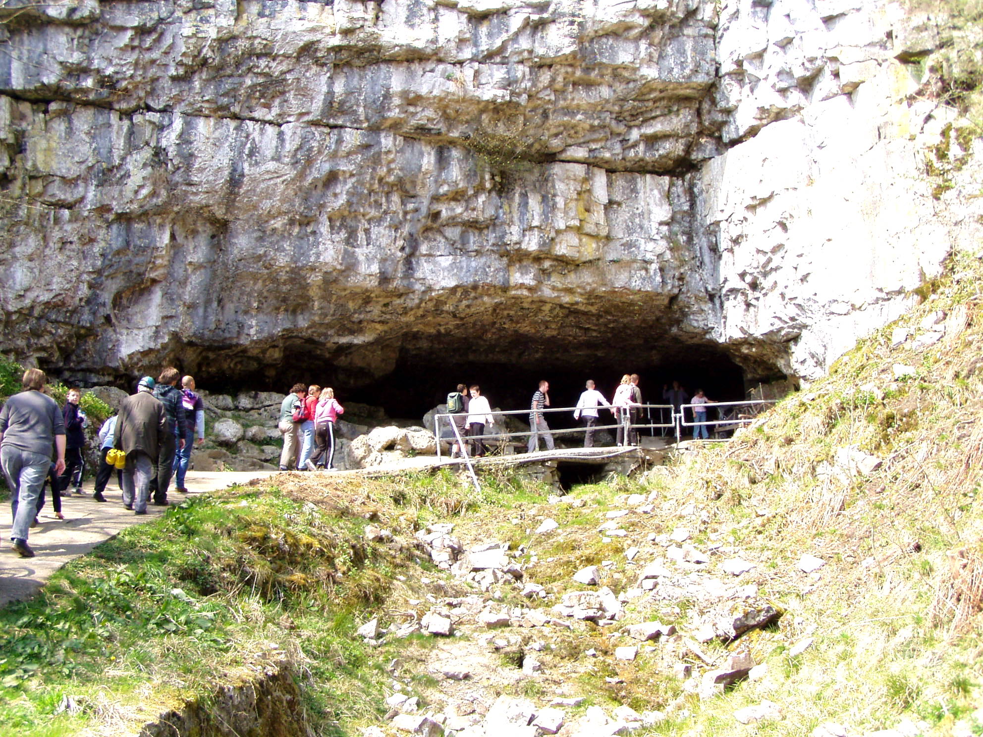
Rayside Plantation

Wood, Forest in Yorkshire Craven

England

Rayside Plantation
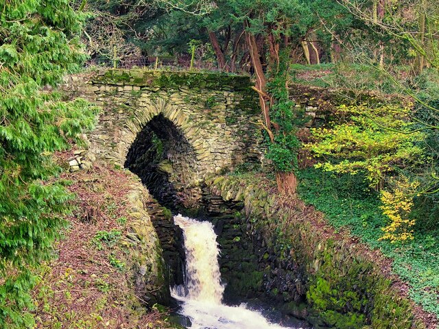
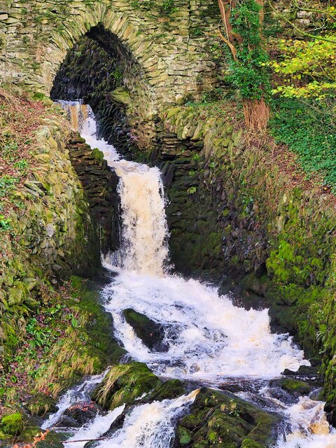
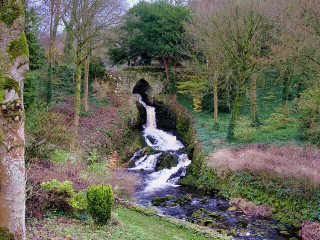
Bridge over Clapham Beck Waterfall Clapham Falls is a man-made waterfall which sees Clapham Beck drop below a bridge, in  three separate tiers, from the lake above into Clapham itself. The waterfall was constructed in 1837 by Oliver and James William Farrar as part of the remodelling of the estate of Ingleborough Hall.
Bridge over Clapham Beck Waterfall Credit: David Dixon

Rayside Plantation, located in Yorkshire, England, is a picturesque woodland area that offers a tranquil escape from the hustle and bustle of city life. This serene forested area covers approximately 500 acres and is a haven for nature enthusiasts and outdoor adventurers alike.

The plantation is predominantly made up of mature oak and beech trees, which provide a stunning display of vibrant colors during autumn. The dense canopy also creates a shaded and cool environment, perfect for leisurely walks or picnics on hot summer days.

Visitors to Rayside Plantation can explore a network of well-maintained trails that meander through the woodland. These trails cater to all levels of fitness, from gentle strolls to more challenging hikes, ensuring there is something for everyone. Along the way, walkers can encounter a variety of plant and animal species, including deer, squirrels, and a wide array of birdlife.

For those interested in history, the plantation boasts a rich heritage. It was once part of a larger estate and has remnants of old stone walls and boundary markers that date back centuries. This adds an extra layer of charm and intrigue to the experience.

Rayside Plantation is a popular spot for family outings, with designated picnic areas and play zones for children to enjoy. Additionally, there are facilities such as toilets and ample parking available, making it easily accessible to visitors.

Overall, Rayside Plantation is a hidden gem in Yorkshire, offering a peaceful retreat where visitors can immerse themselves in the beauty of nature and indulge in outdoor activities.

If you have any feedback on the listing, please let us know in the comments section below.

Rayside Plantation Images

Images are sourced within 2km of 54.137417/-2.3826985 or Grid Reference SD7571. Thanks to Geograph Open Source API. All images are credited.

Bridge over Clapham Beck Waterfall Clapham Falls is a man-made waterfall which sees Clapham Beck drop below a bridge, in  three separate tiers, from the lake above into Clapham itself. The waterfall was constructed in 1837 by Oliver and James William Farrar as part of the remodelling of the estate of Ingleborough Hall.
Bridge over Clapham Beck Waterfall
Clapham Falls is a man-made waterfall which sees Clapham Beck drop below a bridge, in three separate tiers, from the lake above into Clapham itself. The waterfall was constructed in 1837 by Oliver and James William Farrar as part of the remodelling of the estate of Ingleborough Hall.
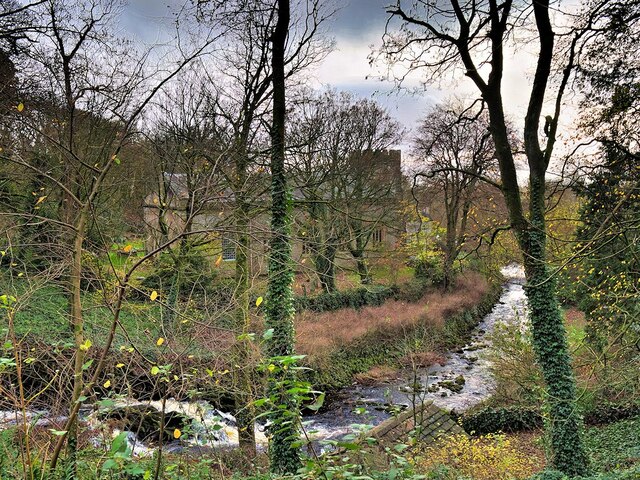
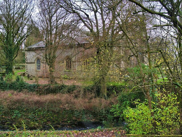
St James' Church, Clapham Looking across Clapham Beck towards the Church of St James at Clapham. 
The majority of the current church dates from 1814 although the tower has been retained from an earlier, fifteenth century, church. It is a Grade II listed building (List Entry Number: 1132398 <span class="nowrap"><a title="https://historicengland.org.uk/listing/the-list/list-entry/1132398" rel="nofollow ugc noopener" href="https://historicengland.org.uk/listing/the-list/list-entry/1132398">Link</a><img style="margin-left:2px;" alt="External link" title="External link - shift click to open in new window" src="https://s1.geograph.org.uk/img/external.png" width="10" height="10"/></span> Historic England)
St James' Church, Clapham
Looking across Clapham Beck towards the Church of St James at Clapham. The majority of the current church dates from 1814 although the tower has been retained from an earlier, fifteenth century, church. It is a Grade II listed building (List Entry Number: 1132398 LinkExternal link Historic England)
Clapham Falls Clapham Falls is a man-made waterfall which sees Clapham Beck drop below a bridge, in  three separate tiers, from the lake above into Clapham itself. The waterfall was constructed in 1837 by Oliver and James William Farrar as part of the remodelling of the estate of Ingleborough Hall.
Clapham Falls
Clapham Falls is a man-made waterfall which sees Clapham Beck drop below a bridge, in three separate tiers, from the lake above into Clapham itself. The waterfall was constructed in 1837 by Oliver and James William Farrar as part of the remodelling of the estate of Ingleborough Hall.
Clapham Beck Waterfall Clapham Falls is a man-made waterfall which sees Clapham Beck drop below a bridge, in  three separate tiers, from the lake above into Clapham itself. The waterfall was constructed in 1837 by Oliver and James William Farrar as part of the remodelling of the estate of Ingleborough Hall.
Clapham Beck Waterfall
Clapham Falls is a man-made waterfall which sees Clapham Beck drop below a bridge, in three separate tiers, from the lake above into Clapham itself. The waterfall was constructed in 1837 by Oliver and James William Farrar as part of the remodelling of the estate of Ingleborough Hall.
Clapham Beck and the Church of St James Looking across Clapham Beck towards the Church of St James at Clapham. 
The majority of the current church dates from 1814 although the tower has been retained from an earlier, fifteenth century, church. It is a Grade II listed building (List Entry Number: 1132398 <span class="nowrap"><a title="https://historicengland.org.uk/listing/the-list/list-entry/1132398" rel="nofollow ugc noopener" href="https://historicengland.org.uk/listing/the-list/list-entry/1132398">Link</a><img style="margin-left:2px;" alt="External link" title="External link - shift click to open in new window" src="https://s1.geograph.org.uk/img/external.png" width="10" height="10"/></span> Historic England)
Clapham Beck and the Church of St James
Looking across Clapham Beck towards the Church of St James at Clapham. The majority of the current church dates from 1814 although the tower has been retained from an earlier, fifteenth century, church. It is a Grade II listed building (List Entry Number: 1132398 LinkExternal link Historic England)
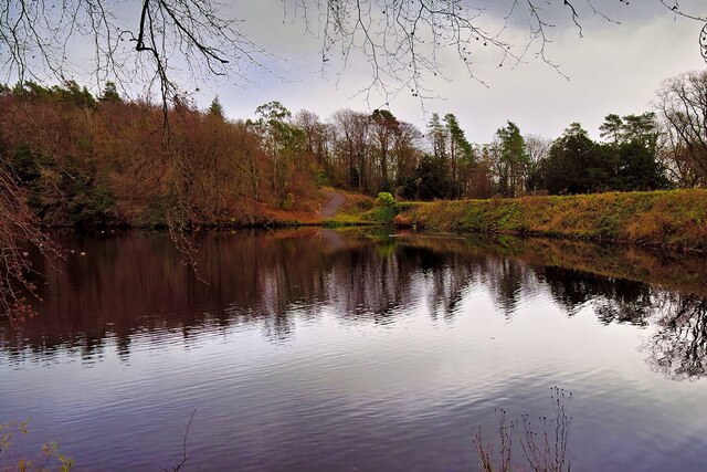
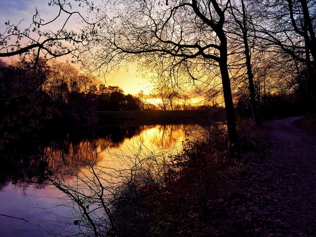
Clapham Lake Clapham Lake is a man-made ornamental lake in Clapdale, just above the village of Clapham. It is surrounded by woodland and is seen here from Clapdale Drive, a wide track that passes along the western side of the lake on its through Clapdale Wood towards Ingleborough Cave.

Known simply as The Lake, this artificial lake was constructed in the 18th century as part of the remodelling of the Ingleborough estate by the Farrar family who built a dam to hold back the waters of Clapham Beck, which drains via the artificial watercourse of Clapham Falls.
Clapham Lake
Clapham Lake is a man-made ornamental lake in Clapdale, just above the village of Clapham. It is surrounded by woodland and is seen here from Clapdale Drive, a wide track that passes along the western side of the lake on its through Clapdale Wood towards Ingleborough Cave. Known simply as The Lake, this artificial lake was constructed in the 18th century as part of the remodelling of the Ingleborough estate by the Farrar family who built a dam to hold back the waters of Clapham Beck, which drains via the artificial watercourse of Clapham Falls.
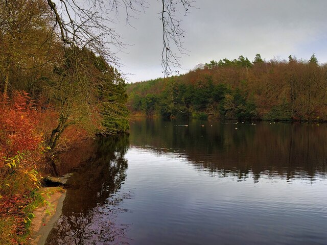
Lake at Clapham Known simply as The Lake, this artificial lake, just above the village of Clapham, was constructed in the 18th century as part of the remodelling of the Ingleborough estate by the Farrar family who built a dam to hold back the waters of Clapham Beck, which drains via the artificial watercourse of Clapham Falls.

The ornamental lake is surrounded by woodland and is seen here from Clapdale Drive, a wide track that passes along the western side of the lake on its through Clapdale Wood towards Ingleborough Cave.
Lake at Clapham
Known simply as The Lake, this artificial lake, just above the village of Clapham, was constructed in the 18th century as part of the remodelling of the Ingleborough estate by the Farrar family who built a dam to hold back the waters of Clapham Beck, which drains via the artificial watercourse of Clapham Falls. The ornamental lake is surrounded by woodland and is seen here from Clapdale Drive, a wide track that passes along the western side of the lake on its through Clapdale Wood towards Ingleborough Cave.
Cat Hole Sike The shallow streambed that passes beneath Clapdale Drive is called Cat Hole Syke. ("Syke" or "sike" is a colloquial term for a small stream). The steeply dipping Ordovician rocks, some more than 400 million years old, were pushed to the surface by a major disturbance in the earth's crust which caused massive earth movements tilting them to their present angle. This is part of the Craven Fault System <span class="nowrap"><a title="https://en.wikipedia.org/wiki/Craven_Fault_System" rel="nofollow ugc noopener" href="https://en.wikipedia.org/wiki/Craven_Fault_System">Link</a><img style="margin-left:2px;" alt="External link" title="External link - shift click to open in new window" src="https://s1.geograph.org.uk/img/external.png" width="10" height="10"/></span> .
Cat Hole Sike
The shallow streambed that passes beneath Clapdale Drive is called Cat Hole Syke. ("Syke" or "sike" is a colloquial term for a small stream). The steeply dipping Ordovician rocks, some more than 400 million years old, were pushed to the surface by a major disturbance in the earth's crust which caused massive earth movements tilting them to their present angle. This is part of the Craven Fault System LinkExternal link .
The Lake, Clapham Known simply as The Lake, this artificial lake, just above the village of Clapham, was constructed in the 18th century as part of the remodelling of the Ingleborough estate by the Farrar family who built a dam to hold back the waters of Clapham Beck, which drains via the artificial watercourse of Clapham Falls.

The ornamental lake is surrounded by woodland and is seen here from Clapdale Drive, a wide track that passes along the western side of the lake on its route through Clapdale Wood towards Ingleborough Cave.
The Lake, Clapham
Known simply as The Lake, this artificial lake, just above the village of Clapham, was constructed in the 18th century as part of the remodelling of the Ingleborough estate by the Farrar family who built a dam to hold back the waters of Clapham Beck, which drains via the artificial watercourse of Clapham Falls. The ornamental lake is surrounded by woodland and is seen here from Clapdale Drive, a wide track that passes along the western side of the lake on its route through Clapdale Wood towards Ingleborough Cave.
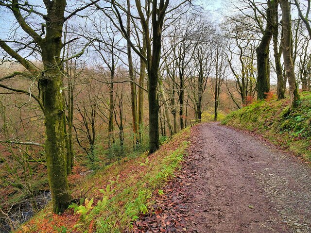
Clapdale Drive, Clapdale Wood Clapdale Drive is a wide track that passes along the western side of the lake and above Clapham Beck as it climbs from Clapham village, through Clapdale Wood towards Ingleborough Cave.
Clapdale Drive, Clapdale Wood
Clapdale Drive is a wide track that passes along the western side of the lake and above Clapham Beck as it climbs from Clapham village, through Clapdale Wood towards Ingleborough Cave.
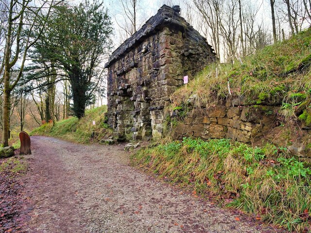
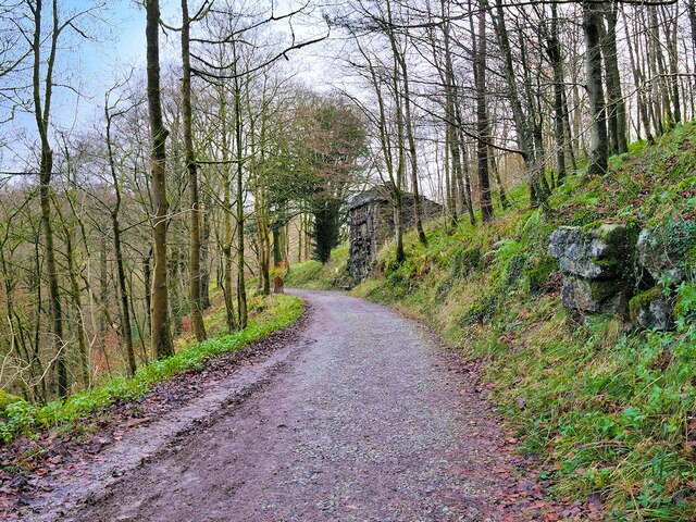
The Grotto, Clapdale Drive The Grotto is a late-nineteenth century folly commissioned by the Farrer family as a place to sit and enjoy the views of Thwaite Scars. It was constructed of large pieces of limestone set back against the steep hillside.

Although it has become rather dilapidated, it is still a useful place to shelter when caught out by the weather.
The Grotto, Clapdale Drive
The Grotto is a late-nineteenth century folly commissioned by the Farrer family as a place to sit and enjoy the views of Thwaite Scars. It was constructed of large pieces of limestone set back against the steep hillside. Although it has become rather dilapidated, it is still a useful place to shelter when caught out by the weather.
Ingleborough Estate Trail, Clapdale Drive Clapdale Drive is a wide track that passes along the western side of the lake and above Clapham Beck as it climbs from Clapham village, through Clapdale Wood towards Ingleborough Cave.
Ingleborough Estate Trail, Clapdale Drive
Clapdale Drive is a wide track that passes along the western side of the lake and above Clapham Beck as it climbs from Clapham village, through Clapdale Wood towards Ingleborough Cave.
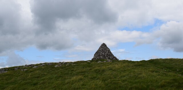
Cairn on Long Scar Quite impressive.
Cairn on Long Scar
Quite impressive.
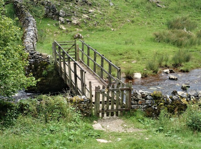
Footbridge over Clapham Beck Footbridge looking over from the Ingleborough Nature Trail path. A view of the footbridge from the opposite side of the Beck can be seen here  - <a title="https://www.geograph.org.uk/photo/1813070" href="https://www.geograph.org.uk/photo/1813070">Link</a>
Footbridge over Clapham Beck
Footbridge looking over from the Ingleborough Nature Trail path. A view of the footbridge from the opposite side of the Beck can be seen here - Link
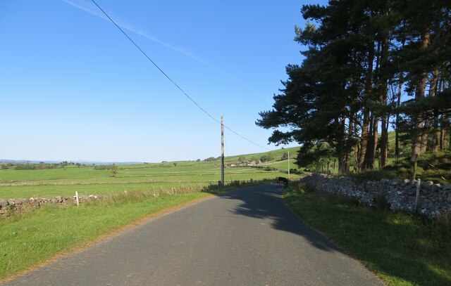
Old Road at Crosshaw Looking north-westward.
Old Road at Crosshaw
Looking north-westward.
Ordnance Survey Cut Mark This Mark can be found on a gatepost beside Old Road at Crosshaw.
The recorded details give a height of 215.5546 metres above sea level.
For more detail see : <span class="nowrap"><a title="https://www.bench-marks.org.uk/bm89251" rel="nofollow ugc noopener" href="https://www.bench-marks.org.uk/bm89251">Link</a><img style="margin-left:2px;" alt="External link" title="External link - shift click to open in new window" src="https://s1.geograph.org.uk/img/external.png" width="10" height="10"/></span>
Ordnance Survey Cut Mark
This Mark can be found on a gatepost beside Old Road at Crosshaw. The recorded details give a height of 215.5546 metres above sea level. For more detail see : LinkExternal link
Track to Austwick through the tunnels Two tunnels take the bridleway underneath the grounds of Ingleborough Hall. I think this was to keep the common people out of sight of the gentry therein.
Track to Austwick through the tunnels
Two tunnels take the bridleway underneath the grounds of Ingleborough Hall. I think this was to keep the common people out of sight of the gentry therein.
Church of St James, Clapham
Show me another place!

Rayside Plantation is located at Grid Ref: SD7571 (Lat: 54.137417, Lng: -2.3826985)

Division: West Riding

Administrative County: North Yorkshire

District: Craven

Police Authority: North Yorkshire

What 3 Words

///exile.cubed.glow. Near Ingleton, North Yorkshire

Related Wikis

Ingleborough Cave

Ingleborough Cave (formerly known as Clapham Caves) is a show cave close to the village of Clapham in North Yorkshire, England, adjacent to where the water...

Bar Pot

Bar Pot is one of the entrances to the Gaping Gill cave system being located about 340 metres (370 yd) south of Gaping Gill Main Shaft, on Ingleborough...

Flood Entrance Pot

Flood Entrance Pot (sometimes known as Flood Exit Pot) is one of the entrances to the Gaping Gill cave system located about 300 metres (330 yd) south of...

Stream Passage Pot

Stream Passage Pot is one of the entrances to the Gaping Gill system being located about 320 metres (350 yd) ESE of Gaping Gill Main Shaft. It is a popular...

Nearby Amenities

Located within 500m of 54.137417,-2.3826985
Beck Head Stream Cave
Access: permit
Image: https://www.geograph.org.uk/photo/283159
Natural: cave_entrance
Lat/Long: 54.1350818/-2.3771786
Clapdale
Place: locality
Source: npe
Lat/Long: 54.1340714/-2.3825622
Ingleborough Cave
Access: customers
Attraction: yes
Fee: yes
Image: https://www.geograph.org.uk/photo/4739798
Natural: cave_entrance
Source: survey
Wikidata: Q1663064
Wikipedia: en:Ingleborough Cave
Lat/Long: 54.1350812/-2.3777363
Man Made: manhole
Manhole: water
Lat/Long: 54.1345168/-2.3776969
Power: pole
Lat/Long: 54.1333106/-2.3801955
Power: pole
Lat/Long: 54.1339313/-2.3795199
Power: pole
Lat/Long: 54.1345107/-2.378899
Power: pole
Lat/Long: 54.1348644/-2.3785051
Power: pole
Lat/Long: 54.1347473/-2.3781429
Barrier: turnstile
Lat/Long: 54.1349486/-2.3775303
Access: customers
Tourism: picnic_site
Lat/Long: 54.1347141/-2.3772378
The data included in this document is from www.openstreetmap.org. The data is made available under ODbL.

Have you been to Rayside Plantation?

Leave your review of Rayside Plantation below (or comments, questions and feedback).