Dry Clough

Valley in Yorkshire Ribble Valley

England

Dry Clough

View NW Towards the Bowland Fells
View NW Credit: Charles Rawding

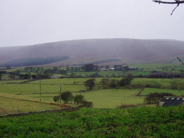
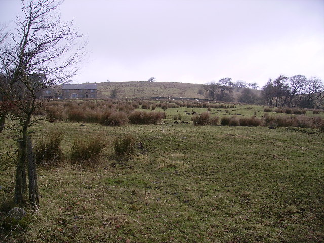
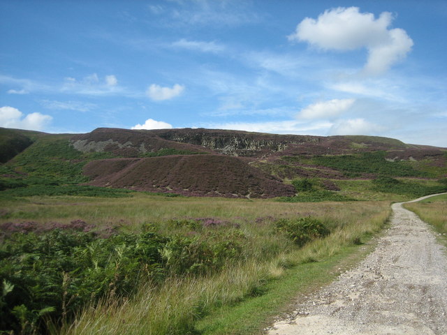
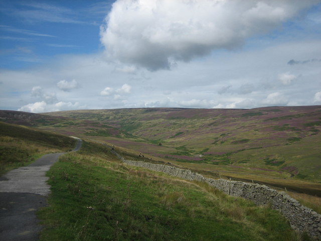
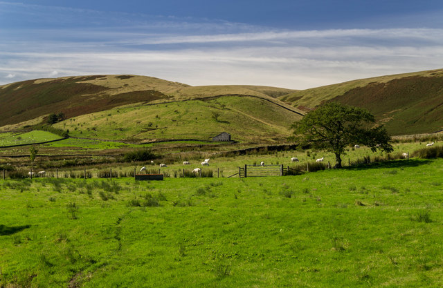
Dry Clough is a picturesque valley located in Yorkshire, England. Nestled in the heart of the Pennines, this valley is known for its stunning natural beauty and tranquil atmosphere. The name "Dry Clough" refers to the absence of a stream or river running through the valley, distinguishing it from other nearby valleys.

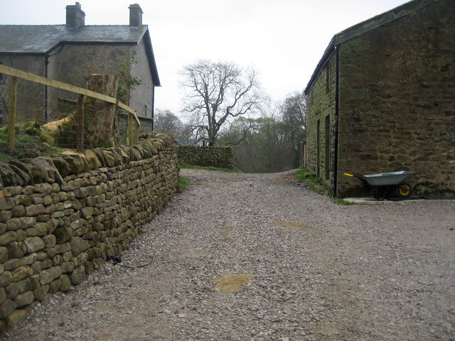
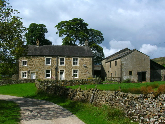
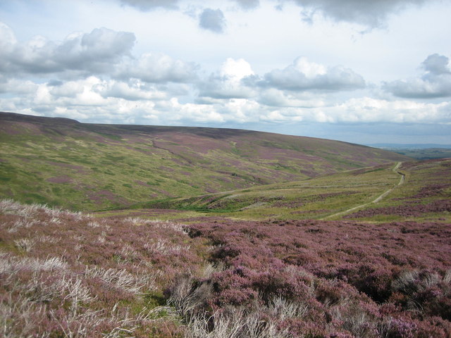
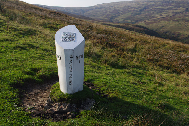
The landscape of Dry Clough is dominated by rolling hills covered in lush green vegetation, interspersed with rocky outcrops and ancient woodlands. The valley offers breathtaking views of the surrounding countryside, with its meandering footpaths and open fields, making it a popular destination for hikers and nature enthusiasts.

The flora and fauna found in Dry Clough are diverse and abundant. Wildflowers carpet the valley floor during the spring and summer months, providing a vibrant burst of color. Various species of birds, such as thrushes and woodpeckers, can be spotted among the trees, while small mammals like rabbits and squirrels scurry about.

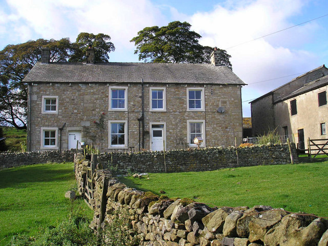
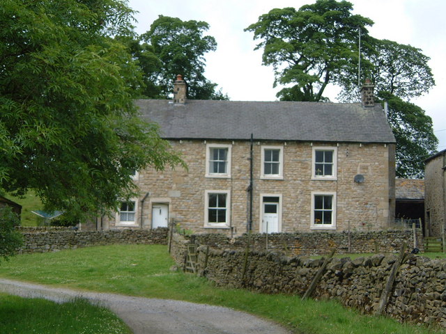
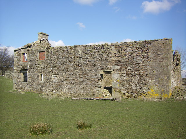
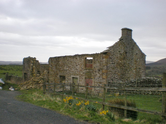
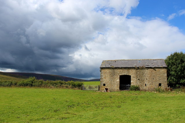
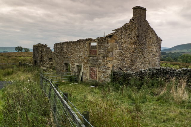
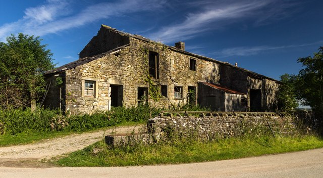
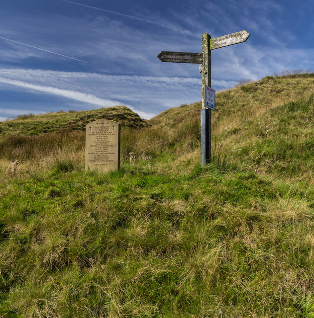
Dry Clough is also rich in history and boasts several archaeological sites. Ruins of old stone cottages and farming structures can be discovered along the valley, remnants of the area's agricultural heritage. Additionally, there are traces of ancient settlements, including burial mounds and stone circles, dating back to prehistoric times.

Overall, Dry Clough offers a tranquil retreat from the hustle and bustle of modern life. Its natural beauty, diverse wildlife, and historical significance make it a must-visit destination for those seeking a peaceful and immersive experience in the heart of Yorkshire.

If you have any feedback on the listing, please let us know in the comments section below.

Dry Clough Images

Images are sourced within 2km of 53.997113/-2.4731336 or Grid Reference SD6955. Thanks to Geograph Open Source API. All images are credited.

View NW Towards the Bowland Fells
View NW
Towards the Bowland Fells
Harkers Farm On the road to Slaidburn in the wonderful Forest of Bowland
Harkers Farm
On the road to Slaidburn in the wonderful Forest of Bowland
Croasdale House Farmhouse in Bowland.
Croasdale House
Farmhouse in Bowland.
The world's best house ever It's the best house ever.
The world's best house ever
It's the best house ever.
Ruin , Lane Side
Ruin , Lane Side
Entering Croasdale House Entering the precincts of Croasdale House from the north.
Entering Croasdale House
Entering the precincts of Croasdale House from the north.
Croasdale House
Croasdale House
Laithe near Croasdale House Stone barn passed while following the footpath from Croasdale to Harkers on the Slaidburn/Bentham Road
Laithe near Croasdale House
Stone barn passed while following the footpath from Croasdale to Harkers on the Slaidburn/Bentham Road
Ruined farm Lane Side
Memorial to WW2 air crash victims A recently erected stone memorial (probably marking 70 years since the end of World War 2) to the victims of several military air crashes which occurred on the nearby fells of the Forest of Bowland. The memorial stone stands by the gate where the public minor road from Slaidburn becomes the Salters Way track across the moors to Hornby and Wray.
Memorial to WW2 air crash victims
A recently erected stone memorial (probably marking 70 years since the end of World War 2) to the victims of several military air crashes which occurred on the nearby fells of the Forest of Bowland. The memorial stone stands by the gate where the public minor road from Slaidburn becomes the Salters Way track across the moors to Hornby and Wray.
Croasdale and Fell End seen from the stone shelter View down Croasdale and across to Fell End, as seen from the stone shelter above the quarry. The Salters Way / Hornby Road track can be seen descending towards the Slaidburn area.
Croasdale and Fell End seen from the stone shelter
View down Croasdale and across to Fell End, as seen from the stone shelter above the quarry. The Salters Way / Hornby Road track can be seen descending towards the Slaidburn area.
Croasdale Quarry seen from the south-east The Croasdale quarry (at an elevation of approx 340m AOD), seen from the east from the Hornby Road track. The quarry has been disused since at least the 1960s, and heather and bracken are increasingly colonising the spoil heaps and softening the scars on the landscape.
Croasdale Quarry seen from the south-east
The Croasdale quarry (at an elevation of approx 340m AOD), seen from the east from the Hornby Road track. The quarry has been disused since at least the 1960s, and heather and bracken are increasingly colonising the spoil heaps and softening the scars on the landscape.
View up Croasdale from the Hornby Road The wild grandeur of Croasdale as first seen when turning the corner into the valley on the Hornby Road track, beyond the gates where motor vehicle access ends. I first saw, and was greatly impressed by, this view on 18 September 1975 and have returned several times since to enjoy the solitude and beauty of this valley.
View up Croasdale from the Hornby Road
The wild grandeur of Croasdale as first seen when turning the corner into the valley on the Hornby Road track, beyond the gates where motor vehicle access ends. I first saw, and was greatly impressed by, this view on 18 September 1975 and have returned several times since to enjoy the solitude and beauty of this valley.
Lancashire Witches Walk - Tercet 6 The Lancashire Witches Walk runs between Barrowford and Lancaster Castle, and was created to commemorate the 400th anniversary of the Lancashire Witches trial and hangings in 1612. Ten cast iron waymarkers created by Stephen Raw have been installed along the route. Each waymarker commemorates one of the "witches" (Elizabeth Device in this case), and is inscribed with one tercet of The Lancashire Witches poem by Carol Ann Duffy. See <a href="https://www.geograph.org.uk/photo/4256644">SD7152 : Tercet marker, Slaidburn</a> and <a href="https://www.geograph.org.uk/photo/4202978">SD5764 : Lancashire Witches Walk - Tercet 7</a>.
Lancashire Witches Walk - Tercet 6
The Lancashire Witches Walk runs between Barrowford and Lancaster Castle, and was created to commemorate the 400th anniversary of the Lancashire Witches trial and hangings in 1612. Ten cast iron waymarkers created by Stephen Raw have been installed along the route. Each waymarker commemorates one of the "witches" (Elizabeth Device in this case), and is inscribed with one tercet of The Lancashire Witches poem by Carol Ann Duffy. See SD7152 : Tercet marker, Slaidburn and SD5764 : Lancashire Witches Walk - Tercet 7.
Higher Wood House Higher Wood House on Wood House Lane.
Higher Wood House
Higher Wood House on Wood House Lane.
Burn End Burn End Laithe at Burn End.
Burn End
Burn End Laithe at Burn End.
Low Fell Memorial stone and signpost at Low Fell.
Low Fell
Memorial stone and signpost at Low Fell.
Show me another place!

Dry Clough is located at Grid Ref: SD6955 (Lat: 53.997113, Lng: -2.4731336)

Division: West Riding

Administrative County: Lancashire

District: Ribble Valley

Police Authority: Lancashire

What 3 Words

///mountains.risks.blend. Near Waddington, Lancashire

Nearby Locations

Dry Clough Low Fell

Related Wikis

Geography of the United Kingdom

The United Kingdom is a sovereign state located off the north-western coast of continental Europe. With a total area of approximately 248,532 square kilometres...

White Hill (Forest of Bowland)

White Hill is a hill in the Forest of Bowland, north-western England. It lies between Slaidburn and High Bentham. The summit houses a tower and a trig...

Stocks Reservoir

Stocks Reservoir is a reservoir situated at the head of the Hodder valley in the Forest of Bowland, Lancashire, England (historically in the West Riding...

King's House, Slaidburn

King's House is a Grade II listed building in Slaidburn, Lancashire, England, now used as a youth hostel. It was originally built in the 18th century,...

Nearby Amenities

Located within 500m of 53.997113,-2.4731336
The data included in this document is from www.openstreetmap.org. The data is made available under ODbL.

Have you been to Dry Clough?

Leave your review of Dry Clough below (or comments, questions and feedback).