Rammer Cleugh

Valley in East Lothian

Scotland

Rammer Cleugh

Dunbar Common Looking out from what was once, for a short while, a conifer plantation. Behind me is a wind turbine one of n+1 wind turbines on the Lammermuir Hills.
Dunbar Common Credit: Richard Webb

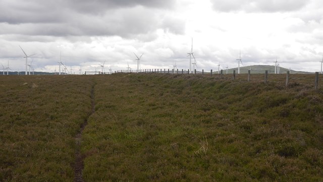
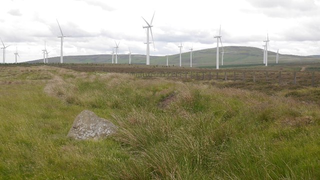
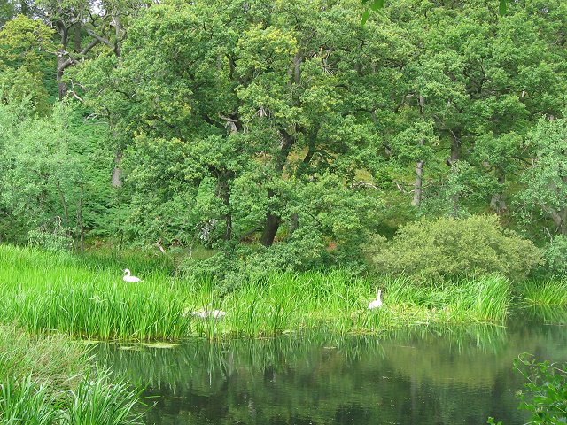
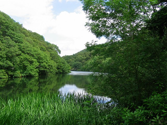
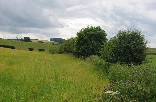
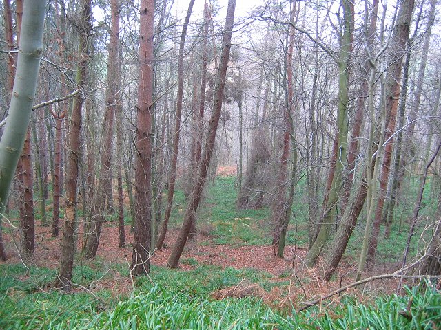
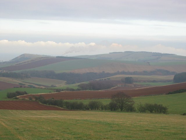
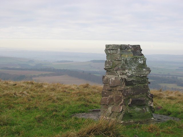
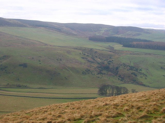
Rammer Cleugh is a picturesque valley located in East Lothian, a historic county in the southeast of Scotland. The valley is nestled between rolling hills and is known for its natural beauty and tranquil atmosphere. It stretches for approximately 3 miles and is flanked by dense woodlands, providing a haven for various wildlife and bird species.

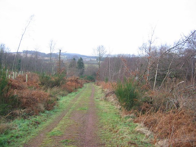
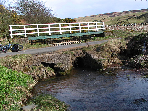
This idyllic valley is a popular destination for hikers, nature enthusiasts, and those seeking a peaceful retreat. Rammer Cleugh offers a range of walking trails, varying in difficulty, allowing visitors to explore the stunning surroundings at their own pace. The trails meander through ancient forests, offering breathtaking views of the lush landscape. The valley is also home to a river that adds to the charm and serenity of the area.

Rammer Cleugh has a rich historical significance. The valley holds remnants of an Iron Age hillfort, known as Traprain Law. This ancient site provides a glimpse into the region's past and attracts archaeology enthusiasts from all over. Additionally, the valley is dotted with several old farmsteads, highlighting the agricultural heritage of the area.

Visitors to Rammer Cleugh can enjoy picnicking by the river, observing the local wildlife, or simply taking in the tranquility of the surroundings. The valley's proximity to the nearby towns of Haddington and North Berwick makes it easily accessible, while still offering a peaceful escape from the bustle of city life.

In conclusion, Rammer Cleugh is a captivating valley in East Lothian, Scotland, offering a haven of natural beauty, historic sites, and serene surroundings for those seeking a tranquil retreat or an adventure in the great outdoors.

If you have any feedback on the listing, please let us know in the comments section below.

Rammer Cleugh Images

Images are sourced within 2km of 55.931901/-2.5882219 or Grid Reference NT6371. Thanks to Geograph Open Source API. All images are credited.

Dunbar Common Looking out from what was once, for a short while, a conifer plantation. Behind me is a wind turbine one of n+1 wind turbines on the Lammermuir Hills.
Dunbar Common
Looking out from what was once, for a short while, a conifer plantation. Behind me is a wind turbine one of n+1 wind turbines on the Lammermuir Hills.
On Dunbar Common Small woodland plots on a heathery part of Dunbar Common.
The large forestry block has since (2009) been felled to make way for the enlargement of the Crystal Rig windfarm.
On Dunbar Common
Small woodland plots on a heathery part of Dunbar Common. The large forestry block has since (2009) been felled to make way for the enlargement of the Crystal Rig windfarm.
Simple butts Grouse butts are often ornate affairs with dyking and drainage. Here heather is held in a wire frame to provide the hide.
Simple butts
Grouse butts are often ornate affairs with dyking and drainage. Here heather is held in a wire frame to provide the hide.
Above Deuchrie Edge Heather moorland north of lots of wind turbines.
Above Deuchrie Edge
Heather moorland north of lots of wind turbines.
Path on Dunbar Common Thanks to recent dry weather, the singletrack gave easy going.
Path on Dunbar Common
Thanks to recent dry weather, the singletrack gave easy going.
View towards Spartleton And Crystal Rig II power station from the path up from Deuchrie.
View towards Spartleton
And Crystal Rig II power station from the path up from Deuchrie.
Path on Dunbar Common Very enjoyable singletrack - worth the slog up from Deuchrie.
Path on Dunbar Common
Very enjoyable singletrack - worth the slog up from Deuchrie.
Marker stone, Lamb Hill Estate march presumably. The double black line on the 1:50,000 map is not a track, but shows the fence here with the adjacent earthbank, presumably that is the remains of an old boundary.
Marker stone, Lamb Hill
Estate march presumably. The double black line on the 1:50,000 map is not a track, but shows the fence here with the adjacent earthbank, presumably that is the remains of an old boundary.
Interpretation board, Crystal Rig Info about the power station where the path from Deuchrie to Whitadder Reservoir enters the wind farm. Newly erected and cattle proofed.
Interpretation board, Crystal Rig
Info about the power station where the path from Deuchrie to Whitadder Reservoir enters the wind farm. Newly erected and cattle proofed.
Pressmennan A long artificial loch set in old oakwoods. There were plans to fell the trees in the 1980's and the place became quite famous. Now in the care of the Woodland Trust.
Taken near the dam at the west end of the loch.
Pressmennan
A long artificial loch set in old oakwoods. There were plans to fell the trees in the 1980's and the place became quite famous. Now in the care of the Woodland Trust. Taken near the dam at the west end of the loch.
Pressmennan Looking eastwards along the loch, deep in oakwoods.
Pressmennan
Looking eastwards along the loch, deep in oakwoods.
Farmland, Woodend Looking southward over rolling farmland on the edge of the Lammermuir Hills.
Farmland, Woodend
Looking southward over rolling farmland on the edge of the Lammermuir Hills.
Pressmennan Wood The Woodland Trust have been active here, conifers removed and replaced by broadleaves in tully tubes.  Taken just above the car park at 11:20
Pressmennan Wood
The Woodland Trust have been active here, conifers removed and replaced by broadleaves in tully tubes. Taken just above the car park at 11:20
Pressmennan Wood Looking downhill from the upper track in Pressmennan.
Pressmennan Wood
Looking downhill from the upper track in Pressmennan.
Gallows Law. 12:00 noon.   Looking east towards the steam plume from Dunbar cement works on an anticyclonic day. It was cloudy here, but sunny a few miles west at Edinburgh,  The condensed water rises so far, until it meets a layer of warmer air and then the cloud spreads. 
The field in the foreground is about to be ploughed.
Gallows Law.
12:00 noon. Looking east towards the steam plume from Dunbar cement works on an anticyclonic day. It was cloudy here, but sunny a few miles west at Edinburgh, The condensed water rises so far, until it meets a layer of warmer air and then the cloud spreads. The field in the foreground is about to be ploughed.
Deuchrie Dod The decaying trig pillar, unusual for these parts in being stone built. Arthur's Seat can be seen rising above the low level mist in Edinburgh. The plume of cloud is rising from Mossmorran petrochemical works in Fife.
Deuchrie Dod
The decaying trig pillar, unusual for these parts in being stone built. Arthur's Seat can be seen rising above the low level mist in Edinburgh. The plume of cloud is rising from Mossmorran petrochemical works in Fife.
Deuchrie. View south from Deuchrie Dod to the Lammermuir Hills, over Deuchrie Farm's fields.
Deuchrie.
View south from Deuchrie Dod to the Lammermuir Hills, over Deuchrie Farm's fields.
The Ford at Stoneypath The ford needs a fair amount of water before it floods the road. Looks like there's a fair amount of erosion in the pipes.

There are several of these fords locally.
The Ford at Stoneypath
The ford needs a fair amount of water before it floods the road. Looks like there's a fair amount of erosion in the pipes. There are several of these fords locally.
Show me another place!

Rammer Cleugh is located at Grid Ref: NT6371 (Lat: 55.931901, Lng: -2.5882219)

Unitary Authority: East Lothian

Police Authority: The Lothians and Scottish Borders

What 3 Words

///robe.glorious.nooks. Near East Linton, East Lothian

Related Wikis

Pressmennan Lake

Pressmennan Lake is a lake in East Lothian in Scotland. It is an artificial reservoir constructed in 1819 by a Mr Nesbit who dammed the streams flowing...

Stenton

Stenton (Scots: Staneton) is a parish and village in East Lothian, Scotland. It is bounded on the north by parts of the parishes of Prestonkirk and Dunbar...

Whittingehame

Whittingehame is a parish with a small village in East Lothian, Scotland, about halfway between Haddington and Dunbar, and near East Linton. The area is...

Whittingehame Tower

Whittingehame Tower, or Whittingehame Castle, is a fifteenth-century tower house about 2.5 miles (4.0 km) south of East Linton, on the west bank of Whittinghame...

Stoneypath Tower

Stoneypath Tower, is an L-plan tower house dating from the late sixteenth century, about 3.5 miles (5.6 km) south of East Linton, and east of the Whittinghame...

Sancta Maria Abbey, Nunraw

Nunraw Abbey or Sancta Maria Abbey, Nunraw is a working Trappist (Ordo Cisterciensis Strictioris Observantiae) monastery. It was the first Cistercian house...

Garvald, East Lothian

Garvald is a village south-east of Haddington in East Lothian, Scotland. It lies on the Papana Water south of the B6370, east of Gifford. The combined...

Biel Water

The Biel Water is a river running through the Biel Estate in Biel, East Lothian. It runs for 4.5 kilometres from the Luggate Burn and the Whittinghame...

Nearby Amenities

Located within 500m of 55.931901,-2.5882219
The data included in this document is from www.openstreetmap.org. The data is made available under ODbL.

Have you been to Rammer Cleugh?

Leave your review of Rammer Cleugh below (or comments, questions and feedback).