Oakwood Bottom

Valley in Gloucestershire Forest of Dean

England

Oakwood Bottom

Former toll house The Pike House, built as a turnpike house.  A 19th century former toll house which was enlarged in the early 20th century.   The house stands on the junction of the B4431 and the road to Bream.  The house is Grade II listed, see: <span class="nowrap"><a title="https://historicengland.org.uk/listing/the-list/list-entry/1299231" rel="nofollow ugc noopener" href="https://historicengland.org.uk/listing/the-list/list-entry/1299231">Link</a><img style="margin-left:2px;" alt="External link" title="External link - shift click to open in new window" src="https://s1.geograph.org.uk/img/external.png" width="10" height="10"/></span>
Former toll house Credit: Philip Halling

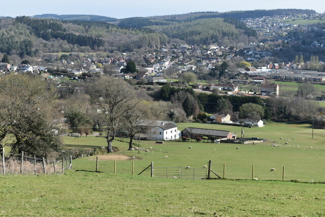
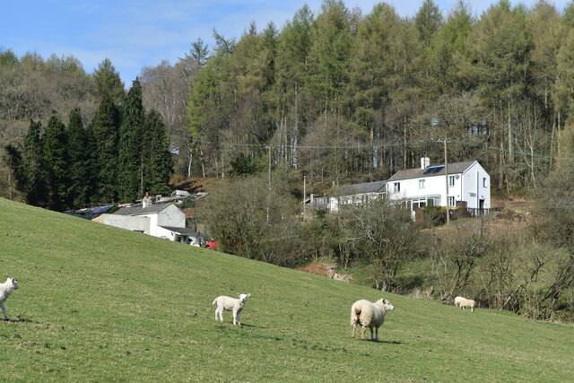
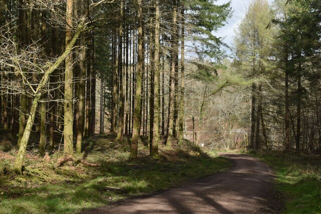
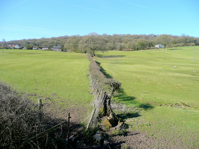
Oakwood Bottom is a picturesque valley located in Gloucestershire, England. Situated in the heart of the Cotswolds, this charming area is known for its natural beauty and tranquil ambiance. The valley is nestled between rolling hills and is adorned with lush greenery, making it a haven for nature lovers and hikers.

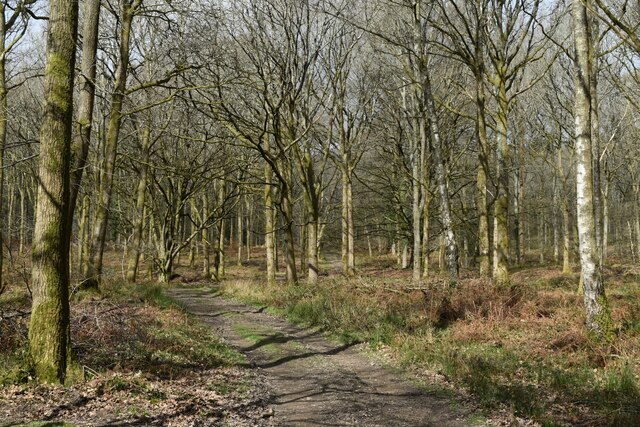
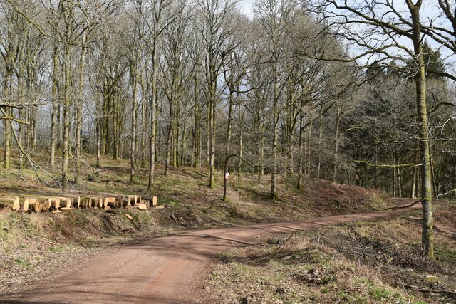
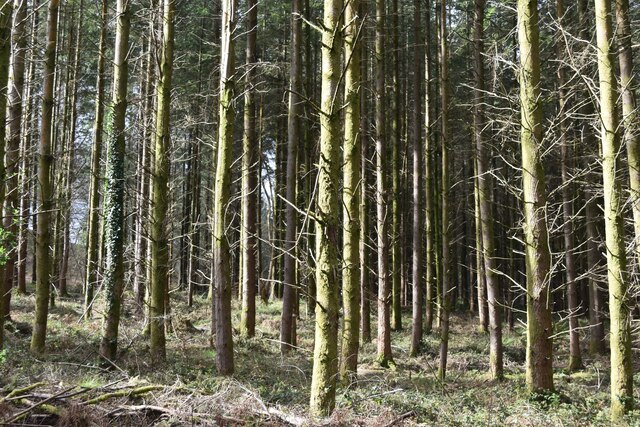
The main feature of Oakwood Bottom is its ancient oak woodland, which has been preserved for centuries. The woodland is home to an array of diverse flora and fauna, including rare species of plants and animals that are unique to this region. Walking through this enchanting woodland, visitors are treated to a serene atmosphere, with the gentle rustling of leaves and birdsong adding to the tranquility.

The valley is also renowned for its crystal-clear streams and small cascades, which meander through the landscape, creating a soothing and picturesque sight. These streams are home to a variety of aquatic life and provide a refreshing spot for visitors to relax and enjoy the peaceful surroundings.

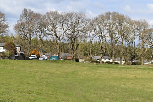
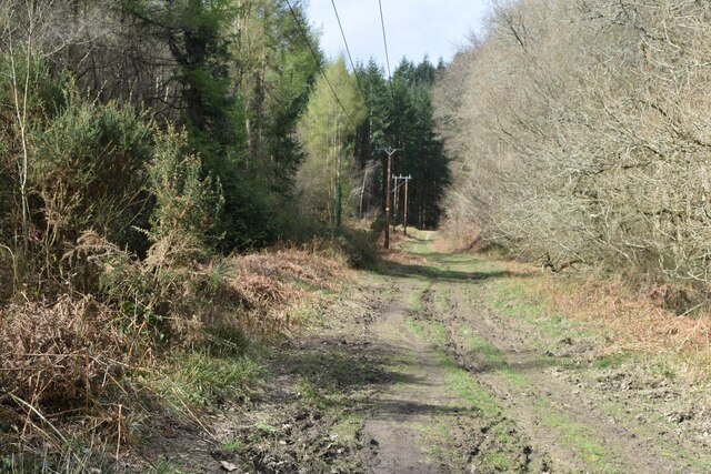
In addition to its natural beauty, Oakwood Bottom offers a range of outdoor activities. The valley features several well-maintained walking trails that cater to all levels of fitness, allowing visitors to explore the area at their own pace. Furthermore, the valley is a popular spot for birdwatching, with numerous bird species making their home in the woodland.

Overall, Oakwood Bottom in Gloucestershire is a hidden gem that showcases the beauty of the Cotswolds. With its ancient oak woodland, crystal-clear streams, and diverse wildlife, this valley offers a serene and idyllic retreat for nature enthusiasts and those seeking a peaceful escape from the busy pace of modern life.

If you have any feedback on the listing, please let us know in the comments section below.

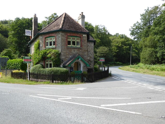
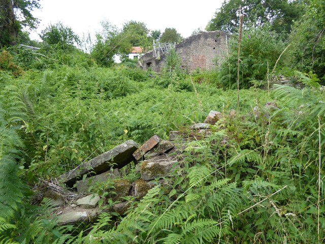
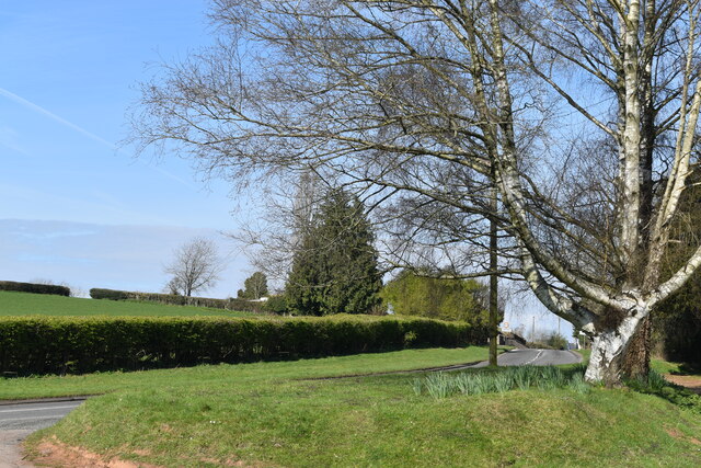
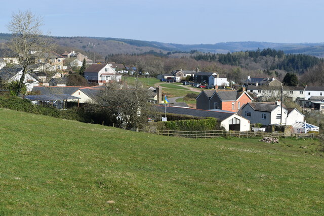
Oakwood Bottom Images

Images are sourced within 2km of 51.755102/-2.5830494 or Grid Reference SO5906. Thanks to Geograph Open Source API. All images are credited.

Former toll house The Pike House, built as a turnpike house.  A 19th century former toll house which was enlarged in the early 20th century.   The house stands on the junction of the B4431 and the road to Bream.  The house is Grade II listed, see: <span class="nowrap"><a title="https://historicengland.org.uk/listing/the-list/list-entry/1299231" rel="nofollow ugc noopener" href="https://historicengland.org.uk/listing/the-list/list-entry/1299231">Link</a><img style="margin-left:2px;" alt="External link" title="External link - shift click to open in new window" src="https://s1.geograph.org.uk/img/external.png" width="10" height="10"/></span>
Former toll house
The Pike House, built as a turnpike house. A 19th century former toll house which was enlarged in the early 20th century. The house stands on the junction of the B4431 and the road to Bream. The house is Grade II listed, see: LinkExternal link
The remains of the Titanic Steelworks The Titanic steelworks were so named because Robert Mushet the owner was experimenting with Titanium at that time.  Robert Mushet was working on solving the problems with the Bessemer steel making process.
The remains of the Titanic Steelworks
The Titanic steelworks were so named because Robert Mushet the owner was experimenting with Titanium at that time. Robert Mushet was working on solving the problems with the Bessemer steel making process.
St James’ Church Bream Sunday morning worshippers gathering outside the door.
St James’ Church Bream
Sunday morning worshippers gathering outside the door.
Wide verge beside Lyndsey Road
View over Pastor’s Hill, Bream
View over Whitecroft The station on the preserved Dean Forest Railway is in the centre of this image.
View over Whitecroft
The station on the preserved Dean Forest Railway is in the centre of this image.
Downhill view at Pastor’s Hill
Houses on hillside at Pastor’s Hill
House above lane on edge of Whitecroft Taken from the location of a former level crossing on a branch line to Princess Royal Colliery.
House above lane on edge of Whitecroft
Taken from the location of a former level crossing on a branch line to Princess Royal Colliery.
Sheep grazing on the verge beside Park Hill
Stream below Whitecroft Road Close to the site of the former Princess Royal Colliery.
Stream below Whitecroft Road
Close to the site of the former Princess Royal Colliery.
Grassy hillside below Cox's Way
Sports ground at Bream Seen from the Cenotaph.
Sports ground at Bream
Seen from the Cenotaph.
Woodland path at Parkend Walk
Timber stacked beside the Gloucestershire Way
Forest track beside Dry Brook
View into woods at Parkend Walk
Forest tack at Parkend Walk
Show me another place!

Oakwood Bottom is located at Grid Ref: SO5906 (Lat: 51.755102, Lng: -2.5830494)

Administrative County: Gloucestershire

District: Forest of Dean

Police Authority: Gloucestershire

What 3 Words

///factored.messaging.cage. Near Bream, Gloucestershire

Related Wikis

Bream, Gloucestershire

Bream (historically known as Breem) is a village in the Forest of Dean, west Gloucestershire, England. The population was around 3,170 in the 2011 census...

West Dean, Gloucestershire

West Dean is a civil parish, situated in the Forest of Dean district of Gloucestershire, England. == History == The Forest of Dean was an extra-parochial...

Mary Rose Young

Mary Rose Young is a ceramic artist who lives and works in the Forest of Dean, Gloucestershire, in the UK. == Early life == Mary Rose Young was born near...

Nagshead

Nagshead is a woodland reserve, located on the western edge of Parkend, in the Forest of Dean, Gloucestershire, and is home to RSPB Nagshead. The site...

Ellwood, Gloucestershire

Ellwood is a hamlet in the Forest of Dean district in Gloucestershire, England. It lies around 3 kilometres (1.9 mi) south-east of Coleford. The hamlet...

Brockhollands

Brockhollands is a hamlet located in the Forest of Dean. It lies between the village of Bream and the town of Lydney in Gloucestershire. It is an obscure...

Devil's Chapel Scowles

Devil's Chapel Scowles (grid reference SO606045) is a 44.79-hectare (110.7-acre) biological Site of Special Scientific Interest in Gloucestershire, notified...

Sling, Gloucestershire

Sling is a village in Gloucestershire, England. The village is located between Clearwell and Bream. It is just south of the village of Milkwall. ��2�...

Related Videos

Let's explore USA coz zindgi na milegi dobara | क्योंकि जिंदगी ना मिलेगी दोबारा #travel

Let's explore USA coz zindgi na milegi dobara | क्योंकि जिंदगी ना मिलेगी दोबारा #travel #world ...

Whitemead Forest Park, Forest of Dean

Greenspan Projects were selected by Whitemead Forest Park to create a stunning 12-hole woodland themed adventure golf ...

Ukulele Party on a Freezing August Bank Holiday

A Socially distanced ukulele get together on a freezing August Bank Holiday Saturday afternoon.

Nearby Amenities

Located within 500m of 51.755102,-2.5830494
Bus Stop
Sun Rise Rd
Naptan AtcoCode: 1600GL3255
Naptan Bearing: NW
Naptan CommonName: Sun Rise Rd
Naptan NaptanCode: gloagjam
Naptan Street: Oakwood Rd
Naptan Verified: no
Source: naptan_import
Lat/Long: 51.752907/-2.577971
Sun Rise Rd
Naptan AtcoCode: 1600GL3256
Naptan Bearing: SE
Naptan BusStopType: CUS
Naptan CommonName: Sun Rise Rd
Naptan Indicator: Opp
Naptan NaptanCode: gloagjap
Naptan Street: Oakwood Rd
Naptan Verified: no
Source: naptan_import
Lat/Long: 51.7529882/-2.577914
Bus Stop
Oakwood Mill
Naptan AtcoCode: 1600GLF303
Naptan Bearing: NW
Naptan CommonName: Oakwood Mill
Naptan NaptanCode: gloagdtd
Naptan Street: Clements End Rd
Naptan Verified: no
Source: naptan_import
Lat/Long: 51.7545108/-2.5809469
Oakwood Mill
Naptan AtcoCode: 1600GLF304
Naptan Bearing: SE
Naptan BusStopType: CUS
Naptan CommonName: Oakwood Mill
Naptan Indicator: Opp
Naptan NaptanCode: gloagdtg
Naptan Street: Clements End Rd
Naptan Verified: no
Source: naptan_import
Lat/Long: 51.7544397/-2.5807866
Turning Circle
Lat/Long: 51.7543072/-2.5759059
Horwell Hill
Place: locality
Source: OS_OpenData_StreetView
Lat/Long: 51.7530185/-2.5873131
Post Box
Post Box Design: hovis
Post Box Mounting: wall
Post Box Type: lamp
Ref: GL15 85
Royal Cypher: GR
Royal Cypher Wikidata: Q33102273
Lat/Long: 51.752935/-2.5780859
Power: pole
Lat/Long: 51.75226/-2.5845337
Power: pole
Lat/Long: 51.751541/-2.5857286
Power: pole
Lat/Long: 51.7512114/-2.5863107
Power: pole
Lat/Long: 51.7514688/-2.5856428
Power: pole
Lat/Long: 51.7523273/-2.584236
Power: pole
Lat/Long: 51.753166/-2.5828153
Location Transition: yes
Power: pole
Lat/Long: 51.7533833/-2.5818032
Location Transition: yes
Power: pole
Lat/Long: 51.7540458/-2.5803508
Power: pole
Lat/Long: 51.754734/-2.5793061
Power: pole
Lat/Long: 51.7555293/-2.5781514
Power: pole
Lat/Long: 51.7565853/-2.5765729
Power: pole
Lat/Long: 51.7565197/-2.576483
Power: pole
Lat/Long: 51.7583128/-2.5794107
Power: pole
Lat/Long: 51.7584888/-2.5849937
Generator Method: photovoltaic
Generator Output Electricity: yes
Generator Source: solar
Generator Type: solar_photovoltaic_panel
Location: roof
Power: generator
Lat/Long: 51.7507473/-2.5812614
Generator Method: photovoltaic
Generator Output Electricity: yes
Generator Source: solar
Generator Type: solar_photovoltaic_panel
Location: roof
Power: generator
Lat/Long: 51.7544028/-2.5778738
Generator Method: photovoltaic
Generator Output Electricity: yes
Generator Source: solar
Generator Type: solar_photovoltaic_panel
Location: roof
Power: generator
Lat/Long: 51.75425/-2.5781393
Generator Method: photovoltaic
Generator Output Electricity: yes
Generator Source: solar
Generator Type: solar_photovoltaic_panel
Location: roof
Power: generator
Lat/Long: 51.7542268/-2.5779596
Generator Method: photovoltaic
Generator Output Electricity: yes
Generator Source: solar
Generator Type: solar_photovoltaic_panel
Location: roof
Power: generator
Lat/Long: 51.754167/-2.5760794
Booth: K6
Covered: booth
Disused Amenity: telephone
Man Made: telephone_box
Lat/Long: 51.7532872/-2.5783692
The data included in this document is from www.openstreetmap.org. The data is made available under ODbL.

Have you been to Oakwood Bottom?

Leave your review of Oakwood Bottom below (or comments, questions and feedback).