Chilcote Combe

Valley in Somerset Mendip

England

Chilcote Combe

Thrupe Houses and farm in this small Mendip hamlet.
Thrupe Credit: Patrick Mackie

Chilcote Combe is a picturesque valley located in Somerset, England. Nestled in the Mendip Hills, this tranquil combe stretches for approximately 2.5 kilometers and is characterized by rolling green hills, dense woodlands, and a meandering stream that runs through its center.

The combe is renowned for its natural beauty and is a popular destination for nature enthusiasts and hikers. The surrounding hills offer stunning panoramic views of the countryside, making it a haven for photographers and artists alike. The area is also home to a diverse range of flora and fauna, with wildflowers, ancient trees, and various bird species scattered throughout.

Chilcote Combe is rich in history, with evidence of human habitation dating back to the Iron Age. Archaeological discoveries, such as pottery and tools, have been unearthed in the area, indicating its significance as a settlement in ancient times.

Walking trails wind their way through the combe, providing visitors with the opportunity to explore its natural wonders at their own pace. The Chilcote Circular Walk is a popular route, guiding hikers along the combe's stream, through charming woodlands, and up to breathtaking viewpoints. Along the way, it is common to spot wildlife such as deer, rabbits, and a variety of bird species.

Overall, Chilcote Combe offers a peaceful retreat from the hustle and bustle of everyday life. With its idyllic scenery, fascinating history, and abundant wildlife, it is a hidden gem waiting to be discovered by nature lovers and adventure seekers.

If you have any feedback on the listing, please let us know in the comments section below.

Chilcote Combe Images

Images are sourced within 2km of 51.212125/-2.5976229 or Grid Reference ST5846. Thanks to Geograph Open Source API. All images are credited.

Thrupe Houses and farm in this small Mendip hamlet.
Thrupe
Houses and farm in this small Mendip hamlet.
Fields near East Horrington The near field beside Crapnell Lane has recently been grazed by cattle.
Fields near East Horrington
The near field beside Crapnell Lane has recently been grazed by cattle.
Type 29 Pillbox Sharcombe park WW2 Pill box near Dulcote, on "defence line green". This is on the edge of Dinder Wood, which is on a ridge facing south. Thank goodness it and many like it were never needed.
Type 29 Pillbox Sharcombe park
WW2 Pill box near Dulcote, on "defence line green". This is on the edge of Dinder Wood, which is on a ridge facing south. Thank goodness it and many like it were never needed.
Wells Golf Course A view facing south from in front of the club house towards King's Castle wood.  The 18th green is directly in front.  Golf courses may be beautiful, but they are incredibly damaging to the environment, leaving a big ecological footprint.
Wells Golf Course
A view facing south from in front of the club house towards King's Castle wood. The 18th green is directly in front. Golf courses may be beautiful, but they are incredibly damaging to the environment, leaving a big ecological footprint.
The Mendip Hospital, South Horrington. Nr Wells This beautiful building on the outskirts of Wells catered for people suffering from mental illnesses.  It closed in the 1980s and subsequently has been turned into apartments, increasing the population of South Horrington dramatically.
The Mendip Hospital, South Horrington. Nr Wells
This beautiful building on the outskirts of Wells catered for people suffering from mental illnesses. It closed in the 1980s and subsequently has been turned into apartments, increasing the population of South Horrington dramatically.
Pond at bottom of dry valley Water has accumulated here at the bottom of a dry valley to form a largish pond where ducks were swimming.  There doesn't, however, appear to be a stream running into it.
Pond at bottom of dry valley
Water has accumulated here at the bottom of a dry valley to form a largish pond where ducks were swimming. There doesn't, however, appear to be a stream running into it.
Pill Box at Furzy Sleight This was part of WWII defences against a possible German invasion. It is part of 'Stop-line Green' which ran from Burnham-on-Sea, across the Somerset Levels, through Wells and then on to Freshford, south of Bath.
Pill Box at Furzy Sleight
This was part of WWII defences against a possible German invasion. It is part of 'Stop-line Green' which ran from Burnham-on-Sea, across the Somerset Levels, through Wells and then on to Freshford, south of Bath.
Pill box at Furzy Sleight In spite of being built very quickly, many pill boxes have survived 50 years of neglect.  They had solid flat walls and thick concrete walls covered by external brick shuttering.  This Type 29 pill box formed part of the Green Line defences for WWII.
Pill box at Furzy Sleight
In spite of being built very quickly, many pill boxes have survived 50 years of neglect. They had solid flat walls and thick concrete walls covered by external brick shuttering. This Type 29 pill box formed part of the Green Line defences for WWII.
Limestone gate post An old, unused limestone gatepost at the northern entrance to Sharcombe Park. The rusted hook to hang the original gate on can be seen at the front.  It is attached to the stone with a lump of lead.
Limestone gate post
An old, unused limestone gatepost at the northern entrance to Sharcombe Park. The rusted hook to hang the original gate on can be seen at the front. It is attached to the stone with a lump of lead.
Stile A slab of limestone forms the barrier to climb over and smaller pieces of limestone are built up on either side to aid people crossing.
Stile
A slab of limestone forms the barrier to climb over and smaller pieces of limestone are built up on either side to aid people crossing.
Recently mown field Mown grass drying in the May sun, waiting to be collected for silage. Thrupe lane lies just beyond the barn and hedge at the bottom of the field.
Recently mown field
Mown grass drying in the May sun, waiting to be collected for silage. Thrupe lane lies just beyond the barn and hedge at the bottom of the field.
Hillview Cottage This beautiful cottage lies on Old Street to the south of Croscombe.  It was once called Paradise cottage.  The lane leading off to the right of the photograph is Paradise lane and further to the right out of the picture is Paradise hill.
Hillview Cottage
This beautiful cottage lies on Old Street to the south of Croscombe. It was once called Paradise cottage. The lane leading off to the right of the photograph is Paradise lane and further to the right out of the picture is Paradise hill.
Biddlecombe Going from the more open area at the bottom, southern end of the combe into the wooded area where the sides of the combe become progressively steeper.
Biddlecombe
Going from the more open area at the bottom, southern end of the combe into the wooded area where the sides of the combe become progressively steeper.
The Britannia Inn Located on the outskirts of Wells, on the old Wells - Bath road, the Britannia Inn was in existence long before all the housing estates which now surround it.
The Britannia Inn
Located on the outskirts of Wells, on the old Wells - Bath road, the Britannia Inn was in existence long before all the housing estates which now surround it.
Lime kiln This lime kiln is very difficult to spot as it is in such a bad state of repair.  All that can be seen now are the outer walls, and these are covered with vegetation making it blend in with the woodland very well.
Lime kiln
This lime kiln is very difficult to spot as it is in such a bad state of repair. All that can be seen now are the outer walls, and these are covered with vegetation making it blend in with the woodland very well.
Stream in Biddlecombe The stream is fed by numerous springs which rise along the combe sides and at its head.  The combe itself is a result of a geological fault (Biddle Fault) The bedrock changes from Devonian Old Red Sandstone, to Carboniferous limestone and finally Dolomitic Conglomerate as you descend the combe from north to south.
Stream in Biddlecombe
The stream is fed by numerous springs which rise along the combe sides and at its head. The combe itself is a result of a geological fault (Biddle Fault) The bedrock changes from Devonian Old Red Sandstone, to Carboniferous limestone and finally Dolomitic Conglomerate as you descend the combe from north to south.
West Horrington A view of the west end of the village of West Horrington.  All the buildings are south facing.
West Horrington
A view of the west end of the village of West Horrington. All the buildings are south facing.
Barn A small stone and breeze block barn at the bottom of Knapp hill overlooking the Wells - Bath road.
Barn
A small stone and breeze block barn at the bottom of Knapp hill overlooking the Wells - Bath road.
Show me another place!

Chilcote Combe is located at Grid Ref: ST5846 (Lat: 51.212125, Lng: -2.5976229)

Administrative County: Somerset

District: Mendip

Police Authority: Avon and Somerset

What 3 Words

///digs.trails.swarm. Near Mendip, Somerset

Related Wikis

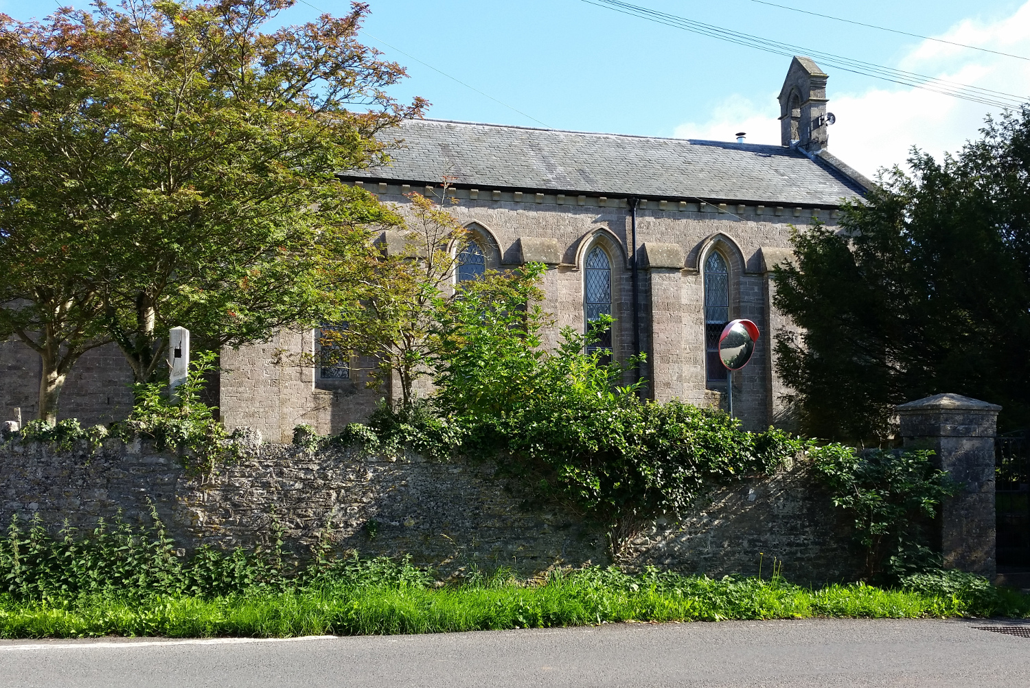
St John's Church, East Horrington

St John's Church is a former Church of England church in East Horrington, Somerset, England. It was built in 1838 to the designs of Richard Carver and...

Horrington

Horrington is a collection of three small villages (South Horrington, East Horrington and West Horrington) in the parish of St Cuthbert Out 1 mile (2 km...
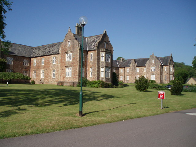
Mendip Hospital

Mendip Hospital opened in 1848 as the Somerset and Bath Pauper Lunatic Asylum at Horrington, near Wells, in the English county of Somerset. As a county...

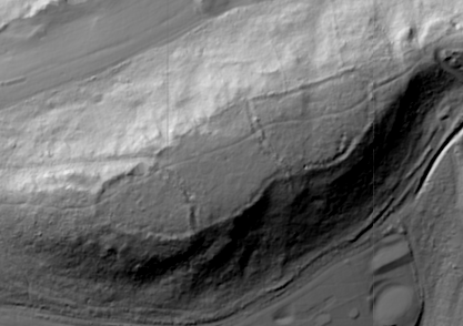
King's Castle, Wells

King's Castle is an Iron Age enclosed hilltop settlement at the south-western edge of the Mendip Hills near Wells in Somerset, England. Though there are...

Dinder

Dinder (which means "the house in the valley") is a small village and former civil parish, now in the parish of St Cuthbert Out, in the Somerset district...

Dinder House

Dinder House, is a Somerset estate with a small country house Grade II Regency listed building in the village of Dinder, in the civil parish of St Cuthbert...

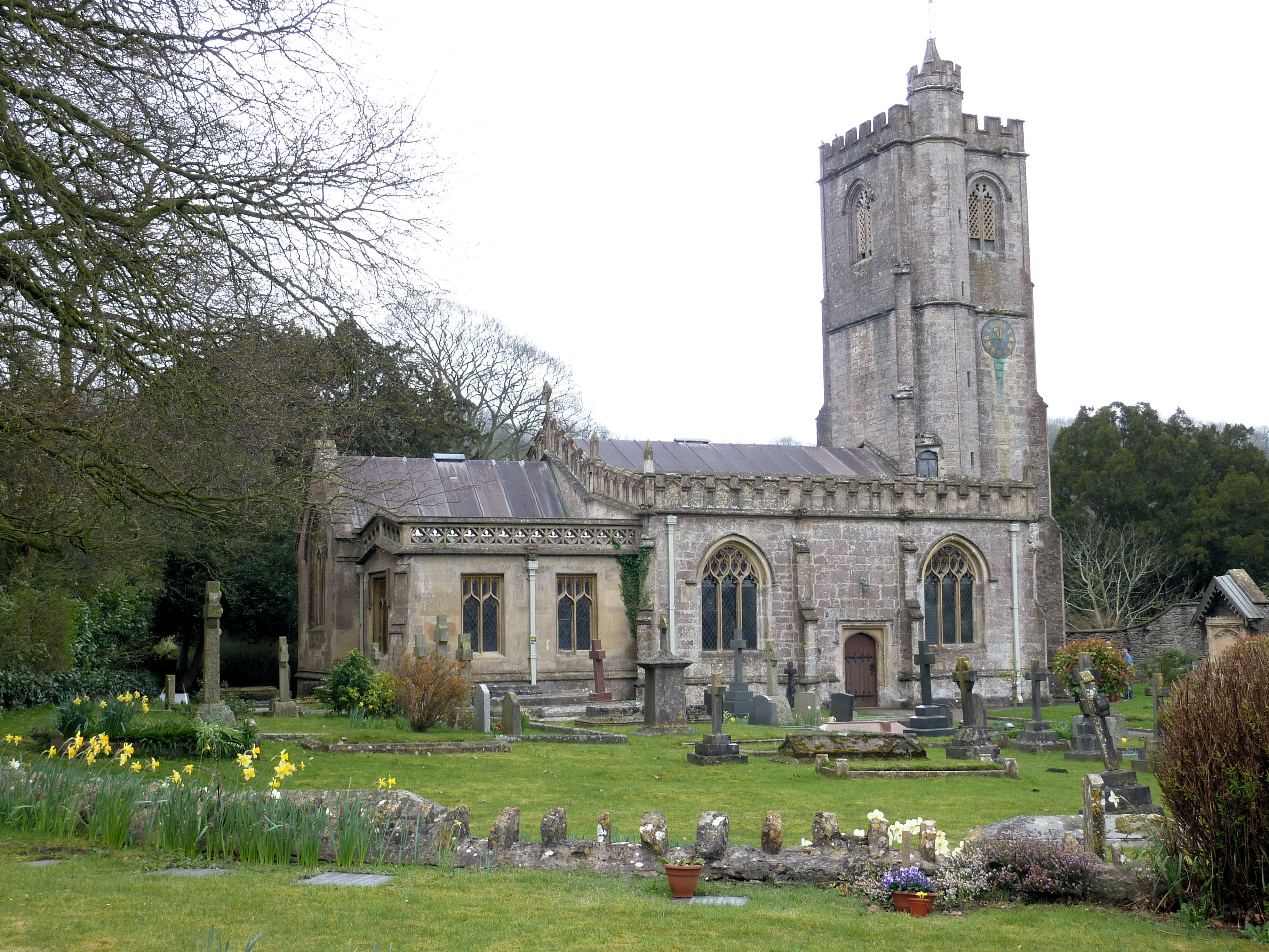
Church of St Michael, Dinder

The Anglican Church of St Michael in Dinder, Somerset, England has Norman origins and was built in the 14th century before being rebuilt in the 15th. It...

The Old Rectory, Croscombe

The Old Rectory in the village of Croscombe within the English county of Somerset was built in the 17th century and rebuilt in the 18th. It is a Grade...

Nearby Amenities

Located within 500m of 51.212125,-2.5976229
Power: pole
Lat/Long: 51.2143439/-2.6036025
Power: pole
Lat/Long: 51.2159179/-2.6006234
Power: pole
Lat/Long: 51.2127923/-2.6040915
Power: pole
Lat/Long: 51.2136229/-2.6034511
Power: pole
Lat/Long: 51.2142712/-2.6026574
The data included in this document is from www.openstreetmap.org. The data is made available under ODbL.

Have you been to Chilcote Combe?

Leave your review of Chilcote Combe below (or comments, questions and feedback).