Horrington, East
Settlement in Somerset Mendip
England
Horrington, East

Horrington is a small village located in the East Somerset region of England. Situated approximately 5 miles west of Wells, it is nestled in the picturesque Mendip Hills, offering residents and visitors breathtaking views of the surrounding countryside.
The village has a rich history dating back to the Domesday Book, where it is recorded as "Horentone." It has evolved over the centuries, and today, it is a charming and tranquil place to live. The community of around 500 residents enjoys a close-knit atmosphere and a strong sense of belonging.
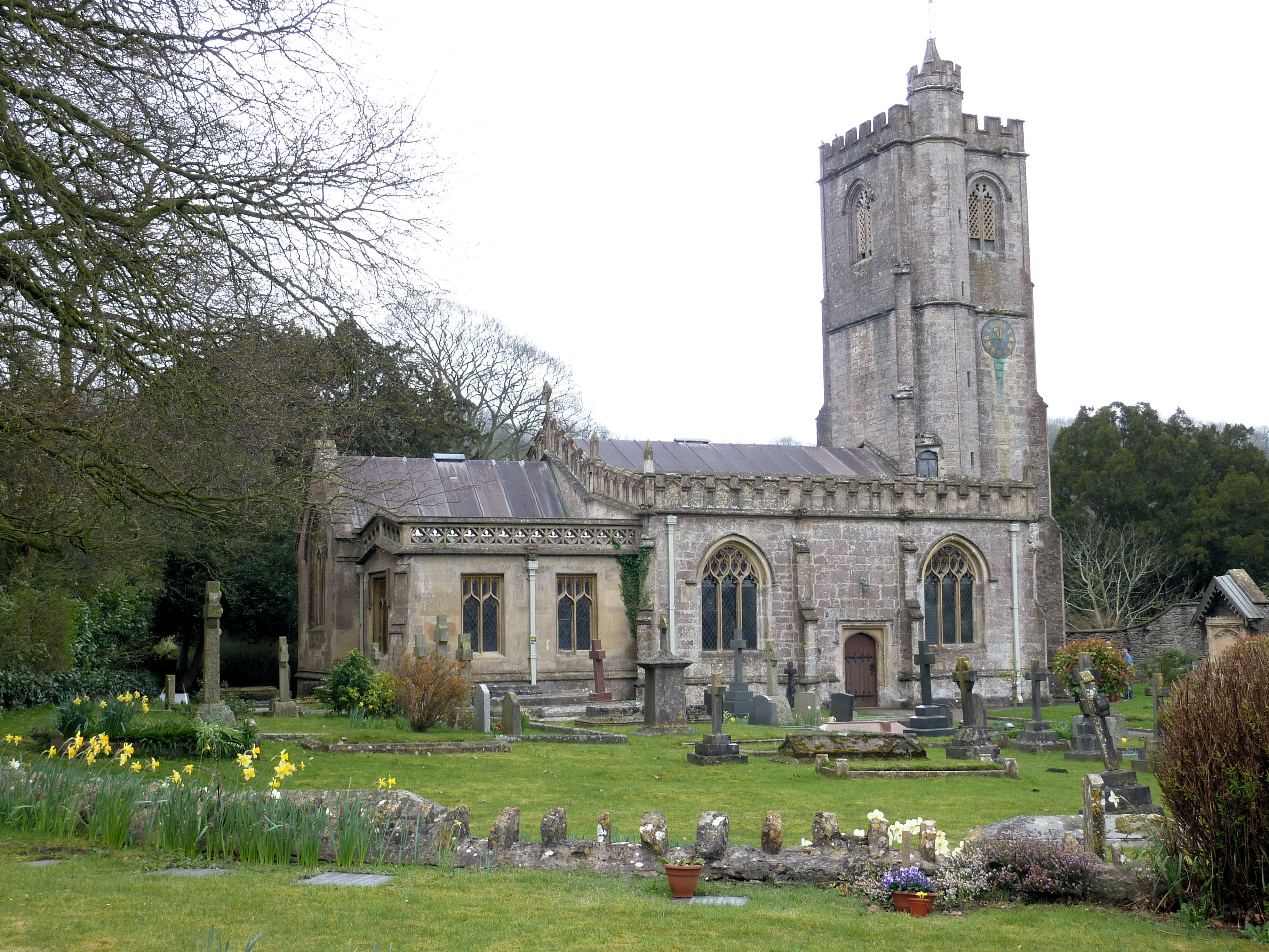
Horrington is known for its quaint architecture, with many traditional stone cottages lining the streets. The local church, St. Leonard's, is a prominent feature, boasting a striking medieval tower. The village also has a village hall, a primary school, and a post office, providing essential services to the community.
Nature lovers are attracted to Horrington due to its proximity to the Mendip Hills Area of Outstanding Natural Beauty. The area offers an array of walking and cycling routes, allowing visitors to explore the idyllic countryside and discover hidden gems such as Ebbor Gorge and Wookey Hole Caves.
While Horrington does not have its own shops or pubs, the nearby town of Wells provides residents with a range of amenities, including supermarkets, restaurants, and a bustling market square.
Overall, Horrington is a quiet and picturesque village that offers a peaceful countryside lifestyle, making it an attractive place to live for those seeking a close-knit community and natural beauty on their doorstep.
If you have any feedback on the listing, please let us know in the comments section below.
Horrington, East Images
Images are sourced within 2km of 51.218271/-2.598478 or Grid Reference ST5846. Thanks to Geograph Open Source API. All images are credited.


Horrington, East is located at Grid Ref: ST5846 (Lat: 51.218271, Lng: -2.598478)
Administrative County: Somerset
District: Mendip
Police Authority: Avon and Somerset
What 3 Words
///clan.powerful.escalates. Near Mendip, Somerset
Nearby Locations
Related Wikis
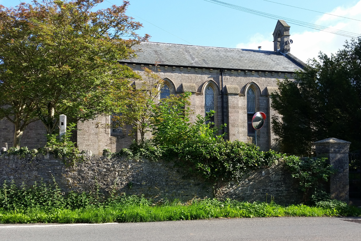
St John's Church, East Horrington
St John's Church is a former Church of England church in East Horrington, Somerset, England. It was built in 1838 to the designs of Richard Carver and...

Horrington
Horrington is a collection of three small villages (South Horrington, East Horrington and West Horrington) in the parish of St Cuthbert Out 1 mile (2 km...
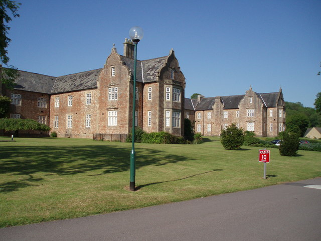
Mendip Hospital
Mendip Hospital opened in 1848 as the Somerset and Bath Pauper Lunatic Asylum at Horrington, near Wells, in the English county of Somerset. As a county...
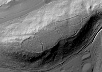
King's Castle, Wells
King's Castle is an Iron Age enclosed hilltop settlement at the south-western edge of the Mendip Hills near Wells in Somerset, England. Though there are...
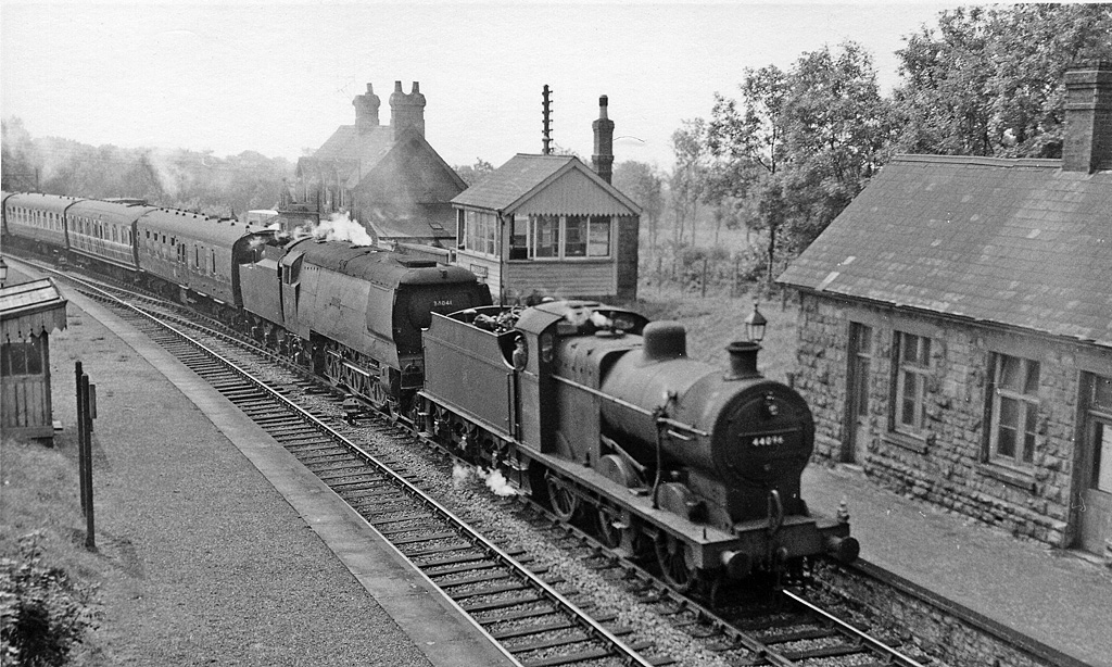
Masbury railway station
Masbury railway station was a small isolated station on the Somerset and Dorset Joint Railway's main line between Evercreech Junction and Bath. It was...
Dinder
Dinder (which means "the house in the valley") is a small village and former civil parish, now in the parish of St Cuthbert Out, in the Somerset district...
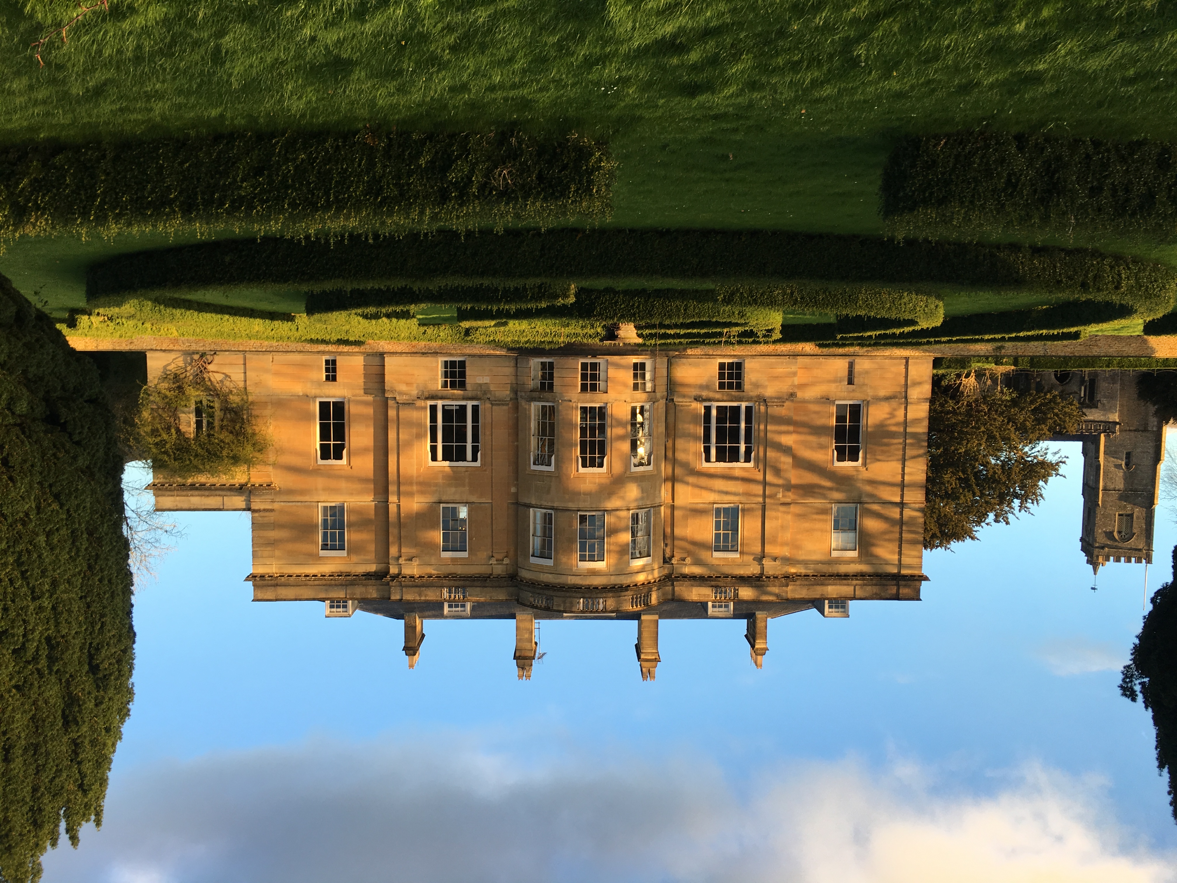
Dinder House
Dinder House, is a Somerset estate with a small country house Grade II Regency listed building in the village of Dinder, in the civil parish of St Cuthbert...

Thrupe Lane Swallet
Thrupe Lane Swallet (grid reference ST603458) is a 0.5 hectares (1.2 acres) geological Site of Special Scientific Interest in Somerset, notified in 1992...
Nearby Amenities
Located within 500m of 51.218271,-2.598478Have you been to Horrington, East?
Leave your review of Horrington, East below (or comments, questions and feedback).