Black Cleugh

Valley in Northumberland

England

Black Cleugh

At the high point of the 'Reivers Route' 357 metres above sea level at Caplestone Fell finds the National Cycle Route 10 deep within forestry.

This photograph was taken during the Coronavirus (COVID-19) pandemic of 2020/21/22.
At the high point of the 'Reivers Route' Credit: James T M Towill

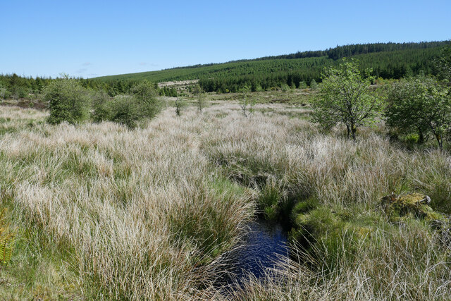
Black Cleugh is a picturesque valley located in Northumberland, England. Situated in the northern part of the county, it is a tranquil and idyllic area known for its natural beauty and stunning landscapes. The valley is nestled between rolling hills and surrounded by dense forests, creating a sense of seclusion and tranquility.

The name "Black Cleugh" refers to the small stream that meanders through the valley, known as Black Cleugh Burn. The clear waters of the burn add to the charm of the area, providing a peaceful soundtrack to the surrounding nature. The valley is also home to a diverse range of wildlife, including various bird species, mammals, and plant life.

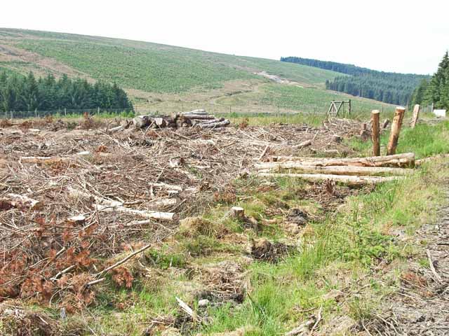
Visitors to Black Cleugh can enjoy a range of outdoor activities, such as hiking and walking along the numerous trails that crisscross the valley. These trails offer breathtaking views of the surrounding countryside, including panoramic vistas of the Northumberland National Park. The valley is also a popular spot for nature photography, as it offers ample opportunities to capture the beauty of the landscape.

In addition to its natural attractions, Black Cleugh is also known for its rich history. The area has archaeological sites dating back to the Bronze Age, with remnants of ancient settlements and burial mounds scattered throughout the valley. These historical features add depth and intrigue to the already captivating surroundings.

Overall, Black Cleugh is a hidden gem in Northumberland, offering visitors a chance to escape the hustle and bustle of everyday life and immerse themselves in the beauty of nature. Whether exploring the trails, capturing stunning photographs, or simply enjoying the tranquility, this valley is a must-visit destination for nature lovers and history enthusiasts alike.

If you have any feedback on the listing, please let us know in the comments section below.

Black Cleugh Images

Images are sourced within 2km of 55.188152/-2.6553789 or Grid Reference NY5888. Thanks to Geograph Open Source API. All images are credited.

At the high point of the 'Reivers Route' 357 metres above sea level at Caplestone Fell finds the National Cycle Route 10 deep within forestry.

This photograph was taken during the Coronavirus (COVID-19) pandemic of 2020/21/22.
At the high point of the 'Reivers Route'
357 metres above sea level at Caplestone Fell finds the National Cycle Route 10 deep within forestry. This photograph was taken during the Coronavirus (COVID-19) pandemic of 2020/21/22.
Scald Sike A small stream draining mainly extensive forestry in this part of the Kielder Forest complex.

This photograph was taken during the Coronavirus (COVID-19) pandemic of 2020/21/22.
Scald Sike
A small stream draining mainly extensive forestry in this part of the Kielder Forest complex. This photograph was taken during the Coronavirus (COVID-19) pandemic of 2020/21/22.
A dusty forestry track by Caplestone Fell Kielder Forest opening out ahead on the route down to Willowbog.

This photograph was taken during the Coronavirus (COVID-19) pandemic of 2020/21/22.
A dusty forestry track by Caplestone Fell
Kielder Forest opening out ahead on the route down to Willowbog. This photograph was taken during the Coronavirus (COVID-19) pandemic of 2020/21/22.
Bound for Willowbog Having headed down from Caplestone Fell after crossing from Scotch Knowe, wide rough forestry tracks are encountered.  I assisted two Dutch cyclists who had four punctures to their tyres near this location.  These tracks are not suitable for conventional road bike tyres.  Later, one of my tyres deflated due to a pinch puncture.

Buck Fell is in the background.

This photograph was taken during the Coronavirus (COVID-19) pandemic of 2020/21/22.
Bound for Willowbog
Having headed down from Caplestone Fell after crossing from Scotch Knowe, wide rough forestry tracks are encountered. I assisted two Dutch cyclists who had four punctures to their tyres near this location. These tracks are not suitable for conventional road bike tyres. Later, one of my tyres deflated due to a pinch puncture. Buck Fell is in the background. This photograph was taken during the Coronavirus (COVID-19) pandemic of 2020/21/22.
Looking down on Willowbog A rural property deep within Kielder Forest.

This photograph was taken during the Coronavirus (COVID-19) pandemic of 2020/21/22.
Looking down on Willowbog
A rural property deep within Kielder Forest. This photograph was taken during the Coronavirus (COVID-19) pandemic of 2020/21/22.
Near Willowbog Looking towards Willowbog.
Near Willowbog
Looking towards Willowbog.
'The Forks' Rally stage 9 Here the stage climbs up towards the Scottish border.
'The Forks' Rally stage 9
Here the stage climbs up towards the Scottish border.
Buck Burn The Buck Burn viewed from a forestry track north west of Willowbog.

This photograph was taken during the Coronavirus (COVID-19) pandemic of 2020/21/22.
Buck Burn
The Buck Burn viewed from a forestry track north west of Willowbog. This photograph was taken during the Coronavirus (COVID-19) pandemic of 2020/21/22.
Cross-border path This path was only constructed about 20 years ago and was the first new crossing of the Scottish border to have been opened up for many years. When I last cycled this way in 1993, trees closed in on the path from both sides, but the forest to the right (north) has since been felled. The path, which is now in urgent need of maintenance is followed by National Cycle Network Regional Route 10 (Reivers Route).
Cross-border path
This path was only constructed about 20 years ago and was the first new crossing of the Scottish border to have been opened up for many years. When I last cycled this way in 1993, trees closed in on the path from both sides, but the forest to the right (north) has since been felled. The path, which is now in urgent need of maintenance is followed by National Cycle Network Regional Route 10 (Reivers Route).
End of the road. Kielder Forest This is the westernmost end of the forest road which follows the Neate Burn. Beyond here to the west, a path (only constructed about 20 years ago) extends to the first new crossing of the Scottish border to have been opened up for many years. The path is followed by National Cycle Network Regional Route 10 (Reivers Route).
End of the road. Kielder Forest
This is the westernmost end of the forest road which follows the Neate Burn. Beyond here to the west, a path (only constructed about 20 years ago) extends to the first new crossing of the Scottish border to have been opened up for many years. The path is followed by National Cycle Network Regional Route 10 (Reivers Route).
Kielder Forest, looking over the valley of the Neate Burn Much of the area around the Neate Burn has been clear felled in recent years. Caplestone Fell in the background.
Kielder Forest, looking over the valley of the Neate Burn
Much of the area around the Neate Burn has been clear felled in recent years. Caplestone Fell in the background.
Kielder Forest - valley of the Neate Burn Much of the area round the Neate Burn has been clear felled in recent years. Young trees have now been planted on the land to renew the forest.
Kielder Forest - valley of the Neate Burn
Much of the area round the Neate Burn has been clear felled in recent years. Young trees have now been planted on the land to renew the forest.
Kielder Forest, near Willowbog Much of the area round Willowbog has been clear felled
Kielder Forest, near Willowbog
Much of the area round Willowbog has been clear felled
Willowbog, Kielder Forest Forestry cottage
Willowbog, Kielder Forest
Forestry cottage
Forest road near Willowbog, Kielder Forest One of the older type forest roads, not suited to heavy haulage.
Forest road near Willowbog, Kielder Forest
One of the older type forest roads, not suited to heavy haulage.
Strait Sike Culvert Concrete culvert taking Straight Sike under the Bloody Bush Road.
Strait Sike Culvert
Concrete culvert taking Straight Sike under the Bloody Bush Road.
Strait Sike Looking downstream at Strait Sike from Bloody Bush Road.
Strait Sike
Looking downstream at Strait Sike from Bloody Bush Road.
Disused Quarry Rocks at entrance to small disused quarry.
Disused Quarry
Rocks at entrance to small disused quarry.
Show me another place!

Black Cleugh is located at Grid Ref: NY5888 (Lat: 55.188152, Lng: -2.6553789)

Unitary Authority: Northumberland

Police Authority: Northumbria

What 3 Words

///flows.animal.bitter. Near Langholm, Dumfries & Galloway

Nearby Locations

Black Cleugh

Related Wikis

Scottish Marches

Scottish Marches was the term used for the Anglo-Scottish border during the late medieval and early modern eras, characterised by violence and cross-border...

Kielder railway station

Kielder railway station is a closed railway station that served the village hamlet of Kielder, Northumberland. == History == Kielder railway station was...

Dinlabyre

Dinlabyre is a village on the B6357 in Liddesdale, on the edge of the Newcastleton Forest, close to Castleton, in the Scottish Borders area of Scotland...

Lewiefield Halt railway station

Lewiefield Halt was a wooden-built halt that served the hamlet of Lewie, and a Ministry of Labour training camp, in Northumberland, England. == History... ==

Kielder Forest Star Camp

The Kielder Forest Star Camp is an annual star party held each autumn and spring in Kielder Forest. The five night event is based on the Kielder Campsite...

HMS Standard (shore establishment)

HMS Standard was a British Royal Navy shore establishment between 1942 and 1945. Situated well away from the sea near Kielder in Northumberland, the base...

Kielder

Kielder is a small, remote village in western Northumberland, England. Located at the head of Kielder Water and in the north west of Kielder Forest, the...

Butteryhaugh

Butteryhaugh is a village in Northumberland, in England. It is situated a short distance to the south-east of Kielder. Although a separate "village" from...

Have you been to Black Cleugh?

Leave your review of Black Cleugh below (or comments, questions and feedback).