Rhymer's Glen

Valley in Roxburghshire

Scotland

Rhymer's Glen

Feeding time for hungry cows The cows posed briefly for the camera as I walked past a cattle shed by the minor road to Kaeside Farm.
Feeding time for hungry cows Credit: Walter Baxter

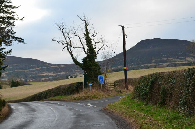
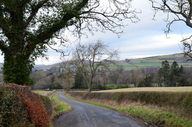
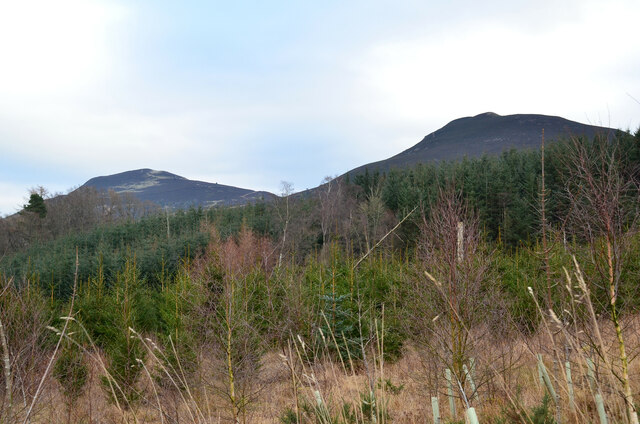
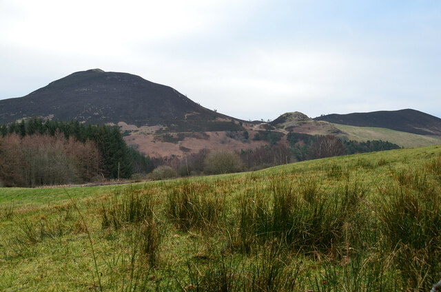
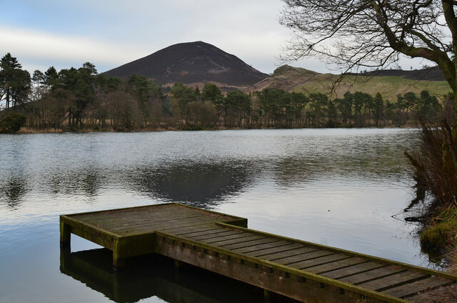
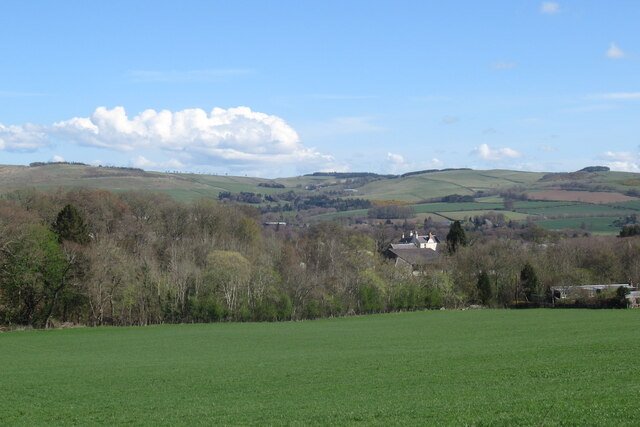
Rhymer's Glen is a picturesque valley located in Roxburghshire, a historic county in the southern part of Scotland. Nestled amidst the stunning rolling hills and lush greenery, this valley is renowned for its natural beauty and rich folklore.

The glen is named after Thomas the Rhymer, a Scottish poet and prophet who is said to have lived in this area during the 13th century. Legend has it that Thomas was gifted with the ability to see the future and possessed an extraordinary talent for composing rhymes. The glen became associated with his name due to the numerous ballads and tales that centered around his prophecies and adventures.

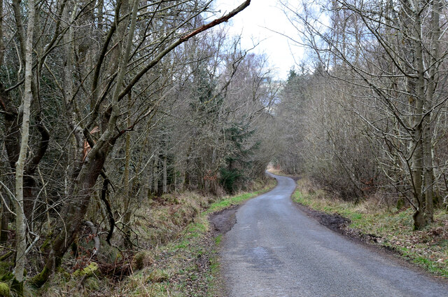
The valley is blessed with a diverse range of flora and fauna, making it a haven for nature enthusiasts. Its enchanting woodlands, meandering streams, and cascading waterfalls provide an idyllic setting for hiking and exploring. Visitors can enjoy leisurely walks along the well-maintained trails that wind through the glen, allowing them to appreciate the tranquility and serenity of the surroundings.

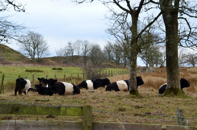
Rhymer's Glen is also home to a variety of wildlife, including red deer, otters, and a wide array of bird species. Nature lovers can spot these creatures in their natural habitats, making it a popular destination for birdwatching and wildlife photography.

With its breathtaking landscapes and mystical aura, Rhymer's Glen offers a unique opportunity to connect with nature and immerse oneself in the ancient folklore of Scotland. Whether it is the captivating tales of Thomas the Rhymer or the sheer beauty of the surroundings, this valley is a truly enchanting destination for visitors of all ages.

If you have any feedback on the listing, please let us know in the comments section below.

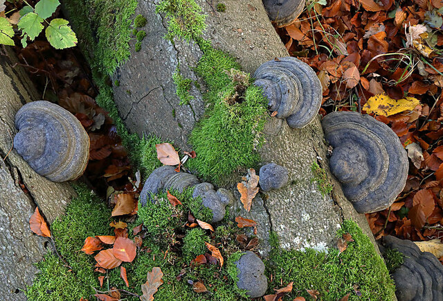
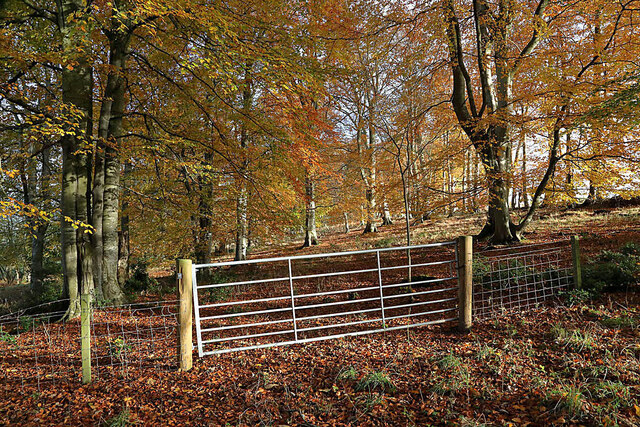
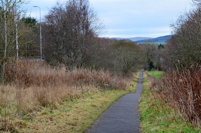
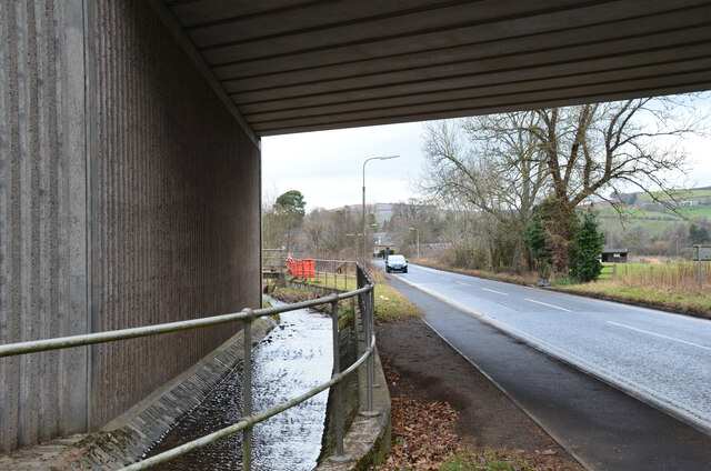
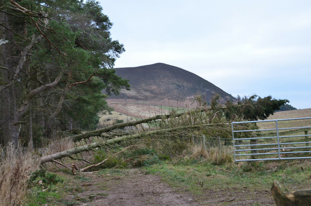
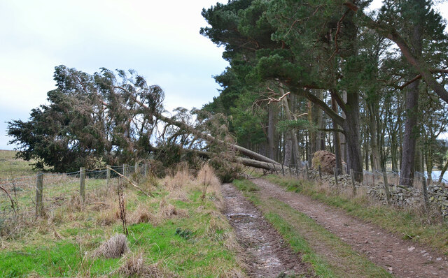
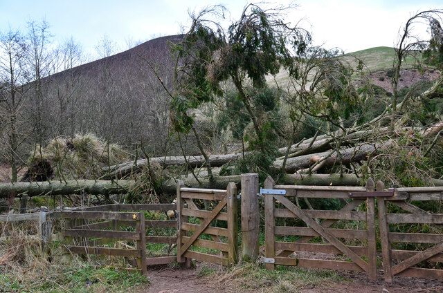
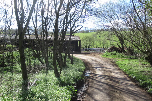
Rhymer's Glen Images

Images are sourced within 2km of 55.585958/-2.7515339 or Grid Reference NT5232. Thanks to Geograph Open Source API. All images are credited.

Feeding time for hungry cows The cows posed briefly for the camera as I walked past a cattle shed by the minor road to Kaeside Farm.
Feeding time for hungry cows
The cows posed briefly for the camera as I walked past a cattle shed by the minor road to Kaeside Farm.
Hoof fungus (Fomes fomentarius) This grey bracket fungus was growing on a fallen beech tree in Broomyknowe Plantation.
Hoof fungus (Fomes fomentarius)
This grey bracket fungus was growing on a fallen beech tree in Broomyknowe Plantation.
A gateway to a beech wood Most of the trees in Broomyknowe Plantation are beech.
A gateway to a beech wood
Most of the trees in Broomyknowe Plantation are beech.
Cyclepath alongside Melrose By-Pass A path by the A6091 east of the Borders General Hospital.
Cyclepath alongside Melrose By-Pass
A path by the A6091 east of the Borders General Hospital.
Underpass near Borders General Hospital The underpass carries the Dingleton road and the Huntly Burn below the A6091 Melrose By-Pass.
Underpass near Borders General Hospital
The underpass carries the Dingleton road and the Huntly Burn below the A6091 Melrose By-Pass.
Road junction near Borders General Hospital Junction for a minor road, single track with passing places, with the road between Darnick and Dingleton. Eildon Mid Hill is to the right.
Road junction near Borders General Hospital
Junction for a minor road, single track with passing places, with the road between Darnick and Dingleton. Eildon Mid Hill is to the right.
Minor road near Dingleton A single-track road through farmland and plantations west of Dingleton.
Minor road near Dingleton
A single-track road through farmland and plantations west of Dingleton.
Minor road through plantations, Dingleton A single-track road west of Dingleton.
Minor road through plantations, Dingleton
A single-track road west of Dingleton.
Eildon Hills from plantations near Dingleton Eildon Hill North (L) and Eildon Mid Hill seen from a minor road west of Dingleton.
Eildon Hills from plantations near Dingleton
Eildon Hill North (L) and Eildon Mid Hill seen from a minor road west of Dingleton.
Eildon Hills from the west Eildon Mid Hill (L), Little Hill (centre) and Wester Hill (R) seen from the single-track road west of Dingleton.
Eildon Hills from the west
Eildon Mid Hill (L), Little Hill (centre) and Wester Hill (R) seen from the single-track road west of Dingleton.
Road junction near Bowdenmoor Reservoir The single-track road meets the B6359 road from Dingleton.
Road junction near Bowdenmoor Reservoir
The single-track road meets the B6359 road from Dingleton.
Belted Galloway cattle, Bowdenmoor Distinctive black and white cattle by the B6359.
Belted Galloway cattle, Bowdenmoor
Distinctive black and white cattle by the B6359.
Bowden Loch This former reservoir is a fishery and it had attracted a number of anglers and walkers on this Sunday afternoon. Eildon Mid Hill dominates the skyline with Little Hill to the right.
Bowden Loch
This former reservoir is a fishery and it had attracted a number of anglers and walkers on this Sunday afternoon. Eildon Mid Hill dominates the skyline with Little Hill to the right.
Fallen trees at Bowden Loch Two Scots pines across the track, aftermath of Storm Arwen's northerly gales in November last year.
Fallen trees at Bowden Loch
Two Scots pines across the track, aftermath of Storm Arwen's northerly gales in November last year.
More fallen trees at Bowden Loch Two more Scots pines near the loch shore, brought down in Storm Arwen in November last year.
More fallen trees at Bowden Loch
Two more Scots pines near the loch shore, brought down in Storm Arwen in November last year.
Fallen trees at east end of Bowden Loch More Scots pines brought down here in Storm Arwen last November. Fortunately there was enough room to squeeze past to the right to gain the open hillside.
Fallen trees at east end of Bowden Loch
More Scots pines brought down here in Storm Arwen last November. Fortunately there was enough room to squeeze past to the right to gain the open hillside.
Road above Abbotsford There is a rightangled bend with a cattle shed beside the road.
Road above Abbotsford
There is a rightangled bend with a cattle shed beside the road.
View over the Tweed Towards the hills north of Melrose.
View over the Tweed
Towards the hills north of Melrose.
Show me another place!

Rhymer's Glen is located at Grid Ref: NT5232 (Lat: 55.585958, Lng: -2.7515339)

Unitary Authority: The Scottish Borders

Police Authority: The Lothians and Scottish Borders

What 3 Words

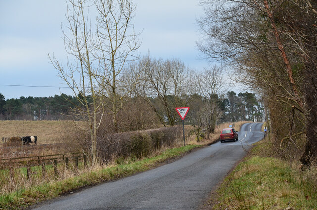
///uncouth.weaned.pencils. Near Tweedbank, Scottish Borders

Related Wikis

Borders General Hospital

Borders General Hospital (BGH) is a district general hospital on the outskirts of Melrose, Scotland. It is managed by NHS Borders. == History == The hospital...

Dingleton Hospital

Dingleton Hospital was a mental health facility in Melrose, Scotland. The former boiler house is a Category B listed building. == History == The hospital...

Darnick

Darnick is a village near Melrose in the Scottish Borders area of Scotland, in the former Roxburghshire. The name was first recorded in 1124, and has changed...

Melrose, Scottish Borders

Melrose (Scottish Gaelic: Maolros, "bald moor") is a town and civil parish in the Scottish Borders, historically in Roxburghshire. It lies within the Eildon...

Nearby Amenities

Located within 500m of 55.585958,-2.7515339
Power: tower
Lat/Long: 55.5857128/-2.7465351
Power: tower
Lat/Long: 55.5899004/-2.7495043
Power: tower
Lat/Long: 55.5878945/-2.748082
Power: tower
Lat/Long: 55.5840895/-2.7453842
Power: pole
Lat/Long: 55.58858/-2.7476825
Power: pole
Lat/Long: 55.5863275/-2.7461045
Power: pole
Lat/Long: 55.5841109/-2.7447531
Power: pole
Lat/Long: 55.5899596/-2.7486412
Power: pole
Lat/Long: 55.589226/-2.7481098
Power: pole
Lat/Long: 55.587771/-2.7471333
Power: pole
Lat/Long: 55.5870482/-2.7466181
Power: pole
Lat/Long: 55.584913/-2.745106
Power: pole
Lat/Long: 55.5856374/-2.7456174
The data included in this document is from www.openstreetmap.org. The data is made available under ODbL.

Have you been to Rhymer's Glen?

Leave your review of Rhymer's Glen below (or comments, questions and feedback).