Dunnerdale
Valley in Cumberland Copeland
England
Dunnerdale

Dunnerdale, also known as Dunnerdale Cumberland Valley, is a picturesque rural valley located in the county of Cumbria, England. Nestled within the Lake District National Park, Dunnerdale is renowned for its stunning landscapes, rolling hills, and peaceful atmosphere.
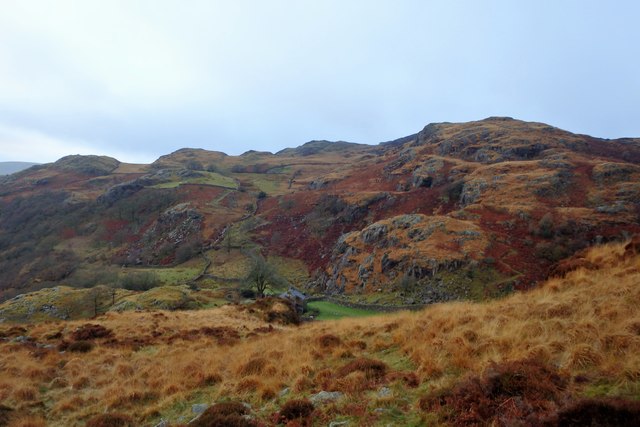
The valley stretches approximately 10 miles long and is encompassed by the towering peaks of Harter Fell and Caw. It is traversed by the River Duddon, which meanders through the valley, offering visitors the opportunity to enjoy scenic walks along its banks.
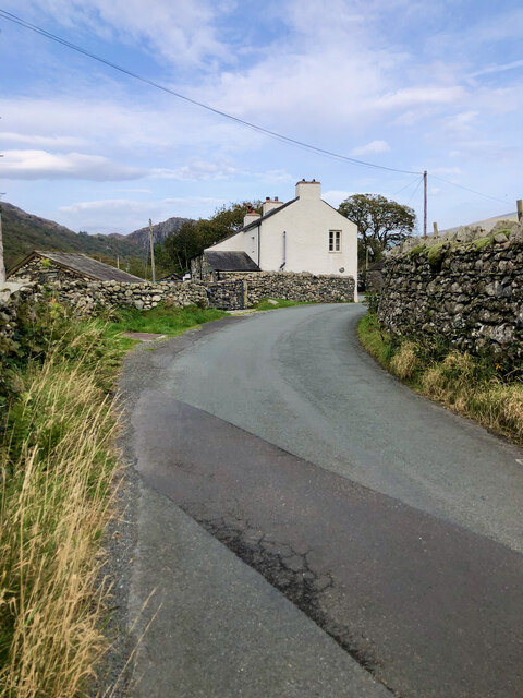
Dunnerdale is sparsely populated, with only a handful of small hamlets scattered across its landscape. These include Seathwaite, Ulpha, and Broughton Mills, each maintaining their own distinct charm and character.
The area is rich in history, with evidence of human settlement dating back to the Neolithic period. Ruins of ancient stone circles and burial mounds can still be found, providing a glimpse into the valley's past.
For outdoor enthusiasts, Dunnerdale offers a plethora of activities, including hiking, mountain biking, and birdwatching. The valley is crisscrossed with a network of footpaths and trails, providing access to the surrounding fells and offering breathtaking views of the surrounding countryside.
The nearby Dunnerdale Fells, with their rugged terrain and panoramic vistas, are a popular destination for hillwalkers and climbers. The valley also boasts several waterfalls, such as Ulpha, Birks, and Stanley Ghyll Force, which attract nature lovers and photographers.
Dunnerdale, Cumberland Valley, is a hidden gem within the Lake District, offering visitors a tranquil retreat amidst stunning natural beauty.
If you have any feedback on the listing, please let us know in the comments section below.
Dunnerdale Images
Images are sourced within 2km of 54.353232/-3.2048972 or Grid Reference SD2195. Thanks to Geograph Open Source API. All images are credited.


![Site of Commonwood Quarries For more information see Heritagegateway.org.uk &lt;<span class="nowrap"><a title="https://www.heritagegateway.org.uk/Gateway/Results_Single.aspx?resourceID=801&amp;uid=2887969" rel="nofollow ugc noopener" href="https://www.heritagegateway.org.uk/Gateway/Results_Single.aspx?resourceID=801&amp;uid=2887969">Link</a><img style="margin-left:2px;" alt="External link" title="External link - shift click to open in new window" src="https://s1.geograph.org.uk/img/external.png" width="10" height="10"/></span> &gt; [accessed 14 October 2023]
](https://s2.geograph.org.uk/geophotos/07/62/43/7624390_93198c44.jpg)


Dunnerdale is located at Grid Ref: SD2195 (Lat: 54.353232, Lng: -3.2048972)
Administrative County: Cumbria
District: Copeland
Police Authority: Cumbria
What 3 Words
///monopoly.repeating.campfires. Near Millom, Cumbria
Nearby Locations
Related Wikis
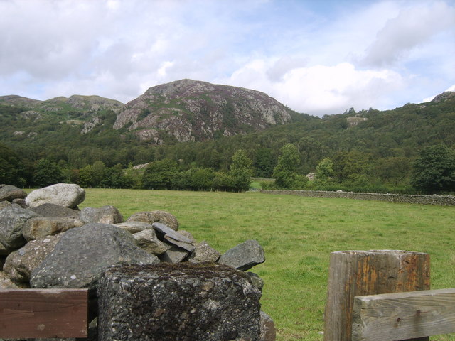
Wallowbarrow Crag
Wallowbarrow Crag is a hill of 292 metres (958 ft) in the Lake District, England. It is on the west of the Duddon Valley, across the valley from the village...

Seathwaite, Westmorland and Furness
Seathwaite is a village in the Dunnerdale-with-Seathwaite civil parish in the Westmorland and Furness district of Cumbria in North West England. It is...

Dunnerdale-with-Seathwaite
Dunnerdale-with-Seathwaite is a civil parish in the Westmorland and Furness district of the ceremonial county of Cumbria, England. It includes the village...
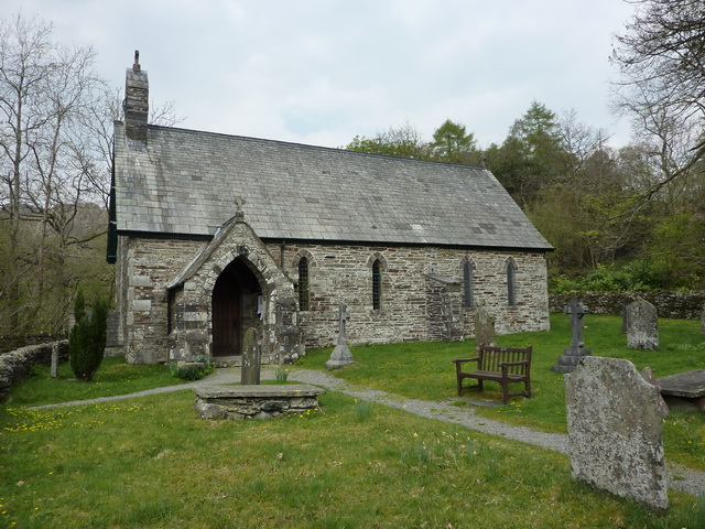
Holy Trinity Church, Seathwaite
Holy Trinity Church is in the village of Seathwaite, Cumbria, England. It is an active Anglican parish church in the deanery of Furness, the archdeaconry...
Nearby Amenities
Located within 500m of 54.353232,-3.2048972Have you been to Dunnerdale?
Leave your review of Dunnerdale below (or comments, questions and feedback).