Fern Hope

Valley in Peeblesshire

Scotland

Fern Hope

Deer fence and gate near Garelet Hill trig point On the boundary of the Borders Forest Trust land
Deer fence and gate near Garelet Hill trig point Credit: wrobison

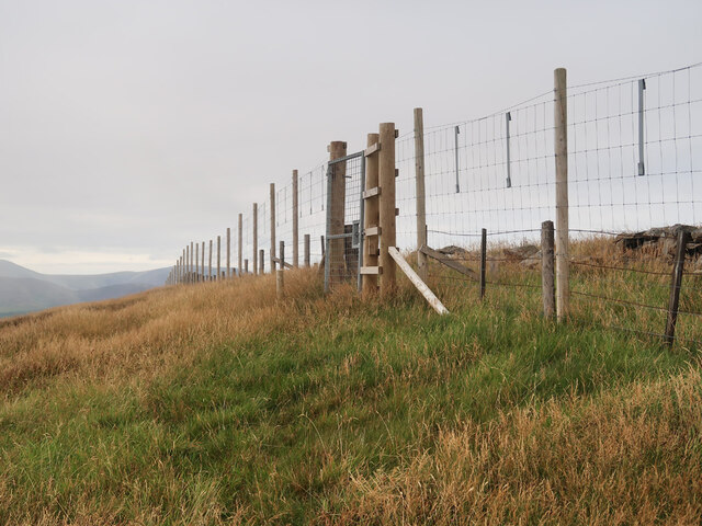
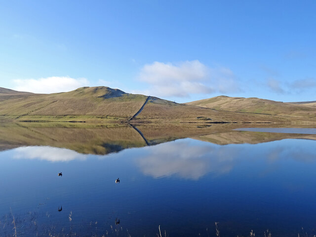
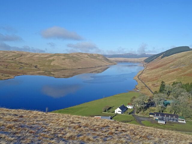
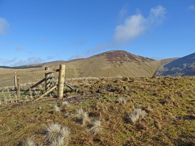
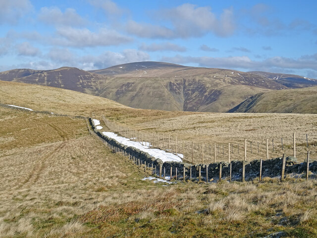
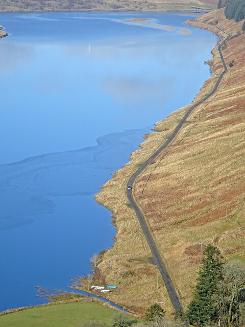
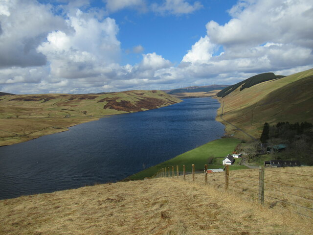
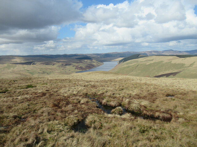
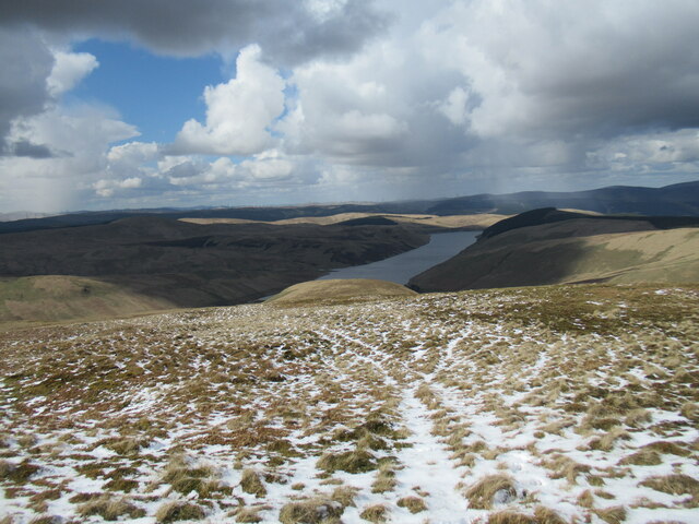
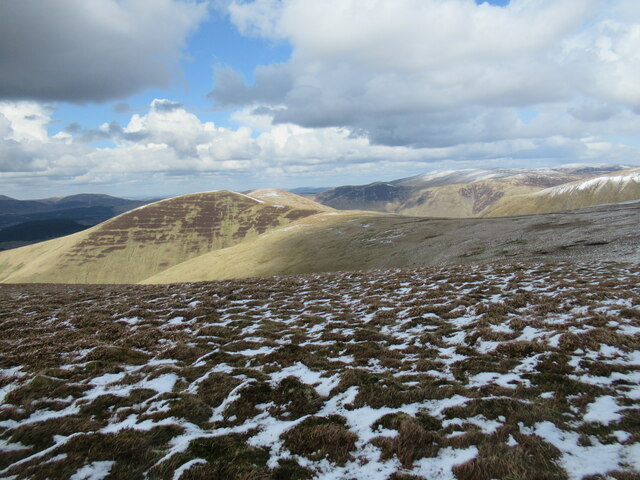
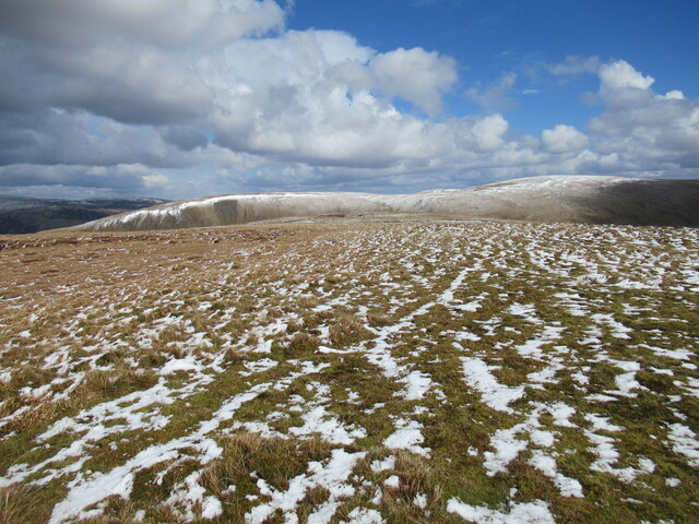
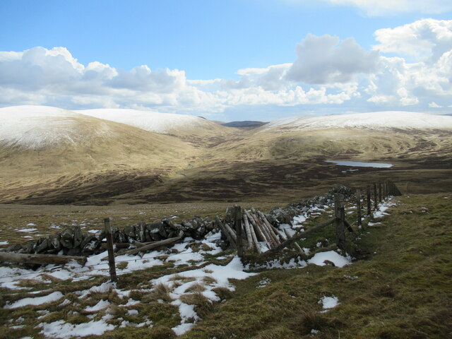
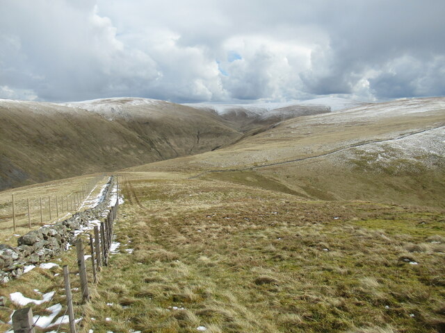
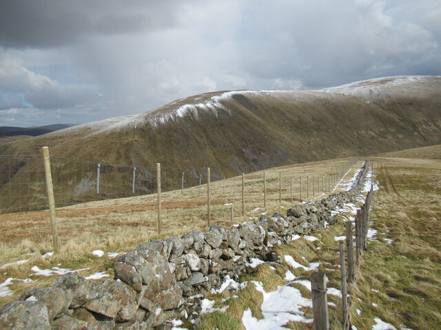
Fern Hope is a picturesque valley located in Peeblesshire, Scotland. This tranquil and scenic area is nestled amidst the rolling hills and lush greenery of the Scottish Borders. The valley is renowned for its natural beauty, making it a popular destination for nature enthusiasts and outdoor adventurers.

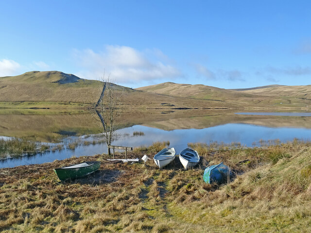
With its idyllic setting, Fern Hope offers visitors a haven of tranquility and an escape from the hustle and bustle of everyday life. The valley is home to a diverse range of plant and animal species, making it a haven for wildlife enthusiasts and birdwatchers. The verdant landscape is dotted with meandering streams and cascading waterfalls, adding to the valley's charm and allure.

Fern Hope is also a haven for outdoor activities, with numerous walking and hiking trails crisscrossing the area. Adventurous souls can explore the valley's rugged terrain and discover hidden gems along the way. The popular Fern Hope Trail offers breathtaking views of the surrounding countryside and is a favorite among hikers.

In addition to its natural beauty, Fern Hope is rich in history and culture. The valley is dotted with ancient ruins and historical landmarks, providing a glimpse into Scotland's past. Visitors can explore the remains of old castles and churches, immersing themselves in the region's storied history.

Whether it's a leisurely stroll through the valley or an adrenaline-fueled adventure, Fern Hope offers something for everyone. Its unspoiled natural beauty, coupled with its rich history, make it a must-visit destination for those seeking an authentic Scottish experience.

If you have any feedback on the listing, please let us know in the comments section below.

Fern Hope Images

Images are sourced within 2km of 55.450842/-3.3900826 or Grid Reference NT1218. Thanks to Geograph Open Source API. All images are credited.

Deer fence and gate near Garelet Hill trig point On the boundary of the Borders Forest Trust land
Deer fence and gate near Garelet Hill trig point
On the boundary of the Borders Forest Trust land
On the summit of Garelet Hill - Trig Point & view to Broad Law This trig point is severely eroded.
On the summit of Garelet Hill - Trig Point & view to Broad Law
This trig point is severely eroded.
Silver Jubilee Road, Laird's Cleuch Across Lairds Cleuch to further along the loop road.
Silver Jubilee Road, Laird's Cleuch
Across Lairds Cleuch to further along the loop road.
Bike on the Silver Jubilee Road A great wee gravel ride, but do it soon.  Last time I was here I saw a lot of spruce.  This time the forestry cycle allowed some amazing views from high in the Tweedsmuir Hills and there were no forestry operations or hostile signage.
Bike on the Silver Jubilee Road
A great wee gravel ride, but do it soon. Last time I was here I saw a lot of spruce. This time the forestry cycle allowed some amazing views from high in the Tweedsmuir Hills and there were no forestry operations or hostile signage.
Taking Flight Two geese have just taken flight after I surprised them at the edge of Fruid Reservoir. The hill to the left of the prominent wall is called Big Knock.
Taking Flight
Two geese have just taken flight after I surprised them at the edge of Fruid Reservoir. The hill to the left of the prominent wall is called Big Knock.
Boats by the Water Several dinghies are pulled up on the shores of Fruid Reservoir. The hills are reflected on the first day of spring.
Boats by the Water
Several dinghies are pulled up on the shores of Fruid Reservoir. The hills are reflected on the first day of spring.
Above Fruid Looking down the length of Fruid Reservoir from the lower slopes of Strawberry Hill with Fruid Farm at the bottom of the picture.
Above Fruid
Looking down the length of Fruid Reservoir from the lower slopes of Strawberry Hill with Fruid Farm at the bottom of the picture.
Erie Hill from Strawberry Hill From the summit of the curiously named Strawberry Hill above Fruid Reservoir looking across to the shapely Erie Hill. A glorious early spring day.
Erie Hill from Strawberry Hill
From the summit of the curiously named Strawberry Hill above Fruid Reservoir looking across to the shapely Erie Hill. A glorious early spring day.
View to Broad Law On the coll between Garelet Dod and Erie Hill there is this fine view of Broad Law the second highest hill in the Southern Uplands. There is a relatively new deer fence on the east side of the original wall so now there are 3 boundaries which seems a bit over the top.
View to Broad Law
On the coll between Garelet Dod and Erie Hill there is this fine view of Broad Law the second highest hill in the Southern Uplands. There is a relatively new deer fence on the east side of the original wall so now there are 3 boundaries which seems a bit over the top.
The Long and Slightly Winding Road As viewed from Strawberry Hill you can see a car making its way along the nearly 2 miles of road from Fruid dam to the farm at the end of the road. The first day of spring and it is a glorious day to be out in the hills.
The Long and Slightly Winding Road
As viewed from Strawberry Hill you can see a car making its way along the nearly 2 miles of road from Fruid dam to the farm at the end of the road. The first day of spring and it is a glorious day to be out in the hills.
Fruid Reservoir viewed from Strawberry Hill The farm buildings at Fruid are visible below, with some of the turbines of the vast Clyde Wind Farm on the distant horizon.
Fruid Reservoir viewed from Strawberry Hill
The farm buildings at Fruid are visible below, with some of the turbines of the vast Clyde Wind Farm on the distant horizon.
Spur leading from Garelet Dod to Strawberry Hill The Fruid Reservoir is visible in the distance.
Spur leading from Garelet Dod to Strawberry Hill
The Fruid Reservoir is visible in the distance.
Wintry showers passing over Fruid Reservoir A cold day of snow and hail flurries and sunny intervals in a northerly airflow.
Wintry showers passing over Fruid Reservoir
A cold day of snow and hail flurries and sunny intervals in a northerly airflow.
Looking towards Erie Hill and Common Law A view from near the summit of Garelet Dod.
Looking towards Erie Hill and Common Law
A view from near the summit of Garelet Dod.
Summit plateau on Garelet Dod Carlavin Hill and Molls Cleuch Dod are visible in the distance. As often seems to happen in April, a warm spell has given way to the return of cold northerly winds and wintry showers.
Summit plateau on Garelet Dod
Carlavin Hill and Molls Cleuch Dod are visible in the distance. As often seems to happen in April, a warm spell has given way to the return of cold northerly winds and wintry showers.
Looking into the upper Games Hope Gameshope Loch is visible in the distance, with snow-covered hillsides above 600m. or so, during a spell of  cold spring weather with northerly winds and wintry showers.
Looking into the upper Games Hope
Gameshope Loch is visible in the distance, with snow-covered hillsides above 600m. or so, during a spell of cold spring weather with northerly winds and wintry showers.
Triple fence line on Erie Hill The old drystane dyke has been joined by a stob and wire fence and now a high deer fence, which seems a bit of overkill.
Triple fence line on Erie Hill
The old drystane dyke has been joined by a stob and wire fence and now a high deer fence, which seems a bit of overkill.
New deer fencing on Erie Hill The old drystane dyke has been joined by a stob and wire fence and now a high deer fence, which seems a bit of overkill. The metal plates on the deer fence are designed to make it more visible to birds in flight.

The flanks of Carlavin Hill and Molls Cleuch Dod form the backdrop.
New deer fencing on Erie Hill
The old drystane dyke has been joined by a stob and wire fence and now a high deer fence, which seems a bit of overkill. The metal plates on the deer fence are designed to make it more visible to birds in flight. The flanks of Carlavin Hill and Molls Cleuch Dod form the backdrop.
Show me another place!

Fern Hope is located at Grid Ref: NT1218 (Lat: 55.450842, Lng: -3.3900826)

Unitary Authority: The Scottish Borders

Police Authority: The Lothians and Scottish Borders

What 3 Words

///submerge.scorecard.dilute. Near Moffat, Dumfries & Galloway

Related Wikis

Talla Water

Talla Water is a river in the Scottish Borders area of Scotland, near Tweedsmuir. It feeds the Talla Reservoir, and is a tributary of the River Tweed....

Fruid Reservoir

Fruid is a small reservoir in the Scottish Borders area of Scotland, UK, near Menzion. It is formed by damming the Fruid Water, and supplements the contents...

Moffat Hills

The Moffat Hills are a range of hills in the Southern Uplands of Scotland. They form a roughly triangular shape with a west facing side, a north facing...

Talla Reservoir

Talla Reservoir, located a mile from Tweedsmuir, Scottish Borders, Scotland, is an earth-work dam fed by Talla Water. The reservoir is supplemented by...

Hart Fell

Hart Fell is a hill in the Moffat Hills range, part of the Southern Uplands of Scotland. It lies north of the town of Moffat on the border with the Scottish...

Victoria Lodge railway station

Victoria Lodge railway station served the village of Tweedsmuir, Scottish Borders, Scotland from 1897 to 1905 on the Symington, Biggar and Broughton Railway...

Fruid Water

Fruid Water is a river in the Scottish Borders area of Scotland. The valley it occupies has been dammed to form the Fruid Reservoir. The river is a tributary...

Loch Skeen

Loch Skeen or Loch Skene is a loch in Dumfries and Galloway in the south of Scotland. It is located about 10 miles to the north-east of Moffat and feeds...

Have you been to Fern Hope?

Leave your review of Fern Hope below (or comments, questions and feedback).