Black Cleuch

Valley in Peeblesshire

Scotland

Black Cleuch

The upper Fruid Water from Strawberry Hill Looking towards the Hart Fell group of hills, where a spell of cold northerly winds with snow showers has left decent snow cover above 600m. or so.
The upper Fruid Water from Strawberry Hill Credit: Alan O'Dowd

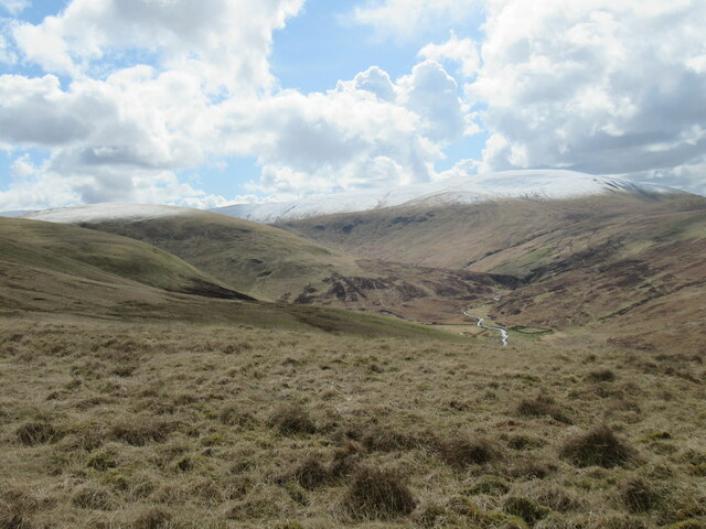
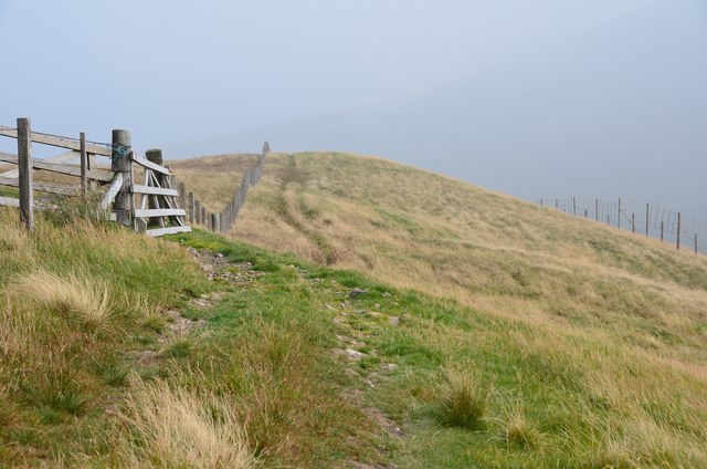
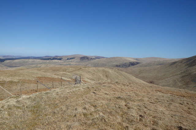
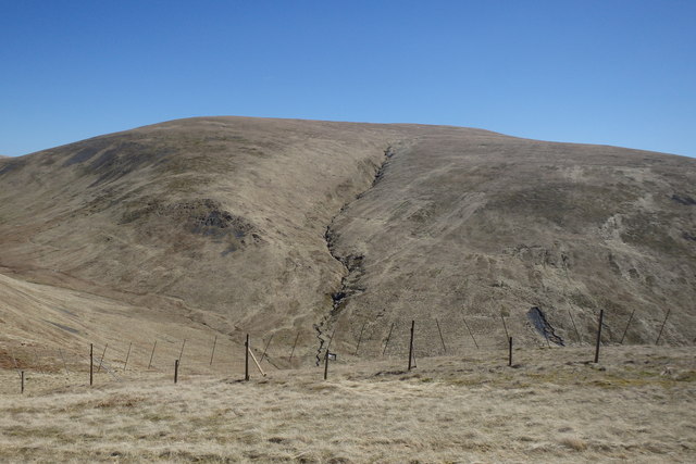
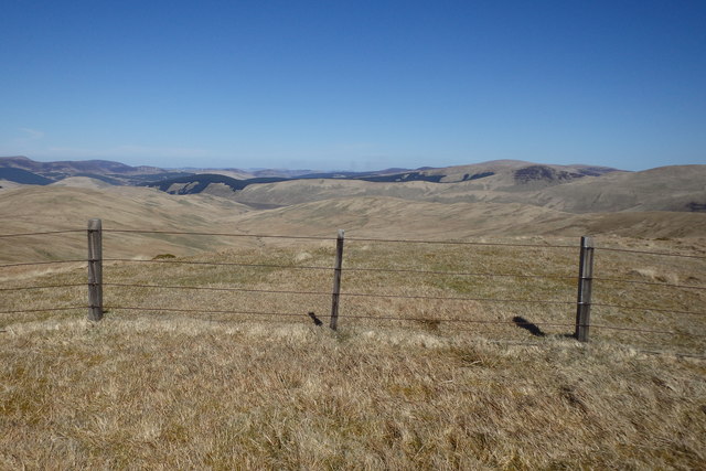
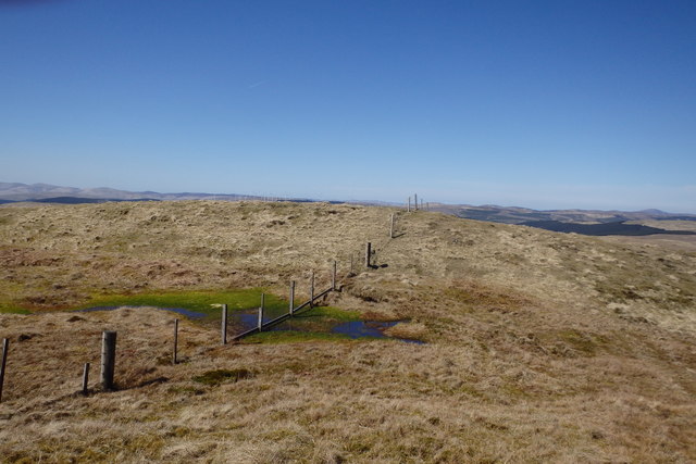
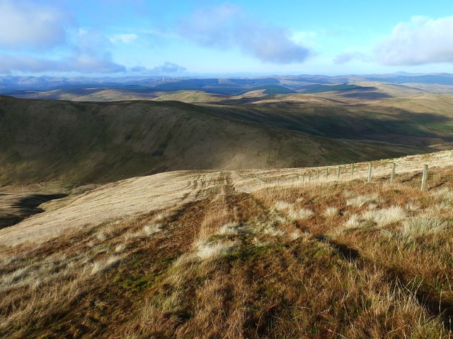
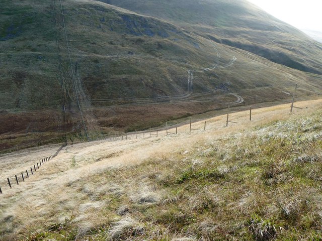
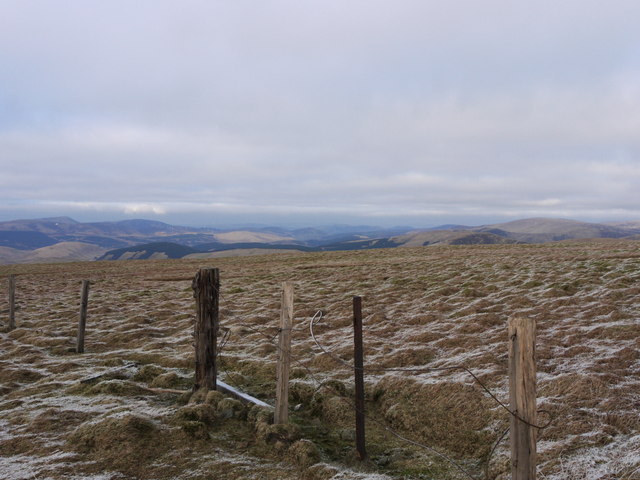
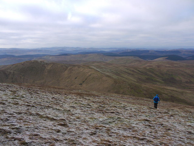
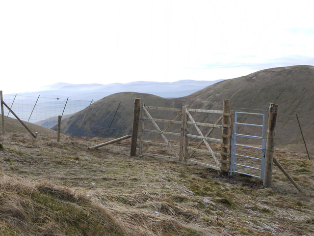
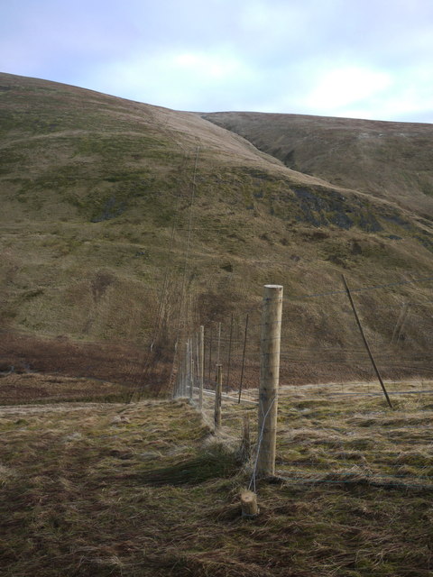
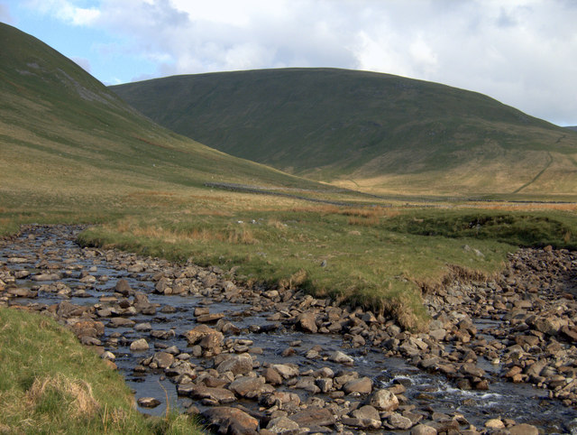
Black Cleuch is a spectacular valley located in Peeblesshire, Scotland. Situated in the stunning countryside, it is a popular destination for outdoor enthusiasts and nature lovers alike. The valley stretches for approximately 3 miles and is surrounded by rolling hills and picturesque landscapes.

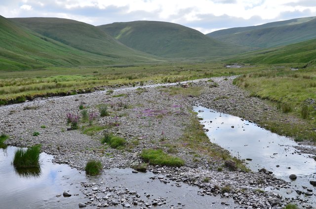
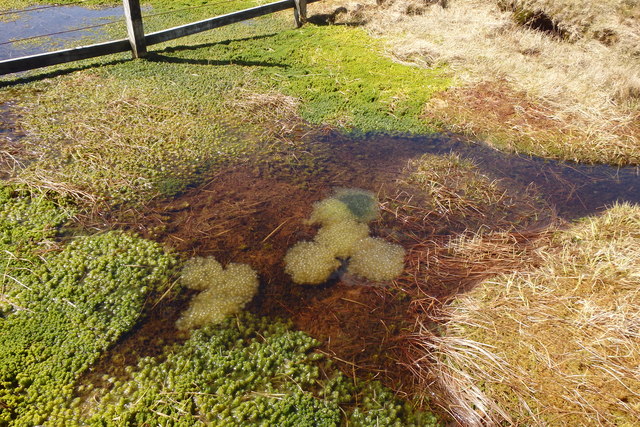
The main feature of Black Cleuch is the sparkling river that runs through it, known as the Black Cleuch Burn. The burn cascades down the valley, creating a series of beautiful waterfalls and gorges. The sound of rushing water and the sight of the glistening pools make for a truly mesmerizing experience.

The valley is home to a diverse range of flora and fauna, making it a haven for wildlife. Visitors may spot various bird species, including buzzards and red kites, soaring above the hills. The surrounding woodlands are filled with a variety of trees, such as oak, birch, and rowan, which provide a rich habitat for many small mammals.

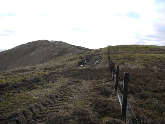
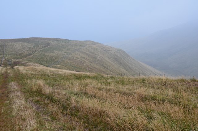
Hikers and walkers will find numerous trails and paths that meander through the valley, offering breathtaking views at every turn. The Black Cleuch circular walk is a popular route that allows visitors to explore the entire valley, passing by the enchanting waterfalls and offering panoramic vistas of the surrounding countryside.

Overall, Black Cleuch is a tranquil and scenic spot, perfect for those seeking a peaceful retreat or an adventurous outing in nature. Its natural beauty and diverse wildlife make it a must-visit destination for anyone exploring Peeblesshire.

If you have any feedback on the listing, please let us know in the comments section below.

Black Cleuch Images

Images are sourced within 2km of 55.427939/-3.4195078 or Grid Reference NT1015. Thanks to Geograph Open Source API. All images are credited.

The upper Fruid Water from Strawberry Hill Looking towards the Hart Fell group of hills, where a spell of cold northerly winds with snow showers has left decent snow cover above 600m. or so.
The upper Fruid Water from Strawberry Hill
Looking towards the Hart Fell group of hills, where a spell of cold northerly winds with snow showers has left decent snow cover above 600m. or so.
Fruid Water and glen A view upstream from the bridge on the track to Fruid farm.
Fruid Water and glen
A view upstream from the bridge on the track to Fruid farm.
Fence and track on The Gyle The tractor tracks have been caused by vehicle access for the extensive deer-fencing to protect an area of new, and not yet planted, forestry.
Fence and track on The Gyle
The tractor tracks have been caused by vehicle access for the extensive deer-fencing to protect an area of new, and not yet planted, forestry.
Grassy ridge to Whitehope Knowe The paths here are within a corridor between the boundary fence and the deer fence on the right.
Grassy ridge to Whitehope Knowe
The paths here are within a corridor between the boundary fence and the deer fence on the right.
On Whitehope Knowe The fence to the left heads north while the Corehead boundary fence continues round to Hart Fell with the deer fence on the right keeping on the lower slopes of the hill, enclosing new plantation.
On Whitehope Knowe
The fence to the left heads north while the Corehead boundary fence continues round to Hart Fell with the deer fence on the right keeping on the lower slopes of the hill, enclosing new plantation.
On Whitehope Heights Looking towards Whitehope Knowe
On Whitehope Heights
Looking towards Whitehope Knowe
On Whitehope Knowe Looking towards Hart Fell
On Whitehope Knowe
Looking towards Hart Fell
On Whitehope Knowe The summit area
On Whitehope Knowe
The summit area
Spring on Garlet Hill Under Whitehope Knowe
Spring on Garlet Hill
Under Whitehope Knowe
Frogspawn, Garlet Hill The spawn has a greenish tinge
Frogspawn, Garlet Hill
The spawn has a greenish tinge
Post Under Ballaman Hill Looking towards Hart Fell. Purpose of post unknown.
Post Under Ballaman Hill
Looking towards Hart Fell. Purpose of post unknown.
Descending NW from Hart Fell A steep descent from Hart Fell followed by a shorter, steep ascent to Whitehope Know.  The tracks have been made by tractors involved in erecting deer fencing.
Descending NW from Hart Fell
A steep descent from Hart Fell followed by a shorter, steep ascent to Whitehope Know. The tracks have been made by tractors involved in erecting deer fencing.
Deer Fencing on Barry Grain Rig The re-afforestation of Corehead involves erecting deer fencing.  Unfortunately, in the saturated conditions  the tractor has left extensive tracks in grass.
Deer Fencing on Barry Grain Rig
The re-afforestation of Corehead involves erecting deer fencing. Unfortunately, in the saturated conditions the tractor has left extensive tracks in grass.
Fence on Ask Law
Fence on Ask Law
Descending the NW slopes of Hart Fell
Deer fencing on Hartfell Shoulder This fence protects a huge area of new forestry planting. The fenced area seems to extend over a huge area to the SW of Hartfell and the access tracks have disrupted some of the paths in the area marked by the OS.
Deer fencing on Hartfell Shoulder
This fence protects a huge area of new forestry planting. The fenced area seems to extend over a huge area to the SW of Hartfell and the access tracks have disrupted some of the paths in the area marked by the OS.
Deer fencing on Barry Grain Rig This fence protects a huge area of new forestry planting. The fenced area seems to extend over an area to the SW of Hartfell and the access tracks have disrupted some of the paths in the area marked by the OS.
Deer fencing on Barry Grain Rig
This fence protects a huge area of new forestry planting. The fenced area seems to extend over an area to the SW of Hartfell and the access tracks have disrupted some of the paths in the area marked by the OS.
Fruid Burn
Fruid Burn
Show me another place!

Black Cleuch is located at Grid Ref: NT1015 (Lat: 55.427939, Lng: -3.4195078)

Unitary Authority: The Scottish Borders

Police Authority: The Lothians and Scottish Borders

What 3 Words

///kitchens.isolating.fooling. Near Moffat, Dumfries & Galloway

Related Wikis

Moffat Hills

The Moffat Hills are a range of hills in the Southern Uplands of Scotland. They form a roughly triangular shape with a west facing side, a north facing...

Hart Fell

Hart Fell is a hill in the Moffat Hills range, part of the Southern Uplands of Scotland. It lies north of the town of Moffat on the border with the Scottish...

Fruid Reservoir

Fruid is a small reservoir in the Scottish Borders area of Scotland, UK, near Menzion. It is formed by damming the Fruid Water, and supplements the contents...

Devil's Beef Tub

The Devil's Beef Tub (Marquis of Annandale's Beef-Tub, Beef-Stand, MacCleran's Loup) is a deep, dramatic hollow in the hills north of the Scottish town...

Annanhead Hill

Annanhead Hill is a 478-metre (1,568 ft) summit in the Moffat Hills of Scotland. It lies on the boundary between the Scottish Borders and Dumfries and...

Talla Water

Talla Water is a river in the Scottish Borders area of Scotland, near Tweedsmuir. It feeds the Talla Reservoir, and is a tributary of the River Tweed....

Crown of Scotland (hill)

The Crown of Scotland is a hill in the Scottish Borders, Scotland. At a relatively small elevation from the surrounding peaks, it is situated to the north...

White Coomb

White Coomb is a hill in the Moffat Hills range, part of the Southern Uplands of Scotland. Its broad summit is the highest point in the range and the registration...

Have you been to Black Cleuch?

Leave your review of Black Cleuch below (or comments, questions and feedback).