Summerside Knowe

Hill, Mountain in Peeblesshire

Scotland

Summerside Knowe

Hart Fell Summit A trig point marks the summit of Hart Fell at 808 metres.
Hart Fell Summit Credit: Robert Struthers

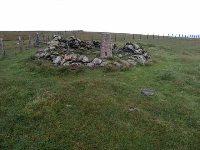
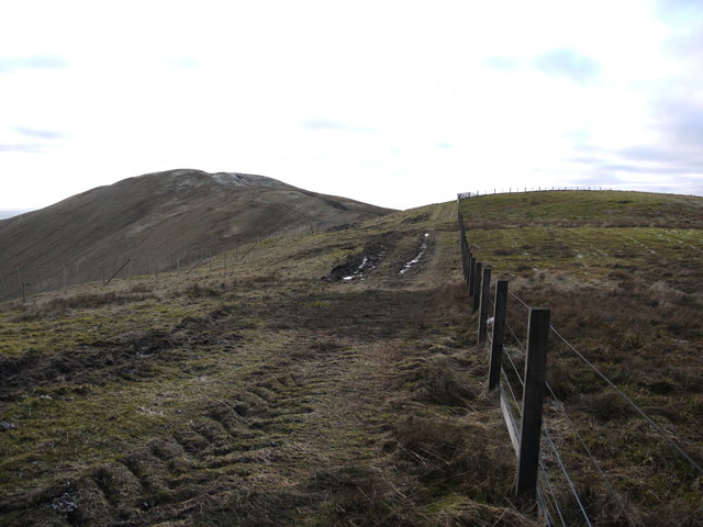
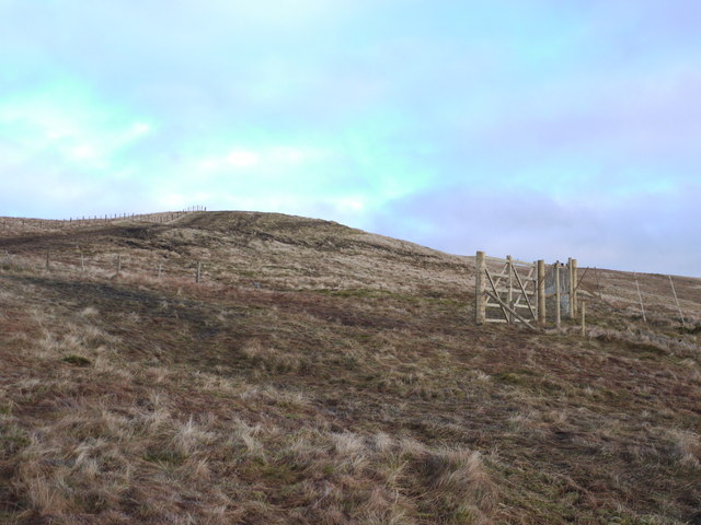
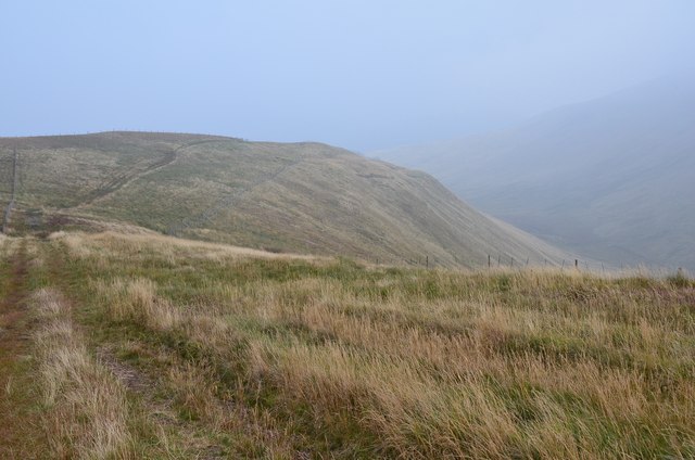
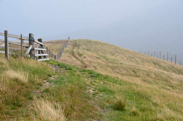
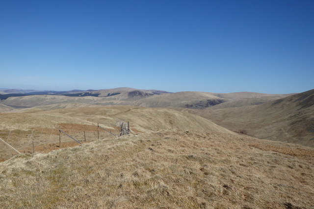
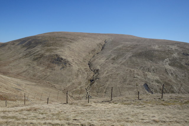
Summerside Knowe is a prominent hill located in the scenic region of Peeblesshire, Scotland. Rising to an elevation of approximately 438 meters (1,437 feet), it offers breathtaking views of the surrounding landscape and is a popular destination for hikers, nature enthusiasts, and photographers.

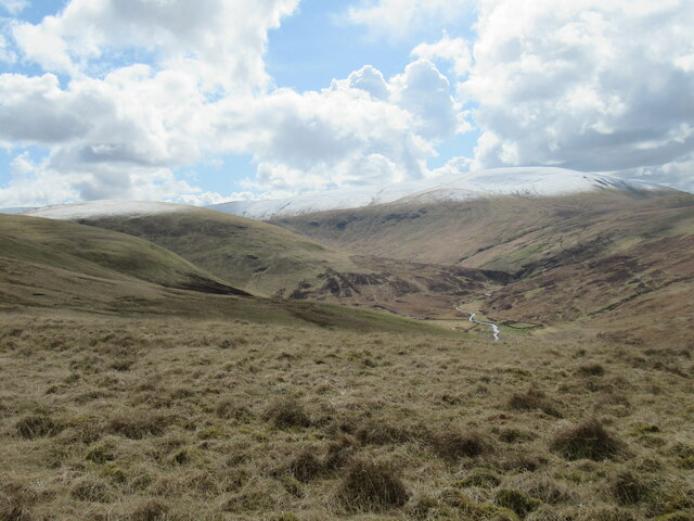
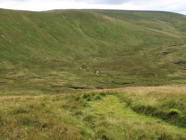
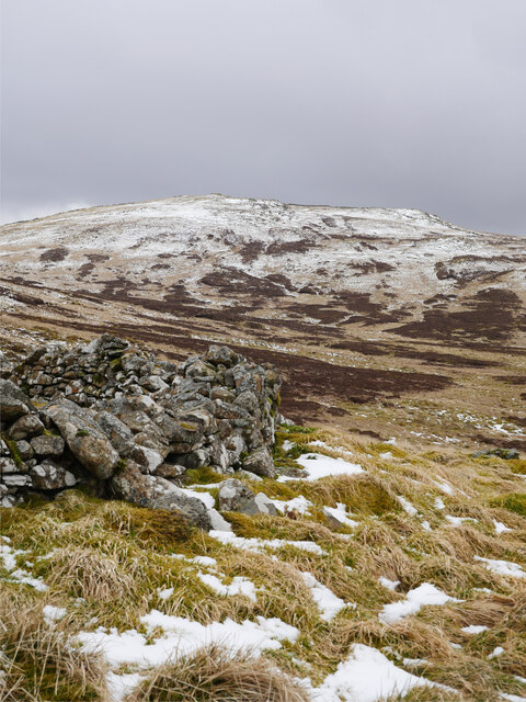
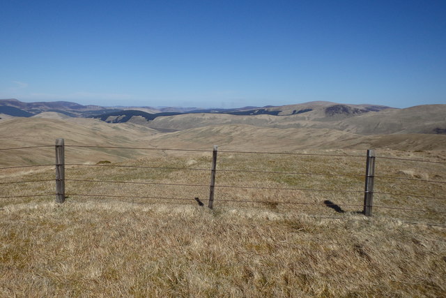
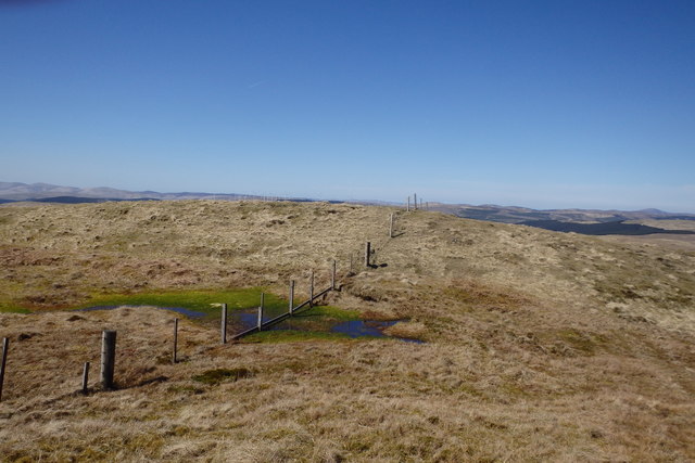
Situated in the southern part of the Scottish Borders, Summerside Knowe is characterized by its gentle slopes and verdant, heather-covered terrain. The hill is part of a larger range known as the Moorfoot Hills, which stretch across the southern uplands of Scotland.

The summit of Summerside Knowe provides an excellent vantage point to admire the picturesque rolling hills, meandering rivers, and lush valleys that define the Peeblesshire region. On clear days, it is even possible to catch a glimpse of the iconic Edinburgh skyline in the distance.

The hill is easily accessible from the nearby town of Peebles, with several well-marked trails leading to its summit. These trails vary in difficulty, catering to both experienced hikers and casual walkers. Along the way, visitors can enjoy the diverse flora and fauna that inhabit the area, including heather, bilberry, and various species of birds.

Summerside Knowe is not only a natural attraction but also holds historical significance. The area is dotted with ancient ruins, including a Bronze Age burial mound known as "The Cairn," adding an extra layer of intrigue to an already captivating landscape.

In conclusion, Summerside Knowe is a beautiful hill in Peeblesshire, Scotland, offering stunning views, varied hiking trails, and a glimpse into the rich history of the region. It is a must-visit destination for anyone seeking to experience the natural beauty and cultural heritage of this enchanting part of Scotland.

If you have any feedback on the listing, please let us know in the comments section below.

Summerside Knowe Images

Images are sourced within 2km of 55.422747/-3.4131277 or Grid Reference NT1015. Thanks to Geograph Open Source API. All images are credited.

Hart Fell Summit A trig point marks the summit of Hart Fell at 808 metres.
Hart Fell Summit
A trig point marks the summit of Hart Fell at 808 metres.
The upper Fruid Water from Strawberry Hill Looking towards the Hart Fell group of hills, where a spell of cold northerly winds with snow showers has left decent snow cover above 600m. or so.
The upper Fruid Water from Strawberry Hill
Looking towards the Hart Fell group of hills, where a spell of cold northerly winds with snow showers has left decent snow cover above 600m. or so.
Back Burn below Hartfell Rig The start of the Fruid Water viewed from Cape Law.
Back Burn below Hartfell Rig
The start of the Fruid Water viewed from Cape Law.
Trig Point on Hart Fell The flat summit of Hart Fell looking towards Saddle Yold in the distance.
Trig Point on Hart Fell
The flat summit of Hart Fell looking towards Saddle Yold in the distance.
Towards Hart Fell summit Approaching the summit from the south.
Towards Hart Fell summit
Approaching the summit from the south.
Din Law Din Law viewed from beside an old sheepfold south-east of Gameshope Loch.

This photograph was taken during the Coronavirus (COVID-19) pandemic of 2020/21.
Din Law
Din Law viewed from beside an old sheepfold south-east of Gameshope Loch. This photograph was taken during the Coronavirus (COVID-19) pandemic of 2020/21.
Fence and track on The Gyle The tractor tracks have been caused by vehicle access for the extensive deer-fencing to protect an area of new, and not yet planted, forestry.
Fence and track on The Gyle
The tractor tracks have been caused by vehicle access for the extensive deer-fencing to protect an area of new, and not yet planted, forestry.
New deer-fence on Whitehope Heights This fence protects a huge area of new forestry planting. The fenced area seems to extend over an area to the SW of Hartfell and the access tracks have disrupted some of the paths in the area marked by the OS.
New deer-fence on Whitehope Heights
This fence protects a huge area of new forestry planting. The fenced area seems to extend over an area to the SW of Hartfell and the access tracks have disrupted some of the paths in the area marked by the OS.
Ladder stile near the summit of Whitehope Heights A steep-sided ladder stile on the skyline, crossing the deer fence that encloses land planted with native tree species as part of a conservation programme by the Borders Forest Trust.
Ladder stile near the summit of Whitehope Heights
A steep-sided ladder stile on the skyline, crossing the deer fence that encloses land planted with native tree species as part of a conservation programme by the Borders Forest Trust.
Grassy ridge to Whitehope Knowe The paths here are within a corridor between the boundary fence and the deer fence on the right.
Grassy ridge to Whitehope Knowe
The paths here are within a corridor between the boundary fence and the deer fence on the right.
On Whitehope Knowe The fence to the left heads north while the Corehead boundary fence continues round to Hart Fell with the deer fence on the right keeping on the lower slopes of the hill, enclosing new plantation.
On Whitehope Knowe
The fence to the left heads north while the Corehead boundary fence continues round to Hart Fell with the deer fence on the right keeping on the lower slopes of the hill, enclosing new plantation.
Cairn on Whitehope Heights A substantial cairn, which looks to have been built recently. In the background is the ladder stile over the deer fence.
Cairn on Whitehope Heights
A substantial cairn, which looks to have been built recently. In the background is the ladder stile over the deer fence.
On Whitehope Heights Looking down Pot Burn
On Whitehope Heights
Looking down Pot Burn
On Whitehope Heights Looking towards Whitehope Knowe
On Whitehope Heights
Looking towards Whitehope Knowe
On Whitehope Knowe Looking towards Hart Fell
On Whitehope Knowe
Looking towards Hart Fell
On Whitehope Knowe The summit area
On Whitehope Knowe
The summit area
Spring on Garlet Hill Under Whitehope Knowe
Spring on Garlet Hill
Under Whitehope Knowe
Frogspawn, Garlet Hill The spawn has a greenish tinge
Frogspawn, Garlet Hill
The spawn has a greenish tinge
Show me another place!

Summerside Knowe is located at Grid Ref: NT1015 (Lat: 55.422747, Lng: -3.4131277)

Unitary Authority: The Scottish Borders

Police Authority: The Lothians and Scottish Borders

What 3 Words

///absorbs.doses.firewall. Near Moffat, Dumfries & Galloway

Related Wikis

Hart Fell

Hart Fell is a hill in the Moffat Hills range, part of the Southern Uplands of Scotland. It lies north of the town of Moffat on the border with the Scottish...

Moffat Hills

The Moffat Hills are a range of hills in the Southern Uplands of Scotland. They form a roughly triangular shape with a west facing side, a north facing...

Fruid Reservoir

Fruid is a small reservoir in the Scottish Borders area of Scotland, UK, near Menzion. It is formed by damming the Fruid Water, and supplements the contents...

Devil's Beef Tub

The Devil's Beef Tub (Marquis of Annandale's Beef-Tub, Beef-Stand, MacCleran's Loup) is a deep, dramatic hollow in the hills north of the Scottish town...

Annanhead Hill

Annanhead Hill is a 478-metre (1,568 ft) summit in the Moffat Hills of Scotland. It lies on the boundary between the Scottish Borders and Dumfries and...

Crown of Scotland (hill)

The Crown of Scotland is a hill in the Scottish Borders, Scotland. At a relatively small elevation from the surrounding peaks, it is situated to the north...

White Coomb

White Coomb is a hill in the Moffat Hills range, part of the Southern Uplands of Scotland. Its broad summit is the highest point in the range and the registration...

Talla Water

Talla Water is a river in the Scottish Borders area of Scotland, near Tweedsmuir. It feeds the Talla Reservoir, and is a tributary of the River Tweed....

Have you been to Summerside Knowe?

Leave your review of Summerside Knowe below (or comments, questions and feedback).