Selworthy Combe

Valley in Somerset Somerset West and Taunton

England

Selworthy Combe

All Saints' Church, Selworthy, Somerset All Saints' Church at Selworthy, Somerset. The Church also has an Ordnance Survey bench mark.
<a href="https://www.geograph.org.uk/photo/6999454">SS9146 : Ordnance Survey Bench Mark</a>
All Saints' Church, Selworthy, Somerset Credit: V1ncenze

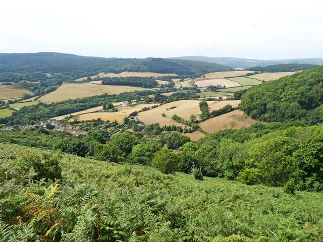
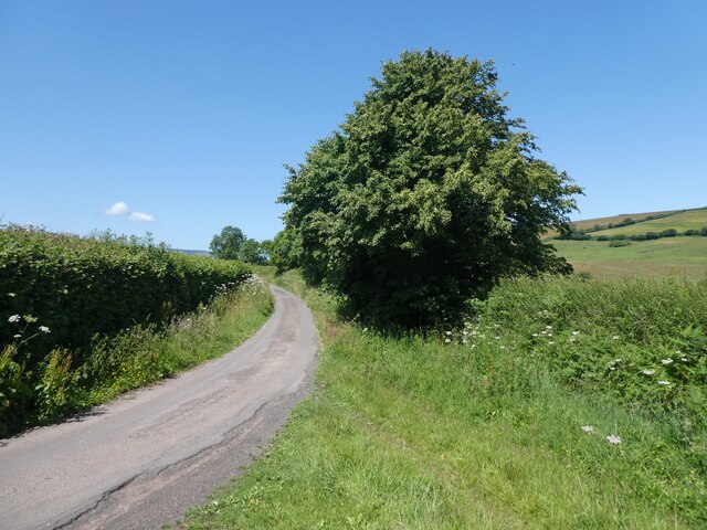
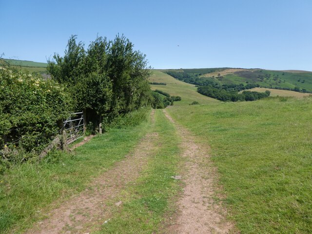
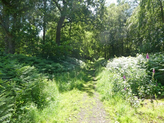
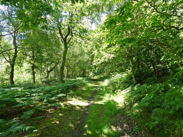
Selworthy Combe is a picturesque valley located in Somerset, England. Nestled within the Exmoor National Park, this stunning natural landscape is renowned for its outstanding beauty and idyllic charm. Selworthy Combe is situated near the village of Selworthy, just a few miles away from the coastal town of Minehead.

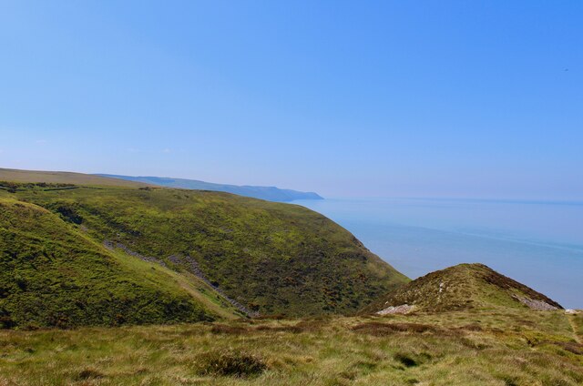
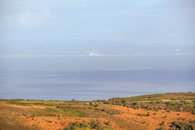
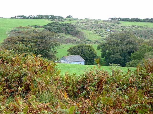
The valley is characterized by its lush greenery, rolling hills, and meandering streams. It is surrounded by dense woodland, which adds to its tranquil and secluded atmosphere. The valley is also home to a diverse range of wildlife, including deer, badgers, and a variety of bird species, making it a popular destination for nature enthusiasts and wildlife photographers.

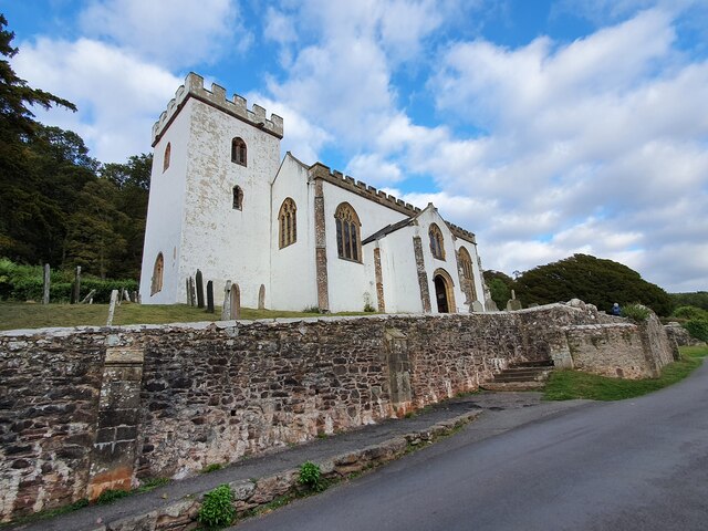
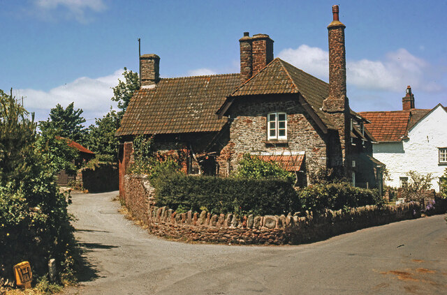
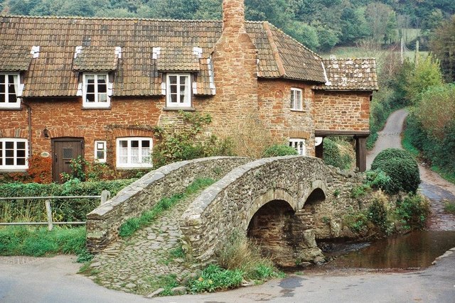
One of the prominent features of Selworthy Combe is the charming thatched-roof cottages that dot the landscape. These historic buildings give the valley a timeless and quintessentially English feel. The whitewashed cottages are maintained by the National Trust, and their picturesque appearance has made them a popular subject for artists and photographers.

Visitors to Selworthy Combe can enjoy a range of activities, such as hiking along the numerous trails that crisscross the valley. The area offers stunning panoramic views and is especially beautiful during spring when wildflowers carpet the meadows. There are also picnic spots and benches dotted throughout the valley, allowing visitors to fully immerse themselves in the peaceful surroundings.

Overall, Selworthy Combe is a gem of natural beauty in Somerset. Its scenic landscapes, charming cottages, and abundant wildlife make it a must-visit destination for those seeking tranquility and a connection with nature.

If you have any feedback on the listing, please let us know in the comments section below.

Selworthy Combe Images

Images are sourced within 2km of 51.213173/-3.5481736 or Grid Reference SS9147. Thanks to Geograph Open Source API. All images are credited.

All Saints' Church, Selworthy, Somerset All Saints' Church at Selworthy, Somerset. The Church also has an Ordnance Survey bench mark.
<a href="https://www.geograph.org.uk/photo/6999454">SS9146 : Ordnance Survey Bench Mark</a>
All Saints' Church, Selworthy, Somerset
All Saints' Church at Selworthy, Somerset. The Church also has an Ordnance Survey bench mark. SS9146 : Ordnance Survey Bench Mark
Ordnance Survey Bench Mark A very warn mark located at All Saints' Church, Selworthy. These marks were used by Ordnance Survey  for mapping purposes.
<a href="https://www.geograph.org.uk/photo/6999451">SS9146 : All Saints' Church, Selworthy, Somerset</a>
Ordnance Survey Bench Mark
A very warn mark located at All Saints' Church, Selworthy. These marks were used by Ordnance Survey for mapping purposes. SS9146 : All Saints' Church, Selworthy, Somerset
View towards Headon Cross
Allerford's packhorse bridge The bridge now only carries those on foot, other traffic takes the ford alongside.
Allerford's packhorse bridge
The bridge now only carries those on foot, other traffic takes the ford alongside.
South West Coast Path The South West Coast Path National Trail - 630 miles of superb coastal walking. From Minehead on the edge of the Exmoor National Park to the shores of Poole Harbour in Dorset. It is the longest of all Britain's National Trails.
Website: <span class="nowrap"><a title="http://www.southwestcoastpath.com/" rel="nofollow ugc noopener" href="http://www.southwestcoastpath.com/">Link</a><img style="margin-left:2px;" alt="External link" title="External link - shift click to open in new window" src="https://s1.geograph.org.uk/img/external.png" width="10" height="10"/></span>
South West Coast Path
The South West Coast Path National Trail - 630 miles of superb coastal walking. From Minehead on the edge of the Exmoor National Park to the shores of Poole Harbour in Dorset. It is the longest of all Britain's National Trails. Website: LinkExternal link
Allerford Post Office c.1970 Still the village Post Office to this day. Allerford, along with Bossington and Selworthy, is contained within the National Trust’s Holnicote Estate, which takes in over 12,000 acres of Exmoor coast and countryside.
Allerford Post Office c.1970
Still the village Post Office to this day. Allerford, along with Bossington and Selworthy, is contained within the National Trust’s Holnicote Estate, which takes in over 12,000 acres of Exmoor coast and countryside.
Ordnance Survey Rivet This OS rivet can be found on the small dam. It marks a point 246.639m above mean sea level.
Ordnance Survey Rivet
This OS rivet can be found on the small dam. It marks a point 246.639m above mean sea level.
Ordnance Survey Rivet This OS rivet can be found on the cattle grid. It marks a point 263.801m above mean sea level.
Ordnance Survey Rivet
This OS rivet can be found on the cattle grid. It marks a point 263.801m above mean sea level.
Back road to Selworthy
Track to Hindon Farm
Little Headon Plantation
Path, inside Little Headon Plantation
Track through Little Headon Plantation
Porlock : Bossington Hill Looking across to Bossington Hill and beyond to the Bristol Channel.
Porlock : Bossington Hill
Looking across to Bossington Hill and beyond to the Bristol Channel.
Allerford Chocolate box country. The packhorse bridge in Allerford.
Allerford
Chocolate box country. The packhorse bridge in Allerford.
Selworthy tea room A National Trust preserved "village".
Selworthy tea room
A National Trust preserved "village".
Exmoor A view across Exmoor from the parking area at the viewpoint in this grid square. Picture was taken looking west.
Exmoor
A view across Exmoor from the parking area at the viewpoint in this grid square. Picture was taken looking west.
Exmoor This view taken from the A39 was taken looking ESE towards Bratton Wood on the distant hill and Minehead to the southeast of the hill. The heather covered hill in the immediate foreground is in this square.
Exmoor
This view taken from the A39 was taken looking ESE towards Bratton Wood on the distant hill and Minehead to the southeast of the hill. The heather covered hill in the immediate foreground is in this square.
Show me another place!

Selworthy Combe is located at Grid Ref: SS9147 (Lat: 51.213173, Lng: -3.5481736)

Administrative County: Somerset

District: Somerset West and Taunton

Police Authority: Avon and Somerset

What 3 Words

///prank.puddles.recording. Near Porlock, Somerset

Related Wikis

Bury Castle, Selworthy

Bury Castle is an Iron Age hillfort near Selworthy, Somerset, England. It has been designated as a scheduled monument. == History == Bury Castle was built...

Selworthy

Selworthy is a small village and civil parish 5 kilometres (3 mi) from Minehead in Somerset, England. It is located in the National Trust's Holnicote Estate...

Selworthy Beacon

Selworthy Beacon is a hill and Marilyn of Exmoor in Somerset, England. It lies within the boundaries of Exmoor National Park, to the north of the village...

Holnicote Estate

Holnicote (pronounced "Hunnicutt") in the parish of Selworthy, West Somerset, England, is a historic estate consisting of 12,420 acres (5,026 hectares...
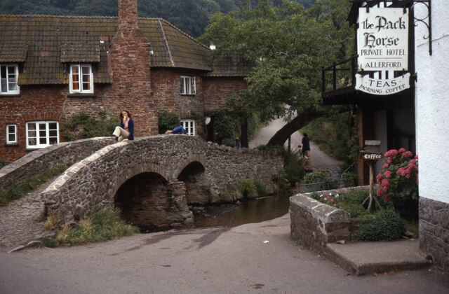
Allerford

Allerford is a village in the county of Somerset, England, located within Exmoor National Park, and is part of the parish of Selworthy in the district...

West Somerset Rural Life Museum and Victorian School

The West Somerset Rural Life Museum is a small museum in Allerford, Somerset, England. The building was built in 1821 as the village school and was closed...

East Myne

East Myne is a univallate Iron Age hill fort enclosure in the West Somerset district of Somerset, England. The hill fort is situated approximately 1.1...

Dovecot at Blackford Farm

The Dovecot At Blackford Farm in Selworthy on Exmoor within the English county of Somerset was probably built in the 11th century. It is a Grade II* listed...

Nearby Amenities

Located within 500m of 51.213173,-3.5481736
Selworthy War Memorial
Historic: memorial
Wikidata: Q66477960
Lat/Long: 51.2102814/-3.5484901
Cafe
Periwinkle Cottage
Lat/Long: 51.2102158/-3.5489049
Toilets
Lat/Long: 51.209665/-3.5500734
Post Box
Brand: Royal Mail
Brand Wikidata: Q638098
Brand Wikipedia: en:Royal Mail
Operator: Royal Mail
Operator Wikidata: Q638098
Post Box Type: wall
Ref: TA24 46
Royal Cypher: VR
Royal Cypher Wikidata: Q33102356
Source: GPS survey
Lat/Long: 51.2095215/-3.550289
Selworthy Farm
Tourism: guest_house
Lat/Long: 51.2093099/-3.5518356
The Tithe Barn
Building: yes
Lat/Long: 51.2095929/-3.5495288
Selworthy
Place: hamlet
Lat/Long: 51.2097215/-3.5490709
Tourism: viewpoint
Lat/Long: 51.2098513/-3.5478215
Bury Castle
Historic: archaeological_site
Wikidata: Q5001077
Wikipedia: en:Bury Castle, Selworthy
Lat/Long: 51.2133916/-3.5511635
Barrier: stile
Lat/Long: 51.2088797/-3.5488947
Barrier: stile
Lat/Long: 51.208711/-3.5480467
Bench
Lat/Long: 51.2105688/-3.5488898
Bench
Lat/Long: 51.2104394/-3.5532859
Bench
Lat/Long: 51.2130757/-3.5464356
Bicycle: no
Horse: no
Lat/Long: 51.2133483/-3.5516203
Hiking: yes
Information: route_marker
Source: GPS survey
Tourism: information
Lat/Long: 51.2150916/-3.5430157
Hiking: yes
Information: route_marker
Source: GPS survey
Tourism: information
Lat/Long: 51.2147169/-3.5444909
Hiking: yes
Information: route_marker
Source: GPS survey
Tourism: information
Lat/Long: 51.2144363/-3.5456362
Hiking: yes
Information: route_marker
Source: GPS survey
Tourism: information
Lat/Long: 51.2137155/-3.5480395
Hiking: yes
Information: guidepost
Source: GPS survey
Tourism: information
Lat/Long: 51.2135122/-3.5481066
Hiking: yes
Information: route_marker
Source: GPS survey
Tourism: information
Lat/Long: 51.2110112/-3.5482085
Hiking: yes
Information: guidepost
Source: GPS survey
Tourism: information
Lat/Long: 51.2106289/-3.5481776
Hiking: yes
Information: guidepost
Source: GPS survey
Tourism: information
Lat/Long: 51.2102441/-3.5483278
Hiking: yes
Information: guidepost
Source: GPS survey
Tourism: information
Lat/Long: 51.2097434/-3.548757
Ford: yes
Lat/Long: 51.2157141/-3.5490771
The data included in this document is from www.openstreetmap.org. The data is made available under ODbL.

Have you been to Selworthy Combe?

Leave your review of Selworthy Combe below (or comments, questions and feedback).