Selworthy Beacon

Hill, Mountain in Somerset Somerset West and Taunton

England

Selworthy Beacon

All Saints' Church, Selworthy, Somerset All Saints' Church at Selworthy, Somerset. The Church also has an Ordnance Survey bench mark.
<a href="https://www.geograph.org.uk/photo/6999454">SS9146 : Ordnance Survey Bench Mark</a>
All Saints' Church, Selworthy, Somerset Credit: V1ncenze

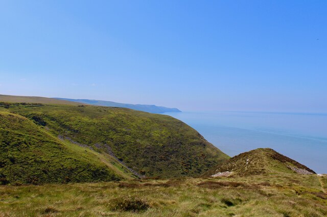
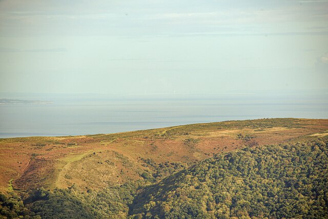
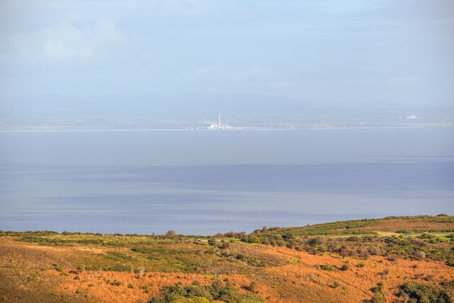
Selworthy Beacon is a prominent hill located in Somerset, England. Standing at an elevation of 308 meters (1,010 feet), it offers breathtaking views of the surrounding countryside and the Bristol Channel. The beacon is situated within the Exmoor National Park, which is renowned for its natural beauty and diverse wildlife.

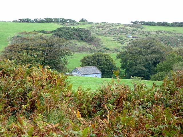
The hill is characterized by its rolling grassland, heather-covered slopes, and rocky outcrops. It is a popular destination for walkers and hikers, who are rewarded with stunning vistas from its summit. On clear days, it is possible to see as far as Wales and the Quantock Hills.

Selworthy Beacon is also significant historically. It was used as a beacon site during the Napoleonic Wars to warn of potential invasion. Today, the remnants of the beacon can still be seen, serving as a reminder of the area's past.

The hill is surrounded by an abundance of flora and fauna, including deer, sheep, and a variety of bird species. The diverse habitats found on Selworthy Beacon, such as heathland and woodland, support a wide range of plant life, including gorse, bracken, and bilberry.

Access to Selworthy Beacon is provided by footpaths and trails that wind through the picturesque countryside. Visitors can enjoy a leisurely stroll or a more challenging hike, taking in the natural beauty and tranquility of the area.

Overall, Selworthy Beacon offers a delightful blend of natural beauty, historical significance, and recreational opportunities, making it a must-visit destination for nature enthusiasts and history buffs alike.

If you have any feedback on the listing, please let us know in the comments section below.

Selworthy Beacon Images

Images are sourced within 2km of 51.220755/-3.5494734 or Grid Reference SS9147. Thanks to Geograph Open Source API. All images are credited.

All Saints' Church, Selworthy, Somerset All Saints' Church at Selworthy, Somerset. The Church also has an Ordnance Survey bench mark.
<a href="https://www.geograph.org.uk/photo/6999454">SS9146 : Ordnance Survey Bench Mark</a>
All Saints' Church, Selworthy, Somerset
All Saints' Church at Selworthy, Somerset. The Church also has an Ordnance Survey bench mark. SS9146 : Ordnance Survey Bench Mark
Ordnance Survey Bench Mark A very warn mark located at All Saints' Church, Selworthy. These marks were used by Ordnance Survey  for mapping purposes.
<a href="https://www.geograph.org.uk/photo/6999451">SS9146 : All Saints' Church, Selworthy, Somerset</a>
Ordnance Survey Bench Mark
A very warn mark located at All Saints' Church, Selworthy. These marks were used by Ordnance Survey for mapping purposes. SS9146 : All Saints' Church, Selworthy, Somerset
Allerford's packhorse bridge The bridge now only carries those on foot, other traffic takes the ford alongside.
Allerford's packhorse bridge
The bridge now only carries those on foot, other traffic takes the ford alongside.
South West Coast Path The South West Coast Path National Trail - 630 miles of superb coastal walking. From Minehead on the edge of the Exmoor National Park to the shores of Poole Harbour in Dorset. It is the longest of all Britain's National Trails.
Website: <span class="nowrap"><a title="http://www.southwestcoastpath.com/" rel="nofollow ugc noopener" href="http://www.southwestcoastpath.com/">Link</a><img style="margin-left:2px;" alt="External link" title="External link - shift click to open in new window" src="https://s1.geograph.org.uk/img/external.png" width="10" height="10"/></span>
South West Coast Path
The South West Coast Path National Trail - 630 miles of superb coastal walking. From Minehead on the edge of the Exmoor National Park to the shores of Poole Harbour in Dorset. It is the longest of all Britain's National Trails. Website: LinkExternal link
Allerford Post Office c.1970 Still the village Post Office to this day. Allerford, along with Bossington and Selworthy, is contained within the National Trust’s Holnicote Estate, which takes in over 12,000 acres of Exmoor coast and countryside.
Allerford Post Office c.1970
Still the village Post Office to this day. Allerford, along with Bossington and Selworthy, is contained within the National Trust’s Holnicote Estate, which takes in over 12,000 acres of Exmoor coast and countryside.
Ordnance Survey Rivet This OS rivet can be found on the small dam. It marks a point 246.639m above mean sea level.
Ordnance Survey Rivet
This OS rivet can be found on the small dam. It marks a point 246.639m above mean sea level.
Ordnance Survey Rivet This OS rivet can be found on the cattle grid. It marks a point 263.801m above mean sea level.
Ordnance Survey Rivet
This OS rivet can be found on the cattle grid. It marks a point 263.801m above mean sea level.
Luccombe : Bossington Hill Looking towards Bossington Hill and beyond to the Bristol Channel. The Prince of Wales Bridge and Severn Bridge can be seen in the very hazy distance.
Luccombe : Bossington Hill
Looking towards Bossington Hill and beyond to the Bristol Channel. The Prince of Wales Bridge and Severn Bridge can be seen in the very hazy distance.
Porlock : Bossington Hill Looking across to Bossington Hill and beyond to the Bristol Channel.
Porlock : Bossington Hill
Looking across to Bossington Hill and beyond to the Bristol Channel.
Bossington Green Bossington Hill rises behind the village.
Bossington Green
Bossington Hill rises behind the village.
Sheep at West Lynch The flat bottom of Porlock Vale with Bossington Hill rising behind.
Sheep at West Lynch
The flat bottom of Porlock Vale with Bossington Hill rising behind.
Bossington A small green in the village of Bossington.
Bossington
A small green in the village of Bossington.
Lane to Bossington
Lane to Bossington
Horner Water
Horner Water
Bossington Pumping Station
Stone built cottage, Bossington Bossington is a small village / hamlet north of the A39 near Porlock. There are no services in the settlement
Stone built cottage, Bossington
Bossington is a small village / hamlet north of the A39 near Porlock. There are no services in the settlement
Horner Water, Bossington
No 1, Bossington
No 1, Bossington
Show me another place!

Selworthy Beacon is located at Grid Ref: SS9147 (Lat: 51.220755, Lng: -3.5494734)

Administrative County: Somerset

District: Somerset West and Taunton

Police Authority: Avon and Somerset

What 3 Words

///clocks.clinic.toddler. Near Porlock, Somerset

Related Wikis

Selworthy Beacon

Selworthy Beacon is a hill and Marilyn of Exmoor in Somerset, England. It lies within the boundaries of Exmoor National Park, to the north of the village...

Bury Castle, Selworthy

Bury Castle is an Iron Age hillfort near Selworthy, Somerset, England. It has been designated as a scheduled monument. == History == Bury Castle was built...

East Myne

East Myne is a univallate Iron Age hill fort enclosure in the West Somerset district of Somerset, England. The hill fort is situated approximately 1.1...
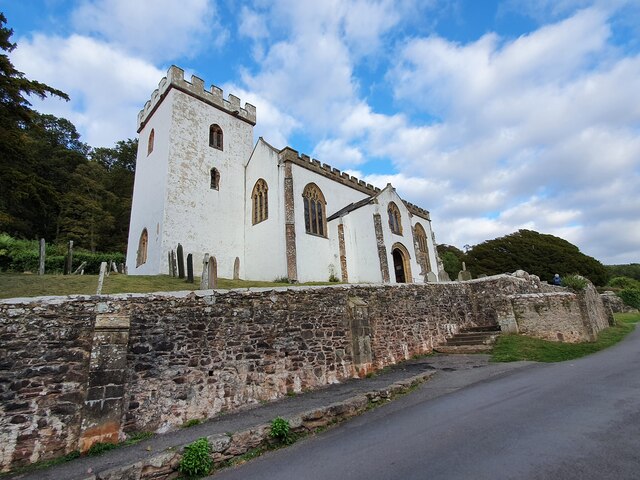
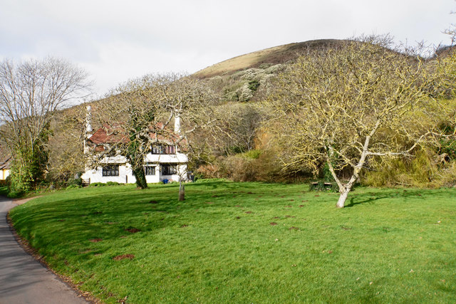
Selworthy

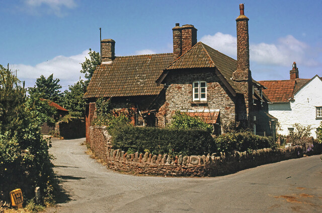
Selworthy is a small village and civil parish 5 kilometres (3 mi) from Minehead in Somerset, England. It is located in the National Trust's Holnicote Estate...
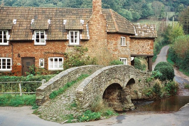
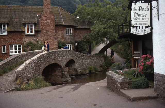
Allerford

Allerford is a village in the county of Somerset, England, located within Exmoor National Park, and is part of the parish of Selworthy in the district...

West Somerset Rural Life Museum and Victorian School

The West Somerset Rural Life Museum is a small museum in Allerford, Somerset, England. The building was built in 1821 as the village school and was closed...

Holnicote Estate

Holnicote (pronounced "Hunnicutt") in the parish of Selworthy, West Somerset, England, is a historic estate consisting of 12,420 acres (5,026 hectares...

Lynch Chapel Of Ease

The Anglican Lynch Chapel Of Ease in West Lynch, Selworthy, Somerset, England was built around 1530. It is a Grade II* listed building. == History == The...

Nearby Amenities

Located within 500m of 51.220755,-3.5494734
Natural: spring
Lat/Long: 51.2232505/-3.5529103
Natural: spring
Lat/Long: 51.2232908/-3.5531839
Selworthy Beacon
Ele: 308
Man Made: survey_point
Natural: peak
Wikidata: Q15275975
Wikipedia: en:Selworthy Beacon
Lat/Long: 51.220816/-3.5495047
Hiking: yes
Information: guidepost
Source: GPS survey
Tourism: information
Lat/Long: 51.2180435/-3.5548416
Man Made: cairn
Lat/Long: 51.2208137/-3.5495992
The data included in this document is from www.openstreetmap.org. The data is made available under ODbL.

Have you been to Selworthy Beacon?

Leave your review of Selworthy Beacon below (or comments, questions and feedback).