Blackadon Bottom
Valley in Devon South Hams
England
Blackadon Bottom
Blackadon Bottom is a picturesque valley located in Devon, England. Situated in the southern region of the Dartmoor National Park, this idyllic spot offers visitors a peaceful and captivating experience. The valley is surrounded by rolling hills and dense woodland, creating a stunning natural landscape that is a haven for nature enthusiasts.
The valley itself is traversed by a meandering river, which adds to the tranquility and charm of the area. The river is flanked by lush vegetation, including ferns, wildflowers, and towering ancient trees. This diverse ecosystem provides a habitat for various species of birds, small mammals, and insects, making it a fantastic destination for wildlife spotting.
Blackadon Bottom is also notable for its historical significance. The area is dotted with remnants of Bronze Age settlements, including stone circles and hut circles, indicating the presence of early human activity in the valley. These archaeological sites offer a glimpse into the rich cultural heritage of the region.
The valley is a popular destination for hikers and walkers, with numerous trails that wind through the surrounding hills and along the riverbank. The undulating terrain provides stunning vistas and opportunities for exploration, making it an ideal location for outdoor enthusiasts.
In summary, Blackadon Bottom is a captivating valley in Devon, offering a perfect blend of natural beauty and historical heritage. With its lush vegetation, diverse wildlife, and scenic trails, it is a must-visit destination for those seeking a peaceful and immersive experience in the heart of Dartmoor National Park.
If you have any feedback on the listing, please let us know in the comments section below.
Blackadon Bottom Images
Images are sourced within 2km of 50.399621/-3.8801657 or Grid Reference SX6657. Thanks to Geograph Open Source API. All images are credited.


Blackadon Bottom is located at Grid Ref: SX6657 (Lat: 50.399621, Lng: -3.8801657)
Administrative County: Devon
District: South Hams
Police Authority: Devon and Cornwall
What 3 Words
///messy.vital.manages. Near Ivybridge, Devon
Nearby Locations
Related Wikis
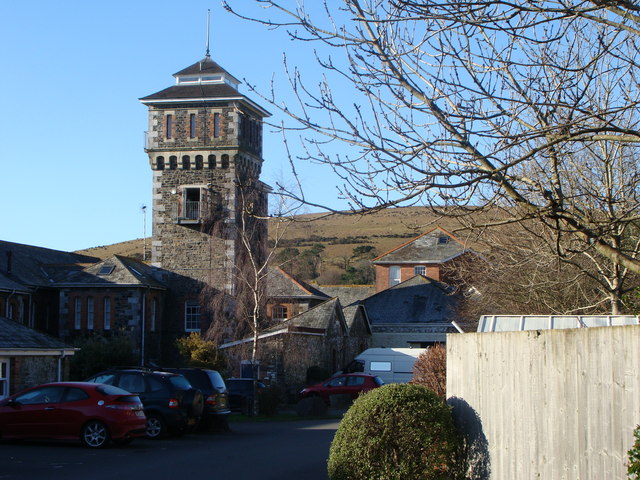
Moorhaven Hospital
Moorhaven Hospital, built as Plymouth Asylum and initially names the Plymouth Borough Asylum, was a mental health facility in Ivybridge, Devon, England...

Bittaford
Bittaford is a village about a mile from Ugborough village, in the civil parish of Ugborough, in the South Hams district, in the county of Devon, England...

Redlake Tramway
The Redlake Tramway was a railway built to carry supplies and workers between Bittaford and the clay workings at Redlake, near the centre of the southern...

Butterdon Hill
Butterdon Hill is on Dartmoor, in southwest England. The remains of a small stone circle and a stone row can be found on the summit. The name Butterdon...

Ivybridge railway station
Ivybridge railway station is situated on the Exeter to Plymouth line and serves the town of Ivybridge in Devon, England. It is 234 miles 27 chains (234...

Ugborough
Ugborough () is a village and civil parish in South Hams in the English county of Devon. It lies south of Dartmoor, 2 miles (3.2 km) from the A38 road...

Stowford House
Stowford House is a former manor house in the South Hams district of Devon. It is close to the village of Harford. The building was designated a Grade...

Ivybridge Community College
Ivybridge Community College is a state-funded secondary school and academy in Ivybridge, Devon, England. Located on the southern slopes of Dartmoor, it...
Nearby Amenities
Located within 500m of 50.399621,-3.8801657Have you been to Blackadon Bottom?
Leave your review of Blackadon Bottom below (or comments, questions and feedback).