Moorhaven Village

Settlement in Devon South Hams

England

Moorhaven Village

Ugborough : Parsonage Lane Looking along the lane off the A3121.
Ugborough : Parsonage Lane Credit: Lewis Clarke

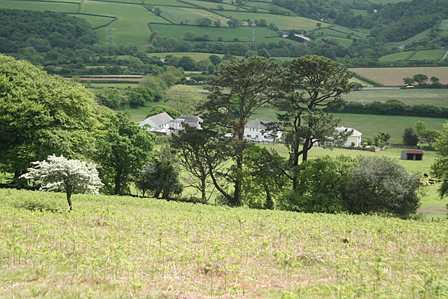
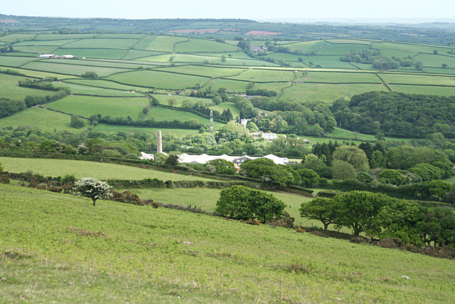
Moorhaven Village is a picturesque residential area located in the county of Devon, in southwestern England. Situated approximately 6 miles from the bustling town of Ivybridge, this tranquil village offers a peaceful retreat amidst the beautiful countryside of Dartmoor National Park.

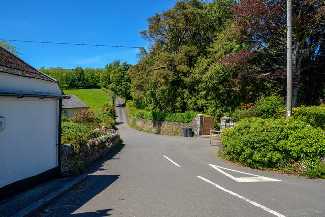
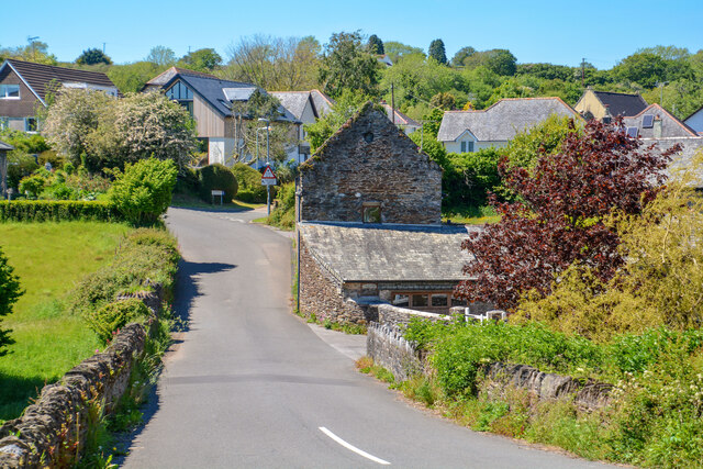
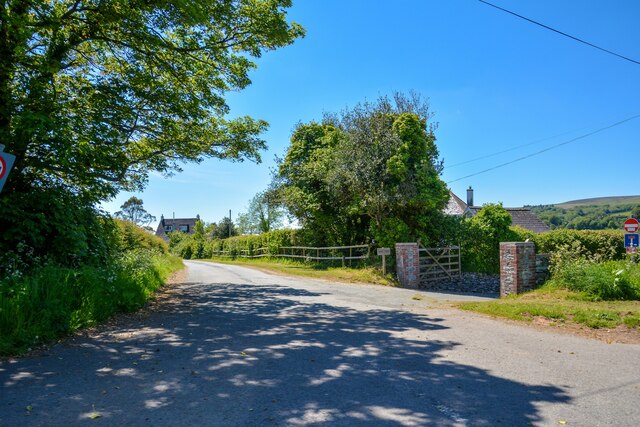
The village is known for its charming character, with a collection of well-preserved historic buildings dating back to the 17th and 18th centuries. These traditional stone cottages and farmhouses lend a sense of old-world charm to the area, creating an idyllic and timeless atmosphere.

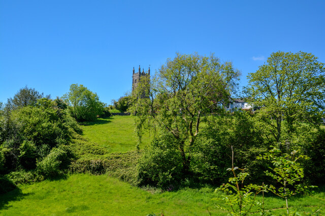
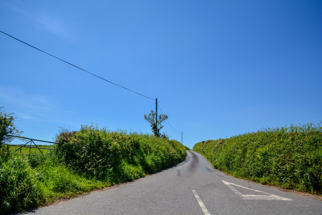
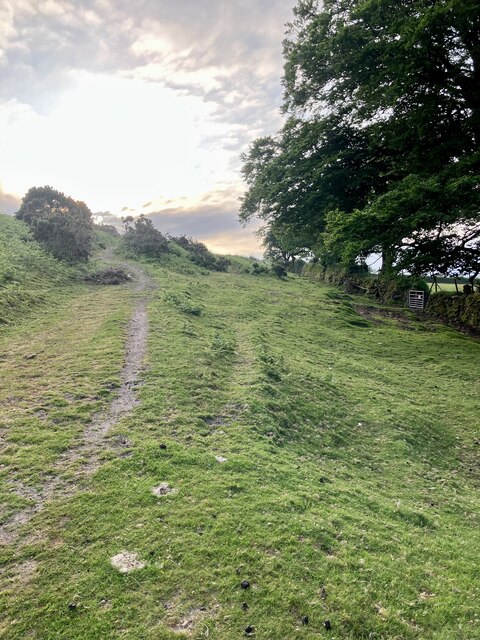
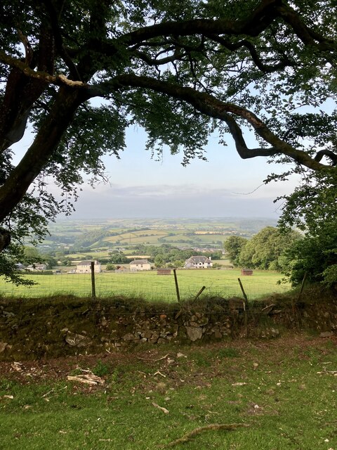
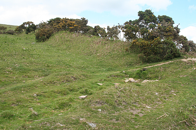
Surrounded by lush green fields and rolling hills, Moorhaven Village is a paradise for nature lovers and outdoor enthusiasts. Numerous walking trails and footpaths crisscross the countryside, inviting residents and visitors to explore the stunning landscapes and enjoy breathtaking views. Dartmoor National Park, with its rugged tors and vast moorlands, is just a stone's throw away from the village, offering endless opportunities for hiking, cycling, and wildlife spotting.

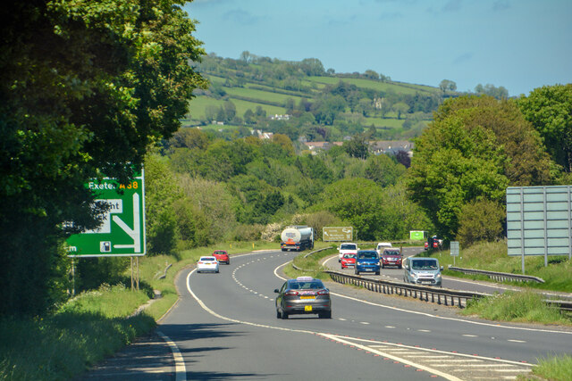
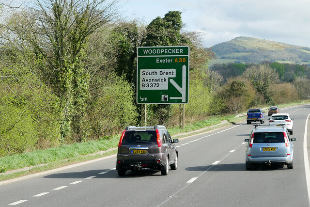
Despite its rural setting, Moorhaven Village is well-connected to nearby towns and cities. The A38 road provides easy access to Plymouth, located approximately 15 miles to the southwest, and Exeter, situated about 30 miles to the northeast. This convenient transport links ensure that residents can enjoy the tranquility of village life while still having access to modern amenities and urban facilities.

With its enchanting countryside, historic charm, and convenient location, Moorhaven Village offers a unique blend of rural serenity and accessibility, making it an ideal place to live or visit for those seeking a peaceful escape in the heart of Devon.

If you have any feedback on the listing, please let us know in the comments section below.

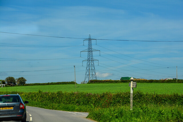
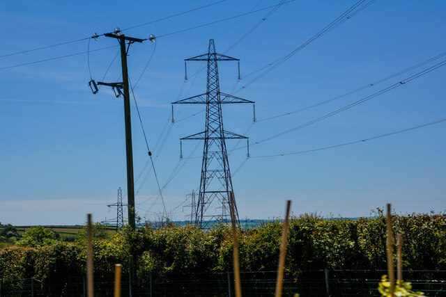
Moorhaven Village Images

Images are sourced within 2km of 50.400236/-3.8732669 or Grid Reference SX6657. Thanks to Geograph Open Source API. All images are credited.

Ugborough : Parsonage Lane Looking along the lane off the A3121.
Ugborough : Parsonage Lane
Looking along the lane off the A3121.
Ugborough : Grassy Field Looking across the fields.
Ugborough : Grassy Field
Looking across the fields.
Ugborough : Road A road off the A3121.
Ugborough : Road
A road off the A3121.
Ugborough : Venn Cross A road heads off the A3121.
Ugborough : Venn Cross
A road heads off the A3121.
Ugborough : The A3121 Approaching Sign of the Owl Cross.
Ugborough : The A3121
Approaching Sign of the Owl Cross.
Ugborough : Pylon Pylons head through the countryside.
Ugborough : Pylon
Pylons head through the countryside.
Ugborough : Road A road off the A3121.
Ugborough : Road
A road off the A3121.
Ugborough : Devon Expressway A38 Looking along the A38.
Ugborough : Devon Expressway A38
Looking along the A38.
Layby on the Devon Expressway (A38) west of Ivybridge The A38 is a major A-class trunk route. When first designated in 1922, it ran from Derby to Plymouth but it was later extended at both ends so that it now runs for 292 miles from Mansfield in Nottinghamshire to Bodmin in Cornwall.

Prior to the opening of the M5 motorway in the 1960s and 1970s, the A38 formed the main "holiday route" from the Midlands to Somerset, Devon and Cornwall and the south-western section was notorious at holiday times for the congestion. Nowadays, for most of the southern section, the A38 is a fairly quiet road shadowing the M5 extremely closely; often running alongside the motorway as a single carriageway road. The section between Exeter and Plymouth is, however, a busy dual carriageway which serves as the southern extension of the M5 and is known as “the Devon Expressway”.

More information at <span class="nowrap"><a title="http://en.wikipedia.org/wiki/A38_road" rel="nofollow ugc noopener" href="http://en.wikipedia.org/wiki/A38_road">Link</a><img style="margin-left:2px;" alt="External link" title="External link - shift click to open in new window" src="https://s1.geograph.org.uk/img/external.png" width="10" height="10"/></span>  (Wikipedia) and <span class="nowrap"><a title="http://www.sabre-roads.org.uk/wiki/index.php?title=A38" rel="nofollow ugc noopener" href="http://www.sabre-roads.org.uk/wiki/index.php?title=A38">Link</a><img style="margin-left:2px;" alt="External link" title="External link - shift click to open in new window" src="https://s1.geograph.org.uk/img/external.png" width="10" height="10"/></span>  (SABRE).
Layby on the Devon Expressway (A38) west of Ivybridge
The A38 is a major A-class trunk route. When first designated in 1922, it ran from Derby to Plymouth but it was later extended at both ends so that it now runs for 292 miles from Mansfield in Nottinghamshire to Bodmin in Cornwall. Prior to the opening of the M5 motorway in the 1960s and 1970s, the A38 formed the main "holiday route" from the Midlands to Somerset, Devon and Cornwall and the south-western section was notorious at holiday times for the congestion. Nowadays, for most of the southern section, the A38 is a fairly quiet road shadowing the M5 extremely closely; often running alongside the motorway as a single carriageway road. The section between Exeter and Plymouth is, however, a busy dual carriageway which serves as the southern extension of the M5 and is known as “the Devon Expressway”. More information at LinkExternal link (Wikipedia) and LinkExternal link (SABRE).
Devon Expressway, Bridge at Wrangaton Cross Junction The A38 is a major A-class trunk route. When first designated in 1922, it ran from Derby to Plymouth but it was later extended at both ends so that it now runs for 292 miles from Mansfield in Nottinghamshire to Bodmin in Cornwall.

Prior to the opening of the M5 motorway in the 1960s and 1970s, the A38 formed the main "holiday route" from the Midlands to Somerset, Devon and Cornwall and the south-western section was notorious at holiday times for the congestion. Nowadays, for most of the southern section, the A38 is a fairly quiet road shadowing the M5 extremely closely; often running alongside the motorway as a single carriageway road. The section between Exeter and Plymouth is, however, a busy dual carriageway which serves as the southern extension of the M5 and is known as “the Devon Expressway”.

More information at <span class="nowrap"><a title="http://en.wikipedia.org/wiki/A38_road" rel="nofollow ugc noopener" href="http://en.wikipedia.org/wiki/A38_road">Link</a><img style="margin-left:2px;" alt="External link" title="External link - shift click to open in new window" src="https://s1.geograph.org.uk/img/external.png" width="10" height="10"/></span>  (Wikipedia) and <span class="nowrap"><a title="http://www.sabre-roads.org.uk/wiki/index.php?title=A38" rel="nofollow ugc noopener" href="http://www.sabre-roads.org.uk/wiki/index.php?title=A38">Link</a><img style="margin-left:2px;" alt="External link" title="External link - shift click to open in new window" src="https://s1.geograph.org.uk/img/external.png" width="10" height="10"/></span>  (SABRE).
Devon Expressway, Bridge at Wrangaton Cross Junction
The A38 is a major A-class trunk route. When first designated in 1922, it ran from Derby to Plymouth but it was later extended at both ends so that it now runs for 292 miles from Mansfield in Nottinghamshire to Bodmin in Cornwall. Prior to the opening of the M5 motorway in the 1960s and 1970s, the A38 formed the main "holiday route" from the Midlands to Somerset, Devon and Cornwall and the south-western section was notorious at holiday times for the congestion. Nowadays, for most of the southern section, the A38 is a fairly quiet road shadowing the M5 extremely closely; often running alongside the motorway as a single carriageway road. The section between Exeter and Plymouth is, however, a busy dual carriageway which serves as the southern extension of the M5 and is known as “the Devon Expressway”. More information at LinkExternal link (Wikipedia) and LinkExternal link (SABRE).
Layby on the A38 near Wrangaton Business Park The A38 is a major A-class trunk route. When first designated in 1922, it ran from Derby to Plymouth but it was later extended at both ends so that it now runs for 292 miles from Mansfield in Nottinghamshire to Bodmin in Cornwall.

Prior to the opening of the M5 motorway in the 1960s and 1970s, the A38 formed the main "holiday route" from the Midlands to Somerset, Devon and Cornwall and the south-western section was notorious at holiday times for the congestion. Nowadays, for most of the southern section, the A38 is a fairly quiet road shadowing the M5 extremely closely; often running alongside the motorway as a single carriageway road. The section between Exeter and Plymouth is, however, a busy dual carriageway which serves as the southern extension of the M5 and is known as “the Devon Expressway”.

More information at <span class="nowrap"><a title="http://en.wikipedia.org/wiki/A38_road" rel="nofollow ugc noopener" href="http://en.wikipedia.org/wiki/A38_road">Link</a><img style="margin-left:2px;" alt="External link" title="External link - shift click to open in new window" src="https://s1.geograph.org.uk/img/external.png" width="10" height="10"/></span>  (Wikipedia) and <span class="nowrap"><a title="http://www.sabre-roads.org.uk/wiki/index.php?title=A38" rel="nofollow ugc noopener" href="http://www.sabre-roads.org.uk/wiki/index.php?title=A38">Link</a><img style="margin-left:2px;" alt="External link" title="External link - shift click to open in new window" src="https://s1.geograph.org.uk/img/external.png" width="10" height="10"/></span>  (SABRE).
Layby on the A38 near Wrangaton Business Park
The A38 is a major A-class trunk route. When first designated in 1922, it ran from Derby to Plymouth but it was later extended at both ends so that it now runs for 292 miles from Mansfield in Nottinghamshire to Bodmin in Cornwall. Prior to the opening of the M5 motorway in the 1960s and 1970s, the A38 formed the main "holiday route" from the Midlands to Somerset, Devon and Cornwall and the south-western section was notorious at holiday times for the congestion. Nowadays, for most of the southern section, the A38 is a fairly quiet road shadowing the M5 extremely closely; often running alongside the motorway as a single carriageway road. The section between Exeter and Plymouth is, however, a busy dual carriageway which serves as the southern extension of the M5 and is known as “the Devon Expressway”. More information at LinkExternal link (Wikipedia) and LinkExternal link (SABRE).
Devon Expressway, Layby near Torpeek The A38 is a major A-class trunk route. When first designated in 1922, it ran from Derby to Plymouth but it was later extended at both ends so that it now runs for 292 miles from Mansfield in Nottinghamshire to Bodmin in Cornwall.

Prior to the opening of the M5 motorway in the 1960s and 1970s, the A38 formed the main "holiday route" from the Midlands to Somerset, Devon and Cornwall and the south-western section was notorious at holiday times for the congestion. Nowadays, for most of the southern section, the A38 is a fairly quiet road shadowing the M5 extremely closely; often running alongside the motorway as a single carriageway road. The section between Exeter and Plymouth is, however, a busy dual carriageway which serves as the southern extension of the M5 and is known as “the Devon Expressway”.

More information at <span class="nowrap"><a title="http://en.wikipedia.org/wiki/A38_road" rel="nofollow ugc noopener" href="http://en.wikipedia.org/wiki/A38_road">Link</a><img style="margin-left:2px;" alt="External link" title="External link - shift click to open in new window" src="https://s1.geograph.org.uk/img/external.png" width="10" height="10"/></span>  (Wikipedia) and <span class="nowrap"><a title="http://www.sabre-roads.org.uk/wiki/index.php?title=A38" rel="nofollow ugc noopener" href="http://www.sabre-roads.org.uk/wiki/index.php?title=A38">Link</a><img style="margin-left:2px;" alt="External link" title="External link - shift click to open in new window" src="https://s1.geograph.org.uk/img/external.png" width="10" height="10"/></span>  (SABRE).
Devon Expressway, Layby near Torpeek
The A38 is a major A-class trunk route. When first designated in 1922, it ran from Derby to Plymouth but it was later extended at both ends so that it now runs for 292 miles from Mansfield in Nottinghamshire to Bodmin in Cornwall. Prior to the opening of the M5 motorway in the 1960s and 1970s, the A38 formed the main "holiday route" from the Midlands to Somerset, Devon and Cornwall and the south-western section was notorious at holiday times for the congestion. Nowadays, for most of the southern section, the A38 is a fairly quiet road shadowing the M5 extremely closely; often running alongside the motorway as a single carriageway road. The section between Exeter and Plymouth is, however, a busy dual carriageway which serves as the southern extension of the M5 and is known as “the Devon Expressway”. More information at LinkExternal link (Wikipedia) and LinkExternal link (SABRE).
Devon Expressway approaching Woodpecker Interchange The A38 is a major A-class trunk route. When first designated in 1922, it ran from Derby to Plymouth but it was later extended at both ends so that it now runs for 292 miles from Mansfield in Nottinghamshire to Bodmin in Cornwall.

Prior to the opening of the M5 motorway in the 1960s and 1970s, the A38 formed the main "holiday route" from the Midlands to Somerset, Devon and Cornwall and the south-western section was notorious at holiday times for the congestion. Nowadays, for most of the southern section, the A38 is a fairly quiet road shadowing the M5 extremely closely; often running alongside the motorway as a single carriageway road. The section between Exeter and Plymouth is, however, a busy dual carriageway which serves as the southern extension of the M5 and is known as “the Devon Expressway”.

More information at <span class="nowrap"><a title="http://en.wikipedia.org/wiki/A38_road" rel="nofollow ugc noopener" href="http://en.wikipedia.org/wiki/A38_road">Link</a><img style="margin-left:2px;" alt="External link" title="External link - shift click to open in new window" src="https://s1.geograph.org.uk/img/external.png" width="10" height="10"/></span>  (Wikipedia) and <span class="nowrap"><a title="http://www.sabre-roads.org.uk/wiki/index.php?title=A38" rel="nofollow ugc noopener" href="http://www.sabre-roads.org.uk/wiki/index.php?title=A38">Link</a><img style="margin-left:2px;" alt="External link" title="External link - shift click to open in new window" src="https://s1.geograph.org.uk/img/external.png" width="10" height="10"/></span>  (SABRE).
Devon Expressway approaching Woodpecker Interchange
The A38 is a major A-class trunk route. When first designated in 1922, it ran from Derby to Plymouth but it was later extended at both ends so that it now runs for 292 miles from Mansfield in Nottinghamshire to Bodmin in Cornwall. Prior to the opening of the M5 motorway in the 1960s and 1970s, the A38 formed the main "holiday route" from the Midlands to Somerset, Devon and Cornwall and the south-western section was notorious at holiday times for the congestion. Nowadays, for most of the southern section, the A38 is a fairly quiet road shadowing the M5 extremely closely; often running alongside the motorway as a single carriageway road. The section between Exeter and Plymouth is, however, a busy dual carriageway which serves as the southern extension of the M5 and is known as “the Devon Expressway”. More information at LinkExternal link (Wikipedia) and LinkExternal link (SABRE).
Path On the lower slopes of Weston Beacon.
Path
On the lower slopes of Weston Beacon.
View South From the lower slopes of Weston Beacon.  The farmland around the edge of the moor outside of the wall is known as the In-Country. A name going back hundreds of years. The buildings in the middle ground are all part of Moorhedge Farm.
View South
From the lower slopes of Weston Beacon. The farmland around the edge of the moor outside of the wall is known as the In-Country. A name going back hundreds of years. The buildings in the middle ground are all part of Moorhedge Farm.
Ugborough: top of Cantrell inclined plane A gorse-grown embankment. All that remains of the inclined plane serving the Redlake tramway. Below the abutments of an overbridge just behind the camera the plane descended to a siding alongside the Exeter-Plymouth main line railway. This has now been ploughed out. The plane and railway provided the link to a china clay quarry seven miles away on the moor at Redlake. This was an early twentieth century venture, closing in about 1931
Ugborough: top of Cantrell inclined plane
A gorse-grown embankment. All that remains of the inclined plane serving the Redlake tramway. Below the abutments of an overbridge just behind the camera the plane descended to a siding alongside the Exeter-Plymouth main line railway. This has now been ploughed out. The plane and railway provided the link to a china clay quarry seven miles away on the moor at Redlake. This was an early twentieth century venture, closing in about 1931
Ugborough: Moorhedge Seen from a point near the formation of the Redlake tramway. The Exeter-Plymouth railway is hidden by trees. The B3213 road runs parallel beyond. Further away, and entirely hidden is the A38 Plymouth Expressway
Ugborough: Moorhedge
Seen from a point near the formation of the Redlake tramway. The Exeter-Plymouth railway is hidden by trees. The B3213 road runs parallel beyond. Further away, and entirely hidden is the A38 Plymouth Expressway
Ugborough: Cantrell dries The china clay dries at Cantrell, alongside the Exeter-Plymouth railway. These ceased processing china clay from Redlake, on the moor, in the 1930s. The site has been adapted for other uses but retains its old stack or chimney
Ugborough: Cantrell dries
The china clay dries at Cantrell, alongside the Exeter-Plymouth railway. These ceased processing china clay from Redlake, on the moor, in the 1930s. The site has been adapted for other uses but retains its old stack or chimney
Show me another place!

Moorhaven Village is located at Grid Ref: SX6657 (Lat: 50.400236, Lng: -3.8732669)

Administrative County: Devon

District: South Hams

Police Authority: Devon and Cornwall

What 3 Words

///powers.crafts.laces. Near Ivybridge, Devon

Related Wikis

Bittaford

Bittaford is a village about a mile from Ugborough village, in the civil parish of Ugborough, in the South Hams district, in the county of Devon, England...
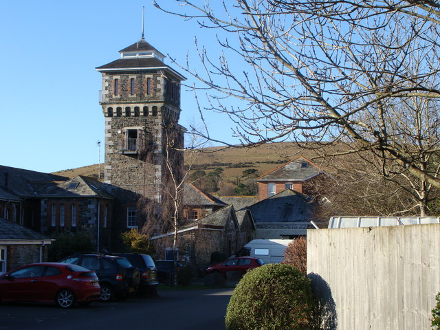
Moorhaven Hospital

Moorhaven Hospital, built as Plymouth Asylum and initially names the Plymouth Borough Asylum, was a mental health facility in Ivybridge, Devon, England...

Redlake Tramway

The Redlake Tramway was a railway built to carry supplies and workers between Bittaford and the clay workings at Redlake, near the centre of the southern...

Ugborough

Ugborough () is a village and civil parish in South Hams in the English county of Devon. It lies south of Dartmoor, 2 miles (3.2 km) from the A38 road...

Related Videos

Walk Meditate Create recap of 2022

Walking up Western Beacon every month has been fascinating to watch the changing scenery as the seasons changed.

Trekking Dartmoor 1

Okolice noclegu.

The Roost - The Cottages at Blackadon Farm

Two bedroom cottage, sleeps up to four. Luxury self catering holiday cottage accommodation in Dartmoor National Park, Devon, ...

Around the Farm - The Cottages at Blackadon Farm

Our luxury self catering holiday cottage accommodation is surrounded by lovely grounds and communal areas. Take a look at our ...

Nearby Amenities

Located within 500m of 50.400236,-3.8732669
Leigh Cross
Junction: yes
Lat/Long: 50.4017127/-3.8697608
Bittaford
Place: village
Source: OS_OpenData_StreetView
Lat/Long: 50.3981395/-3.8791343
Moorhaven Village
Place: village
Population: 400
Source: OS_OpenData_StreetView
Website: http://moorhaven.org.uk/
Lat/Long: 50.4020507/-3.8767211
Seamark Type: gate
Waterway: lock_gate
Lat/Long: 50.4032956/-3.8733106
Generator Method: photovoltaic
Generator Output Electricity: yes
Generator Source: solar
Generator Type: solar_photovoltaic_panel
Location: roof
Power: generator
Lat/Long: 50.4017126/-3.8735813
Generator Method: photovoltaic
Generator Output Electricity: yes
Generator Source: solar
Generator Type: solar_photovoltaic_panel
Location: roof
Power: generator
Lat/Long: 50.4017724/-3.8731683
Generator Method: photovoltaic
Generator Output Electricity: yes
Generator Source: solar
Generator Type: solar_photovoltaic_panel
Location: roof
Power: generator
Lat/Long: 50.4005243/-3.87485
Generator Method: photovoltaic
Generator Output Electricity: yes
Generator Source: solar
Generator Type: solar_photovoltaic_panel
Location: roof
Power: generator
Lat/Long: 50.3986796/-3.87669
Generator Method: photovoltaic
Generator Output Electricity: yes
Generator Source: solar
Generator Type: solar_photovoltaic_panel
Location: roof
Power: generator
Lat/Long: 50.3984761/-3.8769797
Generator Method: photovoltaic
Generator Output Electricity: yes
Generator Source: solar
Generator Type: solar_photovoltaic_panel
Location: roof
Power: generator
Lat/Long: 50.3984419/-3.8767892
Generator Method: photovoltaic
Generator Output Electricity: yes
Generator Source: solar
Generator Type: solar_photovoltaic_panel
Location: roof
Power: generator
Lat/Long: 50.3980127/-3.8760986
Generator Method: photovoltaic
Generator Output Electricity: yes
Generator Source: solar
Generator Type: solar_photovoltaic_panel
Location: roof
Power: generator
Lat/Long: 50.3980025/-3.8757284
Generator Method: photovoltaic
Generator Output Electricity: yes
Generator Source: solar
Generator Type: solar_photovoltaic_panel
Location: roof
Power: generator
Lat/Long: 50.3990217/-3.8690758
Generator Method: photovoltaic
Generator Output Electricity: yes
Generator Source: solar
Generator Type: solar_photovoltaic_panel
Location: roof
Power: generator
Lat/Long: 50.3975377/-3.8726431
Generator Method: photovoltaic
Generator Output Electricity: yes
Generator Source: solar
Generator Type: solar_photovoltaic_panel
Location: roof
Power: generator
Lat/Long: 50.3975009/-3.8727437
Generator Method: photovoltaic
Generator Output Electricity: yes
Generator Source: solar
Generator Type: solar_photovoltaic_panel
Location: roof
Power: generator
Lat/Long: 50.3969743/-3.8771117
Generator Method: photovoltaic
Generator Output Electricity: yes
Generator Source: solar
Generator Type: solar_photovoltaic_panel
Location: roof
Power: generator
Lat/Long: 50.4021855/-3.8719095
Generator Method: photovoltaic
Generator Output Electricity: yes
Generator Source: solar
Generator Type: solar_photovoltaic_panel
Location: roof
Power: generator
Lat/Long: 50.402147/-3.8720141
Generator Method: photovoltaic
Generator Output Electricity: yes
Generator Source: solar
Generator Type: solar_photovoltaic_panel
Location: roof
Power: generator
Lat/Long: 50.4020616/-3.8721241
Generator Method: photovoltaic
Generator Output Electricity: yes
Generator Source: solar
Generator Type: solar_photovoltaic_panel
Location: roof
Power: generator
Lat/Long: 50.4020427/-3.8720664
Generator Method: photovoltaic
Generator Output Electricity: yes
Generator Source: solar
Generator Type: solar_photovoltaic_panel
Location: roof
Power: generator
Lat/Long: 50.4020522/-3.8722059
Generator Method: photovoltaic
Generator Output Electricity: yes
Generator Source: solar
Generator Type: solar_photovoltaic_panel
Location: roof
Power: generator
Lat/Long: 50.4004117/-3.879704
Generator Method: photovoltaic
Generator Output Electricity: yes
Generator Source: solar
Generator Type: solar_photovoltaic_panel
Location: roof
Power: generator
Lat/Long: 50.4004177/-3.8794908
Generator Method: photovoltaic
Generator Output Electricity: yes
Generator Source: solar
Generator Type: solar_photovoltaic_panel
Location: roof
Power: generator
Lat/Long: 50.4002878/-3.8786164
Generator Method: photovoltaic
Generator Output Electricity: yes
Generator Source: solar
Generator Type: solar_photovoltaic_panel
Location: roof
Power: generator
Lat/Long: 50.397848/-3.8775542
Generator Method: photovoltaic
Generator Output Electricity: yes
Generator Source: solar
Generator Type: solar_photovoltaic_panel
Location: roof
Power: generator
Lat/Long: 50.3996402/-3.8745938
Generator Method: photovoltaic
Generator Output Electricity: yes
Generator Source: solar
Generator Type: solar_photovoltaic_panel
Location: roof
Power: generator
Lat/Long: 50.3994526/-3.87499
Generator Method: photovoltaic
Generator Output Electricity: yes
Generator Source: solar
Generator Type: solar_photovoltaic_panel
Location: roof
Power: generator
Lat/Long: 50.3993979/-3.8751657
Generator Method: photovoltaic
Generator Output Electricity: yes
Generator Source: solar
Generator Type: solar_photovoltaic_panel
Location: roof
Power: generator
Lat/Long: 50.3993036/-3.8753241
Public Bookcase
Booth: K6
Disused Amenity: telephone
Man Made: telephone_box
Public Bookcase Type: phone_box
Lat/Long: 50.3972052/-3.8771555
Shelter
Shelter Type: public_transport
Lat/Long: 50.3971658/-3.8770851
Post Box
Brand: Royal Mail
Brand Wikidata: Q638098
Brand Wikipedia: en:Royal Mail
Collection Times: Mo-Fr 15:30; Sa 10:00; Su off
Drive Through: no
Operator: Royal Mail
Operator Wikidata: Q638098
Post Box Design: 2010_pattern
Post Box Mounting: pier
Post Box Type: lamp
Ref: PL21 665
Royal Cypher: EIIR
Royal Cypher Wikidata: Q33102113
Source: survey;streetlevel imagery;aerial imagery
Lat/Long: 50.3971257/-3.8770133
Post Box
Brand: Royal Mail
Brand Wikidata: Q638098
Brand Wikipedia: en:Royal Mail
Collection Times: Mo-Fr 10:00; Sa 10:30; Su off
Drive Through: no
Operator: Royal Mail
Operator Wikidata: Q638098
Post Box Mounting: pier
Post Box Type: lamp
Ref: PL21 476
Royal Cypher: EIIR
Royal Cypher Wikidata: Q33102113
Source: survey;streetlevel imagery
Lat/Long: 50.3987161/-3.877192
Post Box
Brand: Royal Mail
Brand Wikidata: Q638098
Brand Wikipedia: en:Royal Mail
Collection Times: Mo-Fr 10:00; Sa 10:15; Su off
Drive Through: no
Operator: Royal Mail
Operator Wikidata: Q638098
Post Box Mounting: pier
Post Box Type: lamp
Ref: PL21 512
Royal Cypher: EIIR
Royal Cypher Wikidata: Q33102113
Source: survey;streetlevel imagery;aerial imagery
Lat/Long: 50.4021848/-3.8755501
The data included in this document is from www.openstreetmap.org. The data is made available under ODbL.

Have you been to Moorhaven Village?

Leave your review of Moorhaven Village below (or comments, questions and feedback).