Nant Rhaeadr

Valley in Caernarfonshire

Wales

Nant Rhaeadr

Afon Rhaeadr-bach Falls
Afon Rhaeadr-bach Falls Credit: Row17

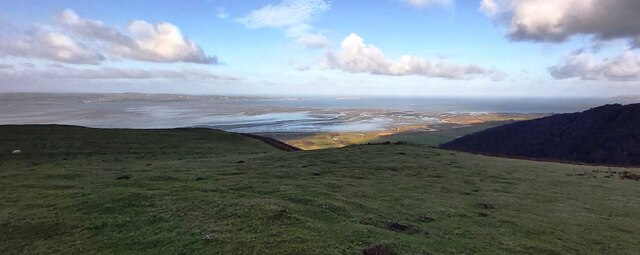
Nant Rhaeadr is a picturesque valley located in Caernarfonshire, a county in northwest Wales. Surrounded by the stunning Snowdonia National Park, this valley is known for its breathtaking natural beauty and tranquil atmosphere.

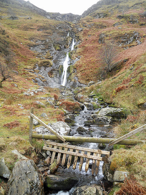
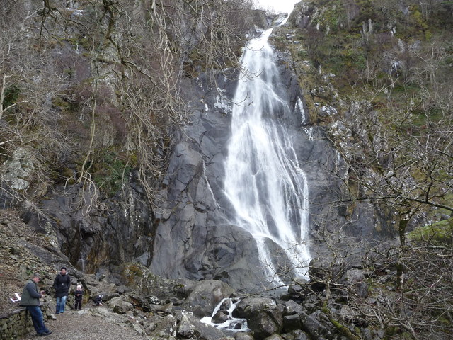
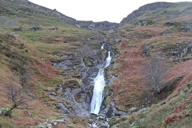
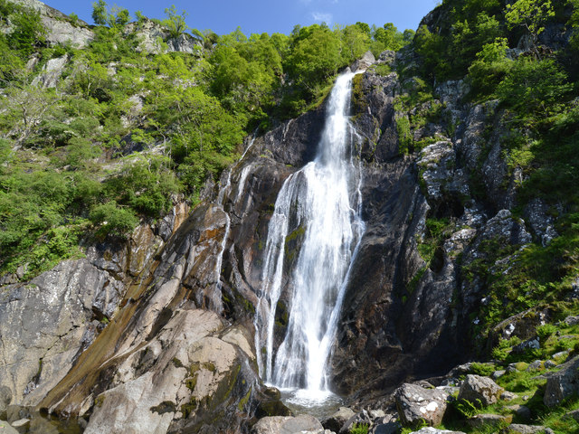
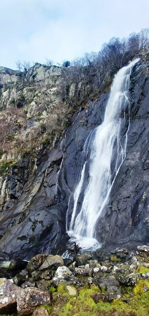
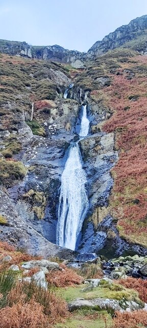
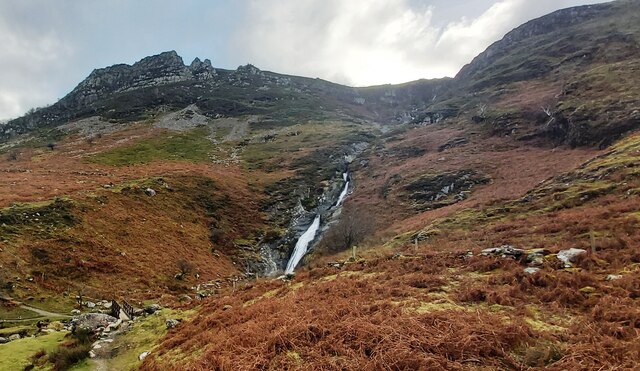
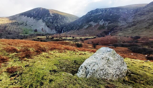
The valley is nestled between the towering mountains of Snowdonia, with the River Rhaeadr flowing through it. The river adds to the charm of Nant Rhaeadr, as it meanders through the valley, creating small waterfalls and cascades along its course.

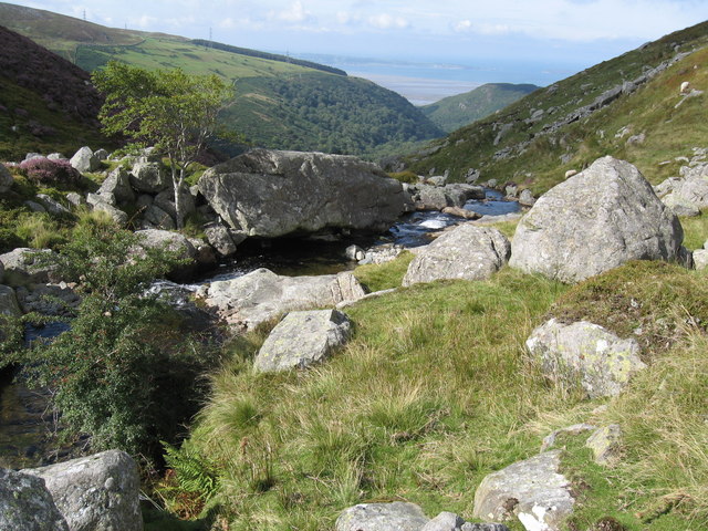
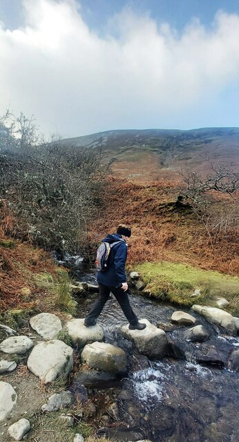
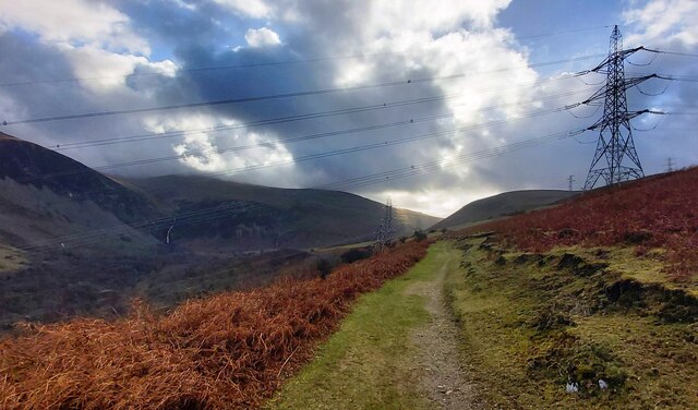
The landscape of Nant Rhaeadr is characterized by lush greenery, rolling hills, and dense woodlands. The valley is home to a variety of plant and animal species, making it a haven for nature lovers and wildlife enthusiasts. Visitors can explore the valley through numerous hiking trails, which offer magnificent views of the surrounding mountains and valleys.

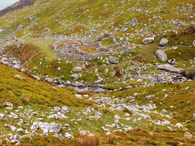
Nant Rhaeadr is also steeped in history, with several ancient ruins and archaeological sites scattered throughout the area. One notable landmark is the 13th-century Dolbadarn Castle, perched on a hill overlooking the valley. This well-preserved castle is a testament to the region's rich history and provides a glimpse into medieval times.

For those seeking a peaceful retreat, Nant Rhaeadr offers a range of accommodations, including cozy cottages and bed and breakfasts. The valley's idyllic setting and serene ambiance make it an ideal destination for relaxation and rejuvenation.

Overall, Nant Rhaeadr is a hidden gem in Caernarfonshire, offering visitors a chance to immerse themselves in nature, explore historical landmarks, and enjoy a tranquil escape in the heart of Snowdonia National Park.

If you have any feedback on the listing, please let us know in the comments section below.

Nant Rhaeadr Images

Images are sourced within 2km of 53.220656/-4.0021958 or Grid Reference SH6671. Thanks to Geograph Open Source API. All images are credited.

Afon Rhaeadr-bach Falls
Afon Goch Above Rhaeadr Fawr.
Afon Goch
Above Rhaeadr Fawr.
Rhaeadr-fawr The human figures add useful scale. The waterfall flows 120 feet / 37 metres over that high lip above.
Rhaeadr-fawr
The human figures add useful scale. The waterfall flows 120 feet / 37 metres over that high lip above.
Rhaeadr-bach The smaller of the two waterfalls near Aber.
Rhaeadr-bach
The smaller of the two waterfalls near Aber.
Aber Falls
Aber Falls
North Wales Expressway (A55) at Abergwyngregyn The A55, also known as the North Wales Expressway (Gwibffordd Gogledd Cymru), is the major road in North Wales running for 88 miles between Chester and Holyhead via Conwy and Bangor. 

The A55 is a very high quality road, much of it rebuilt since the 1970s in response to traffic problems in Colwyn Bay, Colwyn and Llandudno caused by traffic having to pass through town centres on totally unsuitable streets, (especially in Conwy where lorries often scraped their paintwork as they passed through 12th century arches in the town's walls), leading to the construction of an east-west expressway bypassing the urban centres. It is a dual carriageway primary route for its entire length with the exception of the point where it crosses the Britannia Bridge over the Menai Strait. All of its junctions are grade separated except for two roundabouts; one east of Penmaenmawr and one in Llanfairfechan. The road originally ran from Chester to Bangor but was extended parallel to the A5 across Anglesey right into Holyhead Docks in 2001.

<span class="nowrap"><a title="http://www.sabre-roads.org.uk/wiki/index.php?title=A55" rel="nofollow ugc noopener" href="http://www.sabre-roads.org.uk/wiki/index.php?title=A55">Link</a><img style="margin-left:2px;" alt="External link" title="External link - shift click to open in new window" src="https://s1.geograph.org.uk/img/external.png" width="10" height="10"/></span>  SABRE
North Wales Expressway (A55) at Abergwyngregyn
The A55, also known as the North Wales Expressway (Gwibffordd Gogledd Cymru), is the major road in North Wales running for 88 miles between Chester and Holyhead via Conwy and Bangor. The A55 is a very high quality road, much of it rebuilt since the 1970s in response to traffic problems in Colwyn Bay, Colwyn and Llandudno caused by traffic having to pass through town centres on totally unsuitable streets, (especially in Conwy where lorries often scraped their paintwork as they passed through 12th century arches in the town's walls), leading to the construction of an east-west expressway bypassing the urban centres. It is a dual carriageway primary route for its entire length with the exception of the point where it crosses the Britannia Bridge over the Menai Strait. All of its junctions are grade separated except for two roundabouts; one east of Penmaenmawr and one in Llanfairfechan. The road originally ran from Chester to Bangor but was extended parallel to the A5 across Anglesey right into Holyhead Docks in 2001. LinkExternal link SABRE
Gorlan Ger Afon Goch
Aber Falls
Aber Falls
Aber Falls
Aber Falls
Afon Aber
Afon Aber
Rhaeadr-bach
Rhaeadr-bach
Path and footbridge below Rhaeadr-bach
Ford across Afon Gam
Large Boulder on Moorland near Afon Gam
Aber Falls
Aber Falls
Path under the Pylons
Feeding Trough with Lavan Mudflats Beyond
Sheep Pasture
Sheep Pasture
Show me another place!

Nant Rhaeadr is located at Grid Ref: SH6671 (Lat: 53.220656, Lng: -4.0021958)

Unitary Authority: Gwynedd

Police Authority: North Wales

What 3 Words

///sang.burn.etchings. Near Aber, Gwynedd

Nearby Locations

Nant Rhaeadr Coedydd Aber

Related Wikis

Anafon River

The Anafon River, or Afon Anafon, is a river in Gwynedd, Wales, that flows into the Afon Aber. It originates on the slopes of Foel-fras and the Drum of...
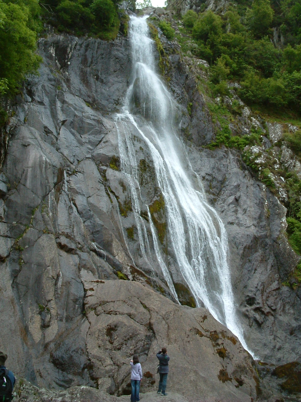
Aber Falls

Aber Falls (Welsh: Rhaeadr Fawr) is a waterfall located about two miles (3 km) south of the village of Abergwyngregyn, Gwynedd, Wales. The waterfall is...

Pen y Bryn

Pen y Bryn is a two-storey manor house, in Abergwyngregyn, Gwynedd, in north-west Wales, adjacent to the A55, five miles east of Bangor and eight miles...

Kingdom of Ceredigion

The Kingdom of Ceredigion was one of several Welsh kingdoms that emerged in post-Roman Britain in the mid-5th century. Cardigan Bay to the west and the...

Nearby Amenities

Located within 500m of 53.220656,-4.0021958
Power: tower
Source: Bing
Lat/Long: 53.2246132/-3.9987549
Power: tower
Lat/Long: 53.2228462/-4.007725
Power: tower
Lat/Long: 53.2223949/-4.0077944
Bench
Source: survey;gps
Lat/Long: 53.2234614/-4.0018748
Covered: no
Leisure: picnic_table
Material: wood
Lat/Long: 53.2211192/-4.0000447
Barrier: kissing_gate
Lat/Long: 53.2190415/-3.9973792
Board Type: nature
Information: board
Tourism: information
Lat/Long: 53.2215957/-3.9998905
Information: route_marker
Tourism: information
Lat/Long: 53.2220968/-3.9999716
The data included in this document is from www.openstreetmap.org. The data is made available under ODbL.

Have you been to Nant Rhaeadr?

Leave your review of Nant Rhaeadr below (or comments, questions and feedback).