Cwm Bychan

Valley in Merionethshire

Wales

Cwm Bychan

Hiking up Cwm Bychan
Hiking up Cwm Bychan Credit: Bill Harrison

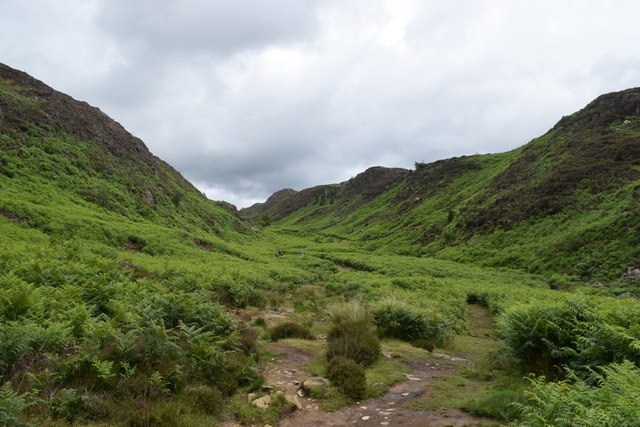
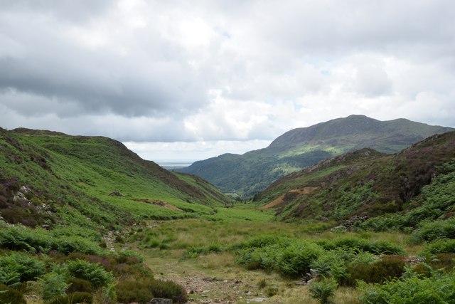
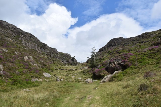
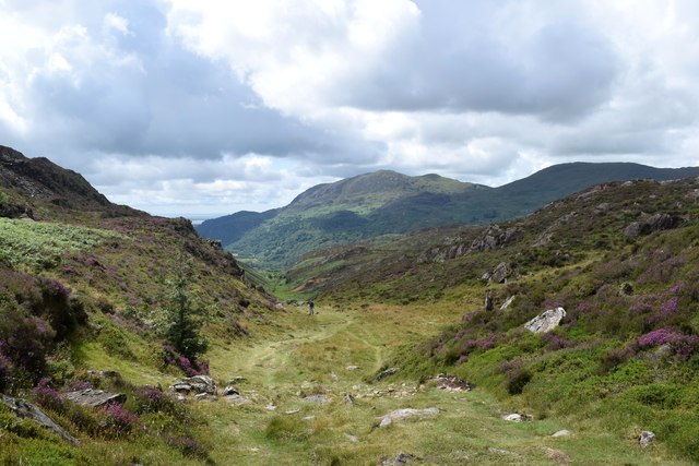
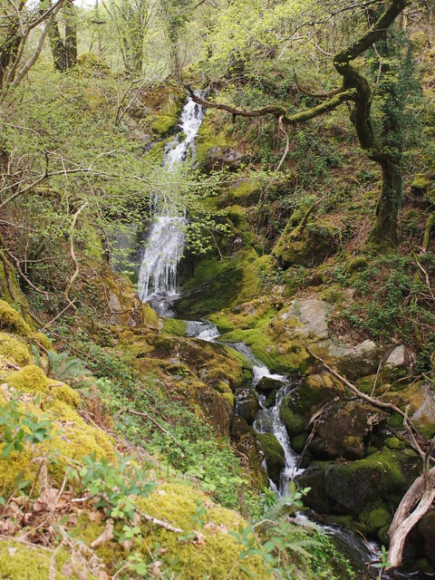
Cwm Bychan is a picturesque valley located in Merionethshire, Wales. Nestled within the Snowdonia National Park, it is renowned for its breathtaking natural beauty and tranquil atmosphere. The valley is bounded by towering mountains, including the prominent Rhinog Fach and Rhinog Fawr peaks, which add to its dramatic landscape.

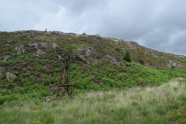
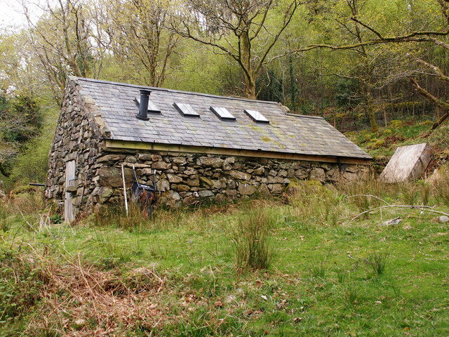
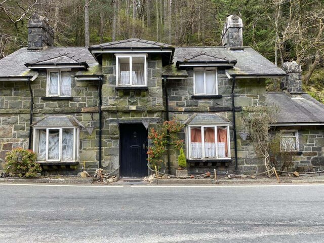
The valley is home to a small, scattered community, with the nearest settlement being the village of Trawsfynydd. It is primarily a rural area, with the main economic activities revolving around farming and tourism. Visitors are drawn to Cwm Bychan for its stunning scenery and the opportunities it offers for outdoor activities such as hiking, mountain biking, and fishing.

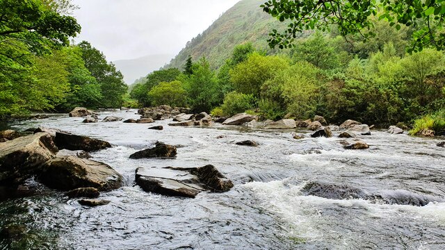
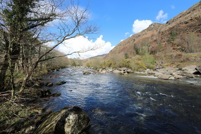
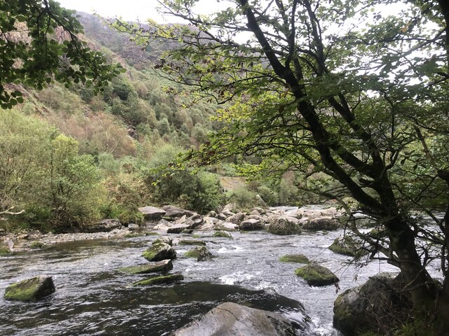
One of the key attractions in Cwm Bychan is its eponymous lake, Llyn Cwm Bychan. This serene mountain lake is located at the head of the valley and is a popular spot for picnicking and wildlife observation. Additionally, the valley is dotted with several other smaller lakes, adding to its charm.

The valley is also a gateway to several notable hiking trails, including the popular Roman Steps route, which follows an ancient Roman road through the valley. This path offers stunning vistas of the surrounding mountains and valleys, making it a must-visit for outdoor enthusiasts.

Overall, Cwm Bychan is a hidden gem in Merionethshire, offering visitors a chance to immerse themselves in the unspoiled natural beauty of the Welsh countryside.

If you have any feedback on the listing, please let us know in the comments section below.

Cwm Bychan Images

Images are sourced within 2km of 53.000093/-4.0862634 or Grid Reference SH6046. Thanks to Geograph Open Source API. All images are credited.

Hiking up Cwm Bychan
Remains of the cableway, Cwm Bychan This once transported copper ore down the valley.
Remains of the cableway, Cwm Bychan
This once transported copper ore down the valley.
Cableway tower, Cwm Bychan
Looking back down Cwm Bychan In the far distance, the sands of the Glaslyn estuary can just be seen under looming clouds.
Looking back down Cwm Bychan
In the far distance, the sands of the Glaslyn estuary can just be seen under looming clouds.
Heading over the top... ...of Bwlch-y-Sygyn.   A lone hiker can be seen in the blown-up photo.
Heading over the top...
...of Bwlch-y-Sygyn. A lone hiker can be seen in the blown-up photo.
The view down Cwm Bychan
Spectacular glacial landscape seen from Bwlch-y-Sygyn Drumlins, moraines, cwms...
Spectacular glacial landscape seen from Bwlch-y-Sygyn
Drumlins, moraines, cwms...
Afon Glaslyn
Afon Glaslyn
The Afon Colwyn at Beddgelert The Afon Colwyn passes under the A498 bridge and joins the Afon Glaslyn just beyond the houses in the distance.
The Afon Colwyn at Beddgelert
The Afon Colwyn passes under the A498 bridge and joins the Afon Glaslyn just beyond the houses in the distance.
The Afon Glaslyn above the gorge From Beddgelert the Afon Glaslyn continues down at a pleasant gradient, but grade three paddlers will have wanted to get off before reaching this section, just before the river becomes engorged and gets significantly harder. Paddling the Aberglaslyn gorge is forbidden in the summer months (and they have already started by early April) though there appears to be no legal basis to this prohibition on what is, by right acknowledged as existing since time immemorial before the Magna Carta, a public navigation (as for all navigable rivers in England and Wales). However, at this level, it is not technically navigable. Paddlers generally adhere to the voluntary agreement not to paddle on any section of the river when it is below a certain level established on prominent markers at the usual points of access for conservation reasons as well as safety and practicality. There are no markers, however, to show when the level is so high that epics are imminent...
The Afon Glaslyn above the gorge
From Beddgelert the Afon Glaslyn continues down at a pleasant gradient, but grade three paddlers will have wanted to get off before reaching this section, just before the river becomes engorged and gets significantly harder. Paddling the Aberglaslyn gorge is forbidden in the summer months (and they have already started by early April) though there appears to be no legal basis to this prohibition on what is, by right acknowledged as existing since time immemorial before the Magna Carta, a public navigation (as for all navigable rivers in England and Wales). However, at this level, it is not technically navigable. Paddlers generally adhere to the voluntary agreement not to paddle on any section of the river when it is below a certain level established on prominent markers at the usual points of access for conservation reasons as well as safety and practicality. There are no markers, however, to show when the level is so high that epics are imminent...
Afon Glaslyn South of Beddgelert
Afon Glaslyn
South of Beddgelert
Waterfall Below Plas Oerddwr
Converted Outbuilding in Coed Oerddwr
Tai Sygun
Tai Sygun
Adfail / A ruin
Adfail / A ruin
Old Milestone, A4085, Pont Aberglaslyn Carved in slate at the junction with the A498 on the parapet of the bridge crossing Afon Glaslyn. Penrhyn Deudraeth translates as "two beach peninsula". More milestones on the bridge or near see <a title="https://www.geograph.org.uk/stuff/list.php?title=Old+Milestone&gridref=SH5946" href="https://www.geograph.org.uk/stuff/list.php?title=Old+Milestone&gridref=SH5946">Link</a>

Inscription: Penrhyndeudraeth 6 Miles ☛

Milestone Society National ID: CAE_PYBD06a
Old Milestone, A4085, Pont Aberglaslyn
Carved in slate at the junction with the A498 on the parapet of the bridge crossing Afon Glaslyn. Penrhyn Deudraeth translates as "two beach peninsula". More milestones on the bridge or near see Link Inscription: Penrhyndeudraeth 6 Miles ☛ Milestone Society National ID: CAE_PYBD06a
Bridge House, A498, Pont Aberglaslyn Former Toll House opposite the bridge taking the A4085 to Penrhyndeudraeth (peninsula with two beaches). It would have originally served the Porthdinllaen & Nanthwynant Turnpike Trust.

Milestone Society National ID: GWY.BED02
Bridge House, A498, Pont Aberglaslyn
Former Toll House opposite the bridge taking the A4085 to Penrhyndeudraeth (peninsula with two beaches). It would have originally served the Porthdinllaen & Nanthwynant Turnpike Trust. Milestone Society National ID: GWY.BED02
Russell at Beddgelert Original Welsh Highland Railway locomotive Russell waits in the rain at Beddgelert station during the WHR100 event on the railway.
Russell at Beddgelert
Original Welsh Highland Railway locomotive Russell waits in the rain at Beddgelert station during the WHR100 event on the railway.
Show me another place!

Cwm Bychan is located at Grid Ref: SH6046 (Lat: 53.000093, Lng: -4.0862634)

Unitary Authority: Gwynedd

Police Authority: North Wales

What 3 Words

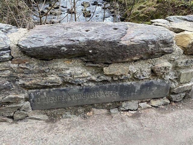
///sounds.shepherdess.undertook. Near Penrhyndeudraeth, Gwynedd

Nearby Locations

Nantmor Cwm Bychan

Related Wikis

Aberglaslyn Pass

The Aberglaslyn Pass (Welsh: Bwlch Aberglaslyn) is a narrow gorge of considerable beauty in Snowdonia, Gwynedd, north Wales. The A498 road/A4085 road follows...

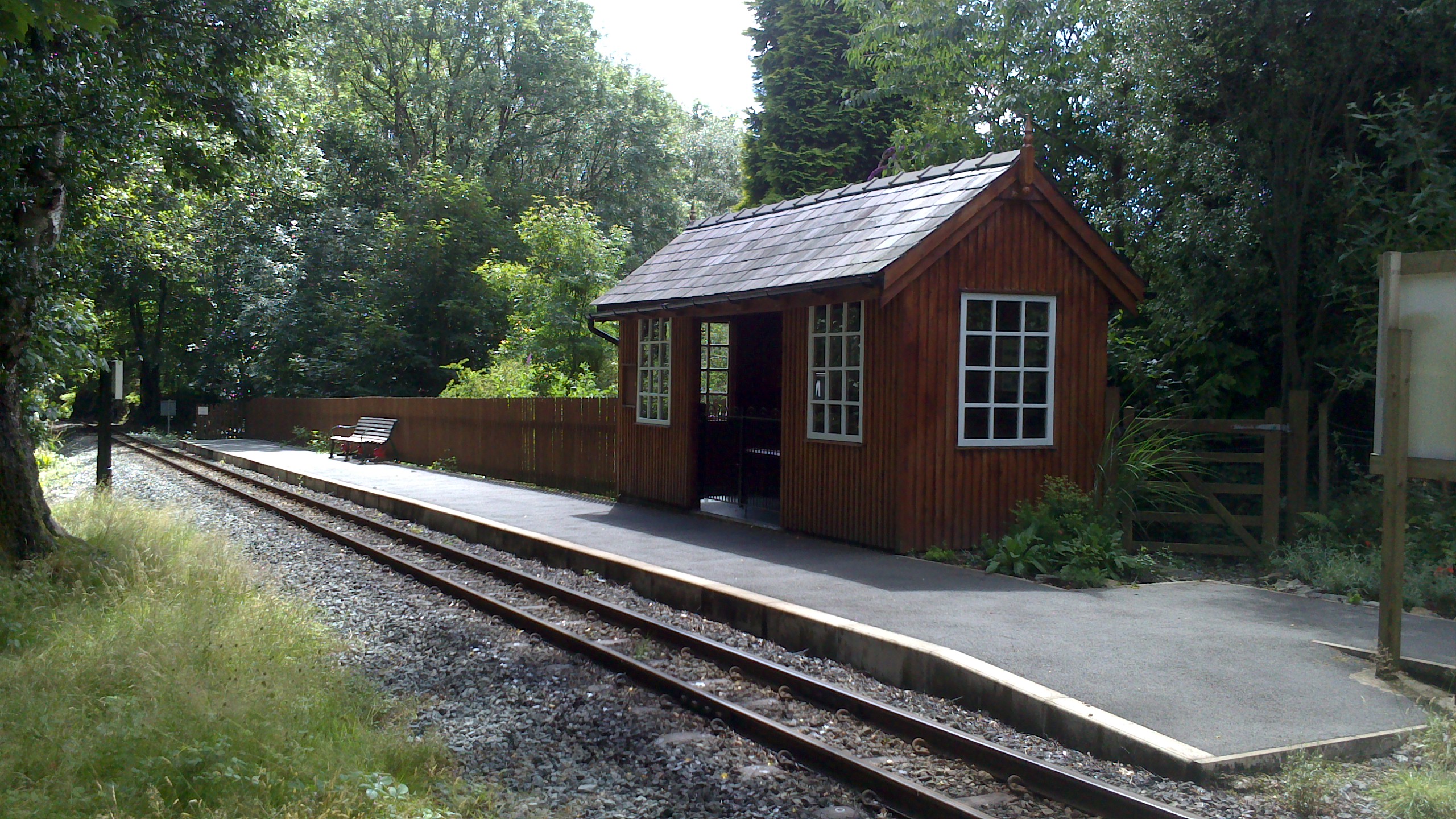
Nantmor railway station

Nantmor is a railway halt in North Wales serving the nearby hamlet of the same name. It is located between the stations of Beddgelert and Pont Croesor...

Pont Aberglaslyn

Pont Aberglaslyn is a stone arch bridge over the Afon Glaslyn and the surrounding hamlet, located near Beddgelert and Nantmor in Gwynedd, north-west Wales...

Nantmor

Nantmor is a hamlet which lies about 1½ miles to the south of the village of Beddgelert in Gwynedd, Wales. The current spelling of the name Nantmor is...

Nearby Amenities

Located within 500m of 53.000093,-4.0862634
Bench
Backrest: yes
Mapillary: 869885000261887
Survey Date: 2018-06-24
Lat/Long: 53.0037701/-4.0840947
Cwm Bychan
Place: locality
Lat/Long: 53.0011253/-4.0850461
The data included in this document is from www.openstreetmap.org. The data is made available under ODbL.

Have you been to Cwm Bychan?

Leave your review of Cwm Bychan below (or comments, questions and feedback).