Cwmpadarn

Valley in Cardiganshire

Wales

Cwmpadarn

Ordnance Survey Cut Mark This OS cut mark can be found on the wall west side of Antaron Avenue. It marks a point 44.640m above mean sea level.
Ordnance Survey Cut Mark Credit: Adrian Dust

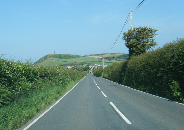
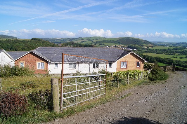
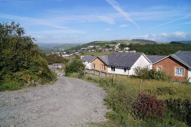
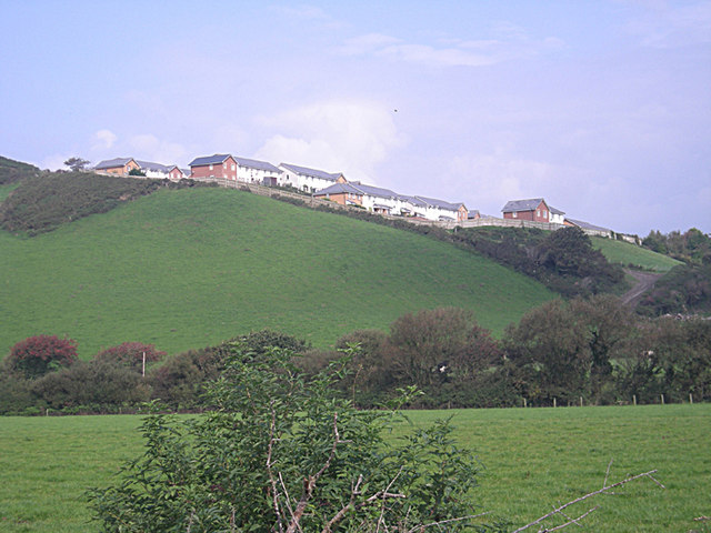
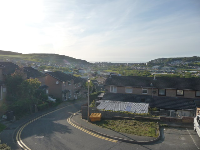
Cwmpadarn is a small village located in the county of Cardiganshire, Wales. Situated in a picturesque valley, it is surrounded by rolling hills and lush green fields, adding to its charm and tranquility. The village is nestled along the banks of the River Padarn, which flows through the valley, providing a scenic backdrop to the area.

Cwmpadarn is known for its natural beauty and is a popular destination for outdoor enthusiasts. The village offers a range of activities, such as hiking, fishing, and birdwatching, making it an ideal spot for nature lovers. The nearby hills and woodlands provide ample opportunities for exploration and offer stunning views of the surrounding countryside.

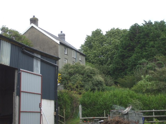
The village itself is small but has a close-knit community. The residents are friendly and welcoming, creating a warm and inviting atmosphere. The local amenities include a village hall, a small shop, and a pub, providing essentials and a place to socialize.

Cwmpadarn's location in the valley offers a peaceful and idyllic setting, away from the hustle and bustle of city life. It is a place where one can escape the pressures of modern living and enjoy the simplicity and beauty of nature. With its stunning landscapes and friendly community, Cwmpadarn is truly a hidden gem in Cardiganshire, offering a slice of rural paradise to all who visit.

If you have any feedback on the listing, please let us know in the comments section below.

Cwmpadarn Images

Images are sourced within 2km of 52.412305/-4.0574029 or Grid Reference SN6081. Thanks to Geograph Open Source API. All images are credited.

Ordnance Survey Cut Mark This OS cut mark can be found on the wall west side of Antaron Avenue. It marks a point 44.640m above mean sea level.
Ordnance Survey Cut Mark
This OS cut mark can be found on the wall west side of Antaron Avenue. It marks a point 44.640m above mean sea level.
A4120 Penparcau Road
Houses on Parc Dinas
Houses in Parc Dinas
OS Flush Bracket S2004 - South Gate Affixed to the wall of a house (formerly a  garage) just north of the junction of the A4120 with the main A487, this flush bracket was used on the Aberystwyth to Machynlleth levelling line during the 3rd geodetic levelling of England & Wales, probably in 1952, at which point it was given a height of 43.8514m above Ordnance Datum Newlyn.
OS Flush Bracket S2004 - South Gate
Affixed to the wall of a house (formerly a garage) just north of the junction of the A4120 with the main A487, this flush bracket was used on the Aberystwyth to Machynlleth levelling line during the 3rd geodetic levelling of England & Wales, probably in 1952, at which point it was given a height of 43.8514m above Ordnance Datum Newlyn.
Rhydyfelin Looking S towards Rhydyfelin
Rhydyfelin
Looking S towards Rhydyfelin
Penparcau on the hill
Piercefield Farm, Penparcau
St Anne's Church, Penparcau
A dangerous road, the B4340
The A4120 approaching Aberystwyth The last straight bit, before a sudden descent and wiggle before its junctions with the B4340 and A487. Beyond, Aberystwyth's iconic Wellington monument can be seen on top of Pen Dinas, with the ramparts of the hill top fort also clearly visible.
The A4120 approaching Aberystwyth
The last straight bit, before a sudden descent and wiggle before its junctions with the B4340 and A487. Beyond, Aberystwyth's iconic Wellington monument can be seen on top of Pen Dinas, with the ramparts of the hill top fort also clearly visible.
Private road up to Penybanc Going north off the A 4120.
Private road up to Penybanc
Going north off the A 4120.
Midfield Holiday Park At Southgate near Aberystwyth.
Midfield Holiday Park
At Southgate near Aberystwyth.
The beginning of Pen Dinas Nature Reserve
The junction of the A4120 and the A487 The A487 to the right is the main coast road. The A4120 to the left goes to Devil's Bridge.
The junction of the A4120 and the A487
The A487 to the right is the main coast road. The A4120 to the left goes to Devil's Bridge.
St Anne's Church, Penparcau
Part of a housing estate in Penparcau A Sunday morning stroll through sleepy homes and quiet streets.
Part of a housing estate in Penparcau
A Sunday morning stroll through sleepy homes and quiet streets.
View towards Aber from part of Penparcau This housing complex has unbeatable views towards the town.
View towards Aber from part of Penparcau
This housing complex has unbeatable views towards the town.
Show me another place!

Cwmpadarn is located at Grid Ref: SN6081 (Lat: 52.412305, Lng: -4.0574029)

Unitary Authority: Ceredigion

Police Authority: Dyfed Powys

What 3 Words

///cheeks.cushy.walked. Near Penparcau, Ceredigion

Related Wikis

Thomas Parry Library

The Thomas Parry Library at Aberystwyth was part of the library of the University of Wales Aberystwyth, it served the Department of Information Studies...

Ysgol Penglais School

Ysgol Penglais School is an 11–18 comprehensive school situated in the town of Aberystwyth, Ceredigion, West Wales. It offers education to approximately...

St Padarn's Church, Llanbadarn Fawr

Saint Padarn's Church is a parish church of the Church in Wales, and the largest mediaeval church in mid-Wales. It is at Llanbadarn Fawr, near Aberystwyth...

Llanbadarn Fawr, Ceredigion

Llanbadarn Fawr (Welsh pronunciation: [ɬanˌbadarn ˈvau̯r]) is a village and community in Ceredigion, Wales. It is on the outskirts of Aberystwyth next...

Nearby Amenities

Located within 500m of 52.412305,-4.0574029
Traffic Calming: chicane
Lat/Long: 52.4143549/-4.0606371
Mini Roundabout
Lat/Long: 52.4138106/-4.0627575
Barrier: bollard
Lat/Long: 52.4153303/-4.0625216
Mini Roundabout
Direction: clockwise
Lat/Long: 52.4110459/-4.0542691
Turning Circle
Lat/Long: 52.4126207/-4.0626086
Telephone
Booth: KX100
Covered: booth
Lat/Long: 52.4159993/-4.0546192
Post Box
Post Box Type: lamp
Ref: SY23 36
Royal Cypher: EIIR
Royal Cypher Wikidata: Q33102113
Lat/Long: 52.4159927/-4.0546405
Turning Circle
Lat/Long: 52.4134108/-4.0586722
Entrance: yes
Lat/Long: 52.415786/-4.0589269
Turning Circle
Lat/Long: 52.4127777/-4.0593291
Post Box
Operator: Royal Mail
Operator Wikidata: Q638098
Ref: SY23 233
Lat/Long: 52.410689/-4.0546283
Post Box
Operator: Royal Mail
Operator Wikidata: Q638098
Ref: SY23 44
Lat/Long: 52.4083869/-4.0597338
Bus Stop
Cwmpadarn Lane
Bus: yes
Naptan AtcoCode: 5230CGX16345
Naptan NaptanCode: cejdwgm
Public Transport: platform
Lat/Long: 52.4160608/-4.0542877
Bus Stop
Primrose Hill
Bus: yes
Naptan AtcoCode: 5230WDB22000
Naptan NaptanCode: cejgajt
Public Transport: platform
Shelter: yes
Lat/Long: 52.4081989/-4.0594025
Bus Stop
Coleg Ceredigion
Bus: yes
Public Transport: platform
Shelter: yes
Lat/Long: 52.4114557/-4.0544121
Bench
Lat/Long: 52.4124462/-4.0618737
Bench
Lat/Long: 52.4124755/-4.0617493
Bench
Lat/Long: 52.4132426/-4.0642221
Bus Stop
Coleg Ceredigion
Bus: yes
Naptan AtcoCode: 5230AWD71078
Naptan NaptanCode: cejawjd
Public Transport: platform
Shelter: yes
Lat/Long: 52.4113381/-4.0551572
Bus Stop
Cefn Esgair
Bus: yes
Public Transport: platform
Shelter: no
Lat/Long: 52.4121877/-4.0523835
Bench
Backrest: no
Lat/Long: 52.413431/-4.0640576
Bench
Backrest: yes
Lat/Long: 52.4138844/-4.063272
Bench
Backrest: no
Lat/Long: 52.4141036/-4.0631408
Entrance: yes
Wheelchair: yes
Lat/Long: 52.412835/-4.0637964
Entrance: main
Wheelchair: no
Lat/Long: 52.4128912/-4.0637345
Access: delivery
Entrance: service
Lat/Long: 52.4129229/-4.0637581
Access: delivery
Entrance: service
Lat/Long: 52.41305/-4.063853
Entrance: main
Wheelchair: yes
Lat/Long: 52.4135717/-4.0644029
Entrance: yes
Wheelchair: yes
Lat/Long: 52.4147593/-4.0628736
Traffic Calming: bump
Lat/Long: 52.4133519/-4.06397
Vending Machine
Vending: parking_tickets
Lat/Long: 52.4141855/-4.0621522
Vending Machine
Vending: parking_tickets
Lat/Long: 52.4145073/-4.0623445
Entrance: main
Lat/Long: 52.4158193/-4.0581568
Traffic Calming: bump
Lat/Long: 52.4148324/-4.0624022
Traffic Calming: bump
Lat/Long: 52.4149954/-4.0605785
Traffic Calming: bump
Lat/Long: 52.4160645/-4.060223
Barrier: bollard
Lat/Long: 52.4164881/-4.059773
Cafe
Blas Padarn
Addr City: Ceredigion
Addr Postcode: SY23 3SG
Addr Street: Cefn Esgair
Name Cy: Blas Padarn
Name En: Blas Padarn
Source: local_knowledge
Wheelchair: yes
Lat/Long: 52.4104247/-4.0550828
Barrier: bollard
Lat/Long: 52.4153635/-4.0626398
Bus Stop
Penglais School
Access: private
Bus: yes
Public Transport: platform
Lat/Long: 52.4164435/-4.0582105
Bus Stop
Cwmpadarn Lane
Bus: yes
Public Transport: platform
Lat/Long: 52.4159381/-4.0542618
Pub
The Black Lion
Addr Postcode: SY23 3RA
Addr Street: Primrose Hill
Fhrs Id: 978196
Source Addr: FHRS Open Data
Wikidata: Q80855947
Lat/Long: 52.4085867/-4.0599061
Ionize Ltd
Addr City: Aberystwyth
Addr Housename: 10b Science Park
Addr Postcode: SY23 3AH
Office: company
Opening Hours: Mo-Fr 07:00-18:00
Website: https://www.ionize.co.uk
Lat/Long: 52.4124117/-4.0613467
Addr City: Aberystwyth
Addr Housename: 10A Science Park
Office: company
Lat/Long: 52.4124104/-4.06157
Historic: memorial
Memorial: war_memorial
Lat/Long: 52.4084488/-4.0596709
Barrier: stile
Lat/Long: 52.4087773/-4.0537958
Direction: SSE
Generator Method: photovoltaic
Generator Output Electricity: yes
Generator Solar Modules: 14
Generator Source: solar
Generator Type: solar_photovoltaic_panel
Location: roof
Power: generator
Lat/Long: 52.4147334/-4.055311
Direction: 185
Generator Method: photovoltaic
Generator Output Electricity: yes
Generator Solar Modules: 12
Generator Source: solar
Generator Type: solar_photovoltaic_panel
Location: roof
Power: generator
Lat/Long: 52.4151615/-4.054679
Direction: 190
Generator Method: photovoltaic
Generator Output Electricity: yes
Generator Solar Modules: 12
Generator Source: solar
Generator Type: solar_photovoltaic_panel
Location: roof
Power: generator
Lat/Long: 52.4155314/-4.053711
Bench
Lat/Long: 52.4140423/-4.0633696
Crossing
Crossing: marked
Crossing Markings: yes
Lat/Long: 52.4151094/-4.0625615
Aberystwyth mass vaccination centre
Addr City: Ceredigion
Addr Housename: Thomas Parry Library
Addr Postcode: SY23 3SG
Addr Street: Cefn Esgair
Email: COVIDenquiries.hdd@wales.nhs.uk
Healthcare: vaccination_centre
Healthcare Speciality: vaccination
Name Cy: Canolfan Brechu Torfol Aberystwyth
Opening Hours: Mo-Su 08:00-18:00
Operator: Hywel Dda University Health Board
Phone: +44 1970 623 131
Vaccination: covid19
Website: https://hduhb.nhs.wales/news/press-releases/people-aged-75-to-79-years-old-invited-to-receive-their-covid-vaccination-at-a-mass-vaccination-centre/
Lat/Long: 52.4104944/-4.054422
Bicycle Parking
Access: yes
Bicycle Parking: hoop
Capacity: 8
Covered: yes
Fee: no
Lat/Long: 52.4109761/-4.0540953
Bicycle Parking
Access: yes
Bicycle Parking: hoop
Capacity: 6
Covered: no
Fee: no
Lat/Long: 52.4102082/-4.0527629
Direction: 215
Generator Method: photovoltaic
Generator Output Electricity: yes
Generator Solar Modules: 8
Generator Source: solar
Generator Type: solar_photovoltaic_panel
Location: roof
Power: generator
Lat/Long: 52.407863/-4.0567929
Direction: 215
Generator Method: photovoltaic
Generator Output Electricity: yes
Generator Solar Modules: 10
Generator Source: solar
Generator Type: solar_photovoltaic_panel
Location: roof
Power: generator
Lat/Long: 52.4079726/-4.056927
Direction: SSE
Generator Method: photovoltaic
Generator Output Electricity: yes
Generator Solar Modules: 11
Generator Source: solar
Generator Type: solar_photovoltaic_panel
Location: roof
Power: generator
Lat/Long: 52.4088382/-4.0576217
Direction: ENE
Generator Method: photovoltaic
Generator Output Electricity: yes
Generator Solar Modules: 10
Generator Source: solar
Generator Type: solar_photovoltaic_panel
Location: roof
Power: generator
Lat/Long: 52.4113873/-4.0591049
Direction: WSW
Generator Method: photovoltaic
Generator Output Electricity: yes
Generator Solar Modules: 6
Generator Source: solar
Generator Type: solar_photovoltaic_panel
Location: roof
Power: generator
Lat/Long: 52.4113775/-4.0591693
Direction: SSW
Generator Method: photovoltaic
Generator Output Electricity: yes
Generator Solar Modules: 17
Generator Source: solar
Generator Type: solar_photovoltaic_panel
Location: roof
Power: generator
Lat/Long: 52.4087924/-4.0617335
Direction: 195
Generator Method: photovoltaic
Generator Output Electricity: yes
Generator Solar Modules: 20
Generator Source: solar
Generator Type: solar_photovoltaic_panel
Location: roof
Power: generator
Lat/Long: 52.4114867/-4.0613245
Direction: 170
Generator Method: photovoltaic
Generator Output Electricity: yes
Generator Solar Modules: 52
Generator Source: solar
Generator Type: solar_photovoltaic_panel
Location: roof
Power: generator
Lat/Long: 52.4111059/-4.0608779
Direction: 165
Generator Method: photovoltaic
Generator Output Electricity: yes
Generator Solar Modules: 20
Generator Source: solar
Generator Type: solar_photovoltaic_panel
Location: roof
Power: generator
Lat/Long: 52.4114724/-4.0608645
Direction: 195
Generator Method: photovoltaic
Generator Output Electricity: yes
Generator Solar Modules: 20
Generator Source: solar
Generator Type: solar_photovoltaic_panel
Location: roof
Power: generator
Lat/Long: 52.4114593/-4.0611675
Direction: 165
Generator Method: photovoltaic
Generator Output Electricity: yes
Generator Solar Modules: 20
Generator Source: solar
Generator Type: solar_photovoltaic_panel
Location: roof
Power: generator
Lat/Long: 52.4114871/-4.0607142
Direction: 175
Generator Method: photovoltaic
Generator Output Electricity: yes
Generator Solar Modules: 16
Generator Source: solar
Generator Type: solar_photovoltaic_panel
Location: roof
Power: generator
Lat/Long: 52.4121841/-4.0603951
Direction: SSW
Generator Method: photovoltaic
Generator Output Electricity: yes
Generator Solar Modules: 14
Generator Source: solar
Generator Type: solar_photovoltaic_panel
Location: roof
Power: generator
Lat/Long: 52.4128942/-4.0598613
Direction: 165
Generator Method: photovoltaic
Generator Output Electricity: yes
Generator Solar Modules: 8
Generator Source: solar
Generator Type: solar_photovoltaic_panel
Location: roof
Power: generator
Lat/Long: 52.412261/-4.0529627
Direction: 165
Generator Method: photovoltaic
Generator Output Electricity: yes
Generator Solar Modules: 8
Generator Source: solar
Generator Type: solar_photovoltaic_panel
Location: roof
Power: generator
Lat/Long: 52.412243/-4.053086
Direction: WSW
Generator Method: photovoltaic
Generator Output Electricity: yes
Generator Solar Modules: 6
Generator Source: solar
Generator Type: solar_photovoltaic_panel
Location: roof
Power: generator
Lat/Long: 52.4116583/-4.054806
Direction: SSE
Generator Method: photovoltaic
Generator Output Electricity: yes
Generator Solar Modules: 11
Generator Source: solar
Generator Type: solar_photovoltaic_panel
Location: roof
Power: generator
Lat/Long: 52.4116916/-4.0548804
Direction: SSE
Generator Method: photovoltaic
Generator Output Electricity: yes
Generator Solar Modules: 12
Generator Source: solar
Generator Type: solar_photovoltaic_panel
Location: roof
Power: generator
Lat/Long: 52.4122643/-4.0557629
Direction: 170
Generator Method: photovoltaic
Generator Output Electricity: yes
Generator Solar Modules: 16
Generator Source: solar
Generator Type: solar_photovoltaic_panel
Location: roof
Power: generator
Lat/Long: 52.4123166/-4.0554088
Direction: S
Generator Method: photovoltaic
Generator Output Electricity: yes
Generator Solar Modules: 8
Generator Source: solar
Generator Type: solar_photovoltaic_panel
Location: roof
Power: generator
Lat/Long: 52.4125232/-4.053712
Direction: S
Generator Method: photovoltaic
Generator Output Electricity: yes
Generator Solar Modules: 10
Generator Source: solar
Generator Type: solar_photovoltaic_panel
Location: roof
Power: generator
Lat/Long: 52.4125445/-4.0536909
Direction: S
Generator Method: photovoltaic
Generator Output Electricity: yes
Generator Solar Modules: 16
Generator Source: solar
Generator Type: solar_photovoltaic_panel
Location: roof
Power: generator
Lat/Long: 52.4127942/-4.0543195
Direction: S
Generator Method: photovoltaic
Generator Output Electricity: yes
Generator Solar Modules: 6
Generator Source: solar
Generator Type: solar_photovoltaic_panel
Location: roof
Power: generator
Lat/Long: 52.4128222/-4.0545639
Direction: S
Generator Method: photovoltaic
Generator Output Electricity: yes
Generator Solar Modules: 10
Generator Source: solar
Generator Type: solar_photovoltaic_panel
Location: roof
Power: generator
Lat/Long: 52.4128222/-4.0544966
Shelter
Shelter Type: public_transport
Lat/Long: 52.4160072/-4.0545863
The data included in this document is from www.openstreetmap.org. The data is made available under ODbL.

Have you been to Cwmpadarn?

Leave your review of Cwmpadarn below (or comments, questions and feedback).