Glenine

Valley in Stirlingshire

Scotland

Glenine

The Great Corrie of Balglass Looking South from B818 towards the corrie in the Campsie Fells some 3km distant.
The Great Corrie of Balglass Credit: JOHN MORELAND

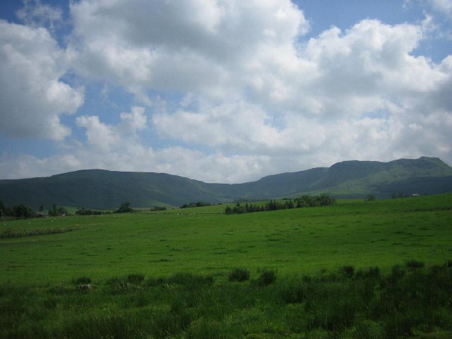
Glenine is a picturesque valley located in Stirlingshire, Scotland. Nestled between rolling hills and surrounded by natural beauty, this tranquil destination is a haven for nature enthusiasts and those seeking a peaceful retreat.

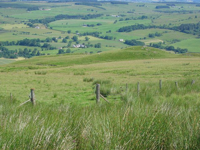
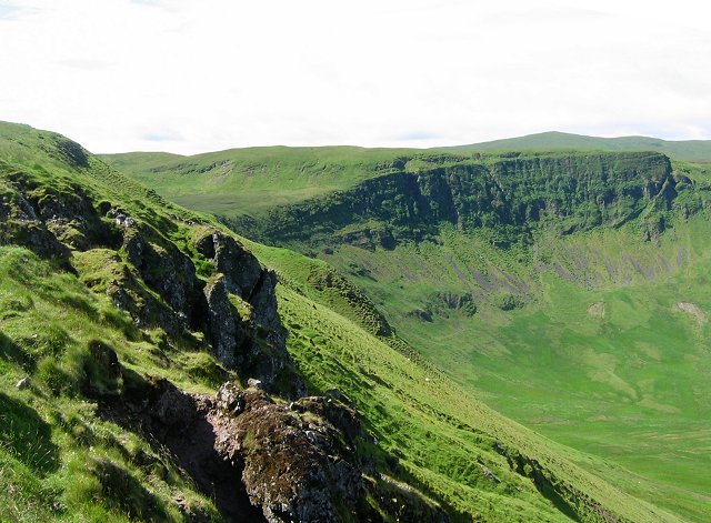
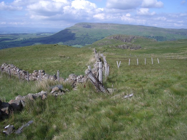
The valley is renowned for its stunning landscapes, characterized by lush greenery, meandering rivers, and cascading waterfalls. The Glenine River, which runs through the heart of the valley, adds to its charm and provides a soothing soundtrack to the area. The surrounding hills offer breathtaking panoramic views, making it a popular spot for hikers and photographers.

The valley is home to a diverse range of wildlife, including red deer, otters, and various bird species. Nature lovers can enjoy spotting these creatures in their natural habitats or simply indulge in bird-watching.

In addition to its natural wonders, Glenine also boasts a rich history. The remnants of ancient settlements and burial sites can be found scattered throughout the valley, offering a glimpse into its past. Visitors can explore these archaeological sites and learn about the area's fascinating heritage.

For those seeking outdoor activities, Glenine offers a range of options, including fishing, cycling, and horseback riding. The valley is also a popular destination for camping and picnicking, allowing visitors to fully immerse themselves in the peaceful surroundings.

Overall, Glenine, Stirlingshire is a hidden gem that offers a perfect combination of natural beauty, tranquility, and historical significance. Whether you are seeking adventure, relaxation, or a deeper connection with nature, this valley has something to offer for everyone.

If you have any feedback on the listing, please let us know in the comments section below.

Glenine Images

Images are sourced within 2km of 56.052224/-4.2460426 or Grid Reference NS6086. Thanks to Geograph Open Source API. All images are credited.

The Great Corrie of Balglass Looking South from B818 towards the corrie in the Campsie Fells some 3km distant.
The Great Corrie of Balglass
Looking South from B818 towards the corrie in the Campsie Fells some 3km distant.
Gate above Balglass Gateway on the Campsie Fells, below the wide open spaces of rough grazing that make up this square.
Gate above Balglass
Gateway on the Campsie Fells, below the wide open spaces of rough grazing that make up this square.
Coire of Balglass The Campsie Fell's big attraction - only I doubt many come here. A big bowl with exposed trap crags. The crags are heavily vegetated.
Coire of Balglass
The Campsie Fell's big attraction - only I doubt many come here. A big bowl with exposed trap crags. The crags are heavily vegetated.
Driveway to Overton Farm Looking towards Dunmore, the hill above Fintry
Driveway to Overton Farm
Looking towards Dunmore, the hill above Fintry
Walls and fences Crumbling dry stone walls have been replaced by fences which are now showing their age.
A view to Dunmore and Stronend.
Walls and fences
Crumbling dry stone walls have been replaced by fences which are now showing their age. A view to Dunmore and Stronend.
Crag, Corrie of Balglass Distinctive crag on the eastern side of the Corrie of Balglass.
Crag, Corrie of Balglass
Distinctive crag on the eastern side of the Corrie of Balglass.
Corrie of Balglass A view from near the highpoint on the eastern side of the Corrie.
Corrie of Balglass
A view from near the highpoint on the eastern side of the Corrie.
B818 near Balglass
B818 near Balglass
Driveway, Knockraich Knockraich is home to a very good cafe.
Driveway, Knockraich
Knockraich is home to a very good cafe.
Farmland, Strathendrick Arable land with some infertile looking upland area in the background.
Farmland, Strathendrick
Arable land with some infertile looking upland area in the background.
Cloch Burn A Campsie burn nears the Endrick in dairy farming country.
Cloch Burn
A Campsie burn nears the Endrick in dairy farming country.
Cloch Burn Burn flowing to the Endrick off the Campsie Fells.
Cloch Burn
Burn flowing to the Endrick off the Campsie Fells.
Balglass Burn A burn draining the north side of Earl's Seat via the Little Corrie but not the Balglass Corrie - that gives rise to the Cloch Burn.
Balglass Burn
A burn draining the north side of Earl's Seat via the Little Corrie but not the Balglass Corrie - that gives rise to the Cloch Burn.
Crags and scree in the Corrie of Balglass Descending slightly from the rim of the corrie gives a good view which contrasts the rocky corrie with the low farmlands in Strath Endrick. Some of the hills of the southern Highlands can be seen in the distance.
Crags and scree in the Corrie of Balglass
Descending slightly from the rim of the corrie gives a good view which contrasts the rocky corrie with the low farmlands in Strath Endrick. Some of the hills of the southern Highlands can be seen in the distance.
Looking into Corrie of Balglass From just below the corrie rim.
Looking into Corrie of Balglass
From just below the corrie rim.
Drystane dyke in the Corrie of Balglass The farm of Head of Balglass lies beyond.
Drystane dyke in the Corrie of Balglass
The farm of Head of Balglass lies beyond.
Scree on the hillside, Corrie of Balglass The corrie offers more varied scenery than is typical for the Campsie Fells, which are largely high moorland plateaux.
Scree on the hillside, Corrie of Balglass
The corrie offers more varied scenery than is typical for the Campsie Fells, which are largely high moorland plateaux.
Cloch Burn Looking upstream towards the farm at Head of Balglass, with the large bowl of the Corrie of Balglass behind.
Cloch Burn
Looking upstream towards the farm at Head of Balglass, with the large bowl of the Corrie of Balglass behind.
Show me another place!

Glenine is located at Grid Ref: NS6086 (Lat: 56.052224, Lng: -4.2460426)

Unitary Authority: Stirling

Police Authority: Forth Valley

What 3 Words

///majors.whoever.wired. Near Balfron, Stirling

Nearby Locations

Glenine Turf Hill

Related Wikis

Fintry

Fintry is a small riverside village in Stirlingshire, central Scotland. It is located 16 miles (26 km) south-west of Stirling and around 19 miles (31 km...

Culcreuch Castle

Culcreuch Castle is a Scottish castle close to the village of Fintry, near Loch Lomond. It had been the home of the Barons of Culcreuch since 1699. In...
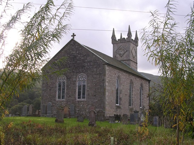
Fintry Kirk

Fintry Kirk is in the village of Fintry in Stirlingshire, Scotland. Fintry is a Church of Scotland Parish in the Presbytery of Stirling. The kirk is located...

Campsie, East Dunbartonshire

Campsie is a civil parish in East Dunbartonshire, Scotland. The parish was formerly part of Stirlingshire. == Settlements == Auchenreoch Clachan of Campsie...

Nearby Amenities

Located within 500m of 56.052224,-4.2460426
Dunmore Fort
Archaeological Site: fortification
Fortification Type: hill_fort
Heritage Operator: Historic Environment Scotland
Heritage Website: https://portal.historicenvironment.scot/designation/SM2575
Historic: archaeological_site
Ref GB Hs: SM2575
Ref Canmore: 45294
Wikidata: Q31109747
Lat/Long: 56.0507951/-4.2412376
The data included in this document is from www.openstreetmap.org. The data is made available under ODbL.

Have you been to Glenine?

Leave your review of Glenine below (or comments, questions and feedback).