Alton Glen

Valley in Wigtownshire

Scotland

Alton Glen

Waves at Drummore nx140368 This is the coast road at Drummore leading to Back Bore and Cairngarroch Bay. The cottages in the mid shot are where we stayed for an excellent week in February 2004
Waves at Drummore nx140368 Credit: Dave Smethurst

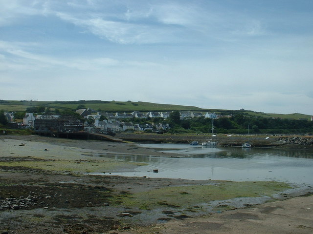
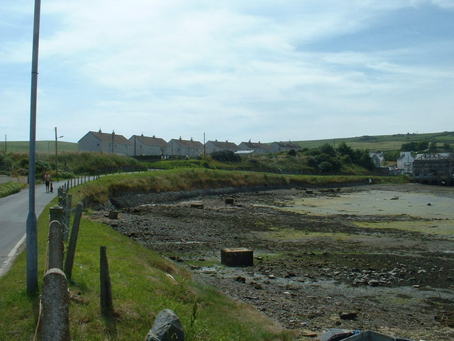
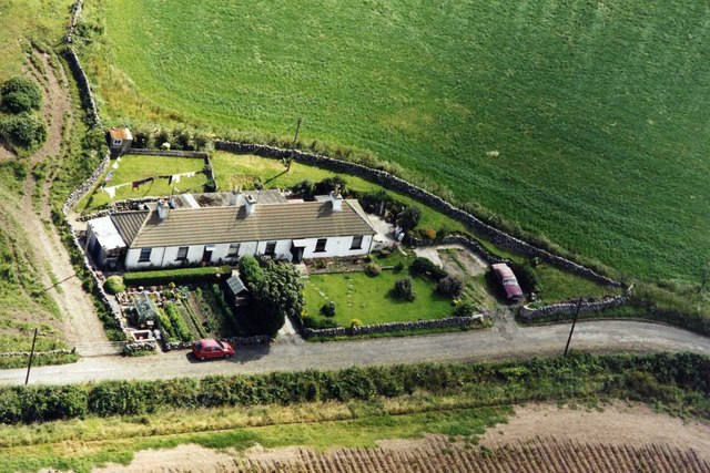
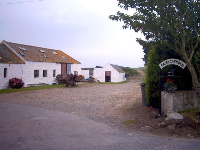
Alton Glen is a picturesque valley located in the region of Wigtownshire, in southwestern Scotland. Nestled amidst rolling hills and lush greenery, this idyllic glen offers a peaceful retreat for both locals and visitors alike.

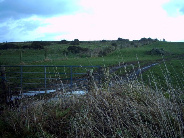
With its tranquil atmosphere and stunning natural beauty, Alton Glen is a haven for outdoor enthusiasts. The valley is home to an extensive network of walking trails that wind through its picturesque landscapes, offering breathtaking views of the surrounding countryside. Visitors can explore the glen's woodlands, meadows, and streams, immersing themselves in the sights and sounds of nature.

Alton Glen is also known for its rich biodiversity. The valley boasts a diverse range of flora and fauna, including rare plant species and various bird species. Birdwatchers can spot a host of avian species, such as buzzards, owls, and woodpeckers, making it a popular destination for bird enthusiasts.

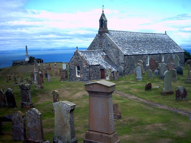
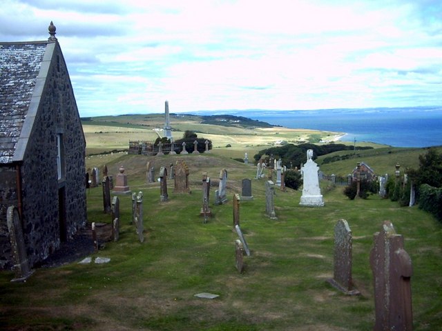
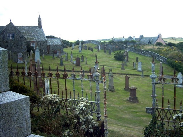
The glen is dotted with charming cottages and traditional farmhouses, adding to its rural charm. These buildings reflect the area's agricultural heritage and provide a glimpse into the local way of life.

In addition to its natural beauty, Alton Glen is also steeped in history. The valley is home to several archaeological sites, including ancient burial mounds and standing stones, which offer a glimpse into the area's ancient past.

Overall, Alton Glen is a hidden gem in Wigtownshire, offering visitors a chance to escape the hustle and bustle of everyday life and reconnect with nature and history in a truly stunning setting.

If you have any feedback on the listing, please let us know in the comments section below.
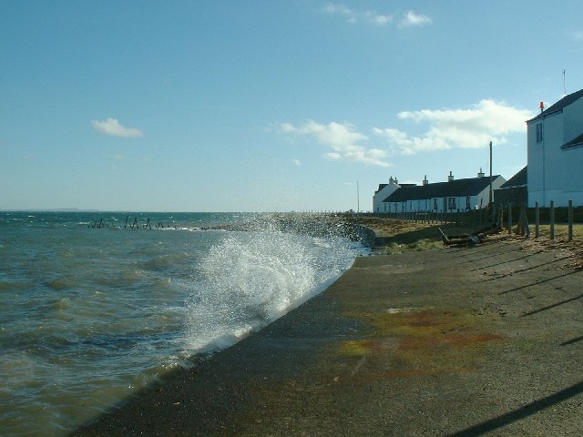
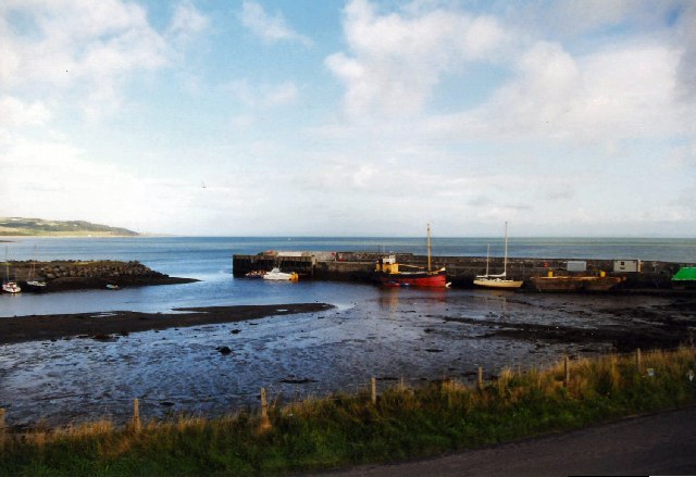
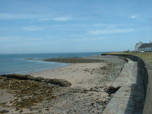
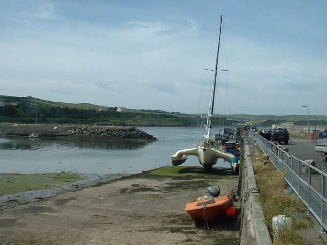
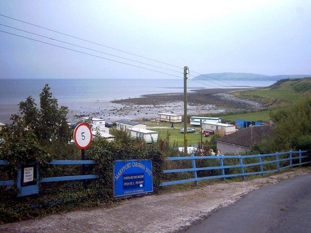
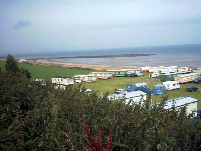
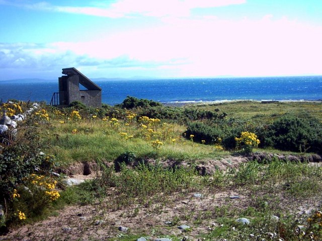
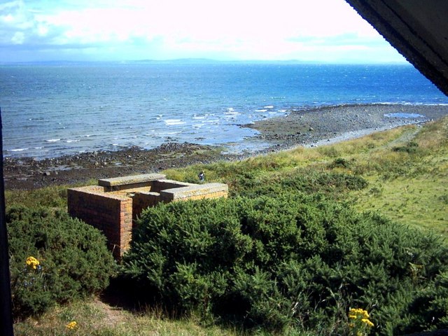
Alton Glen Images

Images are sourced within 2km of 54.678678/-4.8933368 or Grid Reference NX1335. Thanks to Geograph Open Source API. All images are credited.

Waves at Drummore nx140368 This is the coast road at Drummore leading to Back Bore and Cairngarroch Bay. The cottages in the mid shot are where we stayed for an excellent week in February 2004
Waves at Drummore nx140368
This is the coast road at Drummore leading to Back Bore and Cairngarroch Bay. The cottages in the mid shot are where we stayed for an excellent week in February 2004
Drummore Harbour The harbour was used by the M.O.D. in connection with their sea firing exercises, but was sold to the Drummore Harbour Trust in 2004. It is used by local skippers for sea angling and it is open to visiting boats.
Drummore Harbour
The harbour was used by the M.O.D. in connection with their sea firing exercises, but was sold to the Drummore Harbour Trust in 2004. It is used by local skippers for sea angling and it is open to visiting boats.
Groynes at Drummore Same shot as the first Geograph, showing what it's like when there is a calm sea and the tide is out.
Groynes at Drummore
Same shot as the first Geograph, showing what it's like when there is a calm sea and the tide is out.
Drummore Harbour Looking north west, along the breakwater at the southern end of the harbour.
Drummore Harbour
Looking north west, along the breakwater at the southern end of the harbour.
Drummore Harbour Looking west, towards the village.
Drummore Harbour
Looking west, towards the village.
Council houses at Drummore They may be council houses, but they have a superb outlook, north over the harbour and Luce Bay.
Council houses at Drummore
They may be council houses, but they have a superb outlook, north over the harbour and Luce Bay.
Cailiness Cottage The family of the farm worker who still lives in one of the cottages has lived and worked here for more than a century.
Cailiness Cottage
The family of the farm worker who still lives in one of the cottages has lived and worked here for more than a century.
Cairngarroch Farm Cairngarroch is a dairy farm.
Cairngarroch Farm
Cairngarroch is a dairy farm.
Maryport Caravan Park In the background can faintly be seen The Mull of Galloway and lighthouse.
Maryport Caravan Park
In the background can faintly be seen The Mull of Galloway and lighthouse.
Maryport Caravan Park Set on a sandy beach, the shingle bar is called 'Ringwee'.  The Wigtownshire coast across Luce Bay can faintly be seen on the horizon.
Maryport Caravan Park
Set on a sandy beach, the shingle bar is called 'Ringwee'. The Wigtownshire coast across Luce Bay can faintly be seen on the horizon.
Cailiness Point The old military look-out at Cailiness (formerly 'Killiness') Point.  The distant hills across Luce Bay are around Whithorn.
Cailiness Point
The old military look-out at Cailiness (formerly 'Killiness') Point. The distant hills across Luce Bay are around Whithorn.
Cailiness Point An old military building which is now on farmland.  The distant hills across Luce Bay are around Whithorn.
Cailiness Point
An old military building which is now on farmland. The distant hills across Luce Bay are around Whithorn.
Kirkmaiden Parish Church Formerly known as 'Kirk Covenant' a church was built here in 1638.  Remodelled in 1839, this building is the parish church of Kirkmaiden.
Kirkmaiden Parish Church
Formerly known as 'Kirk Covenant' a church was built here in 1638. Remodelled in 1839, this building is the parish church of Kirkmaiden.
Kirkmaiden Parish Church
Kirkmaiden Parish Church The churchyard viewed from the McDouall monument.
Kirkmaiden Parish Church
The churchyard viewed from the McDouall monument.
Damnaglaur Damnaglaur is a hamlet about a mile above the village of Drummore.  The Galloway Hills are visible across Luce Bay.
Damnaglaur
Damnaglaur is a hamlet about a mile above the village of Drummore. The Galloway Hills are visible across Luce Bay.
Creechan Moor
Creechan Moor
Conjured Knowe Why Conjured Knowe?  The Knowe ('knoll' in ancient Scottish) may have been made up or manufactured.
Conjured Knowe
Why Conjured Knowe? The Knowe ('knoll' in ancient Scottish) may have been made up or manufactured.
Show me another place!

Alton Glen is located at Grid Ref: NX1335 (Lat: 54.678678, Lng: -4.8933368)

Unitary Authority: Dumfries and Galloway

Police Authority: Dumfries and Galloway

What 3 Words

///lyricism.colleague.manly. Near Drummore, Dumfries & Galloway

Related Wikis

Drummore

Drummore (drum-ORE; (from Gaelic An Druim Mòr meaning "the great ridge") is the southernmost village in Scotland, located at the southern end of the Rhins...

Kirkmaiden (village)

Kirkmaiden (sometimes Maidenkirk; Scottish Gaelic: Cill M'Eudan) is a small settlement in Galloway, Scotland, located approximately 17 miles (27 km) south...

Kirkmaiden

Kirkmaiden is a parish in the Rhins of Galloway, the most southerly in Scotland; the present Church of Scotland parish has the same name as and is approximately...

Cairngaan

Cairngaan, Wigtownshire, is the southmost settlement in Scotland. The hamlet of Cairngaan lies just north of the Mull of Galloway (which contains Scotland...

Mull of Galloway

The Mull of Galloway (Scottish Gaelic: Maol nan Gall, pronounced [mɯːlˠ̪ nəŋ ˈkaulˠ̪]; grid reference NX158303) is the southernmost point of Scotland....

Port Logan

Port Logan, formerly Port Nessock, is a small village in the parish of Kirkmaiden in the Rhins of Galloway in Wigtownshire. The Gaelic name is Port Neasaig...

Logan Botanic Garden

Logan Botanic Garden is a botanical garden near Port Logan on the Rhins of Galloway, at the south-western tip of Scotland. The Botanic Garden was established...

Nearby Amenities

Located within 500m of 54.678678,-4.8933368
Drummore Glen
Place: locality
Lat/Long: 54.6807667/-4.8947582
Power: pole
Lat/Long: 54.6826048/-4.8962141
Power: pole
Lat/Long: 54.6819991/-4.895116
Power: pole
Lat/Long: 54.6815729/-4.8943554
Power: pole
Lat/Long: 54.6810793/-4.8934649
Power: pole
Lat/Long: 54.6805634/-4.8925045
Power: pole
Lat/Long: 54.6799195/-4.8913365
Power: pole
Lat/Long: 54.6800508/-4.8897281
Power: pole
Lat/Long: 54.6801775/-4.8879703
Power: pole
Lat/Long: 54.6803054/-4.8865656
Power: pole
Lat/Long: 54.679666/-4.8917924
Power: pole
Lat/Long: 54.6793979/-4.8922678
Power: pole
Lat/Long: 54.6791029/-4.8927955
The data included in this document is from www.openstreetmap.org. The data is made available under ODbL.

Have you been to Alton Glen?

Leave your review of Alton Glen below (or comments, questions and feedback).