Glen of the Hole

Valley in Wigtownshire

Scotland

Glen of the Hole

Southbound on the Rhins of Galloway Rockhopping on the way into the mouth of Clanyard bay
Southbound on the Rhins of Galloway Credit: Tony Page

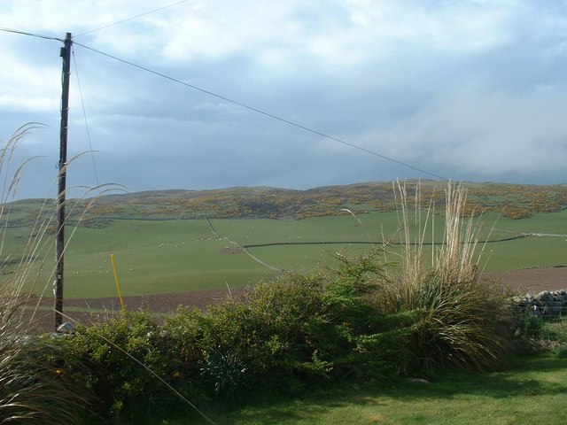
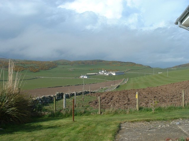
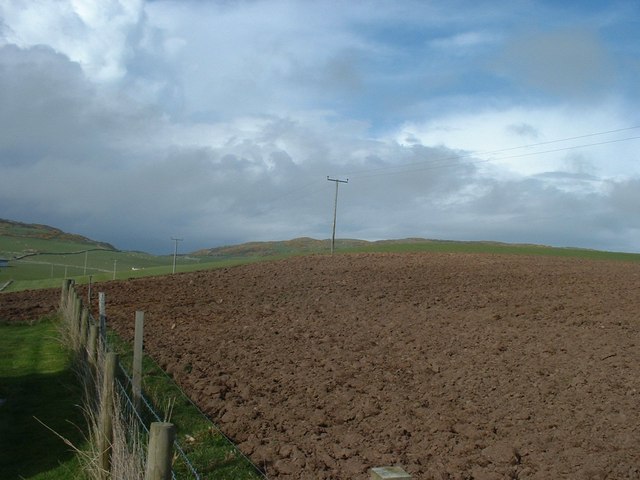
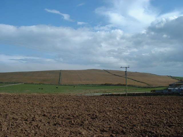
Glen of the Hole, located in Wigtownshire, Scotland, is a picturesque valley that stretches for approximately 5 miles. Nestled between rolling hills and lush greenery, it is a haven for nature enthusiasts and hikers alike. The glen is named after the small village of Hole, which sits at the heart of the valley.

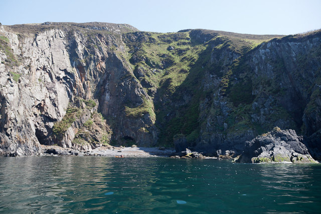
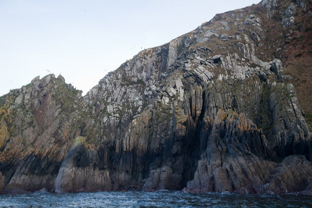
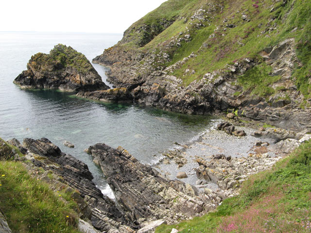
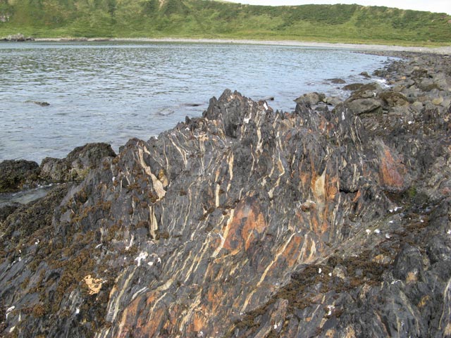
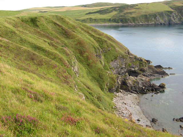
The landscape of Glen of the Hole is characterized by its rugged beauty and tranquil atmosphere. The valley is carved by the meandering Water of Luce, a river that flows through the glen, adding to its charm. The surrounding hills provide a stunning backdrop, with their heather-covered slopes and rocky outcrops.

The glen is home to a diverse range of flora and fauna. Visitors can spot various species of birds, including buzzards and peregrine falcons, soaring through the sky. The river is teeming with fish, making it a popular spot for anglers. The valley is also known for its wildflowers, with vibrant displays of bluebells and primroses during the spring months.

For those seeking outdoor adventures, Glen of the Hole offers numerous walking and hiking trails. The terrain varies from gentle paths suitable for leisurely strolls to more challenging routes for experienced hikers. One popular route is the Glen of the Hole Circular Walk, which takes visitors on a scenic tour of the glen, passing through woodland and alongside the river.

Overall, Glen of the Hole is a hidden gem in Wigtownshire, offering visitors a chance to immerse themselves in the natural beauty of the Scottish countryside. Whether it's a leisurely walk or an adventurous hike, this tranquil valley has something to offer for everyone.

If you have any feedback on the listing, please let us know in the comments section below.

Glen of the Hole Images

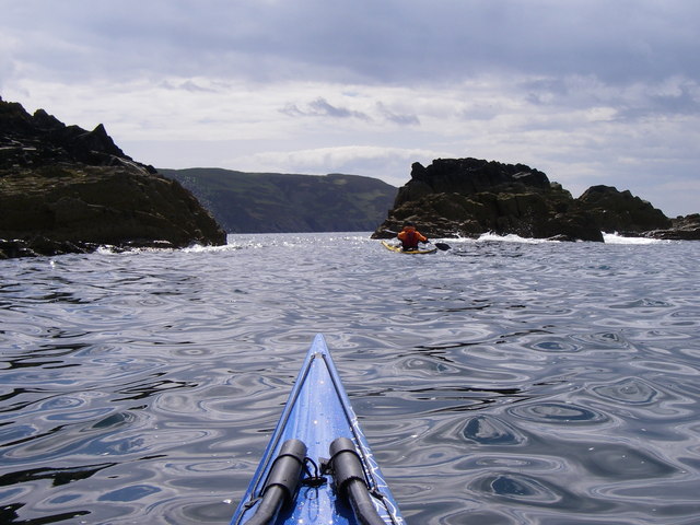
Images are sourced within 2km of 54.691854/-4.9397803 or Grid Reference NX1036. Thanks to Geograph Open Source API. All images are credited.

Southbound on the Rhins of Galloway Rockhopping on the way into the mouth of Clanyard bay
Southbound on the Rhins of Galloway
Rockhopping on the way into the mouth of Clanyard bay
Towards Barncorkrie Moor The gorse on the hillside glows brightly against the new spring grass in the sheep pasture.
Towards Barncorkrie Moor
The gorse on the hillside glows brightly against the new spring grass in the sheep pasture.
Barncorkrie Farm With Barncorkrie Moor behind and the minor road to Inshanks Fell in front.
Barncorkrie Farm
With Barncorkrie Moor behind and the minor road to Inshanks Fell in front.
Fields towards Cairn Fell With Barncorkrie Moor to left.
Fields towards Cairn Fell
With Barncorkrie Moor to left.
Fields by Knockencule With outbuildings of Knockencule Farm to right.
Fields by Knockencule
With outbuildings of Knockencule Farm to right.
Breddock Bay Breddock Bay taken on a sea kayak trip from East Tarbet to port Logan
Breddock Bay
Breddock Bay taken on a sea kayak trip from East Tarbet to port Logan
Craig of Dolt Craig of Dolt is composed of vertical and folded strata of greywacke, a sedimentary rock. The photo was taken in the vicinity of a delightfully named Gobawhilkin, while on a sea kayaking trip from East Tarbet to Port Logan.
Craig of Dolt
Craig of Dolt is composed of vertical and folded strata of greywacke, a sedimentary rock. The photo was taken in the vicinity of a delightfully named Gobawhilkin, while on a sea kayaking trip from East Tarbet to Port Logan.
Cairn, Barncorkrie Moor A rather neat cairn on the summit of the moor overlooking Barncorkrie. Another, nearby, is named the Cairn of Dolt, but I didn't go there.
Cairn, Barncorkrie Moor
A rather neat cairn on the summit of the moor overlooking Barncorkrie. Another, nearby, is named the Cairn of Dolt, but I didn't go there.
Carlin House Bay A small bay eroded along the strike of the rather deformed rocks of the turbiditic greywackes of the Clanyard Bay Formation (Gala Group, Silurian). Much interest attaches to the deformation style and stratigraphy of this area, but I did not climb down from the grassy col between the larger and smaller bays.
Carlin House Bay
A small bay eroded along the strike of the rather deformed rocks of the turbiditic greywackes of the Clanyard Bay Formation (Gala Group, Silurian). Much interest attaches to the deformation style and stratigraphy of this area, but I did not climb down from the grassy col between the larger and smaller bays.
Barncorkrie sheds and house Looking up the farm road past the sheds.
Barncorkrie sheds and house
Looking up the farm road past the sheds.
Farm track Looking up the farm track towards the col of Balloch, with Cairn fell in the right background.
Farm track
Looking up the farm track towards the col of Balloch, with Cairn fell in the right background.
Sheep fanks Looking down onto the sheep fanks at Balloch, with Cairn Fell in the background.
Sheep fanks
Looking down onto the sheep fanks at Balloch, with Cairn Fell in the background.
Granite outcrop Heading west on Barncorkrie Moor the geology changes to granite and quite quickly the heather begins to dominate the moorland pasture.
Granite outcrop
Heading west on Barncorkrie Moor the geology changes to granite and quite quickly the heather begins to dominate the moorland pasture.
Deformed rocks An outcrop of highly deformed greywacke which is intruded by felsite dykes. These rugged rocks drop steeply to the sea from a pronounced feature known as Carlin House.
Deformed rocks
An outcrop of highly deformed greywacke which is intruded by felsite dykes. These rugged rocks drop steeply to the sea from a pronounced feature known as Carlin House.
Raised  beach The west coast of the Rhins only has isolated lengths of raised beach, and this is a quite spectacular section. Another fine length is at Ardwell bay, <a href="https://www.geograph.org.uk/photo/3128116">NX0745 : Raised beach</a>. The great antiquity of the formation is indicated by the prolific growth of lichen on the cobbles, which shows that it is never moved by wave action. It is distressing to see that this very special formation is being dug for hardcore and destroyed.
Raised beach
The west coast of the Rhins only has isolated lengths of raised beach, and this is a quite spectacular section. Another fine length is at Ardwell bay, NX0745 : Raised beach. The great antiquity of the formation is indicated by the prolific growth of lichen on the cobbles, which shows that it is never moved by wave action. It is distressing to see that this very special formation is being dug for hardcore and destroyed.
Moffat shales Between the major blocks of tilted strata it is common to find outcrops of the Moffat Shales, of Silurian age as are the adjoining Gala and Cairnharrow Group greywackes. It appears that these weak rocks formed detachment surfaces along which there was severe deformation and transport of kilometre-scale blocks of strata. Clanyard Bay was formed by erosion of shattered rock adjacent to one of these major faults, and the striped appearance of this shale outcrop is due to intense deformation and injection of quartz veins into fractures which run parallel to the main fault.
Moffat shales
Between the major blocks of tilted strata it is common to find outcrops of the Moffat Shales, of Silurian age as are the adjoining Gala and Cairnharrow Group greywackes. It appears that these weak rocks formed detachment surfaces along which there was severe deformation and transport of kilometre-scale blocks of strata. Clanyard Bay was formed by erosion of shattered rock adjacent to one of these major faults, and the striped appearance of this shale outcrop is due to intense deformation and injection of quartz veins into fractures which run parallel to the main fault.
Calliedown Bay Looking southwards into this unapproachable bay, with Clanyard Bay behind. Streams are eroding gullies into the soft, glacial deposits above the bedrock.
Calliedown Bay
Looking southwards into this unapproachable bay, with Clanyard Bay behind. Streams are eroding gullies into the soft, glacial deposits above the bedrock.
Heathery slope A wonderful patchwork of colours, with heather blooming among dead bracken fronds and dried grasses.
Heathery slope
A wonderful patchwork of colours, with heather blooming among dead bracken fronds and dried grasses.
Show me another place!

Glen of the Hole is located at Grid Ref: NX1036 (Lat: 54.691854, Lng: -4.9397803)

Unitary Authority: Dumfries and Galloway

Police Authority: Dumfries and Galloway

What 3 Words

///staining.commit.artist. Near Drummore, Dumfries & Galloway

Related Wikis

Kirkmaiden (village)

Kirkmaiden (sometimes Maidenkirk; Scottish Gaelic: Cill M'Eudan) is a small settlement in Galloway, Scotland, located approximately 17 miles (27 km) south...

Kirkmaiden

Kirkmaiden is a parish in the Rhins of Galloway, the most southerly in Scotland; the present Church of Scotland parish has the same name as and is approximately...

Drummore

Drummore (drum-ORE; (from Gaelic An Druim Mòr meaning "the great ridge") is the southernmost village in Scotland, located at the southern end of the Rhins...

Port Logan

Port Logan, formerly Port Nessock, is a small village in the parish of Kirkmaiden in the Rhins of Galloway in Wigtownshire. The Gaelic name is Port Neasaig...

Nearby Amenities

Located within 500m of 54.691854,-4.9397803
Low Clanyard
Place: farm
Lat/Long: 54.6956716/-4.937771
Power: pole
Lat/Long: 54.69589/-4.936663
Power: pole
Lat/Long: 54.6951634/-4.9364398
Power: pole
Lat/Long: 54.6944312/-4.9362012
Power: pole
Lat/Long: 54.6942305/-4.9353766
Power: pole
Lat/Long: 54.6939434/-4.9341931
Power: pole
Lat/Long: 54.6936552/-4.9329921
Power: pole
Lat/Long: 54.6927957/-4.9335878
Power: pole
Lat/Long: 54.6919099/-4.9341892
Power: pole
Lat/Long: 54.691163/-4.934717
Power: pole
Lat/Long: 54.6903736/-4.9352641
Power: pole
Lat/Long: 54.6940146/-4.9370685
Power: pole
Lat/Long: 54.693454/-4.9382539
High Clanyard
Place: farm
Lat/Long: 54.6935311/-4.9394586
The data included in this document is from www.openstreetmap.org. The data is made available under ODbL.

Have you been to Glen of the Hole?

Leave your review of Glen of the Hole below (or comments, questions and feedback).