Barns Green

Settlement in Sussex Horsham

England

Barns Green

Rear of house on Marlpost Road The house is called "Woodlands" according to the large-scale map. This is also a cross-grid shot. The camera was just in the square to the west.
Rear of house on Marlpost Road Credit: Ian Cunliffe

Barns Green is a picturesque village located in the Horsham District of West Sussex, England. Situated approximately 3 miles southwest of Horsham, the village is nestled amidst the beautiful countryside of the Weald. With a population of around 1,000 residents, Barns Green exudes a charming and tight-knit community atmosphere.

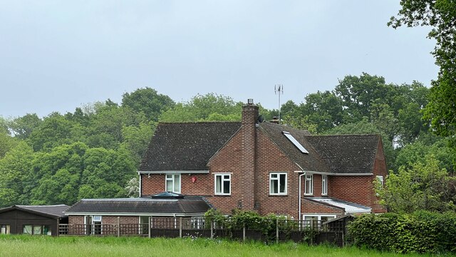
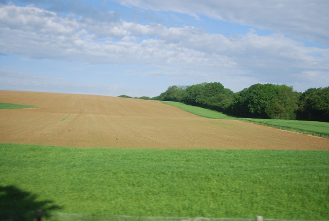
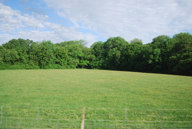
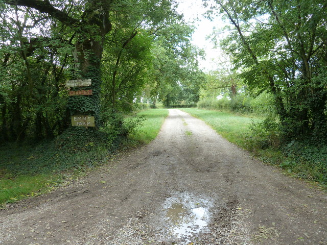
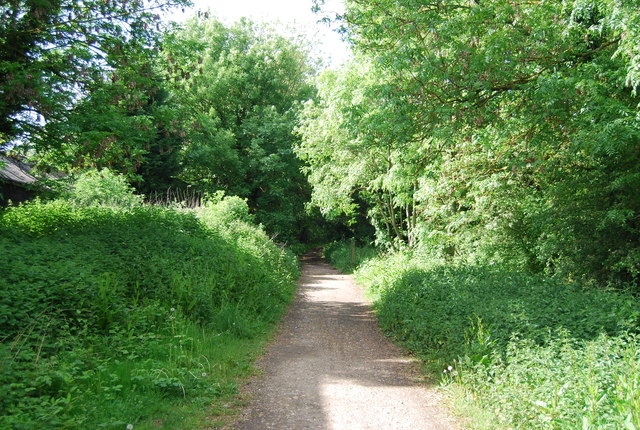
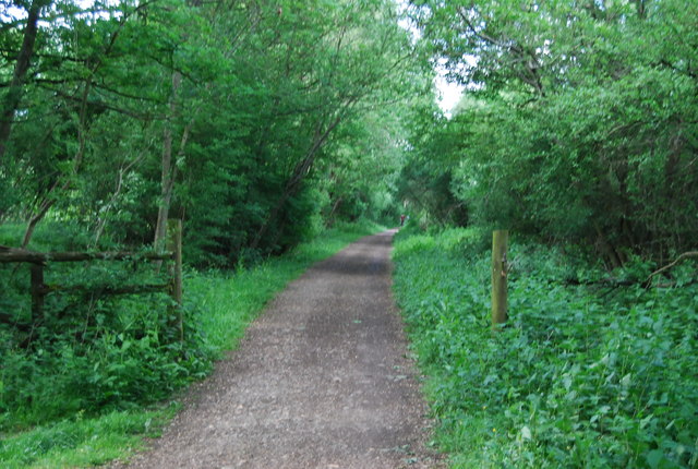
The village is known for its idyllic setting, surrounded by rolling green fields, woodlands, and scenic ponds. It offers a peaceful and tranquil environment, making it an ideal place for those seeking a countryside retreat. The architecture of Barns Green embodies a mix of traditional and modern styles, with a variety of charming cottages and newer houses dotting the landscape.

Local amenities in Barns Green include a primary school, village hall, and a post office. The village is also home to a couple of traditional country pubs, serving up delicious meals and offering a warm welcome to locals and visitors alike. The nearby Horsham town provides additional amenities and services, including shops, restaurants, and leisure facilities.

Barns Green hosts various community events throughout the year, including the renowned Barns Green Half Marathon and the Summer Festival, which brings together residents and visitors for a day of fun-filled activities. The village is also surrounded by numerous walking and cycling trails, allowing residents to explore the stunning natural beauty of the area.

Overall, Barns Green offers a peaceful and picturesque village lifestyle, with its beautiful surroundings, strong sense of community, and convenient access to nearby amenities.

If you have any feedback on the listing, please let us know in the comments section below.

Barns Green Images

Images are sourced within 2km of 51.031287/-0.396029 or Grid Reference TQ1227. Thanks to Geograph Open Source API. All images are credited.

Rear of house on Marlpost Road The house is called "Woodlands" according to the large-scale map. This is also a cross-grid shot. The camera was just in the square to the west.
Rear of house on Marlpost Road
The house is called "Woodlands" according to the large-scale map. This is also a cross-grid shot. The camera was just in the square to the west.
View north across fields west of Madgeland Farm It had begun to rain lightly when I took this shot.
View north across fields west of Madgeland Farm
It had begun to rain lightly when I took this shot.
An empty manger Over the hedge from West Chiltington Lane.
An empty manger
Over the hedge from West Chiltington Lane.
Pond near footpath 1466/2 There is another pond, just visible beyond the reedmace.
Pond near footpath 1466/2
There is another pond, just visible beyond the reedmace.
Bullocks on Shiprods Farm This was intended to be a view of the farm, but these critturs insisted on hogging the camera.
Bullocks on Shiprods Farm
This was intended to be a view of the farm, but these critturs insisted on hogging the camera.
Orchids by the bridleway Bishop's Wood is full of wild flowers, including a few species of orchid, but of these, only the Early-purple Orchid is flowering in early April.
Orchids by the bridleway
Bishop's Wood is full of wild flowers, including a few species of orchid, but of these, only the Early-purple Orchid is flowering in early April.
Bridleway 1476 heads south No dedicated bridleway gates are provided on this stretch, full farm gates have to be opened.
Bridleway 1476 heads south
No dedicated bridleway gates are provided on this stretch, full farm gates have to be opened.
Woodhouse Farm Clearly not the original farmhouse, and at some remove from the farm buildings.
Woodhouse Farm
Clearly not the original farmhouse, and at some remove from the farm buildings.
The lower slopes of Sharpenhurst Hill
Farmland, Sharpenhurst Farm
Lambs near Barns Green
Level crossing, Emms Lane
Valewood Farmhouse Grade II listed.  <span class="nowrap"><a title="http://www.britishlistedbuildings.co.uk/en-299292-valewood-itchingfield" rel="nofollow ugc noopener" href="http://www.britishlistedbuildings.co.uk/en-299292-valewood-itchingfield">Link</a><img style="margin-left:2px;" alt="External link" title="External link - shift click to open in new window" src="https://s1.geograph.org.uk/img/external.png" width="10" height="10"/></span>
Valewood Farmhouse
Grade II listed. LinkExternal link
Horses in a field near Grassy Copse
Field by the Arun Valley Line
Footpath 1904/2 to Emms Farm and Courtlands Farm
Downs Link The Downs Link is a 37-mile (59 km) footpath and bridleway linking the North Downs Way <a title="https://www.geograph.org.uk/snippet/174" href="https://www.geograph.org.uk/snippet/174">Link</a>  at St. Martha's Hill in Surrey with the South Downs Way <a title="https://www.geograph.org.uk/snippet/1186" href="https://www.geograph.org.uk/snippet/1186">Link</a>  near Steyning in West Sussex and on via the Coastal Link to Shoreham-by-Sea. Most of the route follows two dismantled railway lines, both closed by the Beeching cuts in the 1960s. The Shoreham-On-Sea to Christ’s Hospital line and the Christ’s Hospital to Shalford Junction line. The link opened in 1984. 
Cycle Route 223 follows the Downs link from Guildford to Shoreham.
The logo for the walk is the viaduct across the River Arun <a href="https://www.geograph.org.uk/photo/1870646">TQ0932 : Double Viaduct over the River Arun</a>.
A full history of the Cranleigh line (Christ’s Hospital to Shalford Junction) can be read at <span class="nowrap"><a title="http://en.wikipedia.org/wiki/Cranleigh_Line" rel="nofollow ugc noopener" href="http://en.wikipedia.org/wiki/Cranleigh_Line">Link</a><img style="margin-left:2px;" alt="External link" title="External link - shift click to open in new window" src="https://s1.geograph.org.uk/img/external.png" width="10" height="10"/></span>
Downs Link
The Downs Link is a 37-mile (59 km) footpath and bridleway linking the North Downs Way Link at St. Martha's Hill in Surrey with the South Downs Way Link near Steyning in West Sussex and on via the Coastal Link to Shoreham-by-Sea. Most of the route follows two dismantled railway lines, both closed by the Beeching cuts in the 1960s. The Shoreham-On-Sea to Christ’s Hospital line and the Christ’s Hospital to Shalford Junction line. The link opened in 1984. Cycle Route 223 follows the Downs link from Guildford to Shoreham. The logo for the walk is the viaduct across the River Arun TQ0932 : Double Viaduct over the River Arun. A full history of the Cranleigh line (Christ’s Hospital to Shalford Junction) can be read at LinkExternal link
Downs Link in the woods The Downs Link is a 37-mile (59 km) footpath and bridleway linking the North Downs Way <a title="https://www.geograph.org.uk/snippet/174" href="https://www.geograph.org.uk/snippet/174">Link</a>  at St. Martha's Hill in Surrey with the South Downs Way <a title="https://www.geograph.org.uk/snippet/1186" href="https://www.geograph.org.uk/snippet/1186">Link</a>  near Steyning in West Sussex and on via the Coastal Link to Shoreham-by-Sea. Most of the route follows two dismantled railway lines, both closed by the Beeching cuts in the 1960s. The Shoreham-On-Sea to Christ’s Hospital line and the Christ’s Hospital to Shalford Junction line. The link opened in 1984. 
Cycle Route 223 follows the Downs link from Guildford to Shoreham.
The logo for the walk is the viaduct across the River Arun <a href="https://www.geograph.org.uk/photo/1870646">TQ0932 : Double Viaduct over the River Arun</a>.
A full history of the Cranleigh line (Christ’s Hospital to Shalford Junction) can be read at <span class="nowrap"><a title="http://en.wikipedia.org/wiki/Cranleigh_Line" rel="nofollow ugc noopener" href="http://en.wikipedia.org/wiki/Cranleigh_Line">Link</a><img style="margin-left:2px;" alt="External link" title="External link - shift click to open in new window" src="https://s1.geograph.org.uk/img/external.png" width="10" height="10"/></span>
Downs Link in the woods
The Downs Link is a 37-mile (59 km) footpath and bridleway linking the North Downs Way Link at St. Martha's Hill in Surrey with the South Downs Way Link near Steyning in West Sussex and on via the Coastal Link to Shoreham-by-Sea. Most of the route follows two dismantled railway lines, both closed by the Beeching cuts in the 1960s. The Shoreham-On-Sea to Christ’s Hospital line and the Christ’s Hospital to Shalford Junction line. The link opened in 1984. Cycle Route 223 follows the Downs link from Guildford to Shoreham. The logo for the walk is the viaduct across the River Arun TQ0932 : Double Viaduct over the River Arun. A full history of the Cranleigh line (Christ’s Hospital to Shalford Junction) can be read at LinkExternal link
Show me another place!

Barns Green is located at Grid Ref: TQ1227 (Lat: 51.031287, Lng: -0.396029)

Administrative County: West Sussex

District: Horsham

Police Authority: Sussex

What 3 Words

///dented.toys.equipment. Near Southwater, West Sussex

Nearby Locations

Barns Green Muntham Gill

Related Wikis

Barns Green

Barns Green is a village in the Horsham district of West Sussex, England. It lies on the Billingshurst to Itchingfield road 2+1⁄2 miles (4.0 km) north...

Itchingfield

Itchingfield is a small village and civil parish in the Horsham district of West Sussex, England. It lies on the Barns Green to Broadbridge Heath road...

Downs Link

The Downs Link is a 36.7 miles (59.1 km) footpath and bridleway linking the North Downs Way at St. Martha's Hill in Surrey with the South Downs Way near...

Brooks Green

Brooks Green is a hamlet in the Shipley civil parish of the Horsham District of West Sussex, England. It is in the north-west of the parish, approximately...

Billingshurst (electoral division)

Billingshurst is an electoral division of West Sussex in the United Kingdom and returns one member to sit on West Sussex County Council. == Extent == The...

Holy Innocents Church, Southwater

Holy Innocents Church is the Anglican parish church of Southwater, a village in the Horsham District of West Sussex, England. Built in 1849, the church...

Christ's Hospital

Christ's Hospital is a public school (English fee-charging boarding school for pupils aged 11–18) with a royal charter located to the south of Horsham...

Newbuildings Place

Newbuildings Place is a 17th-century Artisan Mannerist house near Shipley, West Sussex. The house is a former home of Wilfrid Scawen Blunt, who is buried...

Nearby Amenities

Located within 500m of 51.031287,-0.396029
Source: Landsat photo
Lat/Long: 51.0307862/-0.3902234
Barns Green
Is In: West Sussex, England, UK
Place: village
Wikidata: Q11687409
Lat/Long: 51.0311401/-0.3940604
Bus Stop
Recreation Ground
Bus: yes
Naptan AtcoCode: 4400HR0277
Naptan Bearing: NE
Naptan CommonName: Recreation Ground
Naptan Indicator: opp Cornerways
Naptan Landmark: Muntham Drive
Naptan NaptanCode: wsxawagj
Naptan Street: Sandhills Road
Naptan Verified: no
Public Transport: platform
Source: naptan_import
Lat/Long: 51.0328071/-0.3939138
Bus Stop
Recreation Ground
Bus: yes
Naptan AtcoCode: 4400HR0278
Naptan Bearing: SW
Naptan CommonName: Recreation Ground
Naptan Indicator: o/s Cornerways
Naptan Landmark: Muntham Drive
Naptan NaptanCode: wsxawagm
Naptan Street: Sandhills Road
Naptan Verified: no
Public Transport: platform
Source: naptan_import
Lat/Long: 51.0327155/-0.3937887
Parkers Corner
Naptan AtcoCode: 4400HR0279
Naptan Bearing: W
Naptan BusStopType: CUS
Naptan CommonName: Parkers Corner
Naptan Indicator: opp Parkers
Naptan Landmark: Sandhills Road
Naptan NaptanCode: wsxawagp
Naptan Street: Two Mile Ash Road
Naptan Verified: no
Source: naptan_import
Lat/Long: 51.0323762/-0.3933155
Bus Stop
Parkers Corner
Bus: yes
Naptan AtcoCode: 4400HR0280
Naptan Bearing: E
Naptan CommonName: Parkers Corner
Naptan Indicator: adj Parkers
Naptan Landmark: Sandhills Road
Naptan NaptanCode: wsxawagt
Naptan Street: Two Mile Ash Road
Naptan Verified: no
Public Transport: platform
Source: naptan_import
Lat/Long: 51.0324641/-0.3931698
Fixme: this needs surveying - Crossing?, where to?
Railway: crossing
Lat/Long: 51.0301637/-0.3913472
Sumners Ponds
Leisure: fishing
Lat/Long: 51.0286002/-0.3989833
Railway: level_crossing
Source: Landsat photo
Lat/Long: 51.0282085/-0.3952087
Railway: level_crossing
Lat/Long: 51.0281875/-0.3951684
Slaughterford Farm
Place: farm
Lat/Long: 51.0292762/-0.3977634
Washout Hydrant
Fire Hydrant
Emergency: fire_hydrant
Fire Hydrant Type: underground
Survey Date: 2018-11-11
Water Source: main
Lat/Long: 51.032691/-0.3941261
Washout Hydrant
Fire Hydrant
Emergency: fire_hydrant
Fire Hydrant Type: underground
Survey Date: 2018-11-11
Water Source: main
Lat/Long: 51.031202/-0.3924661
Bench
Lat/Long: 51.0354862/-0.3958062
Bench
Lat/Long: 51.0354925/-0.395877
Bench
Lat/Long: 51.0354843/-0.3959455
Bench
Lat/Long: 51.0354526/-0.395982
Turning Loop
Lat/Long: 51.0287417/-0.3972401
Railway: crossing
Lat/Long: 51.0301858/-0.3913925
Defibrillator
Defibrillator Location: outside Barns Green Village Hall
Emergency: defibrillator
Indoor: no
Lat/Long: 51.0331891/-0.3955725
Defibrillator
Defibrillator Location: outside village shop, Barns Green
Emergency: defibrillator
Indoor: no
Lat/Long: 51.0313655/-0.3956617
Mareland Farm
Place: farm
Wikidata: Q26637053
Lat/Long: 51.0295386/-0.3896201
Post Box
Operator: Royal Mail
Post Box Type: wall
Ref: RH13 144
Royal Cypher: GVIR
Royal Cypher Wikidata: Q33102169
Lat/Long: 51.0313562/-0.3956714
Entrance: main
Lat/Long: 51.0313493/-0.3956787
Life Ring
Emergency: life_ring
Lat/Long: 51.03177/-0.401181
Life Ring
Emergency: life_ring
Lat/Long: 51.0286844/-0.3988747
The data included in this document is from www.openstreetmap.org. The data is made available under ODbL.

Have you been to Barns Green?

Leave your review of Barns Green below (or comments, questions and feedback).