Muntham Gill
Valley in Sussex Horsham
England
Muntham Gill

Muntham Gill, Sussex, also known as Muntham Valley, is a picturesque area located in the stunning county of West Sussex, England. Nestled within the South Downs National Park, this valley offers a serene and tranquil setting for visitors to enjoy.
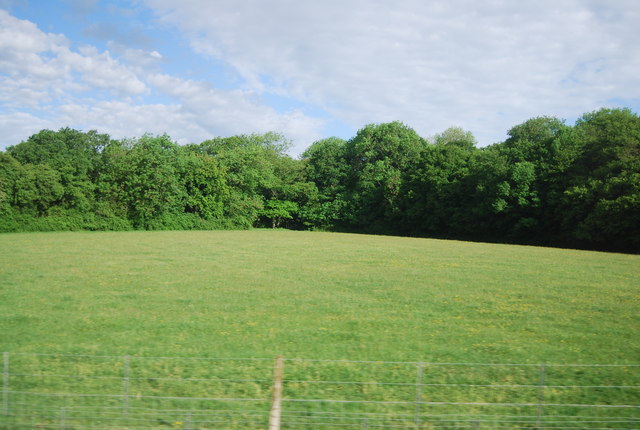
The valley is characterized by its rolling hills, lush green meadows, and thriving wildlife. It is home to a diverse range of flora and fauna, including rare and protected species. Muntham Gill is particularly renowned for its wide variety of wildflowers, which carpet the meadows during the spring and summer months.
The valley is intersected by a small stream, which meanders through the landscape, adding to its charm. The stream is a haven for local wildlife, including ducks, swans, and various species of fish. Visitors can enjoy peaceful walks along the stream, taking in the soothing sounds of running water and the delightful views.
Muntham Gill is also an excellent spot for birdwatching, with numerous species of birds inhabiting the area. Bird enthusiasts can spot woodpeckers, owls, kestrels, and many other feathered friends in their natural habitat.
For those seeking outdoor activities, the valley offers several walking and cycling routes that showcase the area's natural beauty. There are also picnic spots where visitors can relax and enjoy a meal while immersing themselves in the idyllic surroundings.
Overall, Muntham Gill, Sussex is a hidden gem that provides a peaceful escape from the hustle and bustle of everyday life. Its stunning landscapes, diverse wildlife, and recreational opportunities make it a must-visit destination for nature lovers and outdoor enthusiasts alike.
If you have any feedback on the listing, please let us know in the comments section below.
Muntham Gill Images
Images are sourced within 2km of 51.035263/-0.4026376 or Grid Reference TQ1227. Thanks to Geograph Open Source API. All images are credited.
Muntham Gill is located at Grid Ref: TQ1227 (Lat: 51.035263, Lng: -0.4026376)
Administrative County: West Sussex
District: Horsham
Police Authority: Sussex
What 3 Words
///quite.iteration.quick. Near Southwater, West Sussex
Nearby Locations
Related Wikis
Barns Green
Barns Green is a village in the Horsham district of West Sussex, England. It lies on the Billingshurst to Itchingfield road 2+1⁄2 miles (4.0 km) north...
Itchingfield
Itchingfield is a small village and civil parish in the Horsham district of West Sussex, England. It lies on the Barns Green to Broadbridge Heath road...
Billingshurst (electoral division)
Billingshurst is an electoral division of West Sussex in the United Kingdom and returns one member to sit on West Sussex County Council. == Extent == The...
Downs Link
The Downs Link is a 36.7 miles (59.1 km) footpath and bridleway linking the North Downs Way at St. Martha's Hill in Surrey with the South Downs Way near...
Five Oaks
Five Oaks is a large hamlet in the Horsham District of West Sussex, England. It lies about 1.7 miles (2.8 km) north of Billingshurst on the Roman road...
Brooks Green
Brooks Green is a hamlet in the Shipley civil parish of the Horsham District of West Sussex, England. It is in the north-west of the parish, approximately...
Christ's Hospital
Christ's Hospital is a public school (English fee-charging boarding school for pupils aged 11–18) with a royal charter located to the south of Horsham...
Christ's Hospital railway station
Christ's Hospital railway station is near Horsham in West Sussex, England. It is 40 miles 7 chains (64.5 km) down the line from London Bridge via Redhill...
Nearby Amenities
Located within 500m of 51.035263,-0.4026376Have you been to Muntham Gill?
Leave your review of Muntham Gill below (or comments, questions and feedback).


