Broom Hill

Hill, Mountain in Suffolk East Suffolk

England

Broom Hill

Woolverstone Marina
Woolverstone Marina Credit: Chris Holifield

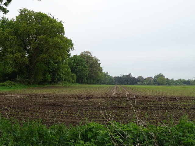
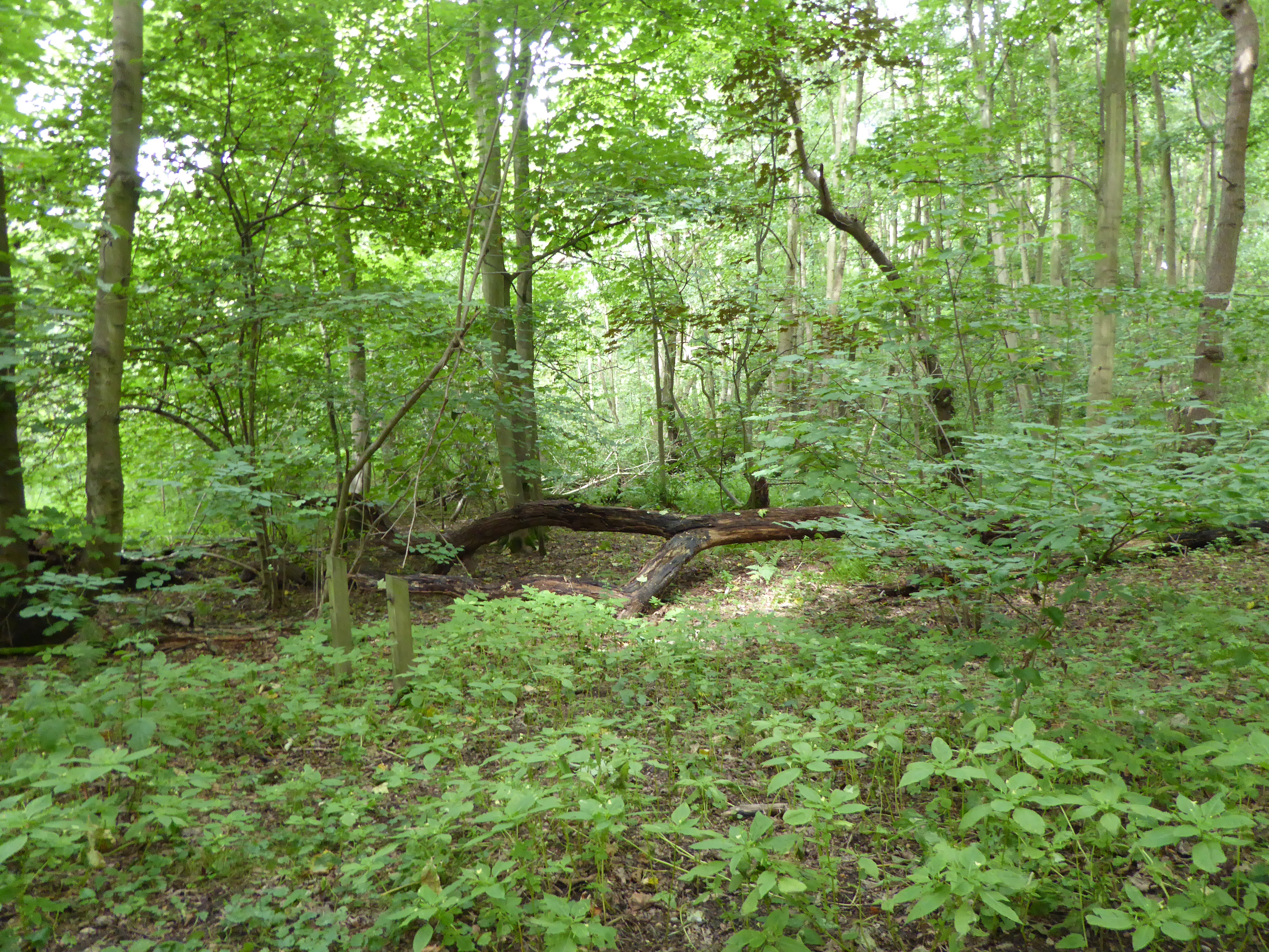
Broom Hill is a small hill located in the county of Suffolk, England. Situated near the village of Trimley St Martin, it is a prominent feature in the surrounding landscape. Despite being referred to as a hill, Broom Hill is more accurately described as a modest elevation rather than a towering mountain.

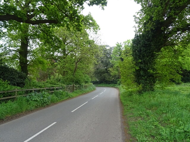
The hill itself is covered in lush green grass and is dotted with a variety of trees and shrubs, providing a picturesque view for visitors and locals alike. Its gentle slope makes it a popular spot for leisurely walks and picnics, as well as a tranquil place for nature enthusiasts to observe the local flora and fauna.

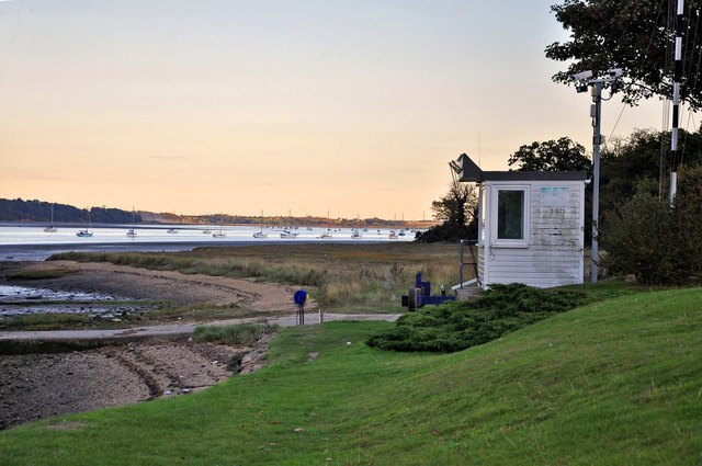
Broom Hill offers panoramic views of the surrounding countryside, including the nearby Orwell Estuary. On clear days, visitors can see the distant outlines of Felixstowe, the largest container port in the United Kingdom, which sits on the opposite side of the estuary.

The hill is also of historical significance, with evidence of human activity dating back to prehistoric times. Archaeological discoveries have revealed the presence of ancient settlements and burial mounds in the area, indicating that Broom Hill has been a significant location for centuries.

Overall, Broom Hill is a charming and serene destination that showcases the natural beauty and rich history of Suffolk. Whether it be for a peaceful stroll or an appreciation of the local heritage, this small hill offers a delightful experience for anyone who visits.

If you have any feedback on the listing, please let us know in the comments section below.

Broom Hill Images

Images are sourced within 2km of 52.021947/1.2027267 or Grid Reference TM1940. Thanks to Geograph Open Source API. All images are credited.

Woolverstone Marina
Woolverstone Marina
Crop field beside woodland
Bend in National Cycle Route 51 Ipswich Road towards Nacton.
Bend in National Cycle Route 51
Ipswich Road towards Nacton.
Woolverstone Marina Wolverstone Marina is the Home of many pleasure crafts.  It is also next to the “Cat House” where it was said that years ago was the home to a man who was sympathetic to boats carrying contraband along the river.  He had a pet cat which he loved.  When it died he had it stuffed and when he could see that no customs boats were patrolling the river put the cat in the window for any smugglers to see, signalling that all was well.
Woolverstone Marina
Wolverstone Marina is the Home of many pleasure crafts. It is also next to the “Cat House” where it was said that years ago was the home to a man who was sympathetic to boats carrying contraband along the river. He had a pet cat which he loved. When it died he had it stuffed and when he could see that no customs boats were patrolling the river put the cat in the window for any smugglers to see, signalling that all was well.
Woolverstone Marina Mdl owned Marina on the River Orwell
Woolverstone Marina
Mdl owned Marina on the River Orwell
Old fence and tree stump At low water the River Orwell is reduced to a narrow, but deep, strip in the centre of the estuary. The fence extends as far as the low water mark, whilst an old tree stump stubbornly refuses to drift away.
Old fence and tree stump
At low water the River Orwell is reduced to a narrow, but deep, strip in the centre of the estuary. The fence extends as far as the low water mark, whilst an old tree stump stubbornly refuses to drift away.
River Orwell fence OK - it's an old fence.  But what purpose did it once serve, other than to mark out someone's property? In days gone by, people who worked on the river's banks wore footwear akin to snow shoes, which prevented them from sinking into the treacherous mud.
River Orwell fence
OK - it's an old fence. But what purpose did it once serve, other than to mark out someone's property? In days gone by, people who worked on the river's banks wore footwear akin to snow shoes, which prevented them from sinking into the treacherous mud.
Old fence in the River Orwell This old fence extends out to the low water mark. The dredged channel can be seen as a blue horizontal strip, as well as a red (port-hand) channel marker buoy on the extreme right of the photo.
Old fence in the River Orwell
This old fence extends out to the low water mark. The dredged channel can be seen as a blue horizontal strip, as well as a red (port-hand) channel marker buoy on the extreme right of the photo.
Cargo ship in the River Orwell The MV Velox is departing the port of Ipswich, heading downstream towards Harwich Harbour.
Cargo ship in the River Orwell
The MV Velox is departing the port of Ipswich, heading downstream towards Harwich Harbour.
River Orwell Sunset over the Orwell, taken from the water's edge.
River Orwell
Sunset over the Orwell, taken from the water's edge.
Woolverstone Marina and Orwell Bridge
Dusk on the River Orwell - Woolverstone
River Orwell and Woolverstone Marina The Orwell Bridge can be seen to the left and rear of the photograph.
River Orwell and Woolverstone Marina
The Orwell Bridge can be seen to the left and rear of the photograph.
Foreshore at dusk - River Orwell Taken from in front of the Royal Harwich Yacht Club.
Foreshore at dusk - River Orwell
Taken from in front of the Royal Harwich Yacht Club.
Race control box at the Royal Harwich Yacht Club - Woolverstone Pictured at dusk on a clearing evening having had heavy cloud all day!
Race control box at the Royal Harwich Yacht Club - Woolverstone
Pictured at dusk on a clearing evening having had heavy cloud all day!
Woolverstone Pier, River Orwell Westerly Fulmar "Meander" tied up alongside Woolverstone Pier.
Woolverstone Pier, River Orwell
Westerly Fulmar "Meander" tied up alongside Woolverstone Pier.
Woolverstone Marina Woolverstone Marina and the River Orwell.
Woolverstone Marina
Woolverstone Marina and the River Orwell.
Approaching the A12 near the Halfway House roundabout
Show me another place!

Broom Hill is located at Grid Ref: TM1940 (Lat: 52.021947, Lng: 1.2027267)

Administrative County: Suffolk

District: East Suffolk

Police Authority: Suffolk

What 3 Words

///ruling.mascots.deal. Near Kesgrave, Suffolk

Related Wikis

Alnesbourne Priory

Alnesbourne Priory, also known as Alnesbourn Priory, was a small Augustinian monastic house in the English county of Suffolk. It was located near Nacton...

Ravenswood, Ipswich

Ravenswood is a district within Ipswich, in the Ipswich district, in the county of Suffolk, England. It is sited on the old Ipswich Airport to the south...

Ransomes Industrial Estate

Ransomes Industrial Estate, also known as Ransomes Europark is combined retail and business park located in Priory Heath Ward, Ipswich, on the southeastern...

Ipswich Airport

Ipswich Airport (IATA: IPW, ICAO: EGSE) was an airfield on the outskirts of Ipswich, Suffolk England. It was known as RAF Nacton when No. 3619 Fighter...

Bridge Wood

Bridge Wood is a 31 hectare Local Nature Reserve on the southern outskirts of Ipswich in Suffolk, England. It is owned and managed by Ipswich Borough Council...

Ipswich Gymnastics Centre

Ipswich Gymnastics Centre in Ipswich is one of only three fully London Organising Committee for the Olympic Games (LOCOG) accredited gymnastics facilities...

Ipswich Academy

Ipswich Academy (formerly Holywells High School) is a mixed secondary school in Ipswich, Suffolk for students aged 11 to 16. Since September 2010, it has...

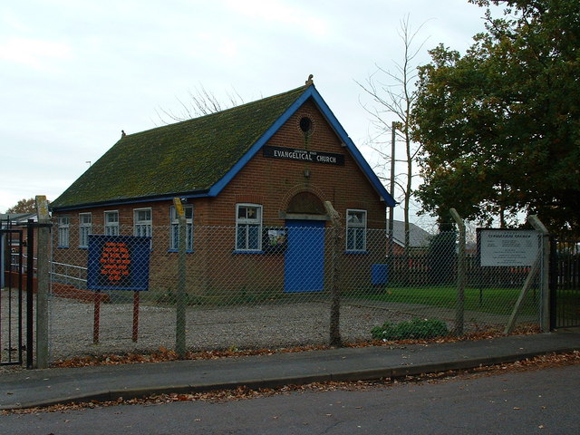
Leighton Road Evangelical Church, Ipswich

Leighton Road Evangelical Church is a nonconformist independent evangelical church located on the Gainsborough estate, Ipswich in the English county of...

Nearby Amenities

Located within 500m of 52.021947,1.2027267
Motorway Junction
Nacton Interchange
Ref: 57
Lat/Long: 52.0244161/1.2009803
Power: pole
Lat/Long: 52.0218855/1.1985752
Bunker Type: pillbox
Historic: ruins
Military: bunker
Note: position is approx
Lat/Long: 52.0254973/1.2004763
Speed Camera
Maxspeed: 60 mph
Maxspeed Variable: yes
Lat/Long: 52.0235147/1.196485
Speed Camera
Maxspeed: 60 mph
Maxspeed Variable: yes
Lat/Long: 52.0243492/1.2003292
The data included in this document is from www.openstreetmap.org. The data is made available under ODbL.

Have you been to Broom Hill?

Leave your review of Broom Hill below (or comments, questions and feedback).