The Alders

Wood, Forest in Suffolk East Suffolk

England

The Alders

Freston Tower A brick built towner probably dating from the 16th Century: <span class="nowrap"><a title="https://en.wikipedia.org/wiki/Freston_Tower" rel="nofollow ugc noopener" href="https://en.wikipedia.org/wiki/Freston_Tower">Link</a><img style="margin-left:2px;" alt="External link" title="External link - shift click to open in new window" src="https://s1.geograph.org.uk/img/external.png" width="10" height="10"/></span>. It now belongs to the Landmark Trust and can be rented as a holdiay home: <span class="nowrap"><a title="https://www.landmarktrust.org.uk/search-and-book/properties/freston-tower-7680/#Overview" rel="nofollow ugc noopener" href="https://www.landmarktrust.org.uk/search-and-book/properties/freston-tower-7680/#Overview">Link</a><img style="margin-left:2px;" alt="External link" title="External link - shift click to open in new window" src="https://s1.geograph.org.uk/img/external.png" width="10" height="10"/></span>
Freston Tower Credit: Chris Holifield

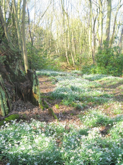
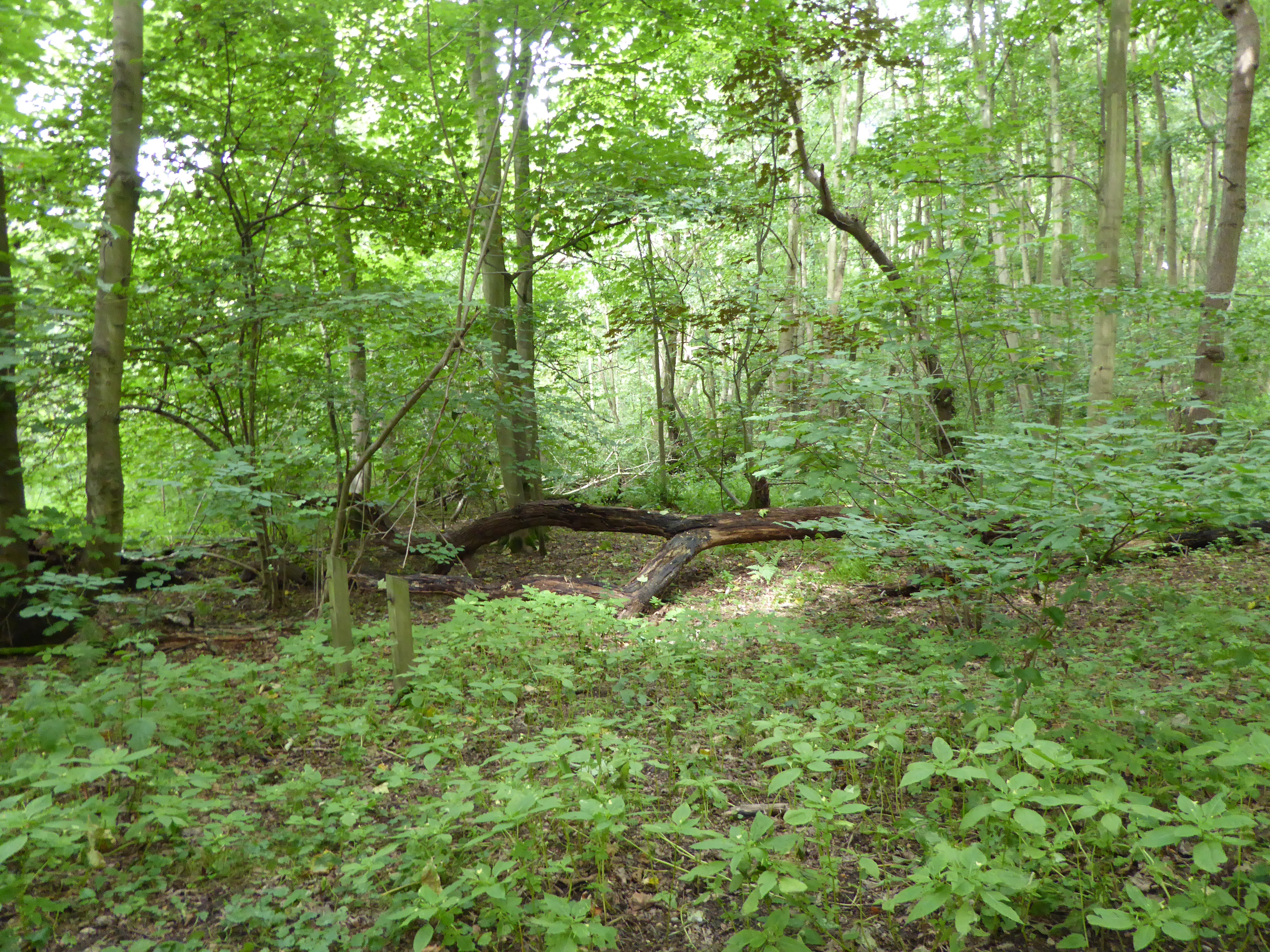
The Alders is a charming woodland located in Suffolk, England. Stretching across a vast area, it is known for its dense population of alder trees, which lend their name to this picturesque forest. The woodland is predominantly composed of mixed deciduous trees, creating a lush and vibrant environment.

The Alders is a haven for nature enthusiasts and offers a myriad of activities for visitors to enjoy. Its well-maintained trails wind through the forest, providing opportunities for peaceful walks and hikes. These pathways are also popular among cyclists and horse riders, who can explore the beauty of the surroundings at their leisure.

Wildlife thrives within The Alders, with numerous species calling it home. Birdwatchers flock to the forest in search of rare and migratory birds, while nature photographers find ample opportunities to capture stunning shots of the diverse flora and fauna.

The management of The Alders is focused on preserving the natural integrity of the woodland. Conservation efforts are in place to protect the delicate ecosystem, ensuring a sustainable future for the forest and its inhabitants. As a result, The Alders is recognized as a Site of Special Scientific Interest (SSSI), further emphasizing its ecological significance.

For those seeking a tranquil retreat in Suffolk, The Alders offers a serene escape. Its beauty and biodiversity make it a cherished destination for nature lovers and a valuable natural resource for the local community.

If you have any feedback on the listing, please let us know in the comments section below.
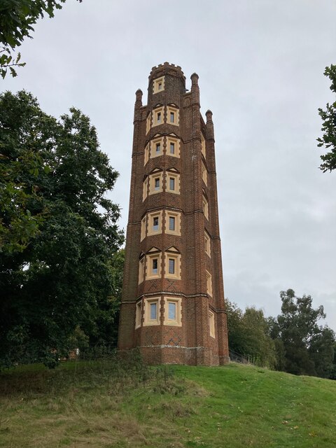
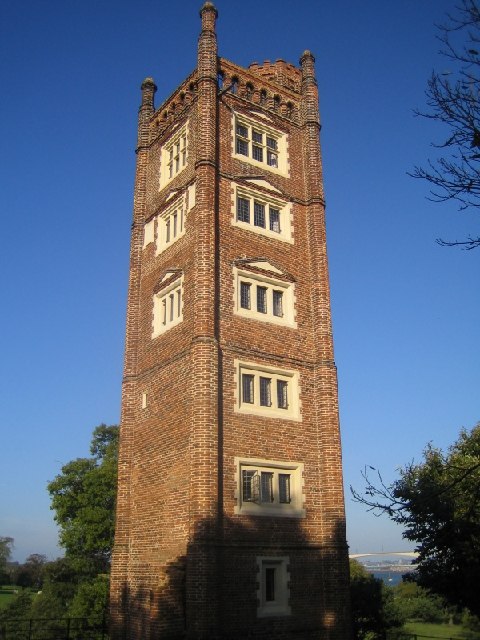
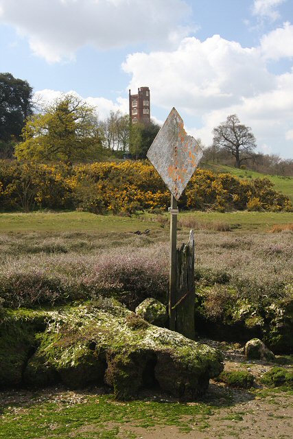
The Alders Images

Images are sourced within 2km of 52.019421/1.1947324 or Grid Reference TM1940. Thanks to Geograph Open Source API. All images are credited.

Freston Tower A brick built towner probably dating from the 16th Century: <span class="nowrap"><a title="https://en.wikipedia.org/wiki/Freston_Tower" rel="nofollow ugc noopener" href="https://en.wikipedia.org/wiki/Freston_Tower">Link</a><img style="margin-left:2px;" alt="External link" title="External link - shift click to open in new window" src="https://s1.geograph.org.uk/img/external.png" width="10" height="10"/></span>. It now belongs to the Landmark Trust and can be rented as a holdiay home: <span class="nowrap"><a title="https://www.landmarktrust.org.uk/search-and-book/properties/freston-tower-7680/#Overview" rel="nofollow ugc noopener" href="https://www.landmarktrust.org.uk/search-and-book/properties/freston-tower-7680/#Overview">Link</a><img style="margin-left:2px;" alt="External link" title="External link - shift click to open in new window" src="https://s1.geograph.org.uk/img/external.png" width="10" height="10"/></span>
Freston Tower
A brick built towner probably dating from the 16th Century: LinkExternal link. It now belongs to the Landmark Trust and can be rented as a holdiay home: LinkExternal link
Woolverstone Marina
Woolverstone Marina
Woolverstone Marina Wolverstone Marina is the Home of many pleasure crafts.  It is also next to the “Cat House” where it was said that years ago was the home to a man who was sympathetic to boats carrying contraband along the river.  He had a pet cat which he loved.  When it died he had it stuffed and when he could see that no customs boats were patrolling the river put the cat in the window for any smugglers to see, signalling that all was well.
Woolverstone Marina
Wolverstone Marina is the Home of many pleasure crafts. It is also next to the “Cat House” where it was said that years ago was the home to a man who was sympathetic to boats carrying contraband along the river. He had a pet cat which he loved. When it died he had it stuffed and when he could see that no customs boats were patrolling the river put the cat in the window for any smugglers to see, signalling that all was well.
Freston Tower Freston Tower, owned by The Landmark Trust. We stayed there in October 2005!
Freston Tower
Freston Tower, owned by The Landmark Trust. We stayed there in October 2005!
A long drive Woolverstone Hall Woolverstone Suffolk.Now a school. More info see <span class="nowrap"><a title="http://en.wikipedia.org/wiki/Woolverstone_Hall" rel="nofollow ugc noopener" href="http://en.wikipedia.org/wiki/Woolverstone_Hall">Link</a><img style="margin-left:2px;" alt="External link" title="External link - shift click to open in new window" src="https://s1.geograph.org.uk/img/external.png" width="10" height="10"/></span>
A long drive
Woolverstone Hall Woolverstone Suffolk.Now a school. More info see LinkExternal link
Snowdrops in Woolverstone wood
St Michael's, Woolverstone Taken from the drive down to the marina.
St Michael's, Woolverstone
Taken from the drive down to the marina.
Foreshore at Woolverstone Looking upstream from the end of the public footpath towards the Orwell Bridge.
Foreshore at Woolverstone
Looking upstream from the end of the public footpath towards the Orwell Bridge.
Cottage in a clearing Sympathetically extended cottage in a clearing in Woolverstone Woods.
Cottage in a clearing
Sympathetically extended cottage in a clearing in Woolverstone Woods.
Woolverstone Marina Mdl owned Marina on the River Orwell
Woolverstone Marina
Mdl owned Marina on the River Orwell
River Orwell saltmarsh An area of saltmarsh at Freston, on the west bank of the River Orwell. The areas of saltmarsh - or 'saltings' - in the river have eroded considerably in recent decades. This may be partly due to the effect of wash from larger vessels using the port of Ipswich.
River Orwell saltmarsh
An area of saltmarsh at Freston, on the west bank of the River Orwell. The areas of saltmarsh - or 'saltings' - in the river have eroded considerably in recent decades. This may be partly due to the effect of wash from larger vessels using the port of Ipswich.
River Orwell foreshore On the Freston foreshore the saltings have eroded, leaving only remnants of slightly harder soil. These apparent 'rocks' are in fact lumps of hardened mud, which will probably disappear in time.
River Orwell foreshore
On the Freston foreshore the saltings have eroded, leaving only remnants of slightly harder soil. These apparent 'rocks' are in fact lumps of hardened mud, which will probably disappear in time.
River Orwell tributary This unnamed stream enters the River Orwell from Freston Park.
River Orwell tributary
This unnamed stream enters the River Orwell from Freston Park.
Freston Park The parkland extends to the river bank, by the line of gorse bushes. The River Orwell and the Orwell Bridge can be seen in the distance.
Freston Park
The parkland extends to the river bank, by the line of gorse bushes. The River Orwell and the Orwell Bridge can be seen in the distance.
Freston Park and Tower The parkland surrounds the tower and neighbouring farmhouse. The folly is owned by the Landmark Trust, and is rented out as one of their more unusual properties.
Freston Park and Tower
The parkland surrounds the tower and neighbouring farmhouse. The folly is owned by the Landmark Trust, and is rented out as one of their more unusual properties.
Riverbank tree This dead tree is on the bank of the River Orwell, below Freston Tower, which can be seen behind the gorse bushes.
Riverbank tree
This dead tree is on the bank of the River Orwell, below Freston Tower, which can be seen behind the gorse bushes.
River Orwell transit beacon The beacon used to be much larger, and higher, and acted as a transit against Freston Tower on the hillside behind. It was used before the Orwell was dredged and straightened and enabled sailing vessels to steer the right course on the then tortuous journey upstream to Ipswich.
River Orwell transit beacon
The beacon used to be much larger, and higher, and acted as a transit against Freston Tower on the hillside behind. It was used before the Orwell was dredged and straightened and enabled sailing vessels to steer the right course on the then tortuous journey upstream to Ipswich.
Freston Park Looking over to the River Orwell from below Freston Tower.
Freston Park
Looking over to the River Orwell from below Freston Tower.
Show me another place!

The Alders is located at Grid Ref: TM1940 (Lat: 52.019421, Lng: 1.1947324)

Administrative County: Suffolk

District: East Suffolk

Police Authority: Suffolk

What 3 Words

///torn.bedrock.regarding. Near Holbrook, Suffolk

Related Wikis

Alnesbourne Priory

Alnesbourne Priory, also known as Alnesbourn Priory, was a small Augustinian monastic house in the English county of Suffolk. It was located near Nacton...

Bridge Wood

Bridge Wood is a 31 hectare Local Nature Reserve on the southern outskirts of Ipswich in Suffolk, England. It is owned and managed by Ipswich Borough Council...

Ravenswood, Ipswich

Ravenswood is a district within Ipswich, in the Ipswich district, in the county of Suffolk, England. It is sited on the old Ipswich Airport to the south...
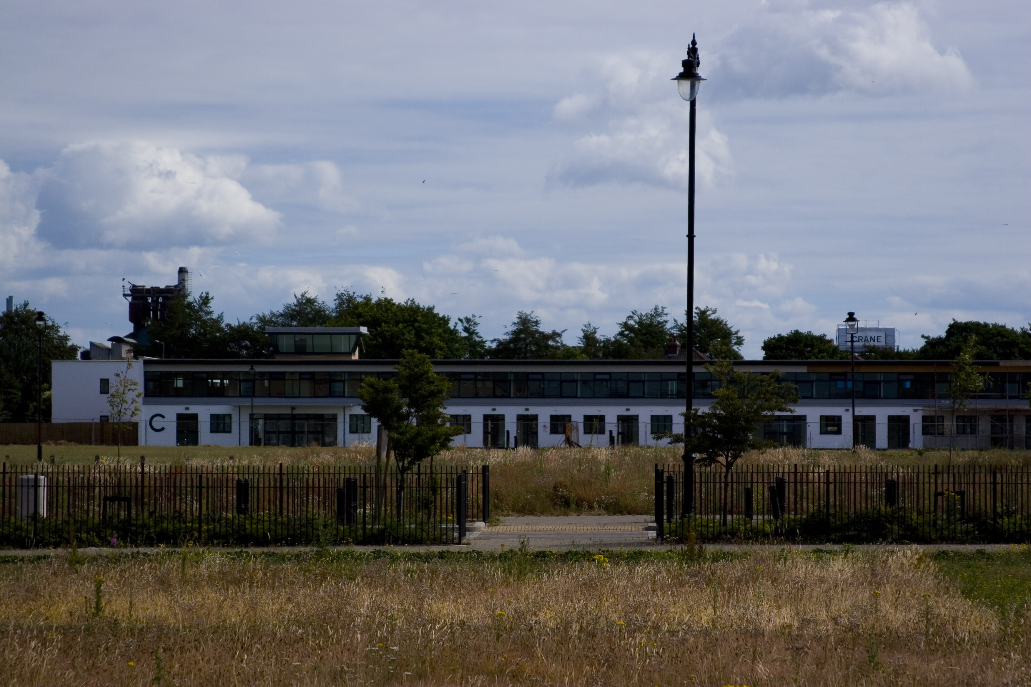
Ipswich Airport

Ipswich Airport (IATA: IPW, ICAO: EGSE) was an airfield on the outskirts of Ipswich, Suffolk England. It was known as RAF Nacton when No. 3619 Fighter...

Nearby Amenities

Located within 500m of 52.019421,1.1947324
Created By: almien_coastlines
Source: PGS
Lat/Long: 52.0152547/1.1927449
Created By: almien_coastlines
Source: PGS
Lat/Long: 52.0153467/1.193713
Source: PGS
Lat/Long: 52.0152661/1.1944744
Source: PGS
Lat/Long: 52.0153958/1.1965101
Source: PGS
Lat/Long: 52.0154351/1.1976964
Power: pole
Lat/Long: 52.0218855/1.1985752
Artwork Type: sculpture
Tourism: artwork
Lat/Long: 52.0197213/1.1878617
Bunker Type: pillbox
Historic: ruins
Military: bunker
Lat/Long: 52.0154995/1.1922551
Bunker Type: pillbox
Historic: ruins
Military: bunker
Lat/Long: 52.0154574/1.1920537
Post Box
Operator: Royal Mail
Operator Type: private
Operator Wikidata: Q638098
Post Box Mounting: pier
Post Box Type: lamp
Ref: IP10 1103
Royal Cypher: EIIR
Royal Cypher Wikidata: Q33102113
Lat/Long: 52.0227025/1.1907451
Power: pole
Lat/Long: 52.0211649/1.1886222
Power: pole
Lat/Long: 52.0210668/1.1879503
Speed Camera
Maxspeed: 60 mph
Maxspeed Variable: yes
Lat/Long: 52.0235147/1.196485
Defibrillator
Emergency: defibrillator
Lat/Long: 52.0207986/1.1953111
Bench
Lat/Long: 52.0188712/1.1882396
The data included in this document is from www.openstreetmap.org. The data is made available under ODbL.

Have you been to The Alders?

Leave your review of The Alders below (or comments, questions and feedback).