Whin Covert

Wood, Forest in Suffolk East Suffolk

England

Whin Covert

Woolverstone Marina
Woolverstone Marina Credit: Chris Holifield

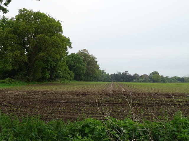
Whin Covert, located in Suffolk, England, is a dense woodland area known for its picturesque beauty and rich biodiversity. Covering an area of approximately 200 acres, it is nestled in the heart of the county's countryside, offering a tranquil retreat for nature enthusiasts and hikers alike.

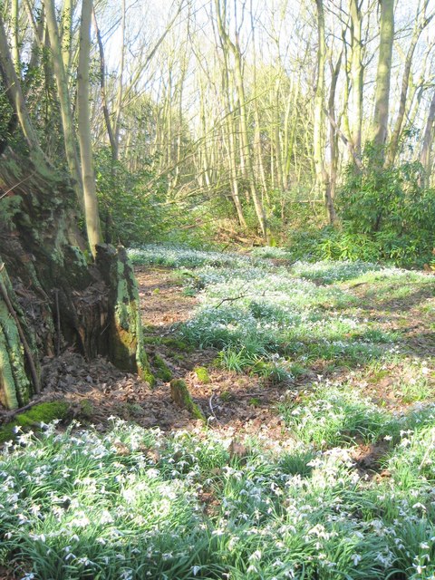
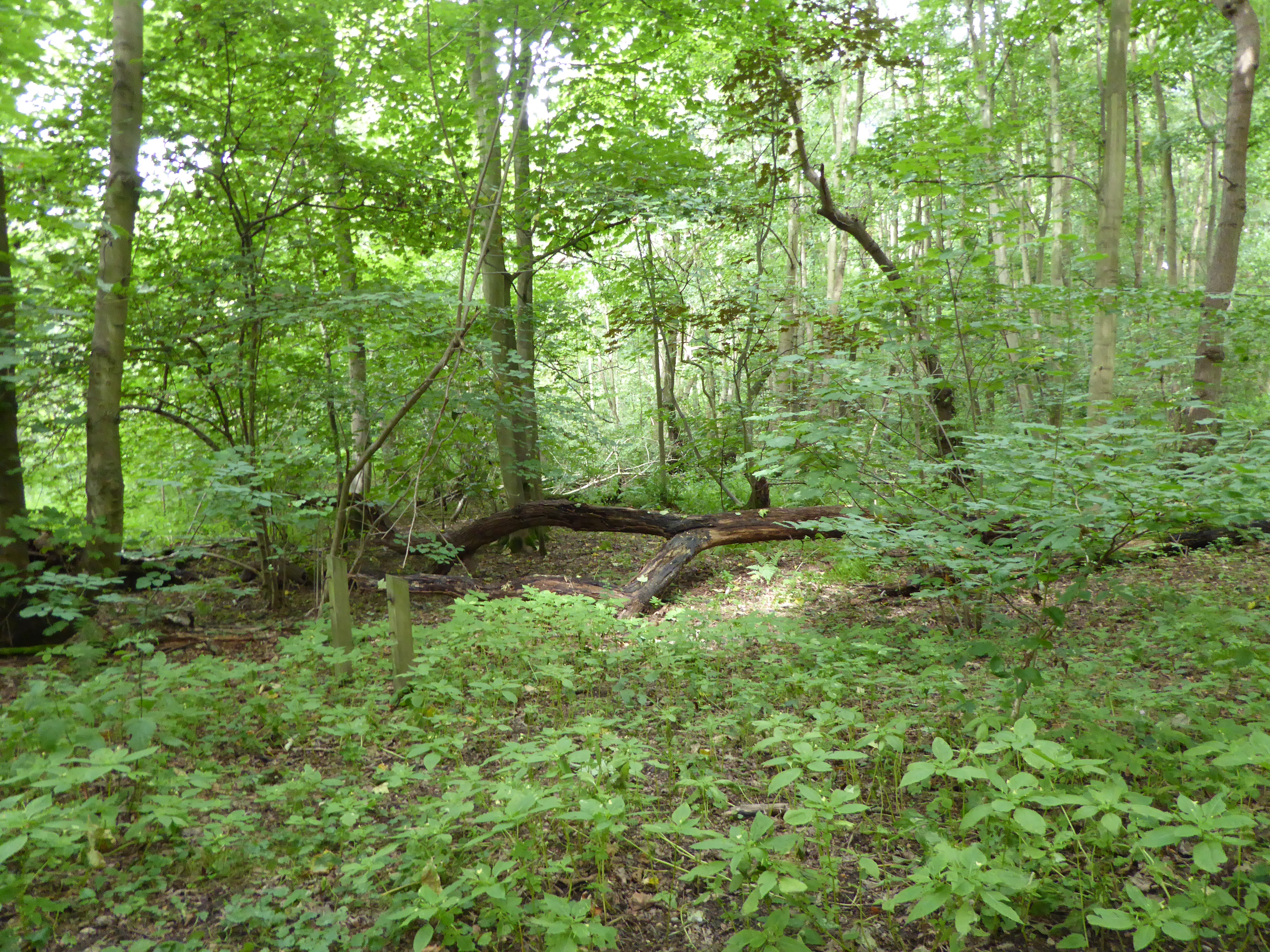
The woodland is predominantly composed of a variety of trees, including oak, beech, birch, and conifers, creating a diverse ecosystem that supports a wide range of flora and fauna. Visitors to Whin Covert can expect to encounter an array of wildflowers, such as bluebells and primroses, which blanket the forest floor during the spring months.

The forest is also home to a diverse range of wildlife. Birdwatchers will delight in the opportunity to spot species such as woodpeckers, owls, and various songbirds. Additionally, Whin Covert is known to house mammals such as deer, badgers, and foxes, adding to the allure of the area for nature lovers.

For those seeking outdoor activities, Whin Covert offers several well-maintained walking trails that meander through the woodland, allowing visitors to fully immerse themselves in the natural beauty that surrounds them. These trails cater to various abilities, ensuring that everyone can enjoy the forest at their own pace.

Overall, Whin Covert in Suffolk is a charming woodland destination that showcases the beauty of the English countryside. Its diverse flora and fauna, coupled with its well-marked trails, make it an ideal location for nature enthusiasts and those seeking solace in the great outdoors.

If you have any feedback on the listing, please let us know in the comments section below.

Whin Covert Images

Images are sourced within 2km of 52.020896/1.2000566 or Grid Reference TM1940. Thanks to Geograph Open Source API. All images are credited.

Woolverstone Marina
Woolverstone Marina
Crop field beside woodland
Woolverstone Marina Wolverstone Marina is the Home of many pleasure crafts.  It is also next to the “Cat House” where it was said that years ago was the home to a man who was sympathetic to boats carrying contraband along the river.  He had a pet cat which he loved.  When it died he had it stuffed and when he could see that no customs boats were patrolling the river put the cat in the window for any smugglers to see, signalling that all was well.
Woolverstone Marina
Wolverstone Marina is the Home of many pleasure crafts. It is also next to the “Cat House” where it was said that years ago was the home to a man who was sympathetic to boats carrying contraband along the river. He had a pet cat which he loved. When it died he had it stuffed and when he could see that no customs boats were patrolling the river put the cat in the window for any smugglers to see, signalling that all was well.
Snowdrops in Woolverstone wood
Foreshore at Woolverstone Looking upstream from the end of the public footpath towards the Orwell Bridge.
Foreshore at Woolverstone
Looking upstream from the end of the public footpath towards the Orwell Bridge.
Cottage in a clearing Sympathetically extended cottage in a clearing in Woolverstone Woods.
Cottage in a clearing
Sympathetically extended cottage in a clearing in Woolverstone Woods.
Woolverstone Marina Mdl owned Marina on the River Orwell
Woolverstone Marina
Mdl owned Marina on the River Orwell
River Orwell foreshore On the Freston foreshore the saltings have eroded, leaving only remnants of slightly harder soil. These apparent 'rocks' are in fact lumps of hardened mud, which will probably disappear in time.
River Orwell foreshore
On the Freston foreshore the saltings have eroded, leaving only remnants of slightly harder soil. These apparent 'rocks' are in fact lumps of hardened mud, which will probably disappear in time.
River Orwell tributary This unnamed stream enters the River Orwell from Freston Park.
River Orwell tributary
This unnamed stream enters the River Orwell from Freston Park.
Riverbank tree This dead tree is on the bank of the River Orwell, below Freston Tower, which can be seen behind the gorse bushes.
Riverbank tree
This dead tree is on the bank of the River Orwell, below Freston Tower, which can be seen behind the gorse bushes.
River Orwell transit beacon The beacon used to be much larger, and higher, and acted as a transit against Freston Tower on the hillside behind. It was used before the Orwell was dredged and straightened and enabled sailing vessels to steer the right course on the then tortuous journey upstream to Ipswich.
River Orwell transit beacon
The beacon used to be much larger, and higher, and acted as a transit against Freston Tower on the hillside behind. It was used before the Orwell was dredged and straightened and enabled sailing vessels to steer the right course on the then tortuous journey upstream to Ipswich.
Freston Park Looking over to the River Orwell from below Freston Tower.
Freston Park
Looking over to the River Orwell from below Freston Tower.
Eroding saltmarsh Lumps of solidified mud remain, remnants of the former extensive saltmarsh on the bank of the River Orwell. On top of the lumps, edible sea purslane (Halimione portulacoides) is growing. In the background is the Orwell Bridge.
Eroding saltmarsh
Lumps of solidified mud remain, remnants of the former extensive saltmarsh on the bank of the River Orwell. On top of the lumps, edible sea purslane (Halimione portulacoides) is growing. In the background is the Orwell Bridge.
Edge of the saltmarsh It can be seen how easily this saltmarsh on the west bank of the River Orwell is being eroded by high tides and waves. The edge is very fragile, despite being covered in places with sea purslane.
Edge of the saltmarsh
It can be seen how easily this saltmarsh on the west bank of the River Orwell is being eroded by high tides and waves. The edge is very fragile, despite being covered in places with sea purslane.
Freston Park Parkland viewed from the bank of the River Orwell.
Freston Park
Parkland viewed from the bank of the River Orwell.
Cluttered Orwell foreshore Amongst the clutter of dead trees and flotsam is a fence and stile, giving access along the west bank of the River Orwell. In the distance is Woolverstone Marina.
Cluttered Orwell foreshore
Amongst the clutter of dead trees and flotsam is a fence and stile, giving access along the west bank of the River Orwell. In the distance is Woolverstone Marina.
Dead tree on Orwell foreshore Erosion of the banks has caused many trees, such as this, to collapse on to the silt on the river's foreshore.
Dead tree on Orwell foreshore
Erosion of the banks has caused many trees, such as this, to collapse on to the silt on the river's foreshore.
Old fence and tree stump At low water the River Orwell is reduced to a narrow, but deep, strip in the centre of the estuary. The fence extends as far as the low water mark, whilst an old tree stump stubbornly refuses to drift away.
Old fence and tree stump
At low water the River Orwell is reduced to a narrow, but deep, strip in the centre of the estuary. The fence extends as far as the low water mark, whilst an old tree stump stubbornly refuses to drift away.
Show me another place!

Whin Covert is located at Grid Ref: TM1940 (Lat: 52.020896, Lng: 1.2000566)

Administrative County: Suffolk

District: East Suffolk

Police Authority: Suffolk

What 3 Words

///recruiter.move.icicles. Near Holbrook, Suffolk

Related Wikis

Alnesbourne Priory

Alnesbourne Priory, also known as Alnesbourn Priory, was a small Augustinian monastic house in the English county of Suffolk. It was located near Nacton...

Ravenswood, Ipswich

Ravenswood is a district within Ipswich, in the Ipswich district, in the county of Suffolk, England. It is sited on the old Ipswich Airport to the south...

Bridge Wood

Bridge Wood is a 31 hectare Local Nature Reserve on the southern outskirts of Ipswich in Suffolk, England. It is owned and managed by Ipswich Borough Council...

Ipswich Airport

Ipswich Airport (IATA: IPW, ICAO: EGSE) was an airfield on the outskirts of Ipswich, Suffolk England. It was known as RAF Nacton when No. 3619 Fighter...

Nearby Amenities

Located within 500m of 52.020896,1.2000566
Motorway Junction
Nacton Interchange
Ref: 57
Lat/Long: 52.0244161/1.2009803
Power: pole
Lat/Long: 52.0218855/1.1985752
Speed Camera
Maxspeed: 60 mph
Maxspeed Variable: yes
Lat/Long: 52.0235147/1.196485
Speed Camera
Maxspeed: 60 mph
Maxspeed Variable: yes
Lat/Long: 52.0243492/1.2003292
Defibrillator
Emergency: defibrillator
Lat/Long: 52.0207986/1.1953111
The data included in this document is from www.openstreetmap.org. The data is made available under ODbL.

Have you been to Whin Covert?

Leave your review of Whin Covert below (or comments, questions and feedback).