Hazelwood Hill

Hill, Mountain in Kent Maidstone

England

Hazelwood Hill

High Speed One from Bowley Lane This view from Bowley Lane, which here crosses High Speed 1 and the M20 (which is just beyond the trees on the left), looks in the direction of Ebbsfleet International and St Pancras International.
High Speed One from Bowley Lane Credit: Marathon

Hazelwood Hill is a prominent geographical feature located in the county of Kent, England. Situated near the village of Hazelwood, this hill is part of the larger North Downs range, which stretches across the southeastern portion of the country. Rising to an elevation of approximately 200 meters (656 feet), Hazelwood Hill offers stunning panoramic views of the surrounding countryside.

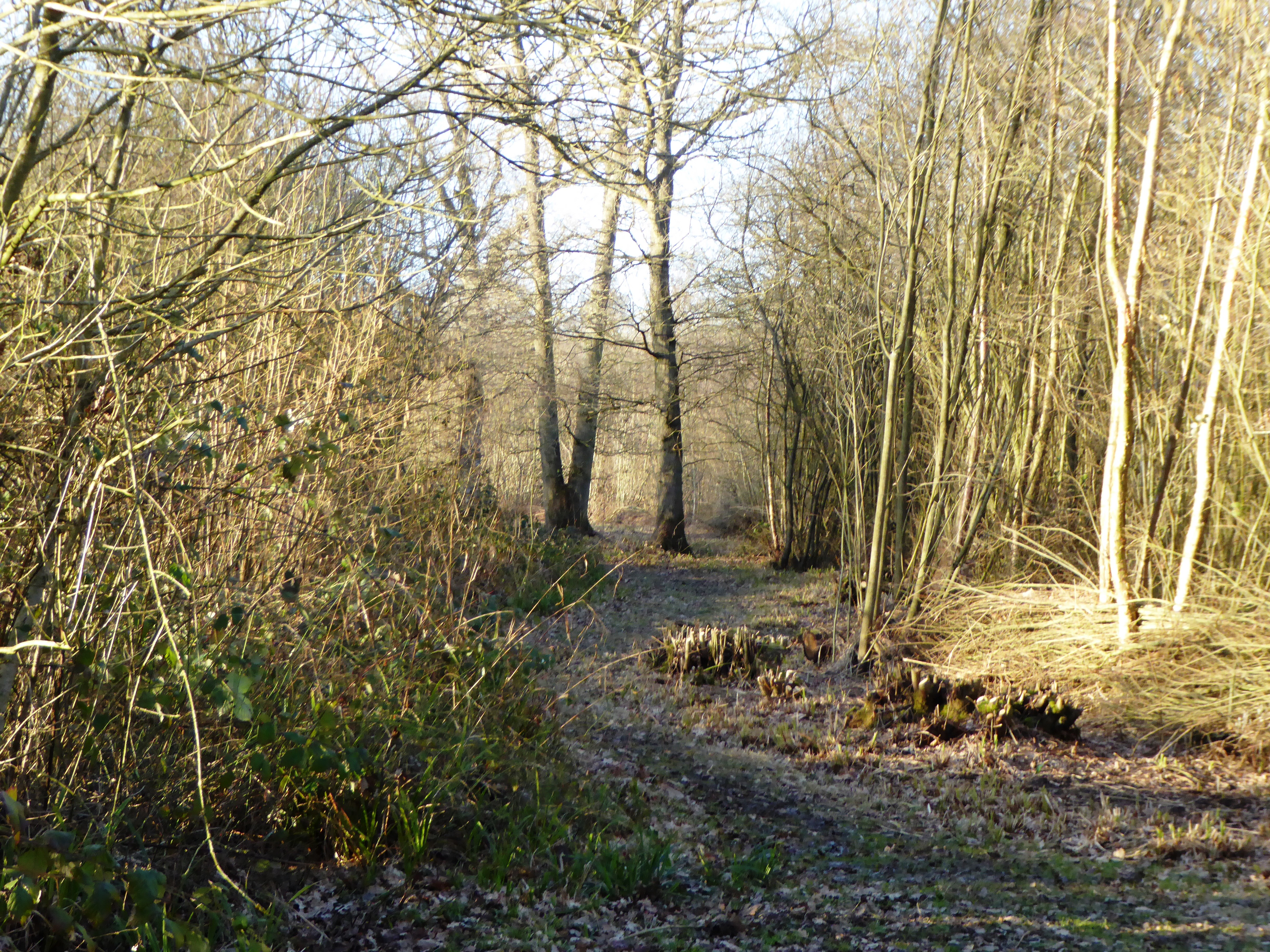
Covered in dense woodland, the hill is characterized by an abundance of hazel trees, from which its name originates. The area is known for its natural beauty, attracting nature enthusiasts and hikers who seek to explore its diverse flora and fauna. The hill is home to a variety of wildlife, including deer, foxes, and numerous bird species.

Hazelwood Hill is a popular destination for outdoor activities, such as walking and cycling. The extensive network of trails and footpaths provides ample opportunities for visitors to immerse themselves in the picturesque landscape and enjoy the tranquil atmosphere.

The hill is also of historical significance, with evidence of human activity dating back to the prehistoric era. Archaeological discoveries in the vicinity have revealed ancient tools and remains, suggesting that the area has been inhabited for thousands of years.

Overall, Hazelwood Hill in Kent is an idyllic natural landmark that captivates visitors with its breathtaking views, diverse wildlife, and rich history. It offers a refreshing escape from the hustle and bustle of daily life, providing a serene setting for relaxation and exploration.

If you have any feedback on the listing, please let us know in the comments section below.

Hazelwood Hill Images

Images are sourced within 2km of 51.211565/0.7074734 or Grid Reference TQ8949. Thanks to Geograph Open Source API. All images are credited.

High Speed One from Bowley Lane This view from Bowley Lane, which here crosses High Speed 1 and the M20 (which is just beyond the trees on the left), looks in the direction of Ebbsfleet International and St Pancras International.
High Speed One from Bowley Lane
This view from Bowley Lane, which here crosses High Speed 1 and the M20 (which is just beyond the trees on the left), looks in the direction of Ebbsfleet International and St Pancras International.
High Speed One from Bowley Lane This view from Bowley Lane, which here crosses High Speed 1 and the M20 (which is just beyond the trees on the right), looks in the direction of Ashford International and the Channel Tunnel.
High Speed One from Bowley Lane
This view from Bowley Lane, which here crosses High Speed 1 and the M20 (which is just beyond the trees on the right), looks in the direction of Ashford International and the Channel Tunnel.
Northbound M20, Bowley Lane Bridge Bowley Lane crosses the M20 at Lenham Heath.
Northbound M20, Bowley Lane Bridge
Bowley Lane crosses the M20 at Lenham Heath.
M20 bridge carries Bowley Lane The lane links Chapel Farm to the north of the motorway with Bowley Farm to the south.
M20 bridge carries Bowley Lane
The lane links Chapel Farm to the north of the motorway with Bowley Farm to the south.
After the rain This is the view from the track to the north of Chapel Farm on the way to Lenham. Earlier sunlight was rapidly followed by dismal grey skies, then squally rain before the sun came out again at 3.30 to give this rainbow and bright sunshine.
After the rain
This is the view from the track to the north of Chapel Farm on the way to Lenham. Earlier sunlight was rapidly followed by dismal grey skies, then squally rain before the sun came out again at 3.30 to give this rainbow and bright sunshine.
Footpath near Mount Castle Farm This footpath near Mount Castle Farm leads down the field ahead and on to either East Lenham or Lenham itself.
Footpath near Mount Castle Farm
This footpath near Mount Castle Farm leads down the field ahead and on to either East Lenham or Lenham itself.
Oast houses at Chapel Farm This is the view from the track to the west of Chapel Farm on the way to Lenham.
Oast houses at Chapel Farm
This is the view from the track to the west of Chapel Farm on the way to Lenham.
Track to the west of Chapel Farm This is the view from the track to the west of Chapel Farm on the way to Lenham. Within three minutes of taking this photograph the sun came out to give a clear rainbow - see <a title="https://www.geograph.org.uk/photo/3726927" href="https://www.geograph.org.uk/photo/3726927">Link</a>
Track to the west of Chapel Farm
This is the view from the track to the west of Chapel Farm on the way to Lenham. Within three minutes of taking this photograph the sun came out to give a clear rainbow - see Link
The rain has just stopped This is the view from the track to the north of Chapel Farm on the way to Lenham. Earlier sunlight was rapidly followed by dismal grey skies, then squally rain before the sun came out again at 3.30 to give a rainbow and bright sunshine - see also <a title="https://www.geograph.org.uk/photo/3726927" href="https://www.geograph.org.uk/photo/3726927">Link</a>
The rain has just stopped
This is the view from the track to the north of Chapel Farm on the way to Lenham. Earlier sunlight was rapidly followed by dismal grey skies, then squally rain before the sun came out again at 3.30 to give a rainbow and bright sunshine - see also Link
Rainbow after the rain This is the view from the track to the north of Chapel Farm on the way to Lenham. Earlier sunlight was rapidly followed by dismal grey skies, then squally rain before the sun came out again at 3.30 to give this rainbow and bright sunshine - see also <a title="https://www.geograph.org.uk/photo/3726927" href="https://www.geograph.org.uk/photo/3726927">Link</a>  and <a title="https://www.geograph.org.uk/photo/3729937" href="https://www.geograph.org.uk/photo/3729937">Link</a>  The heavy shower can be seen receding into the distance.
Rainbow after the rain
This is the view from the track to the north of Chapel Farm on the way to Lenham. Earlier sunlight was rapidly followed by dismal grey skies, then squally rain before the sun came out again at 3.30 to give this rainbow and bright sunshine - see also Link and Link The heavy shower can be seen receding into the distance.
Bowley Lane goes over the M20
Bowley Lane Bridge, M20 The M20 is a 51 mile motorway running between the M25 motorway near Swanley and Folkestone in Kent. It was constructed from 1960. It is a key route for lorries connecting to mainland Europe via the Channel Tunnel and Ferries.
Bowley Lane Bridge, M20
The M20 is a 51 mile motorway running between the M25 motorway near Swanley and Folkestone in Kent. It was constructed from 1960. It is a key route for lorries connecting to mainland Europe via the Channel Tunnel and Ferries.
Lenham Heath Road Sunken lane near Home Farm.
Lenham Heath Road
Sunken lane near Home Farm.
White Horse, Sandway Pub on Lenham Heath Road.
White Horse, Sandway
Pub on Lenham Heath Road.
The Oast House, Home Farm, Boughton Road, Sandway, Kent Single round kiln oast house.
The Oast House, Home Farm, Boughton Road, Sandway, Kent
Single round kiln oast house.
The Oast House, Home Farm, Boughton Road, Sandway, Kent  Single round kiln oast house.
The Oast House, Home Farm, Boughton Road, Sandway, Kent
Single round kiln oast house.
Lewsome Oast, Boughton Road, Sandway, Kent Single square kiln oast house.
Lewsome Oast, Boughton Road, Sandway, Kent
Single square kiln oast house.
Show me another place!

Hazelwood Hill is located at Grid Ref: TQ8949 (Lat: 51.211565, Lng: 0.7074734)

Administrative County: Kent

District: Maidstone

Police Authority: Kent

What 3 Words

///meanders.yard.snares. Near Lenham, Kent

Nearby Locations

Hazelwood Hill Toll Wood

Related Wikis

Boughton Malherbe

Boughton Malherbe ( BAW-tən MAL-ər-bee) is a village and civil parish in the Maidstone district of Kent, England, equidistant between Maidstone and Ashford...

Rivers of Kent

Four major rivers drain the county of Kent, England. == River Medway == The catchment area of the Medway covers almost 25% of the county. The detailed...

Kent

Kent is a county in the South East England region, the closest county to continental Europe. It borders Essex across the entire estuary of the River Thames...

Sandway

Sandway is a hamlet about one mile (1.6 km) to the SW of Lenham in the Maidstone district of Kent, England. The population is included in the civil parish...

Platt's Heath

Platts Heath is a hamlet in the civil parish of Lenham, Kent, England. It is also the source of the River Len, which flows in a westerly direction to join...

Grafty Green

Grafty Green is a village in the Maidstone district of Kent, England, falling within the civil parish of Boughton Malherbe. It contains two public houses...

Lenham Heath

Lenham Heath is a hamlet in Kent situated on the southern edge of the North Downs, halfway between Maidstone and Ashford. grid reference TQ910500. The...

Kiln Wood

Kiln Wood is a 6-hectare (15-acre) nature reserve south of Lenham in Kent. It is managed by Kent Wildlife Trust.This wood is mainly oak, hornbeam and...

Nearby Amenities

Located within 500m of 51.211565,0.7074734
Hazelwood Hill
Place: locality
Lat/Long: 51.2117069/0.7086518
Generator Method: photovoltaic
Generator Output Electricity: yes
Generator Source: solar
Generator Type: solar_photovoltaic_panel
Location: surface
Power: generator
Lat/Long: 51.210681/0.7049663
The data included in this document is from www.openstreetmap.org. The data is made available under ODbL.

Have you been to Hazelwood Hill?

Leave your review of Hazelwood Hill below (or comments, questions and feedback).