Douglas Hill

Hill, Mountain in Kent Sevenoaks

England

Douglas Hill

Goathurst Common Well Prior to the sinking of the well in 1901, villagers used water from rainwater storage tanks. When these ran dry, villagers had to walk down a steep hill to the springs south of Stubbs Woods, to collect their water. Piped water was brought to the area during the 1920s.
Goathurst Common Well Credit: Nikki Mahadevan

Douglas Hill, located in the county of Kent, is a prominent geographical feature known for its scenic beauty and historical significance. This hill, also referred to as Douglas Mountain, is situated near the village of Douglas, nestled in the southeastern region of England.

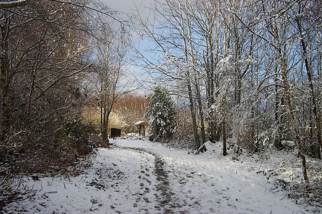
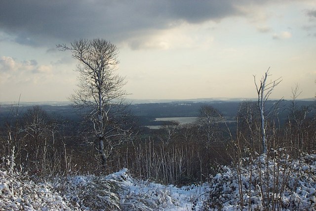
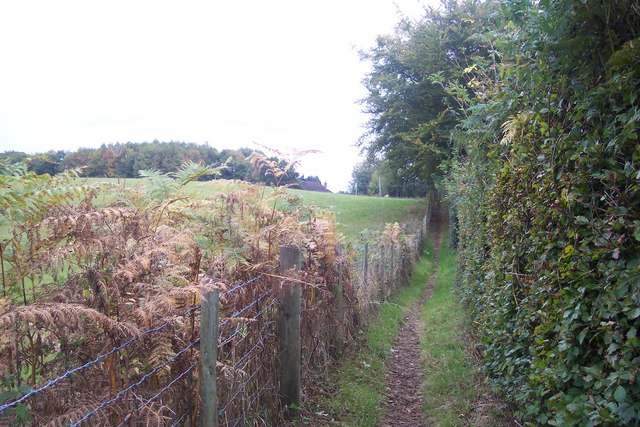
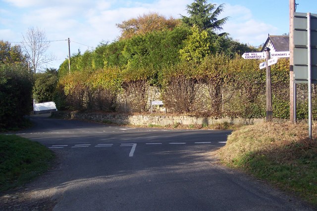
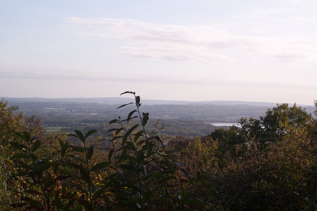
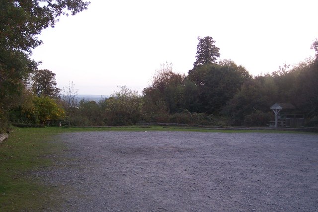
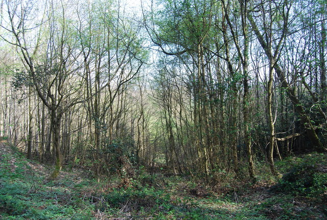
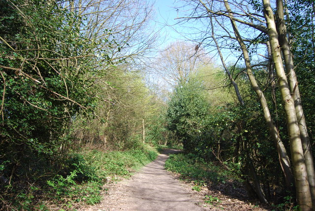
Douglas Hill stands at an elevation of approximately 167 meters (548 feet) above sea level, offering breathtaking panoramic views of the surrounding countryside. The hill is characterized by its gently sloping terrain covered with lush greenery, including grasses, shrubs, and trees. Its landscape is particularly diverse and features a combination of open fields, woodland areas, and agricultural land.

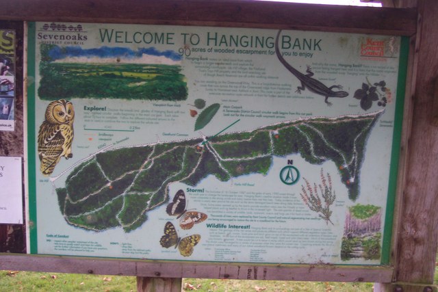
The area surrounding Douglas Hill is rich in history and heritage. It is believed that the hill was once home to an Iron Age fort, which served as a defensive structure during ancient times. The remnants of this fort can still be observed, adding to the hill's historical significance.

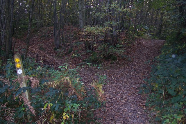
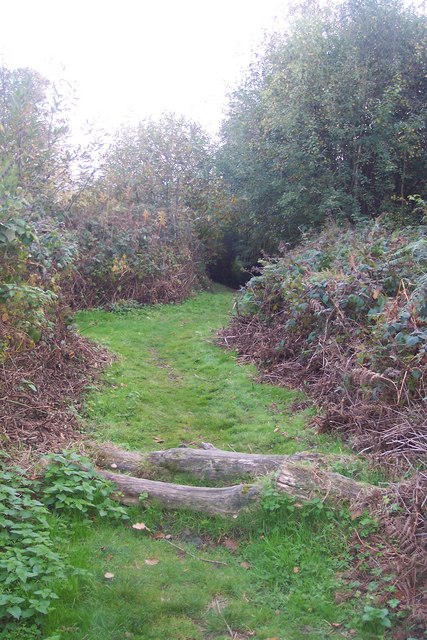
Moreover, Douglas Hill is a popular destination for outdoor enthusiasts and nature lovers. It provides ample opportunities for activities such as hiking, walking, and birdwatching. The hill is also a favored spot for picnics, where visitors can enjoy the stunning vistas and peaceful atmosphere.

In conclusion, Douglas Hill in Kent is a picturesque location that combines natural beauty with historical importance. With its stunning views, diverse landscape, and recreational opportunities, it remains a cherished destination for both locals and tourists seeking tranquility and exploration amidst nature.

If you have any feedback on the listing, please let us know in the comments section below.
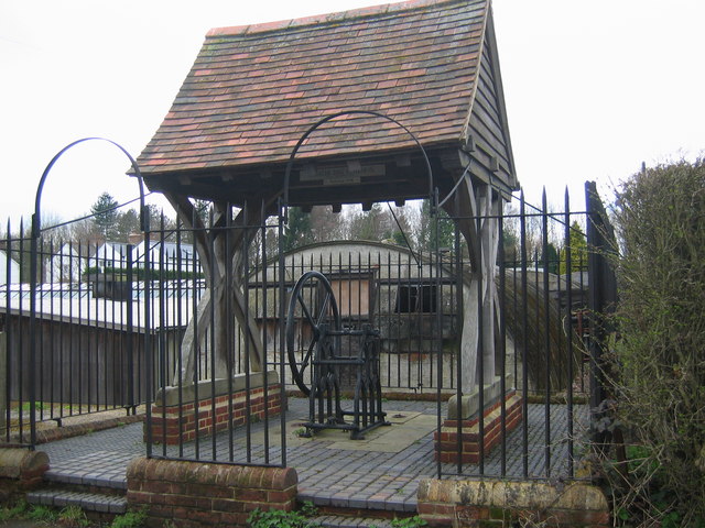
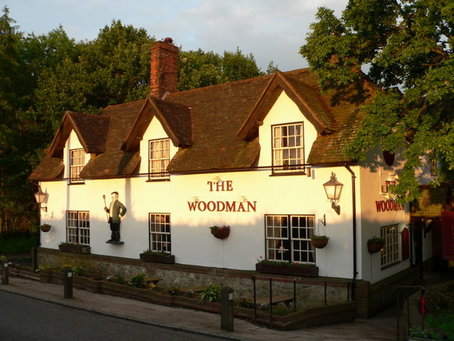
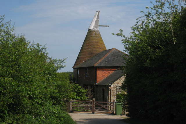
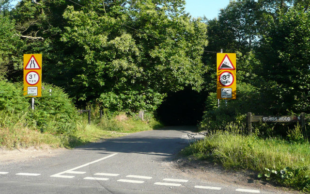
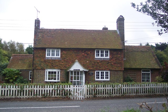
Douglas Hill Images

Images are sourced within 2km of 51.247028/0.1688648 or Grid Reference TQ5151. Thanks to Geograph Open Source API. All images are credited.

Goathurst Common Well Prior to the sinking of the well in 1901, villagers used water from rainwater storage tanks. When these ran dry, villagers had to walk down a steep hill to the springs south of Stubbs Woods, to collect their water. Piped water was brought to the area during the 1920s.
Goathurst Common Well
Prior to the sinking of the well in 1901, villagers used water from rainwater storage tanks. When these ran dry, villagers had to walk down a steep hill to the springs south of Stubbs Woods, to collect their water. Piped water was brought to the area during the 1920s.
Woodland footpath to viewing point at top of York's Hill This mixed deciduous woodland was ravaged by the Great Storm of 1987.
Woodland footpath to viewing point at top of York's Hill
This mixed deciduous woodland was ravaged by the Great Storm of 1987.
Stubbs Wood - Hanging Bank This view through Stubbs Wood, showing Bough Beech Reservoir in the distant valley, would not have been possible before the Great Storm of 1987. Many of the mature beech and other native trees were flattened overnight.
Stubbs Wood - Hanging Bank
This view through Stubbs Wood, showing Bough Beech Reservoir in the distant valley, would not have been possible before the Great Storm of 1987. Many of the mature beech and other native trees were flattened overnight.
The Woodman - Goathurst Common
Pubsign "The Woodman" - Goathurst Common
The Oast House, Nightingale Lane, Ide Hill, Kent Single round kiln oast house.
The Oast House, Nightingale Lane, Ide Hill, Kent
Single round kiln oast house.
Yorks Hill - Steep Hill 16% Yorks Hill, Ide Hill. 16% steep hill down sign.
Yorks Hill - Steep Hill 16%
Yorks Hill, Ide Hill. 16% steep hill down sign.
Whitley Cottage On the B2042 Cold Harbour Road near Goathurst Common.
Whitley Cottage
On the B2042 Cold Harbour Road near Goathurst Common.
Footpath to Cold Arbour Road This path leads from Back Lane, Whitley Row to the B2042. The Woodman Pub (roof) is seen in the background.
Footpath to Cold Arbour Road
This path leads from Back Lane, Whitley Row to the B2042. The Woodman Pub (roof) is seen in the background.
Goathurst Common crossroads Yorks Hill Road leads from Scollops Farm and Yorks Hill farm up hill to here, then Nightingale Lane leads straight on towards the B2045 Ide Hill Road. Gracious Lane leads right towards Sevenoaks, and left towards the B2045 Ide Hill Road to Ide Hill.
Goathurst Common crossroads
Yorks Hill Road leads from Scollops Farm and Yorks Hill farm up hill to here, then Nightingale Lane leads straight on towards the B2045 Ide Hill Road. Gracious Lane leads right towards Sevenoaks, and left towards the B2045 Ide Hill Road to Ide Hill.
View from Greensand Way The long distance path leads through Stubbs Wood towards Ide Hill. The view is of the Sevenoaks Weald beside the Bough Beech Reservoir (on the right).
View from Greensand Way
The long distance path leads through Stubbs Wood towards Ide Hill. The view is of the Sevenoaks Weald beside the Bough Beech Reservoir (on the right).
Footpath junction in Stubbs Wood The Greensand Way (long distance path) heads straight on towards Ide Hill. Other paths go through wood.
Footpath junction in Stubbs Wood
The Greensand Way (long distance path) heads straight on towards Ide Hill. Other paths go through wood.
Bridleway near Goathurst Common carpark A bridleway leads from the carpark on Yorks hill Road downhill through Stubb's Wood to Boarhill access road.
Bridleway near Goathurst Common carpark
A bridleway leads from the carpark on Yorks hill Road downhill through Stubb's Wood to Boarhill access road.
Hanging Bank Information Board This board shows the paths and track to Walk in Stubbs Wood and Brockhill Wood. '90 Acres of wooded escarpment'. Seen on the edge of the carpark on Yorks Hill Road, near Goathurst Common.
Hanging Bank Information Board
This board shows the paths and track to Walk in Stubbs Wood and Brockhill Wood. '90 Acres of wooded escarpment'. Seen on the edge of the carpark on Yorks Hill Road, near Goathurst Common.
Hanging Bank Carpark On Yorkshill Road near the crossroads in Goathurst Common. The information board on the right <a href="https://www.geograph.org.uk/photo/1549330">TQ4951 : Hanging Bank Information Board</a>, shows a map of the walks in the '90 Acres of Wooded Escarpement'.
Hanging Bank Carpark
On Yorkshill Road near the crossroads in Goathurst Common. The information board on the right TQ4951 : Hanging Bank Information Board, shows a map of the walks in the '90 Acres of Wooded Escarpement'.
Barn at Yorkshill Farm
Stubbs Wood Stubbs Wood is located on the Greensand Ridge close to Ide Hill. There are views to the south over Bough Beech Reservoir and on to Ashdown Forest in the distance. The site is owned by Kent County Council and managed jointly with Sevenoaks District Council.
Stubbs Wood is part of a large Site of Special Scientific Interest (SSSI) which includes much of the Toys Hill area. It contains many plants characteristic of ancient woodlands including carpets of bluebells in the spring. The site suffered badly in the 1987 storm but natural regeneration and a programme of replanting have helped it to recover. Some huge ancient Oak and Beech trees survived the gales and still remain.
Stubbs Wood
Stubbs Wood is located on the Greensand Ridge close to Ide Hill. There are views to the south over Bough Beech Reservoir and on to Ashdown Forest in the distance. The site is owned by Kent County Council and managed jointly with Sevenoaks District Council. Stubbs Wood is part of a large Site of Special Scientific Interest (SSSI) which includes much of the Toys Hill area. It contains many plants characteristic of ancient woodlands including carpets of bluebells in the spring. The site suffered badly in the 1987 storm but natural regeneration and a programme of replanting have helped it to recover. Some huge ancient Oak and Beech trees survived the gales and still remain.
Greensand Way, Hanging Bank The Greensand Way is a long distance walk of 108 miles (174 km) in Southeast England, from Haslemere in Surrey to Hamstreet in Kent. It follows the Greensand Ridge along the Surrey Hills and Chart Hills. The route is mostly rural, passing through woods and alongside fruit orchards and hop farms in Kent. and links with the Stour Valley Walk near Pluckley in Kent.

See <span class="nowrap"><a title="http://www.kent.gov.uk/leisure_and_culture/countryside_and_coast/walking/greensand_way.aspx" rel="nofollow ugc noopener" href="http://www.kent.gov.uk/leisure_and_culture/countryside_and_coast/walking/greensand_way.aspx">Link</a><img style="margin-left:2px;" alt="External link" title="External link - shift click to open in new window" src="https://s1.geograph.org.uk/img/external.png" width="10" height="10"/></span> for more details. See also <span class="nowrap"><a title="http://www.walkingpages.co.uk/trails_paths/LDP_greensandway.htm" rel="nofollow ugc noopener" href="http://www.walkingpages.co.uk/trails_paths/LDP_greensandway.htm">Link</a><img style="margin-left:2px;" alt="External link" title="External link - shift click to open in new window" src="https://s1.geograph.org.uk/img/external.png" width="10" height="10"/></span> for more mapping details.
Greensand Way, Hanging Bank
The Greensand Way is a long distance walk of 108 miles (174 km) in Southeast England, from Haslemere in Surrey to Hamstreet in Kent. It follows the Greensand Ridge along the Surrey Hills and Chart Hills. The route is mostly rural, passing through woods and alongside fruit orchards and hop farms in Kent. and links with the Stour Valley Walk near Pluckley in Kent. See LinkExternal link for more details. See also LinkExternal link for more mapping details.
Show me another place!

Douglas Hill is located at Grid Ref: TQ5151 (Lat: 51.247028, Lng: 0.1688648)

Administrative County: Kent

District: Sevenoaks

Police Authority: Kent

What 3 Words

///unfair.music.filed. Near Sevenoaks, Kent

Nearby Locations

Douglas Hill Bayley's Hill

Related Wikis

West Heath School (special school)

West Heath School is an independent school in Sevenoaks, Kent. It caters for children for whom mainstream schooling has become insufficient, for varying...

New Beacon School

The New Beacon Preparatory School is an independent all-boys preparatory school, located at Sevenoaks in the English county of Kent. It admits both day...

Stubbs Wood Country Park

Stubbs Wood Country Park is in Sevenoaks, in Kent, England. It is located on the Greensand Ridge, close to Ide Hill village. The site is owned and managed...

Long Barn

Long Barn, located in the village of Sevenoaks Weald, Kent, is a Grade II* listed building and a Grade II* registered garden. Reputedly the birthplace...

Sevenoaks Weald

Sevenoaks Weald is a village and civil parish in the Sevenoaks District of Kent, England. The parish is located on the Low Weald, immediately south of...

Hubbard's Hill

Hubbard's Hill is a 66.6-hectare (165-acre) geological Site of Special Scientific Interest south of Sevenoaks in Kent. It is a Geological Conservation...

Sevenoaks School

Sevenoaks School is a highly selective coeducational private school in Sevenoaks, Kent, England. It is the second oldest non-denominational school in the...

Ide Hill

Ide Hill is a village within the civil parish of Sundridge with Ide Hill, in the Sevenoaks District of Kent, England. It stands on one of the highest...

Nearby Amenities

Located within 500m of 51.247028,0.1688648
Bayley's Hill
Ele: 208
Natural: peak
Source: NPE
Lat/Long: 51.2462635/0.1672326
Turning Loop
Lat/Long: 51.2475137/0.1741535
The data included in this document is from www.openstreetmap.org. The data is made available under ODbL.

Have you been to Douglas Hill?

Leave your review of Douglas Hill below (or comments, questions and feedback).