Fox Hill

Hill, Mountain in Sussex Mid Sussex

England

Fox Hill

Path in Big Wood, Bedelands Farm A local nature reserve.
Path in Big Wood, Bedelands Farm Credit: Robin Webster

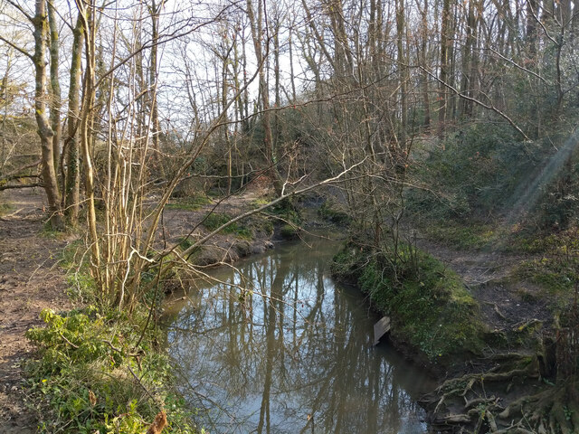
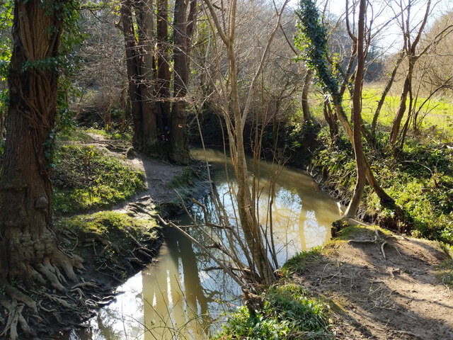
Fox Hill is a prominent hill located in the Sussex region of England. Situated within the South Downs National Park, it forms part of the expansive chalk range that characterizes the area. With an elevation of approximately 200 meters (656 feet), Fox Hill is not classified as a mountain but is still a significant landmark in the region.

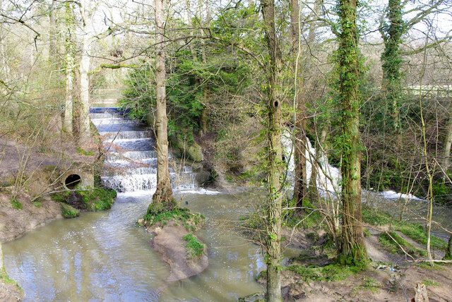
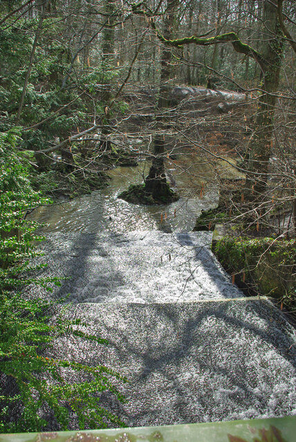
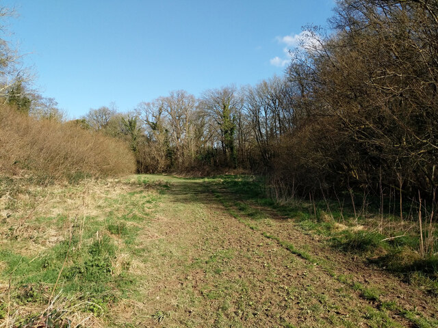
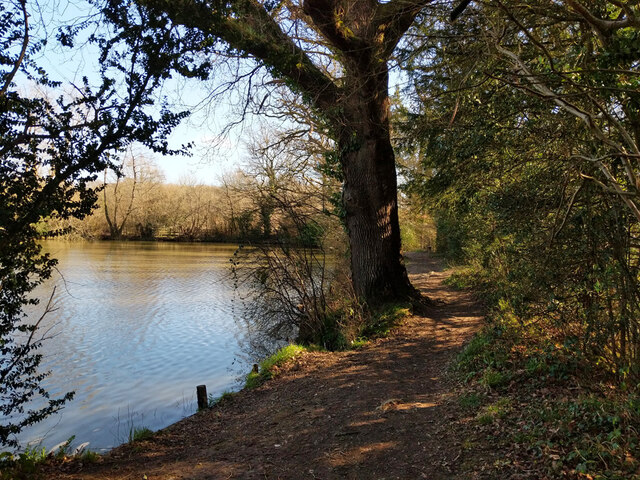
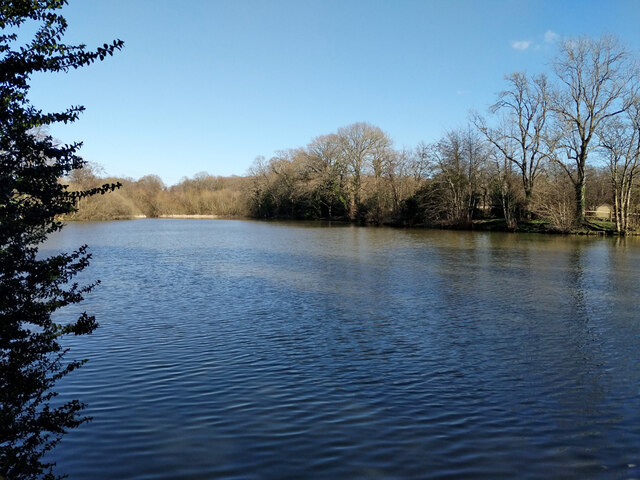
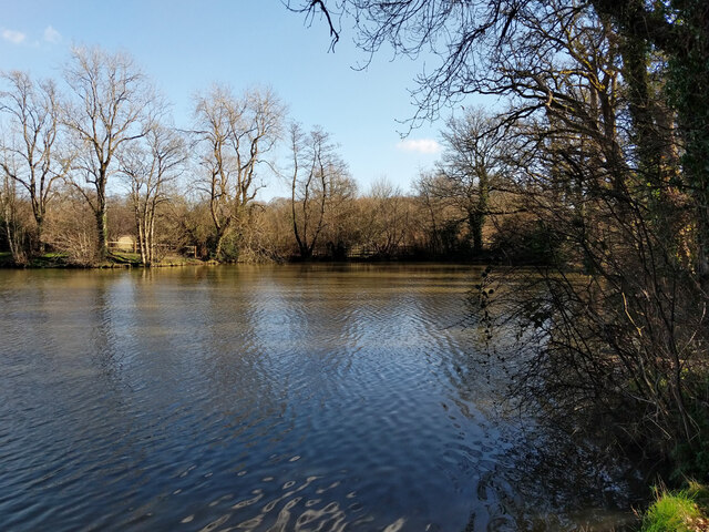
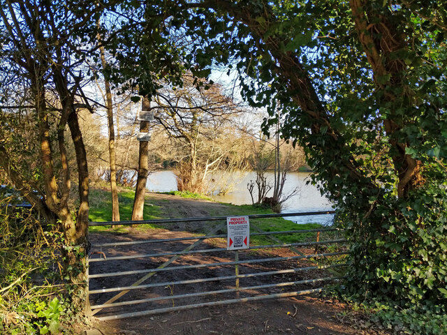
The hill is renowned for its stunning panoramic views, offering breathtaking vistas across the surrounding countryside. From the summit, visitors can admire the undulating landscapes of Sussex, with its patchwork of fields, woodlands, and picturesque villages. On clear days, it is even possible to catch a glimpse of the English Channel in the distance.

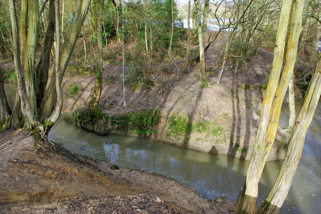
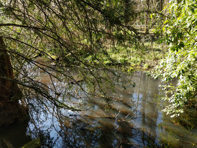
Fox Hill is also notable for its rich biodiversity, showcasing a variety of plant and animal species. The chalk grassland that covers much of the hill provides a habitat for numerous rare and protected plants, including orchids and wildflowers. The area is also home to a range of wildlife, such as butterflies, birds, and small mammals, making it an attractive destination for nature enthusiasts and wildlife photographers.

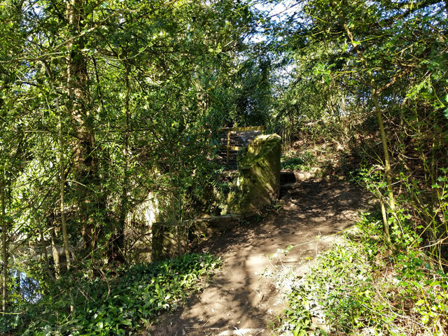
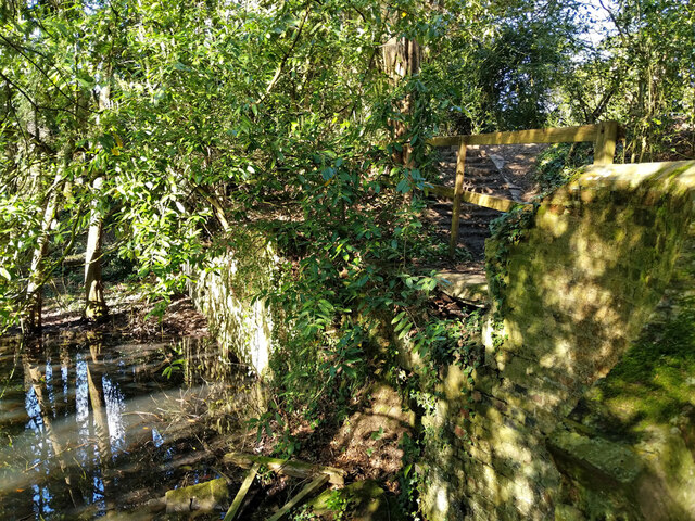
In addition to its natural beauty, Fox Hill holds historical and archaeological significance. The remains of ancient settlements and burial mounds have been discovered on its slopes, offering insights into the area's human occupation throughout the ages.

Overall, Fox Hill in Sussex offers a unique blend of natural beauty, wildlife, and historical importance. Its accessibility and stunning views make it a popular destination for hikers, nature lovers, and those seeking a tranquil escape in the heart of the South Downs.

If you have any feedback on the listing, please let us know in the comments section below.

Fox Hill Images

Images are sourced within 2km of 50.986854/-0.10376427 or Grid Reference TQ3322. Thanks to Geograph Open Source API. All images are credited.

Path in Big Wood, Bedelands Farm A local nature reserve.
Path in Big Wood, Bedelands Farm
A local nature reserve.
Spillways, Valebridge Pond On the eastern branch of the River Adur.
Spillways, Valebridge Pond
On the eastern branch of the River Adur.
Blue rope hanging over River Adur Standard equipment for such places.
Blue rope hanging over River Adur
Standard equipment for such places.
Spillway, Valebridge Pond On the eastern branch of the River Adur.
Spillway, Valebridge Pond
On the eastern branch of the River Adur.
Footpath 95CR towards Valebridge Pond A very wide course along a damp field by the Adur, looking as if it were mown the previous year.
Footpath 95CR towards Valebridge Pond
A very wide course along a damp field by the Adur, looking as if it were mown the previous year.
Footpath 95CR towards Valebridge Pond
River Adur looking upstream Not far below Valebridge Pond.
River Adur looking upstream
Not far below Valebridge Pond.
River Adur looking downstream Not far below Valebridge Pond.
River Adur looking downstream
Not far below Valebridge Pond.
Footpath 95CR climbing pond bay by Valebridge Mill site There is quite a lot of masonry to the left of the path, rather hard to photograph, and that is nearly all that is left of the mill and its house beyond.
Footpath 95CR climbing pond bay by Valebridge Mill site
There is quite a lot of masonry to the left of the path, rather hard to photograph, and that is nearly all that is left of the mill and its house beyond.
Remains of Valebridge Mill Rather hard to photograph in bright dappled sunlight, there is a substantial masonry vertical rear face to the pond bay, but it is hard to work out how the mill fitted in, and all other traces visible are gone.
Remains of Valebridge Mill
Rather hard to photograph in bright dappled sunlight, there is a substantial masonry vertical rear face to the pond bay, but it is hard to work out how the mill fitted in, and all other traces visible are gone.
Tail race, former Valebridge Mill Mapped as having a sluice through the pond bay, but no mechanism was noted. The water probably largely comes from a drain from the north entering a short way below the pond bay.
Tail race, former Valebridge Mill
Mapped as having a sluice through the pond bay, but no mechanism was noted. The water probably largely comes from a drain from the north entering a short way below the pond bay.
Footpath 97CR by Valebridge Pond The path runs along the pond bay. For a brief account of the pond's origin, see <a href="https://www.geograph.org.uk/photo/7123567">TQ3121 : Informative board by Valebridge Pond</a>.
Footpath 97CR by Valebridge Pond
The path runs along the pond bay. For a brief account of the pond's origin, see TQ3121 : Informative board by Valebridge Pond.
Valebridge Pond For a brief account of the pond's origin, see <a href="https://www.geograph.org.uk/photo/7123567">TQ3121 : Informative board by Valebridge Pond</a>.
Valebridge Pond
For a brief account of the pond's origin, see TQ3121 : Informative board by Valebridge Pond.
Informative board by Valebridge Pond
Valebridge Pond For a brief account of the pond's origin, see <a href="https://www.geograph.org.uk/photo/7123567">TQ3121 : Informative board by Valebridge Pond</a>.
Valebridge Pond
For a brief account of the pond's origin, see TQ3121 : Informative board by Valebridge Pond.
Gate to north side of Valebridge Pond This side of the pond is private, the preserve of a local angling society.
Gate to north side of Valebridge Pond
This side of the pond is private, the preserve of a local angling society.
Shed by site of Valebridge Mill For a view twelve years earlier, see <a href="https://www.geograph.org.uk/photo/7126311">TQ3121 : Shed by site of Valebridge Mill</a>.
Shed by site of Valebridge Mill
For a view twelve years earlier, see TQ3121 : Shed by site of Valebridge Mill.
Sign on shed by site of Valebridge Mill For the shed, see <a href="https://www.geograph.org.uk/photo/7124613">TQ3121 : Shed by site of Valebridge Mill</a>. For the sign twelve years earlier, see <a href="https://www.geograph.org.uk/photo/7124753">TQ3121 : Sign on shed by site of Valebridge Mill</a>.
Sign on shed by site of Valebridge Mill
For the shed, see TQ3121 : Shed by site of Valebridge Mill. For the sign twelve years earlier, see TQ3121 : Sign on shed by site of Valebridge Mill.
Show me another place!

Fox Hill is located at Grid Ref: TQ3322 (Lat: 50.986854, Lng: -0.10376427)

Administrative County: West Sussex

District: Mid Sussex

Police Authority: Sussex

What 3 Words

///secret.issue.paints. Near Haywards Heath, West Sussex

Related Wikis

St Francis Rangers F.C.

St Francis Rangers F.C. is a football club based in Haywards Heath, England. They are currently members of the Southern Combination Division Two and play...

St Francis Hospital, Haywards Heath

St Francis Hospital was a mental health facility in Haywards Heath, West Sussex, England. The main building survives and is a Grade II listed building...

Jireh Chapel, Haywards Heath

The Jireh Chapel is a Strict Baptist place of worship in the town of Haywards Heath in the English county of West Sussex. The chapel was built in 1879...

Ashenground and Bolnore Woods

Ashenground and Bolnore Woods is a 14.4-hectare (36-acre) Local Nature Reserve in Haywards Heath in West Sussex. It is owned and managed by Mid Sussex...

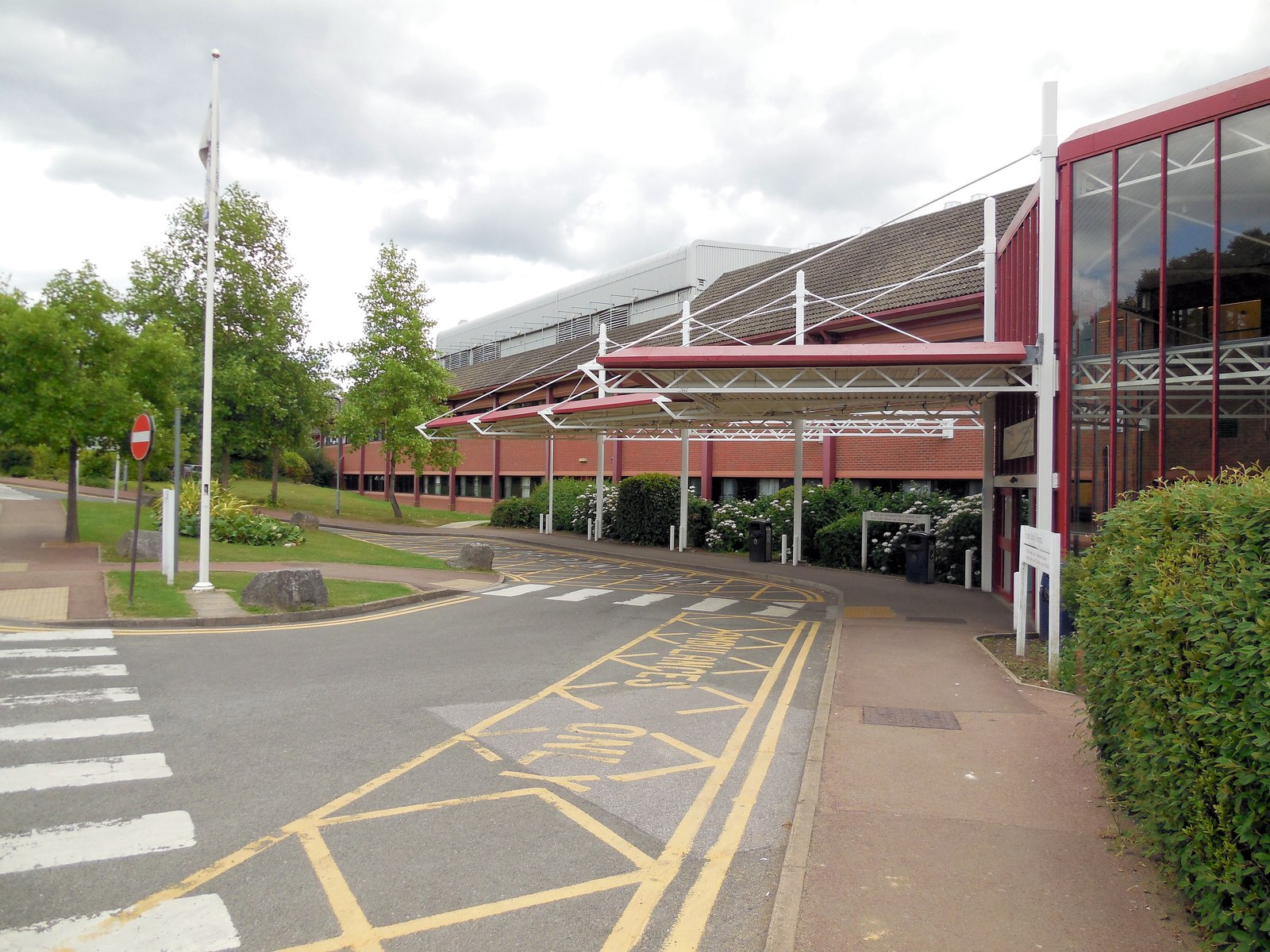
Princess Royal Hospital, Haywards Heath

The Princess Royal Hospital, also known as PRH, is an acute, teaching, general hospital located in Haywards Heath, West Sussex, England. It is the main...

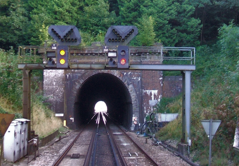
Haywards Heath Tunnel

Haywards Heath tunnel, also known as Folly Hill tunnel, is a railway tunnel on the Brighton Main Line between Haywards Heath and Wivelsfield. It is 249...

Haywards Heath East (electoral division)

Haywards Heath East is an electoral division of West Sussex in the United Kingdom, and returns one member to sit on West Sussex County Council. == Extent... ==

St Wilfrid's Church, Haywards Heath

St Wilfrid's Church is an Anglican church in the town of Haywards Heath in the district of Mid Sussex, one of seven local government districts in the English...

Nearby Amenities

Located within 500m of 50.986854,-0.10376427
Traffic Calming: island
Lat/Long: 50.986875/-0.1051714
Crossing
Bicycle: yes
Button Operated: yes
Crossing: traffic_signals
Crossing Island: no
Crossing Ref: toucan
Kerb: lowered
Tactile Paving: yes
Traffic Signals Sound: yes
Lat/Long: 50.9868581/-0.1064374
Turning Circle
Lat/Long: 50.9857985/-0.103596
Post Box
Collection Times: Mo-Fr 09:00, Sa 07:00
Ref: RH16 43
Lat/Long: 50.9906515/-0.1000938
Bus Stop
Weald Rise
Bus: yes
Naptan AtcoCode: 4400EG0016
Naptan Bearing: N
Naptan CommonName: Weald Rise
Naptan Indicator: adj Weald Rise
Naptan Landmark: Weald Rise
Naptan NaptanCode: wsxampdt
Naptan Street: Fox Hill
Naptan Verified: no
Public Transport: platform
Source: naptan_import
Lat/Long: 50.9840886/-0.0990675
Bus Stop
Rocky Lane
Bus: yes
Naptan AtcoCode: 4400EG0017
Naptan Bearing: S
Naptan CommonName: Rocky Lane
Naptan Indicator: opp Rocky Road
Naptan Landmark: Rocky Lane
Naptan NaptanCode: wsxampdw
Naptan Street: Fox Hill
Naptan Verified: no
Public Transport: platform
Shelter: no
Source: naptan_import
Lat/Long: 50.9880484/-0.1009584
Bus Stop
Rocky Lane
Bus: yes
Naptan AtcoCode: 4400EG0018
Naptan Bearing: N
Naptan CommonName: Rocky Lane
Naptan Indicator: o/s 70
Naptan Landmark: Rocky Lane
Naptan NaptanCode: wsxampga
Naptan PlusbusZoneRef: HYWRDSH
Naptan Street: Wivelfield Road
Naptan Verified: no
Public Transport: platform
Shelter: yes
Source: naptan_import
Lat/Long: 50.9882064/-0.1010947
Bus Stop
Ugly Duckling
Bus: yes
Naptan AtcoCode: 4400EG0019
Naptan Bearing: S
Naptan CommonName: Ugly Duckling
Naptan Indicator: opp 34
Naptan Landmark: Edward Road
Naptan NaptanCode: wsxampgd
Naptan PlusbusZoneRef: HYWRDSH
Naptan Street: Wivelsfield Road
Naptan Verified: no
Public Transport: platform
Shelter: yes
Source: naptan_import
Lat/Long: 50.9901272/-0.1004082
Bus Stop
Ugly Duckling
Bus: yes
Naptan AtcoCode: 4400EG0020
Naptan Bearing: N
Naptan CommonName: Ugly Duckling
Naptan Indicator: outside 30
Naptan Landmark: Edward Road
Naptan NaptanCode: wsxampgj
Naptan PlusbusZoneRef: HYWRDSH
Naptan Street: Wiversfield Road
Naptan Verified: no
Public Transport: platform
Source: naptan_import
Lat/Long: 50.9901927/-0.1005623
Bus Stop
Rumbolds Lane
Bus: yes
Naptan AtcoCode: 4400EG0026
Naptan Bearing: S
Naptan CommonName: Rumbolds Lane
Naptan Indicator: opp Rumbolds Lane
Naptan Landmark: Rumbolds Lane
Naptan NaptanCode: wsxampjd
Naptan PlusbusZoneRef: HYWRDSH
Naptan Street: Sheppeys
Naptan Verified: no
Public Transport: platform
Source: naptan_import
Lat/Long: 50.9889516/-0.1088776
Bus Stop
Rumbolds Lane
Bus: yes
Naptan AtcoCode: 4400EG0027
Naptan Bearing: N
Naptan CommonName: Rumbolds Lane
Naptan Indicator: adj 70
Naptan Landmark: Rumbolds Lane
Naptan NaptanCode: wsxampjg
Naptan PlusbusZoneRef: HYWRDSH
Naptan Street: Sheppeys
Naptan Verified: no
Public Transport: platform
Source: naptan_import
Lat/Long: 50.9886901/-0.1088312
Southdown Close
Naptan AtcoCode: 4400EG0028
Naptan Bearing: SW
Naptan BusStopType: CUS
Naptan CommonName: Southdown Close
Naptan Indicator: opp 92
Naptan Landmark: Southdown Close
Naptan NaptanCode: wsxampjm
Naptan PlusbusZoneRef: HYWRDSH
Naptan Street: Vale Road
Naptan Verified: no
Source: naptan_import
Lat/Long: 50.9896086/-0.1061292
Bus Stop
Burchetts Close
Bus: yes
Naptan AtcoCode: 4400EG0029
Naptan Bearing: W
Naptan CommonName: Burchetts Close
Naptan Indicator: opp flats
Naptan Landmark: Burchetts Close
Naptan NaptanCode: wsxampjp
Naptan PlusbusZoneRef: HYWRDSH
Naptan Street: Bolding Way
Naptan Verified: no
Public Transport: platform
Source: naptan_import
Lat/Long: 50.9875793/-0.1035615
Bus Stop
Burchetts Close
Bus: yes
Naptan AtcoCode: 4400EG0030
Naptan Bearing: E
Naptan CommonName: Burchetts Close
Naptan Indicator: opp 16
Naptan Landmark: Burchetts Close
Naptan NaptanCode: wsxampjt
Naptan PlusbusZoneRef: HYWRDSH
Naptan Street: Bolding Way
Naptan Verified: no
Public Transport: platform
Source: naptan_import
Lat/Long: 50.9875803/-0.1041742
Bus Stop
Vale Road
Bus: yes
Naptan AtcoCode: 4400EG0031
Naptan Bearing: E
Naptan CommonName: Vale Road
Naptan Indicator: Opp Kilbarn Way
Naptan Landmark: Vale Road
Naptan NaptanCode: wsxampjw
Naptan PlusbusZoneRef: HYWRDSH
Naptan Street: Bolding Way
Naptan Verified: no
Public Transport: platform
Source: naptan_import
Lat/Long: 50.9878682/-0.107511
Bus Stop
Pinewood Way
Bus: yes
Naptan AtcoCode: 4400EG0032
Naptan Bearing: N
Naptan CommonName: Pinewood Way
Naptan Indicator: adj Sheppys
Naptan Landmark: Pinewood Way
Naptan NaptanCode: wsxampma
Naptan PlusbusZoneRef: HYWRDSH
Naptan Street: Vale Road
Naptan Verified: no
Public Transport: platform
Source: naptan_import
Lat/Long: 50.9881114/-0.1080853
Bus Stop
Southdown Close
Bus: yes
Naptan AtcoCode: 4400EG0462
Naptan Bearing: NE
Naptan CommonName: Southdown Close
Naptan Indicator: adj
Naptan Landmark: Southdown Close
Naptan Street: Vale Road
Naptan Verified: no
Public Transport: platform
Source: naptan_import
Lat/Long: 50.9894973/-0.1064758
Fox Hill
Is In: Haywards Heath;West Sussex;England;United Kingdom
Place: neighbourhood
Lat/Long: 50.9835495/-0.0998006
Crossing
Lat/Long: 50.987525/-0.1004665
Post Box
Brand: Royal Mail
Brand Wikidata: Q638098
Brand Wikipedia: en:Royal Mail
Operator: Royal Mail
Operator Wikidata: Q638098
Post Box Type: lamp
Ref: RH16 158D
Royal Cypher: EIIR
Royal Cypher Wikidata: Q33102113
Lat/Long: 50.9895301/-0.1064274
Community Centre
Ascension Church/ Community Centre
Note: The Ascension Church is so much more than just a church. It is a community centre, a day care centre, it host sports and fitness classes and even shows films!
Lat/Long: 50.9893155/-0.1079735
Post Box
Brand: Royal Mail
Brand Wikidata: Q638098
Brand Wikipedia: en:Royal Mail
Operator: Royal Mail
Operator Wikidata: Q638098
Post Box Type: lamp
Ref: RH16 182D
Royal Cypher: EIIR
Royal Cypher Wikidata: Q33102113
Lat/Long: 50.9876983/-0.1035461
Crossing
Bicycle: yes
Crossing: traffic_signals
Crossing Ref: toucan
Kerb: lowered
Tactile Paving: yes
Lat/Long: 50.985847/-0.1103737
Crossing
Bicycle: yes
Kerb: lowered
Tactile Paving: yes
Lat/Long: 50.9862399/-0.1101448
Crossing
Lat/Long: 50.9878867/-0.1010737
Crossing
Lat/Long: 50.9878961/-0.1009748
Crossing
Lat/Long: 50.9874682/-0.1005721
Crossing
Lat/Long: 50.9873791/-0.1009084
Crossing
Lat/Long: 50.9873972/-0.1010316
Crossing
Lat/Long: 50.9875353/-0.1012802
Crossing
Lat/Long: 50.9876057/-0.1013107
Bus Stop
Old House Farm
Bus: yes
Public Transport: platform
Lat/Long: 50.986517/-0.1089046
Bus Stop
Old House Farm
Bus: yes
Public Transport: platform
Lat/Long: 50.9865234/-0.1092905
Crossing
Lat/Long: 50.9878599/-0.1006238
Crossing
Lat/Long: 50.9878079/-0.1005411
Addr City: Haywards Heath
Addr Housename: Sandrocks Lodge
Addr Postcode: RH16 4RN
Addr Street: Rocky Lane
Lat/Long: 50.9868546/-0.1073733
Addr Postcode: RH16 4SR
Addr Street: Southdowns Park
Lat/Long: 50.9887903/-0.0974929
Crossing
Bicycle: yes
Kerb: lowered
Tactile Paving: yes
Lat/Long: 50.9862836/-0.1100777
The data included in this document is from www.openstreetmap.org. The data is made available under ODbL.

Have you been to Fox Hill?

Leave your review of Fox Hill below (or comments, questions and feedback).