Cade's Hill

Hill, Mountain in Huntingdonshire Huntingdonshire

England

Cade's Hill

Apartment block, Alconbury Weald
Apartment block, Alconbury Weald Credit: Jonathan Thacker

Cade's Hill is a prominent geographical feature located in Huntingdonshire, a historic county in the eastern part of England. Considered more of a hill than a mountain, it rises to an elevation of approximately 120 meters (394 feet) above sea level. The hill is situated within the rural landscape and offers picturesque views of the surrounding countryside.

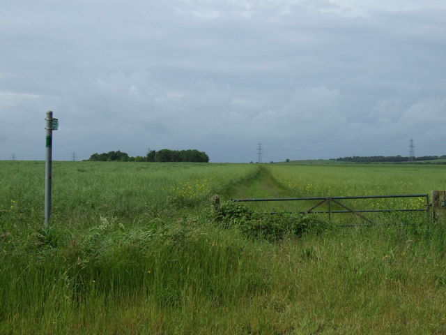
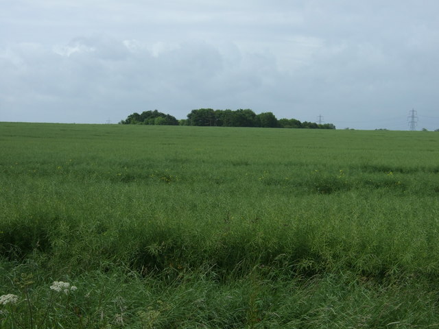
Covered by lush greenery, Cade's Hill is predominantly made up of grassland and scattered trees. Its slopes are gentle, making it an accessible destination for hikers and nature enthusiasts. The hill is known for its tranquil atmosphere, attracting visitors seeking a serene and peaceful retreat.

Cade's Hill holds significance in local folklore and history. It is believed to have been named after the mythical figure Cade, who was associated with the area in ancient times. The hill has witnessed centuries of human activity, and remnants of ancient settlements, burial mounds, or other archaeological features may be found in the vicinity.

The hill is a popular spot for outdoor activities such as walking, picnicking, and birdwatching. It serves as a habitat for various bird species, making it an ideal location for ornithologists and bird lovers. The surrounding area also offers opportunities for wildlife observation, with occasional sightings of deer, rabbits, and other small mammals.

Access to Cade's Hill is typically unrestricted, with public footpaths leading to its summit. The hill's location within the countryside provides a peaceful escape from the hustle and bustle of urban life, and visitors often appreciate the hill's natural beauty and tranquil ambiance.

If you have any feedback on the listing, please let us know in the comments section below.
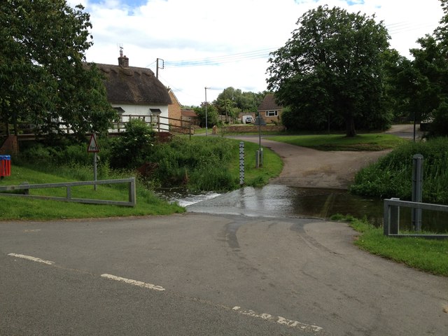
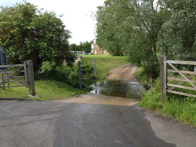
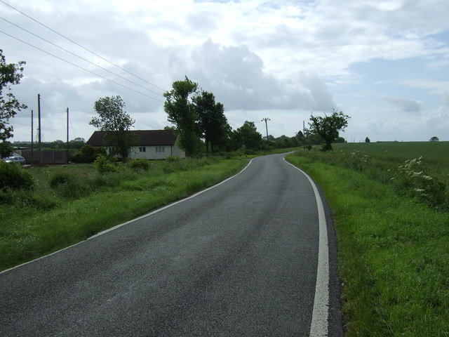
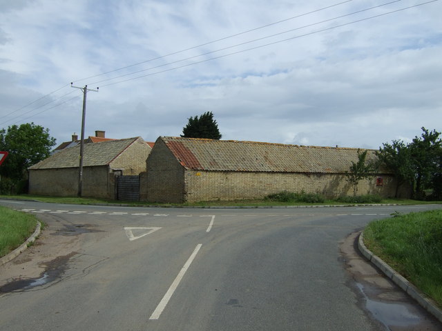
Cade's Hill Images

Images are sourced within 2km of 52.377511/-0.2612839 or Grid Reference TL1876. Thanks to Geograph Open Source API. All images are credited.

Apartment block, Alconbury Weald
Milestone, Alconbury Hill Dates from about 1770 <span class="nowrap"><a title="https://historicengland.org.uk/listing/the-list/list-entry/1130211" rel="nofollow ugc noopener" href="https://historicengland.org.uk/listing/the-list/list-entry/1130211">Link</a><img style="margin-left:2px;" alt="External link" title="External link - shift click to open in new window" src="https://s1.geograph.org.uk/img/external.png" width="10" height="10"/></span> The A1(M) thunders behind.
Milestone, Alconbury Hill
Dates from about 1770 LinkExternal link The A1(M) thunders behind.
Old Milestone, Ermine Street On the Great North Road (ex A1). On the NE side of the road.

Inscription: from / London / 66 / Miles / to / Stilton / 9 / Miles

Milestone Society National ID:  HU_LY66
Old Milestone, Ermine Street
On the Great North Road (ex A1). On the NE side of the road. Inscription: from / London / 66 / Miles / to / Stilton / 9 / Miles Milestone Society National ID: HU_LY66
Bridge at Alconbury, A14
Joining the A1(M) The junction of the A1(M) and A14.
Joining the A1(M)
The junction of the A1(M) and A14.
A1(M), Alconbury Hill The A1 is the longest numbered road in the UK at 410 miles long. It connects London with Edinburgh, via the east of England. 
For much of its path it follows the Great North Road the old coaching route between London and Edinburgh. Several sections of the route are classified as motorway A1(M). The modern A1 bypasses the towns the Great North Road passed through and is dual carriageway for most of its route through England.
A1(M), Alconbury Hill
The A1 is the longest numbered road in the UK at 410 miles long. It connects London with Edinburgh, via the east of England. For much of its path it follows the Great North Road the old coaching route between London and Edinburgh. Several sections of the route are classified as motorway A1(M). The modern A1 bypasses the towns the Great North Road passed through and is dual carriageway for most of its route through England.
A14 exit  to B1043 Contrary to usual practice for motorways and trunk roads, this junction is apparently not numbered.
A14 exit to B1043
Contrary to usual practice for motorways and trunk roads, this junction is apparently not numbered.
B1043 bridge over A14(M) There is only about a mile of A14(M) before it joins the A1(M).
B1043 bridge over A14(M)
There is only about a mile of A14(M) before it joins the A1(M).
The A14(M) joins the A1(M) North of the junction the A1(M) has eight lanes for some distance.
The A14(M) joins the A1(M)
North of the junction the A1(M) has eight lanes for some distance.
A1(M) - gantries on Alconbury Hill No messages today, traffic is flowing well.
A1(M) - gantries on Alconbury Hill
No messages today, traffic is flowing well.
Alconbury Brook The ford on Alconbury Brook at Alconbury Weston
Alconbury Brook
The ford on Alconbury Brook at Alconbury Weston
Footpath to Park Farm Footpath to Park Farm off the Buckworth Road
Footpath to Park Farm
Footpath to Park Farm off the Buckworth Road
Ford at Alconbury Weston This gated ford is found in Alconbury Weston. The ford on the Alconbury Brook provides access between High Street and Hamerton Road.
Ford at Alconbury Weston
This gated ford is found in Alconbury Weston. The ford on the Alconbury Brook provides access between High Street and Hamerton Road.
Alconbury Ford This gated ford is found in Alconbury.
Alconbury Ford
This gated ford is found in Alconbury.
Footpath near Corner Farm
Farmland, Four Winds Farm
Road towards Alconbury
Corner Farm
Corner Farm
Show me another place!

Cade's Hill is located at Grid Ref: TL1876 (Lat: 52.377511, Lng: -0.2612839)

Administrative County: Cambridgeshire

District: Huntingdonshire

Police Authority: Cambridgeshire

What 3 Words

///noticing.ticking.sprinkler. Near Alconbury, Cambridgeshire

Nearby Locations

Manor House Cade's Hill

Related Wikis

Alconbury Weston

Alconbury Weston – in Huntingdonshire (now part of Cambridgeshire), England – is a village and civil parish, lying just outside of the Fens, having just...

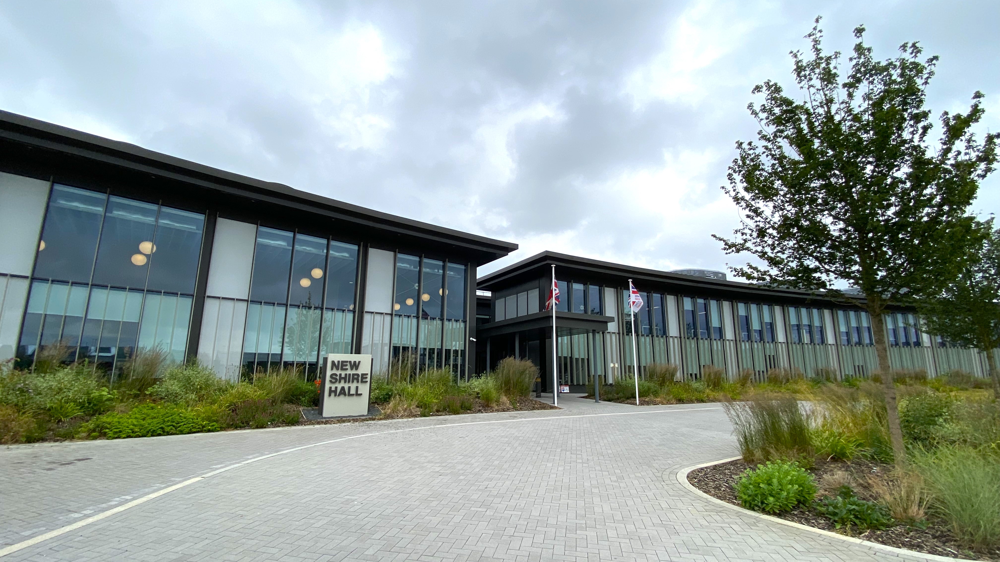
New Shire Hall, Alconbury Weald

New Shire Hall is a municipal building on Emery Crescent, Alconbury Weald, Cambridgeshire, England, built in 2019–2020. It is the headquarters of Cambridgeshire...

Alconbury Weald

Alconbury Weald is a new settlement in Cambridgeshire, England, lying to the north-west of the town of Huntingdon. The site was previously part of RAF...

Upton, Huntingdonshire

Upton is a village and former civil parish, now in the parish of Upton and Coppingford, in the Huntingdonshire district, in the county of Cambridgeshire...

Nearby Amenities

Located within 500m of 52.377511,-0.2612839
Turning Circle
Lat/Long: 52.3764296/-0.2673327
Barrier: bollard
Source: survey
Lat/Long: 52.3753767/-0.2662756
Phone
Check Date: 2023-12-22
Emergency: phone
Lat/Long: 52.3786307/-0.2551429
Phone
Check Date: 2023-12-22
Emergency: phone
Lat/Long: 52.3786031/-0.2555664
Power: pole
Lat/Long: 52.3778064/-0.2658687
Power: pole
Lat/Long: 52.3762591/-0.2628513
Power: pole
Lat/Long: 52.3766751/-0.2636614
Power: pole
Lat/Long: 52.3743237/-0.2570898
Power: pole
Lat/Long: 52.3746512/-0.2557943
Power: pole
Lat/Long: 52.3745987/-0.2595764
Power: pole
Lat/Long: 52.373983/-0.2584874
Power: pole
Lat/Long: 52.3785679/-0.2682639
Power: pole
Lat/Long: 52.3784811/-0.2680011
Power: pole
Lat/Long: 52.3731398/-0.2619233
Power: pole
Lat/Long: 52.3756664/-0.2617087
Power: pole
Lat/Long: 52.3735672/-0.2601611
Power: pole
Lat/Long: 52.3783255/-0.2673225
Power: pole
Lat/Long: 52.3770975/-0.264466
Power: pole
Lat/Long: 52.375208/-0.2606922
Power: pole
Lat/Long: 52.3781693/-0.2665976
The data included in this document is from www.openstreetmap.org. The data is made available under ODbL.

Have you been to Cade's Hill?

Leave your review of Cade's Hill below (or comments, questions and feedback).