The Nower

Hill, Mountain in Surrey Mole Valley

England

The Nower

Open fields near Ranmore Road
Open fields near Ranmore Road Credit: James Emmans

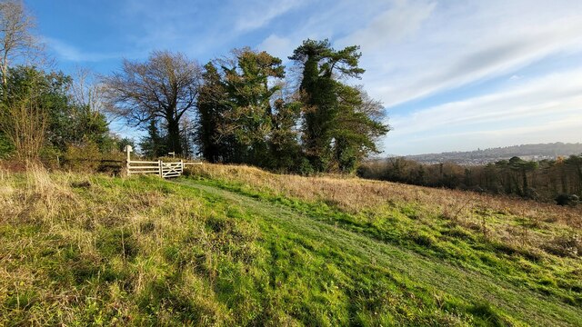
The Nower is a picturesque hill located in Surrey, England. It is situated just outside the town of Dorking and offers breathtaking views of the surrounding countryside. While not technically a mountain, The Nower is often referred to as such due to its significant height and steep slopes.

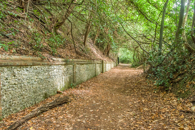
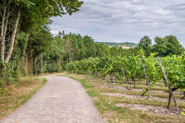
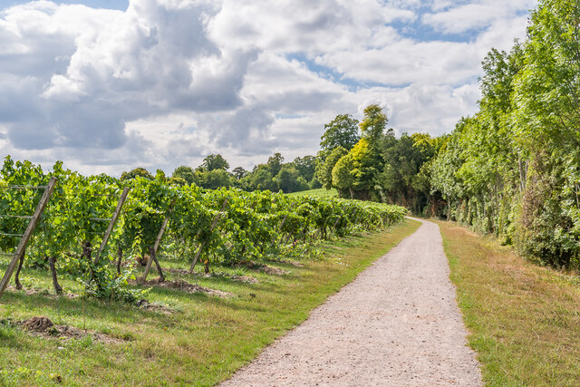
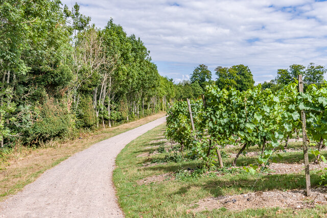
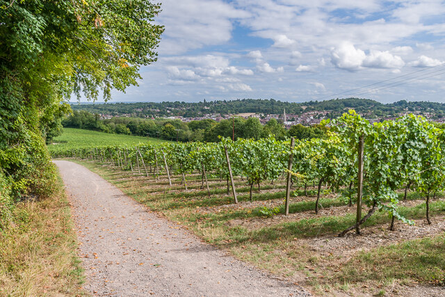
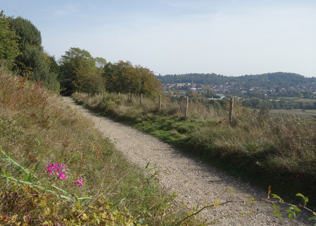
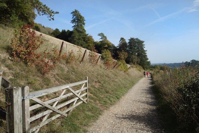
Covered in lush greenery and dotted with trees, The Nower is a popular destination for outdoor enthusiasts and nature lovers. Its elevated position allows visitors to enjoy panoramic vistas of the Surrey Hills Area of Outstanding Natural Beauty, with its rolling hills, charming villages, and expansive woodlands.

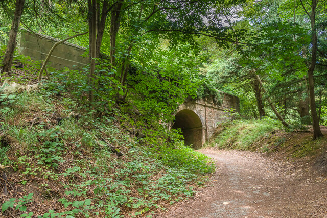
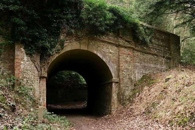
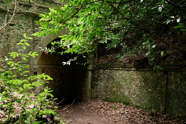
The hill is home to a variety of wildlife, including birds, butterflies, and small mammals, making it an ideal spot for birdwatching and nature photography. There are several well-marked walking trails that wind their way through The Nower, catering to both casual strollers and more experienced hikers. These paths provide access to the summit, which rewards visitors with stunning views that stretch as far as the eye can see.

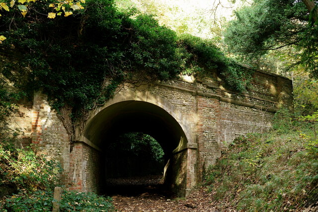
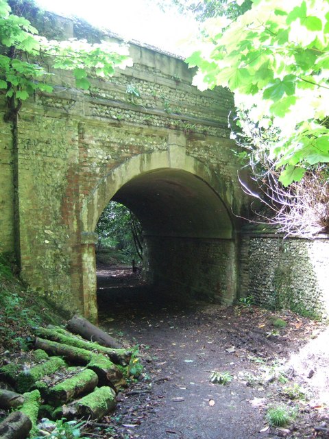
The Nower also boasts a rich history. It is believed to have been used as a ceremonial site by the Celts and later played a role in the Civil War. Today, the remnants of a 17th-century fortification known as The Fort can still be seen on the hill, adding an intriguing element to the area.

With its natural beauty, diverse wildlife, and historical significance, The Nower is a captivating destination that offers a peaceful retreat from urban life. Whether one seeks a leisurely walk, a spot for a picnic, or simply a place to soak in the beauty of the Surrey countryside, The Nower is sure to delight all who visit.

If you have any feedback on the listing, please let us know in the comments section below.

The Nower Images

Images are sourced within 2km of 51.223064/-0.3453784 or Grid Reference TQ1548. Thanks to Geograph Open Source API. All images are credited.

Open fields near Ranmore Road
Mini roundabout Residential junction on the A2003
Mini roundabout
Residential junction on the A2003
Former carriage drive to Denbies Former carriage drive to Denbies from South Lodge on Ranmore Road, seen here as it approaches a bridge under Ranmore Road, its route involving a single zigzag to reduce its gradient.
Former carriage drive to Denbies
Former carriage drive to Denbies from South Lodge on Ranmore Road, seen here as it approaches a bridge under Ranmore Road, its route involving a single zigzag to reduce its gradient.
Former carriage drive to Denbies Former carriage drive to Denbies from South Lodge on Ranmore Road, this section with a brick and flint retaining wall.
Former carriage drive to Denbies
Former carriage drive to Denbies from South Lodge on Ranmore Road, this section with a brick and flint retaining wall.
Denbies Vineyard Track alongside the southernmost section of Denbies Vineyard.  In the distance is Box Hill.
Denbies Vineyard
Track alongside the southernmost section of Denbies Vineyard. In the distance is Box Hill.
Denbies Vineyard Track alongside the southernmost section of Denbies Vineyard.
Denbies Vineyard
Track alongside the southernmost section of Denbies Vineyard.
Denbies Vineyard Track alongside the southernmost section of Denbies Vineyard.
Denbies Vineyard
Track alongside the southernmost section of Denbies Vineyard.
Denbies Vineyard Track alongside the southernmost section of Denbies Vineyard.  In the distance is Dorking, with the spire of St Martin's Church prominent.
Denbies Vineyard
Track alongside the southernmost section of Denbies Vineyard. In the distance is Dorking, with the spire of St Martin's Church prominent.
Ranmore Common Bridge carrying the road from Dorking up to Ranmore Common, at the point where it crosses the former carriage drive to the Denbies Estate.
Ranmore Common
Bridge carrying the road from Dorking up to Ranmore Common, at the point where it crosses the former carriage drive to the Denbies Estate.
Ashcombe Road, Dorking A residential street near Dorking West Station.
Ashcombe Road, Dorking
A residential street near Dorking West Station.
The Pilgrims' Way near Dorking A historic trackway between Winchester and Canterbury.
Some sections, like here, are shown in antique script so presumably can be identified as ancient. Elsewhere the route is less distinct, merging with the North Downs Way ldp, or other pathways.
Dorking is down in the valley.
The Pilgrims' Way near Dorking
A historic trackway between Winchester and Canterbury. Some sections, like here, are shown in antique script so presumably can be identified as ancient. Elsewhere the route is less distinct, merging with the North Downs Way ldp, or other pathways. Dorking is down in the valley.
The Pilgrims' Way, Ranmore Common Marked as "trackway" in antique lettering on the map, this section of the historic path between Winchester and Canterbury is looking good for its age.
Although the road a short distance north of here is also marked in the same script, so it must be pretty much guesswork where those old pilgrims actually went. 
There are good views over the valley and Dorking town, interspersed with shady woodland all along here, and as you see, the route is in very good condition.
The Pilgrims' Way, Ranmore Common
Marked as "trackway" in antique lettering on the map, this section of the historic path between Winchester and Canterbury is looking good for its age. Although the road a short distance north of here is also marked in the same script, so it must be pretty much guesswork where those old pilgrims actually went. There are good views over the valley and Dorking town, interspersed with shady woodland all along here, and as you see, the route is in very good condition.
Ranmore Common Bridge carrying the road from Dorking up to Ranmore Common, at the point where it crosses the former carriage drive to the Denbies Estate.
Ranmore Common
Bridge carrying the road from Dorking up to Ranmore Common, at the point where it crosses the former carriage drive to the Denbies Estate.
Path into Denbies Hillside Denbies Hillside is a chalk escarpment with views across to Leith Hill. it is named after John Denby, a 17th-century farmer and is now owned by the National Trust.
Path into Denbies Hillside
Denbies Hillside is a chalk escarpment with views across to Leith Hill. it is named after John Denby, a 17th-century farmer and is now owned by the National Trust.
Roundabout at the end of Ashcombe Road This is where the road meets the A2003
Roundabout at the end of Ashcombe Road
This is where the road meets the A2003
Ranmore Road looking east
Ranmore Road
looking east
Secret  Tunnel Carrying a track from Denbies <a href="https://www.geograph.org.uk/photo/52405">TQ1650 : Denbies Vineyards</a> under Ranmore Road to join up with the Pilgrims' Way.
Secret Tunnel
Carrying a track from Denbies TQ1650 : Denbies Vineyards under Ranmore Road to join up with the Pilgrims' Way.
Show me another place!

The Nower is located at Grid Ref: TQ1548 (Lat: 51.223064, Lng: -0.3453784)

Administrative County: Surrey

District: Mole Valley

Police Authority: Surrey

What 3 Words

///mole.feed.flag. Near Dorking, Surrey

Related Wikis

The Priory School, Dorking

The Priory (C of E Aided) School, Dorking is a voluntary-aided Church of England school for pupils aged 11–16, in Dorking, Surrey. The school opened 1996...

St Joseph's Church, Dorking

St Joseph's Church is a Roman Catholic Church in Dorking, Surrey. It was founded in 1872 with help from the Duke of Norfolk. It is situated in Falkland...

Milton Court

Milton Court, at the far west of the town of Dorking, is a 17th-century country house in Surrey. The court was expanded and substantially rebuilt by the...

Dorking Caves

The Dorking Caves are a network of manmade tunnels excavated in the soft sandstone of the Upper Greensand deposits beneath Dorking in Surrey, England....

Westcott, Surrey

Westcott is a village in central Surrey, England, about 1.5 miles (2.5 km) west of the centre of Dorking. It is in the Mole Valley district and the Surrey...
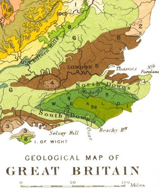
Vale of Holmesdale

Holmesdale, also known as the Vale of Holmesdale, is a valley in South-East England that falls between the hill ranges of the North Downs and the Greensand...

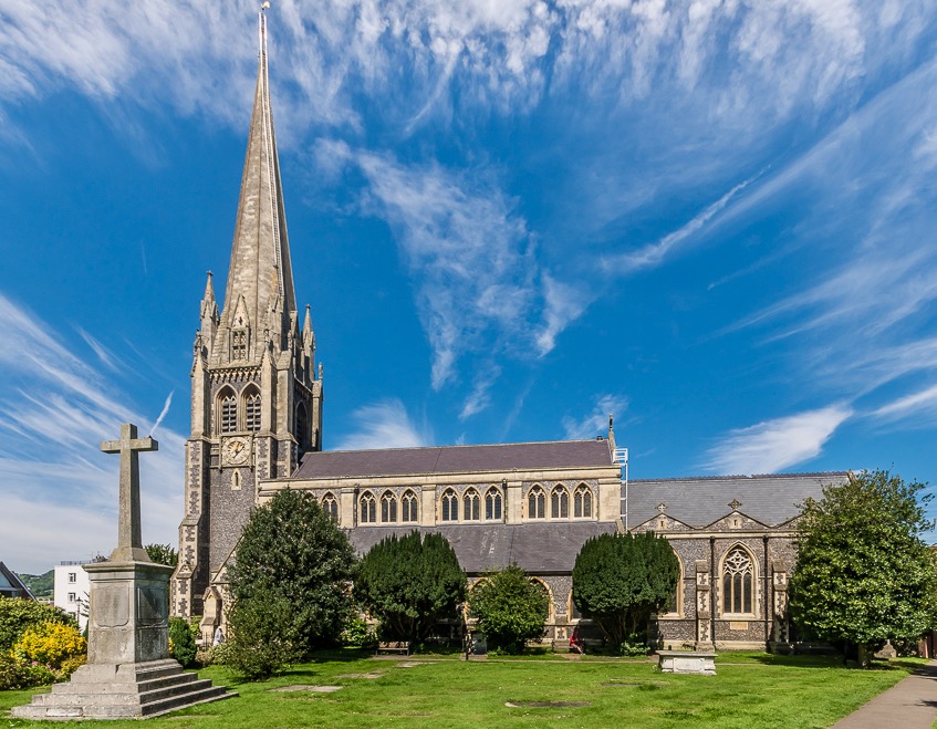
St Martin's Church, Dorking

St Martin's Church is an Anglican parish church in Dorking, Surrey. It is a Grade II* listed building and surviving parts of the structure date back to...
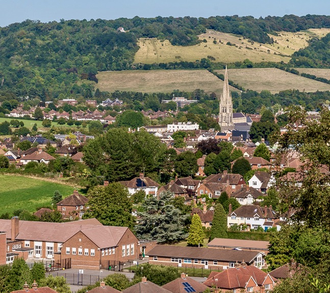
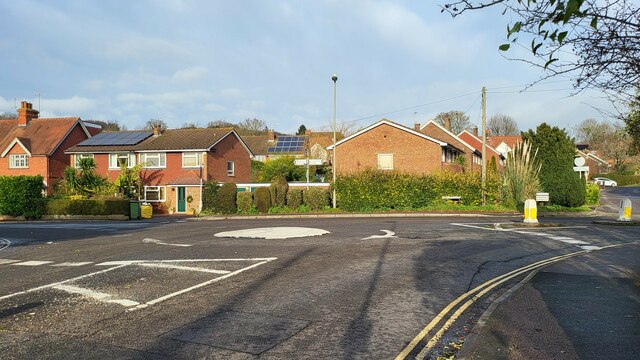
Dorking

Dorking () is a market town in Surrey in South East England, about 21 mi (34 km) south of London. It is in Mole Valley District and the council headquarters...

Nearby Amenities

Located within 500m of 51.223064,-0.3453784
Bury Hill
Created By: Potlatch 0.10c
Natural: peak
Source: npe
Lat/Long: 51.2234234/-0.3512015
The Nower
Man Made: survey_point
Ref: 3360
Source: TMJ-Mobile_0.6.2
Tpuk Ref: TP6411
Lat/Long: 51.2230363/-0.3452191
The Temple
Building: yes
Historic: folly
Note: Folly
Source: TMJ-Mobile_0.6.2
Tourism: viewpoint
Lat/Long: 51.2233554/-0.3467194
Bus Stop
The Priory School
Access: private
Naptan AtcoCode: 40004408109A
Naptan Bearing: E
Naptan BusStopType: CUS
Naptan CommonName: The Priory School
Naptan Indicator: Opp
Naptan Landmark: The Priory School
Naptan NaptanCode: surdagat
Naptan Street: Longfield Road
Naptan Verified: no
Public Transport: platform
Source: naptan_import
Lat/Long: 51.2256516/-0.34392
Barrier: kissing_gate
Foot: yes
Lat/Long: 51.2241914/-0.3487236
The Nower
Place: locality
Wikidata: Q60255142
Wikipedia: en:Milton Heath and The Nower
Lat/Long: 51.2240801/-0.3430487
Waste Basket
Lat/Long: 51.2263543/-0.3475028
Tourism: information
Lat/Long: 51.2263628/-0.3475339
Bench
Backrest: yes
Seats: 3
Source: gps
Lat/Long: 51.2234394/-0.3470725
Bench
Backrest: yes
Seats: 2
Source: gps
Lat/Long: 51.22352/-0.3474963
Bench
Backrest: yes
Seats: 2
Source: gps
Waste: trash
Lat/Long: 51.2234041/-0.3462866
Bench
Backrest: yes
Seats: 2
Source: gps
Lat/Long: 51.2229858/-0.3442669
Bench
Backrest: yes
Material: wood
Lat/Long: 51.2251032/-0.3395269
Bench
Backrest: no
Seats: 2
Lat/Long: 51.2244674/-0.3462698
Bench
Backrest: yes
Seats: 2
Lat/Long: 51.2252872/-0.3467774
Bury Hill House (site of)
Historic: archaeological_site
Lat/Long: 51.2222142/-0.3515626
Addr Housename: New Cottages
Addr Housenumber: 2
Lat/Long: 51.2260379/-0.345923
Addr Housename: New Cottages
Addr Housenumber: 1
Lat/Long: 51.2259966/-0.3458344
Traffic Calming: table
Lat/Long: 51.2257167/-0.3432386
Traffic Calming: table
Lat/Long: 51.2258171/-0.3420332
Bench
Backrest: yes
Seats: 1
Lat/Long: 51.223384/-0.346691
Addr Housename: Wembury
Lat/Long: 51.2253901/-0.3392864
Addr Housename: Sandown
Lat/Long: 51.2253689/-0.3394048
Addr Housename: Carnoy
Lat/Long: 51.2253433/-0.3395565
Addr Housename: Westbourne
Lat/Long: 51.2253324/-0.339652
Addr Housename: Little Coombe
Lat/Long: 51.2253307/-0.3398756
Addr Housename: Rosenlaui
Lat/Long: 51.2254786/-0.3399614
Addr Housename: Fistral
Lat/Long: 51.2257158/-0.3401047
Addr Housename: Brookhurst
Lat/Long: 51.2262803/-0.3403803
Addr Housename: Danby
Lat/Long: 51.2261955/-0.34034
Addr Housename: Simla
Lat/Long: 51.2260838/-0.3402837
Addr Housename: Edington
Lat/Long: 51.2260242/-0.3402555
Addr Housenumber: 4
Lat/Long: 51.2258343/-0.341785
Addr Housenumber: 3
Lat/Long: 51.2258311/-0.3418898
Addr Housenumber: 5
Lat/Long: 51.2261373/-0.3418707
Addr Housenumber: 6
Lat/Long: 51.2261305/-0.3419553
Addr Housenumber: 24
Lat/Long: 51.2256714/-0.3435317
Addr Housenumber: 23
Lat/Long: 51.225928/-0.3435866
Addr Housenumber: 18-21
Lat/Long: 51.2259777/-0.3432515
Addr Housenumber: 22
Lat/Long: 51.2259397/-0.3435037
Addr Housenumber: 25
Lat/Long: 51.225686/-0.3434243
Addr Housenumber: 26
Lat/Long: 51.225716/-0.3431406
Addr Housenumber: 27
Lat/Long: 51.2257204/-0.343067
Addr Housenumber: 17
Lat/Long: 51.2260062/-0.3429783
Addr Housenumber: 16
Lat/Long: 51.2260209/-0.3428931
Addr Housenumber: 15
Lat/Long: 51.2260296/-0.3427845
Addr Housenumber: 14
Lat/Long: 51.2260413/-0.3427051
Addr Housenumber: 12
Lat/Long: 51.2260538/-0.3425884
Addr Housenumber: 22
Lat/Long: 51.2257606/-0.3423817
Addr Housenumber: 2
Lat/Long: 51.2258052/-0.3422358
Addr Housenumber: 1
Lat/Long: 51.2257957/-0.3421424
Addr Housenumber: 7-10
Lat/Long: 51.2260945/-0.3422514
Addr Housename: Wood View
Lat/Long: 51.2254119/-0.344456
Addr Housenumber: 8
Lat/Long: 51.225382/-0.3449967
Addr Housenumber: 7
Lat/Long: 51.2253135/-0.3449567
Addr Housenumber: 6
Lat/Long: 51.2251968/-0.344892
Addr Housenumber: 5
Lat/Long: 51.2251398/-0.3448381
Addr Housenumber: 2
Lat/Long: 51.2250752/-0.3444576
Bench
Backrest: yes
Seats: 4
Source: gps
Lat/Long: 51.2230194/-0.3454793
Bench
Backrest: yes
Material: wood
Lat/Long: 51.2237808/-0.3385625
Waste Basket
Waste: dog_excrement
Lat/Long: 51.2247513/-0.3430545
Waste Basket
Waste: dog_excrement
Lat/Long: 51.2253149/-0.3492303
Waste Basket
Waste: trash
Lat/Long: 51.2253199/-0.3491767
Addr Housenumber: 8
Lat/Long: 51.2227863/-0.3518908
Addr Housenumber: 5-7
Lat/Long: 51.2227901/-0.3515907
Addr Housenumber: 2-4
Lat/Long: 51.2227245/-0.3511242
Addr Housenumber: 1
Lat/Long: 51.2226598/-0.3508402
The data included in this document is from www.openstreetmap.org. The data is made available under ODbL.

Have you been to The Nower?

Leave your review of The Nower below (or comments, questions and feedback).