Barnes Cray

Settlement in Kent

England

Barnes Cray

Old Milestone High Street, Dartford By The Royal Victoria and Bull Hotel in the pedestrianised area. In parish of DARTFORD (DARTFORD District), High Street, by No.1, The Royal Victoria and Bull Hotel, set in paviors by brick wall, on South side of road. Gravesend iron plate, erected by the Dartford & Strood turnpike trust in the 19th century. Alternative view <a href="https://www.geograph.org.uk/photo/6037659">TQ5474 : Old Milestone by The Royal Victoria and Bull Hotel, High Street, Dartford</a>

Inscription reads:-
15 / MILES / TO / LONDON // 7 / MILES / TO / GRAVESEND

Milestone Society National ID: KE_LD15
Old Milestone High Street, Dartford Credit: Ivan Clare

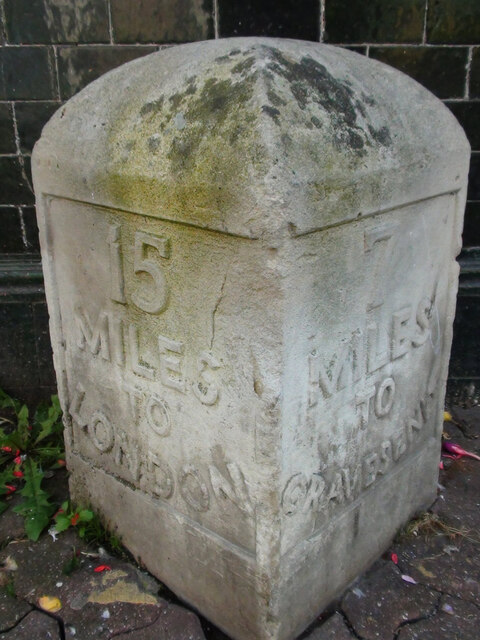
Barnes Cray is a small village located in the county of Kent, England. Situated approximately 15 miles southeast of London, it falls within the administrative boundaries of the London Borough of Bexley. The village is surrounded by picturesque countryside, with the River Cray flowing nearby.

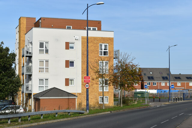
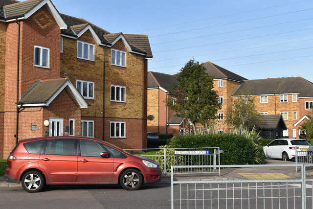
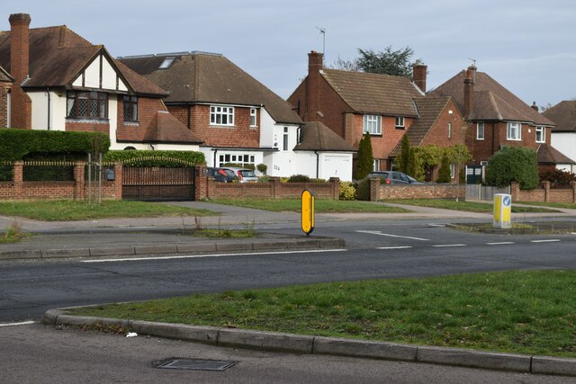
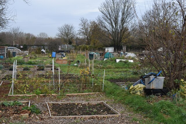
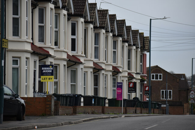
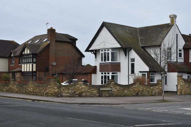
Historically, Barnes Cray was an agricultural settlement, with farming being the primary occupation. Over the years, the village has seen some development, but it has managed to retain its rural charm and character. The village is primarily residential, with a mix of older traditional houses and newer developments.

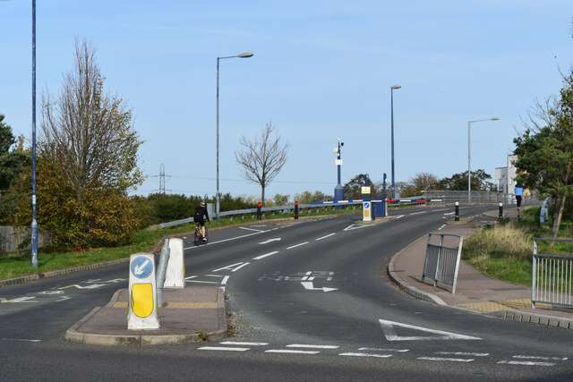
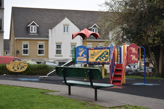
Barnes Cray benefits from its proximity to both the countryside and the city. The nearby Crayford town center provides residents with a range of amenities, including shops, restaurants, and leisure facilities. The village also benefits from excellent transport links, with easy access to the A2 and M25 motorways, as well as several train stations within a short drive.

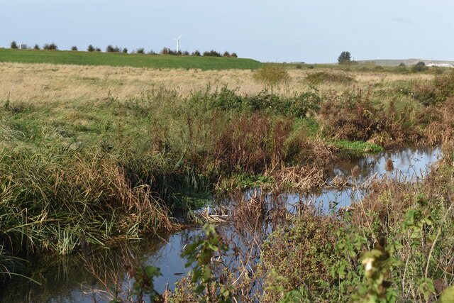
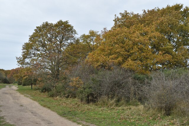
Nature enthusiasts will appreciate the tranquil surroundings of Barnes Cray, with opportunities for walking, cycling, and birdwatching in the nearby countryside. The River Cray is a popular spot for fishing and provides a haven for wildlife.

Overall, Barnes Cray offers a peaceful and idyllic setting, ideal for those seeking a quieter residential area with the convenience of nearby amenities and excellent transport links.

If you have any feedback on the listing, please let us know in the comments section below.
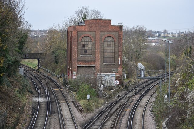
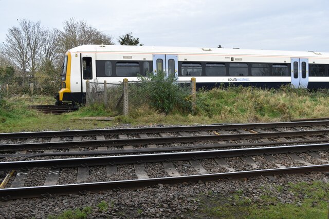
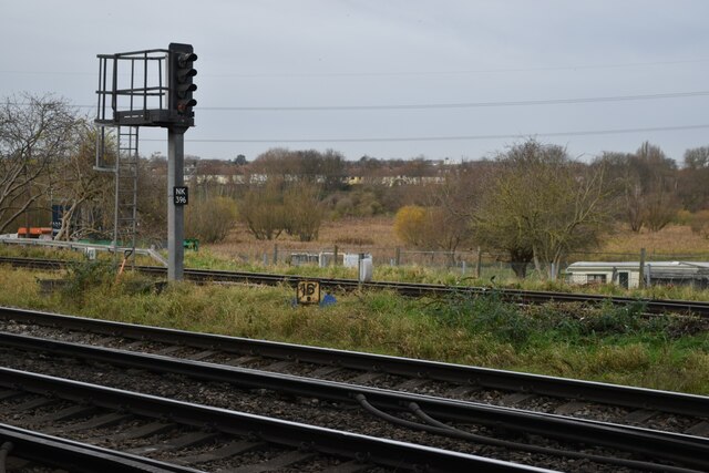
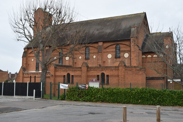
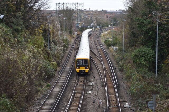
Barnes Cray Images

Images are sourced within 2km of 51.454238/0.196377 or Grid Reference TQ5275. Thanks to Geograph Open Source API. All images are credited.

Old Milestone High Street, Dartford By The Royal Victoria and Bull Hotel in the pedestrianised area. In parish of DARTFORD (DARTFORD District), High Street, by No.1, The Royal Victoria and Bull Hotel, set in paviors by brick wall, on South side of road. Gravesend iron plate, erected by the Dartford & Strood turnpike trust in the 19th century. Alternative view <a href="https://www.geograph.org.uk/photo/6037659">TQ5474 : Old Milestone by The Royal Victoria and Bull Hotel, High Street, Dartford</a>

Inscription reads:-
15 / MILES / TO / LONDON // 7 / MILES / TO / GRAVESEND

Milestone Society National ID: KE_LD15
Old Milestone High Street, Dartford
By The Royal Victoria and Bull Hotel in the pedestrianised area. In parish of DARTFORD (DARTFORD District), High Street, by No.1, The Royal Victoria and Bull Hotel, set in paviors by brick wall, on South side of road. Gravesend iron plate, erected by the Dartford & Strood turnpike trust in the 19th century. Alternative view TQ5474 : Old Milestone by The Royal Victoria and Bull Hotel, High Street, Dartford Inscription reads:- 15 / MILES / TO / LONDON // 7 / MILES / TO / GRAVESEND Milestone Society National ID: KE_LD15
Apartment block beside Fastrack dedicated bus route For details see <span class="nowrap"><a title="https://www.go-fastrack.co.uk/" rel="nofollow ugc noopener" href="https://www.go-fastrack.co.uk/">Link</a><img style="margin-left:2px;" alt="External link" title="External link - shift click to open in new window" src="https://s1.geograph.org.uk/img/external.png" width="10" height="10"/></span>
Apartment block beside Fastrack dedicated bus route
For details see LinkExternal link
Entrance to Fastrack dedicated bus route For details see <span class="nowrap"><a title="https://www.go-fastrack.co.uk/" rel="nofollow ugc noopener" href="https://www.go-fastrack.co.uk/">Link</a><img style="margin-left:2px;" alt="External link" title="External link - shift click to open in new window" src="https://s1.geograph.org.uk/img/external.png" width="10" height="10"/></span>
Entrance to Fastrack dedicated bus route
For details see LinkExternal link
Modern housing at Joyce Green Lane
Drainage ditch beside Joyce Green Lane
Sand and gravel quarrying beside Joyce Green Lane
Houses opposite the end of Heathclose Road
Path on Dartford Heath
Dartford Junction Tracks on the left to Crayford, tracks on the right to Slade Green.
Dartford Junction
Tracks on the left to Crayford, tracks on the right to Slade Green.
Train waiting at former level crossing The train is waiting on the curve from Slade Green, heading onto the Dartford Loop Line towards Crayford.
Train waiting at former level crossing
The train is waiting on the curve from Slade Green, heading onto the Dartford Loop Line towards Crayford.
View across railway north of Wilmot Road
Christ Church Dartford
Allotments behind Marcet Road houses
Terraced houses on Highfield Road
Houses on the corner of Christchurch Road
Colourful play area on a grey day
Junction at the bottom of West Hill Looking into Spital Street.  The timber-framed building is The Royal Oak pub.
Junction at the bottom of West Hill
Looking into Spital Street. The timber-framed building is The Royal Oak pub.
London-bound train leaving Dartford
Show me another place!

Barnes Cray is located at Grid Ref: TQ5275 (Lat: 51.454238, Lng: 0.196377)

Unitary Authority: Bexley

Police Authority: Metropolitan

What 3 Words

///zeal.gone.sake. Near Dartford, Kent

Related Wikis

Barnes Cray

Barnes Cray is an area in south-east London within the London Borough of Bexley. It is located on the Greater London border with Kent, bordering the Dartford...

Haberdashers' Crayford Academy

Haberdashers' Crayford Academy (formerly Haberdashers' Aske's Crayford Academy) is a mixed secondary school and sixth form with academy status sponsored...

Crayford Urban District

Crayford was a local government district in north west Kent from 1920 to 1965 around the town of Crayford. As well as Crayford, it included Barnehurst...

Wentworth Primary School

Wentworth Primary School is a primary school in Dartford, Kent, England. In 2017, the Gemili block (named after Olympic sprint athlete and alumni Adam...

Nearby Amenities

Located within 500m of 51.454238,0.196377
Railway: switch
Lat/Long: 51.4537345/0.2029089
Railway: switch
Lat/Long: 51.4511924/0.1976495
Barrier: lift_gate
Lat/Long: 51.4564364/0.1997184
Mini Roundabout
Lat/Long: 51.4545755/0.1913535
Ref GB Tflcid: RWG180713
Traffic Calming: cushion
Lat/Long: 51.4549471/0.1942084
Source: local knowledge
Traffic Sign: low_emission_zone
Lat/Long: 51.4564557/0.1958182
Ref GB Tflcid: RWG182461
Traffic Calming: hump
Lat/Long: 51.4568994/0.2019628
Ref GB Tflcid: RWG182480
Traffic Calming: hump
Lat/Long: 51.4567632/0.1946457
Crossing
Crossing: unmarked
Lat/Long: 51.4566279/0.196292
Crossing
Bicycle: yes
Crossing: traffic_signals
Crossing Ref: toucan
Lat/Long: 51.4567513/0.1954113
Crossing
Bicycle: yes
Crossing: traffic_signals
Crossing Ref: toucan
Lat/Long: 51.4568741/0.1954424
Power: tower
Lat/Long: 51.4525689/0.1911522
Power: tower
Lat/Long: 51.4544824/0.199252
Crossing
Crossing: unmarked
Crossing Markings: no
Lat/Long: 51.4568672/0.1949927
Turning Circle
Lat/Long: 51.4540547/0.1904508
Crossing
Bicycle: yes
Crossing: traffic_signals
Crossing Ref: toucan
Lat/Long: 51.4560214/0.1956624
Source: local knowledge
Traffic Sign: low_emission_zone
Lat/Long: 51.4561616/0.1961237
Bus Stop
Mayplace Avenue
Bus: yes
Naptan AtcoCode: 490009785S
Naptan Bearing: S
Naptan CommonName: Medway Road Thames Road
Naptan Indicator: Stop
Naptan Verified: no
Public Transport: platform
Ref: 57711
Source Ref: naptan
Lat/Long: 51.4579399/0.1939716
Bus Stop
Stanham Place
Bus: yes
Naptan AtcoCode: 490012543E
Naptan Bearing: E
Naptan CommonName: Stanham Place
Naptan Street: CRAYFORD WAY
Naptan Verified: no
Public Transport: platform
Ref: 49819
Source Ref: naptan
Lat/Long: 51.4546628/0.1920637
Bus Stop
Village Green Road
Naptan AtcoCode: 490014077W
Naptan Bearing: W
Naptan CommonName: Village Green Road
Naptan Street: CRAYFORD WAY
Naptan Verified: no
Public Transport: platform
Lat/Long: 51.4544391/0.1896624
Bus Stop
Mill Place
Bus: yes
Naptan AtcoCode: 490013433N
Naptan Bearing: N
Naptan CommonName: The Jolly Farmers
Naptan Indicator: Stop
Naptan Verified: no
Public Transport: platform
Ref: 51040
Source Ref: naptan
Lat/Long: 51.4557306/0.1951616
Bus Stop
The Jolly Farmers Open Space
Bus: yes
Naptan AtcoCode: 490013433S
Naptan Bearing: S
Naptan CommonName: The Jolly Farmers
Naptan Indicator: Stop
Naptan Verified: no
Public Transport: platform
Ref: 75082
Source Ref: naptan
Lat/Long: 51.4547583/0.1938246
Ref GB Tflcid: RWG182478
Traffic Calming: hump
Lat/Long: 51.4571769/0.1943244
Ref GB Tflcid: RWG182466
Traffic Calming: hump
Lat/Long: 51.4575851/0.1937097
Barrier: kissing_gate
Lat/Long: 51.4569334/0.1979886
Power: tower
Lat/Long: 51.4522335/0.194793
Ref GB Tflcid: RWG182488
Traffic Calming: hump
Lat/Long: 51.4563211/0.1914637
Railway: switch
Lat/Long: 51.4512202/0.197612
Railway: railway_crossing
Lat/Long: 51.4512248/0.1980457
Railway: railway_crossing
Lat/Long: 51.4534616/0.2030969
Railway: switch
Lat/Long: 51.4537008/0.2028838
Barrier: lift_gate
Source: survey
Lat/Long: 51.4567574/0.1980189
Railway: signal
Lat/Long: 51.4558182/0.2009726
Crossing
Crossing: unmarked
Lat/Long: 51.4562915/0.1966106
Crossing
Crossing: unmarked
Lat/Long: 51.4563924/0.1966548
Ref GB Tflcid: RWG182458
Traffic Calming: hump
Lat/Long: 51.4565599/0.2023402
Crossing
Crossing: unmarked
Lat/Long: 51.458322/0.1969522
Crossing
Crossing: unmarked
Lat/Long: 51.4570502/0.195338
Crossing
Crossing: unmarked
Lat/Long: 51.4559871/0.1954591
Crossing
Crossing: unmarked
Crossing Island: yes
Crossing Markings: no
Lat/Long: 51.4546606/0.1913379
Crossing
Crossing: unmarked
Crossing Island: yes
Crossing Markings: no
Lat/Long: 51.4545892/0.1915813
Crossing
Crossing: unmarked
Crossing Island: yes
Crossing Markings: no
Lat/Long: 51.4545689/0.1912085
Crossing
Crossing: unmarked
Crossing Island: yes
Crossing Markings: no
Lat/Long: 51.4544957/0.191369
Traffic Sign Backward: low_emission_zone
Lat/Long: 51.4566448/0.1962982
Note: Additional node marks deviation of Low Emission Zone.
Lat/Long: 51.4563026/0.2026131
Note: Barrier now removed
Lat/Long: 51.4543142/0.2033886
Waste Basket
Lat/Long: 51.4559862/0.1975541
Barrier: swing_gate
Locked: yes
Material: metal
Lat/Long: 51.4529621/0.1918061
Wilmot Road
Bus: yes
Public Transport: stop_position
Lat/Long: 51.4500096/0.196847
Bus Stop
Wilmot Road
Bus: yes
Local Ref: NE-bound
Naptan AtcoCode: 2400A050900A
Naptan Bearing: NE
Naptan BusStopType: MKD
Naptan CommonName: Wilmot Road
Naptan Indicator: NE-bound
Naptan Landmark: Walkley Road
Naptan NaptanCode: kntjgwtm
Naptan RevisionNumber: 5
Naptan Status: act
Naptan Street: Wilmot Road
Naptan Verified: no
Public Transport: platform
Ref: kntjgwtm
Source: naptan_import
Source Date: 2018-02-14
Lat/Long: 51.4500539/0.1968178
Coal tax post
Historic: boundary_stone
Inscription: 24 & 25 VICT CAP 42
Material: iron
Note: Coal tax boundary marker 214
Lat/Long: 51.4507578/0.1918778
Entrance: yes
Lat/Long: 51.4552416/0.1905934
Crayford Spur 'A' Junction
Alt Name: Crayford Spur Junction
Railway: junction
Lat/Long: 51.4537077/0.2028595
Crayford Spur 'B' Junction
Alt Name: Crayford Spur Junction
Railway: junction
Lat/Long: 51.4512056/0.1976319
Board Type: nature
Information: map;board
Operator: Thames 21
Tourism: information
Lat/Long: 51.4558964/0.1975179
Entrance: yes
Lat/Long: 51.4564796/0.1998852
Entrance: yes
Lat/Long: 51.4564822/0.1992955
Entrance: yes
Lat/Long: 51.4565017/0.1989522
Entrance: yes
Lat/Long: 51.4565114/0.1987832
Entrance: yes
Lat/Long: 51.4565259/0.1985286
Entrance: yes
Lat/Long: 51.4565303/0.1984499
Waste Basket
Lat/Long: 51.4555538/0.1961593
Bench
Material: metal
Lat/Long: 51.4555822/0.1961942
Waste Basket
Waste: dog_excrement
Lat/Long: 51.4559436/0.1957195
Barrier: kissing_gate
Height: 1.8
Material: metal
Lat/Long: 51.4559624/0.1957275
Barrier: yes
Lat/Long: 51.4575565/0.1945518
Crossing
Lat/Long: 51.4533209/0.1917627
Crossing
Lat/Long: 51.4534159/0.1916679
Traffic Calming: hump
Lat/Long: 51.4537262/0.1893961
Traffic Calming: hump
Lat/Long: 51.4536058/0.1904151
Traffic Calming: hump
Lat/Long: 51.4534802/0.1914774
Give Way
Direction: forward
Lat/Long: 51.4534641/0.1916132
Waste Basket
Waste: dog_excrement
Lat/Long: 51.4529531/0.1918765
Barnes Cray
Place: suburb
Source: OS OpenMap Local
Lat/Long: 51.4553884/0.1936238
Crossing
Lat/Long: 51.4562181/0.1904757
Colour: white
Height: 3
Historic: boundary_stone
Listed Status: Grade II
Marker: obelisk
Note: Coal tax boundary marker. Height of 3m is estimated
Lat/Long: 51.454111/0.2027851
Traffic Calming: choker
Lat/Long: 51.4508082/0.1918374
Railway: location_case
Lat/Long: 51.4531677/0.203291
Railway: location_case
Lat/Long: 51.4531781/0.2032809
Railway: location_case
Lat/Long: 51.4535546/0.2028967
Railway: location_case
Lat/Long: 51.453441/0.2029904
Railway: location_case
Lat/Long: 51.4534716/0.2029649
Railway: location_case
Lat/Long: 51.4534842/0.2029552
Railway: location_case
Lat/Long: 51.4534954/0.202946
Railway: location_case
Lat/Long: 51.4535068/0.2029364
Railway: location_case
Lat/Long: 51.4544479/0.202137
Railway: location_case
Lat/Long: 51.4552881/0.2013789
Railway: location_case
Lat/Long: 51.45574/0.2009736
Ref GB Tflcid: RWG182463
Traffic Calming: hump
Lat/Long: 51.4581656/0.1931626
Ref GB Tflcid: RWG182398
Traffic Calming: hump
Lat/Long: 51.4553335/0.1918933
Ref GB Tflcid: RWG182764
Traffic Calming: hump
Lat/Long: 51.4537842/0.1915799
Ref GB Tflcid: RWG182470
Traffic Calming: hump
Lat/Long: 51.4574552/0.1925289
Ref GB Tflcid: RWG182401
Traffic Calming: hump
Lat/Long: 51.455579/0.1935031
Ref GB Tflcid: RWG182474
Traffic Calming: hump
Lat/Long: 51.4573718/0.1913754
Ref GB Tflcid: RWG182413
Traffic Calming: hump
Lat/Long: 51.4570947/0.1908406
Ref GB Tflcid: RWG182395
Traffic Calming: hump
Lat/Long: 51.4550756/0.1912455
Ref GB Tflcid: RWG182485
Traffic Calming: hump
Lat/Long: 51.4565028/0.1925098
Ref GB Tflcid: RWG182396
Traffic Calming: hump
Lat/Long: 51.4558711/0.1911157
Ref GB Tflcid: RWG182410
Traffic Calming: hump
Lat/Long: 51.4565429/0.1909708
Ref GB Tflcid: RWG182399
Traffic Calming: hump
Lat/Long: 51.4557415/0.1908496
Ref GB Tflcid: RWG182468
Traffic Calming: hump
Lat/Long: 51.4570068/0.2012786
Ref GB Tflcid: RWG182769
Traffic Calming: hump
Lat/Long: 51.4546541/0.1928219
Bicycle Parking
Capacity: 22
Ref GB Tflcid: RWG171658
Lat/Long: 51.4570042/0.2012411
Traffic Signals
Crossing: no
Traffic Signals: pedestrian_crossing
Traffic Signals Direction: forward
Lat/Long: 51.4583163/0.1933703
Traffic Signals
Crossing: no
Traffic Signals: pedestrian_crossing
Traffic Signals Direction: forward
Lat/Long: 51.4581356/0.1934367
Crossing
Crossing: traffic_signals
Crossing Markings: dots
Crossing Signals: yes
Lat/Long: 51.458173/0.1933903
Crossing
Crossing: traffic_signals
Crossing Markings: dots
Crossing Signals: yes
Lat/Long: 51.4582833/0.1934123
The data included in this document is from www.openstreetmap.org. The data is made available under ODbL.

Have you been to Barnes Cray?

Leave your review of Barnes Cray below (or comments, questions and feedback).