Catworth Hill

Hill, Mountain in Huntingdonshire Huntingdonshire

England

Catworth Hill

Looking east along the A14 from the bridge at Brington
Looking east along the A14 from the bridge at Brington Credit: Christopher Hilton

Catworth Hill is a prominent geographical feature located in the county of Huntingdonshire, England. Situated in the eastern part of the country, it is classified as a hill rather than a mountain due to its moderate elevation. The hill is part of the larger Catworth village, which lies within the district of Huntingdonshire.

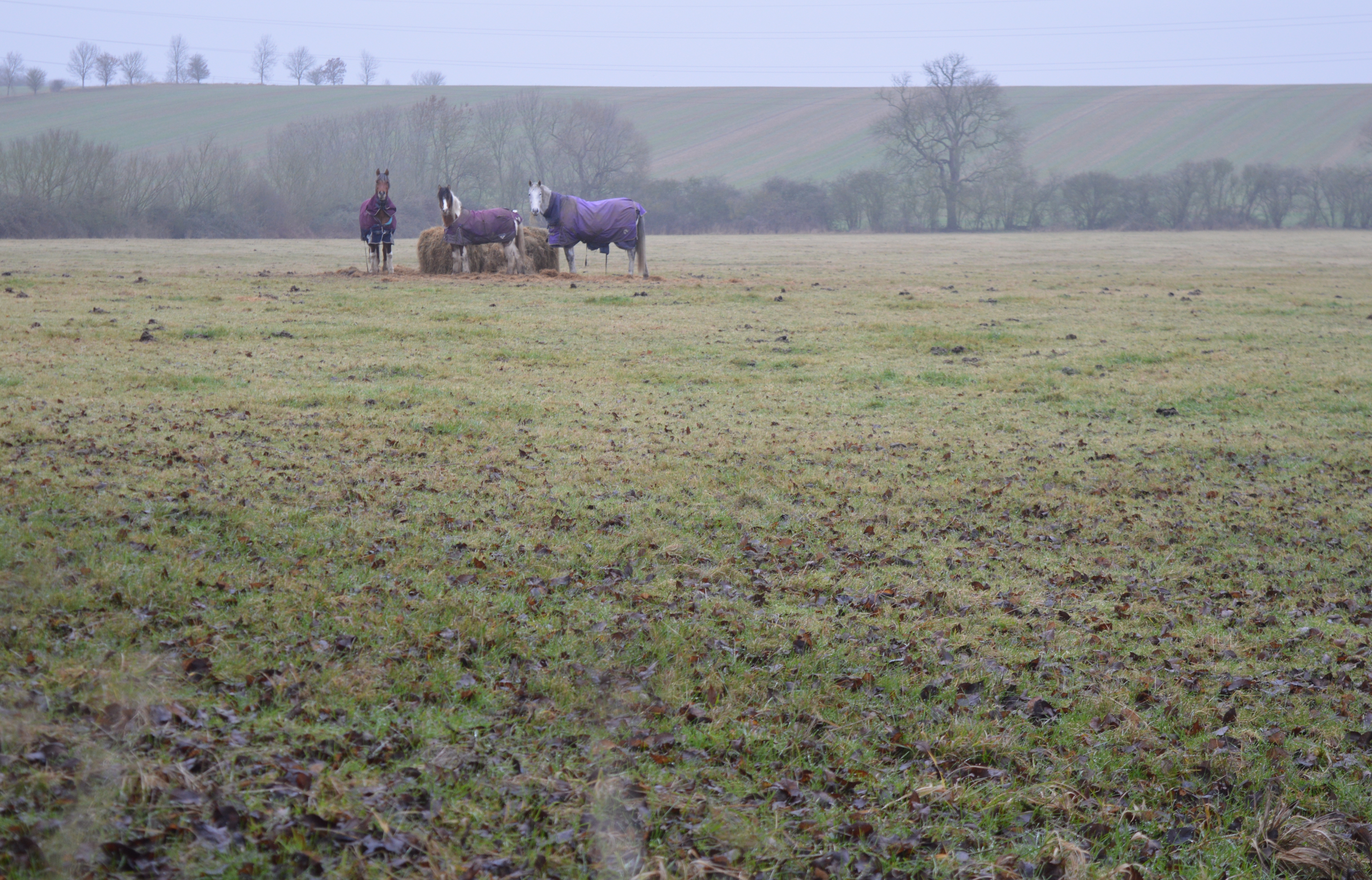
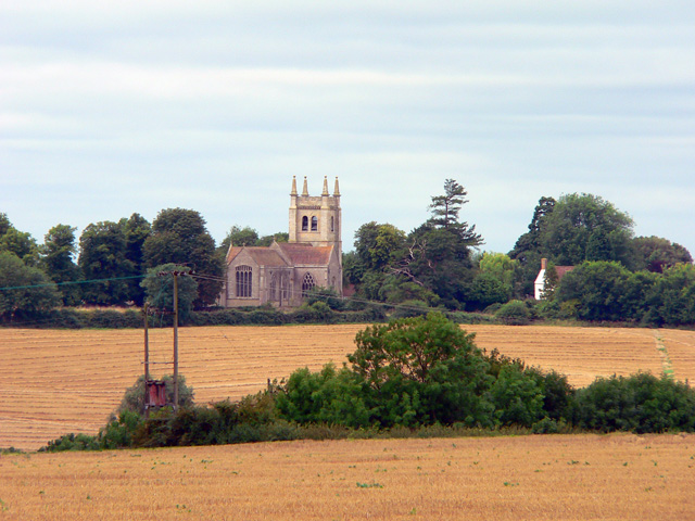
Catworth Hill is characterized by its gently sloping terrain and is predominantly covered in lush green vegetation, including grasses, shrubs, and scattered trees. The hill offers picturesque views of the surrounding countryside, with its summit serving as an ideal vantage point for visitors to enjoy panoramic vistas.

The hill is a popular destination for nature enthusiasts and hikers, offering a range of walking trails and paths that wind through its scenic landscapes. It provides ample opportunities for outdoor activities such as picnicking, birdwatching, and photography. The diverse flora and fauna found on Catworth Hill make it an attractive spot for nature lovers, with a variety of species calling it home.

Historically, Catworth Hill has been significant in the region, featuring in various local folklore and legends. Its name is derived from the Old English word "Catte-wyrth," meaning "enclosure for cats," suggesting a possible association with ancient rituals or beliefs.

Overall, Catworth Hill stands as a notable natural landmark within the picturesque surroundings of Huntingdonshire, offering visitors a chance to immerse themselves in the beauty of the English countryside.

If you have any feedback on the listing, please let us know in the comments section below.

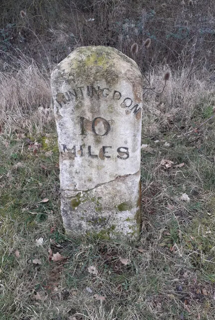
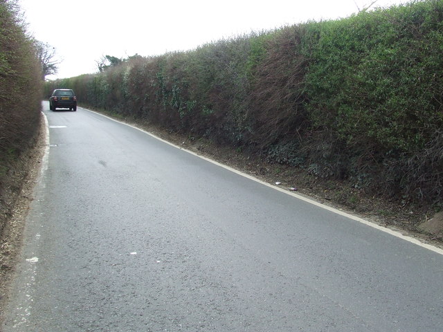
Catworth Hill Images

Images are sourced within 2km of 52.348613/-0.38485121 or Grid Reference TL1073. Thanks to Geograph Open Source API. All images are credited.

Looking east along the A14 from the bridge at Brington
High Street, Catworth
Fox Road Interchange, Brington Connecting to the A14
Fox Road Interchange, Brington
Connecting to the A14
Old Milestone by the A14 Carved stone post by the A14, in parish of CATWORTH (HUNTINGDONSHIRE District), on slip road, near junction with B660, on the verge (DC reinstated close to original place), on Northwest side of road. Huntingdon stone, erected by the Market Harborough & Brampton turnpike trust in the 19th century. An earlier photograph can be found here <a title="https://www.geograph.org.uk/photo/6038244" href="https://www.geograph.org.uk/photo/6038244">Link</a>.

Inscription reads:-
: TO / THRAPSTON / 7 / MILES : : TO / HUNTINGDON / 10 / MILES : 

Milestone Society National ID: HU_HUTH10.
Old Milestone by the A14
Carved stone post by the A14, in parish of CATWORTH (HUNTINGDONSHIRE District), on slip road, near junction with B660, on the verge (DC reinstated close to original place), on Northwest side of road. Huntingdon stone, erected by the Market Harborough & Brampton turnpike trust in the 19th century. An earlier photograph can be found here Link. Inscription reads:- : TO / THRAPSTON / 7 / MILES : : TO / HUNTINGDON / 10 / MILES : Milestone Society National ID: HU_HUTH10.
A14 looking towards Thrapston Traffic thunders past a lay-by on the eastbound carriageway of the A14; in common with other lay-bys on this stretch an SOS telephone is provided.
A14 looking towards Thrapston
Traffic thunders past a lay-by on the eastbound carriageway of the A14; in common with other lay-bys on this stretch an SOS telephone is provided.
B660 at the A14 junction Fox Road B660 at the A14 junction
B660 at the A14 junction
Fox Road B660 at the A14 junction
Three Shires Way just below Molly Rose Lodge
Recently planted trees by the Three Shires Way This part of the Three Shires Way has received a bit of a makeover with French drains installed, trees planted and overgrown scrub reined in.
Recently planted trees by the Three Shires Way
This part of the Three Shires Way has received a bit of a makeover with French drains installed, trees planted and overgrown scrub reined in.
Track to Molly Rose Lodge Part of the Three Shires Way
Track to Molly Rose Lodge
Part of the Three Shires Way
Old Milepost Old milepost near to Brington, Cambridgeshire. The correct location would have been half a mile further east but must have been moved with the creation of the A.14. For overall view see <a title="https://www.geograph.org.uk/photo/2880795" href="https://www.geograph.org.uk/photo/2880795">Link</a>
Old Milepost
Old milepost near to Brington, Cambridgeshire. The correct location would have been half a mile further east but must have been moved with the creation of the A.14. For overall view see Link
66 Miles From London Old milepost on the B660 near to Catworth, Cambridgeshire. For close up view see <a title="https://www.geograph.org.uk/photo/2883402" href="https://www.geograph.org.uk/photo/2883402">Link</a>
66 Miles From London
Old milepost on the B660 near to Catworth, Cambridgeshire. For close up view see Link
Old Milepost Old milepost on the B660 near to Catworth, Cambridgeshire. For overall view see <a title="https://www.geograph.org.uk/photo/2883546" href="https://www.geograph.org.uk/photo/2883546">Link</a>
Old Milepost
Old milepost on the B660 near to Catworth, Cambridgeshire. For overall view see Link
67 Miles From London Old milepost hidden in hedge on the B660 near to Catworth, Cambridgeshire. For close up view see <a title="https://www.geograph.org.uk/photo/2883540" href="https://www.geograph.org.uk/photo/2883540">Link</a>
67 Miles From London
Old milepost hidden in hedge on the B660 near to Catworth, Cambridgeshire. For close up view see Link
B660 towards Catworth
Beasts in a field
Beasts in a field
Junction of High Street and Station Road, Catworth
St Leonard's Church, Catworth 14th century. See <span class="nowrap"><a title="http://www.britishlistedbuildings.co.uk/en-398941-parish-church-of-st-leonards-catworth-ca" rel="nofollow ugc noopener" href="http://www.britishlistedbuildings.co.uk/en-398941-parish-church-of-st-leonards-catworth-ca">Link</a><img style="margin-left:2px;" alt="External link" title="External link - shift click to open in new window" src="https://s1.geograph.org.uk/img/external.png" width="10" height="10"/></span>
St Leonard's Church, Catworth
14th century. See LinkExternal link
Catworth, seating area opposite Race Horse pub and village sign
Show me another place!

Catworth Hill is located at Grid Ref: TL1073 (Lat: 52.348613, Lng: -0.38485121)

Administrative County: Cambridgeshire

District: Huntingdonshire

Police Authority: Cambridgeshire

What 3 Words

///steer.cuts.hammocks. Near Kimbolton, Cambridgeshire

Related Wikis

Little Catworth Meadow

Little Catworth Meadow is a 5.2-hectare (13-acre) biological Site of Special Scientific Interest between Catworth and Spaldwick in Cambridgeshire.The meadow...
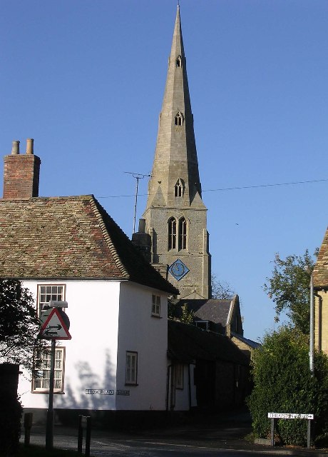
Catworth

Catworth is a village and civil parish in Cambridgeshire, England. Catworth lies approximately 9 miles (14 km) west of Huntingdon. The civil parish covers...

Stow Longa

Stow Longa is a village and civil parish in Cambridgeshire, England. Stow Longa lies approximately 8 miles (13 km) west of Huntingdon and two miles north...

Leighton Bromswold

Leighton Bromswold (also known as Leighton) is a small village and civil parish in Cambridgeshire, England. Leighton lies approximately 10 miles (16 km...

Kimbolton railway station

Kimbolton railway station was a railway station in Kimbolton, Cambridgeshire. The station and its line closed in 1959. The journey from London St. Pancras...

A142 road

The A142 is a road that runs from Newmarket in Suffolk to Chatteris in Cambridgeshire. == References ==

Brington, Cambridgeshire

Brington is a village and former civil parish, now in the parish of Brington and Molesworth, in Cambridgeshire, England. Brington lies approximately 9...

Spaldwick

Spaldwick is a village and civil parish in Cambridgeshire, England. Spaldwick lies approximately 6 miles (10 km) west of Huntingdon, near Catworth. Spaldwick...

Nearby Amenities

Located within 500m of 52.348613,-0.38485121
Power: tower
Lat/Long: 52.3446213/-0.3834279
Power: tower
Lat/Long: 52.3458928/-0.3863456
Power: tower
Lat/Long: 52.3474924/-0.3900363
The data included in this document is from www.openstreetmap.org. The data is made available under ODbL.

Have you been to Catworth Hill?

Leave your review of Catworth Hill below (or comments, questions and feedback).